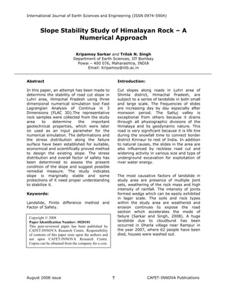
2. Slope Stability Study of Himalayan Rock – A Numerical Approach
Kripamoy Sarkar and Trilok N. Singh8
Slopes fracturing by tectonic activity,
subsequent weathering and erosion
processes, compounded by anthropogenic
factors leads to frequent slope failure in this
high relief mountain system (Starkel, 1972;
Bartarya and Valdiya, 1989; Gupta et al.,
1993; Virdi et al., 1995). Over the years,
human activity has contributed to an
increase in slope failures in the Himalaya
because of the expansion of road networks,
settlements, and other developmental
activities (Haigh et al., 1989; Virdi and Sah,
1991).Apart from disruption to road
transportation and high sediment delivery
into the river system, the landslides also
add to destruction of property and loss of
human lives every year (Sah et al., 1996).
Singh et.al (2007a) demonstrated the
capability of three dimensional finite
difference methods (FDM) to study the hill
slope stability of Rudraprayag area. A
number of study have been carried out
using Finite element method (FEM) as well
as finite difference method to determine the
factor of safety of slopes (Singh et.al
2007b, Sarkar et.al 2007, Sarkar and
Singh, 2007).The Particle Flow Code which
is able to model both intact rock and joints,
has shown its power in solving complex
problems related to jointed rock masses
(Itasca 1999 a, b).
The present paper deals with the
application of Finite difference method to
evaluate the strength of the existing slope
along the hill slope from Luhri to Sonaogi
area (approx. 14 Km). The particular slope
is on left bank of the Satluj river near
Rampur area. For this, a commercially
available FDM code FLAC 3D has been used.
The study area
The study area lies between the Latitudes
31°20´N - 31°24´ N and Longitude
77°23´E - 77°26´E. The nearest railhead is
Shimla located at an approximate distance
of 120 Km from the study area (Fig.1). The
road section under investigation lies on the
left bank of river Satluj, which is connected
by Hindustan Tibet Road (NH 22). The area
experiences sub humid to temperate
climates. Snowfall is mainly in December to
March and experience heavy rain fall in the
month of April to June. The annual rainfall
in the area is 80-100 cm in the month of
July to September and winter rains in the
month of November to February. The river
Satluj cuts the topography exposing the
basement rocks in the form of windows
which is made up of Shali and Rampur
formations overlain by Chail and Jutogh
formations. The study area lies in the
Shimla Block which falls in the seismic zone
V. The major rock types exposed in the
study area are mainly Quartz Mica Schist,
Quartzite, Slate and Limestone.
3. International Journal of Earth Sciences and Engineering (ISSN 0974-5904)
August 2008 issue CAFET-INNOVA Publications9
Fig. 1 Location Map of the study area
Results and discussion
The collected rock samples were cored in
the laboratory using diamond drilling
machine. The specimens were prepared on
lathe machine to avoid the surface
irregularity. Rock specimens were tested in
different modes to understand its
mechanical behaviour as well as for the use
it as input parameters for the slope
behaviour (Tables1-2) as per ISRM
specification (1981).
5. International Journal of Earth Sciences and Engineering (ISSN 0974-5904)
August 2008 issue CAFET-INNOVA Publications11
The area is mainly divided into four zones
on the basis of lithological contrast and with
varying slope geometry. Figs. 2a-b exhibits
the slope with 495 m height having two
benches of quartz mica schist and slope
angle varying from 72-780 because of
irregular slope profile. The maximum
velocity vectors calculated in both the dry
and wet condition are 1.284e-007 ms-1 and
1.571e-007 ms-1 respectively. The velocity
vector indicates that the rock mass falls
outside of the body of the rock mass and
may fall due to the twisting of weak toe.
This phenomenon has been observed in
field also. The maximum relative
displacement is 3.497e-001m in dry
condition whereas in wet condition it is
3.267e-001m.The relative displacement is
decreases 6.57% from dry to wet condition.
The shear strain rate increases within the
upper bench due to accumulation of stress
and material properties (Figs. 3a-b). These
stress accumulation leads to rock
dislocation in that region. The shear strain
rate increases at the top and decreases in
the bottom indicates probability of rock fall.
Fig.2a Displacement magnitude (Dry
Condition)
Fig.2b Displacement magnitude (Wet
Condition)
Fig.3a Contour of Shear strain rate (Dry
Condition)
Fig.3b Contour of Shear strain rate (Wet
Condition)
6. Slope Stability Study of Himalayan Rock – A Numerical Approach
Kripamoy Sarkar and Trilok N. Singh12
The Factor of Safety (FOS) under dry
condition is 2.15, whereas in wet condition
it is 1.46, this indicates that the slope is
marginally stable due to presence of
hydrostatic pressure within the rock mass.
The FOS significantly decreases 32% from
dry to wet condition.
Another location was chosen due to
variation in the slope height and rock type
(Quartzite) also. A slope with 325 m height,
where the top weak rock unit is about 100
m high, and slope angle varying from 75-
780 was simulated. The maximum velocity
vectors calculated in both the dry and wet
condition are 2.423e-008 ms-1 and 2.965e-
008 ms-1 respectively. The maximum
relative displacement is 6.437e-002 m in
dry condition whereas in wet condition it is
6.118 e-002 m. The relative displacement
decreases 4.95% from dry to wet condition
(Figs.4a-b).The shear strain rate increases
from the lower to upper bench.Figs.5a-b
exhibits no stress variation particularly in
the upper bench, whereas lower bench
shows significant increase in stress.
Fig.4a Displacement magnitude (Dry
Condition)
Fig.4b Displacement magnitude (Wet
Condition)
Fig.5a Contour of Shear strain rat (Dry
Condition)
Fig.5b Contour of Shear strain rate (Wet
Condition)
7. International Journal of Earth Sciences and Engineering (ISSN 0974-5904)
August 2008 issue CAFET-INNOVA Publications13
The Factor of Safety under dry condition is
very high i.e. 8.19 whereas in wet condition
it is 5.14, this indicates that the overall
slope is stable in both the conditions. A
drastic decrease in factor of safety due to
local or global disturbance may detoriate
the slope because the area many time
suffered seismic activity and few rock fall
(small scale) has been reported in the hard
rock terrain. The FOS decreases 37% from
dry to wet condition.
Another slope was simulated where slaty
rock dominates. The slope with 200 m
height having two benches and slope angle
varying from 80-850.The maximum velocity
vectors calculated in both the dry and wet
condition are 8.458e-009 ms-1 and 7.877e-
009 ms-1 respectively. The maximum
relative displacement observed is 3.074e-
002 m in dry condition whereas 1.365 e-
002 m in wet condition. The relative
displacement decreases 55.59% from dry
to wet condition (Figs.6a-b).
Fig.6a Displacement magnitude (Dry
condition)
Fig.6b Displacement magnitude (Wet
condition)
The velocity vector shows that the material
falls out side of the rock mass and may fall
due to the twisting in the toe region. This is
most important agreement with field
observation. The shear strain rate increases
from the bottom to top indicate more
instability in upper bench than lower one.
Similar trend was observed in wet slope
also (Figs.7a-b). The Factor of Safety under
dry condition is 3.23 and in wet condition
2.12. This indicates that the slope is stable.
The FOS is decreases 34% from dry to wet
condition.
Fig.7a Contour of Shear strain rate (Dry
Condition)
8. Slope Stability Study of Himalayan Rock – A Numerical Approach
Kripamoy Sarkar and Trilok N. Singh14
Fig.7b Contour of Shear strain rate (Wet
Condition)
The slope with 450 m height (lower rock
unit having the height of 300m) and slope
angle varying from 82-880 has taken for
numerical simulation in limestone terrain as
per geological record from the area. The
maximum velocity vectors are 7.513e-009
ms-1 in dry condition and 1.451e-008 ms-1
in wet condition. The maximum relative
displacement is 6.516e-002 m in dry
condition whereas in wet condition it is
6.244 e-002 m. The relative displacement
decreases at very low rate (4.17%) as
compared to other rock types (Figs.8 a-
b).The shear strain rate increases from the
lower to upper benches. Here very few
unstable zones were observed in the upper
benches in both the dry and wet conditions
(Figs.9a-b). FOS reduced upto 3.52 in wet
condition whereas in dry condition it is
5.73, which infer that the slope is stable.
Any small scale disturbance may further
reduce the FOS and causes failure,
particularly when the area experience
heavy rainfall. The FOS decreases 38%
from dry to wet condition.
Fig.8a Displacement magnitude (Dry
Condition)
Fig.8b Displacement magnitude (Wet
Condition)
Fig 9a Contour of Shear strain rate (Dry
Condition)
9. International Journal of Earth Sciences and Engineering (ISSN 0974-5904)
August 2008 issue CAFET-INNOVA Publications15
Fig.9b Contour of Shear strain rate (Wet
Condition)
Conclusions:
In this paper, Luhri slope has been
simulated using three dimensional
numerical tool provide some useful
information about the existing slope. It is
an effective tool which can certainly help to
demarcate the vulnerable zones in a high
hilly terrain like Himalayas. The global
factor of safety were calculated in both dry
and wet condition. This infers that the
overall slope is critically stable in some area
but some part of the road unstable due to
presence of geological discontinuities and
unscientific widening of road without taking
care of rock response. The present study
provides the information to strengthening
the weak slope at few locations to keep
safe transportation along the road side and
minimize the damage as well, the area
which are stable do not need any support to
economize the stabilization cost.
References
1. Bartarya, S.K. and Valdiya, K.S.
(1989) Landslides and erosion in the
Catchment of the Gaula River,
Kumaun Lesser Himalaya, India.
Mountain Res.Dev.,9 (4), 405-419.
2. Gupta, V., Sah, M.P., Virdi, N.S. and
Bartarya, S.K. (1993) Landslide
hazard zonation in the upper Satluj
Valley, District Kinnaur Himachal
Pradesh.J.Himalayan Geol.,4 (1),
81-93.
3. Haigh, M.J., Rawat, J.S. and
Bartarya, S.K. (1989) Environmental
Indicators of landslide activity along
the Kilbury road Nainital, Kumaun
LesserHimalaya.MountainRes.Dev.,
9, 25-33.
4. ISRM, (1981) Rock Characterization
Testing and Monitoring, ISRM
Suggested Methods.Int. Soc. for
Rock Mech., 211.
5. Itasca Consulting Group Inc.
(1999a) PFC2D (Particle Flow code
in 2 Dimensions) version 1.1, ICG:
Minneapolis, MN.
6. Itasca Consuting Group Inc. (1999b)
PFC3D (Particle Flow Code in 3
Dimensions), version 1.1, ICG:
Minneapolis, MN.
7. Sah, M.P., Virdi, N.S. and Bartarya,
S.K. (1996) The Malling slide of
Kinnaur: causes, consequences and
its control on channel Blocking and
flash floods in the lower Spiti Valley,
Himachal Pradesh. Proceedings, Int.
Conf. on Disasters and Mitigation,
Anna University, Madras, 1(A-4),
102-106.
8. Sarkar, K. and Singh, T.N. (2007)
Evaluation of Instability Analysis of
Slope – A Numerical Approach”
Mining Engineers Journal,
Hyderabad, 8, 11-31.
10. Slope Stability Study of Himalayan Rock – A Numerical Approach
Kripamoy Sarkar and Trilok N. Singh16
9. Sarkar, K. and Singh, T.N. (2008)
Rock Slope Stability Analysis – A
Case Study, National seminar cum
workshop on Recent Trends and
Application in Geotech Engineering,
16-17.
10. Sarkar, K., Hydrose, M.K. and Singh,
T.N. (2007) Assessment of Dump
Slope stability in an Iron ore Mine,
Goa, India, Geominetech
Symposium, ENTMS, Bhubaneswar,
31-33.
11. Singh, T.N., Barde, K.S., Purwar, N.,
Gupta, S. and Sarkar, K.(2007b)
Assessing Stability of Waste Dump –
A Case Study, Tenth Int. Symp. on
Environmental Issues and Waste
Management in Energy and Mineral
Production, 769-779.
12. Singh, T.N.,Gulati,A.,
Dontha,L.K.and
Bharadwaj,V.(2007a) Evaluating cut
slope failure by Numerical Analysis -
A Case Study, Natural Hazards,(In
press).
13. Starkel, L. (1972) The role of
catastrophic rainfall in the shaping of
the relief of the Lower Himalaya
Darjeeling Hills. Geographia
Polonica, 21,103 -147.
14. Virdi, N.S., Sah, M.P. and Bartarya,
S.K. (1995) Project report: Landslide
hazard zonation in the Beas and
Satluj Valleys of Himachal Pradesh,
Phase-I Satluj Valley, Wadia
Institute Himalayan Geology
Technical Report, 132,
(unpublished).
15. Virdi,N.S. and Sah,M.P. (1991)
Landslides along the H.T. Road (NH-
22) in Kinnaur District H.P,A
preliminary Technical Report, Wadia
Institute Himalayan Geology
Technical Report,14, (unpublished).