Milan, Italy - The study of city pattern
•Transferir como PPTX, PDF•
4 gostaram•3,113 visualizações

Note: ( Animated content) see the slide in slide show only for more content NOTE : high res. map of milan city is added in the slide

Recomendados
Mais conteúdo relacionado
Mais procurados
Mais procurados (20)
Destaque
Destaque (20)
Semelhante a Milan, Italy - The study of city pattern
Semelhante a Milan, Italy - The study of city pattern (20)
Último
Último (20)
Milan, Italy - The study of city pattern
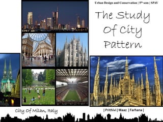
- 1. 1 Urban Design and Conservation | 5th sem | SPAV City Of Milan, Italy | Prithivi | Maaz | Farhana |
- 2. Milan is the second most populous city in Italy (with a population of 1.3 million) and the capital of Lombardy, while its urban area is the 5th largest in the EU and the most populous in Italy, with an estimated population of about 5,264,000. The massive suburban sprawl that followed the post-war boom of the 1950s– 60s and the growth of a vast commuter belt, suggest that socioeconomic linkages have expanded well beyond the boundaries of its administrative limits and its agglomeration, creating a polycentric metropolitan area of 7 million people. It has been suggested that the Milan metropolitan region is part of the so-called Blue Banana, the area of Europe with the highest population and industrial density. Note : The Blue Banana (also known as the Hot Banana, Bluemerang, European Megalopolis, Manchester-Milan Axisor European Backbone) is a discontinuous corridor of urbanisation in Western Europe, with a population of around 111 million. It stretches approximately from North West England in the north to Northern Italy in the south. The city is a major world fashion and design capital. Milan's museums, theatres and landmarks (including the Milan Cathedral, the fifth largest cathedral in the world, and Santa Maria delle Grazie, decorated with Leonardo da Vinci paintings, a UNESCO World Heritage Site) attracts over 6 million annual visitors. 2 The Study Of Ci ty Pat tern – Mi lan, I taly
- 3. Recreation place Predominant area 3 Planned settlements Planned settlements The Study Of Ci ty Pat tern – Mi lan, I taly Observation From the image, it can be observed from the grain size and grain distribution that the space is flat or contour less. Because, the grains are distributed in the entire space, where a flow can be observed. If contours were present, the grains must have been allocated to different regions which cannot be seen in this image. This indicates that the landform is flat or a valley. Road Primary Road Secondary Road Canal Connecting linkage from city centre
- 4. • Another observation that can be made is from the pattern or alignment of the roads. It can be seen 4 that there is a central point of focus, a main land mark or an important building at the centre. Because all the roads coming from outside are getting connected to the centre. • The city is also having a radial pattern. This shows that there must be a very important building at the centre or maybe at earlier era, it was a walled city. This might have resulted for the radial growth of the city. • Another important feature observed is that there are so many nodes or junctions in the city. This shows that there is good connectivity. A canal or a water body can be seen in the image. This may be the water source for the city or may be used for inland waterways. • It can also be seen that only one open space or garden is present in the entire area. This might be the major recreational area or public space. This space is also connected to the central part of the city. This indicates that the garden or open area might have come up due to the central part which may be a palace or an administrative structure. The Study Of Ci ty Pat tern – Mi lan, I taly
- 5. 5 • The right side and the north side of the city has a specific alignment of roads. And the grain size of the buildings also look similar. This indicates that the area is a planned area. While the Central part of the city, within the first ring road has an unorganised pattern with buildings of different grain sizes. This shows that this area is not a planned area. • The presence of different ring roads and long linear roads in the outer part, indicate that they must be outer ring roads that connect Milan to other towns. • The two metro rail present at the north and the pattern of the settlements in the northern and eastern part of the city indicates that the growth of the settlements took place later. The earlier growth of the city must have taken place in the central part of the city, as there is an organic pattern observed in this part. Later, the settlements might have grown towards the outer part. The Study Of Ci ty Pat tern – Mi lan, I taly
- 6. 6 Clustered Settlement Pattern The Study Of Ci ty Pat tern – Mi lan, I taly Clustered Road Pattern Clustered settlement and road pattern most observed in centre core city and These settlement pattern spread along 2km radius from centre
- 7. Linear Settlement Pattern 7 The Study Of Ci ty Pat tern – Mi lan, I taly Linear Road Pattern Planned settlement and linear type of road are mostly observed in east and northern part of the city from core centre area
- 8. Conclusion We have made certain observations about the Milan city from the image, which have been already mentioned above. It is observed that Milan is a city with a radial pattern and has a flat topography. The grain size and the organisation of the grains observed indicate about the city’s spatial pattern and connectivity. The important feature observed from the image is that the entire city is dependent on the central part, which may be due to the presence of an important structure. The image of the city displays a beautiful city pattern which shows about the planned and unplanned spaces in the area. The map also shows about the different road patterns and nodes in the area. 8 The Study Of Ci ty Pat tern – Mi lan, I taly