
Recomendados
Recomendados
Mais conteúdo relacionado
Mais procurados
Mais procurados (16)
Semelhante a Leveraging Crowdsourced data for Agent-based modeling: Opportunities, Examples and Challenges
Semelhante a Leveraging Crowdsourced data for Agent-based modeling: Opportunities, Examples and Challenges (20)
Último
Último (20)
Leveraging Crowdsourced data for Agent-based modeling: Opportunities, Examples and Challenges
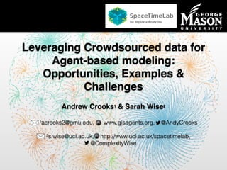
- 1. Department of Computational Social Science Leveraging Crowdsourced data for Agent-based modeling: Opportunities, Examples & Challenges Andrew Crooks1 & Sarah Wise2 1acrooks2@gmu.edu, www.gisagents.org, @AndyCrooks 2s.wise@ucl.ac.uk, http://www.ucl.ac.uk/spacetimelab, @ComplexityWise
- 2. Harvesting Ambient Geographic Information • Web 2.0 and Social Media: • Volunteered Geographical Information (VGI) and Ambient Geographical information (AGI). • Provides a new lens to study the human landscape as a living, evolving social organism: • Advanced situational awareness. • Unique opportunities for actionable knowledge discovery and modeling: • Can it be leveraged to help understand human behavior and actions? Stefanidis, Crooks, & Radzikowski. (2013), Harvesting Ambient Geospatial Information from Social Media Feeds, GeoJournal 78, (2): 319-338.
- 3. A GeoSocial Approach GeoSocial data mining: The combination of geospatial, social network, and content analysis, to understand the human landscape and gain situational awareness.
- 4. • Twitter: 645 million accounts (288 active users). • flickr: 8 billion photos (1.4 million photos uploaded every day). • Facebook: 1.4 billion users, and 350 million photos uploaded daily. • QQ has 829 million active users. Source: http://en.wikipedia.org/wiki/List_of_countries_by_population Ambient Information in Numbers
- 5. Traffic Speeds Crooks et al., (2015), Crowdsourcing Urban Form and Function, International Journal of Geographical Information Science. DOI: 10.1080/13658816.2014.977905 Changing traffic situation as detected by floating car data – Berlin, Germany (only major roads shown). (a) 16 December 2013 – 1 am. (b) 8 am. (c) 5:30 pm.
- 6. Thematic Spaces (neighborhood example)
- 7. Opportunities: Supplement Traditional Data Crooks et al., (2015), Crowdsourcing Urban Form and Function, International Journal of Geographical Information Science. DOI: 10.1080/13658816.2014.977905
- 8. Event Responses in Twitterdom
- 9. Event Responses in Twitterdom
- 10. Adjusted times between event occurrence and tweets Tweets delineating the impact area Crooks, A.T., Croitoru, A., Stefanidis, A. and Radzikowski, J. (2013), #Earthquake: Twitter as a Distributed Sensor System, Transactions in GIS, 17(1): 124-147 Event Responses in Twitterdom #Earthquake: Twitter as a Distributed Sensor System
- 11. Agent-Based Modeling • How can we use the crowd here? – New sources of spatial data. – Near “real time” information. – New ways to explore how people perceive & use the space. – Insights into human behavior? – Rob Axtell: “… there is a large research program to be done over the next 20 years, or even 100 years, for building good high-fidelity models of human behavior and interactions” Crooks & Heppenstall (2012), Introduction to Agent-based Modelling, in Heppenstall, Crooks, See & Batty (eds.), Agent-based Models of Geographical Systems.. Mobile agents Immobile agents Artificial World If <cond> then <action1> else <action2>
- 12. • Instant reports from media and Web 2.0 technology (e.g. Twitter, Ushahidi etc..) • Data released over the internet: Haiti Earthquake 12th January 2010 - Mostly from the “bottom-up” via crowdsourcing and VGI - E.g. Google Map Maker, OpenStreetMap etc... – Ground damage, tent cities etc... • Can ABM and GIS be integrated to assist post-disaster relief operations rather than just evacuations? Crooks & Wise (2013), GIS and Agent-Based models for Humanitarian Assistance, Computers, Environment and Urban Systems, 41: 100-111. ABM and GIS for Disaster Relief
- 13. • Roads (green primary, red secondary). • Refugee camps emerge (blue). Source: http://vimeo.com/9182869 Haiti Earthquake 12th January 2010
- 14. Model Inputs: All Geo-referenced
- 16. Colorado Wildfires • June and July of 2012 • Wildfires in northern and central Colorado prompted the evacuation of over 30,000 citizens • Research question: Can social multimedia be used to delineate the extent of the wildfire and fused with an agent-based model? • Case Study: Waldo Canyon
- 17. Note: word size normalized relative to the occurrence of “fire” Frequently Adopted Toponym Terms
- 18. q Delineating Events: Flickr Images Panteras, Wise, Lu, Croitoru, Crooks, & Stefanidis, (2014), Triangulating Social Multimedia Content for Event Localization using Flickr and Twitter, Transactions in GIS. DOI: 10.1111/tgis.12122
- 20. Source: Wise 2014 Deriving Mood
- 21. Building Agent Populations • ~~ Source: Wise 2014
- 23. Social media for validating agent-based models Source: Wise 2014
- 24. Summary & Challenges • Crowdsourced data: • Provides a new lens for understanding of how people perceive, use and are affected by space over time. • Provides links across scales: from micro to macro phenomena. • Challenges: • Collection and storage of data. • Short time scales vs. long term problems. • Validation (cross source), participation bias etc….. • Emerging research opportunities for Geosimulation: • Lots of work to be done.
- 25. Summary & Outlook Crooks et al., (2015), Crowdsourcing Urban Form and Function, International Journal of Geographical Information Science. DOI: 10.1080/13658816.2014.977905
- 27. Acknowledgments Anthony Stefanidis, Arie Croitoru, Dieter Pfoser, Jacek Radzikowski & Andrew Jenkins. www.geosocial.gmu.edu