SlideShare uma empresa Scribd logo
1 de 15
Baixar para ler offline
George E. Pataki, Governor

Randy A. Daniels, Secretary of State

A Vision for The

South Shore Bayway

Long Island South Shore Estuary Reserve

January, 2004
This report was prepared with financial assistance from the
New York State Environmental Protection Fund and the U.S.
Department of Commerce, National Oceanic and Atmospheric
Administration, Office of Ocean and Coastal Resource
Management, under the Coastal Zone Management Act of
1972, as amended.
A Vision for The South Shore Bayway
Long Island South Shore Estuary Reserve
January, 2004

Prepared for the South Shore Estuary Reserve Council with assistance from
the South Shore Estuary Reserve Office and the
New York State Department of State, Division of Coastal Resources
Picture a network

of trails, scenic roads
and bike lanes leading
to the beautiful waters
of Long Islandʼs south
shore bays....

Gardiner County Park, West Bay Shore
Imagine a coordinated
system of signs,

exhibits and street
improvements leading
the way to the
shoreline....

Waterfront Access, Patchogue
Envision exploring the
bays, barrier beaches

and tributaries alone in
a kayak or with friends
on a sunset cruise....

Santopogue Creek, Lindenhurst
Picture Long Islanders
and visitors better

connected with the
beauty, history and
natural splendor
of the South Shore
Estuary....

View across Bay to Fire Island
You are experiencing the new Long Island
South Shore Bayway!
The Vision

The South Shore Estuary Reserve Bayway will be an interwoven
network of existing maritime centers, parks, historic and cultural
sites, community centers, and waterfronts used by pedestrians,
bicyclists, boaters and motorists. Coordinated and cohesive signs
will interpret key estuary features, offer self-guided tours and orient
Bayway residents and visitors to appreciate the many resources the
Reserve offers. Trails, sidewalks, local streets and highways will be
safe. Community character will be enhanced. Scenic roads and areas
will be recognized, and the regionʼs identity is unified. Shoreline
access will exist throughout the Bayway with adequate parking,
pedestrian amenities and boating facilities to meet the needs of many
user groups from the young to the elderly and from waders to divers.
The estuaryʼs health will be protected through on-going preservation,
enhancement and monitoring for future generations to enjoy. The
vision is elaborated in further detail in the italicized paragraphs below.
The
Long
Island
South Shore Estuary
Reserve Comprehensive
Management
Plan
establishes a number of
recommendations
for
the future preservation
and
enjoyment
of
the Reserve.
The
Terrill River, East Moriches
implementation section
of the plan identifies increased public use of the estuary and expanded
tourism as an important outcome. The South Shore Estuary Reserve
Bayway provides opportunities for all people to experience the
estuarine setting through shoreline recreation facilities, open space
resources and the Reserveʼs rich maritime heritage and culture.
Access to the water, in a variety of forms, and the development of a
cohesive interpretive and signage program, are integral to the Bayway
system. The Bayway provides a regional framework for the overall
A Vision for The South Shore Bayway

interpretation of and access
to the significant natural,
cultural and recreational
resources within the Reserve.
Virtual Bayway:
The
Bayway web site will
provide the public with a
Captree Island, Robert Moses Causeway comprehensive overview of
the Baywayʼs environment,
its natural and cultural resources, and promotes stewardship of
the estuary. The site will list facilities and events sponsored by the
many partners providing recreational experiences and educational
opportunities. The site will also contain specific up-to-date
information: attractions, programs, interactive maps, guides,
tours, transportation information, ferry schedules, festivals and
locations of visitors centers throughout the Bayway.
Communication is a key component of the Bayway. One of the best
ways to communicate effectively and quickly with large numbers
of people is the Internet. Many Bayway
features and attractions already exist and
need to be presented and described in a
coordinated fashion to become part of
the Bayway. The web site will feature
maps, locations of interpretive sites and
kiosks, location of visitor centers, public
transportation links and other detailed
information.
Signage & Interpretation: The Baywayʼs
image will be easily recognized through its NYS Coastal Resources
coordinated interpretive signs, exhibits, Interpretive Program Estuary
logo and guide books. The signage system Reserve Signage
Page 1
will publicize, explain
and guide the public to
cultural sites, access
points, natural features
and recreation areas.
Interpretation will be
centered around four
central themes: living on
the waterfront, working
on
the
waterfront,
enjoying the coast, and
Bay Shore Maritime Center
protecting the waterfront
and its maritime heritage.
The Bayway is as much an idea as it is a physical network of roads
and waterways. Roadside way finding signs, safety signs, logo signs
and identification signs for trail destinations will also provide an
identity for the Bayway and guide visitors safely and efficiently to
points of interest.
Interpretive exhibits are located at points along the Bayway such as
overlooks, rest areas, historical sites, waterfront areas and recreational
sites. These wayside exhibits graphically tell the story of the site
and its history. Topics include maritime history, environmental
education, cultural sites, South Shore estates, Native American sites,
bay houses, ecology of the estuary, fishing and shell fishing, whaling,
boat building and other relevant topics. Self-guided tours by car,
boat, bike or on foot lead visitors through the Bayway with booklets
and numbered signs locating key features.
Roadway Corridors: Montauk Highway/Merrick Road will be the
Baywayʼs major east-west roadway corridor, serving as the primary
transportation artery from which spokes diverge to access a variety
of natural, cultural and recreational attractions and sites. Residents
and visitors will travel through the Bayway on this primary route via
many forms of transportation.
A Vision for The South Shore Bayway

Pedestrian and bicycle improvements
along Montauk Highway and Merrick
Road allow this important road to serve
as an east-west spine for the Bayway,
providing access to the various northsouth routes that lead to tributary streams
and the waterfront.
The regionʼs
public transit system, including busses
and trains, becomes part of the Bayway
through a public education program,
maps and information in compartments
Wantagh Bikeway
and stations and the enhancement of
existing service to include facilities for bicycles and strollers. Some
modification or expansion of bus routes provides direct access to
shoreline access sites and other Bayway destinations.
Maritime Centers: The Bayway will feature existing maritime
centers with their mix of restaurants, shops, cultural & recreational
activities and waterfront businesses. This will enhance the vitality
of the centers and takes advantage of the transportation, shopping
and entertainment resources these areas offer. Existing centers will
be hubs from which radiate the spokes of the Bayway leading to the
shore, parks and cultural sites.
Maritime centers feature working
waterfront uses such as commercial
fishing, boat building and ferries, access
to the waterfront
and residential
neighborhoods that make these areas
unique.
They serve as hubs for
water-based activities and attractions.
Strengthening and enhancing existing
centers also promotes transit-oriented
development and the use of alternative
modes of transportation to the automobile.
Howellʼs Creek, Bellport
This helps reduce highway congestion.

Page 2
Recreation and Linkages: The Bayway system will incorporate
existing recreation areas such as parks, beaches, hiking trails, bicycle
paths, golf courses, marinas, charter boats and watersports centers.
Recreation sites will become destination points, and linkages will be
developed to connect these various recreational activities.
Alternative modes of access
and improved access to existing
recreational areas enhance waterbased sports and activities. Nonwater dependent activities such as
golf, sunbathing, scenic viewing,
birding, wildlife observation, hiking
and hunting are also a key part of
Bayway related recreation.
Existing and Proposed Trails: A
number of existing trails, public
access points and bikeways will form
a central element of the Bayway.
Pedestrian Bridge, Carmanʼs River Many of the regionʼs historic village
and town centers have pedestrian amenities such as sidewalks,
plazas and parks that extend into surrounding neighborhoods and
trail systems. These will offer a unique resource that can be linked
together and enhanced throughout the Bayway.
Most of the trails are located in parks such as Heckscher State Park,
Wertheim National Wildlife Refuge and Connetquot River State Park.
Public beaches, boardwalks and waterfront roads provide access for
the public to many of the regionʼs waterfronts. Pedestrian and bicycle
improvements to existing roads and trails and the construction of new
trail links such as the new blueway and underwater trail concepts
create a comprehensive trail system from existing resources.
Many plans are currently underway to build new bicycle and
pedestrian trails, improve public access to the water and to promote
the region. The Bayway coordinates with these plans in order to
A Vision for The South Shore Bayway

pool resources, promote
efficiency
and
avoid
confusion and duplication of
effort. The New York State
DOT is currently planning
a number of bicycle,
handicapped access and
pedestrian
improvements
Boat Launch Access
along the Wantagh State
Parkway to Jones Beach, the Robert Moses bridge, Ocean Parkway
and the Meadowbrook State Parkway.
Trails in the Long Island Pine Barrens have been proposed in
Southampton and adjacent communities to improve hiking and
bicycle access to this unique ecosystem. These trails create an
important regional link for the Bayway to the South Fork where trails
such as the Paumanok have already been developed and provide a
valuable recreational resource.
Also, the Long Island Rail Road
allows bicycles on the trains during off-peak hours. This could be
coordinated with buses equipped with racks that leave from key
stations.
Water Trail:
The
Baywayʼs water trail
will create a boating
network
connecting
waterfront
access
sites, maritime centers,
recreation areas and
cultural sites along the
Long Island and barrier Canoeing on Yaphank Creek
island shorelines. Visitors and residents will be able to find a range
of boating options from self-guided tours for private motorized and
non-motorized boaters to charters and scheduled boat trips featuring
varying themes and destinations.
Page 3
The Bayways water trail connects the regionʼs public access points
as well as the existing ferry system and a range of natural, cultural
and recreational destinations. Small non-motorized boats explore
the narrow tributaries, salt marshes and tidal channels. The existing
ferry system linking Long Island mainland with Fire Island across
Great South Bay is one example of the best ways for residents and
visitors to experience the water, marshes and beaches of the south
shore. Visitors find their way by car, bicycle, shuttle system, train
or foot to a variety of waterfront access sites with the help of the
Baywayʼs signs and exhibits. Parking and access at sites will be
attractive, convenient and well marked.
With the help of
guidebooks, boat trips
feature nature study,
birding, marine life,
clamming and fishing.
Other
excursions
visit
the
regionʼs
cultural sites, historic
waterfront mansions,
outdoor
theatres,
Historic Bay Houses
maritime
museums
and boat building centers. The more adventurous can find boats
to visit beaches, go water-skiing, scuba diving or parasailing. The
Baywayʼs boating network encourages a range of boat types, creative
interpretation and an environmental sensitivity on the part of the boat
operators. It also becomes an integral component of a State-wide
Blueway Trail being initiated by the New York State Department of
State.
History and Culture: The Bayway will make the water the focal
point for the quality of life on Long Island for residents and visitors.
For centuries, Long Islanders have been closely connected with the
water. The rich historical and cultural resources still in existence will
provide a significant portion of the Baywayʼs interpretive program.
A Vision for The South Shore Bayway

Native Americans fished, hunted
and gathered shellfish in the
south bays and their tributary
streams and hunted whales
offshore. Early European settlers
continued these traditions and
introduced shipbuilding, offshore
fishing, ice harvesting, shipping
and recreational boating. Later
generations introduced duck
Historic Boat Building Enterprise
hunting and rum running, and
built bay houses. Wealthy families of the Gilded Era including the
Belmonts, Phelpses, Floyds, Heckschers, Vanderbilts, Cuttings, and
Bournes built large estates on the south shore, many of which remain
as parks and historic sites.
Due to the decline of traditional water-based activities and the
development of the shoreline after World War II, the natural access to
the beauty of the shoreline was dramatically altered. Large sections
of the coastline have been privatized and the few remaining ports and
public access points are overcrowded. The Bayway system renews
accessibility to the water and to the
significant historical and cultural features
that inspired the original inhabitants of
the region.
Natural Resources and Stewardship:
The preservation, enhancement and
public stewardship of the regionʼs natural
resources is critical to the success of the
Bayway. Environmental education will
be incorporated into Bayway signage,
exhibits, tours and brochures to explain
the unique ecology of the bays and the
steps that need to be taken to protect and
improve their health.

South Oyster Bay ,
Town of Oyster Bay
Page 4
Environmental preservation elements of the Bayway include open
space corridors and greenways that extend on either side of trails,
streams and rivers. These greenways also serve as wildlife corridors
and natural areas. Wildlife habitats are a key focus of the Bayway,
both for their preservation and for their interpretive value and appeal
for visitors. Parks are created and expanded at key sites to provide
waterfront access, protect unique resources and to link existing
open spaces. Salt marsh preservation efforts are reinforced, and
environmental education on the role of salt marshes and the estuarine
ecosystem are highlighted.
Coastal ecology and the relationship of the estuary to marine and
upland environments are incorporated into the Bayway program.
The connection between urban stormwater runoff, tributaries, rivers
and bays is explored, and the use of new techniques such as low
impact development and best management practices is interpreted.
Educating the public regarding “ecologically correct” boating is vital
to the preservation of the unique natural resources of the estuary.
Scenery and Landscape: The natural
beauty of the South Shore Estuary
Reserve is a major resource and one of
the primary reasons people will visit and
use the Bayway. The vast salt marshes,
endless dunes, wide sandy beaches and
winding tributary streams create a unique
visual setting that contrasts with the
congested suburban streets of the interior.
Protecting, interpreting and accessing this
scenic resource will be a central feature in
the overall mission of the Bayway.
A thorough analysis of the regionʼs scenic
resources is currently underway. The
Distinctive Natural Character project identifies the elements that create
the estuaryʼs unique scenery, locates areas
A Vision for The South Shore Bayway

with varying degrees of scenic character and identifies strategies
for protecting scenic resources. Key elements include protecting
undeveloped lands, continuing the cleanup of the bays and the
environmental remediation of contaminated sites, removing eyesores
and preventing inappropriate development, especially in sensitive
waterfront areas.
The Bayway both
protects and promotes
scenic
resources.
Increasing access to
scenic vistas allows
people to experience
the beauty of the
South Shore Estuary
at various times of
the day and at various
Boardwalk at Fire Island National Seashore
seasons. The Bayway
brings visitors to places previously only accessible to private boat
owners.
Parks and conservation areas along major tributaries
are increasingly accessible through the Bayway and other access
programs. Protecting the scenery of these areas by increasing the
size of parks and controlling neighboring development enhances the
scenic character of the Bayway.
Transportation: The Bayway will use the regionʼs existing
transportation system while creating new linkages and promoting
transportation improvements that enhance safety and ease of use for
pedestrians, bicyclists, boaters and users of mass transit. In addition
to improving safety and transportation efficiency, these improvements
will also enhance the character, scenery and quality of life along the
Bayway.
New bicycle lanes, sidewalk improvements, safer pedestrian
crossings, street tree plantings, handicapped improvements and
traffic calming measures ensure that both cars and pedestrians and
bicyclists coexist on the regionʼs streets.
The new and enhanced
Page 5
trails and linkages for bikes and pedestrians lead to water access
points. Improved parking areas that blend in with the character of
the neighborhoods facilitate access for drivers. While most of the
Bayway is accessible by car, improved facilities for bicycles and
pedestrians promote other modes of transportation.
Designating
scenic
roads helps protect the
regionʼs scenic byways
and provides protection
and management for
these unique resources.
Scenic roads designation
also makes it easier for
municipalities to receive
grants from the federal
Village Center with Sidewalk: Bellport
TEA-21 program to
improve pedestrian and bike amenities, plant trees, provide signage
and exhibits and manage visual corridors along roads.
Existing and proposed waterfront access sites and maritime centers
need to be easily accessible by all modes of transportation with
ample and welldesigned
parking
that doesnʼt detract
from the character
of the waterfront
and
surrounding
neighborhoods.
Attractive plantings,
trees,
islands
and
walkways
enhance
safety
while
improving
the aesthetics of Walkable Communities
the area.
These
A Vision for The South Shore Bayway

improvements
create
an
attractive
and
efficient
environment for access to the resources of the Bayway.
Parking: The Bayway will carefully
and creatively address parking while
enhancing the pedestrian character,
beauty and diversity of the region.
Creative parking lot siting and
design respects existing cultural and
environmental
features,
addresses
access and safety concerns, respects
neighbors and community context and
incorporates extensive plantings and
pedestrian features.
Lack of adequate parking is problematic,
but poorly planned parking and excessive Schematic Parking Design
reliance on the automobile ruins the
character of the destination points that are key to the success of the
Bayway. Opportunities exist to use the extensive Long Island Rail
Road parking lot during off-peak hours on the weekends. Providing
attractive and accessible parking is a key element in getting people to
the water and increasing their enjoyment of the experience.

Page 6
Implementing the Bayway Vision
Nominations by Community Groups and Municipalities
Implementing the Bayway vision will involve all those who will
benefit from it. Neighborhood associations, cycling and paddling
clubs, community service organizations, and others are encouraged
by the South Shore Estuary Reserve Council to nominate areas
suitable for inclusion in the Bayway (streets, trails, bikeways, parks,
visitors centers and other sites) for recognition by the Council.
Municipal projects that establish or improve Council-recognized
elements of the Bayway will be eligible for financial assistance
through the Local Waterfront Revitalization Program Environmental
Protection Fund (LWRP EFP) administered by the Department of
State.
Consensus on a South Shore Bayway strategy.
Ensuring communities along the Bayway are able to make the
most of what the Bayway has to offer requires consensus on the
Baywayʼs development and promotion. A strategy will be completed
to: identify opportunities to expand existing programs and increase
interpretation of the South Shore Estuary Reserve; develop
themes for interpretation of the natural and cultural resources of
the Reserve; identify locations along the Bayway that function as
major destinations; recommend partnered capital improvements
that implement the Bayway; and solicit financial support from the
private and public sectors.
A virtual Bayway.
Built on the South Shore Estuary Reserveʼs existing web site
(www.estuary.cog.ny.us), a virtual Bayway will parallel and track
development of the physical Bayway. The virtual Bayway will
present on the Internet the many trails, cultural and historic sites,
maritime centers, museums, visitors centers and other noteworthy
destinations that have been recognized as part of the South Shore
Bayway.
A Vision for The South Shore Bayway

The installation of kiosks and wayside interpretive exhibits.
The Bayway will have increased visibility with the installation
of kiosks and wayside interpretive exhibits at strategic locations
throughout the Reserve. Communities will be encouraged to install
kiosks and wayside exhibits consistent with the New York State
Coastal Resources Interpretive Program signage design guidelines.
Such kiosks and exhibits will also be eligible for LWRP EPF
financial assistance.
An initial set of kiosks is currently being installed in the maritime
centers of Freeport, Bayshore, Patchogue and at the Shinnecock
Canal. Initial wayside interpretive exhibits are planned for highly
visible parks and natural areas within the towns of Hempstead,
Oyster Bay, Babylon and Brookhaven.
What You Can Do
Familiarize yourself with the trails, parks, visitors centers and other
destinations in your community that have potential for inclusion in
the Bayway. Work with your municipality to nominate these areas to
the South Shore Estuary Reserve Council.
Browse the South Shore Estuary Reserveʼs comprehensive
management plan, especially the sections on public use and
enjoyment of the estuary and the estuary-related economy.
Enjoy the Long Island South Shore Estuary Reserve, home to some
of the finest recreational activities in the Northeast!

Page 7

Mais conteúdo relacionado

Mais procurados

Chumphon marina bay property final lvh25082017
Chumphon marina bay property final lvh25082017Chumphon marina bay property final lvh25082017
Chumphon marina bay property final lvh25082017ChumphonMarina
 
Whitby Feasibility Study final final 555 final final
Whitby Feasibility Study final final 555 final finalWhitby Feasibility Study final final 555 final final
Whitby Feasibility Study final final 555 final finalEdison Mugoya
 
HeritageParkLandscape
HeritageParkLandscapeHeritageParkLandscape
HeritageParkLandscapeJohn Walls
 
Gloucester. VA Earnest Lane VDOT Project Information, 2014
Gloucester. VA Earnest Lane VDOT Project Information, 2014Gloucester. VA Earnest Lane VDOT Project Information, 2014
Gloucester. VA Earnest Lane VDOT Project Information, 2014Chuck Thompson
 
Celebration Walk Siegel
Celebration Walk SiegelCelebration Walk Siegel
Celebration Walk SiegelJohn Sr.
 
Vicksburg community park
Vicksburg community parkVicksburg community park
Vicksburg community parkJ03Van
 

Mais procurados (9)

CC4781_booklet
CC4781_bookletCC4781_booklet
CC4781_booklet
 
Chumphon marina bay property final lvh25082017
Chumphon marina bay property final lvh25082017Chumphon marina bay property final lvh25082017
Chumphon marina bay property final lvh25082017
 
Whitby Feasibility Study final final 555 final final
Whitby Feasibility Study final final 555 final finalWhitby Feasibility Study final final 555 final final
Whitby Feasibility Study final final 555 final final
 
HeritageParkLandscape
HeritageParkLandscapeHeritageParkLandscape
HeritageParkLandscape
 
Lw imbc 2014 presentation
Lw imbc 2014 presentationLw imbc 2014 presentation
Lw imbc 2014 presentation
 
Gloucester. VA Earnest Lane VDOT Project Information, 2014
Gloucester. VA Earnest Lane VDOT Project Information, 2014Gloucester. VA Earnest Lane VDOT Project Information, 2014
Gloucester. VA Earnest Lane VDOT Project Information, 2014
 
Celebration Walk Siegel
Celebration Walk SiegelCelebration Walk Siegel
Celebration Walk Siegel
 
Vicksburg community park
Vicksburg community parkVicksburg community park
Vicksburg community park
 
041916-HBP-Media Packet-Complete
041916-HBP-Media Packet-Complete041916-HBP-Media Packet-Complete
041916-HBP-Media Packet-Complete
 

Semelhante a Vision Report: The Bay Way (2004)

CZ09 Sea Grant presentations
CZ09 Sea Grant presentationsCZ09 Sea Grant presentations
CZ09 Sea Grant presentationsmoniquemyers
 
Upper James River Blueway Trail
Upper James River Blueway TrailUpper James River Blueway Trail
Upper James River Blueway Trailccraft07
 
Inspiring Journeys Case Statement
Inspiring Journeys Case StatementInspiring Journeys Case Statement
Inspiring Journeys Case StatementKim Mills
 
CMPP Draft 6.10.14 SJans
CMPP Draft 6.10.14 SJansCMPP Draft 6.10.14 SJans
CMPP Draft 6.10.14 SJansSheila Jans
 
Potential water activities in and around cox's bazar
Potential water activities in and around cox's bazarPotential water activities in and around cox's bazar
Potential water activities in and around cox's bazarMd.Nazmul Islam
 
Mapping the pillars of sustainability(final)
Mapping the pillars of sustainability(final)Mapping the pillars of sustainability(final)
Mapping the pillars of sustainability(final)Paul Boyd
 
Ventura River Parkway
Ventura River ParkwayVentura River Parkway
Ventura River Parkwayvchporg
 
Nisqually River Water Trail Draft Recommendation
Nisqually River Water Trail Draft RecommendationNisqually River Water Trail Draft Recommendation
Nisqually River Water Trail Draft RecommendationNisqually River Council
 
USACE National Award of Excellance-Tailrace Launch
USACE National Award of Excellance-Tailrace LaunchUSACE National Award of Excellance-Tailrace Launch
USACE National Award of Excellance-Tailrace LaunchMichael Lowe
 
Tourism in the UK
Tourism in the UK Tourism in the UK
Tourism in the UK em1307
 
Parramatta city river strategy
Parramatta city river strategyParramatta city river strategy
Parramatta city river strategyKaustubh Umekar
 
Lake Nasworthy Redevelopment Initiative Presentation - Gateway San Angelo Com...
Lake Nasworthy Redevelopment Initiative Presentation - Gateway San Angelo Com...Lake Nasworthy Redevelopment Initiative Presentation - Gateway San Angelo Com...
Lake Nasworthy Redevelopment Initiative Presentation - Gateway San Angelo Com...City of San Angelo Texas
 
Landscape Record - Urban Renewal and Regeneration
Landscape Record - Urban Renewal and RegenerationLandscape Record - Urban Renewal and Regeneration
Landscape Record - Urban Renewal and RegenerationMike Brown
 
Landscape Record - Urban Renewal and Regeneration
Landscape Record - Urban Renewal and RegenerationLandscape Record - Urban Renewal and Regeneration
Landscape Record - Urban Renewal and RegenerationMike Brown
 
Waterfront development
Waterfront developmentWaterfront development
Waterfront developmentmisschand
 

Semelhante a Vision Report: The Bay Way (2004) (20)

CZ09 Sea Grant presentations
CZ09 Sea Grant presentationsCZ09 Sea Grant presentations
CZ09 Sea Grant presentations
 
2018 Annual Report
2018 Annual Report2018 Annual Report
2018 Annual Report
 
Upper James River Blueway Trail
Upper James River Blueway TrailUpper James River Blueway Trail
Upper James River Blueway Trail
 
Inspiring Journeys Case Statement
Inspiring Journeys Case StatementInspiring Journeys Case Statement
Inspiring Journeys Case Statement
 
CMPP Draft 6.10.14 SJans
CMPP Draft 6.10.14 SJansCMPP Draft 6.10.14 SJans
CMPP Draft 6.10.14 SJans
 
Potential water activities in and around cox's bazar
Potential water activities in and around cox's bazarPotential water activities in and around cox's bazar
Potential water activities in and around cox's bazar
 
Mapping the pillars of sustainability(final)
Mapping the pillars of sustainability(final)Mapping the pillars of sustainability(final)
Mapping the pillars of sustainability(final)
 
Jordan River State Park Proposal
Jordan River State Park ProposalJordan River State Park Proposal
Jordan River State Park Proposal
 
Ventura River Parkway
Ventura River ParkwayVentura River Parkway
Ventura River Parkway
 
Nisqually River Water Trail Draft Recommendation
Nisqually River Water Trail Draft RecommendationNisqually River Water Trail Draft Recommendation
Nisqually River Water Trail Draft Recommendation
 
USACE National Award of Excellance-Tailrace Launch
USACE National Award of Excellance-Tailrace LaunchUSACE National Award of Excellance-Tailrace Launch
USACE National Award of Excellance-Tailrace Launch
 
Tourism in the UK
Tourism in the UK Tourism in the UK
Tourism in the UK
 
Parramatta city river strategy
Parramatta city river strategyParramatta city river strategy
Parramatta city river strategy
 
Nisqually River Access & Water Trail
Nisqually River Access & Water TrailNisqually River Access & Water Trail
Nisqually River Access & Water Trail
 
FINAL PPT.pptx
FINAL PPT.pptxFINAL PPT.pptx
FINAL PPT.pptx
 
Lake Nasworthy Redevelopment Initiative Presentation - Gateway San Angelo Com...
Lake Nasworthy Redevelopment Initiative Presentation - Gateway San Angelo Com...Lake Nasworthy Redevelopment Initiative Presentation - Gateway San Angelo Com...
Lake Nasworthy Redevelopment Initiative Presentation - Gateway San Angelo Com...
 
Landscape Record - Urban Renewal and Regeneration
Landscape Record - Urban Renewal and RegenerationLandscape Record - Urban Renewal and Regeneration
Landscape Record - Urban Renewal and Regeneration
 
Landscape Record - Urban Renewal and Regeneration
Landscape Record - Urban Renewal and RegenerationLandscape Record - Urban Renewal and Regeneration
Landscape Record - Urban Renewal and Regeneration
 
minn kota 17
minn kota 17minn kota 17
minn kota 17
 
Waterfront development
Waterfront developmentWaterfront development
Waterfront development
 

Mais de Save The Great South Bay

The great south bay past, present and future
The great south bay past, present and futureThe great south bay past, present and future
The great south bay past, present and futureSave The Great South Bay
 
Water Matters , Episode II 1-29-2016 Prof Sarah Meyland on Managing Long Isl...
Water Matters , Episode II  1-29-2016 Prof Sarah Meyland on Managing Long Isl...Water Matters , Episode II  1-29-2016 Prof Sarah Meyland on Managing Long Isl...
Water Matters , Episode II 1-29-2016 Prof Sarah Meyland on Managing Long Isl...Save The Great South Bay
 
Nitrogen Pollution and The Future of Long Island By Prof. Christopher Gobler
Nitrogen Pollution and The Future of Long Island By Prof. Christopher GoblerNitrogen Pollution and The Future of Long Island By Prof. Christopher Gobler
Nitrogen Pollution and The Future of Long Island By Prof. Christopher GoblerSave The Great South Bay
 
South Shore Estuary Reserve Council Comprehensive Management Plan (2001)
South Shore Estuary Reserve Council Comprehensive Management Plan (2001)South Shore Estuary Reserve Council Comprehensive Management Plan (2001)
South Shore Estuary Reserve Council Comprehensive Management Plan (2001)Save The Great South Bay
 
Letter on The Bay Park Sewage Treatment Plant 12-11-13 via The Nature Conserv...
Letter on The Bay Park Sewage Treatment Plant 12-11-13 via The Nature Conserv...Letter on The Bay Park Sewage Treatment Plant 12-11-13 via The Nature Conserv...
Letter on The Bay Park Sewage Treatment Plant 12-11-13 via The Nature Conserv...Save The Great South Bay
 
Susan Brown Great South Bay Series Part II 73 -135
Susan Brown Great South Bay Series Part II 73 -135 Susan Brown Great South Bay Series Part II 73 -135
Susan Brown Great South Bay Series Part II 73 -135 Save The Great South Bay
 
Kings point morning to night, sayville ferries
Kings point morning to night, sayville ferriesKings point morning to night, sayville ferries
Kings point morning to night, sayville ferriesSave The Great South Bay
 
Susan Brown GSB Series Part 1 -- 72 paintings
Susan Brown GSB Series Part 1 --  72 paintingsSusan Brown GSB Series Part 1 --  72 paintings
Susan Brown GSB Series Part 1 -- 72 paintingsSave The Great South Bay
 
East Wind Blow Out Of The Great South Bay (courtesy Michael Busch and greatso...
East Wind Blow Out Of The Great South Bay (courtesy Michael Busch and greatso...East Wind Blow Out Of The Great South Bay (courtesy Michael Busch and greatso...
East Wind Blow Out Of The Great South Bay (courtesy Michael Busch and greatso...Save The Great South Bay
 
Water Worries -- Nitrogen From Septic Tanks, Fertilizer, Poor Sewage Treatmen...
Water Worries -- Nitrogen From Septic Tanks, Fertilizer, Poor Sewage Treatmen...Water Worries -- Nitrogen From Septic Tanks, Fertilizer, Poor Sewage Treatmen...
Water Worries -- Nitrogen From Septic Tanks, Fertilizer, Poor Sewage Treatmen...Save The Great South Bay
 
Long Island's Drinking Water: Threats and Solutions
Long Island's Drinking Water:  Threats and SolutionsLong Island's Drinking Water:  Threats and Solutions
Long Island's Drinking Water: Threats and SolutionsSave The Great South Bay
 
Long Island's Drinking Water -- Threats and Solutions
Long Island's Drinking Water -- Threats and SolutionsLong Island's Drinking Water -- Threats and Solutions
Long Island's Drinking Water -- Threats and SolutionsSave The Great South Bay
 

Mais de Save The Great South Bay (20)

The great south bay past, present and future
The great south bay past, present and futureThe great south bay past, present and future
The great south bay past, present and future
 
Teaching Resources
Teaching ResourcesTeaching Resources
Teaching Resources
 
Earth Day Presentation - 2016
Earth Day Presentation - 2016Earth Day Presentation - 2016
Earth Day Presentation - 2016
 
Water Matters , Episode II 1-29-2016 Prof Sarah Meyland on Managing Long Isl...
Water Matters , Episode II  1-29-2016 Prof Sarah Meyland on Managing Long Isl...Water Matters , Episode II  1-29-2016 Prof Sarah Meyland on Managing Long Isl...
Water Matters , Episode II 1-29-2016 Prof Sarah Meyland on Managing Long Isl...
 
Nitrogen Pollution and The Future of Long Island By Prof. Christopher Gobler
Nitrogen Pollution and The Future of Long Island By Prof. Christopher GoblerNitrogen Pollution and The Future of Long Island By Prof. Christopher Gobler
Nitrogen Pollution and The Future of Long Island By Prof. Christopher Gobler
 
South Shore Estuary Reserve Council Comprehensive Management Plan (2001)
South Shore Estuary Reserve Council Comprehensive Management Plan (2001)South Shore Estuary Reserve Council Comprehensive Management Plan (2001)
South Shore Estuary Reserve Council Comprehensive Management Plan (2001)
 
Letter on The Bay Park Sewage Treatment Plant 12-11-13 via The Nature Conserv...
Letter on The Bay Park Sewage Treatment Plant 12-11-13 via The Nature Conserv...Letter on The Bay Park Sewage Treatment Plant 12-11-13 via The Nature Conserv...
Letter on The Bay Park Sewage Treatment Plant 12-11-13 via The Nature Conserv...
 
Bellport dec 21_2013_b
Bellport dec 21_2013_bBellport dec 21_2013_b
Bellport dec 21_2013_b
 
Bellport mar 23_2013
Bellport mar 23_2013Bellport mar 23_2013
Bellport mar 23_2013
 
Visit to thatch island oyster farm
Visit to thatch island oyster farmVisit to thatch island oyster farm
Visit to thatch island oyster farm
 
Susan Brown Great South Bay Series Part II 73 -135
Susan Brown Great South Bay Series Part II 73 -135 Susan Brown Great South Bay Series Part II 73 -135
Susan Brown Great South Bay Series Part II 73 -135
 
Kings point morning to night, sayville ferries
Kings point morning to night, sayville ferriesKings point morning to night, sayville ferries
Kings point morning to night, sayville ferries
 
Susan Brown GSB Series Part 1 -- 72 paintings
Susan Brown GSB Series Part 1 --  72 paintingsSusan Brown GSB Series Part 1 --  72 paintings
Susan Brown GSB Series Part 1 -- 72 paintings
 
East Wind Blow Out Of The Great South Bay (courtesy Michael Busch and greatso...
East Wind Blow Out Of The Great South Bay (courtesy Michael Busch and greatso...East Wind Blow Out Of The Great South Bay (courtesy Michael Busch and greatso...
East Wind Blow Out Of The Great South Bay (courtesy Michael Busch and greatso...
 
Water Worries -- Nitrogen From Septic Tanks, Fertilizer, Poor Sewage Treatmen...
Water Worries -- Nitrogen From Septic Tanks, Fertilizer, Poor Sewage Treatmen...Water Worries -- Nitrogen From Septic Tanks, Fertilizer, Poor Sewage Treatmen...
Water Worries -- Nitrogen From Septic Tanks, Fertilizer, Poor Sewage Treatmen...
 
Long Island's Drinking Water: Threats and Solutions
Long Island's Drinking Water:  Threats and SolutionsLong Island's Drinking Water:  Threats and Solutions
Long Island's Drinking Water: Threats and Solutions
 
Long Island's Drinking Water -- Threats and Solutions
Long Island's Drinking Water -- Threats and SolutionsLong Island's Drinking Water -- Threats and Solutions
Long Island's Drinking Water -- Threats and Solutions
 
Stgsb may 2nd deck
Stgsb may 2nd deckStgsb may 2nd deck
Stgsb may 2nd deck
 
Stgsb may 2nd deck
Stgsb may 2nd deckStgsb may 2nd deck
Stgsb may 2nd deck
 
Stgsb may 1st deck
Stgsb may 1st deckStgsb may 1st deck
Stgsb may 1st deck
 

Último

Introduction to Nonprofit Accounting: The Basics
Introduction to Nonprofit Accounting: The BasicsIntroduction to Nonprofit Accounting: The Basics
Introduction to Nonprofit Accounting: The BasicsTechSoup
 
Holdier Curriculum Vitae (April 2024).pdf
Holdier Curriculum Vitae (April 2024).pdfHoldier Curriculum Vitae (April 2024).pdf
Holdier Curriculum Vitae (April 2024).pdfagholdier
 
Call Girls in Dwarka Mor Delhi Contact Us 9654467111
Call Girls in Dwarka Mor Delhi Contact Us 9654467111Call Girls in Dwarka Mor Delhi Contact Us 9654467111
Call Girls in Dwarka Mor Delhi Contact Us 9654467111Sapana Sha
 
Unit-IV- Pharma. Marketing Channels.pptx
Unit-IV- Pharma. Marketing Channels.pptxUnit-IV- Pharma. Marketing Channels.pptx
Unit-IV- Pharma. Marketing Channels.pptxVishalSingh1417
 
Paris 2024 Olympic Geographies - an activity
Paris 2024 Olympic Geographies - an activityParis 2024 Olympic Geographies - an activity
Paris 2024 Olympic Geographies - an activityGeoBlogs
 
Activity 01 - Artificial Culture (1).pdf
Activity 01 - Artificial Culture (1).pdfActivity 01 - Artificial Culture (1).pdf
Activity 01 - Artificial Culture (1).pdfciinovamais
 
BAG TECHNIQUE Bag technique-a tool making use of public health bag through wh...
BAG TECHNIQUE Bag technique-a tool making use of public health bag through wh...BAG TECHNIQUE Bag technique-a tool making use of public health bag through wh...
BAG TECHNIQUE Bag technique-a tool making use of public health bag through wh...Sapna Thakur
 
Advanced Views - Calendar View in Odoo 17
Advanced Views - Calendar View in Odoo 17Advanced Views - Calendar View in Odoo 17
Advanced Views - Calendar View in Odoo 17Celine George
 
Software Engineering Methodologies (overview)
Software Engineering Methodologies (overview)Software Engineering Methodologies (overview)
Software Engineering Methodologies (overview)eniolaolutunde
 
BASLIQ CURRENT LOOKBOOK LOOKBOOK(1) (1).pdf
BASLIQ CURRENT LOOKBOOK  LOOKBOOK(1) (1).pdfBASLIQ CURRENT LOOKBOOK  LOOKBOOK(1) (1).pdf
BASLIQ CURRENT LOOKBOOK LOOKBOOK(1) (1).pdfSoniaTolstoy
 
The Most Excellent Way | 1 Corinthians 13
The Most Excellent Way | 1 Corinthians 13The Most Excellent Way | 1 Corinthians 13
The Most Excellent Way | 1 Corinthians 13Steve Thomason
 
APM Welcome, APM North West Network Conference, Synergies Across Sectors
APM Welcome, APM North West Network Conference, Synergies Across SectorsAPM Welcome, APM North West Network Conference, Synergies Across Sectors
APM Welcome, APM North West Network Conference, Synergies Across SectorsAssociation for Project Management
 
Beyond the EU: DORA and NIS 2 Directive's Global Impact
Beyond the EU: DORA and NIS 2 Directive's Global ImpactBeyond the EU: DORA and NIS 2 Directive's Global Impact
Beyond the EU: DORA and NIS 2 Directive's Global ImpactPECB
 
Z Score,T Score, Percential Rank and Box Plot Graph
Z Score,T Score, Percential Rank and Box Plot GraphZ Score,T Score, Percential Rank and Box Plot Graph
Z Score,T Score, Percential Rank and Box Plot GraphThiyagu K
 
Class 11th Physics NEET formula sheet pdf
Class 11th Physics NEET formula sheet pdfClass 11th Physics NEET formula sheet pdf
Class 11th Physics NEET formula sheet pdfAyushMahapatra5
 
IGNOU MSCCFT and PGDCFT Exam Question Pattern: MCFT003 Counselling and Family...
IGNOU MSCCFT and PGDCFT Exam Question Pattern: MCFT003 Counselling and Family...IGNOU MSCCFT and PGDCFT Exam Question Pattern: MCFT003 Counselling and Family...
IGNOU MSCCFT and PGDCFT Exam Question Pattern: MCFT003 Counselling and Family...PsychoTech Services
 
9548086042 for call girls in Indira Nagar with room service
9548086042  for call girls in Indira Nagar  with room service9548086042  for call girls in Indira Nagar  with room service
9548086042 for call girls in Indira Nagar with room servicediscovermytutordmt
 
Accessible design: Minimum effort, maximum impact
Accessible design: Minimum effort, maximum impactAccessible design: Minimum effort, maximum impact
Accessible design: Minimum effort, maximum impactdawncurless
 
A Critique of the Proposed National Education Policy Reform
A Critique of the Proposed National Education Policy ReformA Critique of the Proposed National Education Policy Reform
A Critique of the Proposed National Education Policy ReformChameera Dedduwage
 

Último (20)

Introduction to Nonprofit Accounting: The Basics
Introduction to Nonprofit Accounting: The BasicsIntroduction to Nonprofit Accounting: The Basics
Introduction to Nonprofit Accounting: The Basics
 
Holdier Curriculum Vitae (April 2024).pdf
Holdier Curriculum Vitae (April 2024).pdfHoldier Curriculum Vitae (April 2024).pdf
Holdier Curriculum Vitae (April 2024).pdf
 
Call Girls in Dwarka Mor Delhi Contact Us 9654467111
Call Girls in Dwarka Mor Delhi Contact Us 9654467111Call Girls in Dwarka Mor Delhi Contact Us 9654467111
Call Girls in Dwarka Mor Delhi Contact Us 9654467111
 
Unit-IV- Pharma. Marketing Channels.pptx
Unit-IV- Pharma. Marketing Channels.pptxUnit-IV- Pharma. Marketing Channels.pptx
Unit-IV- Pharma. Marketing Channels.pptx
 
Paris 2024 Olympic Geographies - an activity
Paris 2024 Olympic Geographies - an activityParis 2024 Olympic Geographies - an activity
Paris 2024 Olympic Geographies - an activity
 
Mattingly "AI & Prompt Design: Structured Data, Assistants, & RAG"
Mattingly "AI & Prompt Design: Structured Data, Assistants, & RAG"Mattingly "AI & Prompt Design: Structured Data, Assistants, & RAG"
Mattingly "AI & Prompt Design: Structured Data, Assistants, & RAG"
 
Activity 01 - Artificial Culture (1).pdf
Activity 01 - Artificial Culture (1).pdfActivity 01 - Artificial Culture (1).pdf
Activity 01 - Artificial Culture (1).pdf
 
BAG TECHNIQUE Bag technique-a tool making use of public health bag through wh...
BAG TECHNIQUE Bag technique-a tool making use of public health bag through wh...BAG TECHNIQUE Bag technique-a tool making use of public health bag through wh...
BAG TECHNIQUE Bag technique-a tool making use of public health bag through wh...
 
Advanced Views - Calendar View in Odoo 17
Advanced Views - Calendar View in Odoo 17Advanced Views - Calendar View in Odoo 17
Advanced Views - Calendar View in Odoo 17
 
Software Engineering Methodologies (overview)
Software Engineering Methodologies (overview)Software Engineering Methodologies (overview)
Software Engineering Methodologies (overview)
 
BASLIQ CURRENT LOOKBOOK LOOKBOOK(1) (1).pdf
BASLIQ CURRENT LOOKBOOK  LOOKBOOK(1) (1).pdfBASLIQ CURRENT LOOKBOOK  LOOKBOOK(1) (1).pdf
BASLIQ CURRENT LOOKBOOK LOOKBOOK(1) (1).pdf
 
The Most Excellent Way | 1 Corinthians 13
The Most Excellent Way | 1 Corinthians 13The Most Excellent Way | 1 Corinthians 13
The Most Excellent Way | 1 Corinthians 13
 
APM Welcome, APM North West Network Conference, Synergies Across Sectors
APM Welcome, APM North West Network Conference, Synergies Across SectorsAPM Welcome, APM North West Network Conference, Synergies Across Sectors
APM Welcome, APM North West Network Conference, Synergies Across Sectors
 
Beyond the EU: DORA and NIS 2 Directive's Global Impact
Beyond the EU: DORA and NIS 2 Directive's Global ImpactBeyond the EU: DORA and NIS 2 Directive's Global Impact
Beyond the EU: DORA and NIS 2 Directive's Global Impact
 
Z Score,T Score, Percential Rank and Box Plot Graph
Z Score,T Score, Percential Rank and Box Plot GraphZ Score,T Score, Percential Rank and Box Plot Graph
Z Score,T Score, Percential Rank and Box Plot Graph
 
Class 11th Physics NEET formula sheet pdf
Class 11th Physics NEET formula sheet pdfClass 11th Physics NEET formula sheet pdf
Class 11th Physics NEET formula sheet pdf
 
IGNOU MSCCFT and PGDCFT Exam Question Pattern: MCFT003 Counselling and Family...
IGNOU MSCCFT and PGDCFT Exam Question Pattern: MCFT003 Counselling and Family...IGNOU MSCCFT and PGDCFT Exam Question Pattern: MCFT003 Counselling and Family...
IGNOU MSCCFT and PGDCFT Exam Question Pattern: MCFT003 Counselling and Family...
 
9548086042 for call girls in Indira Nagar with room service
9548086042  for call girls in Indira Nagar  with room service9548086042  for call girls in Indira Nagar  with room service
9548086042 for call girls in Indira Nagar with room service
 
Accessible design: Minimum effort, maximum impact
Accessible design: Minimum effort, maximum impactAccessible design: Minimum effort, maximum impact
Accessible design: Minimum effort, maximum impact
 
A Critique of the Proposed National Education Policy Reform
A Critique of the Proposed National Education Policy ReformA Critique of the Proposed National Education Policy Reform
A Critique of the Proposed National Education Policy Reform
 

Vision Report: The Bay Way (2004)

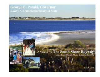
  • 1. George E. Pataki, Governor Randy A. Daniels, Secretary of State A Vision for The South Shore Bayway Long Island South Shore Estuary Reserve January, 2004
  • 2. This report was prepared with financial assistance from the New York State Environmental Protection Fund and the U.S. Department of Commerce, National Oceanic and Atmospheric Administration, Office of Ocean and Coastal Resource Management, under the Coastal Zone Management Act of 1972, as amended.
  • 3. A Vision for The South Shore Bayway Long Island South Shore Estuary Reserve January, 2004 Prepared for the South Shore Estuary Reserve Council with assistance from the South Shore Estuary Reserve Office and the New York State Department of State, Division of Coastal Resources
  • 4. Picture a network of trails, scenic roads and bike lanes leading to the beautiful waters of Long Islandʼs south shore bays.... Gardiner County Park, West Bay Shore
  • 5. Imagine a coordinated system of signs, exhibits and street improvements leading the way to the shoreline.... Waterfront Access, Patchogue
  • 6. Envision exploring the bays, barrier beaches and tributaries alone in a kayak or with friends on a sunset cruise.... Santopogue Creek, Lindenhurst
  • 7. Picture Long Islanders and visitors better connected with the beauty, history and natural splendor of the South Shore Estuary.... View across Bay to Fire Island
  • 8. You are experiencing the new Long Island South Shore Bayway!
  • 9. The Vision The South Shore Estuary Reserve Bayway will be an interwoven network of existing maritime centers, parks, historic and cultural sites, community centers, and waterfronts used by pedestrians, bicyclists, boaters and motorists. Coordinated and cohesive signs will interpret key estuary features, offer self-guided tours and orient Bayway residents and visitors to appreciate the many resources the Reserve offers. Trails, sidewalks, local streets and highways will be safe. Community character will be enhanced. Scenic roads and areas will be recognized, and the regionʼs identity is unified. Shoreline access will exist throughout the Bayway with adequate parking, pedestrian amenities and boating facilities to meet the needs of many user groups from the young to the elderly and from waders to divers. The estuaryʼs health will be protected through on-going preservation, enhancement and monitoring for future generations to enjoy. The vision is elaborated in further detail in the italicized paragraphs below. The Long Island South Shore Estuary Reserve Comprehensive Management Plan establishes a number of recommendations for the future preservation and enjoyment of the Reserve. The Terrill River, East Moriches implementation section of the plan identifies increased public use of the estuary and expanded tourism as an important outcome. The South Shore Estuary Reserve Bayway provides opportunities for all people to experience the estuarine setting through shoreline recreation facilities, open space resources and the Reserveʼs rich maritime heritage and culture. Access to the water, in a variety of forms, and the development of a cohesive interpretive and signage program, are integral to the Bayway system. The Bayway provides a regional framework for the overall A Vision for The South Shore Bayway interpretation of and access to the significant natural, cultural and recreational resources within the Reserve. Virtual Bayway: The Bayway web site will provide the public with a Captree Island, Robert Moses Causeway comprehensive overview of the Baywayʼs environment, its natural and cultural resources, and promotes stewardship of the estuary. The site will list facilities and events sponsored by the many partners providing recreational experiences and educational opportunities. The site will also contain specific up-to-date information: attractions, programs, interactive maps, guides, tours, transportation information, ferry schedules, festivals and locations of visitors centers throughout the Bayway. Communication is a key component of the Bayway. One of the best ways to communicate effectively and quickly with large numbers of people is the Internet. Many Bayway features and attractions already exist and need to be presented and described in a coordinated fashion to become part of the Bayway. The web site will feature maps, locations of interpretive sites and kiosks, location of visitor centers, public transportation links and other detailed information. Signage & Interpretation: The Baywayʼs image will be easily recognized through its NYS Coastal Resources coordinated interpretive signs, exhibits, Interpretive Program Estuary logo and guide books. The signage system Reserve Signage Page 1
  • 10. will publicize, explain and guide the public to cultural sites, access points, natural features and recreation areas. Interpretation will be centered around four central themes: living on the waterfront, working on the waterfront, enjoying the coast, and Bay Shore Maritime Center protecting the waterfront and its maritime heritage. The Bayway is as much an idea as it is a physical network of roads and waterways. Roadside way finding signs, safety signs, logo signs and identification signs for trail destinations will also provide an identity for the Bayway and guide visitors safely and efficiently to points of interest. Interpretive exhibits are located at points along the Bayway such as overlooks, rest areas, historical sites, waterfront areas and recreational sites. These wayside exhibits graphically tell the story of the site and its history. Topics include maritime history, environmental education, cultural sites, South Shore estates, Native American sites, bay houses, ecology of the estuary, fishing and shell fishing, whaling, boat building and other relevant topics. Self-guided tours by car, boat, bike or on foot lead visitors through the Bayway with booklets and numbered signs locating key features. Roadway Corridors: Montauk Highway/Merrick Road will be the Baywayʼs major east-west roadway corridor, serving as the primary transportation artery from which spokes diverge to access a variety of natural, cultural and recreational attractions and sites. Residents and visitors will travel through the Bayway on this primary route via many forms of transportation. A Vision for The South Shore Bayway Pedestrian and bicycle improvements along Montauk Highway and Merrick Road allow this important road to serve as an east-west spine for the Bayway, providing access to the various northsouth routes that lead to tributary streams and the waterfront. The regionʼs public transit system, including busses and trains, becomes part of the Bayway through a public education program, maps and information in compartments Wantagh Bikeway and stations and the enhancement of existing service to include facilities for bicycles and strollers. Some modification or expansion of bus routes provides direct access to shoreline access sites and other Bayway destinations. Maritime Centers: The Bayway will feature existing maritime centers with their mix of restaurants, shops, cultural & recreational activities and waterfront businesses. This will enhance the vitality of the centers and takes advantage of the transportation, shopping and entertainment resources these areas offer. Existing centers will be hubs from which radiate the spokes of the Bayway leading to the shore, parks and cultural sites. Maritime centers feature working waterfront uses such as commercial fishing, boat building and ferries, access to the waterfront and residential neighborhoods that make these areas unique. They serve as hubs for water-based activities and attractions. Strengthening and enhancing existing centers also promotes transit-oriented development and the use of alternative modes of transportation to the automobile. Howellʼs Creek, Bellport This helps reduce highway congestion. Page 2
  • 11. Recreation and Linkages: The Bayway system will incorporate existing recreation areas such as parks, beaches, hiking trails, bicycle paths, golf courses, marinas, charter boats and watersports centers. Recreation sites will become destination points, and linkages will be developed to connect these various recreational activities. Alternative modes of access and improved access to existing recreational areas enhance waterbased sports and activities. Nonwater dependent activities such as golf, sunbathing, scenic viewing, birding, wildlife observation, hiking and hunting are also a key part of Bayway related recreation. Existing and Proposed Trails: A number of existing trails, public access points and bikeways will form a central element of the Bayway. Pedestrian Bridge, Carmanʼs River Many of the regionʼs historic village and town centers have pedestrian amenities such as sidewalks, plazas and parks that extend into surrounding neighborhoods and trail systems. These will offer a unique resource that can be linked together and enhanced throughout the Bayway. Most of the trails are located in parks such as Heckscher State Park, Wertheim National Wildlife Refuge and Connetquot River State Park. Public beaches, boardwalks and waterfront roads provide access for the public to many of the regionʼs waterfronts. Pedestrian and bicycle improvements to existing roads and trails and the construction of new trail links such as the new blueway and underwater trail concepts create a comprehensive trail system from existing resources. Many plans are currently underway to build new bicycle and pedestrian trails, improve public access to the water and to promote the region. The Bayway coordinates with these plans in order to A Vision for The South Shore Bayway pool resources, promote efficiency and avoid confusion and duplication of effort. The New York State DOT is currently planning a number of bicycle, handicapped access and pedestrian improvements Boat Launch Access along the Wantagh State Parkway to Jones Beach, the Robert Moses bridge, Ocean Parkway and the Meadowbrook State Parkway. Trails in the Long Island Pine Barrens have been proposed in Southampton and adjacent communities to improve hiking and bicycle access to this unique ecosystem. These trails create an important regional link for the Bayway to the South Fork where trails such as the Paumanok have already been developed and provide a valuable recreational resource. Also, the Long Island Rail Road allows bicycles on the trains during off-peak hours. This could be coordinated with buses equipped with racks that leave from key stations. Water Trail: The Baywayʼs water trail will create a boating network connecting waterfront access sites, maritime centers, recreation areas and cultural sites along the Long Island and barrier Canoeing on Yaphank Creek island shorelines. Visitors and residents will be able to find a range of boating options from self-guided tours for private motorized and non-motorized boaters to charters and scheduled boat trips featuring varying themes and destinations. Page 3
  • 12. The Bayways water trail connects the regionʼs public access points as well as the existing ferry system and a range of natural, cultural and recreational destinations. Small non-motorized boats explore the narrow tributaries, salt marshes and tidal channels. The existing ferry system linking Long Island mainland with Fire Island across Great South Bay is one example of the best ways for residents and visitors to experience the water, marshes and beaches of the south shore. Visitors find their way by car, bicycle, shuttle system, train or foot to a variety of waterfront access sites with the help of the Baywayʼs signs and exhibits. Parking and access at sites will be attractive, convenient and well marked. With the help of guidebooks, boat trips feature nature study, birding, marine life, clamming and fishing. Other excursions visit the regionʼs cultural sites, historic waterfront mansions, outdoor theatres, Historic Bay Houses maritime museums and boat building centers. The more adventurous can find boats to visit beaches, go water-skiing, scuba diving or parasailing. The Baywayʼs boating network encourages a range of boat types, creative interpretation and an environmental sensitivity on the part of the boat operators. It also becomes an integral component of a State-wide Blueway Trail being initiated by the New York State Department of State. History and Culture: The Bayway will make the water the focal point for the quality of life on Long Island for residents and visitors. For centuries, Long Islanders have been closely connected with the water. The rich historical and cultural resources still in existence will provide a significant portion of the Baywayʼs interpretive program. A Vision for The South Shore Bayway Native Americans fished, hunted and gathered shellfish in the south bays and their tributary streams and hunted whales offshore. Early European settlers continued these traditions and introduced shipbuilding, offshore fishing, ice harvesting, shipping and recreational boating. Later generations introduced duck Historic Boat Building Enterprise hunting and rum running, and built bay houses. Wealthy families of the Gilded Era including the Belmonts, Phelpses, Floyds, Heckschers, Vanderbilts, Cuttings, and Bournes built large estates on the south shore, many of which remain as parks and historic sites. Due to the decline of traditional water-based activities and the development of the shoreline after World War II, the natural access to the beauty of the shoreline was dramatically altered. Large sections of the coastline have been privatized and the few remaining ports and public access points are overcrowded. The Bayway system renews accessibility to the water and to the significant historical and cultural features that inspired the original inhabitants of the region. Natural Resources and Stewardship: The preservation, enhancement and public stewardship of the regionʼs natural resources is critical to the success of the Bayway. Environmental education will be incorporated into Bayway signage, exhibits, tours and brochures to explain the unique ecology of the bays and the steps that need to be taken to protect and improve their health. South Oyster Bay , Town of Oyster Bay Page 4
  • 13. Environmental preservation elements of the Bayway include open space corridors and greenways that extend on either side of trails, streams and rivers. These greenways also serve as wildlife corridors and natural areas. Wildlife habitats are a key focus of the Bayway, both for their preservation and for their interpretive value and appeal for visitors. Parks are created and expanded at key sites to provide waterfront access, protect unique resources and to link existing open spaces. Salt marsh preservation efforts are reinforced, and environmental education on the role of salt marshes and the estuarine ecosystem are highlighted. Coastal ecology and the relationship of the estuary to marine and upland environments are incorporated into the Bayway program. The connection between urban stormwater runoff, tributaries, rivers and bays is explored, and the use of new techniques such as low impact development and best management practices is interpreted. Educating the public regarding “ecologically correct” boating is vital to the preservation of the unique natural resources of the estuary. Scenery and Landscape: The natural beauty of the South Shore Estuary Reserve is a major resource and one of the primary reasons people will visit and use the Bayway. The vast salt marshes, endless dunes, wide sandy beaches and winding tributary streams create a unique visual setting that contrasts with the congested suburban streets of the interior. Protecting, interpreting and accessing this scenic resource will be a central feature in the overall mission of the Bayway. A thorough analysis of the regionʼs scenic resources is currently underway. The Distinctive Natural Character project identifies the elements that create the estuaryʼs unique scenery, locates areas A Vision for The South Shore Bayway with varying degrees of scenic character and identifies strategies for protecting scenic resources. Key elements include protecting undeveloped lands, continuing the cleanup of the bays and the environmental remediation of contaminated sites, removing eyesores and preventing inappropriate development, especially in sensitive waterfront areas. The Bayway both protects and promotes scenic resources. Increasing access to scenic vistas allows people to experience the beauty of the South Shore Estuary at various times of the day and at various Boardwalk at Fire Island National Seashore seasons. The Bayway brings visitors to places previously only accessible to private boat owners. Parks and conservation areas along major tributaries are increasingly accessible through the Bayway and other access programs. Protecting the scenery of these areas by increasing the size of parks and controlling neighboring development enhances the scenic character of the Bayway. Transportation: The Bayway will use the regionʼs existing transportation system while creating new linkages and promoting transportation improvements that enhance safety and ease of use for pedestrians, bicyclists, boaters and users of mass transit. In addition to improving safety and transportation efficiency, these improvements will also enhance the character, scenery and quality of life along the Bayway. New bicycle lanes, sidewalk improvements, safer pedestrian crossings, street tree plantings, handicapped improvements and traffic calming measures ensure that both cars and pedestrians and bicyclists coexist on the regionʼs streets. The new and enhanced Page 5
  • 14. trails and linkages for bikes and pedestrians lead to water access points. Improved parking areas that blend in with the character of the neighborhoods facilitate access for drivers. While most of the Bayway is accessible by car, improved facilities for bicycles and pedestrians promote other modes of transportation. Designating scenic roads helps protect the regionʼs scenic byways and provides protection and management for these unique resources. Scenic roads designation also makes it easier for municipalities to receive grants from the federal Village Center with Sidewalk: Bellport TEA-21 program to improve pedestrian and bike amenities, plant trees, provide signage and exhibits and manage visual corridors along roads. Existing and proposed waterfront access sites and maritime centers need to be easily accessible by all modes of transportation with ample and welldesigned parking that doesnʼt detract from the character of the waterfront and surrounding neighborhoods. Attractive plantings, trees, islands and walkways enhance safety while improving the aesthetics of Walkable Communities the area. These A Vision for The South Shore Bayway improvements create an attractive and efficient environment for access to the resources of the Bayway. Parking: The Bayway will carefully and creatively address parking while enhancing the pedestrian character, beauty and diversity of the region. Creative parking lot siting and design respects existing cultural and environmental features, addresses access and safety concerns, respects neighbors and community context and incorporates extensive plantings and pedestrian features. Lack of adequate parking is problematic, but poorly planned parking and excessive Schematic Parking Design reliance on the automobile ruins the character of the destination points that are key to the success of the Bayway. Opportunities exist to use the extensive Long Island Rail Road parking lot during off-peak hours on the weekends. Providing attractive and accessible parking is a key element in getting people to the water and increasing their enjoyment of the experience. Page 6
  • 15. Implementing the Bayway Vision Nominations by Community Groups and Municipalities Implementing the Bayway vision will involve all those who will benefit from it. Neighborhood associations, cycling and paddling clubs, community service organizations, and others are encouraged by the South Shore Estuary Reserve Council to nominate areas suitable for inclusion in the Bayway (streets, trails, bikeways, parks, visitors centers and other sites) for recognition by the Council. Municipal projects that establish or improve Council-recognized elements of the Bayway will be eligible for financial assistance through the Local Waterfront Revitalization Program Environmental Protection Fund (LWRP EFP) administered by the Department of State. Consensus on a South Shore Bayway strategy. Ensuring communities along the Bayway are able to make the most of what the Bayway has to offer requires consensus on the Baywayʼs development and promotion. A strategy will be completed to: identify opportunities to expand existing programs and increase interpretation of the South Shore Estuary Reserve; develop themes for interpretation of the natural and cultural resources of the Reserve; identify locations along the Bayway that function as major destinations; recommend partnered capital improvements that implement the Bayway; and solicit financial support from the private and public sectors. A virtual Bayway. Built on the South Shore Estuary Reserveʼs existing web site (www.estuary.cog.ny.us), a virtual Bayway will parallel and track development of the physical Bayway. The virtual Bayway will present on the Internet the many trails, cultural and historic sites, maritime centers, museums, visitors centers and other noteworthy destinations that have been recognized as part of the South Shore Bayway. A Vision for The South Shore Bayway The installation of kiosks and wayside interpretive exhibits. The Bayway will have increased visibility with the installation of kiosks and wayside interpretive exhibits at strategic locations throughout the Reserve. Communities will be encouraged to install kiosks and wayside exhibits consistent with the New York State Coastal Resources Interpretive Program signage design guidelines. Such kiosks and exhibits will also be eligible for LWRP EPF financial assistance. An initial set of kiosks is currently being installed in the maritime centers of Freeport, Bayshore, Patchogue and at the Shinnecock Canal. Initial wayside interpretive exhibits are planned for highly visible parks and natural areas within the towns of Hempstead, Oyster Bay, Babylon and Brookhaven. What You Can Do Familiarize yourself with the trails, parks, visitors centers and other destinations in your community that have potential for inclusion in the Bayway. Work with your municipality to nominate these areas to the South Shore Estuary Reserve Council. Browse the South Shore Estuary Reserveʼs comprehensive management plan, especially the sections on public use and enjoyment of the estuary and the estuary-related economy. Enjoy the Long Island South Shore Estuary Reserve, home to some of the finest recreational activities in the Northeast! Page 7