SlideShare uma empresa Scribd logo
1 de 44
Baixar para ler offline
Appendix B
County of Caroline, Virginia
Carmel Church Community Plan
Adopted by the Board of Supervisors
January 23, 2007
Appendix B - Carmel Church Community Plan B - 1
Table of Contents
Page
Acknowledgments 2
Introduction 3
Demographics & Growth Trends 5
Community Design 8
Land Use 13
Resource Protection 22
Public Facilities 27
Economic Development 34
Transportation 38
APPENDIX B - CARMEL CHURCH COMMUNITY PLAN
Appendix B - Carmel Church Community Plan B - 2
Caroline County Board of Supervisors
Calvin Taylor, Chairman
Wayne Accors, Vice-chairman
Robert Farmer
Maxie Rozell
Floyd Thomas
County Administrator
Percy C. Ashcraft
Caroline County Planning Commission
M. Raymond Piland, III, Chairman
Dr. Milton Bush, Vice-chairman
Joseph Brown, Jr.
William L. Smith
Pete Davis
Carmel Church Citizen Planning Committee
Mrs. Sandra Stevens, Chairman
Mr. Stuart Martin, Vice-chairman
Ms. Nancy Albright, Secretary
Mr. Bruce Claiborne
Mr. Bernie Runk
Mr. Pierpont Williams
Mr. G. Warren Samuel
Mr. Stuart Lane
Mr. Johnson Coleman
Mr. John Braun
Mr. Art Strader
Mr. Rory Smith
Mr. Floyd W. Thomas, Chairman Board of
Supervisors
Mr. D. M. “Maxie” Rozell, Jr., Vice-chairman
Board of Supervisors
Mr. William "Leon" Smith, Planning Com-
mission - Reedy Church
Dr. Milton Bush, Planning Commission –
Mattaponi
Project Staff
Gary D. Mitchell, Project Planner
Dennis Carney, Comprehensive Planner
Michael A. Finchum, Director of Planning and Community Development
Rappahannock Area Development Commission
ACKNOWLEDGEMENTS
The members of the Port Royal Area Planning Advisory committee gratefully acknowledge the efforts of the
following officials, organizations and individuals who assisted in the preparation of this document. We also
thank the citizens who participated in the process.
Appendix B - Carmel Church Community Plan B - 3
INTRODUCTION
The Carmel Church Community Plan is part of the Caroline County Comprehensive Plan, the official policy
guide for future development decisions. Both Plans are long range in nature and provide a picture of how the
community wishes to develop over the next 20 to 25 years.
As a policy document, the plan provides a framework for the community’s residents and decision makers to
conceptualize how the community should look and function. The major goals of the Community Plan aim
to guide the community into the future.
GOALS
x Provide a guide for the numerous public entities and promote decisions that will create the
future community;
x Promote the interests of the Community as a whole;
x Enhance, describe and promote the Community’s physical development;
x Evaluate short-term actions against long-term goals; and
x Recognize the natural resources, historical, and architectural significance of the Carmel
Church Community and the surrounding area so that they can be more effectively pre-
served, protected, and integrated into an orderly pattern of development.
The overall goal of the Carmel Church Community Plan is best revealed by following the Vision Statement:
Carmel Church is a strategically located historic community and transportation hub offering
opportunities for employment, peaceful living, and a warm shopping environment. The com-
munity will retain its rural character through managed growth by attracting and promoting
socially and environmentally responsible economic development. Through managed growth it
will become a vibrant place to live and work.
CARMEL CHURCH PLANNING PROCESS
PLAN ORGANIZATION
The Community Plan is divided into several sections covering the following topics; architecture/design, land
use, resources, economic development, transportation and community facilities. Each section has a general
discussion of these topics followed by the Goals and Action Strategies.
PLANNING PROCESS
The process began in the autumn of 2005 and involved the selection of a citizen committee by the Board of
Supervisors who attended the first annual Caroline County Citizen’s Planning Academy. This academy was
a four week course facilitated by Dr. Michael Chandler, Director of Education of the Virginia Citizen Plan-
ning Education Association (VCPEA). The training focused intensely on the history of planning and the
legal framework for planning in Virginia. At the conclusion of the academy, the citizen committee developed
a mini-land use map, used as a resource in launching this planning effort in the Carmel Church Community.
The mini-land use map was the first attempt to develop a community wide plan for Carmel Church. The
process was organized as a citizen driven process, where a Community Survey was conducted, responses
tabulated and analyzed. The citizen planning committee used the results of the survey as a basis to formulate
the goals, objectives, concepts, and strategies for the community.
Appendix B - Carmel Church Community Plan B - 4
The planning committee held semi-monthly meetings advertised in the local media and met with a wide vari-
ety of public and private interest groups and agencies. In the spring of 2006, the committee participated in a
planning exercise, composed of three parts. First, the committee members were asked to identify a key par-
cels in the Carmel Church Community that when and if developed, may potentially completely change the
nature of the community. Secondly, they were asked to identify all the resources in the community. Finally,
the committee members developed a list of “Hot Button” issues. After identifying these items, the committee
ranked their findings and compiled the top three items from each part and used the lists to help draft this
plan.
Key Parcel Analysis
The section of land bounded by I-95 (east), Route 1 (west), Route 207 (north) and the Hanover-Caroline
County Line (south)
The four quadrants of the I-95 interchange
Commercial area in front of Belmont Development
Community Resource Analysis
Sewage Treatment Plant
VA Sports Complex
Carmel Church Commercial Center
Hot Button Issues
Improve traffic control, safety and management of traffic and provide for better enforcement of traffic
laws, in and around the I-95/Route 207 interchange
Provision of utilities (water & sewer)
Construction of an elementary school
These same concerns in all three planning exercises were also expressed in the results of a community survey.
The survey results provide further evidence that the conclusions of the Committee from the exercises are sup-
ported in the Carmel Church Community.
In the summer of 2006, the committee divided itself into sub-committees to work on the various topics of the
plan. Upon completion of this work a draft plan was prepared by County staff using the work of the sub-
committees. Once this draft plan had been reviewed and revised by the Carmel Church Committee, an Open
House was held October 21, 2006 to display the results of the Committee’s work and draft plan. Some of the
interest groups that participated in the Open House and planning process were Fredericksburg Home
Builder’s Association, Caroline County Chamber of Commerce, and FREDricksburg Regional Transit.
At the conclusion of the Open House, County staff revised the draft document based upon the comments
received at the Open House. The Carmel Church Community Plan was presented to the Caroline County
Planning Commission on December 20, 2006 and forwarded to the Board of Supervisors with a recommen-
dation of approval. The Caroline County Board of Supervisors approved the Carmel Church Community
Plan January 27, 2007.
Appendix B - Carmel Church Community Plan B - 5
DEMOGRAPHICS & GROWTH TRENDS
OVERVIEW
This section briefly reviews recent trends in demographic factors such as age, household composition, and
income. This summary and analysis of existing conditions and trends is intended to provide background in-
formation and rationale for the various goals and action strategies outlined in this Community Plan. In order
to plan effectively for the future it is important to understand where the community has been, where it is and
where it is going.
SUMMARY OF COUNTYWIDE GROWTH TRENDS
This information is a brief summary of information that is contained in the 2003-04 Caroline County Demo-
graphic Analysis. This summary provides public officials, local citizens, and other interested parties with ba-
sic information on past trends and current conditions for the County.
Caroline County has experienced increases in population, housing, and employment over the last thirty
years. From 1970 to 2000, the County’s population increased from 13,925 to 22,121, which represents a
population growth of nearly 59%. In 1980, the County population was 17,904 rising to 19,217 by 1990,
which represented an increase of approximately 7.3%. The County’s total population reached 22,121 accord-
ing to the 2000 Census. This is an increase of approximately 15% over the previous Census findings. The
Weldon-Cooper Center for Public Service of the University of Virginia, estimates that by 2010 the County
population will increase by 13.5% to 25,099.
As of July 2002, the Weldon-Cooper Center released provisional estimates of population indicating a total
population of 22,200. This is an increase of 0.5% since the 2000 Census or approximately 0.2% per year.
Based upon historical trends and current building permit activity, the population will continue to grow at a
similar rate well into the next decade.
The economic strength of the County has also seen significant increase. The County’s median household
income continues to rise at a steady rate. The 1970 Census reveals a median household income of $19,991.
The 2000 Census indicated that the County’s median household income was at $39,845. Since 1970, the me-
dian household income has risen by $19,854, an increase of almost 100%.
Total employment in the County has also grown steadily over the last 30 years. According to the 1970 Cen-
sus, Caroline County had 3,569 total employees, which increased to 4,741 employees by 1980 and 5,738 em-
ployees by 1990. By 2000, there were 7,978 employees, an increase of 124% from 1970. The economy also
became more diversified over this time period, with increases in employment in the Construction, Service,
FIRE (finance, insurance and real estate), Wholesale and Retail Trade sectors.
CARMEL CHURCH COMMUNITY DEMOGRAPHICS
The following statistics reflect the demographics for the Carmel Church community, which provide insight
into the community based on the 2000 Census data and a conservative extrapolation of population growth
trends based upon the 2000 population and the new homes that have been built in the County between 2000
and August 2006.
POPULATION
The population increase in the Carmel Church area is a major component of the growth of Caroline County.
Overall, Caroline County has grown by approximately 15.1 percent and based upon building permit records,
Carmel Church grew by 74.4 percent. This accounts for over half of the growth in a five year period. Chart 1
shows the growth of population of the County and Carmel Church Community during this time.
Appendix B - Carmel Church Community Plan B - 6
HOUSING
There were 431 new homes constructed
during that time period. This report takes
the conservative approach of multiplying
the total number of homes by the average
house population size of 2.83 for these
Census Blocks from the 2000 Census. It
is noted that, with the future approved
section of the Belmont community and
other large potential residential communi-
ties, the Carmel Church area will be a
major focal point for population growth
for Caroline County for many years in the
future.
INCOME
Income is a measure of change for a rural
suburbanizing community. Rising in-
come and decreasing poverty levels are
signs that more prosperous residents are
migrating to the area and that the eco-
nomic condition of existing residents is
improving. The Carmel Church area has
experienced a higher median family in-
come and per capita income than the
remainder of Caroline County. Further-
more, the area has fewer people below
the poverty level.
0
5,000
10,000
15,000
20,000
25,000
Caroline County Carmel Church
Community
Chart 1: Total Population Of Caroline County
and Carmel Church Community
2000
2005
Total Population of Caroline County
and Carmel Church Community
0
2,000
4,000
6,000
8,000
10,000
12,000
Units
2000 2005
Time
Chart 3: Total Housing Units in Caroline County and Carmel
Church
Caroline County
Carmel Church Community
Total Housing Units in Caroline County
and Carmel Church
0
5,000
10,000
15,000
20,000
25,000
30,000
35,000
40,000
45,000
Thousands($)
Median Family Income Per Capita Income
Chart 5: Income of Caroline County and Carmel Church
Caroline County
Carmel Church
Community
Income of Caroline County and Carmel Church
Appendix B - Carmel Church Community Plan B - 7
AGE
Age groups reflect the opportunities and concerns that face a community. Carmel Church has a slightly
younger population than that of Caroline County and the Commonwealth of Virginia. Since a majority of
the Carmel Church population falls between the ages of 18 and 65, approximately 60 percent of community’s
population is in the age groups that constitute the bulk of the workforce. This large percentage bodes well for
the economic prospects for the future.
Table B.1: Population Age Groups
Age Category Number Percent of Population
Under 18 Years
Carmel Church 427 26.1
Caroline County 5,386 24.8
Over 18 Years and Less than 65 Years
Carmel Church 669 40.9
Caroline County 8,240 39
Over Age 65 Years
Carmel Church 242 14.8
Caroline County 2,854 12.9
Appendix B - Carmel Church Community Plan B - 8
COMMUNITY DESIGN
OVERVIEW
The Carmel Church Community desires all new construction, as well as any redevelopment, to reflect its
heritage through the use of architectural standards and improved site design. Future growth of the commu-
nity needs to enhance a small town character and significant historic properties located in the area. The im-
provement of the appearance and design of the community is a major factor that was identified by the citizen
planning committee.
NATURAL ENVIRONMENT
The citizen planning committee and survey iden-
tified preservation of the natural environment
and the agricultural heritage of the community
as vital. Future development should foster a
“sense of place” and be consistent with the fur-
ther development of the “Village of Carmel
Church”, instead of the typical suburban devel-
opment pattern. Threats to this desired develop-
ment pattern include insensitive and incompati-
ble development, inconsistent regulations, pollu-
tion and litter, and the lack of appreciation for
the scenic beauty. The committee and the sur-
vey also expressed an interest in protecting his-
toric buildings and sites within the Carmel
Church Community. Additionally, the survey
reflected the desire of residents to protect and
enhance existing, as well as future, neighbor-
hoods within the Carmel Church Community
from incompatible development. Other special characteristics of the community are its tranquility, quietness,
farmhouses and the large, expansive agricultural landscapes with scattered forests along fence rows and creek
basins leading to the South Anna River. The creation of a village in the Carmel Church Community
strengthens the preservation of the rural landscape surrounding the community. Use of conservation subdivi-
sions can enhance the preservation of significant tracts of land surrounding the village center.
GATEWAYS
As identified in the Community Vision Statement, the Carmel Church
Community is the southern gateway to Caroline County. A gateway
should provide an inviting picture and gesture of welcome to visitors and
tourists. The entrance to a community should reflect the care and quality
of the environment within. One of the planning exercises that the Com-
mittee conducted was to list the community identifiers or symbols that let
a person know they are in Carmel Church. The number one ranked com-
munity identifier was the commercial development at the I-95 inter-
change and the Petro sign.
The Carmel Church Community has two major southern entrances into
Caroline County: U.S. Route 1 and Interstate 95.
There are a variety of methods to address the appearance of these corri-
dors entering the Carmel Church Community. They range from the Vir-
ginia Department of Highway’s Adopt-A-Highway program to neighborhood cleanup drives and use of vol-
unteers to establish and maintain entrance feature landscaping. These are the types of programs that need to
be initiated by the residents of the Carmel Church Community.
Appendix B - Carmel Church Community Plan B - 9
These principal roads leading into the Carmel Church Community need special attention and care as devel-
opment occurs. Particular attention needs to be paid to signage and landscaping of developments on these
corridors. The citizen committee and the survey expressed concern about the landscaping and appearance of
non-residential development along these major roads. The creation and implementation of a development
standards policy by the County has been identified as one solution to this concern. Ideally, such a policy
would require the planting of street trees and other landscaping on non-residential parcels along with archi-
tectural treatment to respect the historic character of the community. The integration of Low Impact Devel-
opment techniques (LID) with the principles of traditional neighborhood design (TND) is strongly supported
by the citizen planning committee and would provide a framework for the implementation of a development
standards policy.
COMMUNITY IDENTITY & FUTURE DEVELOPMENT
The Carmel Church Community is a small community with many identities. It is a historic village, a rural
farming community, and emerging commercial center. The area exudes nostalgia of a simpler time in its
tight-knit residential areas. The real issue is how these identities can survive, while still promoting and pre-
paring for the growth that will eventually come to the Community.
Priority items include issues such as promotion of historic heritage and tourism, preservation of scenic views
and the natural environment, and stimulating redevelopment of existing commercial sites in ways that are
compatible with the community’s historic past.
ROUTE 207 & I-95
The interchange of these two major roads has already experi-
enced substantial growth. Highway oriented commercial uses
extend from the intersection of Route 207 and Route 1 through
the interchange and east towards the Belmont neighborhood.
To integrate this existing development into a village concept
will require the use of grant funds to install sidewalks, land-
scaping and a reduction in permitted signage. Several new
development proposals in this portion of the Community are
contributing such improvements as a part of their development
process. The County should seek out grant funds to provide
further improvements to integrate these uses into the overall
community.
THE VILLAGE CORE
The citizen committee identified the location of the village core for the future of the Carmel Church Commu-
nity to be the land lying primarily between U.S. Route 1 and State Route 652. The northern limit of the core
is bounded by U.S. Route 207 with the southern boundary being the North Anna River. Lands lying adja-
cent to these boundaries should serve as transition zones to the more rural areas of the Carmel Church Com-
munity. Moving out from the core the use of conservation subdivisions need to be promoted with extensive
tracts of land preserved and permanently protected from future development.
TRADITIONAL NEIGHBORHOOD DESIGN (TND)
The use of TND design principles need to be included in all new developments within the core of the Carmel
Church Community. The major theme, or design, elements of TND development involve the following fea-
tures:
x The development has a discernible center often characterized by a square or a green. A transit stop
or facility would be located at this location.
Business on 207 adjacent to I-95 interchange
Appendix B - Carmel Church Community Plan B - 10
x Most dwellings are within a 5-minute walk of the center or other public spaces such as pocket parks.
A 5-minute walk is approximately an average of 2,000 feet.
x There are a variety of housing types which are mixed together. For example, a street may have some
row houses and detached single-family dwellings along with live-work units. The housing types are
intermixed and not segregated and the designs reflect consistent themes.
x On the edges of the neighborhood are shops and other commercial uses designed to meet the needs
of the community.
x Garage apartments are permitted within the backyard of each dwelling unit. It may used as a rental
unit or a craft shop or office for a particular service business.
x Typically an elementary school is located within the community in close enough proximity that
many children can walk to school. This facility may be in or close to the center of the development.
x Small playgrounds and/or pocket parks are accessible to every dwelling unit. In order to meet this
accessibility factor such facilities need to be not more than one-tenth (1/10) of a mile away.
x Streets within the community form an interconnected network which disperses traffic by providing a
variety of pedestrian and vehicular routes to any destination. Additionally, the spine or major en-
trance road would be designed as a boulevard with a landscaped median. Other streets are relatively
narrow and shaded by rows of trees. This design element slows traffic and makes the environment
suitable for pedestrians and bicycles.
x Buildings and dwellings are placed relatively close to the street creating a well defined outdoor room.
Parking lots and garage rarely front on the street. Parking lots are relegated to the rear of all build-
ings usually accessed by alleys.
x Prominent sites at the termination of streets are reserved for public buildings or public uses such as
churches, commentaries, statues, fountains, and parks, etc. Often these public spaces are developed
as part of the development of the community and dedicated to a public entity. These sites are used
for public meetings, education, religious or cultural activities.
x Finally, the architecture of the all the buildings in a TND are one which promotes and respects the
history of the area. Dwelling units typically have front porches, garages located behind the house
and served by alleys.
There are several examples of older, possibly historic, dwellings in the Carmel Church Community that re-
flect the architecture one may find in a traditional neighborhood. Below are two examples.
Appendix B - Carmel Church Community Plan B - 11
GOALS, ACTION STRATEGIES AND IMPLEMENTATION
GOAL 1.1: SUPPORT THE CREATION OF THE VILLAGE OF CARMEL CHURCH
Action Strategy 1.1-1: Use traditional neighborhood design principles in the development of the
Village of Carmel Church.
Action Strategy 1.1-2: Establish a transit stop within the Village of Carmel Church.
Action Strategy 1.1-3: Require open space and landscaping throughout the planning area with an
emphasis on preserving existing vegetation to the greatest extent possible.
Action Strategy 1.1-4: Encourage the use of sustainable development techniques and procedures.
Action Strategy 1.1-5: Use drip irrigation systems for maintenance of all landscaping requirements.
Action Strategy 1.1-6: Adopt policies encouraging the use of energy star compliant regulations for
all new development in relation to mechanical equipment, appliances, and building materials.
Action Strategy 1.1-7: Modify policies to require any dedication of land for a public facility be sub-
stantially improved, so that such a facility can be implemented in a cost effective manor .
Goal 1.2: Preserve the natural resources and rural character of the Carmel
Church Community
Action Strategy 1.2-1: Adopt conservation subdivision provisions in the County’s ordinance to per-
manently preserve substantial portions of the rural lands in the community.
Action Strategy 1.2-2: Adopt and implement an agricultural and forestal district program.
Action Strategy 1.2-3: Adopt a transfer of development and/or purchase of development rights pro-
gram.
Action Strategy 1.2-4: Preserve areas with productive soils for continued agricultural and forestry
uses by preserving blocks of land large enough to allow for efficient operations.
Action Strategy 1.2-5: Adopt a right to farm provision in the County Zoning Ordinance.
GOAL 1.3: ESTABLISH A STRONG SENSE OF COMMUNITY IDENTIFICATION BY THE PRESERVATION
OF RURAL LANDSCAPES AND PROMOTION OF A TRADITIONAL NEIGHBORHOOD DESIGN
TO SERVE AS THE CORE OF THE CARMEL CHURCH COMMUNITY.
Action Strategy 1.3-1: Preserve areas containing unique and sensitive natural features associated
with the rural landscape of the community. Such features may include wildlife habitats, migration
corridors, steep slopes, streams, and wetlands.
Action Strategy 1.3-2: Minimize land disturbance through retention of existing vegetation and use
of Low Impact Development techniques.
Action Strategy 1.3-3: Preserve scenic views, the river, historic and archeological sites and incorpo-
rate a park/greenway system to link these resources.
Action Strategy 1.3-4: Create traditional neighborhoods that are accessible to open space ameni-
ties, replicate historic development patterns, and create a strong community identity.
Appendix B - Carmel Church Community Plan B - 12
Action Strategy 1.3-5: Create a gateway via the use of a marker or monument on the major routes
leading into Carmel Church.
Action Strategy 1.3-6: Develop a network of community volunteers to assist in community beautifi-
cation and assistance to property owners who are physically, mentally and/or economically disad-
vantaged.
IMPLEMENTATION
Each method of implementation has the associated action strategy (AS) that correspond to this activity iden-
tified.
WITHIN 5 YEARS;
x Adopt Traditional Neighborhood Design (TND) principles in an overlay district for the Carmel
Church Community (AS 1.1-1 & 1.1-3).
x Adopt policies and revised ordinance provisions promoting sustainable development and energy star
compliance for all components of new and re-development projects (AS 1.1-4, 1.1-5, & 1.1-6).
x Adopt conservation subdivision provisions in the County’s ordinance (AS 1.2-1, 1.2-3).
x Adopt a TDR provision in the County Code to permit density to be increased in targeted growth
areas and to permanently protect valuable agricultural and forestal lands (AS 1.2-3, 1.2-4).
x Revise proffer guidelines to require site improvements and/or actual construction of public facilities
in place of land dedications for such facilities (AS 1.1-7).
x Enact an Agricultural and Forestal District Program to preserve valuable crop and forest land re-
sources (AS 1.2-2 & 1.2-5).
WITHIN 7 YEARS;
x Adopt a Right-to-Farm provision in the Zoning Ordinance requiring property owners or their repre-
sentatives to disclose to potential buyers of real estate of the activities associated with agricultural
and forestal operations (AS 1.2-5).
x Adopt low impact development techniques in stormwater management provisions of the County
ordinance (AS 1.3-2).
x Develop a greenway and open space plan for the Carmel Church Community (AS 1.3-3).
x Explore the creation of a purchase of development rights (PDR) program to preserve valuable natu-
ral habitat, agricultural lands and forestry resources (AS 1.2-1, 1.2-4 & 1.3-1).
WITHIN 10 YEARS;
x Acquire resources to establish a Carmel Church gateway marker and utilize volunteers for its main-
tenance (AS 1.3-6).
x Establish a volunteer network through the Community Pride Program to assist disabled and elderly
residents to improve and maintain their property (AS 1.3-6).
Appendix B - Carmel Church Community Plan B - 13
LAND USE
OVERVIEW
The Carmel Church Citizen Planning Advisory (CPAC) was appointed by the Board of Supervisors to assist
the County with the update of its current comprehensive plan. The Committee began its mission with three
major goals:
x To help establish the boundaries of the Carmel Church Community
x To navigate the future direction of the Carmel Church Community
x To provide a guide toward establishing a community identity for the Carmel Church Community
The Community has experienced rapid residential growth due to increasing development pressure from the
metropolitan areas of northern and central Virginia. This growth is starting to make some changes in this
region of the County. With a lack of transportation coordination, along with appropriate monetary alloca-
tions from the Commonwealth of Virginia, the traffic situation has significantly deteriorated around the I-95
interchange. Furthermore, growth in Carmel Church will require additional public facilities such as parks,
recreational facilities, libraries, schools, solid waste, emergency services and senior centers. While growth
cannot be stopped, the citizens of the Community desire to control or manage such growth.
CARMEL CHURCH COMMUNITY BOUNDARY
The western boundary of the Carmel Church Community is designated as the eastern boundary of the Caro-
line Pines neighborhood and the high voltage transmission lines. The eastern boundary terminates at the
Pole Cat Creek crossing of the transmission lines. The northern boundary follows Pole Cat Creek, crossing
U.S. Route 207 and branching off along the southern most tributary of the Creek. The boundary then crosses
I-95 and U.S. Route 1 terminating at old Telegraph Road. The western boundary follows old Telegraph
Road transitioning to the existing Telegraph Road, and then to the intersection of Telegraph and Jordan
Smith Roads. The western boundary follows Jordan Smith Road in a straight line to Jericho Road near the
western property line of the Carmel Christian Academy. The western boundary line then follows Jericho
Road in a western direction terminating at the intersection of Jericho Road and Long Creek. The southern
boundary follows Long Creek in a southeasterly direction transitioning to the telephone line right-of-way and
then to the North Anna River, terminating where the high voltage transmission lines cross the river.
GROWTH MANAGEMENT
A growth management strategy needs to be developed to identify and guide new growth to locations where
public facilities can be provided. Public facilities include the provision of adequate roads, storm water man-
agement, schools, parks, emergency services, and water and sewer. Open space and agricultural areas, as
well as environmentally sensitive areas requiring protection, need to be identified and appropriate preserva-
tion programs initiated by both the Community and the County. The implementation of such a program will
guide growth and help to maintain an important and desired distinction between the village core (growth
area) and rural area of the Carmel Church Community.
One method of managing growth is to promote the use of Traditional Neighborhood Designs (TND), which
incorporates business and residential uses in a single unified development plan. Such developments promote
the linking of residential areas to non-residential areas via sidewalks, trails and bike lanes. Additionally,
TND’s often promote the use of historic and “human-scale” architecture as it relates to site and building de-
signs. Human scale relates to the height and mass of the building. Typically human scale architecture per-
mits structures to be no more than two to three stories in height. Additionally, this type of development cre-
ates unique places for community gatherings while promoting non-motorized modes of transportation.
Another benefit to a the TND type of development is that it typically preserves open space by promoting the
clustering of homes and businesses into compact areas within the overall development along with common
open spaces for passive recreational uses. The citizen sub-committee and responses from the various partici-
Appendix B - Carmel Church Community Plan B - 14
pants during the Open House supported this approach as it relates to managing future growth in the Carmel
Church Community.
RESIDENTIAL DEVELOPMENT
Question 5 of the Community Survey posed to Carmel Church residents asked, “Recognizing that the popu-
lation growth in the County and the Carmel Church Community will continue to grow, what kinds of resi-
dential development would be desirable in the Carmel Church Community?” In general, respondents an-
swered that mixed-use development would be the most desirable. This was followed by single-family homes
on parcels of one to five acre, single-family homes on parcels of less than one acre, and single-family homes
in conservation subdivisions with surrounding open space. Least desirable proved to be the addition of mo-
bile homes to mobile home parks with less than 1% choosing this option. In total over 80% of the residents
preferred mixed use developments, homes on lots less than 5 acres and/or conservation subdivisions.
When asked where new residential development should take place, less than 1% of the community stated that
there should be no new residential development, while 52% stated that new residential development should
be located off U.S. Route 1. Nearly 30% stated new residential development should occur in Belmont, while
16% stated they preferred new residential development to occur along U.S. Route 207.
Generally, you can
find several existing
examples of residential
developments that
exist in the Commu-
nity. Holly Ridge
(right) is a neighbor-
hood with parcels
ranging in size from
two to four acres,
while Belmont (left), a newer neighborhood, has lots less than one acre, sidewalks and open space. Caroline
Pines is an older residential community with parcels generally less than one acre and open space throughout
the development.
NON-RESIDENTIAL DEVELOPMENT
Carmel Church contains all ingredients needed for economic growth. The area is serviced by public water
and sewer. The existing wastewater plant will soon be expanded to include more areas and uses. There is an
excellent regional and national transportation system and general costs of business, such as land and taxes,
are relatively low.
In relation to Caroline County, the Carmel Church area is primed to become the predominant economic de-
velopment area for the County and the region. The community can become a major employment center that
could draw workers not only from Caroline, but also from Richmond, Fredericksburg and , the Washington
DC area, with implementation of a commuter rail. As an economic center, the Carmel Church area would
provide a positive cash flow to the County and provide a larger tax base contributing the resources needed to
implement other initiatives such as parks, new schools and other public infrastructure. It is imperative that
the Carmel Church Community Plan promote a TND/Planned Development designation to foster the future
development of a town center and/or village core. This designation would provide protection to the more
rural landscapes within the Carmel Church Community, while promoting the growth of the County’s tax
base in the village center.
COMMUNITY IDENTITY
Placemaking is the deliberate creation of a living and working environment that brings a sense of community
and identity to areas as small as a village and as large as a city. It is difficult to “create” a sense of place from
the ground-up without a foundation upon which to build.
Appendix B - Carmel Church Community Plan B - 15
Carmel Church must inspire a vision of where it belongs to-
day as an important transportation, commercial, business and
residential center. To establish a sense of uniqueness and
“place” to Carmel Church, and a place in which a variety of
people will wish to live, visit, and work, this area must de-
velop a coherent set of business, retail, and housing structures
that follow an architectural standard. Distinct roads with
residential homes, loft apartments, and other residential styles
combined with restaurants and other retail, entertainment,
specialty, and convenience stores need to be designed and
built. Most importantly, however, a Town Center (village
core) needs to be established with open space for local gather-
ings, such as farmers and flea markets, musical and outdoor
entertainment opportunities such as “Movies on the Lawn”,
as well as other public functions for holidays and other occa-
sions.
FUTURE LAND USE
The committee developed a future land use map (Map B.1) based upon the existing land use map in the cur-
rent Comprehensive Plan and a utility phasing plan consistent to the County’s Water and Wasterwater Mas-
ter Plan. A land bay method was used to link the land bays to the provision of utility services. Each land bay
may have several color coded future land use designations.
This land use map is intended to guide development until 2030 for the Carmel Church Community. Land
Bay “A” contains the village core (light blue), planned residential development (orange), commercial/office
uses (red), office/light industrial (lavender) and heavy industrial uses (purple). The use of a transect ap-
proach would best accomplish the intent of the land use plan and the various land bays associated with the
plan. An example of a transect plan is shown below:
The transect approach reveals a dense core with gradually decreasing densities from the center to the outer
edges. Therefore, as one moves along the transect from rural to urban conditions the density and complexity
of the human elements increase while the density and complexity of the natural elements decrease. The rural
end of the transect typically have low density, deeper setback, paths and trails, open swales, and “country
roads”. The opposite is found on the urban end of the transect, typically contain higher density, shallow set-
backs, streets and alleys, a grid street network, sidewalks, and “formal” gardens and landscaping. The land
bays designated on the Future Land Use Map (Map B.1) reflect this pattern of development.
Village Core
Appendix B - Carmel Church Community Plan B - 16
MapB.1
Appendix B - Carmel Church Community Plan B - 17
LAND BAY A
The land use map essentially designates a TND/Planned Development designation on the lands lying be-
tween U.S. Route 1 and State Route 652. This is intended to become the village core and includes the estab-
lishment of a transit facility. This designation should encourage a high density in the center of the village (10
to 15 units per acre) with density decreasing in concentric rings moving outward from the center. If “big
box” retail desires to be within the Carmel Church Community, it should be incorporated into the village
core. Public facilities, such as a library and recreational areas, should also be included within the core. In
the outer most ring of the village, density should decrease so as not to exceed four and a half units per acre.
The area south of U.S. Route 207 and north of the CSX rail road tracks is designated as a planned industrial
area. While all types of industrial development are needed, the heavier industrial uses should be located
within the center of this area and lighter uses should act as a transition to the lower density rural lands to the
south and east. While there is no specified density recommended in this part of Land Bay A, there should be
a minimum requirement of 20% or more open space on individual parcels that have industrial uses.
The area surrounding the County Waste Water Treatment Plant is also designated as industrial with primar-
ily heavier industrial uses located between the plant and the existing Shamrock Industrial Park. Light indus-
trial uses are envisioned to be located along the frontage of Route 207. Open space in this area should be
20% or more of any parcel.
The area north of U.S. Route 207 and south of Moncure Drive is designated as Planned Development. How-
ever, any planned development within this area should include elements of the TND development. Overall
densities in this area should not exceed three units per acre. However, in light of the more intense industrial
land uses immediately south of Route 207, portions of this area may be better suited for light office develop-
ment as a transition to the rural areas immediately north of Moncure Drive. If residential development is
proposed within this land bay, such development should be limited and serve as another transition zone from
the light office development to the rural area. The use of such transition zones serves to promote and support
the transect model for future development in the Carmel Church Community.
The area around the I-95 interchange, U.S. Route 207 and Route 1 is designated as planned commercial. A
variety of commercial uses, office/service uses and light industrial uses is envisioned to be located within this
area of the Carmel Church Community. “Big box” retail should not be allowed to locate in these areas with-
out strict design standards consistent with the village core and the highway overlay district guidelines.
LAND BAY B
This land bay is envisioned to be an extension of the planned residential development north of Route 207 and
south of Moncure Drive. An elementary school should be accommodated in any future development within
Carmel Church Community. Depending upon the sequence of development, the school should be located
either within the village core or within this land bay. Land dedication alone for public facilities, historically,
has not been sufficient to mitigate the impacts proposed developments. Applicants may consider alternatives
to mitigate the impacts of their proposed developments. Future overall density should not exceed three and a
quarter (3.25) units per acre within this land bay.
LAND BAY C
This section of the Carmel Church Community represents several pre-existing residential neighborhoods and
the potential for other such small neighborhoods to be developed. Some of these areas are the result of fam-
ily divisions of land, while others were platted several decades ago. Developers of properties adjacent to
these neighborhoods should provide for inter-parcel connections via street and/or road extensions. The
planning committee intends for these developments to be protected and to preserve the existing settlement
pattern. The overall density for this land bay should not exceed two units per acre.
Appendix B - Carmel Church Community Plan B - 18
LAND BAY D
This area is intended to be a future extension of the village core with parkland preserved along the North
Anna River. The creation of a North Anna River Park would be consistent with a TND approach for this
future segment of the village core. Densities in this area need to be low (maximum 2.5 units/acre) to protect
and preserve the sensitive environmental lands along the river front.
LAND BAY E
Land bay E is designated to be preserved until 2020 or until the Pole Cat Creek interceptor has been con-
structed. This area is envisioned to be developed in a planned development manner with an emphasis on
preserving sensitive environmental features associated with the wetlands surrounding the watershed. Rather
than clear cutting and removing the forest lands, a more sensitive approach should be followed and only the
trees that are within the area needed to construct the roads, utilities and houses are removed. Overall densi-
ties should not exceed 2.5 units per acre. Additionally, upgrading Moncure Drive and its intersection with
State Route 207 is a necessity to accommodate the increased traffic generated by the development of this par-
cel.
LAND BAY F
This land bay is envisioned to be developed in the latter portion of the planning period, approximately 20
years from now. This area will need a new sewer trunk line installed off the future Pole Cat Creek intercep-
tor. When this infrastructure is constructed, the area is intended to be developed in a planned development
format with 50% of the development to be residential and 50% of the development to be non-residential.
This ratio is based upon the fact that much of the land area lies between I-95 and U.S. Route 1. Additionally,
development proposals for this land bay should contain provisions for non-residential development to occur
in conjunction with residential development. The commercial areas within this land bay should have a mini-
mum of 25% open space and the residential areas should have a maximum density of two units per acre.
The area now known as Mt. Olympus is identified as a park/open space area within this land bay. This site
has been identified by the Committee as a community resource and should be protected from development.
Therefore, any intense development on this parcel should be avoided.
RURAL TRANSITION
The remaining lands, not identified within a land bay, are designated as rural transition zones. These areas
are intended to be the transition from the community to the more rural parts of the County. The use of con-
servation subdivisions is envisioned to be located in the areas designated as rural transition. Conservation
subdivisions should have a majority of the parcel preserved in permanent open space with an overall density
of one-half (0.5) unit per acre. Open space preservation needs to be accomplished through donation to a land
trust or some other non-profit entity.
Appendix B - Carmel Church Community Plan B - 19
GOALS, ACTION STRATEGIES AND IMPLEMENTATION
GOAL 2.1: FACILITATE THE DEVELOPMENT OF A VILLAGE CORE IN THE CARMEL CHURCH COM-
MUNITY, WHILE PRESERVING THE SURROUNDING RURAL LANDSCAPE AND QUALITY OF
LIFE.
Action Strategy 2.1-1: Provide for a diversity of housing types in the areas designated for residential
development.
Action Strategy 2.1-2: Concentrate housing in the designated areas based upon the land use plan.
Action Strategy 2.1-3: Revise ordinance standards to allow higher density development in the vil-
lage core with a gradual transition to lower density outside the village core.
Action Strategy 2.1-4: Encourage development to locate in areas with planned public facilities.
Action Strategy 2.1-5: New development should ensure that the Level of Service (LOS) for existing
and/or planned public facilities is not less than a LOS B.
Action Strategy 2.1-7: Phase development in conjunction with the availability of public facilities.
GOAL 2.2: PROMOTE THE USE OF TRADITIONAL NEIGHBORHOOD DESIGN TECHNIQUES.
Action Strategy 2.2-1: Integrate TND standards into the County Zoning Ordinance.
Action Strategy 2.2-2: Specify acceptable architectural standards.
Action Strategy 2.2-3: The Village Core should support the 3 D’s of the built environment – den-
sity, diversity of uses, and design.
Action Strategy 2.2-4: Large tracts and/or developments need to include civic uses, such as parks,
plazas, schools, libraries, and senior/community centers.
Action Strategy 2.2.5: Actively support and encourage a transit facility to be located within the Vil-
lage Core of the Carmel Church Community.
GOAL 2.3.: PROVIDE FOR CONSERVATION OF OPEN SPACE AND RURAL LANDSCAPES THROUGH
CONSERVATION EASEMENTS AND SUBDIVISIONS.
Action Strategy 2.3-1: Ensure that rural development is sensitive to the need for rural preservation
and the protection of environmentally sensitive areas.
Action Strategy 2.3-2: Require open space in rural developments to protect agricultural lands and
forests, and preserve the rural character of those areas.
Action Strategy 2.3-3: Preserve the rural character of the Carmel Church Community by only al-
lowing rural subdivisions that provide permanent easements on agricultural lands, forest lands, and
open spaces.
Action Strategy 2.3-4: Encourage the use of conservation easements and land trusts in rural areas to
facilitate open space preservation and the protection of agricultural lands, forests, natural areas, and
environmentally sensitive areas.
Action Strategy 2.3-5: Utilize County utility easements for the development of greenways to con-
nect communities within the County.
Appendix B - Carmel Church Community Plan B - 20
GOAL 2.4: PROTECT EXISTING AND PLANNED DEVELOPMENT FROM ENCROACHMENT OF INCOM-
PATIBLE LAND USES.
Action Strategy 2.4-1: Evaluate rezonings and special exception permit applications to ensure con-
sistency with the Comprehensive Plan and compatibility with existing and planned land uses, as well
as the character of the area.
Action Strategy 2.4-2: Require documentation of impacts of a proposed development, including but
not limited to, traffic studies, historical and archeological resources, water quality and quantity and
other environmental factors and fiscal impact. Recommendations from such studies should be ade-
quately addressed prior to preparation of development plans.
Action Strategy 2.4-3: Require usable open space in developments within the Carmel Church Com-
munity to provide active and passive recreational activities.
GOAL 2.5: ESTABLISH AN IDENTITY FOR THE CARMEL CHURCH COMMUNITY AS THE SOUTHERN
GATEWAY INTO CAROLINE COUNTY.
Action Strategy 2.5-1: Existing development along U.S. Route 1, I-95, and State Route 207 should
be encouraged to maintain and improve their appearance.
Action Strategy 2.5-2: The County should seek out grant funding to improve the streetscape along
State Route 207.
Action Strategy 2.5-3: Enact development standards requiring all new developments to install
landscaping, sidewalks, street trees and lighting.
Action Strategy 2.5-4: Developers should address civic identity and uses as part of its development
plan.
IMPLEMENTATION
Each method of implementation has the associated action strategy (AS) that corresponds to this activity iden-
tified.
WITHIN 5 YEARS;
x All new development projects should be determined to be consistent with the requirements of this
plan (AS 2.4-1).
x Adopt provisions to increase the diversity of housing types within the Carmel Church Community
and support the provision of accessory apartments and carriage houses in TND developments (AS
2.1-1, 2.1-2, 2.1-3).
x Support and encourage residential and non-residential development in areas where existing infra-
structure could support such growth (AS 2.1-4, 2.1-5 & 2.1-6).
x Enact policies and ordinances that establish a Level of Service (LOS) B for the Carmel Church Com-
munity. Require any new development proposals to mitigate impacts and install the required infra-
structure to maintain a LOS B (2.1-6).
x Apply for transportation improvement grants to improve the existing streetscape from the intersec-
tion of Route 207 and U.S. Route 1 east to the site of the County Visitor’s Center (AS 2.5-2).
x Develop and implement performance criteria for new development and preservation (AS 2.4-2).
Appendix B - Carmel Church Community Plan B - 21
x Incorporate provisions within County ordinances to require preservation of open space for passive
recreational use (AS 2.3-1, 2.3-2, 2.3-3 & 2.3-4).
x Revise ordinances to permit density increases in exchange for preserving open space and sensitive
environmental features within the Carmel Church Community (AS 2.2-3, 2.2-4).
x Require that the Village Core have a usable, open, public space at its center (AS 2.2-4 & 2.5-4).
x Adopt transportation standards requiring any road constructed within the Carmel Church Commu-
nity with more than 1,000 AADT to be designed as a boulevard with a raised landscaped median
(2.5-3).
WITHIN 7 YEARS;
x Establish an Architectural Review Board, or similar entity, to review architecture of new develop-
ment proposals to ensure it meets TND standards (AS 2.2-1, 2.2-2).
x Adopt an affordable housing provision, as permitted under the State Code of Virginia, to provide a
variety of housing for the County’s residents (AS 2.1-1).
x Develop a greenway and open space plan for the Carmel Church Community (AS 2.3-5).
x Establish a transit center at the Village Core to occur with any proposed development on land identi-
fied on the Future Land Use Map (AS 2.2-5).
WITHIN 10 YEARS;
x Acquire the required land for future potential sites for emergency services, schools, and other public
facilities in anticipation of the provision of such services (AS 2.2-5).
x Acquire more public access points along the North Anna River in the Carmel Church Community
(AS 2.3-4, 2.4-3).
Appendix B - Carmel Church Community Plan B - 22
RESOURCE PROTECTION
OVERVIEW
The Carmel Church Community has been influenced by both the traditional agricultural forces of farming
and forestry and the modern economic forces of industries serving the major east coast transportation routes,
of U.S. Route 1 and Interstate 95. As these transportation “magnets” grew, so did typical suburban growth
from the Washington D.C./Fredericksburg and Richmond areas. In recent years, this growth has accelerated
causing the large conversion of fields and forests to residential, industrial and commercial development. The
County is concerned about the protection of its natural resources, such as forests, farmland, groundwater,
streams and rivers, as well as the retention of the heritage and history of its rural, agrarian roots. This section
deals with the policies that will protect and preserve these vital aspects of the County within the Carmel
Church Community.
RURAL PRESERVATION
Over the years, many industries and occupations have
come and gone. One industry that can never completely
die out is agriculture. People must have food, shelter,
and clothing. All of these needs, especially food, depend
on agriculture. Caroline County has been a part of this
industry since its founding. The County is made up of
hundreds of acres of fertile rich top soil and because of
this valuable resource, Caroline County produces abun-
dant crops of corn, wheat, soybeans, hay, timber and
livestock each year.
The fertile, rich soils that are good for farming are also
very good for residential, business and industrial land
uses. Because of this, the farmland and forests are slowly
being converted to houses, roads, schools and shopping centers. Once the land is developed for these uses, it
will never be used again for agricultural/forestal purposes. The Carmel Church Community is one of the
areas of the County that is changing rapidly. At this time, there are still large tracts of land being farmed in
the Carmel Church Community. The Community must plan wisely how to secure a compatible mix of uses,
and determine what should be developed, where it should be developed and what should be conserved and
protected from urban/suburban uses.
ENVIRONMENTAL PROTECTION
The area has numerous streams, and is bounded to the south by
the North Anna River. It is of vital importance that this watershed
and the numerous other streams that traverse the Carmel Church
Community and flow into the North Anna River remain as pris-
tine as possible. Steps to provide adequate buffers via the Chesa-
peake Bay Act, use Best Management Practices on land converted
to non-agrarian practices, as well as sound farm conservation prac-
tices, are included for implementation in this Plan.
Although some of the area within the scope of this Plan is served
by water and sewer, many of the residents and businesses are still
served by private wells and septic tanks. Because of this, ground-
water protection is very important. Many of the policies discussed
and advocated stem from this very basic protection.
Appendix B - Carmel Church Community Plan B - 23
MINERAL RESOURCES
There are defined deposits of quality rock types found in the Carmel Church Community; more particularly,
the southwest corner of Caroline County. These granitic and gneisic rock types are hard and durable. Once
extracted, crushed, and sized; they are used in the construction of roads, water/sewer lines, parking areas and
buildings and in the manufacture of ready mixed concrete, concrete blocks, concrete pipes and asphalt.
These mineral resource deposits should be identified and protected from unsuitable development, as they
may offer the mineral resources that can be used in the future development and advancement of Caroline
County. Construction activities in Caroline County are on a significant incline and it is almost certain there
will be continued demand for construction aggregates produced at crushed stone operations. Such demand
will ensure that Caroline County can benefit from this local mineral resource. It will be an important and
valuable economic asset for many years into the future.
Crushed stone operations and related activities in the mineral resource area may present a challenge to
County land-use planning. If potential threats (such as: noise, dust, water, traffic and vibration) associated
with these operations and facilities are not properly managed or mitigated there may be detrimental impacts
to the neighborhood and surrounding environment. The County may establish and maintain zoning regula-
tions for a protective mineral resource zoning district, and which will emphasize the continued viability and
compatibility of this important industry.
A possible solution to address these concerns and utilize this valuable resource is to develop a mineral extrac-
tion overlay district. Such a district would allow the extraction of such minerals and set basic standards for
the extraction of these mineral resources. A second possible process may involve allowing such utilization of
resources through the special exception permit process. Regardless of which approach is adopted, the
County needs to address the utilization of such minerals in a way which protects our natural environment
and mitigates noise, dust and associated traffic impacts with such operations.
ENVIRONMENTAL DATABASE
An environmental database is an excellent tool for planning, zoning, reviewing projects and for determining
priorities and capital project needs for both public and private sectors. It is essential to the implementation of
this plan as well as the County’s Zoning Ordinance that such a database contain information such as the con-
dition and use of forest and agricultural lands, specific pollution problems, conditions of water bodies, wild-
life habitat, steep slopes, wetlands and other environmental information.
This database is most commonly used in conjunction with a Geographic Information System (GIS). In addi-
tion to developing this data base the GIS system can assist in many functions of government and provide in-
formation to the public, as well as the private sector. Information provided may have a slight fee associated
with it in order to help defray the costs of developing and maintaining such a system.
Appendix B - Carmel Church Community Plan B - 24
GOALS, ACTION STRATEGIES AND IMPLEMENTATION
GOAL 3.1: PRESERVE AREAS WITH THE MOST PRODUCTIVE SOILS FOR CONTINUED AGRICUL-
TURAL AND FORESTRY USES.
Action Strategy 3.1-1: All Class I land, as designated by the Department of Soil and Water Conser-
vation and Department of Agriculture, that is also shown on the Future Land-Use Map as Rural
Preservation should not be rezoned for commercial, industrial or residential or developed for large-
lot residential development.
Action Strategy 3.1-2: Adopt regulations to permit the use of conservation subdivisions to perma-
nently protect large tracts of open space.
Action Strategy 3.1-3: Residential, commercial and industrial developments should be as compact
as possible with a transition from the higher density/intensity of development to those areas of lower
density and buffered by viable agricultural/forested property that will remain intact and not be con-
verted to residential, commercial or industrial uses.
GOAL 3.2: PRESERVE BLOCKS OF LAND LARGE ENOUGH TO ALLOW FOR EFFICIENT AGRICUL-
TURAL OR FORESTAL OPERATIONS.
Action Strategy 3.2-1: Adopt and implement an agricultural and forestal district program to pro-
vide additional incentives for land to remain in agricultural and forestal use.
Action Strategy 3.2-2: Adopt a right to farm ordinance with an annual notice sent to property own-
ers advising them that certain activities associated with agricultural operations may conflict with
traditional residential use of property.
Action Strategy 3.2-3: Adopt County Code provisions requiring representatives of the real estate
and financial community to disclose to potential buyers of real estate of the activities associated with
agricultural and forestal operations in areas where there are potential conflicts.
GOAL 3.3: PRESERVE AREAS CONTAINING UNIQUE AND SENSITIVE NATURAL FEATURES, SUCH AS
WILDLIFE HABITATS, MIGRATION CORRIDORS, STEEP SLOPES, STREAMS AND WET-
LANDS
Action Strategy 3.3-1: Future Land Use Map should not propose any residential, commercial or
industrial zoning uses that border on the North Anna River.
Action Strategy 3.3-2: Implement a county operated GIS system with an environmental database
to identify sensitive environmental features and valuable agricultural soils.
GOAL 3.4: MINIMIZE LAND DISTURBANCE AND MAINTAIN EXISTING VEGETATION DURING NECES-
SARY CONSTRUCTION WHEREVER POSSIBLE.
Action Strategy 3.4-1: Retain and preserve as much vegetation as possible by minimizing land dis-
turbance, and prevent erosion through sound farming methods and erosion and sediment control
practices.
Action Strategy 3.4-2: Encourage and promote the use of “no-till” farming methods in order to
retain topsoil and reduce erosion and sedimentation.
Actions Strategy 3.4-3: Establish methods and processes to utilize the community’s valuable re-
sources to preserve the rural character and mitigate all impacts from such activities.
Appendix B - Carmel Church Community Plan B - 25
GOAL 3.5: PRESERVE SCENIC VIEWS, THE NORTH ANNA RIVER, AND HISTORICAL AND ARCHEO-
LOGICAL SITES.
Action Strategy 3.5-1: Create an updated study of any known historical or archaeological site to
determine the areas to be protected from incompatible land uses.
Action Strategy 3.5-2: Provide the necessary resources to conduct a historic resources survey for the
Carmel Church Community.
GOAL 3.6: PRESERVE OPEN SPACE IN APPROPRIATE RURAL RESIDENTIAL SUBDIVISIONS TO PRO-
TECT ADJACENT AGRICULTURAL, FOREST, AND ENVIRONMENTALLY SENSITIVE LANDS
AND THE RURAL CHARACTER OF THE AREAS TO BE MAINTAINED FOR RURAL/
AGRICULTURAL LAND USES.
Action Strategy 3.6-1: Explore the use of Transfer of Development Rights/Purchase of Develop-
ment Rights.
Action Strategy 3.6-2: The Future Land Use Map should be strictly followed and agricultural/
wooded lands should not be rezoned if the proposals are outside of the areas designated for the vari-
ous types of uses proposed.
GOAL 3.7: PRESERVE THE RURAL CHARACTER OF THE CARMEL CHURCH COMMUNITY BY DIS-
COURAGING RURAL “LARGE LOT” DEVELOPMENT IN THE AREAS DESIGNATED FOR THE
PROTECTION OF FARMING AND FORESTRY.
Action Strategy 3.7-1: Implement open space provisions into the Subdivision Ordinance permit-
ting lots of less than ten acre in the RP District provided density requirements are met and open
space is provided. Provide a density bonus for the permanent preservation of additional agricultural
and forestal lands.
Action Strategy 3.7-2: Promote conservation via conservation easements, proffers and deed cove-
nants on large tracts of land for wildlife habitats, large forested areas, swamps, rivers, streams and
areas with steep topography.
IMPLEMENTATION
Each method of implementation has the associated action strategy (AS) that corresponds to this activity iden-
tified.
WITHIN 5 YEARS;
x Adopt an agricultural and forestal district program to protect valuable agricultural land from devel-
opment pressure (AS 3.2-1).
x Provide the resources needed to implement a fully functioning GIS system to identify valuable agri-
cultural and forestal soils (AS 3.1-1).
x Explore density bonuses if a project provides resources to protect other environmentally valuable
land areas in the Community (AS 3.6-1 & 3.6-2).
x Adopt a Right-to-Farm section in the Ordinance requiring that property owners or their representa-
tives disclose to potential buyers of real estate of the activities associated with agricultural and fore-
stal operations (AS 3.2-2 & 3.2-3).
x Revise the Subdivision Ordinance to require preservation of at least 20% permanent open space for
passive recreational use by the property owners of the subdivision (AS 3.1-2, 3.7-1, & 3.7-2).
Appendix B - Carmel Church Community Plan B - 26
x Enact a Conservation Zoning District providing for the preservation of open space of environmen-
tally sensitive areas such as wetlands, forest lands, and valuable agricultural soils (AS 3.1-3, 3.3-1 &
3.4-3).
x Revise ordinances to require the use of LID methods to improve water quality and reduce over land
grading (AS 3.4-1)
WITHIN 7 YEARS;
x Fund a complete historic resources survey of Caroline County with a digital component that may be
integrated into the GIS system (AS 3.5-1 & 3.5-2)
x Explore the creation of a purchase of development rights (PDR) program to preserve valuable natu-
ral habitat, agricultural lands and forestry resources (AS 3.4-3, 3.6-1 & 3.7-2).
WITHIN 10 YEARS;
x Implement a TDR program to preserve farmland and encourage development of a viable agricultural
economy (AS 3.6-1).
Appendix B - Carmel Church Community Plan B - 27
PUBLIC FACILITIES
OVERVIEW
Public facilities and services are those minimum facilities and services that the County provides for the public
welfare. These include institutions, services, and land intended for general use to benefit of the Carmel
Church Community as a whole. The quality of these public facilities and services contributes to and en-
hances the County’s quality of life. Ensuring that public facilities are phased with the demand or need is a
major growth management concern.
Providing suitable and accessible public facilities and services is one of the essential functions of local govern-
ment. The efficiency and effectiveness of a local government is often determined by its ability to plan and
finance these types of facilities and services.
PUBLIC SAFETY
The safety of citizens is one of the major concerns of the Carmel Church Community. The threat of crime,
fire and individual or community disaster calls for the placement of considerable emphasis on the facilities
and services related to the protection of citizens and their property.
EMERGENCY SERVICES
Caroline County provides the fire and emergency service coverage for the Carmel Church area. The devel-
oper of the Belmont Community has proffered a site for the construction of an Emergency Services facility,
needed as a response to the growth that is occurring in the area. The new facility is to be located at the inter-
section of Enterprise Parkway and U.S. Route 207.
A related issue is the use of an emergency pre-exemption signal on the traffic lights in the Carmel Church
Community. This device receives a specific signal from emergency vehicles causing the light to change, stop-
ping all vehicle movements except those traveling in the direction of the emergency vehicle. Providing this
type of signal will decrease the response time for emergency equipment passing through this intersection. All
future traffic control devices installed in the County should have a pre-exemption signal installed.
SHERIFF’S SUBSTATION
The community survey, along with the Citizen Planning Committee, expressed a desire to have increased
police protection in the Carmel Church Community. During a meeting of the citizen planning sub-
committee, this desire was expressed to the representative from the Sheriff’s Office, who stated that one possi-
ble solution to this would be the placement of a substation in the Carmel Church area. He further explained
that such a facility exists in the Ladysmith Community, which consists of a small building that serves as an
office and interrogation room. However, he stressed that such a facility would require a secure building since
there is an interrogation room and the possible storage of evidence collected by law enforcement.
When a new emergency facilities building is located in the Carmel Church Community it should be designed
to meet the needs of the fire, rescue services and incorporate a Sheriff’s substation.
PARKS & RECREATION
The use of open space greenways, parks, and recreational programs is essential for the Carmel Church Com-
munity. These open spaces and programs enhance the social and psychological well being of citizens by pro-
viding them with enjoyable activities and settings in which to spend their leisure time. Conservation benefits
are also derived from the preservation of open space and park areas by maintaining the integrity of water-
sheds and protecting wildlife habitats and water quality in streams and underground aquifers. The economic
benefits of preserving open spaces and offering recreational opportunities include increases in the value of
surrounding properties and an enhanced quality of life in Carmel Church.
Appendix B - Carmel Church Community Plan B - 28
There are no County owned parks or recreation facilities in the Carmel Church Community. The reason is
that there was not enough population in this area in the past to justify this as a location for such a facility.
However, with recent residential subdivision development in the Community, the demand for facilities and
programs has increased and continues to increase with growth and development.
The Citizen Planning Committee and the survey indicated a preference for the provision of some recreational
programs to be offered in the Carmel Church Community. The citizen committee identified a site on Jericho
Road beside the Carmel Christian Academy as a preferred site for a community park. This site is large
enough to offer the potential for several athletic fields, tot lots, and picnic shelter along with associated park-
ing facilities. The Committee also identified Mt. Olympus Farm as a site to be preserved and protected from
development. This operating farm should be preserved as open space within the Carmel Church Commu-
nity.
As part of the park system in the Carmel Church Community, locations for greenways and bike lanes need to
be considered. The Belmont neighborhood has trails and sidewalks, but they are not linked to other areas.
Greenways and bike lanes could offer such linkages, not only to other communities in Caroline County, but
to public buildings in Carmel Church such as the Visitor’s Center, Post Office and existing retail operations.
The proposed Pole Cat inceptor line offers a great opportunity to establish a Greenway to link the Carmel
Church Community to the Ladysmith Community. When this facility is constructed, easements or rights-of
way need to include the use and installation of a non-motorized trail (greenway) along the easement.
SCHOOLS
The public school system is a primary component of any com-
munity. Schools are an area of community focus and a gather-
ing place for community and youth activities. Schools provide
the essential function of educating our children and preparing
them to enter a diverse, expanding work force. There are two
elementary schools that serve the Carmel Church Community;
Ladysmith Primary (grades K-2) and Ladysmith Elementary
(grades 3-5). Some children who live in the Carmel Church
Community are transported over fifteen miles to the Primary
& Elementary schools. The citizen committee strongly feels
that the next school to be constructed in Caroline County
needs to be located within their community.
The Carmel Church Community is also home to the Carmel Christian Academy. This school presently oper-
ates out of the Carmel Baptist Church. However, the academy is constructing a new facility a few miles from
the church’s present location on Jericho Road.
SOLID WASTE
The Caroline County Department of Public Works has three facilities
that serve the Carmel Church Community. The first site is located on
Jericho Road but is only open on Saturdays. There is a second site
near the animal shelter on Devils Three Jump Road and another fa-
cility off Green Road in Ladysmith. With continued growth the
County needs to consider either expanding the operations of the Jeri-
cho Road site or to identify another site closer to the Carmel Church
Community.
UTILITIES
The County just conducted an extensive evaluation of its water and
sewer system. Due to recent legislative actions regarding the quality
Carmel Christian Academy
Jericho Convenience Site
Appendix B - Carmel Church Community Plan B - 29
of the discharge from the sewer plant, the
County is faced with improving the quality of
its discharge, as well as the expansion of the
current plant. The initial phase of this expan-
sion and upgrading is expected to be underway
in 2007 and completed by 2010. This includes
the expansion of the current waste water treat-
ment plant from 0.5 million gallons per day
(MGD) to 3.0 MGD.
The preferred method of wastewater collection
is by gravity flow. This method is preferred due
to the lower costs of construction, as well as the
lower long term operation and maintenance
costs. Pump and lift stations should be mini-
mized and phased out to the greatest extent
possible. Therefore, any future expansions of
service to areas of the County should be limited
to those areas that can be served by gravity.
The land use plan is tied to this principle. As a
result, Land Bays E and F would be the last areas in Carmel Church Community scheduled to receive ser-
vice. Therefore, their phasing occurs towards the end of the planning horizon in 2020 or later.
Additionally, the County and the developer of the Haymount Community are working together to acquire
the required permits to withdraw water from the Rappahannock River. Once the permitting process is com-
plete the County will be able to supplement its current deep wells with water from the River. The water treat-
ment plant associated with this is also scheduled to be completed by 2010. At this time, there is no antici-
pated shortage in the quantity of water for the County.
The Water and Sewer Master Plan of Caroline County is hereby incorporated into the Carmel Church Com-
munity Plan and its recommendations are included as recommendations of this plan.
INFORMATION TECHNOLOGY
Information technology is a new component of the Community Plan. Given the rapid rate of technological
development and its ever increasing impact on people’s daily lives, this topic needs to be addressed as a part
of public facilities. Planning for how information technology may impact the Community in the future is
impossible due to its rapidity of change. However, we can focus on how this technology can serve the needs
of the citizens of the Carmel Church Community.
The County has developed and began to implement a three tier technology plan to provide high speed inter-
net access to local government offices, schools and libraries. Currently, the County is in the midst of imple-
menting this plan, which involves the upgrading of the technology infrastructure of County facilities. The
next phase of this program will incorporate the development of a fully functioning GIS system, enabling the
last part of the technology plan to be implemented. The final phase is to make all possible business transac-
tions with the County accessible via the internet, otherwise known as “e-government”. The impact to the
residents of the Carmel Church Community will be a more efficient government operation.
Additionally, with the advent of wireless networks, the County should consider setting up such a network in
public buildings in the Carmel Church Community. Potential sites where members of the public could access
a wireless network could be at new schools, libraries, or the Visitor’s Center in the Carmel Church Commu-
nity.
Caroline County Wastewater Treatment Facility on Rogers Clark Blvd
Appendix B - Carmel Church Community Plan B - 30
LIBRARY
The Caroline County Library system currently has four branches, Dawn, Bowling Green, Ladysmith, and
Carmel Church. Currently, the Ladysmith Branch is to be replaced with a new facility currently under con-
struction by the developer of the Ladysmith Village. The Caroline County system is tied into the state sys-
tem, but is not part of any other regional or sub-regional system. A branch library in the Carmel Church
Community is essential as the area continues to develop and more people move to the Community. Ideally,
the location of such a facility should be within the village core where it could serve as a focal point within the
village.
Appendix B - Carmel Church Community Plan B - 31
GOALS, ACTION STRATEGIES AND IMPLEMENTATION
GOAL 4.1: ESTABLISH AND PROVIDE EFFECTIVE AND EFFICIENT PUBLIC FACILITIES TO SERVE THE
EXISTING AND ANTICIPATED NEEDS OF DEVELOPMENT IN THE CARMEL CHURCH COM-
MUNITY.
Action Strategy 4.1-1: Revise proffer policies to require development proposals to provide the sites
for and construct public facilities.
Action Strategy 4.1-2: Design public facilities for joint use by County agencies whenever possible.
Action Strategy 4.1-3: All future expansions of sewer service should utilize a gravity flow design to
the greatest extent possible.
Action Strategy 4.1-4: Plan development in conjunction with the availability of public facilities.
GOAL 4.2: PROVIDE ADEQUATE, HIGH QUALITY PUBLIC FACILITIES FOR SCHOOLS, LIBRARIES, AND
INFORMATION TECHNOLOGY INFRASTRUCTURE THAT WILL ALLOW THE CARMEL
CHURCH COMMUNITY TO PROSPER WITH A STATE-OF-THE ART COMMUNITY.
Action Strategy 4.2-1: Conduct a needs analysis to determine when a library and/or school are war-
ranted based upon growth in the Community.
Action Strategy 4.2-2: Identify and acquire sites for new public facilities
Action Strategy 4.3-3: Support and encourage the use of technology and a continued expansion
and maintenance of technological equipment and infrastructure.
GOAL 4.3: PROVIDE ADEQUATE FACILITIES IN THE CARMEL CHURCH COMMUNITY TO ALLOW FOR
THE COLLECTION AND DISPOSAL OF SOLID WASTE.
Action Strategy 4.3-1: Identify and acquire a site in the Carmel Church Community for future solid
waste collection and disposal.
Action Strategy 4.3-2: Manage the solid waste collection site and ensure compliance with all envi-
ronmental policies and regulations.
Action Strategy 4.3-3: Support and encourage the use of private contractors for the collection and
disposal of solid waste in residential and commercial areas.
GOAL 4.4: PROVIDE AN ADEQUATE LEVEL OF EMERGENCY SERVICE PROTECTION FOR THE CAR-
MEL CHURCH COMMUNITY
Action Strategy 4.4-1: Recognize the “high-risk” potential of being located next to an interstate
highway and provide the appropriate level of service, manpower, and equipment.
Action Strategy 4.4-2: Construct a state of the art Public Safety Building in the Carmel Church
Community.
Action Strategy 4.4-3: Install emergency pre-emption signals on all traffic control devices in the
Carmel Church Community.
Action Strategy 4.4-4: Development and implement a crime prevention program for business own-
ers and neighborhoods.
Appendix B - Carmel Church Community Plan B - 32
Action Strategy 4.4-5: Encourage more interaction between the public safety services and the com-
munity.
GOAL 4.5: PROVIDE ADEQUATE, WELL-MAINTAINED RECREATIONAL FACILITIES, SERVICES AND
PROGRAMS FOR THE CARMEL CHURCH COMMUNITY.
Action Strategy 4.5-1: Adopt proffer guidelines requiring new developments to construct new facili-
ties.
Action Strategy 4.5-2: A community park located near Carmel Christian School with a Commu-
nity Center should be constructed with appropriate open space and greenway easements within the
Community.
Action Strategy 4.5-3: Provide supervised transportation services to those interested in participating
in recreational programs offered in other parts of the County.
Action Strategy 4.5-4: Develop a volunteer network to support the recreational programs.
Action Strategy 4.5-5: Encourage joint use of facilities at schools or within neighborhoods to maxi-
mize effectiveness, including but not limited to walking trails, sports fields, and greenways.
IMPLEMENTATION
Each method of implementation has the associated action strategy (AS) that corresponds to this activity iden-
tified.
WITHIN 5 YEARS;
x Study options for and construct multi-use facilities for public safety, recreation, and libraries (AS 4.1-
2 & 4.5-5).
x Study long term community service requirements and growth patterns to plan for the location of ad-
ditional public facilities and services (AS 4.2-1 & 4.2-2, 4.5-1, 4.1-3, & 4.1-4)
x Acquire a site within the Community to provide a new solid waste collection site within five years of
acquisition (AS 4.3-1, 4.3-2, & 4.3-3)
x Include measures in traffic signal upgrades to help emergency personnel improve response times and
to ensure the safety of personnel traveling through signalized intersections (AS 4.3-3 & 4.4-4).
x Establish a partnership with the school system and/or FRED to provide the needed transportation
service to allow Carmel Church residents and their children to participate in recreational programs
offered by the County (AS 4.5-3).
WITHIN 7 YEARS:
x Monitor and upgrade, as necessary, communications equipment and technology for emergency per-
sonnel (AS 4.4-1& 4.4-2).
x Fully implement the technology plan and prepare the way for a fully function GIS and e-government
service delivery (AS 4.3-3).
x Dedicate resources to provide first rate technology service to the County Offices and School System
(AS 3.4-1, 2 & 3).
Appendix B - Carmel Church Community Plan B - 33
x Construct a public safety building that accommodates fire, emergency services and a sheriff substa-
tion needs in a single facility (AS 4.4-2, 4.4-3, 4.4-5, and 4.4-6).
x Study the needs for additional personnel as calls for service increase (AS 4.4-1).
x Acquire land along the North Anna River to ensure public access to the river, preserve sensitive envi-
ronmental areas and provide water based recreational activities (AS 4.1-1 & 4.5-2).
x Develop an open space plan for the Community that includes greenway elements linking different
communities of the County (AS 4.5-2).
WITHIN 10 YEARS:
x Continually upgrade the GIS system with the latest technology (AS 3.4-1, 2 & 3).
x Encourage and support the installation of curb-to-home fiber optics (AS 4.3-3).
x Connect all County facilities with fiber optics(AS 4.3-3).
Appendix B - Carmel Church Community Plan B - 34
ECONOMIC DEVELOPMENT
OVERVIEW
Economic development refers the economic changes that occur due to growth and expansion. Economies
develop due to interactions among increasing populations, increasing numbers of employers and employees,
and increasing numbers of businesses providing goods and services for local consumption and export to other
communities.
The Carmel Church Community currently has several businesses that offer an array of employment opportu-
nities. There are several service industries associated with the highway oriented commercial businesses lo-
cated around the I-95 interchange. A vast majority of the Carmel Church population commutes to other ar-
eas within and outside of Caroline County’s borders for employment. The three main sources of job creation
are: (1) retention and expansion of existing businesses, (2) recruitment of new businesses, and (3) formation
of new businesses.
A majority of Carmel Church Community residents recognize that the community is poised for future growth
due to its proximity to the Richmond and Fredericksburg metropolitan areas. The challenge for the Carmel
Church Community is to manage growth in a manner that retains the quality of life, while creating a village
center for the Community.
RECENT ECONOMIC DEVELOPMENT INITIATIVES
Recent economic development projects include the Culpepper Farmers Cooperative, a farm and garden sup-
ply store offering a full line of farm, garden and hardware products. The new Union Bankshares Operations
Center, bringing approximately 300 jobs to the Community and County as a whole, is also located in the
business park located on Route 1 at Route 207.
Additionally, the community has seen two older commercial buildings revitalized. The reuse of existing
commercial buildings is a cost effective and valuable re-development tool. The Carmel Church Rental Cen-
ter is now located in the old grocery store at the intersection of Jericho Road and U.S. Route 1. To the west
of the Rental Center is the Carquest Automotive Parts store, at the intersection of Telegraph Road and Jeri-
cho Road.
ECONOMIC DEVELOPMENT FACTORS
One of the major factors to consider in promoting economic development is the education level of the work-
force. In today’s economy of increasing technological advancements, the workforce must continually strive
Union Bankshares Operations Center in Carmel Church
Appendix B - Carmel Church Community Plan B - 35
to add to its skill set and offer the tools and abilities for which industries are looking when hiring new em-
ployees.
In 1990, the Census revealed that 24% of the persons over 25 years of age either had attended college or ob-
tained a degree. Based upon the 2000 Census, that number rose to nearly 33.6%. Continued strides in edu-
cational achievement should be encouraged and supported to attract future business operations to the Carmel
Church Community and Caroline County as a whole.
The presence or availability of infrastructure is a major factor in attracting future employers to the Carmel
Church Community. Since this area is the site of the County’s waste water treatment plant and has a mini-
mum 8-inch and a maximum 12-inch water main located along State Route 207, there is adequate water sup-
ply to support additional economic development incentives.
Another infrastructure factor is the transportation network. While the Community is served by three major
highways (State Route 207, U.S. Route 1 and Interstate 95), any significant development in the area should
be required to make improvements to the existing road network to maintain the capacity of the road system.
Additionally, the Department of Transportation has scheduled significant improvements for the eastern side
of the I-95 interchange, scheduled to begin in 2008. However, new developments should mitigate their im-
pacts on traffic and maintain a Level of Service (LOS) of “B” or better as it relates to the road network in the
community.
Site selection is also an important factor in economic development. The Carmel Church Community has
many sites in varying sizes to accommodate all types of business enterprises. Many of these sites are already
zoned for business.
TOURISM
One of the major economic development initiatives for the Caroline County Community is to attract more
tourists and tourist related service businesses. Although not located in the Carmel Church Community, the
Virginia State Fair recently moved its operations to Caroline County, approximately five miles from the Car-
mel Church Community. Additionally, Caroline County has acquired grant funds to build a Visitor’s Center
and future office space for the Department of Economic Development in the Carmel Church Community.
Appendix B - Carmel Church Community Plan B - 36
GOALS, ACTION STRATEGIES AND IMPLEMENTATION
GOAL 5.1: CAPITALIZE ON THE HISTORIC HERITAGE AND SCENIC BEAUTY OF THE CARMEL
CHURCH COMMUNITY TO CREATE AN ENVIRONMENT THAT PROMOTES TOURISM TO
FOSTER GROWTH AND EXPANSION OF EXISTING BUSINESSES AS WELL AS ATTRACT
NEW BUSINESSES.
Action Strategy 5.1-1: Use the recently completed Historic Caroline Map to promote the historic
sites in the Caroline County.
Action Strategy 5.1-2: Acquire resources to construct “pull-offs” along highways where historical
markers have been erected in the County.
GOAL 5.2: EXPAND UPON CURRENT AND DEVELOP ADDITIONAL ACTIVITIES AND EVENTS TO MAKE
CARMEL CHURCH A DESTINATION LOCATION THAT WOULD BRING PEOPLE TO THE
AREA AND PATRONIZE LOCAL BUSINESSES.
Action Strategy 5.2-1: Support the establishment of more cultural events located in the Carmel
Church Community.
Action Strategy 5.2-2: Seek out resources to establish a County History Museum to attract more
tourists to the Community and the County as a whole.
GOAL 5.3: EXPAND MARKETS FOR LOCAL BUSINESSES AND REDUCE IMPORTS INTO THE
COUNTY.
Action Strategy 5.3-1: Promote the purchase of local goods by residents, as well as private business
and the County.
Action Strategy 5.3-2: Aggressively market the County to businesses exporting much of their prod-
ucts and services to other localities.
Action Strategy 5.3.3: Maintain and improve, as needed, the adequate public facilities standards
policy tied to acceptable levels of service (LOS).
GOAL 5.4: PROMOTE THE CARMEL CHURCH COMMUNITY IN THE OVERALL ECONOMIC DEVELOP-
MENT STRATEGY OF THE COUNTY WITH AN EMPHASIS ON JOB CREATION.
Action Strategy 5.4-1: Continue to offer a quality educational system for the County’s youth.
Action Strategy 5.4-2: Assist and encourage all local businesses to identify and penetrate new ex-
port markets.
Action Strategy 5.4-3: Provide the necessary infrastructure to attract new businesses into the Com-
munity.
Action Strategy 5.4-4: As part of the County’s overall economic development plan, provide ade-
quate resources to make the Carmel Church Community a prime location for incubator or start up
businesses.
Appendix B - Carmel Church Community Plan B - 37
IMPLEMENTATION
Each method of implementation has the associated action strategy (AS) that corresponds to this activity iden-
tified.
WITHIN 5 YEARS;
x Develop a self-directed driving tour of historic sites via brochures available through the State’s Tour-
ism Office and County Visitor’s Center (AS 5.1-1).
x Place an interactive kiosk in the Visitor’s Center to provide tourist related information for visitors
entering the Carmel Church Community (AS 5.1-1).
x Support the establishment of community festivals and establish yearly Spring and Fall festivals for
the Carmel Church Community (AS 5.2-1).
x Develop a “Buy Caroline First” campaign to support the purchase of goods, services, and materials
from local merchants instead of spending resources in other localities (AS 5.3-1).
WITHIN 7 YEARS;
x Seek out transportation enhancement grants or tourism promotion grants to construct pull-off areas
promoting tourism (AS 5.1-2).
x Work with the Commonwealth of Virginia and/or Federal Government to access funds to establish
a history museum/center within the Community (AS 5.2-2)
x Aggressively market the Community as part of the County overall economic development strategy
(AS 5.3-1, 5.3-2 & 5.3-3).
x Support the expansion and improvement of schools and programs in Caroline County to better pre-
pare our youth for employment in local businesses (AS 5.4-1).
WITHIN 10 YEARS;
x Establish adequate infrastructure to provide water and sewer service within the identified service
area boundaries (AS 5.3-3, 5.4-3).
x Initiate a shell building program to attract new businesses into the Community (AS 5.4-4).
Appendix B - Carmel Church Community Plan B - 38
TRANSPORTATION
INTRODUCTION
This section provides an overview of the public transportation system that serves the Carmel Church Com-
munity. Future transportation systems need to be designed to offer alternatives to the motor vehicles and
encourage the use of other modes of transportation. Additionally, a method of separating “pass through traf-
fic” associated with I-95 from local traffic should be identified. The future system should strive to balance
safety, service, cost, community character, and convenience. Each part of the system should be complemen-
tary to the other and serve as a network for the community.
VIRGINIA DEPARTMENT OF TRANSPORTATION (VDOT)
There are three major types of roads in the Carmel
Church Community; Interstate, Primary and Secon-
dary. The interstate highway is Interstate 95, a major
highway connecting Maine and Florida. This highway
has an interchange at State Route 207, which is the
connection for two primary roads within Caroline
County; U.S. Route 1 and U.S. Route 301. These two
primary roads run parallel to I-95 and are generally
used as detours when I-95 traffic is heavy or slowed.
U.S. Route 1 is located within the Carmel Church
Community and U.S. Route 301 is located approxi-
mately 10 miles east, passing through Bowling Green.
Both primary and interstate roads are designed to carry
high volumes of traffic, larger motor vehicles at 55+
miles per hour. This class of road typically offers trans-
portation on a regional and/or interstate scale.
In addition to the interstate and primary roads, there
are a number of secondary roads in the community.
Generally, secondary roads are smaller and not de-
signed to carry high volumes of traffic and larger mo-
tor vehicles. Typically, this class of road provides
direct access to land and short intra-county trips.
Some of the more heavily traveled secondary roads
are: Ruther Glen Road (Route 652 - south), Cool
Water Drive (Route 652 - north) and Jericho Road.
Together with VDOT, the Caroline County Board of
Supervisors identifies road projects for inclusion in
the Secondary Road 6-Year Plan, revised annually
based upon the funds allocated to the County for road
improvements. Currently, Phase 1 of the relocation of State Route 652 and the redesign of the southeastern
and northeastern quadrants of the I-95/Route 207 interchange are scheduled to be constructed on FY 2008.
Future phases of this project have yet to be finalized. However, it is anticipated that as further development
occurs within the area such road improvements will be installed as part of the development process. There
are no other road improvements in the 6-Year Plan for the Carmel Church Community.
HIGHWAY CORRIDOR OVERLAY DISTRICT (HCOD)
In order to maintain the safety and efficiency of primary roads in Caroline County, the Board of Supervisors
adopted a highway overlay district (HCOD). This district prevents excessive curb-cuts and promotes the use
of shared entrances, service roads, and inter-parcel connections, whenever possible. The overlay regulations
Typical Secondary Road
Interstate 95 at Carmel Church
Appendix B - Carmel Church Community Plan B - 39
also govern the setbacks and other site design strategies to improve the efficiency of the existing transporta-
tion network. Additionally, the district mandates that parking areas be located in the rear of non-residential
development to create an attractive relationship between buildings, the street and the surrounding areas.
Both U.S. Route 1 and State Route 207 are subject to this overlay district and all new development or re-
development must adhere to its provisions.
There are three main points of entry/exit in the Carmel Church Community. The first is I-95 entering Caro-
line from the north at the Spotsylvania County line and exiting to the south at the Hanover County line. Sec-
ondly is U.S. Route 1, also connecting Maine to Florida, entering from the north at the Spotsylvania County
line and exiting to the south at the Hanover County line. The final point of entry/exit is State Route 207,
beginning at the intersection of U.S. Route 1 and extending northeast to Bowling Green where it merges with
U.S. Route 301 and exits the county at the King George County line to the north . Table B.2 illustrates the
major entry and exist points.
Table B.2: Major Points of Entry/Exit - Primary Roads - Carmel Church Community
PRIVATE ROADS
There are many miles of privately owned subdivision roads in
the County. These roads were not designed nor were they built
to VDOT standards. As a result, these roads often become a
burden and a source of conflict to property owners. These sub-
standard roads have become more heavily traveled and the de-
terioration rate has increased. As of 1990, the use private roads
in new subdivisions is prohibited. However, there are many
lots platted and recorded that were intended to be served by
private roads.
In the Carmel Church Community one of the largest residential
developments with private roads is Caroline Pines. There are
over 1,000 lots in the Caroline Pines neighborhood. Some of
the roads in the community are paved, while many of the roads
are gravel. Other existing developments with private roads in-
clude the Lake Caroline & Land Land ‘Or communities.
TRANSIT SERVICE
The Carmel Church Community is served by the Fredericksburg Regional Transit Service (FRED). FRED
has service to the Carmel Church Community every day of the week. While there are a number of elderly
residents in the Carmel Church Community, there is not a sufficient client base to expand this service at the
present time. A systemic review process of the client base should be performed to ensure that there is suffi-
cient demand before expanding transit service in the Carmel Church Community.
RAIL SERVICE
Currently, there is no rail service in the Carmel Church Community. However, the community is transected
by an existing rail line owned by CSX Railroad. The Washington D.C.-Richmond Rail corridor has been a
major force for economic development in Virginia since before the Civil War. Historically, one of the major
Highway Entry/Exit County Border Entry/Exit County Border
Interstate 95 Hanover South Spotsylvania North
U.S. Route 1 Hanover South Spotsylvania North
State Route 207/U.S.
301
---- ---- King George North
Typical private road, outside of existing developments
Carmel Church Community Plan

Mais conteúdo relacionado

Mais procurados

Balochistan conservation strategy
Balochistan conservation strategyBalochistan conservation strategy
Balochistan conservation strategyzubeditufail
 
prsp-balochistan
 prsp-balochistan prsp-balochistan
prsp-balochistanidspak
 
Reston Transportation Funding Plan: Funding Scenarios Continued: Sept. 26, 2016
Reston Transportation Funding Plan: Funding Scenarios Continued: Sept. 26, 2016Reston Transportation Funding Plan: Funding Scenarios Continued: Sept. 26, 2016
Reston Transportation Funding Plan: Funding Scenarios Continued: Sept. 26, 2016Fairfax County
 
Fred Banham Services Outline
Fred Banham Services OutlineFred Banham Services Outline
Fred Banham Services OutlineFred Banham
 
Continuation of Countywide Dialogue on Transportation: Project Selection A Si...
Continuation of Countywide Dialogue on Transportation: Project Selection A Si...Continuation of Countywide Dialogue on Transportation: Project Selection A Si...
Continuation of Countywide Dialogue on Transportation: Project Selection A Si...Fairfax County
 
Jonesboro Scott Park Neighborhood Plan
Jonesboro Scott Park Neighborhood PlanJonesboro Scott Park Neighborhood Plan
Jonesboro Scott Park Neighborhood PlanEms DC
 
Chandigarh vipul mehta
Chandigarh vipul mehtaChandigarh vipul mehta
Chandigarh vipul mehtavipularch
 
Southrun Road-2016 VDOT Repaving: Complete Streets-Improving Multimodal Mobility
Southrun Road-2016 VDOT Repaving: Complete Streets-Improving Multimodal MobilitySouthrun Road-2016 VDOT Repaving: Complete Streets-Improving Multimodal Mobility
Southrun Road-2016 VDOT Repaving: Complete Streets-Improving Multimodal MobilityFairfax County
 
Developing a Regional WIP Response
Developing a Regional WIP ResponseDeveloping a Regional WIP Response
Developing a Regional WIP ResponseCleanH2O
 
Kathy Vesom Internship Report Final Copy
Kathy Vesom Internship Report Final CopyKathy Vesom Internship Report Final Copy
Kathy Vesom Internship Report Final Copynongkat
 
Canyon corridor boundaries and population by tract ar group
Canyon corridor boundaries and population by tract  ar groupCanyon corridor boundaries and population by tract  ar group
Canyon corridor boundaries and population by tract ar groupAubrey Relf
 
Hunter Mill District Community Outreach Meeting
Hunter Mill District Community Outreach MeetingHunter Mill District Community Outreach Meeting
Hunter Mill District Community Outreach MeetingFairfax County
 
City of Salina-Comprehensive Plan
City of Salina-Comprehensive PlanCity of Salina-Comprehensive Plan
City of Salina-Comprehensive PlanCity of Salina
 
Fairfax County Countywide Transit Network Study: Proposed High Quality Transi...
Fairfax County Countywide Transit Network Study: Proposed High Quality Transi...Fairfax County Countywide Transit Network Study: Proposed High Quality Transi...
Fairfax County Countywide Transit Network Study: Proposed High Quality Transi...Fairfax County
 
DRAFT Inner Melbourne Action Plan Consultation document - Jan 2016
DRAFT Inner Melbourne Action Plan Consultation document - Jan 2016DRAFT Inner Melbourne Action Plan Consultation document - Jan 2016
DRAFT Inner Melbourne Action Plan Consultation document - Jan 2016Stonnington
 
Transportation Funding Discussion: Board Retreat 2012
Transportation Funding Discussion: Board Retreat 2012Transportation Funding Discussion: Board Retreat 2012
Transportation Funding Discussion: Board Retreat 2012Fairfax County
 
2019 Comprehensive Plan and UDO Annual Review
2019 Comprehensive Plan and UDO Annual Review2019 Comprehensive Plan and UDO Annual Review
2019 Comprehensive Plan and UDO Annual ReviewCity of College Station
 

Mais procurados (20)

Balochistan conservation strategy
Balochistan conservation strategyBalochistan conservation strategy
Balochistan conservation strategy
 
prsp-balochistan
 prsp-balochistan prsp-balochistan
prsp-balochistan
 
Reston Transportation Funding Plan: Funding Scenarios Continued: Sept. 26, 2016
Reston Transportation Funding Plan: Funding Scenarios Continued: Sept. 26, 2016Reston Transportation Funding Plan: Funding Scenarios Continued: Sept. 26, 2016
Reston Transportation Funding Plan: Funding Scenarios Continued: Sept. 26, 2016
 
Fred Banham Services Outline
Fred Banham Services OutlineFred Banham Services Outline
Fred Banham Services Outline
 
Continuation of Countywide Dialogue on Transportation: Project Selection A Si...
Continuation of Countywide Dialogue on Transportation: Project Selection A Si...Continuation of Countywide Dialogue on Transportation: Project Selection A Si...
Continuation of Countywide Dialogue on Transportation: Project Selection A Si...
 
Jonesboro Scott Park Neighborhood Plan
Jonesboro Scott Park Neighborhood PlanJonesboro Scott Park Neighborhood Plan
Jonesboro Scott Park Neighborhood Plan
 
Chandigarh vipul mehta
Chandigarh vipul mehtaChandigarh vipul mehta
Chandigarh vipul mehta
 
Reston Funding Plan
Reston Funding PlanReston Funding Plan
Reston Funding Plan
 
Southrun Road-2016 VDOT Repaving: Complete Streets-Improving Multimodal Mobility
Southrun Road-2016 VDOT Repaving: Complete Streets-Improving Multimodal MobilitySouthrun Road-2016 VDOT Repaving: Complete Streets-Improving Multimodal Mobility
Southrun Road-2016 VDOT Repaving: Complete Streets-Improving Multimodal Mobility
 
Reston Funding Plan
Reston Funding PlanReston Funding Plan
Reston Funding Plan
 
Developing a Regional WIP Response
Developing a Regional WIP ResponseDeveloping a Regional WIP Response
Developing a Regional WIP Response
 
Kathy Vesom Internship Report Final Copy
Kathy Vesom Internship Report Final CopyKathy Vesom Internship Report Final Copy
Kathy Vesom Internship Report Final Copy
 
Canyon corridor boundaries and population by tract ar group
Canyon corridor boundaries and population by tract  ar groupCanyon corridor boundaries and population by tract  ar group
Canyon corridor boundaries and population by tract ar group
 
Hunter Mill District Community Outreach Meeting
Hunter Mill District Community Outreach MeetingHunter Mill District Community Outreach Meeting
Hunter Mill District Community Outreach Meeting
 
City of Salina-Comprehensive Plan
City of Salina-Comprehensive PlanCity of Salina-Comprehensive Plan
City of Salina-Comprehensive Plan
 
Fairfax County Countywide Transit Network Study: Proposed High Quality Transi...
Fairfax County Countywide Transit Network Study: Proposed High Quality Transi...Fairfax County Countywide Transit Network Study: Proposed High Quality Transi...
Fairfax County Countywide Transit Network Study: Proposed High Quality Transi...
 
DRAFT Inner Melbourne Action Plan Consultation document - Jan 2016
DRAFT Inner Melbourne Action Plan Consultation document - Jan 2016DRAFT Inner Melbourne Action Plan Consultation document - Jan 2016
DRAFT Inner Melbourne Action Plan Consultation document - Jan 2016
 
2016 HOA Forum - Broadlands Presentation
2016 HOA Forum - Broadlands Presentation2016 HOA Forum - Broadlands Presentation
2016 HOA Forum - Broadlands Presentation
 
Transportation Funding Discussion: Board Retreat 2012
Transportation Funding Discussion: Board Retreat 2012Transportation Funding Discussion: Board Retreat 2012
Transportation Funding Discussion: Board Retreat 2012
 
2019 Comprehensive Plan and UDO Annual Review
2019 Comprehensive Plan and UDO Annual Review2019 Comprehensive Plan and UDO Annual Review
2019 Comprehensive Plan and UDO Annual Review
 

Destaque

Strategic planning in the christian context
Strategic planning in the christian contextStrategic planning in the christian context
Strategic planning in the christian contextWilliam Davis
 
Strategic Planning for Churches
Strategic Planning for ChurchesStrategic Planning for Churches
Strategic Planning for ChurchesDavid Rudd
 
7 Steps To Creating A Strategic Plan For Your Church
7 Steps To Creating A Strategic Plan For Your Church7 Steps To Creating A Strategic Plan For Your Church
7 Steps To Creating A Strategic Plan For Your ChurchPortable Church Industries
 
Sample church strategic plan
Sample church strategic planSample church strategic plan
Sample church strategic planToni Watson, MAOL
 
Características de los medios de transmisión
Características de los medios de transmisiónCaracterísticas de los medios de transmisión
Características de los medios de transmisiónJuan Anaya
 
536 физика. 8кл. раб. тетрадь к перышкину 2014 -128с
536  физика. 8кл. раб. тетрадь к перышкину 2014 -128с536  физика. 8кл. раб. тетрадь к перышкину 2014 -128с
536 физика. 8кл. раб. тетрадь к перышкину 2014 -128сdfdkfjs
 
4. Operations and Operations Management Course Certificate
4. Operations and Operations Management Course Certificate4. Operations and Operations Management Course Certificate
4. Operations and Operations Management Course CertificateLee Lillie, Copywriter
 
Apresentação ABCOmm e PentaTZ | Social Media Ceará
Apresentação ABCOmm e PentaTZ | Social Media CearáApresentação ABCOmm e PentaTZ | Social Media Ceará
Apresentação ABCOmm e PentaTZ | Social Media CearáPaulo Gustavo
 
United State University international application (campus)
United State University  international application (campus)United State University  international application (campus)
United State University international application (campus)Abhishek Bajaj
 
636 русский язык. 8кл. тестовые задания богданова-2012 -184с
636  русский язык. 8кл. тестовые задания богданова-2012 -184с636  русский язык. 8кл. тестовые задания богданова-2012 -184с
636 русский язык. 8кл. тестовые задания богданова-2012 -184сdfdkfjs
 
Trabalho de Equações Diferenciais Parciais
Trabalho de Equações Diferenciais ParciaisTrabalho de Equações Diferenciais Parciais
Trabalho de Equações Diferenciais ParciaisPaulo Cambinda
 
Photo 5.2
Photo 5.2Photo 5.2
Photo 5.2CKozak
 

Destaque (20)

Strategic planning in the christian context
Strategic planning in the christian contextStrategic planning in the christian context
Strategic planning in the christian context
 
Strategic Planning for Churches
Strategic Planning for ChurchesStrategic Planning for Churches
Strategic Planning for Churches
 
7 Steps To Creating A Strategic Plan For Your Church
7 Steps To Creating A Strategic Plan For Your Church7 Steps To Creating A Strategic Plan For Your Church
7 Steps To Creating A Strategic Plan For Your Church
 
Sample church strategic plan
Sample church strategic planSample church strategic plan
Sample church strategic plan
 
Growth Action Plan: Year 2
Growth Action Plan: Year 2Growth Action Plan: Year 2
Growth Action Plan: Year 2
 
Strategic planning for churches
Strategic  planning for churchesStrategic  planning for churches
Strategic planning for churches
 
Características de los medios de transmisión
Características de los medios de transmisiónCaracterísticas de los medios de transmisión
Características de los medios de transmisión
 
536 физика. 8кл. раб. тетрадь к перышкину 2014 -128с
536  физика. 8кл. раб. тетрадь к перышкину 2014 -128с536  физика. 8кл. раб. тетрадь к перышкину 2014 -128с
536 физика. 8кл. раб. тетрадь к перышкину 2014 -128с
 
NEBOSH IGC
NEBOSH IGCNEBOSH IGC
NEBOSH IGC
 
Eras geologicas
Eras geologicasEras geologicas
Eras geologicas
 
4. Operations and Operations Management Course Certificate
4. Operations and Operations Management Course Certificate4. Operations and Operations Management Course Certificate
4. Operations and Operations Management Course Certificate
 
InsightsSuccess The 10 Most Valuable Digital Marketing Companies
InsightsSuccess The 10 Most Valuable Digital Marketing CompaniesInsightsSuccess The 10 Most Valuable Digital Marketing Companies
InsightsSuccess The 10 Most Valuable Digital Marketing Companies
 
presentation (1)
presentation (1)presentation (1)
presentation (1)
 
ΟΠΕΚΕΠΕ: 150072 (26-10-16)
ΟΠΕΚΕΠΕ: 150072 (26-10-16)ΟΠΕΚΕΠΕ: 150072 (26-10-16)
ΟΠΕΚΕΠΕ: 150072 (26-10-16)
 
Apresentação ABCOmm e PentaTZ | Social Media Ceará
Apresentação ABCOmm e PentaTZ | Social Media CearáApresentação ABCOmm e PentaTZ | Social Media Ceará
Apresentação ABCOmm e PentaTZ | Social Media Ceará
 
United State University international application (campus)
United State University  international application (campus)United State University  international application (campus)
United State University international application (campus)
 
636 русский язык. 8кл. тестовые задания богданова-2012 -184с
636  русский язык. 8кл. тестовые задания богданова-2012 -184с636  русский язык. 8кл. тестовые задания богданова-2012 -184с
636 русский язык. 8кл. тестовые задания богданова-2012 -184с
 
Trabalho de Equações Diferenciais Parciais
Trabalho de Equações Diferenciais ParciaisTrabalho de Equações Diferenciais Parciais
Trabalho de Equações Diferenciais Parciais
 
Photo 5.2
Photo 5.2Photo 5.2
Photo 5.2
 
Media kit
Media kitMedia kit
Media kit
 

Semelhante a Carmel Church Community Plan

RECOVERED Mackinaw Comp Plan Final 7.25.13_reduced
RECOVERED Mackinaw Comp Plan Final 7.25.13_reducedRECOVERED Mackinaw Comp Plan Final 7.25.13_reduced
RECOVERED Mackinaw Comp Plan Final 7.25.13_reducedJillian Goforth
 
Building Community Buy-in Through Vision-based Comprehensive Planning
Building Community Buy-in Through Vision-based Comprehensive PlanningBuilding Community Buy-in Through Vision-based Comprehensive Planning
Building Community Buy-in Through Vision-based Comprehensive PlanningLeslie
 
Mid Process Presentation To Council
Mid Process Presentation To CouncilMid Process Presentation To Council
Mid Process Presentation To CouncilTpalmer
 
Community Development Plan
Community Development PlanCommunity Development Plan
Community Development PlanLinda Hawkins
 
Cabarrus County 2004 Community Assessment
Cabarrus County 2004 Community AssessmentCabarrus County 2004 Community Assessment
Cabarrus County 2004 Community AssessmentAlessandraQuattrocch
 
GTH FINAL DOCUMENT_reduced
GTH FINAL DOCUMENT_reducedGTH FINAL DOCUMENT_reduced
GTH FINAL DOCUMENT_reducedJillian Goforth
 
Strategic Planning Process - Stockyard, Clark-Fulton, Brooklyn Centre Communi...
Strategic Planning Process - Stockyard, Clark-Fulton, Brooklyn Centre Communi...Strategic Planning Process - Stockyard, Clark-Fulton, Brooklyn Centre Communi...
Strategic Planning Process - Stockyard, Clark-Fulton, Brooklyn Centre Communi...Tom Romito, Facilitator
 
01HudsonCountyCEDSPlan2010-2014
01HudsonCountyCEDSPlan2010-201401HudsonCountyCEDSPlan2010-2014
01HudsonCountyCEDSPlan2010-2014Eric Tuvel
 
City of Cockburn Strategic Community plan 2012-22
City of Cockburn Strategic Community plan 2012-22City of Cockburn Strategic Community plan 2012-22
City of Cockburn Strategic Community plan 2012-22MrsWNel
 
Strategic Community Plan 2012-22
Strategic Community Plan 2012-22Strategic Community Plan 2012-22
Strategic Community Plan 2012-22Wilmari
 
Edited apr 2015 final 29.02.2016-clean
Edited apr 2015 final 29.02.2016-cleanEdited apr 2015 final 29.02.2016-clean
Edited apr 2015 final 29.02.2016-cleandtv19
 
Upper Coastal Plain Digital Inclusion Plan
Upper Coastal Plain Digital Inclusion PlanUpper Coastal Plain Digital Inclusion Plan
Upper Coastal Plain Digital Inclusion PlanRobert Hiett
 
LakewoodCO Sustainability Plan 2015
LakewoodCO Sustainability Plan 2015LakewoodCO Sustainability Plan 2015
LakewoodCO Sustainability Plan 2015Lynn Coppedge
 
Hemet City Manager Update to Community Given by Christopher Lopez
Hemet City Manager Update to Community Given by Christopher LopezHemet City Manager Update to Community Given by Christopher Lopez
Hemet City Manager Update to Community Given by Christopher LopezChristopherLopez311127
 
Mid-Atlantic Regional Planning Roundtable Program History, Goals and Objectives
Mid-Atlantic Regional Planning Roundtable Program History, Goals and Objectives Mid-Atlantic Regional Planning Roundtable Program History, Goals and Objectives
Mid-Atlantic Regional Planning Roundtable Program History, Goals and Objectives Tom Christoffel
 

Semelhante a Carmel Church Community Plan (20)

RECOVERED Mackinaw Comp Plan Final 7.25.13_reduced
RECOVERED Mackinaw Comp Plan Final 7.25.13_reducedRECOVERED Mackinaw Comp Plan Final 7.25.13_reduced
RECOVERED Mackinaw Comp Plan Final 7.25.13_reduced
 
Building Community Buy-in Through Vision-based Comprehensive Planning
Building Community Buy-in Through Vision-based Comprehensive PlanningBuilding Community Buy-in Through Vision-based Comprehensive Planning
Building Community Buy-in Through Vision-based Comprehensive Planning
 
Mid Process Presentation To Council
Mid Process Presentation To CouncilMid Process Presentation To Council
Mid Process Presentation To Council
 
Community Development Plan
Community Development PlanCommunity Development Plan
Community Development Plan
 
Cabarrus County 2004 Community Assessment
Cabarrus County 2004 Community AssessmentCabarrus County 2004 Community Assessment
Cabarrus County 2004 Community Assessment
 
GTH FINAL DOCUMENT_reduced
GTH FINAL DOCUMENT_reducedGTH FINAL DOCUMENT_reduced
GTH FINAL DOCUMENT_reduced
 
Highland Hills Comprehensive Plan Public Meeting #1
Highland Hills Comprehensive Plan Public Meeting #1Highland Hills Comprehensive Plan Public Meeting #1
Highland Hills Comprehensive Plan Public Meeting #1
 
HUD FINAL_1e_print
HUD FINAL_1e_printHUD FINAL_1e_print
HUD FINAL_1e_print
 
Broward County Facts
Broward County FactsBroward County Facts
Broward County Facts
 
Strategic Planning Process - Stockyard, Clark-Fulton, Brooklyn Centre Communi...
Strategic Planning Process - Stockyard, Clark-Fulton, Brooklyn Centre Communi...Strategic Planning Process - Stockyard, Clark-Fulton, Brooklyn Centre Communi...
Strategic Planning Process - Stockyard, Clark-Fulton, Brooklyn Centre Communi...
 
Bay Village Master Plan final presentation
Bay Village Master Plan final presentationBay Village Master Plan final presentation
Bay Village Master Plan final presentation
 
01HudsonCountyCEDSPlan2010-2014
01HudsonCountyCEDSPlan2010-201401HudsonCountyCEDSPlan2010-2014
01HudsonCountyCEDSPlan2010-2014
 
City of Cockburn Strategic Community plan 2012-22
City of Cockburn Strategic Community plan 2012-22City of Cockburn Strategic Community plan 2012-22
City of Cockburn Strategic Community plan 2012-22
 
Strategic Community Plan 2012-22
Strategic Community Plan 2012-22Strategic Community Plan 2012-22
Strategic Community Plan 2012-22
 
Planning for YMCA Visit
Planning for YMCA VisitPlanning for YMCA Visit
Planning for YMCA Visit
 
Edited apr 2015 final 29.02.2016-clean
Edited apr 2015 final 29.02.2016-cleanEdited apr 2015 final 29.02.2016-clean
Edited apr 2015 final 29.02.2016-clean
 
Upper Coastal Plain Digital Inclusion Plan
Upper Coastal Plain Digital Inclusion PlanUpper Coastal Plain Digital Inclusion Plan
Upper Coastal Plain Digital Inclusion Plan
 
LakewoodCO Sustainability Plan 2015
LakewoodCO Sustainability Plan 2015LakewoodCO Sustainability Plan 2015
LakewoodCO Sustainability Plan 2015
 
Hemet City Manager Update to Community Given by Christopher Lopez
Hemet City Manager Update to Community Given by Christopher LopezHemet City Manager Update to Community Given by Christopher Lopez
Hemet City Manager Update to Community Given by Christopher Lopez
 
Mid-Atlantic Regional Planning Roundtable Program History, Goals and Objectives
Mid-Atlantic Regional Planning Roundtable Program History, Goals and Objectives Mid-Atlantic Regional Planning Roundtable Program History, Goals and Objectives
Mid-Atlantic Regional Planning Roundtable Program History, Goals and Objectives
 

Carmel Church Community Plan

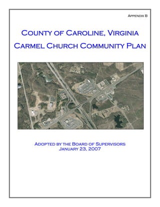
  • 1. Appendix B County of Caroline, Virginia Carmel Church Community Plan Adopted by the Board of Supervisors January 23, 2007
  • 2. Appendix B - Carmel Church Community Plan B - 1 Table of Contents Page Acknowledgments 2 Introduction 3 Demographics & Growth Trends 5 Community Design 8 Land Use 13 Resource Protection 22 Public Facilities 27 Economic Development 34 Transportation 38 APPENDIX B - CARMEL CHURCH COMMUNITY PLAN
  • 3. Appendix B - Carmel Church Community Plan B - 2 Caroline County Board of Supervisors Calvin Taylor, Chairman Wayne Accors, Vice-chairman Robert Farmer Maxie Rozell Floyd Thomas County Administrator Percy C. Ashcraft Caroline County Planning Commission M. Raymond Piland, III, Chairman Dr. Milton Bush, Vice-chairman Joseph Brown, Jr. William L. Smith Pete Davis Carmel Church Citizen Planning Committee Mrs. Sandra Stevens, Chairman Mr. Stuart Martin, Vice-chairman Ms. Nancy Albright, Secretary Mr. Bruce Claiborne Mr. Bernie Runk Mr. Pierpont Williams Mr. G. Warren Samuel Mr. Stuart Lane Mr. Johnson Coleman Mr. John Braun Mr. Art Strader Mr. Rory Smith Mr. Floyd W. Thomas, Chairman Board of Supervisors Mr. D. M. “Maxie” Rozell, Jr., Vice-chairman Board of Supervisors Mr. William "Leon" Smith, Planning Com- mission - Reedy Church Dr. Milton Bush, Planning Commission – Mattaponi Project Staff Gary D. Mitchell, Project Planner Dennis Carney, Comprehensive Planner Michael A. Finchum, Director of Planning and Community Development Rappahannock Area Development Commission ACKNOWLEDGEMENTS The members of the Port Royal Area Planning Advisory committee gratefully acknowledge the efforts of the following officials, organizations and individuals who assisted in the preparation of this document. We also thank the citizens who participated in the process.
  • 4. Appendix B - Carmel Church Community Plan B - 3 INTRODUCTION The Carmel Church Community Plan is part of the Caroline County Comprehensive Plan, the official policy guide for future development decisions. Both Plans are long range in nature and provide a picture of how the community wishes to develop over the next 20 to 25 years. As a policy document, the plan provides a framework for the community’s residents and decision makers to conceptualize how the community should look and function. The major goals of the Community Plan aim to guide the community into the future. GOALS x Provide a guide for the numerous public entities and promote decisions that will create the future community; x Promote the interests of the Community as a whole; x Enhance, describe and promote the Community’s physical development; x Evaluate short-term actions against long-term goals; and x Recognize the natural resources, historical, and architectural significance of the Carmel Church Community and the surrounding area so that they can be more effectively pre- served, protected, and integrated into an orderly pattern of development. The overall goal of the Carmel Church Community Plan is best revealed by following the Vision Statement: Carmel Church is a strategically located historic community and transportation hub offering opportunities for employment, peaceful living, and a warm shopping environment. The com- munity will retain its rural character through managed growth by attracting and promoting socially and environmentally responsible economic development. Through managed growth it will become a vibrant place to live and work. CARMEL CHURCH PLANNING PROCESS PLAN ORGANIZATION The Community Plan is divided into several sections covering the following topics; architecture/design, land use, resources, economic development, transportation and community facilities. Each section has a general discussion of these topics followed by the Goals and Action Strategies. PLANNING PROCESS The process began in the autumn of 2005 and involved the selection of a citizen committee by the Board of Supervisors who attended the first annual Caroline County Citizen’s Planning Academy. This academy was a four week course facilitated by Dr. Michael Chandler, Director of Education of the Virginia Citizen Plan- ning Education Association (VCPEA). The training focused intensely on the history of planning and the legal framework for planning in Virginia. At the conclusion of the academy, the citizen committee developed a mini-land use map, used as a resource in launching this planning effort in the Carmel Church Community. The mini-land use map was the first attempt to develop a community wide plan for Carmel Church. The process was organized as a citizen driven process, where a Community Survey was conducted, responses tabulated and analyzed. The citizen planning committee used the results of the survey as a basis to formulate the goals, objectives, concepts, and strategies for the community.
  • 5. Appendix B - Carmel Church Community Plan B - 4 The planning committee held semi-monthly meetings advertised in the local media and met with a wide vari- ety of public and private interest groups and agencies. In the spring of 2006, the committee participated in a planning exercise, composed of three parts. First, the committee members were asked to identify a key par- cels in the Carmel Church Community that when and if developed, may potentially completely change the nature of the community. Secondly, they were asked to identify all the resources in the community. Finally, the committee members developed a list of “Hot Button” issues. After identifying these items, the committee ranked their findings and compiled the top three items from each part and used the lists to help draft this plan. Key Parcel Analysis The section of land bounded by I-95 (east), Route 1 (west), Route 207 (north) and the Hanover-Caroline County Line (south) The four quadrants of the I-95 interchange Commercial area in front of Belmont Development Community Resource Analysis Sewage Treatment Plant VA Sports Complex Carmel Church Commercial Center Hot Button Issues Improve traffic control, safety and management of traffic and provide for better enforcement of traffic laws, in and around the I-95/Route 207 interchange Provision of utilities (water & sewer) Construction of an elementary school These same concerns in all three planning exercises were also expressed in the results of a community survey. The survey results provide further evidence that the conclusions of the Committee from the exercises are sup- ported in the Carmel Church Community. In the summer of 2006, the committee divided itself into sub-committees to work on the various topics of the plan. Upon completion of this work a draft plan was prepared by County staff using the work of the sub- committees. Once this draft plan had been reviewed and revised by the Carmel Church Committee, an Open House was held October 21, 2006 to display the results of the Committee’s work and draft plan. Some of the interest groups that participated in the Open House and planning process were Fredericksburg Home Builder’s Association, Caroline County Chamber of Commerce, and FREDricksburg Regional Transit. At the conclusion of the Open House, County staff revised the draft document based upon the comments received at the Open House. The Carmel Church Community Plan was presented to the Caroline County Planning Commission on December 20, 2006 and forwarded to the Board of Supervisors with a recommen- dation of approval. The Caroline County Board of Supervisors approved the Carmel Church Community Plan January 27, 2007.
  • 6. Appendix B - Carmel Church Community Plan B - 5 DEMOGRAPHICS & GROWTH TRENDS OVERVIEW This section briefly reviews recent trends in demographic factors such as age, household composition, and income. This summary and analysis of existing conditions and trends is intended to provide background in- formation and rationale for the various goals and action strategies outlined in this Community Plan. In order to plan effectively for the future it is important to understand where the community has been, where it is and where it is going. SUMMARY OF COUNTYWIDE GROWTH TRENDS This information is a brief summary of information that is contained in the 2003-04 Caroline County Demo- graphic Analysis. This summary provides public officials, local citizens, and other interested parties with ba- sic information on past trends and current conditions for the County. Caroline County has experienced increases in population, housing, and employment over the last thirty years. From 1970 to 2000, the County’s population increased from 13,925 to 22,121, which represents a population growth of nearly 59%. In 1980, the County population was 17,904 rising to 19,217 by 1990, which represented an increase of approximately 7.3%. The County’s total population reached 22,121 accord- ing to the 2000 Census. This is an increase of approximately 15% over the previous Census findings. The Weldon-Cooper Center for Public Service of the University of Virginia, estimates that by 2010 the County population will increase by 13.5% to 25,099. As of July 2002, the Weldon-Cooper Center released provisional estimates of population indicating a total population of 22,200. This is an increase of 0.5% since the 2000 Census or approximately 0.2% per year. Based upon historical trends and current building permit activity, the population will continue to grow at a similar rate well into the next decade. The economic strength of the County has also seen significant increase. The County’s median household income continues to rise at a steady rate. The 1970 Census reveals a median household income of $19,991. The 2000 Census indicated that the County’s median household income was at $39,845. Since 1970, the me- dian household income has risen by $19,854, an increase of almost 100%. Total employment in the County has also grown steadily over the last 30 years. According to the 1970 Cen- sus, Caroline County had 3,569 total employees, which increased to 4,741 employees by 1980 and 5,738 em- ployees by 1990. By 2000, there were 7,978 employees, an increase of 124% from 1970. The economy also became more diversified over this time period, with increases in employment in the Construction, Service, FIRE (finance, insurance and real estate), Wholesale and Retail Trade sectors. CARMEL CHURCH COMMUNITY DEMOGRAPHICS The following statistics reflect the demographics for the Carmel Church community, which provide insight into the community based on the 2000 Census data and a conservative extrapolation of population growth trends based upon the 2000 population and the new homes that have been built in the County between 2000 and August 2006. POPULATION The population increase in the Carmel Church area is a major component of the growth of Caroline County. Overall, Caroline County has grown by approximately 15.1 percent and based upon building permit records, Carmel Church grew by 74.4 percent. This accounts for over half of the growth in a five year period. Chart 1 shows the growth of population of the County and Carmel Church Community during this time.
  • 7. Appendix B - Carmel Church Community Plan B - 6 HOUSING There were 431 new homes constructed during that time period. This report takes the conservative approach of multiplying the total number of homes by the average house population size of 2.83 for these Census Blocks from the 2000 Census. It is noted that, with the future approved section of the Belmont community and other large potential residential communi- ties, the Carmel Church area will be a major focal point for population growth for Caroline County for many years in the future. INCOME Income is a measure of change for a rural suburbanizing community. Rising in- come and decreasing poverty levels are signs that more prosperous residents are migrating to the area and that the eco- nomic condition of existing residents is improving. The Carmel Church area has experienced a higher median family in- come and per capita income than the remainder of Caroline County. Further- more, the area has fewer people below the poverty level. 0 5,000 10,000 15,000 20,000 25,000 Caroline County Carmel Church Community Chart 1: Total Population Of Caroline County and Carmel Church Community 2000 2005 Total Population of Caroline County and Carmel Church Community 0 2,000 4,000 6,000 8,000 10,000 12,000 Units 2000 2005 Time Chart 3: Total Housing Units in Caroline County and Carmel Church Caroline County Carmel Church Community Total Housing Units in Caroline County and Carmel Church 0 5,000 10,000 15,000 20,000 25,000 30,000 35,000 40,000 45,000 Thousands($) Median Family Income Per Capita Income Chart 5: Income of Caroline County and Carmel Church Caroline County Carmel Church Community Income of Caroline County and Carmel Church
  • 8. Appendix B - Carmel Church Community Plan B - 7 AGE Age groups reflect the opportunities and concerns that face a community. Carmel Church has a slightly younger population than that of Caroline County and the Commonwealth of Virginia. Since a majority of the Carmel Church population falls between the ages of 18 and 65, approximately 60 percent of community’s population is in the age groups that constitute the bulk of the workforce. This large percentage bodes well for the economic prospects for the future. Table B.1: Population Age Groups Age Category Number Percent of Population Under 18 Years Carmel Church 427 26.1 Caroline County 5,386 24.8 Over 18 Years and Less than 65 Years Carmel Church 669 40.9 Caroline County 8,240 39 Over Age 65 Years Carmel Church 242 14.8 Caroline County 2,854 12.9
  • 9. Appendix B - Carmel Church Community Plan B - 8 COMMUNITY DESIGN OVERVIEW The Carmel Church Community desires all new construction, as well as any redevelopment, to reflect its heritage through the use of architectural standards and improved site design. Future growth of the commu- nity needs to enhance a small town character and significant historic properties located in the area. The im- provement of the appearance and design of the community is a major factor that was identified by the citizen planning committee. NATURAL ENVIRONMENT The citizen planning committee and survey iden- tified preservation of the natural environment and the agricultural heritage of the community as vital. Future development should foster a “sense of place” and be consistent with the fur- ther development of the “Village of Carmel Church”, instead of the typical suburban devel- opment pattern. Threats to this desired develop- ment pattern include insensitive and incompati- ble development, inconsistent regulations, pollu- tion and litter, and the lack of appreciation for the scenic beauty. The committee and the sur- vey also expressed an interest in protecting his- toric buildings and sites within the Carmel Church Community. Additionally, the survey reflected the desire of residents to protect and enhance existing, as well as future, neighbor- hoods within the Carmel Church Community from incompatible development. Other special characteristics of the community are its tranquility, quietness, farmhouses and the large, expansive agricultural landscapes with scattered forests along fence rows and creek basins leading to the South Anna River. The creation of a village in the Carmel Church Community strengthens the preservation of the rural landscape surrounding the community. Use of conservation subdivi- sions can enhance the preservation of significant tracts of land surrounding the village center. GATEWAYS As identified in the Community Vision Statement, the Carmel Church Community is the southern gateway to Caroline County. A gateway should provide an inviting picture and gesture of welcome to visitors and tourists. The entrance to a community should reflect the care and quality of the environment within. One of the planning exercises that the Com- mittee conducted was to list the community identifiers or symbols that let a person know they are in Carmel Church. The number one ranked com- munity identifier was the commercial development at the I-95 inter- change and the Petro sign. The Carmel Church Community has two major southern entrances into Caroline County: U.S. Route 1 and Interstate 95. There are a variety of methods to address the appearance of these corri- dors entering the Carmel Church Community. They range from the Vir- ginia Department of Highway’s Adopt-A-Highway program to neighborhood cleanup drives and use of vol- unteers to establish and maintain entrance feature landscaping. These are the types of programs that need to be initiated by the residents of the Carmel Church Community.
  • 10. Appendix B - Carmel Church Community Plan B - 9 These principal roads leading into the Carmel Church Community need special attention and care as devel- opment occurs. Particular attention needs to be paid to signage and landscaping of developments on these corridors. The citizen committee and the survey expressed concern about the landscaping and appearance of non-residential development along these major roads. The creation and implementation of a development standards policy by the County has been identified as one solution to this concern. Ideally, such a policy would require the planting of street trees and other landscaping on non-residential parcels along with archi- tectural treatment to respect the historic character of the community. The integration of Low Impact Devel- opment techniques (LID) with the principles of traditional neighborhood design (TND) is strongly supported by the citizen planning committee and would provide a framework for the implementation of a development standards policy. COMMUNITY IDENTITY & FUTURE DEVELOPMENT The Carmel Church Community is a small community with many identities. It is a historic village, a rural farming community, and emerging commercial center. The area exudes nostalgia of a simpler time in its tight-knit residential areas. The real issue is how these identities can survive, while still promoting and pre- paring for the growth that will eventually come to the Community. Priority items include issues such as promotion of historic heritage and tourism, preservation of scenic views and the natural environment, and stimulating redevelopment of existing commercial sites in ways that are compatible with the community’s historic past. ROUTE 207 & I-95 The interchange of these two major roads has already experi- enced substantial growth. Highway oriented commercial uses extend from the intersection of Route 207 and Route 1 through the interchange and east towards the Belmont neighborhood. To integrate this existing development into a village concept will require the use of grant funds to install sidewalks, land- scaping and a reduction in permitted signage. Several new development proposals in this portion of the Community are contributing such improvements as a part of their development process. The County should seek out grant funds to provide further improvements to integrate these uses into the overall community. THE VILLAGE CORE The citizen committee identified the location of the village core for the future of the Carmel Church Commu- nity to be the land lying primarily between U.S. Route 1 and State Route 652. The northern limit of the core is bounded by U.S. Route 207 with the southern boundary being the North Anna River. Lands lying adja- cent to these boundaries should serve as transition zones to the more rural areas of the Carmel Church Com- munity. Moving out from the core the use of conservation subdivisions need to be promoted with extensive tracts of land preserved and permanently protected from future development. TRADITIONAL NEIGHBORHOOD DESIGN (TND) The use of TND design principles need to be included in all new developments within the core of the Carmel Church Community. The major theme, or design, elements of TND development involve the following fea- tures: x The development has a discernible center often characterized by a square or a green. A transit stop or facility would be located at this location. Business on 207 adjacent to I-95 interchange
  • 11. Appendix B - Carmel Church Community Plan B - 10 x Most dwellings are within a 5-minute walk of the center or other public spaces such as pocket parks. A 5-minute walk is approximately an average of 2,000 feet. x There are a variety of housing types which are mixed together. For example, a street may have some row houses and detached single-family dwellings along with live-work units. The housing types are intermixed and not segregated and the designs reflect consistent themes. x On the edges of the neighborhood are shops and other commercial uses designed to meet the needs of the community. x Garage apartments are permitted within the backyard of each dwelling unit. It may used as a rental unit or a craft shop or office for a particular service business. x Typically an elementary school is located within the community in close enough proximity that many children can walk to school. This facility may be in or close to the center of the development. x Small playgrounds and/or pocket parks are accessible to every dwelling unit. In order to meet this accessibility factor such facilities need to be not more than one-tenth (1/10) of a mile away. x Streets within the community form an interconnected network which disperses traffic by providing a variety of pedestrian and vehicular routes to any destination. Additionally, the spine or major en- trance road would be designed as a boulevard with a landscaped median. Other streets are relatively narrow and shaded by rows of trees. This design element slows traffic and makes the environment suitable for pedestrians and bicycles. x Buildings and dwellings are placed relatively close to the street creating a well defined outdoor room. Parking lots and garage rarely front on the street. Parking lots are relegated to the rear of all build- ings usually accessed by alleys. x Prominent sites at the termination of streets are reserved for public buildings or public uses such as churches, commentaries, statues, fountains, and parks, etc. Often these public spaces are developed as part of the development of the community and dedicated to a public entity. These sites are used for public meetings, education, religious or cultural activities. x Finally, the architecture of the all the buildings in a TND are one which promotes and respects the history of the area. Dwelling units typically have front porches, garages located behind the house and served by alleys. There are several examples of older, possibly historic, dwellings in the Carmel Church Community that re- flect the architecture one may find in a traditional neighborhood. Below are two examples.
  • 12. Appendix B - Carmel Church Community Plan B - 11 GOALS, ACTION STRATEGIES AND IMPLEMENTATION GOAL 1.1: SUPPORT THE CREATION OF THE VILLAGE OF CARMEL CHURCH Action Strategy 1.1-1: Use traditional neighborhood design principles in the development of the Village of Carmel Church. Action Strategy 1.1-2: Establish a transit stop within the Village of Carmel Church. Action Strategy 1.1-3: Require open space and landscaping throughout the planning area with an emphasis on preserving existing vegetation to the greatest extent possible. Action Strategy 1.1-4: Encourage the use of sustainable development techniques and procedures. Action Strategy 1.1-5: Use drip irrigation systems for maintenance of all landscaping requirements. Action Strategy 1.1-6: Adopt policies encouraging the use of energy star compliant regulations for all new development in relation to mechanical equipment, appliances, and building materials. Action Strategy 1.1-7: Modify policies to require any dedication of land for a public facility be sub- stantially improved, so that such a facility can be implemented in a cost effective manor . Goal 1.2: Preserve the natural resources and rural character of the Carmel Church Community Action Strategy 1.2-1: Adopt conservation subdivision provisions in the County’s ordinance to per- manently preserve substantial portions of the rural lands in the community. Action Strategy 1.2-2: Adopt and implement an agricultural and forestal district program. Action Strategy 1.2-3: Adopt a transfer of development and/or purchase of development rights pro- gram. Action Strategy 1.2-4: Preserve areas with productive soils for continued agricultural and forestry uses by preserving blocks of land large enough to allow for efficient operations. Action Strategy 1.2-5: Adopt a right to farm provision in the County Zoning Ordinance. GOAL 1.3: ESTABLISH A STRONG SENSE OF COMMUNITY IDENTIFICATION BY THE PRESERVATION OF RURAL LANDSCAPES AND PROMOTION OF A TRADITIONAL NEIGHBORHOOD DESIGN TO SERVE AS THE CORE OF THE CARMEL CHURCH COMMUNITY. Action Strategy 1.3-1: Preserve areas containing unique and sensitive natural features associated with the rural landscape of the community. Such features may include wildlife habitats, migration corridors, steep slopes, streams, and wetlands. Action Strategy 1.3-2: Minimize land disturbance through retention of existing vegetation and use of Low Impact Development techniques. Action Strategy 1.3-3: Preserve scenic views, the river, historic and archeological sites and incorpo- rate a park/greenway system to link these resources. Action Strategy 1.3-4: Create traditional neighborhoods that are accessible to open space ameni- ties, replicate historic development patterns, and create a strong community identity.
  • 13. Appendix B - Carmel Church Community Plan B - 12 Action Strategy 1.3-5: Create a gateway via the use of a marker or monument on the major routes leading into Carmel Church. Action Strategy 1.3-6: Develop a network of community volunteers to assist in community beautifi- cation and assistance to property owners who are physically, mentally and/or economically disad- vantaged. IMPLEMENTATION Each method of implementation has the associated action strategy (AS) that correspond to this activity iden- tified. WITHIN 5 YEARS; x Adopt Traditional Neighborhood Design (TND) principles in an overlay district for the Carmel Church Community (AS 1.1-1 & 1.1-3). x Adopt policies and revised ordinance provisions promoting sustainable development and energy star compliance for all components of new and re-development projects (AS 1.1-4, 1.1-5, & 1.1-6). x Adopt conservation subdivision provisions in the County’s ordinance (AS 1.2-1, 1.2-3). x Adopt a TDR provision in the County Code to permit density to be increased in targeted growth areas and to permanently protect valuable agricultural and forestal lands (AS 1.2-3, 1.2-4). x Revise proffer guidelines to require site improvements and/or actual construction of public facilities in place of land dedications for such facilities (AS 1.1-7). x Enact an Agricultural and Forestal District Program to preserve valuable crop and forest land re- sources (AS 1.2-2 & 1.2-5). WITHIN 7 YEARS; x Adopt a Right-to-Farm provision in the Zoning Ordinance requiring property owners or their repre- sentatives to disclose to potential buyers of real estate of the activities associated with agricultural and forestal operations (AS 1.2-5). x Adopt low impact development techniques in stormwater management provisions of the County ordinance (AS 1.3-2). x Develop a greenway and open space plan for the Carmel Church Community (AS 1.3-3). x Explore the creation of a purchase of development rights (PDR) program to preserve valuable natu- ral habitat, agricultural lands and forestry resources (AS 1.2-1, 1.2-4 & 1.3-1). WITHIN 10 YEARS; x Acquire resources to establish a Carmel Church gateway marker and utilize volunteers for its main- tenance (AS 1.3-6). x Establish a volunteer network through the Community Pride Program to assist disabled and elderly residents to improve and maintain their property (AS 1.3-6).
  • 14. Appendix B - Carmel Church Community Plan B - 13 LAND USE OVERVIEW The Carmel Church Citizen Planning Advisory (CPAC) was appointed by the Board of Supervisors to assist the County with the update of its current comprehensive plan. The Committee began its mission with three major goals: x To help establish the boundaries of the Carmel Church Community x To navigate the future direction of the Carmel Church Community x To provide a guide toward establishing a community identity for the Carmel Church Community The Community has experienced rapid residential growth due to increasing development pressure from the metropolitan areas of northern and central Virginia. This growth is starting to make some changes in this region of the County. With a lack of transportation coordination, along with appropriate monetary alloca- tions from the Commonwealth of Virginia, the traffic situation has significantly deteriorated around the I-95 interchange. Furthermore, growth in Carmel Church will require additional public facilities such as parks, recreational facilities, libraries, schools, solid waste, emergency services and senior centers. While growth cannot be stopped, the citizens of the Community desire to control or manage such growth. CARMEL CHURCH COMMUNITY BOUNDARY The western boundary of the Carmel Church Community is designated as the eastern boundary of the Caro- line Pines neighborhood and the high voltage transmission lines. The eastern boundary terminates at the Pole Cat Creek crossing of the transmission lines. The northern boundary follows Pole Cat Creek, crossing U.S. Route 207 and branching off along the southern most tributary of the Creek. The boundary then crosses I-95 and U.S. Route 1 terminating at old Telegraph Road. The western boundary follows old Telegraph Road transitioning to the existing Telegraph Road, and then to the intersection of Telegraph and Jordan Smith Roads. The western boundary follows Jordan Smith Road in a straight line to Jericho Road near the western property line of the Carmel Christian Academy. The western boundary line then follows Jericho Road in a western direction terminating at the intersection of Jericho Road and Long Creek. The southern boundary follows Long Creek in a southeasterly direction transitioning to the telephone line right-of-way and then to the North Anna River, terminating where the high voltage transmission lines cross the river. GROWTH MANAGEMENT A growth management strategy needs to be developed to identify and guide new growth to locations where public facilities can be provided. Public facilities include the provision of adequate roads, storm water man- agement, schools, parks, emergency services, and water and sewer. Open space and agricultural areas, as well as environmentally sensitive areas requiring protection, need to be identified and appropriate preserva- tion programs initiated by both the Community and the County. The implementation of such a program will guide growth and help to maintain an important and desired distinction between the village core (growth area) and rural area of the Carmel Church Community. One method of managing growth is to promote the use of Traditional Neighborhood Designs (TND), which incorporates business and residential uses in a single unified development plan. Such developments promote the linking of residential areas to non-residential areas via sidewalks, trails and bike lanes. Additionally, TND’s often promote the use of historic and “human-scale” architecture as it relates to site and building de- signs. Human scale relates to the height and mass of the building. Typically human scale architecture per- mits structures to be no more than two to three stories in height. Additionally, this type of development cre- ates unique places for community gatherings while promoting non-motorized modes of transportation. Another benefit to a the TND type of development is that it typically preserves open space by promoting the clustering of homes and businesses into compact areas within the overall development along with common open spaces for passive recreational uses. The citizen sub-committee and responses from the various partici-
  • 15. Appendix B - Carmel Church Community Plan B - 14 pants during the Open House supported this approach as it relates to managing future growth in the Carmel Church Community. RESIDENTIAL DEVELOPMENT Question 5 of the Community Survey posed to Carmel Church residents asked, “Recognizing that the popu- lation growth in the County and the Carmel Church Community will continue to grow, what kinds of resi- dential development would be desirable in the Carmel Church Community?” In general, respondents an- swered that mixed-use development would be the most desirable. This was followed by single-family homes on parcels of one to five acre, single-family homes on parcels of less than one acre, and single-family homes in conservation subdivisions with surrounding open space. Least desirable proved to be the addition of mo- bile homes to mobile home parks with less than 1% choosing this option. In total over 80% of the residents preferred mixed use developments, homes on lots less than 5 acres and/or conservation subdivisions. When asked where new residential development should take place, less than 1% of the community stated that there should be no new residential development, while 52% stated that new residential development should be located off U.S. Route 1. Nearly 30% stated new residential development should occur in Belmont, while 16% stated they preferred new residential development to occur along U.S. Route 207. Generally, you can find several existing examples of residential developments that exist in the Commu- nity. Holly Ridge (right) is a neighbor- hood with parcels ranging in size from two to four acres, while Belmont (left), a newer neighborhood, has lots less than one acre, sidewalks and open space. Caroline Pines is an older residential community with parcels generally less than one acre and open space throughout the development. NON-RESIDENTIAL DEVELOPMENT Carmel Church contains all ingredients needed for economic growth. The area is serviced by public water and sewer. The existing wastewater plant will soon be expanded to include more areas and uses. There is an excellent regional and national transportation system and general costs of business, such as land and taxes, are relatively low. In relation to Caroline County, the Carmel Church area is primed to become the predominant economic de- velopment area for the County and the region. The community can become a major employment center that could draw workers not only from Caroline, but also from Richmond, Fredericksburg and , the Washington DC area, with implementation of a commuter rail. As an economic center, the Carmel Church area would provide a positive cash flow to the County and provide a larger tax base contributing the resources needed to implement other initiatives such as parks, new schools and other public infrastructure. It is imperative that the Carmel Church Community Plan promote a TND/Planned Development designation to foster the future development of a town center and/or village core. This designation would provide protection to the more rural landscapes within the Carmel Church Community, while promoting the growth of the County’s tax base in the village center. COMMUNITY IDENTITY Placemaking is the deliberate creation of a living and working environment that brings a sense of community and identity to areas as small as a village and as large as a city. It is difficult to “create” a sense of place from the ground-up without a foundation upon which to build.
  • 16. Appendix B - Carmel Church Community Plan B - 15 Carmel Church must inspire a vision of where it belongs to- day as an important transportation, commercial, business and residential center. To establish a sense of uniqueness and “place” to Carmel Church, and a place in which a variety of people will wish to live, visit, and work, this area must de- velop a coherent set of business, retail, and housing structures that follow an architectural standard. Distinct roads with residential homes, loft apartments, and other residential styles combined with restaurants and other retail, entertainment, specialty, and convenience stores need to be designed and built. Most importantly, however, a Town Center (village core) needs to be established with open space for local gather- ings, such as farmers and flea markets, musical and outdoor entertainment opportunities such as “Movies on the Lawn”, as well as other public functions for holidays and other occa- sions. FUTURE LAND USE The committee developed a future land use map (Map B.1) based upon the existing land use map in the cur- rent Comprehensive Plan and a utility phasing plan consistent to the County’s Water and Wasterwater Mas- ter Plan. A land bay method was used to link the land bays to the provision of utility services. Each land bay may have several color coded future land use designations. This land use map is intended to guide development until 2030 for the Carmel Church Community. Land Bay “A” contains the village core (light blue), planned residential development (orange), commercial/office uses (red), office/light industrial (lavender) and heavy industrial uses (purple). The use of a transect ap- proach would best accomplish the intent of the land use plan and the various land bays associated with the plan. An example of a transect plan is shown below: The transect approach reveals a dense core with gradually decreasing densities from the center to the outer edges. Therefore, as one moves along the transect from rural to urban conditions the density and complexity of the human elements increase while the density and complexity of the natural elements decrease. The rural end of the transect typically have low density, deeper setback, paths and trails, open swales, and “country roads”. The opposite is found on the urban end of the transect, typically contain higher density, shallow set- backs, streets and alleys, a grid street network, sidewalks, and “formal” gardens and landscaping. The land bays designated on the Future Land Use Map (Map B.1) reflect this pattern of development. Village Core
  • 17. Appendix B - Carmel Church Community Plan B - 16 MapB.1
  • 18. Appendix B - Carmel Church Community Plan B - 17 LAND BAY A The land use map essentially designates a TND/Planned Development designation on the lands lying be- tween U.S. Route 1 and State Route 652. This is intended to become the village core and includes the estab- lishment of a transit facility. This designation should encourage a high density in the center of the village (10 to 15 units per acre) with density decreasing in concentric rings moving outward from the center. If “big box” retail desires to be within the Carmel Church Community, it should be incorporated into the village core. Public facilities, such as a library and recreational areas, should also be included within the core. In the outer most ring of the village, density should decrease so as not to exceed four and a half units per acre. The area south of U.S. Route 207 and north of the CSX rail road tracks is designated as a planned industrial area. While all types of industrial development are needed, the heavier industrial uses should be located within the center of this area and lighter uses should act as a transition to the lower density rural lands to the south and east. While there is no specified density recommended in this part of Land Bay A, there should be a minimum requirement of 20% or more open space on individual parcels that have industrial uses. The area surrounding the County Waste Water Treatment Plant is also designated as industrial with primar- ily heavier industrial uses located between the plant and the existing Shamrock Industrial Park. Light indus- trial uses are envisioned to be located along the frontage of Route 207. Open space in this area should be 20% or more of any parcel. The area north of U.S. Route 207 and south of Moncure Drive is designated as Planned Development. How- ever, any planned development within this area should include elements of the TND development. Overall densities in this area should not exceed three units per acre. However, in light of the more intense industrial land uses immediately south of Route 207, portions of this area may be better suited for light office develop- ment as a transition to the rural areas immediately north of Moncure Drive. If residential development is proposed within this land bay, such development should be limited and serve as another transition zone from the light office development to the rural area. The use of such transition zones serves to promote and support the transect model for future development in the Carmel Church Community. The area around the I-95 interchange, U.S. Route 207 and Route 1 is designated as planned commercial. A variety of commercial uses, office/service uses and light industrial uses is envisioned to be located within this area of the Carmel Church Community. “Big box” retail should not be allowed to locate in these areas with- out strict design standards consistent with the village core and the highway overlay district guidelines. LAND BAY B This land bay is envisioned to be an extension of the planned residential development north of Route 207 and south of Moncure Drive. An elementary school should be accommodated in any future development within Carmel Church Community. Depending upon the sequence of development, the school should be located either within the village core or within this land bay. Land dedication alone for public facilities, historically, has not been sufficient to mitigate the impacts proposed developments. Applicants may consider alternatives to mitigate the impacts of their proposed developments. Future overall density should not exceed three and a quarter (3.25) units per acre within this land bay. LAND BAY C This section of the Carmel Church Community represents several pre-existing residential neighborhoods and the potential for other such small neighborhoods to be developed. Some of these areas are the result of fam- ily divisions of land, while others were platted several decades ago. Developers of properties adjacent to these neighborhoods should provide for inter-parcel connections via street and/or road extensions. The planning committee intends for these developments to be protected and to preserve the existing settlement pattern. The overall density for this land bay should not exceed two units per acre.
  • 19. Appendix B - Carmel Church Community Plan B - 18 LAND BAY D This area is intended to be a future extension of the village core with parkland preserved along the North Anna River. The creation of a North Anna River Park would be consistent with a TND approach for this future segment of the village core. Densities in this area need to be low (maximum 2.5 units/acre) to protect and preserve the sensitive environmental lands along the river front. LAND BAY E Land bay E is designated to be preserved until 2020 or until the Pole Cat Creek interceptor has been con- structed. This area is envisioned to be developed in a planned development manner with an emphasis on preserving sensitive environmental features associated with the wetlands surrounding the watershed. Rather than clear cutting and removing the forest lands, a more sensitive approach should be followed and only the trees that are within the area needed to construct the roads, utilities and houses are removed. Overall densi- ties should not exceed 2.5 units per acre. Additionally, upgrading Moncure Drive and its intersection with State Route 207 is a necessity to accommodate the increased traffic generated by the development of this par- cel. LAND BAY F This land bay is envisioned to be developed in the latter portion of the planning period, approximately 20 years from now. This area will need a new sewer trunk line installed off the future Pole Cat Creek intercep- tor. When this infrastructure is constructed, the area is intended to be developed in a planned development format with 50% of the development to be residential and 50% of the development to be non-residential. This ratio is based upon the fact that much of the land area lies between I-95 and U.S. Route 1. Additionally, development proposals for this land bay should contain provisions for non-residential development to occur in conjunction with residential development. The commercial areas within this land bay should have a mini- mum of 25% open space and the residential areas should have a maximum density of two units per acre. The area now known as Mt. Olympus is identified as a park/open space area within this land bay. This site has been identified by the Committee as a community resource and should be protected from development. Therefore, any intense development on this parcel should be avoided. RURAL TRANSITION The remaining lands, not identified within a land bay, are designated as rural transition zones. These areas are intended to be the transition from the community to the more rural parts of the County. The use of con- servation subdivisions is envisioned to be located in the areas designated as rural transition. Conservation subdivisions should have a majority of the parcel preserved in permanent open space with an overall density of one-half (0.5) unit per acre. Open space preservation needs to be accomplished through donation to a land trust or some other non-profit entity.
  • 20. Appendix B - Carmel Church Community Plan B - 19 GOALS, ACTION STRATEGIES AND IMPLEMENTATION GOAL 2.1: FACILITATE THE DEVELOPMENT OF A VILLAGE CORE IN THE CARMEL CHURCH COM- MUNITY, WHILE PRESERVING THE SURROUNDING RURAL LANDSCAPE AND QUALITY OF LIFE. Action Strategy 2.1-1: Provide for a diversity of housing types in the areas designated for residential development. Action Strategy 2.1-2: Concentrate housing in the designated areas based upon the land use plan. Action Strategy 2.1-3: Revise ordinance standards to allow higher density development in the vil- lage core with a gradual transition to lower density outside the village core. Action Strategy 2.1-4: Encourage development to locate in areas with planned public facilities. Action Strategy 2.1-5: New development should ensure that the Level of Service (LOS) for existing and/or planned public facilities is not less than a LOS B. Action Strategy 2.1-7: Phase development in conjunction with the availability of public facilities. GOAL 2.2: PROMOTE THE USE OF TRADITIONAL NEIGHBORHOOD DESIGN TECHNIQUES. Action Strategy 2.2-1: Integrate TND standards into the County Zoning Ordinance. Action Strategy 2.2-2: Specify acceptable architectural standards. Action Strategy 2.2-3: The Village Core should support the 3 D’s of the built environment – den- sity, diversity of uses, and design. Action Strategy 2.2-4: Large tracts and/or developments need to include civic uses, such as parks, plazas, schools, libraries, and senior/community centers. Action Strategy 2.2.5: Actively support and encourage a transit facility to be located within the Vil- lage Core of the Carmel Church Community. GOAL 2.3.: PROVIDE FOR CONSERVATION OF OPEN SPACE AND RURAL LANDSCAPES THROUGH CONSERVATION EASEMENTS AND SUBDIVISIONS. Action Strategy 2.3-1: Ensure that rural development is sensitive to the need for rural preservation and the protection of environmentally sensitive areas. Action Strategy 2.3-2: Require open space in rural developments to protect agricultural lands and forests, and preserve the rural character of those areas. Action Strategy 2.3-3: Preserve the rural character of the Carmel Church Community by only al- lowing rural subdivisions that provide permanent easements on agricultural lands, forest lands, and open spaces. Action Strategy 2.3-4: Encourage the use of conservation easements and land trusts in rural areas to facilitate open space preservation and the protection of agricultural lands, forests, natural areas, and environmentally sensitive areas. Action Strategy 2.3-5: Utilize County utility easements for the development of greenways to con- nect communities within the County.
  • 21. Appendix B - Carmel Church Community Plan B - 20 GOAL 2.4: PROTECT EXISTING AND PLANNED DEVELOPMENT FROM ENCROACHMENT OF INCOM- PATIBLE LAND USES. Action Strategy 2.4-1: Evaluate rezonings and special exception permit applications to ensure con- sistency with the Comprehensive Plan and compatibility with existing and planned land uses, as well as the character of the area. Action Strategy 2.4-2: Require documentation of impacts of a proposed development, including but not limited to, traffic studies, historical and archeological resources, water quality and quantity and other environmental factors and fiscal impact. Recommendations from such studies should be ade- quately addressed prior to preparation of development plans. Action Strategy 2.4-3: Require usable open space in developments within the Carmel Church Com- munity to provide active and passive recreational activities. GOAL 2.5: ESTABLISH AN IDENTITY FOR THE CARMEL CHURCH COMMUNITY AS THE SOUTHERN GATEWAY INTO CAROLINE COUNTY. Action Strategy 2.5-1: Existing development along U.S. Route 1, I-95, and State Route 207 should be encouraged to maintain and improve their appearance. Action Strategy 2.5-2: The County should seek out grant funding to improve the streetscape along State Route 207. Action Strategy 2.5-3: Enact development standards requiring all new developments to install landscaping, sidewalks, street trees and lighting. Action Strategy 2.5-4: Developers should address civic identity and uses as part of its development plan. IMPLEMENTATION Each method of implementation has the associated action strategy (AS) that corresponds to this activity iden- tified. WITHIN 5 YEARS; x All new development projects should be determined to be consistent with the requirements of this plan (AS 2.4-1). x Adopt provisions to increase the diversity of housing types within the Carmel Church Community and support the provision of accessory apartments and carriage houses in TND developments (AS 2.1-1, 2.1-2, 2.1-3). x Support and encourage residential and non-residential development in areas where existing infra- structure could support such growth (AS 2.1-4, 2.1-5 & 2.1-6). x Enact policies and ordinances that establish a Level of Service (LOS) B for the Carmel Church Com- munity. Require any new development proposals to mitigate impacts and install the required infra- structure to maintain a LOS B (2.1-6). x Apply for transportation improvement grants to improve the existing streetscape from the intersec- tion of Route 207 and U.S. Route 1 east to the site of the County Visitor’s Center (AS 2.5-2). x Develop and implement performance criteria for new development and preservation (AS 2.4-2).
  • 22. Appendix B - Carmel Church Community Plan B - 21 x Incorporate provisions within County ordinances to require preservation of open space for passive recreational use (AS 2.3-1, 2.3-2, 2.3-3 & 2.3-4). x Revise ordinances to permit density increases in exchange for preserving open space and sensitive environmental features within the Carmel Church Community (AS 2.2-3, 2.2-4). x Require that the Village Core have a usable, open, public space at its center (AS 2.2-4 & 2.5-4). x Adopt transportation standards requiring any road constructed within the Carmel Church Commu- nity with more than 1,000 AADT to be designed as a boulevard with a raised landscaped median (2.5-3). WITHIN 7 YEARS; x Establish an Architectural Review Board, or similar entity, to review architecture of new develop- ment proposals to ensure it meets TND standards (AS 2.2-1, 2.2-2). x Adopt an affordable housing provision, as permitted under the State Code of Virginia, to provide a variety of housing for the County’s residents (AS 2.1-1). x Develop a greenway and open space plan for the Carmel Church Community (AS 2.3-5). x Establish a transit center at the Village Core to occur with any proposed development on land identi- fied on the Future Land Use Map (AS 2.2-5). WITHIN 10 YEARS; x Acquire the required land for future potential sites for emergency services, schools, and other public facilities in anticipation of the provision of such services (AS 2.2-5). x Acquire more public access points along the North Anna River in the Carmel Church Community (AS 2.3-4, 2.4-3).
  • 23. Appendix B - Carmel Church Community Plan B - 22 RESOURCE PROTECTION OVERVIEW The Carmel Church Community has been influenced by both the traditional agricultural forces of farming and forestry and the modern economic forces of industries serving the major east coast transportation routes, of U.S. Route 1 and Interstate 95. As these transportation “magnets” grew, so did typical suburban growth from the Washington D.C./Fredericksburg and Richmond areas. In recent years, this growth has accelerated causing the large conversion of fields and forests to residential, industrial and commercial development. The County is concerned about the protection of its natural resources, such as forests, farmland, groundwater, streams and rivers, as well as the retention of the heritage and history of its rural, agrarian roots. This section deals with the policies that will protect and preserve these vital aspects of the County within the Carmel Church Community. RURAL PRESERVATION Over the years, many industries and occupations have come and gone. One industry that can never completely die out is agriculture. People must have food, shelter, and clothing. All of these needs, especially food, depend on agriculture. Caroline County has been a part of this industry since its founding. The County is made up of hundreds of acres of fertile rich top soil and because of this valuable resource, Caroline County produces abun- dant crops of corn, wheat, soybeans, hay, timber and livestock each year. The fertile, rich soils that are good for farming are also very good for residential, business and industrial land uses. Because of this, the farmland and forests are slowly being converted to houses, roads, schools and shopping centers. Once the land is developed for these uses, it will never be used again for agricultural/forestal purposes. The Carmel Church Community is one of the areas of the County that is changing rapidly. At this time, there are still large tracts of land being farmed in the Carmel Church Community. The Community must plan wisely how to secure a compatible mix of uses, and determine what should be developed, where it should be developed and what should be conserved and protected from urban/suburban uses. ENVIRONMENTAL PROTECTION The area has numerous streams, and is bounded to the south by the North Anna River. It is of vital importance that this watershed and the numerous other streams that traverse the Carmel Church Community and flow into the North Anna River remain as pris- tine as possible. Steps to provide adequate buffers via the Chesa- peake Bay Act, use Best Management Practices on land converted to non-agrarian practices, as well as sound farm conservation prac- tices, are included for implementation in this Plan. Although some of the area within the scope of this Plan is served by water and sewer, many of the residents and businesses are still served by private wells and septic tanks. Because of this, ground- water protection is very important. Many of the policies discussed and advocated stem from this very basic protection.
  • 24. Appendix B - Carmel Church Community Plan B - 23 MINERAL RESOURCES There are defined deposits of quality rock types found in the Carmel Church Community; more particularly, the southwest corner of Caroline County. These granitic and gneisic rock types are hard and durable. Once extracted, crushed, and sized; they are used in the construction of roads, water/sewer lines, parking areas and buildings and in the manufacture of ready mixed concrete, concrete blocks, concrete pipes and asphalt. These mineral resource deposits should be identified and protected from unsuitable development, as they may offer the mineral resources that can be used in the future development and advancement of Caroline County. Construction activities in Caroline County are on a significant incline and it is almost certain there will be continued demand for construction aggregates produced at crushed stone operations. Such demand will ensure that Caroline County can benefit from this local mineral resource. It will be an important and valuable economic asset for many years into the future. Crushed stone operations and related activities in the mineral resource area may present a challenge to County land-use planning. If potential threats (such as: noise, dust, water, traffic and vibration) associated with these operations and facilities are not properly managed or mitigated there may be detrimental impacts to the neighborhood and surrounding environment. The County may establish and maintain zoning regula- tions for a protective mineral resource zoning district, and which will emphasize the continued viability and compatibility of this important industry. A possible solution to address these concerns and utilize this valuable resource is to develop a mineral extrac- tion overlay district. Such a district would allow the extraction of such minerals and set basic standards for the extraction of these mineral resources. A second possible process may involve allowing such utilization of resources through the special exception permit process. Regardless of which approach is adopted, the County needs to address the utilization of such minerals in a way which protects our natural environment and mitigates noise, dust and associated traffic impacts with such operations. ENVIRONMENTAL DATABASE An environmental database is an excellent tool for planning, zoning, reviewing projects and for determining priorities and capital project needs for both public and private sectors. It is essential to the implementation of this plan as well as the County’s Zoning Ordinance that such a database contain information such as the con- dition and use of forest and agricultural lands, specific pollution problems, conditions of water bodies, wild- life habitat, steep slopes, wetlands and other environmental information. This database is most commonly used in conjunction with a Geographic Information System (GIS). In addi- tion to developing this data base the GIS system can assist in many functions of government and provide in- formation to the public, as well as the private sector. Information provided may have a slight fee associated with it in order to help defray the costs of developing and maintaining such a system.
  • 25. Appendix B - Carmel Church Community Plan B - 24 GOALS, ACTION STRATEGIES AND IMPLEMENTATION GOAL 3.1: PRESERVE AREAS WITH THE MOST PRODUCTIVE SOILS FOR CONTINUED AGRICUL- TURAL AND FORESTRY USES. Action Strategy 3.1-1: All Class I land, as designated by the Department of Soil and Water Conser- vation and Department of Agriculture, that is also shown on the Future Land-Use Map as Rural Preservation should not be rezoned for commercial, industrial or residential or developed for large- lot residential development. Action Strategy 3.1-2: Adopt regulations to permit the use of conservation subdivisions to perma- nently protect large tracts of open space. Action Strategy 3.1-3: Residential, commercial and industrial developments should be as compact as possible with a transition from the higher density/intensity of development to those areas of lower density and buffered by viable agricultural/forested property that will remain intact and not be con- verted to residential, commercial or industrial uses. GOAL 3.2: PRESERVE BLOCKS OF LAND LARGE ENOUGH TO ALLOW FOR EFFICIENT AGRICUL- TURAL OR FORESTAL OPERATIONS. Action Strategy 3.2-1: Adopt and implement an agricultural and forestal district program to pro- vide additional incentives for land to remain in agricultural and forestal use. Action Strategy 3.2-2: Adopt a right to farm ordinance with an annual notice sent to property own- ers advising them that certain activities associated with agricultural operations may conflict with traditional residential use of property. Action Strategy 3.2-3: Adopt County Code provisions requiring representatives of the real estate and financial community to disclose to potential buyers of real estate of the activities associated with agricultural and forestal operations in areas where there are potential conflicts. GOAL 3.3: PRESERVE AREAS CONTAINING UNIQUE AND SENSITIVE NATURAL FEATURES, SUCH AS WILDLIFE HABITATS, MIGRATION CORRIDORS, STEEP SLOPES, STREAMS AND WET- LANDS Action Strategy 3.3-1: Future Land Use Map should not propose any residential, commercial or industrial zoning uses that border on the North Anna River. Action Strategy 3.3-2: Implement a county operated GIS system with an environmental database to identify sensitive environmental features and valuable agricultural soils. GOAL 3.4: MINIMIZE LAND DISTURBANCE AND MAINTAIN EXISTING VEGETATION DURING NECES- SARY CONSTRUCTION WHEREVER POSSIBLE. Action Strategy 3.4-1: Retain and preserve as much vegetation as possible by minimizing land dis- turbance, and prevent erosion through sound farming methods and erosion and sediment control practices. Action Strategy 3.4-2: Encourage and promote the use of “no-till” farming methods in order to retain topsoil and reduce erosion and sedimentation. Actions Strategy 3.4-3: Establish methods and processes to utilize the community’s valuable re- sources to preserve the rural character and mitigate all impacts from such activities.
  • 26. Appendix B - Carmel Church Community Plan B - 25 GOAL 3.5: PRESERVE SCENIC VIEWS, THE NORTH ANNA RIVER, AND HISTORICAL AND ARCHEO- LOGICAL SITES. Action Strategy 3.5-1: Create an updated study of any known historical or archaeological site to determine the areas to be protected from incompatible land uses. Action Strategy 3.5-2: Provide the necessary resources to conduct a historic resources survey for the Carmel Church Community. GOAL 3.6: PRESERVE OPEN SPACE IN APPROPRIATE RURAL RESIDENTIAL SUBDIVISIONS TO PRO- TECT ADJACENT AGRICULTURAL, FOREST, AND ENVIRONMENTALLY SENSITIVE LANDS AND THE RURAL CHARACTER OF THE AREAS TO BE MAINTAINED FOR RURAL/ AGRICULTURAL LAND USES. Action Strategy 3.6-1: Explore the use of Transfer of Development Rights/Purchase of Develop- ment Rights. Action Strategy 3.6-2: The Future Land Use Map should be strictly followed and agricultural/ wooded lands should not be rezoned if the proposals are outside of the areas designated for the vari- ous types of uses proposed. GOAL 3.7: PRESERVE THE RURAL CHARACTER OF THE CARMEL CHURCH COMMUNITY BY DIS- COURAGING RURAL “LARGE LOT” DEVELOPMENT IN THE AREAS DESIGNATED FOR THE PROTECTION OF FARMING AND FORESTRY. Action Strategy 3.7-1: Implement open space provisions into the Subdivision Ordinance permit- ting lots of less than ten acre in the RP District provided density requirements are met and open space is provided. Provide a density bonus for the permanent preservation of additional agricultural and forestal lands. Action Strategy 3.7-2: Promote conservation via conservation easements, proffers and deed cove- nants on large tracts of land for wildlife habitats, large forested areas, swamps, rivers, streams and areas with steep topography. IMPLEMENTATION Each method of implementation has the associated action strategy (AS) that corresponds to this activity iden- tified. WITHIN 5 YEARS; x Adopt an agricultural and forestal district program to protect valuable agricultural land from devel- opment pressure (AS 3.2-1). x Provide the resources needed to implement a fully functioning GIS system to identify valuable agri- cultural and forestal soils (AS 3.1-1). x Explore density bonuses if a project provides resources to protect other environmentally valuable land areas in the Community (AS 3.6-1 & 3.6-2). x Adopt a Right-to-Farm section in the Ordinance requiring that property owners or their representa- tives disclose to potential buyers of real estate of the activities associated with agricultural and fore- stal operations (AS 3.2-2 & 3.2-3). x Revise the Subdivision Ordinance to require preservation of at least 20% permanent open space for passive recreational use by the property owners of the subdivision (AS 3.1-2, 3.7-1, & 3.7-2).
  • 27. Appendix B - Carmel Church Community Plan B - 26 x Enact a Conservation Zoning District providing for the preservation of open space of environmen- tally sensitive areas such as wetlands, forest lands, and valuable agricultural soils (AS 3.1-3, 3.3-1 & 3.4-3). x Revise ordinances to require the use of LID methods to improve water quality and reduce over land grading (AS 3.4-1) WITHIN 7 YEARS; x Fund a complete historic resources survey of Caroline County with a digital component that may be integrated into the GIS system (AS 3.5-1 & 3.5-2) x Explore the creation of a purchase of development rights (PDR) program to preserve valuable natu- ral habitat, agricultural lands and forestry resources (AS 3.4-3, 3.6-1 & 3.7-2). WITHIN 10 YEARS; x Implement a TDR program to preserve farmland and encourage development of a viable agricultural economy (AS 3.6-1).
  • 28. Appendix B - Carmel Church Community Plan B - 27 PUBLIC FACILITIES OVERVIEW Public facilities and services are those minimum facilities and services that the County provides for the public welfare. These include institutions, services, and land intended for general use to benefit of the Carmel Church Community as a whole. The quality of these public facilities and services contributes to and en- hances the County’s quality of life. Ensuring that public facilities are phased with the demand or need is a major growth management concern. Providing suitable and accessible public facilities and services is one of the essential functions of local govern- ment. The efficiency and effectiveness of a local government is often determined by its ability to plan and finance these types of facilities and services. PUBLIC SAFETY The safety of citizens is one of the major concerns of the Carmel Church Community. The threat of crime, fire and individual or community disaster calls for the placement of considerable emphasis on the facilities and services related to the protection of citizens and their property. EMERGENCY SERVICES Caroline County provides the fire and emergency service coverage for the Carmel Church area. The devel- oper of the Belmont Community has proffered a site for the construction of an Emergency Services facility, needed as a response to the growth that is occurring in the area. The new facility is to be located at the inter- section of Enterprise Parkway and U.S. Route 207. A related issue is the use of an emergency pre-exemption signal on the traffic lights in the Carmel Church Community. This device receives a specific signal from emergency vehicles causing the light to change, stop- ping all vehicle movements except those traveling in the direction of the emergency vehicle. Providing this type of signal will decrease the response time for emergency equipment passing through this intersection. All future traffic control devices installed in the County should have a pre-exemption signal installed. SHERIFF’S SUBSTATION The community survey, along with the Citizen Planning Committee, expressed a desire to have increased police protection in the Carmel Church Community. During a meeting of the citizen planning sub- committee, this desire was expressed to the representative from the Sheriff’s Office, who stated that one possi- ble solution to this would be the placement of a substation in the Carmel Church area. He further explained that such a facility exists in the Ladysmith Community, which consists of a small building that serves as an office and interrogation room. However, he stressed that such a facility would require a secure building since there is an interrogation room and the possible storage of evidence collected by law enforcement. When a new emergency facilities building is located in the Carmel Church Community it should be designed to meet the needs of the fire, rescue services and incorporate a Sheriff’s substation. PARKS & RECREATION The use of open space greenways, parks, and recreational programs is essential for the Carmel Church Com- munity. These open spaces and programs enhance the social and psychological well being of citizens by pro- viding them with enjoyable activities and settings in which to spend their leisure time. Conservation benefits are also derived from the preservation of open space and park areas by maintaining the integrity of water- sheds and protecting wildlife habitats and water quality in streams and underground aquifers. The economic benefits of preserving open spaces and offering recreational opportunities include increases in the value of surrounding properties and an enhanced quality of life in Carmel Church.
  • 29. Appendix B - Carmel Church Community Plan B - 28 There are no County owned parks or recreation facilities in the Carmel Church Community. The reason is that there was not enough population in this area in the past to justify this as a location for such a facility. However, with recent residential subdivision development in the Community, the demand for facilities and programs has increased and continues to increase with growth and development. The Citizen Planning Committee and the survey indicated a preference for the provision of some recreational programs to be offered in the Carmel Church Community. The citizen committee identified a site on Jericho Road beside the Carmel Christian Academy as a preferred site for a community park. This site is large enough to offer the potential for several athletic fields, tot lots, and picnic shelter along with associated park- ing facilities. The Committee also identified Mt. Olympus Farm as a site to be preserved and protected from development. This operating farm should be preserved as open space within the Carmel Church Commu- nity. As part of the park system in the Carmel Church Community, locations for greenways and bike lanes need to be considered. The Belmont neighborhood has trails and sidewalks, but they are not linked to other areas. Greenways and bike lanes could offer such linkages, not only to other communities in Caroline County, but to public buildings in Carmel Church such as the Visitor’s Center, Post Office and existing retail operations. The proposed Pole Cat inceptor line offers a great opportunity to establish a Greenway to link the Carmel Church Community to the Ladysmith Community. When this facility is constructed, easements or rights-of way need to include the use and installation of a non-motorized trail (greenway) along the easement. SCHOOLS The public school system is a primary component of any com- munity. Schools are an area of community focus and a gather- ing place for community and youth activities. Schools provide the essential function of educating our children and preparing them to enter a diverse, expanding work force. There are two elementary schools that serve the Carmel Church Community; Ladysmith Primary (grades K-2) and Ladysmith Elementary (grades 3-5). Some children who live in the Carmel Church Community are transported over fifteen miles to the Primary & Elementary schools. The citizen committee strongly feels that the next school to be constructed in Caroline County needs to be located within their community. The Carmel Church Community is also home to the Carmel Christian Academy. This school presently oper- ates out of the Carmel Baptist Church. However, the academy is constructing a new facility a few miles from the church’s present location on Jericho Road. SOLID WASTE The Caroline County Department of Public Works has three facilities that serve the Carmel Church Community. The first site is located on Jericho Road but is only open on Saturdays. There is a second site near the animal shelter on Devils Three Jump Road and another fa- cility off Green Road in Ladysmith. With continued growth the County needs to consider either expanding the operations of the Jeri- cho Road site or to identify another site closer to the Carmel Church Community. UTILITIES The County just conducted an extensive evaluation of its water and sewer system. Due to recent legislative actions regarding the quality Carmel Christian Academy Jericho Convenience Site
  • 30. Appendix B - Carmel Church Community Plan B - 29 of the discharge from the sewer plant, the County is faced with improving the quality of its discharge, as well as the expansion of the current plant. The initial phase of this expan- sion and upgrading is expected to be underway in 2007 and completed by 2010. This includes the expansion of the current waste water treat- ment plant from 0.5 million gallons per day (MGD) to 3.0 MGD. The preferred method of wastewater collection is by gravity flow. This method is preferred due to the lower costs of construction, as well as the lower long term operation and maintenance costs. Pump and lift stations should be mini- mized and phased out to the greatest extent possible. Therefore, any future expansions of service to areas of the County should be limited to those areas that can be served by gravity. The land use plan is tied to this principle. As a result, Land Bays E and F would be the last areas in Carmel Church Community scheduled to receive ser- vice. Therefore, their phasing occurs towards the end of the planning horizon in 2020 or later. Additionally, the County and the developer of the Haymount Community are working together to acquire the required permits to withdraw water from the Rappahannock River. Once the permitting process is com- plete the County will be able to supplement its current deep wells with water from the River. The water treat- ment plant associated with this is also scheduled to be completed by 2010. At this time, there is no antici- pated shortage in the quantity of water for the County. The Water and Sewer Master Plan of Caroline County is hereby incorporated into the Carmel Church Com- munity Plan and its recommendations are included as recommendations of this plan. INFORMATION TECHNOLOGY Information technology is a new component of the Community Plan. Given the rapid rate of technological development and its ever increasing impact on people’s daily lives, this topic needs to be addressed as a part of public facilities. Planning for how information technology may impact the Community in the future is impossible due to its rapidity of change. However, we can focus on how this technology can serve the needs of the citizens of the Carmel Church Community. The County has developed and began to implement a three tier technology plan to provide high speed inter- net access to local government offices, schools and libraries. Currently, the County is in the midst of imple- menting this plan, which involves the upgrading of the technology infrastructure of County facilities. The next phase of this program will incorporate the development of a fully functioning GIS system, enabling the last part of the technology plan to be implemented. The final phase is to make all possible business transac- tions with the County accessible via the internet, otherwise known as “e-government”. The impact to the residents of the Carmel Church Community will be a more efficient government operation. Additionally, with the advent of wireless networks, the County should consider setting up such a network in public buildings in the Carmel Church Community. Potential sites where members of the public could access a wireless network could be at new schools, libraries, or the Visitor’s Center in the Carmel Church Commu- nity. Caroline County Wastewater Treatment Facility on Rogers Clark Blvd
  • 31. Appendix B - Carmel Church Community Plan B - 30 LIBRARY The Caroline County Library system currently has four branches, Dawn, Bowling Green, Ladysmith, and Carmel Church. Currently, the Ladysmith Branch is to be replaced with a new facility currently under con- struction by the developer of the Ladysmith Village. The Caroline County system is tied into the state sys- tem, but is not part of any other regional or sub-regional system. A branch library in the Carmel Church Community is essential as the area continues to develop and more people move to the Community. Ideally, the location of such a facility should be within the village core where it could serve as a focal point within the village.
  • 32. Appendix B - Carmel Church Community Plan B - 31 GOALS, ACTION STRATEGIES AND IMPLEMENTATION GOAL 4.1: ESTABLISH AND PROVIDE EFFECTIVE AND EFFICIENT PUBLIC FACILITIES TO SERVE THE EXISTING AND ANTICIPATED NEEDS OF DEVELOPMENT IN THE CARMEL CHURCH COM- MUNITY. Action Strategy 4.1-1: Revise proffer policies to require development proposals to provide the sites for and construct public facilities. Action Strategy 4.1-2: Design public facilities for joint use by County agencies whenever possible. Action Strategy 4.1-3: All future expansions of sewer service should utilize a gravity flow design to the greatest extent possible. Action Strategy 4.1-4: Plan development in conjunction with the availability of public facilities. GOAL 4.2: PROVIDE ADEQUATE, HIGH QUALITY PUBLIC FACILITIES FOR SCHOOLS, LIBRARIES, AND INFORMATION TECHNOLOGY INFRASTRUCTURE THAT WILL ALLOW THE CARMEL CHURCH COMMUNITY TO PROSPER WITH A STATE-OF-THE ART COMMUNITY. Action Strategy 4.2-1: Conduct a needs analysis to determine when a library and/or school are war- ranted based upon growth in the Community. Action Strategy 4.2-2: Identify and acquire sites for new public facilities Action Strategy 4.3-3: Support and encourage the use of technology and a continued expansion and maintenance of technological equipment and infrastructure. GOAL 4.3: PROVIDE ADEQUATE FACILITIES IN THE CARMEL CHURCH COMMUNITY TO ALLOW FOR THE COLLECTION AND DISPOSAL OF SOLID WASTE. Action Strategy 4.3-1: Identify and acquire a site in the Carmel Church Community for future solid waste collection and disposal. Action Strategy 4.3-2: Manage the solid waste collection site and ensure compliance with all envi- ronmental policies and regulations. Action Strategy 4.3-3: Support and encourage the use of private contractors for the collection and disposal of solid waste in residential and commercial areas. GOAL 4.4: PROVIDE AN ADEQUATE LEVEL OF EMERGENCY SERVICE PROTECTION FOR THE CAR- MEL CHURCH COMMUNITY Action Strategy 4.4-1: Recognize the “high-risk” potential of being located next to an interstate highway and provide the appropriate level of service, manpower, and equipment. Action Strategy 4.4-2: Construct a state of the art Public Safety Building in the Carmel Church Community. Action Strategy 4.4-3: Install emergency pre-emption signals on all traffic control devices in the Carmel Church Community. Action Strategy 4.4-4: Development and implement a crime prevention program for business own- ers and neighborhoods.
  • 33. Appendix B - Carmel Church Community Plan B - 32 Action Strategy 4.4-5: Encourage more interaction between the public safety services and the com- munity. GOAL 4.5: PROVIDE ADEQUATE, WELL-MAINTAINED RECREATIONAL FACILITIES, SERVICES AND PROGRAMS FOR THE CARMEL CHURCH COMMUNITY. Action Strategy 4.5-1: Adopt proffer guidelines requiring new developments to construct new facili- ties. Action Strategy 4.5-2: A community park located near Carmel Christian School with a Commu- nity Center should be constructed with appropriate open space and greenway easements within the Community. Action Strategy 4.5-3: Provide supervised transportation services to those interested in participating in recreational programs offered in other parts of the County. Action Strategy 4.5-4: Develop a volunteer network to support the recreational programs. Action Strategy 4.5-5: Encourage joint use of facilities at schools or within neighborhoods to maxi- mize effectiveness, including but not limited to walking trails, sports fields, and greenways. IMPLEMENTATION Each method of implementation has the associated action strategy (AS) that corresponds to this activity iden- tified. WITHIN 5 YEARS; x Study options for and construct multi-use facilities for public safety, recreation, and libraries (AS 4.1- 2 & 4.5-5). x Study long term community service requirements and growth patterns to plan for the location of ad- ditional public facilities and services (AS 4.2-1 & 4.2-2, 4.5-1, 4.1-3, & 4.1-4) x Acquire a site within the Community to provide a new solid waste collection site within five years of acquisition (AS 4.3-1, 4.3-2, & 4.3-3) x Include measures in traffic signal upgrades to help emergency personnel improve response times and to ensure the safety of personnel traveling through signalized intersections (AS 4.3-3 & 4.4-4). x Establish a partnership with the school system and/or FRED to provide the needed transportation service to allow Carmel Church residents and their children to participate in recreational programs offered by the County (AS 4.5-3). WITHIN 7 YEARS: x Monitor and upgrade, as necessary, communications equipment and technology for emergency per- sonnel (AS 4.4-1& 4.4-2). x Fully implement the technology plan and prepare the way for a fully function GIS and e-government service delivery (AS 4.3-3). x Dedicate resources to provide first rate technology service to the County Offices and School System (AS 3.4-1, 2 & 3).
  • 34. Appendix B - Carmel Church Community Plan B - 33 x Construct a public safety building that accommodates fire, emergency services and a sheriff substa- tion needs in a single facility (AS 4.4-2, 4.4-3, 4.4-5, and 4.4-6). x Study the needs for additional personnel as calls for service increase (AS 4.4-1). x Acquire land along the North Anna River to ensure public access to the river, preserve sensitive envi- ronmental areas and provide water based recreational activities (AS 4.1-1 & 4.5-2). x Develop an open space plan for the Community that includes greenway elements linking different communities of the County (AS 4.5-2). WITHIN 10 YEARS: x Continually upgrade the GIS system with the latest technology (AS 3.4-1, 2 & 3). x Encourage and support the installation of curb-to-home fiber optics (AS 4.3-3). x Connect all County facilities with fiber optics(AS 4.3-3).
  • 35. Appendix B - Carmel Church Community Plan B - 34 ECONOMIC DEVELOPMENT OVERVIEW Economic development refers the economic changes that occur due to growth and expansion. Economies develop due to interactions among increasing populations, increasing numbers of employers and employees, and increasing numbers of businesses providing goods and services for local consumption and export to other communities. The Carmel Church Community currently has several businesses that offer an array of employment opportu- nities. There are several service industries associated with the highway oriented commercial businesses lo- cated around the I-95 interchange. A vast majority of the Carmel Church population commutes to other ar- eas within and outside of Caroline County’s borders for employment. The three main sources of job creation are: (1) retention and expansion of existing businesses, (2) recruitment of new businesses, and (3) formation of new businesses. A majority of Carmel Church Community residents recognize that the community is poised for future growth due to its proximity to the Richmond and Fredericksburg metropolitan areas. The challenge for the Carmel Church Community is to manage growth in a manner that retains the quality of life, while creating a village center for the Community. RECENT ECONOMIC DEVELOPMENT INITIATIVES Recent economic development projects include the Culpepper Farmers Cooperative, a farm and garden sup- ply store offering a full line of farm, garden and hardware products. The new Union Bankshares Operations Center, bringing approximately 300 jobs to the Community and County as a whole, is also located in the business park located on Route 1 at Route 207. Additionally, the community has seen two older commercial buildings revitalized. The reuse of existing commercial buildings is a cost effective and valuable re-development tool. The Carmel Church Rental Cen- ter is now located in the old grocery store at the intersection of Jericho Road and U.S. Route 1. To the west of the Rental Center is the Carquest Automotive Parts store, at the intersection of Telegraph Road and Jeri- cho Road. ECONOMIC DEVELOPMENT FACTORS One of the major factors to consider in promoting economic development is the education level of the work- force. In today’s economy of increasing technological advancements, the workforce must continually strive Union Bankshares Operations Center in Carmel Church
  • 36. Appendix B - Carmel Church Community Plan B - 35 to add to its skill set and offer the tools and abilities for which industries are looking when hiring new em- ployees. In 1990, the Census revealed that 24% of the persons over 25 years of age either had attended college or ob- tained a degree. Based upon the 2000 Census, that number rose to nearly 33.6%. Continued strides in edu- cational achievement should be encouraged and supported to attract future business operations to the Carmel Church Community and Caroline County as a whole. The presence or availability of infrastructure is a major factor in attracting future employers to the Carmel Church Community. Since this area is the site of the County’s waste water treatment plant and has a mini- mum 8-inch and a maximum 12-inch water main located along State Route 207, there is adequate water sup- ply to support additional economic development incentives. Another infrastructure factor is the transportation network. While the Community is served by three major highways (State Route 207, U.S. Route 1 and Interstate 95), any significant development in the area should be required to make improvements to the existing road network to maintain the capacity of the road system. Additionally, the Department of Transportation has scheduled significant improvements for the eastern side of the I-95 interchange, scheduled to begin in 2008. However, new developments should mitigate their im- pacts on traffic and maintain a Level of Service (LOS) of “B” or better as it relates to the road network in the community. Site selection is also an important factor in economic development. The Carmel Church Community has many sites in varying sizes to accommodate all types of business enterprises. Many of these sites are already zoned for business. TOURISM One of the major economic development initiatives for the Caroline County Community is to attract more tourists and tourist related service businesses. Although not located in the Carmel Church Community, the Virginia State Fair recently moved its operations to Caroline County, approximately five miles from the Car- mel Church Community. Additionally, Caroline County has acquired grant funds to build a Visitor’s Center and future office space for the Department of Economic Development in the Carmel Church Community.
  • 37. Appendix B - Carmel Church Community Plan B - 36 GOALS, ACTION STRATEGIES AND IMPLEMENTATION GOAL 5.1: CAPITALIZE ON THE HISTORIC HERITAGE AND SCENIC BEAUTY OF THE CARMEL CHURCH COMMUNITY TO CREATE AN ENVIRONMENT THAT PROMOTES TOURISM TO FOSTER GROWTH AND EXPANSION OF EXISTING BUSINESSES AS WELL AS ATTRACT NEW BUSINESSES. Action Strategy 5.1-1: Use the recently completed Historic Caroline Map to promote the historic sites in the Caroline County. Action Strategy 5.1-2: Acquire resources to construct “pull-offs” along highways where historical markers have been erected in the County. GOAL 5.2: EXPAND UPON CURRENT AND DEVELOP ADDITIONAL ACTIVITIES AND EVENTS TO MAKE CARMEL CHURCH A DESTINATION LOCATION THAT WOULD BRING PEOPLE TO THE AREA AND PATRONIZE LOCAL BUSINESSES. Action Strategy 5.2-1: Support the establishment of more cultural events located in the Carmel Church Community. Action Strategy 5.2-2: Seek out resources to establish a County History Museum to attract more tourists to the Community and the County as a whole. GOAL 5.3: EXPAND MARKETS FOR LOCAL BUSINESSES AND REDUCE IMPORTS INTO THE COUNTY. Action Strategy 5.3-1: Promote the purchase of local goods by residents, as well as private business and the County. Action Strategy 5.3-2: Aggressively market the County to businesses exporting much of their prod- ucts and services to other localities. Action Strategy 5.3.3: Maintain and improve, as needed, the adequate public facilities standards policy tied to acceptable levels of service (LOS). GOAL 5.4: PROMOTE THE CARMEL CHURCH COMMUNITY IN THE OVERALL ECONOMIC DEVELOP- MENT STRATEGY OF THE COUNTY WITH AN EMPHASIS ON JOB CREATION. Action Strategy 5.4-1: Continue to offer a quality educational system for the County’s youth. Action Strategy 5.4-2: Assist and encourage all local businesses to identify and penetrate new ex- port markets. Action Strategy 5.4-3: Provide the necessary infrastructure to attract new businesses into the Com- munity. Action Strategy 5.4-4: As part of the County’s overall economic development plan, provide ade- quate resources to make the Carmel Church Community a prime location for incubator or start up businesses.
  • 38. Appendix B - Carmel Church Community Plan B - 37 IMPLEMENTATION Each method of implementation has the associated action strategy (AS) that corresponds to this activity iden- tified. WITHIN 5 YEARS; x Develop a self-directed driving tour of historic sites via brochures available through the State’s Tour- ism Office and County Visitor’s Center (AS 5.1-1). x Place an interactive kiosk in the Visitor’s Center to provide tourist related information for visitors entering the Carmel Church Community (AS 5.1-1). x Support the establishment of community festivals and establish yearly Spring and Fall festivals for the Carmel Church Community (AS 5.2-1). x Develop a “Buy Caroline First” campaign to support the purchase of goods, services, and materials from local merchants instead of spending resources in other localities (AS 5.3-1). WITHIN 7 YEARS; x Seek out transportation enhancement grants or tourism promotion grants to construct pull-off areas promoting tourism (AS 5.1-2). x Work with the Commonwealth of Virginia and/or Federal Government to access funds to establish a history museum/center within the Community (AS 5.2-2) x Aggressively market the Community as part of the County overall economic development strategy (AS 5.3-1, 5.3-2 & 5.3-3). x Support the expansion and improvement of schools and programs in Caroline County to better pre- pare our youth for employment in local businesses (AS 5.4-1). WITHIN 10 YEARS; x Establish adequate infrastructure to provide water and sewer service within the identified service area boundaries (AS 5.3-3, 5.4-3). x Initiate a shell building program to attract new businesses into the Community (AS 5.4-4).
  • 39. Appendix B - Carmel Church Community Plan B - 38 TRANSPORTATION INTRODUCTION This section provides an overview of the public transportation system that serves the Carmel Church Com- munity. Future transportation systems need to be designed to offer alternatives to the motor vehicles and encourage the use of other modes of transportation. Additionally, a method of separating “pass through traf- fic” associated with I-95 from local traffic should be identified. The future system should strive to balance safety, service, cost, community character, and convenience. Each part of the system should be complemen- tary to the other and serve as a network for the community. VIRGINIA DEPARTMENT OF TRANSPORTATION (VDOT) There are three major types of roads in the Carmel Church Community; Interstate, Primary and Secon- dary. The interstate highway is Interstate 95, a major highway connecting Maine and Florida. This highway has an interchange at State Route 207, which is the connection for two primary roads within Caroline County; U.S. Route 1 and U.S. Route 301. These two primary roads run parallel to I-95 and are generally used as detours when I-95 traffic is heavy or slowed. U.S. Route 1 is located within the Carmel Church Community and U.S. Route 301 is located approxi- mately 10 miles east, passing through Bowling Green. Both primary and interstate roads are designed to carry high volumes of traffic, larger motor vehicles at 55+ miles per hour. This class of road typically offers trans- portation on a regional and/or interstate scale. In addition to the interstate and primary roads, there are a number of secondary roads in the community. Generally, secondary roads are smaller and not de- signed to carry high volumes of traffic and larger mo- tor vehicles. Typically, this class of road provides direct access to land and short intra-county trips. Some of the more heavily traveled secondary roads are: Ruther Glen Road (Route 652 - south), Cool Water Drive (Route 652 - north) and Jericho Road. Together with VDOT, the Caroline County Board of Supervisors identifies road projects for inclusion in the Secondary Road 6-Year Plan, revised annually based upon the funds allocated to the County for road improvements. Currently, Phase 1 of the relocation of State Route 652 and the redesign of the southeastern and northeastern quadrants of the I-95/Route 207 interchange are scheduled to be constructed on FY 2008. Future phases of this project have yet to be finalized. However, it is anticipated that as further development occurs within the area such road improvements will be installed as part of the development process. There are no other road improvements in the 6-Year Plan for the Carmel Church Community. HIGHWAY CORRIDOR OVERLAY DISTRICT (HCOD) In order to maintain the safety and efficiency of primary roads in Caroline County, the Board of Supervisors adopted a highway overlay district (HCOD). This district prevents excessive curb-cuts and promotes the use of shared entrances, service roads, and inter-parcel connections, whenever possible. The overlay regulations Typical Secondary Road Interstate 95 at Carmel Church
  • 40. Appendix B - Carmel Church Community Plan B - 39 also govern the setbacks and other site design strategies to improve the efficiency of the existing transporta- tion network. Additionally, the district mandates that parking areas be located in the rear of non-residential development to create an attractive relationship between buildings, the street and the surrounding areas. Both U.S. Route 1 and State Route 207 are subject to this overlay district and all new development or re- development must adhere to its provisions. There are three main points of entry/exit in the Carmel Church Community. The first is I-95 entering Caro- line from the north at the Spotsylvania County line and exiting to the south at the Hanover County line. Sec- ondly is U.S. Route 1, also connecting Maine to Florida, entering from the north at the Spotsylvania County line and exiting to the south at the Hanover County line. The final point of entry/exit is State Route 207, beginning at the intersection of U.S. Route 1 and extending northeast to Bowling Green where it merges with U.S. Route 301 and exits the county at the King George County line to the north . Table B.2 illustrates the major entry and exist points. Table B.2: Major Points of Entry/Exit - Primary Roads - Carmel Church Community PRIVATE ROADS There are many miles of privately owned subdivision roads in the County. These roads were not designed nor were they built to VDOT standards. As a result, these roads often become a burden and a source of conflict to property owners. These sub- standard roads have become more heavily traveled and the de- terioration rate has increased. As of 1990, the use private roads in new subdivisions is prohibited. However, there are many lots platted and recorded that were intended to be served by private roads. In the Carmel Church Community one of the largest residential developments with private roads is Caroline Pines. There are over 1,000 lots in the Caroline Pines neighborhood. Some of the roads in the community are paved, while many of the roads are gravel. Other existing developments with private roads in- clude the Lake Caroline & Land Land ‘Or communities. TRANSIT SERVICE The Carmel Church Community is served by the Fredericksburg Regional Transit Service (FRED). FRED has service to the Carmel Church Community every day of the week. While there are a number of elderly residents in the Carmel Church Community, there is not a sufficient client base to expand this service at the present time. A systemic review process of the client base should be performed to ensure that there is suffi- cient demand before expanding transit service in the Carmel Church Community. RAIL SERVICE Currently, there is no rail service in the Carmel Church Community. However, the community is transected by an existing rail line owned by CSX Railroad. The Washington D.C.-Richmond Rail corridor has been a major force for economic development in Virginia since before the Civil War. Historically, one of the major Highway Entry/Exit County Border Entry/Exit County Border Interstate 95 Hanover South Spotsylvania North U.S. Route 1 Hanover South Spotsylvania North State Route 207/U.S. 301 ---- ---- King George North Typical private road, outside of existing developments