SlideShare uma empresa Scribd logo
1 de 30
Remote Sensing And
GIS Application In
Wetland Mapping
By
Swetha A
Introduction
 Land consisting of marshes or
swamps that is saturated with
moisture .Wetlands are areas of
land that are either temporarily or
permanently covered by water
 Time depending on seasonal
variability.
 Wetlands vary widely because of
regional and local differences in
soils, topography, climate,
hydrology, water chemistry,
vegetation, and other factors,
including human disturbance.
 Wetlands are also
considered the most
biologically diverse of all
ecosystems, serving as
home to a wide range of
plant and animal life.
 The largest wetlands in
the world include the
Amazon River basin and
the West Siberian Plain.
Another large wetland is
the Pantanal, which
straddles Brazil, Bolivia,
and Paraguay in
South America
v
Hydric S oil
S oil that develops certain characteristics from
being saturated for several weeks.
v
Hydrophytic Vegetation
Vegetation that thrives in wetland conditions
v
Hydrology
Water either from ground or surface sources
Three Major Criteria
of Wetlands
DATA USED
Remote sensing data
 IRS P6 LISS III data was used to map the wetlands .
 IRS P6 LISS III provides data in 4 spectral bands; green, red,
Near Infra Red (NIR) and Short wave Infra Red (SWIR), with 23.5
m spatial resolution,141km-wide swath and 24 day repeat cycle.
 The spatial resolution is suitable for 1:50,000 scale mapping. The
state of Karnataka is covered in 24 IRS LISS III scene
 Two-date data,
 October/November= post-monsoon
 April/May =pre-monsoon
 National Wetland
Inventory and
Assessment (NWIA)
project was formulated
as a joint vision of
Ministry of
Environment &
Forestry, Govt. India,
and Space
Applications Centre
(ISRO) .
 Normalised Difference Water Index (NDWI) = (Green-NIR) / (Green + NIR)
 Modified Normalised Difference Water Index (MNDWI) = (Green-MIR) / (Green +
MIR)
 Normalised Difference Vegetation Index (NDVI) = (NIR - Red) / (NIR + Red)
 Normalised Difference Pond Index (NDPI) = (MIR – Green / MIR + Green)
 Normalised Difference Turbidity Index (NDTI) = (Red – Green) / (Red + Green)
GIS Application
 Link between Water Analysis Simulation
Program v.4 (WASP4) and Arc/Info
 Spatial/temporal analysis of data
 Model input configuration/editing/conversion
 Model output interpretation/reporting/display
 Model calibration/confirmation/application
Vegetation unioned with…
…Geology.
Union the two layers…
…to form one layer with
both attributes.
1.
2.
3.
By using SQL we can
isolate polygons with
attributes that meet
wetland requirements…
…to delineate the
possible locations of
wetlands seen here
isolated in bright blue.
Map showing
distribution of
various types
of wetlands in
India derived
using LISS III
KARNATAKA
Bangalore Rural
IRS LISS-III FCC - 5 km buffer
area of Maddur Lake
25 MARCH
2012
 Karnataka (4250 ha)
 Magadhi
 Gudavi Bird Sanctuary
 Bonal
 Hidkal & Ghataprabha
 Heggeri
 Ranganthittu
 K.G. Koppa
State-wise area of identified Wetlands under
National Wetland Conservation & Management
Program (NWCMP)
Importance of Wetlands in
Ecological Functions
 Wetlands act as the biological "kidneys" of the
landscape by filtering out any water
 coastal wetlands can actually be regarded as stress-
controlled ecosystems.
 The presence of wetlands in a hydrological basin
can modify the floods by reducing the total volume
of floodwater and retarding flood peaks.
Cnt1…
 Wetlands, having dense vegetation, reduce flow velocity,
which facilitates sedimentation.
 Temperature is regulated by these wetlands.
 Wetlands constitute about 6% of the hydrosphere
 Various autotrophic organisms convert solar radiation
through photosynthesis
 important functions of upland and aquatic systems, physical
and biological processes
Cnt2..
 Wetland biodiversity is a remarkable part of Earth's
biodiversity.
 Wetlands offer rich grazing materials for cattle, sheep and
goats during a long period of the year.
 An erosion control value since it retains soil and
disseminates Erosional forces of flowing water and waves
 Their role in trapping atmospheric carbon dioxide
 Biodegradation of organic matter, paleoecology,
biodiversity,
Human Impact on Wetlands
 Land development
 Waste dumping that pollutes the wetlands
 Hunting and trapping
 Wetlands for agricultural drainage
SOURCES OF POLLUTION
 Point Sources -municipal and industrial
wastewater.
 Non-point Sources -urban and agricultural run-off
 Major degrading factors - acidification from
atmospheric sources, acid mine drainage;
contamination by toxic metals such as mercury
and organic compounds such as poly-chlorinated
biphenyls.
CONSEQUENCES OF LOSS OF
WETLANDS
 The tanks were reclaimed for various purposes
such as residential layouts, commercial
establishments, sport complexes, etc.
 For e.g. Darmombuditank has been converted into
the current city bus stand, Millers tank into a
residential layout, Sampangitank into the
Kanteervastadium,etc.
 This has changed the climate of the city and
affected its ground water level.
Cnt…
 The loss of wetlands has led to decrease in water
storage capacity, wetland area, number of
migratory birds, floral and faunal diversity and
ground water table.
 Studies reveal the decrease in depth of the ground
water table from 35-40 to 250-300 feet in 20 years
due to the disappearance of wetlands
Conservation of wetlands
 An ecosystem approach is needed to address the wetland
problems
 The ecosystem approach considers both human water needs
within the larger context of the drainage basin and
environmental water needs or ecological requirements.
 Increasingly, constructed wetlands are used for the treatment
of municipal and industrial wastewater before the treated
water is let into lakes and wetlands.
 They offer the most sustainable means for the treatment of
wastewater
 NATIONAL WETLAND ATLAS ,KARNATAKA
Sponsored by -Ministry of Environment and Forests,
Government of India As a part of the project on National
Wetland Inventory and Assessment (NWIA) Space
Applications Centre (ISRO), Ahmadabad And Karnataka
State Remote Sensing Applications Centre, (KSRSAC),
Bangalore
 National Wetland Conservation & Management –Minister
Environment & Forests Government of India.
 Wetlands Mapping Standard-FGDC Wetlands
Subcommittee July 2009
 Wetlands Indicators: A Guide to Wetland Identification,
Delineation, Classification, and Mapping by
Ralph W. Tiner
References:
Thank you
Any Queries

Mais conteúdo relacionado

Mais procurados

GIS application in Natural Resource Management
GIS application in Natural Resource ManagementGIS application in Natural Resource Management
GIS application in Natural Resource ManagementAchal Gupta
 
Remote Sensing and GIS in Land Use / Land Cover Mapping
Remote Sensing and GIS in Land Use / Land Cover MappingRemote Sensing and GIS in Land Use / Land Cover Mapping
Remote Sensing and GIS in Land Use / Land Cover MappingVenkatKamal1
 
APPLICATIONS OF REMOTE SENSING AND GIS IN WATERSHED MANAGEMENT
APPLICATIONS OF REMOTE SENSING AND GIS IN WATERSHED MANAGEMENTAPPLICATIONS OF REMOTE SENSING AND GIS IN WATERSHED MANAGEMENT
APPLICATIONS OF REMOTE SENSING AND GIS IN WATERSHED MANAGEMENTSriram Chakravarthy
 
GIS & RS in Forest Mapping
GIS & RS in Forest MappingGIS & RS in Forest Mapping
GIS & RS in Forest MappingKamlesh Kumar
 
IMAGE INTERPRETATION TECHNIQUES of survey
IMAGE INTERPRETATION TECHNIQUES of surveyIMAGE INTERPRETATION TECHNIQUES of survey
IMAGE INTERPRETATION TECHNIQUES of surveyKaran Patel
 
Remote sensing and image interpretation
Remote sensing and image interpretationRemote sensing and image interpretation
Remote sensing and image interpretationMd. Nazir Hossain
 
drought monitoring and management using remote sensing
drought monitoring and management using remote sensingdrought monitoring and management using remote sensing
drought monitoring and management using remote sensingveerendra manduri
 
Remote Sensing and Water Management, Awni Kloup
Remote Sensing and Water Management, Awni KloupRemote Sensing and Water Management, Awni Kloup
Remote Sensing and Water Management, Awni KloupNENAwaterscarcity
 
MODERN trends of GIS
MODERN trends of GISMODERN trends of GIS
MODERN trends of GISVAISHALI JAIN
 
Gis application on forest management
Gis application on forest managementGis application on forest management
Gis application on forest managementprahladpatel6
 
Digitizing features_2 in ARC GIS
Digitizing features_2 in ARC GISDigitizing features_2 in ARC GIS
Digitizing features_2 in ARC GISKU Leuven
 
Spatial interpolation techniques
Spatial interpolation techniquesSpatial interpolation techniques
Spatial interpolation techniquesManisha Shrivastava
 
Digital image processing
Digital image processingDigital image processing
Digital image processinglakhveer singh
 
Role of electromagnetic Radiation in Remote Sensing
Role of electromagnetic Radiation in  Remote SensingRole of electromagnetic Radiation in  Remote Sensing
Role of electromagnetic Radiation in Remote SensingNzar Braim
 

Mais procurados (20)

GIS application in Natural Resource Management
GIS application in Natural Resource ManagementGIS application in Natural Resource Management
GIS application in Natural Resource Management
 
Remote Sensing and GIS in Land Use / Land Cover Mapping
Remote Sensing and GIS in Land Use / Land Cover MappingRemote Sensing and GIS in Land Use / Land Cover Mapping
Remote Sensing and GIS in Land Use / Land Cover Mapping
 
Digital Elevation Model (DEM)
Digital Elevation Model (DEM)Digital Elevation Model (DEM)
Digital Elevation Model (DEM)
 
APPLICATIONS OF REMOTE SENSING AND GIS IN WATERSHED MANAGEMENT
APPLICATIONS OF REMOTE SENSING AND GIS IN WATERSHED MANAGEMENTAPPLICATIONS OF REMOTE SENSING AND GIS IN WATERSHED MANAGEMENT
APPLICATIONS OF REMOTE SENSING AND GIS IN WATERSHED MANAGEMENT
 
GIS & RS in Forest Mapping
GIS & RS in Forest MappingGIS & RS in Forest Mapping
GIS & RS in Forest Mapping
 
IMAGE INTERPRETATION TECHNIQUES of survey
IMAGE INTERPRETATION TECHNIQUES of surveyIMAGE INTERPRETATION TECHNIQUES of survey
IMAGE INTERPRETATION TECHNIQUES of survey
 
Remote sensing and image interpretation
Remote sensing and image interpretationRemote sensing and image interpretation
Remote sensing and image interpretation
 
Land cover and Land Use
Land cover and Land UseLand cover and Land Use
Land cover and Land Use
 
drought monitoring and management using remote sensing
drought monitoring and management using remote sensingdrought monitoring and management using remote sensing
drought monitoring and management using remote sensing
 
Visual Interpretation
Visual InterpretationVisual Interpretation
Visual Interpretation
 
Land use cover pptx.
Land use cover pptx.Land use cover pptx.
Land use cover pptx.
 
Remote Sensing and Water Management, Awni Kloup
Remote Sensing and Water Management, Awni KloupRemote Sensing and Water Management, Awni Kloup
Remote Sensing and Water Management, Awni Kloup
 
MODERN trends of GIS
MODERN trends of GISMODERN trends of GIS
MODERN trends of GIS
 
Gis application on forest management
Gis application on forest managementGis application on forest management
Gis application on forest management
 
Digitizing features_2 in ARC GIS
Digitizing features_2 in ARC GISDigitizing features_2 in ARC GIS
Digitizing features_2 in ARC GIS
 
Digital elevation model in GIS
Digital elevation model in GISDigital elevation model in GIS
Digital elevation model in GIS
 
Spatial interpolation techniques
Spatial interpolation techniquesSpatial interpolation techniques
Spatial interpolation techniques
 
Digital image processing
Digital image processingDigital image processing
Digital image processing
 
Functions of GIS
Functions of GISFunctions of GIS
Functions of GIS
 
Role of electromagnetic Radiation in Remote Sensing
Role of electromagnetic Radiation in  Remote SensingRole of electromagnetic Radiation in  Remote Sensing
Role of electromagnetic Radiation in Remote Sensing
 

Destaque

Remote Sensing And GIS Application In Mineral , Oil , Ground Water MappingMin...
Remote Sensing And GIS Application In Mineral , Oil , Ground Water MappingMin...Remote Sensing And GIS Application In Mineral , Oil , Ground Water MappingMin...
Remote Sensing And GIS Application In Mineral , Oil , Ground Water MappingMin...Swetha A
 
Remote sensing application in agriculture & forestry_Dr Menon A R R (The Kera...
Remote sensing application in agriculture & forestry_Dr Menon A R R (The Kera...Remote sensing application in agriculture & forestry_Dr Menon A R R (The Kera...
Remote sensing application in agriculture & forestry_Dr Menon A R R (The Kera...India Water Portal
 
Application of Remote Sensing in Agriculture
Application of Remote Sensing in AgricultureApplication of Remote Sensing in Agriculture
Application of Remote Sensing in AgricultureUTTAM KUMAR
 
Remote Sensing PPT
Remote Sensing PPTRemote Sensing PPT
Remote Sensing PPTAmal Murali
 
Gis Day Presentation 2010 - ACCC - Expanded Version
Gis Day Presentation 2010 - ACCC - Expanded VersionGis Day Presentation 2010 - ACCC - Expanded Version
Gis Day Presentation 2010 - ACCC - Expanded Versionpdcaris
 
Polly use of remote sensing products for local water
Polly use of remote sensing products for local waterPolly use of remote sensing products for local water
Polly use of remote sensing products for local waterGeCo in the Rockies
 
Archaeological applications of multi/hyper-spectral data: challenges and pote...
Archaeological applications of multi/hyper-spectral data: challenges and pote...Archaeological applications of multi/hyper-spectral data: challenges and pote...
Archaeological applications of multi/hyper-spectral data: challenges and pote...DART Project
 
TERN eMAST : Observations and terrestrial ecosystem models : Terrestrial Ecos...
TERN eMAST : Observations and terrestrial ecosystem models : Terrestrial Ecos...TERN eMAST : Observations and terrestrial ecosystem models : Terrestrial Ecos...
TERN eMAST : Observations and terrestrial ecosystem models : Terrestrial Ecos...Brad Evans
 
Wetland restoration, enhancement and creation
Wetland restoration, enhancement and creationWetland restoration, enhancement and creation
Wetland restoration, enhancement and creationPari Doll
 
Mathematical Modelling in Industry
Mathematical Modelling in IndustryMathematical Modelling in Industry
Mathematical Modelling in IndustryInnovation Centre WA
 
Remote sensing of biophysical parameters: linking field, airborne and contine...
Remote sensing of biophysical parameters: linking field, airborne and contine...Remote sensing of biophysical parameters: linking field, airborne and contine...
Remote sensing of biophysical parameters: linking field, airborne and contine...TERN Australia
 
Wetland and Water Bodies Atlas of Jammu and kashmir
Wetland and Water Bodies Atlas of Jammu and kashmirWetland and Water Bodies Atlas of Jammu and kashmir
Wetland and Water Bodies Atlas of Jammu and kashmirShakil Romshoo
 
STATUS AND STRATEGIES FOR WETLAND MANAGMENT IN BANGLADESH
STATUS AND STRATEGIES FOR WETLAND MANAGMENT IN BANGLADESHSTATUS AND STRATEGIES FOR WETLAND MANAGMENT IN BANGLADESH
STATUS AND STRATEGIES FOR WETLAND MANAGMENT IN BANGLADESHRafikul Islam
 
QGIS - How does it work?
QGIS - How does it work?QGIS - How does it work?
QGIS - How does it work?Nathan Woodrow
 
Applications of Remote Sensing
Applications of Remote SensingApplications of Remote Sensing
Applications of Remote SensingAbhiram Kanigolla
 
Multispectral remote sensing
Multispectral remote sensingMultispectral remote sensing
Multispectral remote sensingDharmendera Meena
 

Destaque (20)

Remote Sensing And GIS Application In Mineral , Oil , Ground Water MappingMin...
Remote Sensing And GIS Application In Mineral , Oil , Ground Water MappingMin...Remote Sensing And GIS Application In Mineral , Oil , Ground Water MappingMin...
Remote Sensing And GIS Application In Mineral , Oil , Ground Water MappingMin...
 
Remote sensing application in agriculture & forestry_Dr Menon A R R (The Kera...
Remote sensing application in agriculture & forestry_Dr Menon A R R (The Kera...Remote sensing application in agriculture & forestry_Dr Menon A R R (The Kera...
Remote sensing application in agriculture & forestry_Dr Menon A R R (The Kera...
 
Application of Remote Sensing in Agriculture
Application of Remote Sensing in AgricultureApplication of Remote Sensing in Agriculture
Application of Remote Sensing in Agriculture
 
Remote Sensing PPT
Remote Sensing PPTRemote Sensing PPT
Remote Sensing PPT
 
Gis Day Presentation 2010 - ACCC - Expanded Version
Gis Day Presentation 2010 - ACCC - Expanded VersionGis Day Presentation 2010 - ACCC - Expanded Version
Gis Day Presentation 2010 - ACCC - Expanded Version
 
Conservation, management and restoration of wetlands
Conservation, management and restoration of wetlandsConservation, management and restoration of wetlands
Conservation, management and restoration of wetlands
 
#11 - Comp Plan - Wetland Management
#11 - Comp Plan - Wetland Management#11 - Comp Plan - Wetland Management
#11 - Comp Plan - Wetland Management
 
Polly use of remote sensing products for local water
Polly use of remote sensing products for local waterPolly use of remote sensing products for local water
Polly use of remote sensing products for local water
 
Archaeological applications of multi/hyper-spectral data: challenges and pote...
Archaeological applications of multi/hyper-spectral data: challenges and pote...Archaeological applications of multi/hyper-spectral data: challenges and pote...
Archaeological applications of multi/hyper-spectral data: challenges and pote...
 
TERN eMAST : Observations and terrestrial ecosystem models : Terrestrial Ecos...
TERN eMAST : Observations and terrestrial ecosystem models : Terrestrial Ecos...TERN eMAST : Observations and terrestrial ecosystem models : Terrestrial Ecos...
TERN eMAST : Observations and terrestrial ecosystem models : Terrestrial Ecos...
 
Wetland restoration, enhancement and creation
Wetland restoration, enhancement and creationWetland restoration, enhancement and creation
Wetland restoration, enhancement and creation
 
Mathematical Modelling in Industry
Mathematical Modelling in IndustryMathematical Modelling in Industry
Mathematical Modelling in Industry
 
Remote sensing of biophysical parameters: linking field, airborne and contine...
Remote sensing of biophysical parameters: linking field, airborne and contine...Remote sensing of biophysical parameters: linking field, airborne and contine...
Remote sensing of biophysical parameters: linking field, airborne and contine...
 
Wetland and Water Bodies Atlas of Jammu and kashmir
Wetland and Water Bodies Atlas of Jammu and kashmirWetland and Water Bodies Atlas of Jammu and kashmir
Wetland and Water Bodies Atlas of Jammu and kashmir
 
STATUS AND STRATEGIES FOR WETLAND MANAGMENT IN BANGLADESH
STATUS AND STRATEGIES FOR WETLAND MANAGMENT IN BANGLADESHSTATUS AND STRATEGIES FOR WETLAND MANAGMENT IN BANGLADESH
STATUS AND STRATEGIES FOR WETLAND MANAGMENT IN BANGLADESH
 
QGIS - How does it work?
QGIS - How does it work?QGIS - How does it work?
QGIS - How does it work?
 
Applications of Remote Sensing
Applications of Remote SensingApplications of Remote Sensing
Applications of Remote Sensing
 
Multispectral remote sensing
Multispectral remote sensingMultispectral remote sensing
Multispectral remote sensing
 
Basics to gis concepts unit i
Basics to gis concepts unit iBasics to gis concepts unit i
Basics to gis concepts unit i
 
Components of a gis
Components of a gisComponents of a gis
Components of a gis
 

Semelhante a Remote Sensing And GIS Application In Wetland Mapping

Science forum Day 2 - Suan Pheng Kam - Integrated aquculture planning
Science forum Day 2 - Suan Pheng Kam - Integrated aquculture planningScience forum Day 2 - Suan Pheng Kam - Integrated aquculture planning
Science forum Day 2 - Suan Pheng Kam - Integrated aquculture planningWorldFish
 
IRJET- Hydrogeochemistry and Environmental Implication of Periyar River S...
IRJET-  	  Hydrogeochemistry and Environmental Implication of Periyar River S...IRJET-  	  Hydrogeochemistry and Environmental Implication of Periyar River S...
IRJET- Hydrogeochemistry and Environmental Implication of Periyar River S...IRJET Journal
 
Aptitude of Ground waters for Irrigation in the South-East Coastal Region of ...
Aptitude of Ground waters for Irrigation in the South-East Coastal Region of ...Aptitude of Ground waters for Irrigation in the South-East Coastal Region of ...
Aptitude of Ground waters for Irrigation in the South-East Coastal Region of ...inventionjournals
 
Presentation on remote sensing & gis and watershed copy
Presentation on remote sensing & gis and watershed   copyPresentation on remote sensing & gis and watershed   copy
Presentation on remote sensing & gis and watershed copydivya sahgal
 
NISAR NASA-ISRO Synthetic Aperture Radar (NISAR) Ecosystems
NISAR NASA-ISRO Synthetic Aperture Radar (NISAR) EcosystemsNISAR NASA-ISRO Synthetic Aperture Radar (NISAR) Ecosystems
NISAR NASA-ISRO Synthetic Aperture Radar (NISAR) EcosystemsDr. Pankaj Dhussa
 
Water harvesting: Past and Future
Water harvesting: Past and FutureWater harvesting: Past and Future
Water harvesting: Past and FutureSotirakou964
 
Application of Remote sensing in wasteland Mappings.pptx
Application of Remote sensing in wasteland Mappings.pptxApplication of Remote sensing in wasteland Mappings.pptx
Application of Remote sensing in wasteland Mappings.pptxsapna kinattinkara
 
Groundwater Potential Zone Identification of Karwi Area, Mandakini River Basi...
Groundwater Potential Zone Identification of Karwi Area, Mandakini River Basi...Groundwater Potential Zone Identification of Karwi Area, Mandakini River Basi...
Groundwater Potential Zone Identification of Karwi Area, Mandakini River Basi...inventionjournals
 
Water Quality Guidelines For Agriculture
Water Quality Guidelines For AgricultureWater Quality Guidelines For Agriculture
Water Quality Guidelines For AgricultureTiffany Surratt
 
Watershed management by remote sensing
Watershed management by remote sensingWatershed management by remote sensing
Watershed management by remote sensingHARSHALIDEORE1
 
REMOTE SENSING & GIS APPLICATIONS IN WATERSHED MANAGEMENT
REMOTE SENSING & GIS APPLICATIONS IN WATERSHED MANAGEMENT REMOTE SENSING & GIS APPLICATIONS IN WATERSHED MANAGEMENT
REMOTE SENSING & GIS APPLICATIONS IN WATERSHED MANAGEMENT Sumant Diwakar
 
Climate Change & Drought_Dr. Vinod K. Sharma, Sikkim SDMA_16October 2014
Climate Change & Drought_Dr. Vinod K. Sharma, Sikkim SDMA_16October 2014Climate Change & Drought_Dr. Vinod K. Sharma, Sikkim SDMA_16October 2014
Climate Change & Drought_Dr. Vinod K. Sharma, Sikkim SDMA_16October 2014India Water Portal
 
Essay On Wetland Restoration
Essay On Wetland RestorationEssay On Wetland Restoration
Essay On Wetland RestorationMegan Espinoza
 
Max Finlayson GippslandLakes Presentation
Max Finlayson GippslandLakes PresentationMax Finlayson GippslandLakes Presentation
Max Finlayson GippslandLakes Presentationhneg
 

Semelhante a Remote Sensing And GIS Application In Wetland Mapping (20)

Science forum Day 2 - Suan Pheng Kam - Integrated aquculture planning
Science forum Day 2 - Suan Pheng Kam - Integrated aquculture planningScience forum Day 2 - Suan Pheng Kam - Integrated aquculture planning
Science forum Day 2 - Suan Pheng Kam - Integrated aquculture planning
 
Intrinsic vulnerability
Intrinsic vulnerabilityIntrinsic vulnerability
Intrinsic vulnerability
 
IRJET- Hydrogeochemistry and Environmental Implication of Periyar River S...
IRJET-  	  Hydrogeochemistry and Environmental Implication of Periyar River S...IRJET-  	  Hydrogeochemistry and Environmental Implication of Periyar River S...
IRJET- Hydrogeochemistry and Environmental Implication of Periyar River S...
 
Aptitude of Ground waters for Irrigation in the South-East Coastal Region of ...
Aptitude of Ground waters for Irrigation in the South-East Coastal Region of ...Aptitude of Ground waters for Irrigation in the South-East Coastal Region of ...
Aptitude of Ground waters for Irrigation in the South-East Coastal Region of ...
 
Presentation on remote sensing & gis and watershed copy
Presentation on remote sensing & gis and watershed   copyPresentation on remote sensing & gis and watershed   copy
Presentation on remote sensing & gis and watershed copy
 
IJG_2016042716323074
IJG_2016042716323074IJG_2016042716323074
IJG_2016042716323074
 
NISAR NASA-ISRO Synthetic Aperture Radar (NISAR) Ecosystems
NISAR NASA-ISRO Synthetic Aperture Radar (NISAR) EcosystemsNISAR NASA-ISRO Synthetic Aperture Radar (NISAR) Ecosystems
NISAR NASA-ISRO Synthetic Aperture Radar (NISAR) Ecosystems
 
Water harvesting: Past and Future
Water harvesting: Past and FutureWater harvesting: Past and Future
Water harvesting: Past and Future
 
Application of Remote sensing in wasteland Mappings.pptx
Application of Remote sensing in wasteland Mappings.pptxApplication of Remote sensing in wasteland Mappings.pptx
Application of Remote sensing in wasteland Mappings.pptx
 
Groundwater Potential Zone Identification of Karwi Area, Mandakini River Basi...
Groundwater Potential Zone Identification of Karwi Area, Mandakini River Basi...Groundwater Potential Zone Identification of Karwi Area, Mandakini River Basi...
Groundwater Potential Zone Identification of Karwi Area, Mandakini River Basi...
 
Water Quality Guidelines For Agriculture
Water Quality Guidelines For AgricultureWater Quality Guidelines For Agriculture
Water Quality Guidelines For Agriculture
 
Watershed management by remote sensing
Watershed management by remote sensingWatershed management by remote sensing
Watershed management by remote sensing
 
REMOTE SENSING & GIS APPLICATIONS IN WATERSHED MANAGEMENT
REMOTE SENSING & GIS APPLICATIONS IN WATERSHED MANAGEMENT REMOTE SENSING & GIS APPLICATIONS IN WATERSHED MANAGEMENT
REMOTE SENSING & GIS APPLICATIONS IN WATERSHED MANAGEMENT
 
Climate Change & Drought_Dr. Vinod K. Sharma, Sikkim SDMA_16October 2014
Climate Change & Drought_Dr. Vinod K. Sharma, Sikkim SDMA_16October 2014Climate Change & Drought_Dr. Vinod K. Sharma, Sikkim SDMA_16October 2014
Climate Change & Drought_Dr. Vinod K. Sharma, Sikkim SDMA_16October 2014
 
Essay On Wetland Restoration
Essay On Wetland RestorationEssay On Wetland Restoration
Essay On Wetland Restoration
 
Conservation of wetlands ecosystem
Conservation of wetlands ecosystemConservation of wetlands ecosystem
Conservation of wetlands ecosystem
 
Max Finlayson GippslandLakes Presentation
Max Finlayson GippslandLakes PresentationMax Finlayson GippslandLakes Presentation
Max Finlayson GippslandLakes Presentation
 
EPA Water Conference 2021 Posters
EPA Water Conference 2021 PostersEPA Water Conference 2021 Posters
EPA Water Conference 2021 Posters
 
Ijciet 10 01_014
Ijciet 10 01_014Ijciet 10 01_014
Ijciet 10 01_014
 
Southeast Asia Conference 08
Southeast Asia Conference 08Southeast Asia Conference 08
Southeast Asia Conference 08
 

Mais de Swetha A

Microcontroller(18CS44) module 1
Microcontroller(18CS44)  module 1Microcontroller(18CS44)  module 1
Microcontroller(18CS44) module 1Swetha A
 
MISSION TO PLANETS (CHANDRAYAAN,MAVEN,CURIOSITY,MANGALYAAN,CASSINI SOLSTICE M...
MISSION TO PLANETS (CHANDRAYAAN,MAVEN,CURIOSITY,MANGALYAAN,CASSINI SOLSTICE M...MISSION TO PLANETS (CHANDRAYAAN,MAVEN,CURIOSITY,MANGALYAAN,CASSINI SOLSTICE M...
MISSION TO PLANETS (CHANDRAYAAN,MAVEN,CURIOSITY,MANGALYAAN,CASSINI SOLSTICE M...Swetha A
 
Few Indicies(NDVI... etc) performed on ERDAS software using Model Maker
Few Indicies(NDVI... etc) performed on ERDAS software using Model MakerFew Indicies(NDVI... etc) performed on ERDAS software using Model Maker
Few Indicies(NDVI... etc) performed on ERDAS software using Model MakerSwetha A
 
Steps for Principal Component Analysis (pca) using ERDAS software
Steps for Principal Component Analysis (pca) using ERDAS softwareSteps for Principal Component Analysis (pca) using ERDAS software
Steps for Principal Component Analysis (pca) using ERDAS softwareSwetha A
 
Digitising using ERDAS software
Digitising using ERDAS softwareDigitising using ERDAS software
Digitising using ERDAS softwareSwetha A
 
Map to Image Georeferencing using ERDAS software
 Map  to Image Georeferencing using ERDAS software Map  to Image Georeferencing using ERDAS software
Map to Image Georeferencing using ERDAS softwareSwetha A
 
Developing Efficient Web-based GIS Applications
Developing Efficient Web-based GIS ApplicationsDeveloping Efficient Web-based GIS Applications
Developing Efficient Web-based GIS ApplicationsSwetha A
 
GIS software
GIS softwareGIS software
GIS softwareSwetha A
 
GEOPROCESSING IN QGIS
GEOPROCESSING IN QGISGEOPROCESSING IN QGIS
GEOPROCESSING IN QGISSwetha A
 
Glacier and snow
Glacier and snowGlacier and snow
Glacier and snowSwetha A
 

Mais de Swetha A (10)

Microcontroller(18CS44) module 1
Microcontroller(18CS44)  module 1Microcontroller(18CS44)  module 1
Microcontroller(18CS44) module 1
 
MISSION TO PLANETS (CHANDRAYAAN,MAVEN,CURIOSITY,MANGALYAAN,CASSINI SOLSTICE M...
MISSION TO PLANETS (CHANDRAYAAN,MAVEN,CURIOSITY,MANGALYAAN,CASSINI SOLSTICE M...MISSION TO PLANETS (CHANDRAYAAN,MAVEN,CURIOSITY,MANGALYAAN,CASSINI SOLSTICE M...
MISSION TO PLANETS (CHANDRAYAAN,MAVEN,CURIOSITY,MANGALYAAN,CASSINI SOLSTICE M...
 
Few Indicies(NDVI... etc) performed on ERDAS software using Model Maker
Few Indicies(NDVI... etc) performed on ERDAS software using Model MakerFew Indicies(NDVI... etc) performed on ERDAS software using Model Maker
Few Indicies(NDVI... etc) performed on ERDAS software using Model Maker
 
Steps for Principal Component Analysis (pca) using ERDAS software
Steps for Principal Component Analysis (pca) using ERDAS softwareSteps for Principal Component Analysis (pca) using ERDAS software
Steps for Principal Component Analysis (pca) using ERDAS software
 
Digitising using ERDAS software
Digitising using ERDAS softwareDigitising using ERDAS software
Digitising using ERDAS software
 
Map to Image Georeferencing using ERDAS software
 Map  to Image Georeferencing using ERDAS software Map  to Image Georeferencing using ERDAS software
Map to Image Georeferencing using ERDAS software
 
Developing Efficient Web-based GIS Applications
Developing Efficient Web-based GIS ApplicationsDeveloping Efficient Web-based GIS Applications
Developing Efficient Web-based GIS Applications
 
GIS software
GIS softwareGIS software
GIS software
 
GEOPROCESSING IN QGIS
GEOPROCESSING IN QGISGEOPROCESSING IN QGIS
GEOPROCESSING IN QGIS
 
Glacier and snow
Glacier and snowGlacier and snow
Glacier and snow
 

Último

Disha NEET Physics Guide for classes 11 and 12.pdf
Disha NEET Physics Guide for classes 11 and 12.pdfDisha NEET Physics Guide for classes 11 and 12.pdf
Disha NEET Physics Guide for classes 11 and 12.pdfchloefrazer622
 
Software Engineering Methodologies (overview)
Software Engineering Methodologies (overview)Software Engineering Methodologies (overview)
Software Engineering Methodologies (overview)eniolaolutunde
 
APM Welcome, APM North West Network Conference, Synergies Across Sectors
APM Welcome, APM North West Network Conference, Synergies Across SectorsAPM Welcome, APM North West Network Conference, Synergies Across Sectors
APM Welcome, APM North West Network Conference, Synergies Across SectorsAssociation for Project Management
 
The Most Excellent Way | 1 Corinthians 13
The Most Excellent Way | 1 Corinthians 13The Most Excellent Way | 1 Corinthians 13
The Most Excellent Way | 1 Corinthians 13Steve Thomason
 
CARE OF CHILD IN INCUBATOR..........pptx
CARE OF CHILD IN INCUBATOR..........pptxCARE OF CHILD IN INCUBATOR..........pptx
CARE OF CHILD IN INCUBATOR..........pptxGaneshChakor2
 
The byproduct of sericulture in different industries.pptx
The byproduct of sericulture in different industries.pptxThe byproduct of sericulture in different industries.pptx
The byproduct of sericulture in different industries.pptxShobhayan Kirtania
 
Call Girls in Dwarka Mor Delhi Contact Us 9654467111
Call Girls in Dwarka Mor Delhi Contact Us 9654467111Call Girls in Dwarka Mor Delhi Contact Us 9654467111
Call Girls in Dwarka Mor Delhi Contact Us 9654467111Sapana Sha
 
Measures of Central Tendency: Mean, Median and Mode
Measures of Central Tendency: Mean, Median and ModeMeasures of Central Tendency: Mean, Median and Mode
Measures of Central Tendency: Mean, Median and ModeThiyagu K
 
1029 - Danh muc Sach Giao Khoa 10 . pdf
1029 -  Danh muc Sach Giao Khoa 10 . pdf1029 -  Danh muc Sach Giao Khoa 10 . pdf
1029 - Danh muc Sach Giao Khoa 10 . pdfQucHHunhnh
 
Separation of Lanthanides/ Lanthanides and Actinides
Separation of Lanthanides/ Lanthanides and ActinidesSeparation of Lanthanides/ Lanthanides and Actinides
Separation of Lanthanides/ Lanthanides and ActinidesFatimaKhan178732
 
JAPAN: ORGANISATION OF PMDA, PHARMACEUTICAL LAWS & REGULATIONS, TYPES OF REGI...
JAPAN: ORGANISATION OF PMDA, PHARMACEUTICAL LAWS & REGULATIONS, TYPES OF REGI...JAPAN: ORGANISATION OF PMDA, PHARMACEUTICAL LAWS & REGULATIONS, TYPES OF REGI...
JAPAN: ORGANISATION OF PMDA, PHARMACEUTICAL LAWS & REGULATIONS, TYPES OF REGI...anjaliyadav012327
 
Measures of Dispersion and Variability: Range, QD, AD and SD
Measures of Dispersion and Variability: Range, QD, AD and SDMeasures of Dispersion and Variability: Range, QD, AD and SD
Measures of Dispersion and Variability: Range, QD, AD and SDThiyagu K
 
The basics of sentences session 2pptx copy.pptx
The basics of sentences session 2pptx copy.pptxThe basics of sentences session 2pptx copy.pptx
The basics of sentences session 2pptx copy.pptxheathfieldcps1
 
POINT- BIOCHEMISTRY SEM 2 ENZYMES UNIT 5.pptx
POINT- BIOCHEMISTRY SEM 2 ENZYMES UNIT 5.pptxPOINT- BIOCHEMISTRY SEM 2 ENZYMES UNIT 5.pptx
POINT- BIOCHEMISTRY SEM 2 ENZYMES UNIT 5.pptxSayali Powar
 
Beyond the EU: DORA and NIS 2 Directive's Global Impact
Beyond the EU: DORA and NIS 2 Directive's Global ImpactBeyond the EU: DORA and NIS 2 Directive's Global Impact
Beyond the EU: DORA and NIS 2 Directive's Global ImpactPECB
 
Nutritional Needs Presentation - HLTH 104
Nutritional Needs Presentation - HLTH 104Nutritional Needs Presentation - HLTH 104
Nutritional Needs Presentation - HLTH 104misteraugie
 
A Critique of the Proposed National Education Policy Reform
A Critique of the Proposed National Education Policy ReformA Critique of the Proposed National Education Policy Reform
A Critique of the Proposed National Education Policy ReformChameera Dedduwage
 
9548086042 for call girls in Indira Nagar with room service
9548086042  for call girls in Indira Nagar  with room service9548086042  for call girls in Indira Nagar  with room service
9548086042 for call girls in Indira Nagar with room servicediscovermytutordmt
 
Mastering the Unannounced Regulatory Inspection
Mastering the Unannounced Regulatory InspectionMastering the Unannounced Regulatory Inspection
Mastering the Unannounced Regulatory InspectionSafetyChain Software
 

Último (20)

Disha NEET Physics Guide for classes 11 and 12.pdf
Disha NEET Physics Guide for classes 11 and 12.pdfDisha NEET Physics Guide for classes 11 and 12.pdf
Disha NEET Physics Guide for classes 11 and 12.pdf
 
Software Engineering Methodologies (overview)
Software Engineering Methodologies (overview)Software Engineering Methodologies (overview)
Software Engineering Methodologies (overview)
 
APM Welcome, APM North West Network Conference, Synergies Across Sectors
APM Welcome, APM North West Network Conference, Synergies Across SectorsAPM Welcome, APM North West Network Conference, Synergies Across Sectors
APM Welcome, APM North West Network Conference, Synergies Across Sectors
 
Código Creativo y Arte de Software | Unidad 1
Código Creativo y Arte de Software | Unidad 1Código Creativo y Arte de Software | Unidad 1
Código Creativo y Arte de Software | Unidad 1
 
The Most Excellent Way | 1 Corinthians 13
The Most Excellent Way | 1 Corinthians 13The Most Excellent Way | 1 Corinthians 13
The Most Excellent Way | 1 Corinthians 13
 
CARE OF CHILD IN INCUBATOR..........pptx
CARE OF CHILD IN INCUBATOR..........pptxCARE OF CHILD IN INCUBATOR..........pptx
CARE OF CHILD IN INCUBATOR..........pptx
 
The byproduct of sericulture in different industries.pptx
The byproduct of sericulture in different industries.pptxThe byproduct of sericulture in different industries.pptx
The byproduct of sericulture in different industries.pptx
 
Call Girls in Dwarka Mor Delhi Contact Us 9654467111
Call Girls in Dwarka Mor Delhi Contact Us 9654467111Call Girls in Dwarka Mor Delhi Contact Us 9654467111
Call Girls in Dwarka Mor Delhi Contact Us 9654467111
 
Measures of Central Tendency: Mean, Median and Mode
Measures of Central Tendency: Mean, Median and ModeMeasures of Central Tendency: Mean, Median and Mode
Measures of Central Tendency: Mean, Median and Mode
 
1029 - Danh muc Sach Giao Khoa 10 . pdf
1029 -  Danh muc Sach Giao Khoa 10 . pdf1029 -  Danh muc Sach Giao Khoa 10 . pdf
1029 - Danh muc Sach Giao Khoa 10 . pdf
 
Separation of Lanthanides/ Lanthanides and Actinides
Separation of Lanthanides/ Lanthanides and ActinidesSeparation of Lanthanides/ Lanthanides and Actinides
Separation of Lanthanides/ Lanthanides and Actinides
 
JAPAN: ORGANISATION OF PMDA, PHARMACEUTICAL LAWS & REGULATIONS, TYPES OF REGI...
JAPAN: ORGANISATION OF PMDA, PHARMACEUTICAL LAWS & REGULATIONS, TYPES OF REGI...JAPAN: ORGANISATION OF PMDA, PHARMACEUTICAL LAWS & REGULATIONS, TYPES OF REGI...
JAPAN: ORGANISATION OF PMDA, PHARMACEUTICAL LAWS & REGULATIONS, TYPES OF REGI...
 
Measures of Dispersion and Variability: Range, QD, AD and SD
Measures of Dispersion and Variability: Range, QD, AD and SDMeasures of Dispersion and Variability: Range, QD, AD and SD
Measures of Dispersion and Variability: Range, QD, AD and SD
 
The basics of sentences session 2pptx copy.pptx
The basics of sentences session 2pptx copy.pptxThe basics of sentences session 2pptx copy.pptx
The basics of sentences session 2pptx copy.pptx
 
POINT- BIOCHEMISTRY SEM 2 ENZYMES UNIT 5.pptx
POINT- BIOCHEMISTRY SEM 2 ENZYMES UNIT 5.pptxPOINT- BIOCHEMISTRY SEM 2 ENZYMES UNIT 5.pptx
POINT- BIOCHEMISTRY SEM 2 ENZYMES UNIT 5.pptx
 
Beyond the EU: DORA and NIS 2 Directive's Global Impact
Beyond the EU: DORA and NIS 2 Directive's Global ImpactBeyond the EU: DORA and NIS 2 Directive's Global Impact
Beyond the EU: DORA and NIS 2 Directive's Global Impact
 
Nutritional Needs Presentation - HLTH 104
Nutritional Needs Presentation - HLTH 104Nutritional Needs Presentation - HLTH 104
Nutritional Needs Presentation - HLTH 104
 
A Critique of the Proposed National Education Policy Reform
A Critique of the Proposed National Education Policy ReformA Critique of the Proposed National Education Policy Reform
A Critique of the Proposed National Education Policy Reform
 
9548086042 for call girls in Indira Nagar with room service
9548086042  for call girls in Indira Nagar  with room service9548086042  for call girls in Indira Nagar  with room service
9548086042 for call girls in Indira Nagar with room service
 
Mastering the Unannounced Regulatory Inspection
Mastering the Unannounced Regulatory InspectionMastering the Unannounced Regulatory Inspection
Mastering the Unannounced Regulatory Inspection
 

Remote Sensing And GIS Application In Wetland Mapping

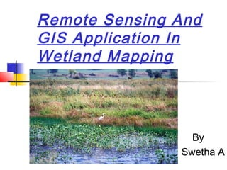
  • 1. Remote Sensing And GIS Application In Wetland Mapping By Swetha A
  • 2. Introduction  Land consisting of marshes or swamps that is saturated with moisture .Wetlands are areas of land that are either temporarily or permanently covered by water  Time depending on seasonal variability.  Wetlands vary widely because of regional and local differences in soils, topography, climate, hydrology, water chemistry, vegetation, and other factors, including human disturbance.
  • 3.  Wetlands are also considered the most biologically diverse of all ecosystems, serving as home to a wide range of plant and animal life.  The largest wetlands in the world include the Amazon River basin and the West Siberian Plain. Another large wetland is the Pantanal, which straddles Brazil, Bolivia, and Paraguay in South America
  • 4. v Hydric S oil S oil that develops certain characteristics from being saturated for several weeks. v Hydrophytic Vegetation Vegetation that thrives in wetland conditions v Hydrology Water either from ground or surface sources Three Major Criteria of Wetlands
  • 5. DATA USED Remote sensing data  IRS P6 LISS III data was used to map the wetlands .  IRS P6 LISS III provides data in 4 spectral bands; green, red, Near Infra Red (NIR) and Short wave Infra Red (SWIR), with 23.5 m spatial resolution,141km-wide swath and 24 day repeat cycle.  The spatial resolution is suitable for 1:50,000 scale mapping. The state of Karnataka is covered in 24 IRS LISS III scene  Two-date data,  October/November= post-monsoon  April/May =pre-monsoon
  • 6.  National Wetland Inventory and Assessment (NWIA) project was formulated as a joint vision of Ministry of Environment & Forestry, Govt. India, and Space Applications Centre (ISRO) .
  • 7.
  • 8.  Normalised Difference Water Index (NDWI) = (Green-NIR) / (Green + NIR)  Modified Normalised Difference Water Index (MNDWI) = (Green-MIR) / (Green + MIR)  Normalised Difference Vegetation Index (NDVI) = (NIR - Red) / (NIR + Red)  Normalised Difference Pond Index (NDPI) = (MIR – Green / MIR + Green)  Normalised Difference Turbidity Index (NDTI) = (Red – Green) / (Red + Green)
  • 9.
  • 10. GIS Application  Link between Water Analysis Simulation Program v.4 (WASP4) and Arc/Info  Spatial/temporal analysis of data  Model input configuration/editing/conversion  Model output interpretation/reporting/display  Model calibration/confirmation/application
  • 12. Union the two layers… …to form one layer with both attributes. 1. 2. 3.
  • 13. By using SQL we can isolate polygons with attributes that meet wetland requirements… …to delineate the possible locations of wetlands seen here isolated in bright blue.
  • 14.
  • 15. Map showing distribution of various types of wetlands in India derived using LISS III
  • 18. IRS LISS-III FCC - 5 km buffer area of Maddur Lake
  • 20.  Karnataka (4250 ha)  Magadhi  Gudavi Bird Sanctuary  Bonal  Hidkal & Ghataprabha  Heggeri  Ranganthittu  K.G. Koppa State-wise area of identified Wetlands under National Wetland Conservation & Management Program (NWCMP)
  • 21. Importance of Wetlands in Ecological Functions  Wetlands act as the biological "kidneys" of the landscape by filtering out any water  coastal wetlands can actually be regarded as stress- controlled ecosystems.  The presence of wetlands in a hydrological basin can modify the floods by reducing the total volume of floodwater and retarding flood peaks.
  • 22. Cnt1…  Wetlands, having dense vegetation, reduce flow velocity, which facilitates sedimentation.  Temperature is regulated by these wetlands.  Wetlands constitute about 6% of the hydrosphere  Various autotrophic organisms convert solar radiation through photosynthesis  important functions of upland and aquatic systems, physical and biological processes
  • 23. Cnt2..  Wetland biodiversity is a remarkable part of Earth's biodiversity.  Wetlands offer rich grazing materials for cattle, sheep and goats during a long period of the year.  An erosion control value since it retains soil and disseminates Erosional forces of flowing water and waves  Their role in trapping atmospheric carbon dioxide  Biodegradation of organic matter, paleoecology, biodiversity,
  • 24. Human Impact on Wetlands  Land development  Waste dumping that pollutes the wetlands  Hunting and trapping  Wetlands for agricultural drainage
  • 25. SOURCES OF POLLUTION  Point Sources -municipal and industrial wastewater.  Non-point Sources -urban and agricultural run-off  Major degrading factors - acidification from atmospheric sources, acid mine drainage; contamination by toxic metals such as mercury and organic compounds such as poly-chlorinated biphenyls.
  • 26. CONSEQUENCES OF LOSS OF WETLANDS  The tanks were reclaimed for various purposes such as residential layouts, commercial establishments, sport complexes, etc.  For e.g. Darmombuditank has been converted into the current city bus stand, Millers tank into a residential layout, Sampangitank into the Kanteervastadium,etc.  This has changed the climate of the city and affected its ground water level.
  • 27. Cnt…  The loss of wetlands has led to decrease in water storage capacity, wetland area, number of migratory birds, floral and faunal diversity and ground water table.  Studies reveal the decrease in depth of the ground water table from 35-40 to 250-300 feet in 20 years due to the disappearance of wetlands
  • 28. Conservation of wetlands  An ecosystem approach is needed to address the wetland problems  The ecosystem approach considers both human water needs within the larger context of the drainage basin and environmental water needs or ecological requirements.  Increasingly, constructed wetlands are used for the treatment of municipal and industrial wastewater before the treated water is let into lakes and wetlands.  They offer the most sustainable means for the treatment of wastewater
  • 29.  NATIONAL WETLAND ATLAS ,KARNATAKA Sponsored by -Ministry of Environment and Forests, Government of India As a part of the project on National Wetland Inventory and Assessment (NWIA) Space Applications Centre (ISRO), Ahmadabad And Karnataka State Remote Sensing Applications Centre, (KSRSAC), Bangalore  National Wetland Conservation & Management –Minister Environment & Forests Government of India.  Wetlands Mapping Standard-FGDC Wetlands Subcommittee July 2009  Wetlands Indicators: A Guide to Wetland Identification, Delineation, Classification, and Mapping by Ralph W. Tiner References: