

Recomendados
Mais conteúdo relacionado
Mais procurados
Mais procurados (20)
Semelhante a UD3.- RELIEF AND LANDFORMS
Semelhante a UD3.- RELIEF AND LANDFORMS (20)
Mais de Mencar Car
Mais de Mencar Car (20)
Último
Último (20)
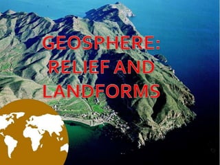
UD3.- RELIEF AND LANDFORMS
- 1. EL RELIEVE
- 3. Stop and Think: What Would Earth Look Like if We Could Look Inside?
- 4. According to its composition: Crust: Between 6 and 70 km. Mantle: It lies at a depth of 2900 km approximately. Core: Lies at a depth between 2900 and 6370 km. It is divided in external and internal core. According to its rigidity: Lithosphere: Composed by the crust and the upper mantle, thickness of around 100 km. Mesosphere: Inner mantle. Composed by magma. Endosphere: It coincides with the core.
- 5. STRUCTURE OF THE GEOSPHERE
- 9. TECTONIC PLATES/ PLACAS TECTÓNICAS The lithosphere (crust and the upper mantle) is divided into tectonic plates (placas tectónicas), which are blocks that float on top of the molten materials in the mantle. The scientific study of the movements and changes of the lithosphere is called plate tectonics (tectónica de placas).
- 12. The tectonic plates can be: Continental plates (formed only by emerged lands). Oceanic plates (formed by the lithosphere of the ocean floor). Mixed plates (formed by continental and oceanic lithosphere). The edges of the plates are zones of contact and of greater instability of the crust.
- 14. RELIEF FORMATION The Earth’s relief consists of the natural forms and features that make up the surface of the planet. They are formed by: Plate tectonics. The action of external agents which change and shape them.
- 16. OROGENESIS It is the process of formation of the Earth’s relief by the action of internal forces of the Earth. Orogenesis’ processes: Volcanic mountain formation. Fault blocks. Folding
- 17. VOLCANIC MOUNTAIN FORMATION Movimiento divergente o de separación It occurs when two tectonic plates separate. In the separation line a ridge (dorsal) is created. Magma erupts from there, when it gets cold and solidifies, mountain ranges and volcanic cones are formed.
- 18. OROGENIA VOLCÁNICA Se genera cuando dos placas tectónicas se separan y dan origen a una zona de volcanes. A través de ellos emergen los materiales fundidos del manto. Cuando se solidifican forman cordilleras y conos volcánicos.
- 19. FAULT BLOCKS Movimiento convergente o de choque: It occurs when forces on blocks of hard materials which cannot fold. These forces produce earthquakes.
- 20. OROGENIA POR FALLA Se forman al colisionar dos placas formadas por materiales duros, no pueden plegarse, se fracturan y producen terremotos. Bloques levantados y hundidos.
- 21. FOLDING Movimiento convergente o de choque: It occurs when two tectonic plates with edges made of relatively soft materials collide. The edges of the plates fold and rise, creating large mountains.
- 22. OROGENIA POR PLEGAMIENTO Se produce al chocar dos placas tectónicas constituidas por materiales blandos. Da lugar a grandes montañas
- 23. DERIVA CONTINENTAL Es una teoría que defiende que hace millones de años todos los continentes se hallaban unidos en un continente único (Pangea). El continente se dividió inicialmente en dos: Laurasia y Gondwana (hace unos 150 millones de años). Estas masas se fracturaron hasta que se formaron los actuales continentes.
- 25. Vídeo: https://www.youtube.com/watch?v=kwfNGat xUJI https://www.youtube.com/watch?v=tcPghqn nTVk https://www.youtube.com/watch?v=alkXhmp pGMA http://www.profesorfrancisco.es/2013/02/la- tectonica-de-placas-en-flash.html
- 26. EXTERNAL AGENTS
- 27. Elevated landforms are modified by the action of external agents. The main external agents are: water, wind, temperatura and living beings.
- 29. Processes that shape the relief: Erosion Disintegration of relief shapes by the external agents. Transport Movement of the eroded materials. Deposition Deposit of transported materials.
- 31. WATER EROSION Pluvial It is caused by rainwater. Rainwater wears away the materials that are dragged by rivers and streams. Glacial It is caused by glaciers. Glaciers are masses of ice that move very slowly. They erode the surface and deposit sediment, forming moraines. Coastal caused by the movement of the sea, such as waves, tides and currents. The sea shapes the coasts, forming cliffs or depositing materials on the beaches. Fluvial Caused by rivers. It may form valleys and canyons.
- 37. WIND EROSION It is caused by particles carried by the wind. The sediment transported by the wind is then deposited, forming piles of sand or dunes.
- 38. TEMPERATURE EROSION Freezing and thawing erosion is caused by water penetrating the crack son rocky surfaces.When the water freezes, its volumen increases producing bigger cracks in the earth and rocks.
- 39. BIOLOGICAL EROSION It is caused by living things. For example, plants break the soil with their roots. Animals erode the soil when they build their dens. Human activity is the most significant agents in shaping the Earth’s surface.Through the use of technology and heavy machinery, we shape the Earth according to our needs.
- 40. Human activity is the most significant agents in shaping the Earth’s surface. Through the use of technology and heavy machinery, we shape the Earth according to our needs. Human activity is the most significant agents in shaping the Earth’s surface. Through the use of technology and heavy machinery, we shape the Earth according to our needs.
- 41. TYPES OF RELIEF TYPES OF LANDFORMS
- 42. LAS FORMAS DEL RELIEVE The relief is the set of complex forms that compose the terrestrial surface.
- 45. MOUNTAINS Natural elevations of the terrain with great height. más
- 50. MOUNTAIN RANGE / CORDILLERA Conjunto de montañas enlazadas entre sí.
- 52. SIERRA Parte de una cordillera
- 53. HILLS / COLINAS Elevations of low height.
- 54. Colinas de Chocolate, de Filipinas
- 55. PLAINS These are flat areas located at altitudes below 150 m. Plains are often fertile areas that are good for agriculture.
- 57. PLATEAU / MESETA Extensive plain located in an elevated position with respect to the level of the sea.
- 59. VALLEY Space between mountains. If it is a fluvial valley it has a "V" shape. If it has been created by a glacier, it has a "U" shape.
- 61. DEPRESSION Extensive terrain that lies below the level of the surrounding lands.
- 65. Coastal relief is located in areas where the emerging land is in contact with the sea. If the continental area is flat and has a low altitude dominated by beaches. If the continental area is mountainous cliffs. They can be different forms: beaches, capes, gulfs, peninsulas, inlets and fjords, islands and archipelagos…
- 66. COAST / LITORAL Zone of contact between land and sea
- 67. BEACH Flat land located between land and sea. Almost flat stretch of sand or stones on the seashore, a river or a lake.
- 68. BEACH
- 69. CAPE Portion of land that penetrates the sea more than the rest.
- 71. GULF AND BAY Gulf: s ea entrance on the coast. Bays have rounded shapes and are smaller
- 73. PENINSULA AND ISTHMUS Península: land area almost completely surrounded by the sea, except by a narrow strip called isthmus.
- 75. ISLAND/ARCHIPELAGO Land surface surrounded by water. A group of islands forms an archipelago.
- 77. ISLAS GALÁPAGOS
- 79. INLETS/FJORDS Strip of sea that penetrates the earth, taking advantage of the mouth of a river. If you take advantage of a glacier, it is a fjord.
- 80. Ría de Ribadeo
- 83. DELTA Mouth of a river that forms an accumulation of sediments.
- 84. DELTA DEL NILO
- 85. CLIFFS Abrupt contact between land and sea by means of a very steep rocky zone.
- 88. POND / ALBUFERA Lagoon of salt water, formed in low lands contiguous to the sea, that is isolated of this by a cord or sand bank.
- 89. Albufera
- 90. MARSH / MARISMA A marshy ground located below sea level, which has been invaded by the sea or an estuary.
- 93. Ocean relief landforms are located at great depths under the sea. Distintas formas: plataforma continental, talud continental, llanuras abisales, dorsales oceánicas y fosas oceánicas.
- 95. CONTINENTAL SHELVES/PLATAFORMA CONTINENTAL Inclined plain that links the mainland with the seabed.
- 96. CONTINENTAL SLOPES / TALUD CONTINENTAL Sharp end of the continental shelf, as a step.
- 97. OCEAN BASINS / LLANURAS ABISALES Seabed composed of large plains between 3000 and 6000 meters deep.
- 98. OCEAN RIDGE / DORSAL OCEÁNICA Great submarine mountain range located in the middle of the oceans in the abyssal plains. They are created by a great crack where magma from the mantle appears.
- 100. RIFT Centre of the ocean ridges.
- 101. OCEAN TRENCH / FOSA MARINA They are great underground depressions located along the edges of ocean basins. They are the deepest areas of the planet. The deepest ocean trench is that of the Marianas with 11,033 meters of depth.
- 104. THE CONTINENTS OF THE EARTH Earth: Marine and oceanic water 70% Land 30%
- 106. Most of the emerging lands Continents. Continent: large areas of land surrounded by marine waters. In addition to continents, there are islands, which are emerged lands, but smaller. The continents are: Asia, Africa, America, Europe,Antarctica and Oceania.
- 108. Europa y Asia formarían un conjunto: Eurasia. Se consideran independientes. La mayor parte de los continentes se sitúa en el hemisferio norte y en el hemisferio occidental.
- 111. AMERICA It has an elongated shape from North to South. It is located in the western hemisphere. It has an area of more than 42 million km2. It limits to the north with the ArcticGlacial Ocean; to the south with the O. Glacial Antarctic; to the east, with the O. Atlántico; to the west with the Pacific O., which separates it from Asia by the Bering Strait. Most of its islands are in the Atlantic, the Caribbean or the Canadian coast.
- 113. ANTARCTICA It contains an extension of more than 13 million km2.The Drake Strait, in the Pacific Ocean, separates it from America. This continent is in the Antarctic Circle. It is covered with ice.
- 117. EUROPE It is the fifth continent in terms of its extension. It has an area of more than 10 million km2. It borders on the Atlantic and Arctic Ocean, as well as the Mediterranean Sea (that separates it from Asia and Africa). Its islands in the Atlantic Ocean are large; of smaller size those of the Mediterranean Sea.
- 119. ASIA It is the continent of greater extension, occupies more than 44 million km2. To the east and southeast of the continent are the main archipelagos: Japan, the Philippines and Indonesia.
- 122. OCEANIA It is the continent of smaller extent, occupying a little less than 9 million km2. Formed by islands. Highlights Australia, New Guinea, New Zealand andTasmania. The island of Australia is the largest in the world.
- 125. AFRICA It has an extension of more than 30 million km2. The islands of the African continent are scarce.The island of Madagascar stands out. In addition to the archipelagos of the Canary Islands, CapeVerde and the Seychelles.