SlideShare uma empresa Scribd logo
1 de 36
Introduction to GIS
     and ArcGIS


    How a GIS works

 Introduction to ArcGIS
A GIS integrates five basic
                   components

   software      method
                 s


hardware
              data

                          people
Data
Types of datasets
Vector formats
(“feature classes”)


Points

Lines (”arcs”)

Polygons
Types of datasets

Raster formats
  Matrices of square
  cells (grids, pixels)
Types of datasets

Attribute tables:
tables of data describing
spatial features
Methods
Basic GIS Functions

      Capture
       Store
       Query
      Analyze
      Display
      Output
Capturing data


Digital images
                              Paper maps


                        GIS


                              GPS output


  Coordinate lists
Query
 Identifying specific features
        Where is parcel No. 2945?


Identifying
features based
on conditions
Find all trees with DBH > 35 cm
Analysis

Proximity : which roads are within a
100 ft from a stream

Overlay: combines the features of two
or more layers to create a new layer
(intersections, unions…)

Network: examines how linear features
are connected
Analysis
Analysis
Display


   Maps
   Graphs
Reports/Tables
Examples of GIS maps
surface drapes & 3-D modeling
Examples of GIS generated maps
detailed
topographic maps
Output

Paper map
Internet
Image (cc.jpg, cc.pdf)
Document (cc.mxd)
Poster
How a GIS works

Introduction to ArcGIS
What is ArcGIS?
                                                                                    E
                             E       ArcGIS Desktop                ArcGIS Engine    X
                                                                                    T
                             X                                                      E
                                                                                    N
                             T                         ArcInfo
                                                                      Custom
                                                                                    S
                             E                                       Application    I
ArcGIS Clients               N
                                                                                    O
                                                                                    N
                             S             ArcEditor                                S

                             I
                             O
                                 ArcView                                         Web
                 ArcReader   N                                   ArcPad
                                                                               Browser
                             S

Components                                    ArcObjects

                                                Network

                     ArcGIS Server                                    ArcIMS

Application/Data                                ArcSDE
Servers
                                                RDBMS
ArcGIS Desktop Products


                             ArcInfo


                 ArcEditor


       ArcView


Increased Functionality
The history of ESRI products


  ArcInfo   ArcView   ArcGIS         ArcInfo


                                ArcEditor
                      ArcView


             time
All ArcGIS products share
                ArcInfo
                        common applications
        ArcEditor

  ArcView                    ArcCatalog-window to database


ArcMap-displaying


                    ArcToolbox-geographic processing functions
What is unique about ArcGIS GIS?


  •GUI   (Graphic User Interface)

  •Customization     & Programming

  •Extensions    to Increase Functionality

  •Scalability
GUI


Beware:
  The ArcGIS GUI is complicated and many-
  layered.
  There is no command-line control; all
  automation must be scripted.
Customization & Programming
•   Many functions are not available from the GUI
•   Custom functions and operations can be created
    with various programming languages
•   Repetitive tasks can be automated
•   New functions and operations can be added to
    the GUI menus, buttons, and tools
•   Entire new applications can be developed
•   But:
    Scripting is not easy to learn
Extensions -> Increase Functionality
     Functionality not included in the core
      ArcGIS product can increase productivity
     Some extensions are built-in, but just need
      to be enabled
     Other extensions are available for free
      (web); some are available for sale
     We will be using several extensions during
      the course
ArcGIS
Scalability
                                                                  Custom
                                     Desktop         ArcInfo
                                                                 Application
                                            ArcEditor
                                      ArcView                            Web
                         ArcReader                             ArcPad
                                                                        Browser
                                                ArcObjects
                                                 Network
                              ArcGIS                              ArcIMS
                              Server             ArcSDE
                                                 RDBMS
The ArcGIS suite contains
  Desktop application
     (we will be using this quarter)
  Data server application (ArcSDE)
  Application servers (ArcGIS Server)
  Internet mapping servers (ArcIMS)
GIS software
Ecological Applications: Vol. 17, No. 3, pp. 791–805


   ASSESSING THE RISK OF
IGNITION IN THE RUSSIAN FAR
  EAST WITHIN A MODELING
FRAMEWORK OF FIRE THREAT
      Tatiana V. Loboda and Ivan A. Csiszar
Homework
•Read: “What is ArcGIS9”
       “Exploring the ArcGIS interface”
       “ArcGIS GUI”
       “ArcGIS modules”


•Do: Assignment 1 and submit with “Collect-it”

•Check E-post regularly

Mais conteúdo relacionado

Semelhante a Intro arcgis

Introduction to ArcGIS for Developers, Esri, Charles van der Put, Jim Barry
Introduction toArcGIS for Developers, Esri, Charles van der Put, Jim BarryIntroduction toArcGIS for Developers, Esri, Charles van der Put, Jim Barry
Introduction to ArcGIS for Developers, Esri, Charles van der Put, Jim Barry
Esri Nederland
 
Defination of gis and components of arc gis
Defination of gis and components of arc gisDefination of gis and components of arc gis
Defination of gis and components of arc gis
Sreedhar Siddhu
 
Building good web_maps, Esri, Joris Bak
Building good web_maps, Esri, Joris BakBuilding good web_maps, Esri, Joris Bak
Building good web_maps, Esri, Joris Bak
Esri Nederland
 
Esri Scotland Conf 2016 Web AppBuilder
Esri Scotland Conf 2016   Web AppBuilderEsri Scotland Conf 2016   Web AppBuilder
Esri Scotland Conf 2016 Web AppBuilder
Esri UK
 
Arc2Earth - ESRI NYC Dev Meetup
Arc2Earth - ESRI NYC Dev MeetupArc2Earth - ESRI NYC Dev Meetup
Arc2Earth - ESRI NYC Dev Meetup
Arc2Earth
 

Semelhante a Intro arcgis (20)

Introduction to ArcGIS for Developers, Esri, Charles van der Put, Jim Barry
Introduction toArcGIS for Developers, Esri, Charles van der Put, Jim BarryIntroduction toArcGIS for Developers, Esri, Charles van der Put, Jim Barry
Introduction to ArcGIS for Developers, Esri, Charles van der Put, Jim Barry
 
Enterprise GIS
Enterprise GIS Enterprise GIS
Enterprise GIS
 
Navteq Developer Days - ArcGIS + POI
Navteq Developer Days - ArcGIS + POINavteq Developer Days - ArcGIS + POI
Navteq Developer Days - ArcGIS + POI
 
Geographic information system
Geographic information systemGeographic information system
Geographic information system
 
Defination of gis and components of arc gis
Defination of gis and components of arc gisDefination of gis and components of arc gis
Defination of gis and components of arc gis
 
Esriuk_track5_pro_launch
Esriuk_track5_pro_launchEsriuk_track5_pro_launch
Esriuk_track5_pro_launch
 
Arc gis server
Arc gis serverArc gis server
Arc gis server
 
ArcGIS Server Javascript API
ArcGIS Server Javascript APIArcGIS Server Javascript API
ArcGIS Server Javascript API
 
NDGeospatialSummit2019 - ArcGIS Pro – Next-Generation Desktop GIS
NDGeospatialSummit2019 - ArcGIS Pro – Next-Generation Desktop GISNDGeospatialSummit2019 - ArcGIS Pro – Next-Generation Desktop GIS
NDGeospatialSummit2019 - ArcGIS Pro – Next-Generation Desktop GIS
 
NDGISUC2017 - Introducing ArcGIS Pro
NDGISUC2017 - Introducing ArcGIS ProNDGISUC2017 - Introducing ArcGIS Pro
NDGISUC2017 - Introducing ArcGIS Pro
 
Providing New Geographic Solutions to the Company
Providing New Geographic Solutions to the Company Providing New Geographic Solutions to the Company
Providing New Geographic Solutions to the Company
 
Gis without the_box_may2012
Gis without the_box_may2012Gis without the_box_may2012
Gis without the_box_may2012
 
Building good web_maps, Esri, Joris Bak
Building good web_maps, Esri, Joris BakBuilding good web_maps, Esri, Joris Bak
Building good web_maps, Esri, Joris Bak
 
Esri Scotland Conf 2016 Web AppBuilder
Esri Scotland Conf 2016   Web AppBuilderEsri Scotland Conf 2016   Web AppBuilder
Esri Scotland Conf 2016 Web AppBuilder
 
Arc gis desktop_and_geoprocessing
Arc gis desktop_and_geoprocessingArc gis desktop_and_geoprocessing
Arc gis desktop_and_geoprocessing
 
Arc2Earth - ESRI NYC Dev Meetup
Arc2Earth - ESRI NYC Dev MeetupArc2Earth - ESRI NYC Dev Meetup
Arc2Earth - ESRI NYC Dev Meetup
 
Using GIS in the Management of Animal Health Crisis
Using GIS in the Management of Animal Health CrisisUsing GIS in the Management of Animal Health Crisis
Using GIS in the Management of Animal Health Crisis
 
Lect 9 lab-1 intro to interface
Lect 9 lab-1 intro to interfaceLect 9 lab-1 intro to interface
Lect 9 lab-1 intro to interface
 
NDGISUC2017 - Mobile Data Collection & Reporting System
NDGISUC2017 - Mobile Data Collection & Reporting SystemNDGISUC2017 - Mobile Data Collection & Reporting System
NDGISUC2017 - Mobile Data Collection & Reporting System
 
GIS software
GIS softwareGIS software
GIS software
 

Último

Neurulation and the formation of the neural tube
Neurulation and the formation of the neural tubeNeurulation and the formation of the neural tube
Neurulation and the formation of the neural tube
SaadHumayun7
 
ppt your views.ppt your views of your college in your eyes
ppt your views.ppt your views of your college in your eyesppt your views.ppt your views of your college in your eyes
ppt your views.ppt your views of your college in your eyes
ashishpaul799
 
Industrial Training Report- AKTU Industrial Training Report
Industrial Training Report- AKTU Industrial Training ReportIndustrial Training Report- AKTU Industrial Training Report
Industrial Training Report- AKTU Industrial Training Report
Avinash Rai
 

Último (20)

Removal Strategy _ FEFO _ Working with Perishable Products in Odoo 17
Removal Strategy _ FEFO _ Working with Perishable Products in Odoo 17Removal Strategy _ FEFO _ Working with Perishable Products in Odoo 17
Removal Strategy _ FEFO _ Working with Perishable Products in Odoo 17
 
Basic_QTL_Marker-assisted_Selection_Sourabh.ppt
Basic_QTL_Marker-assisted_Selection_Sourabh.pptBasic_QTL_Marker-assisted_Selection_Sourabh.ppt
Basic_QTL_Marker-assisted_Selection_Sourabh.ppt
 
Gyanartha SciBizTech Quiz slideshare.pptx
Gyanartha SciBizTech Quiz slideshare.pptxGyanartha SciBizTech Quiz slideshare.pptx
Gyanartha SciBizTech Quiz slideshare.pptx
 
Incoming and Outgoing Shipments in 2 STEPS Using Odoo 17
Incoming and Outgoing Shipments in 2 STEPS Using Odoo 17Incoming and Outgoing Shipments in 2 STEPS Using Odoo 17
Incoming and Outgoing Shipments in 2 STEPS Using Odoo 17
 
Basic phrases for greeting and assisting costumers
Basic phrases for greeting and assisting costumersBasic phrases for greeting and assisting costumers
Basic phrases for greeting and assisting costumers
 
aaaaaaaaaaaaaaaaaaaaaaaaaaaaaaaaaaaaaaaaaaaaaaaaaaaaaaa
aaaaaaaaaaaaaaaaaaaaaaaaaaaaaaaaaaaaaaaaaaaaaaaaaaaaaaaaaaaaaaaaaaaaaaaaaaaaaaaaaaaaaaaaaaaaaaaaaaaaaaaaaaaaaa
aaaaaaaaaaaaaaaaaaaaaaaaaaaaaaaaaaaaaaaaaaaaaaaaaaaaaaa
 
Neurulation and the formation of the neural tube
Neurulation and the formation of the neural tubeNeurulation and the formation of the neural tube
Neurulation and the formation of the neural tube
 
The Art Pastor's Guide to Sabbath | Steve Thomason
The Art Pastor's Guide to Sabbath | Steve ThomasonThe Art Pastor's Guide to Sabbath | Steve Thomason
The Art Pastor's Guide to Sabbath | Steve Thomason
 
....................Muslim-Law notes.pdf
....................Muslim-Law notes.pdf....................Muslim-Law notes.pdf
....................Muslim-Law notes.pdf
 
Advances in production technology of Grapes.pdf
Advances in production technology of Grapes.pdfAdvances in production technology of Grapes.pdf
Advances in production technology of Grapes.pdf
 
ppt your views.ppt your views of your college in your eyes
ppt your views.ppt your views of your college in your eyesppt your views.ppt your views of your college in your eyes
ppt your views.ppt your views of your college in your eyes
 
Championnat de France de Tennis de table/
Championnat de France de Tennis de table/Championnat de France de Tennis de table/
Championnat de France de Tennis de table/
 
UNIT – IV_PCI Complaints: Complaints and evaluation of complaints, Handling o...
UNIT – IV_PCI Complaints: Complaints and evaluation of complaints, Handling o...UNIT – IV_PCI Complaints: Complaints and evaluation of complaints, Handling o...
UNIT – IV_PCI Complaints: Complaints and evaluation of complaints, Handling o...
 
Dementia (Alzheimer & vasular dementia).
Dementia (Alzheimer & vasular dementia).Dementia (Alzheimer & vasular dementia).
Dementia (Alzheimer & vasular dementia).
 
How to Manage Notification Preferences in the Odoo 17
How to Manage Notification Preferences in the Odoo 17How to Manage Notification Preferences in the Odoo 17
How to Manage Notification Preferences in the Odoo 17
 
Word Stress rules esl .pptx
Word Stress rules esl               .pptxWord Stress rules esl               .pptx
Word Stress rules esl .pptx
 
Industrial Training Report- AKTU Industrial Training Report
Industrial Training Report- AKTU Industrial Training ReportIndustrial Training Report- AKTU Industrial Training Report
Industrial Training Report- AKTU Industrial Training Report
 
Morse OER Some Benefits and Challenges.pptx
Morse OER Some Benefits and Challenges.pptxMorse OER Some Benefits and Challenges.pptx
Morse OER Some Benefits and Challenges.pptx
 
Application of Matrices in real life. Presentation on application of matrices
Application of Matrices in real life. Presentation on application of matricesApplication of Matrices in real life. Presentation on application of matrices
Application of Matrices in real life. Presentation on application of matrices
 
Operations Management - Book1.p - Dr. Abdulfatah A. Salem
Operations Management - Book1.p  - Dr. Abdulfatah A. SalemOperations Management - Book1.p  - Dr. Abdulfatah A. Salem
Operations Management - Book1.p - Dr. Abdulfatah A. Salem
 

Intro arcgis

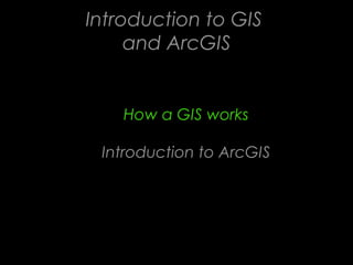
  • 1. Introduction to GIS and ArcGIS How a GIS works Introduction to ArcGIS
  • 2. A GIS integrates five basic components software method s hardware data people
  • 4. Types of datasets Vector formats (“feature classes”) Points Lines (”arcs”) Polygons
  • 5. Types of datasets Raster formats Matrices of square cells (grids, pixels)
  • 6. Types of datasets Attribute tables: tables of data describing spatial features
  • 8. Basic GIS Functions Capture Store Query Analyze Display Output
  • 9. Capturing data Digital images Paper maps GIS GPS output Coordinate lists
  • 10. Query Identifying specific features Where is parcel No. 2945? Identifying features based on conditions Find all trees with DBH > 35 cm
  • 11. Analysis Proximity : which roads are within a 100 ft from a stream Overlay: combines the features of two or more layers to create a new layer (intersections, unions…) Network: examines how linear features are connected
  • 14. Display Maps Graphs Reports/Tables
  • 15. Examples of GIS maps surface drapes & 3-D modeling
  • 16. Examples of GIS generated maps detailed topographic maps
  • 17. Output Paper map Internet Image (cc.jpg, cc.pdf) Document (cc.mxd) Poster
  • 18. How a GIS works Introduction to ArcGIS
  • 19. What is ArcGIS? E E ArcGIS Desktop ArcGIS Engine X T X E N T ArcInfo Custom S E Application I ArcGIS Clients N O N S ArcEditor S I O ArcView Web ArcReader N ArcPad Browser S Components ArcObjects Network ArcGIS Server ArcIMS Application/Data ArcSDE Servers RDBMS
  • 20. ArcGIS Desktop Products ArcInfo ArcEditor ArcView Increased Functionality
  • 21. The history of ESRI products ArcInfo ArcView ArcGIS ArcInfo ArcEditor ArcView time
  • 22. All ArcGIS products share ArcInfo common applications ArcEditor ArcView ArcCatalog-window to database ArcMap-displaying ArcToolbox-geographic processing functions
  • 23. What is unique about ArcGIS GIS? •GUI (Graphic User Interface) •Customization & Programming •Extensions to Increase Functionality •Scalability
  • 24. GUI Beware: The ArcGIS GUI is complicated and many- layered. There is no command-line control; all automation must be scripted.
  • 25. Customization & Programming • Many functions are not available from the GUI • Custom functions and operations can be created with various programming languages • Repetitive tasks can be automated • New functions and operations can be added to the GUI menus, buttons, and tools • Entire new applications can be developed • But: Scripting is not easy to learn
  • 26. Extensions -> Increase Functionality  Functionality not included in the core ArcGIS product can increase productivity  Some extensions are built-in, but just need to be enabled  Other extensions are available for free (web); some are available for sale  We will be using several extensions during the course
  • 27. ArcGIS Scalability Custom Desktop ArcInfo Application ArcEditor ArcView Web ArcReader ArcPad Browser ArcObjects Network ArcGIS ArcIMS Server ArcSDE RDBMS The ArcGIS suite contains Desktop application (we will be using this quarter) Data server application (ArcSDE) Application servers (ArcGIS Server) Internet mapping servers (ArcIMS)
  • 29. Ecological Applications: Vol. 17, No. 3, pp. 791–805 ASSESSING THE RISK OF IGNITION IN THE RUSSIAN FAR EAST WITHIN A MODELING FRAMEWORK OF FIRE THREAT Tatiana V. Loboda and Ivan A. Csiszar
  • 30.
  • 31.
  • 32.
  • 33.
  • 34.
  • 35.
  • 36. Homework •Read: “What is ArcGIS9” “Exploring the ArcGIS interface” “ArcGIS GUI” “ArcGIS modules” •Do: Assignment 1 and submit with “Collect-it” •Check E-post regularly

Notas do Editor

  1. ArcGIS is the name used to identify ESRI’s flagship family of GIS products. ArcGIS ® includes ArcGIS client software, components as well as application and data server software. ArcGIS itself is not a GIS application; rather, it is a set of software products for building ArcGIS systems that best suit your GIS needs. ArcGIS is based on a common library of shared GIS software components, called ArcObjects ™ . ArcGIS is composed of client and server applications. Each software application can create, manage, analyze, and serve data stored in one or more formats. ArcGIS Desktop: Integrated suite of advanced GIS applications consisting of three software products: ArcView ® , ArcEditor ™ , and ArcInfo ® . The ArcGIS Desktop applications provide the same core mapping, editing, and analysis functionality. The level of functionality available differs depending on which license you have. ArcInfo provides users with the most complete level of GIS functionality. It is composed of ArcInfo Desktop, as well as ArcInfo Workstation. ArcReader ™ : Allows users to view high quality published maps (.PMFs) created in ArcMap ™ . ArcGIS ® Engine: Developer toolkit of embeddable GIS components for building custom stand alone applications using COM, C++, Java, and .NET ArcPad ® : Used with PDAs for creating and managing data while in the field ArcGIS ® Server: A shared library of GIS software objects used to build/develop serverside GIS applications in enterprise and Web computing frameworks ArcIMS ® : Use to publish maps, data, and metadata through open internet protocols ArcSDE ® : Manages and serves spatial information from external RDBMS to ArcGIS clients For more information, go to http://www.esri.com/software/index.html.