Gulf hypoxia initiative schwartz
•
0 gostou•157 visualizações

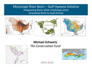
71st SWCS International Annual Conference July 24-27, 2016 Louisville, KY

Recomendados
Recomendados
Mais conteúdo relacionado
Mais procurados
Mais procurados (20)
Semelhante a Gulf hypoxia initiative schwartz
Semelhante a Gulf hypoxia initiative schwartz (20)
Mais de Soil and Water Conservation Society
Mais de Soil and Water Conservation Society (20)
Último
Último (20)
Gulf hypoxia initiative schwartz
- 3. Precision Conservation Blueprint GOALS Benefit Species Conservation Benefit Water Quality Benefit Agricultural Production OBJECTIVES Leverage Investments Where are the interests? First Step – Identify Landscapes Where are the opportunities? Second Step – Identify Site Scale Opportunities Where can these opportunities benefit habitat? Third Step – Evaluate Landscape Context
- 4. Landscape Opportunity Landscapes ‐ Where Are The Interests? Where are investments occurring? Conservation Water Quality Where are agricultural nutrient loads focused? Where are the production systems focused? Data Used to Identify Opportunity Landscapes Nutrient Loads Conservation Interests Water Quality Interests Distribution of agricultural production systems
- 5. Landscape Opportunity Landscapes Water Quality Priority Zone Highest potential for nutrient loads from agriculture = Water Quality Opportunities Conservation and Watershed Interest Focal Areas Leveraging Opportunities Species Opportunities Water Quality Opportunities Production Systems System Specific Opportunities Corn & Soybeans Cotton Rice Grazing
- 6. Landscape Water Quality Priority Zone Highest loads from Ag sources – USGS SPARROW (2002) Highest proportion of cropland – Current Era
- 10. Landscape Pilot Basins Maximum Alignment Water Quality Priority Zone Conservation Interests Watershed Interests Production Systems Multi‐Benefit Landscapes Tier 1: Have the highest nutrient load potential and the highest amount of implementation interest Tier 2: Have either lower load potential or lower implementation interest than Tier 1 pilot basins
- 11. Site Where Are the Site‐Scale Opportunities? Where are the least profitable agricultural lands? Gridded SSURGO – National Commodity Crop Productivity Index Marginal Crop Field = Mean NCCPI below threshold for most productive lands Which sites are most conducive to wetland restoration? Gridded SSURGO – Potential Wetland Soil Landscapes Site Context Which sites can provide highest benefit for water quality? Cropland in riparian zone Forest/Wetland/Prairie restoration opportunities Tile drainage areas Where Are the Opportunities to Enhance Habitat? Which of these sites are contiguous to existing habitat or along a habitat corridor?
- 12. Site
- 13. Site Outputs Marginal Cropland Contiguous to existing habitat Contiguous to aquatic, forest, or grassland corridor Wet Cropland Within tile drainage area Contiguous to aquatic or wetland corridor Cropland in Riparian Zone Marginal Wet Contiguous to existing habitat Mainstem Bottomlands – Large River Floodplains Identify lands suitable for reforestation Identify opportunities to expand existing forest patches Identify potential large forest blocks (> 500 acres)
- 15. Benefits Agricultural Benefits Focus on least productive lands – Marginal Cropland Wildlife Benefits Enhance Existing Habitat Enhance Connectivity Create New Habitat Leverage Aligned Conservation Interests Aquatic Benefits (Species/Water Quality/Hypoxia) Enhance Existing Habitat Enhance Connectivity (Riparian) Create New Habitat Drainage Water Management Leverage Aligned Watershed Interests Focus on Water Quality Priority Zone
- 16. Data Delivery Data Basin Hosted by Conservation Biology Institute Data Discovery Online Mapping ScienceBase Hosted by USGS Data Storage Metadata Data Access Map Services Direct Download
- 17. QUESTIONS? MichaelSchwartz@conservationfund.org Gwen_White@fws.gov Jorgen_Rose@fws.gov Gulf Hypoxia Initiative Site: www.tallgrassprairielcc.org/issue/gulf‐hypoxia Con. Blueprint Resources: tallgrassprairielcc.org/gulf‐hypoxia/where Data Basin GHI Site: tinyurl.com/MRB‐GHI‐DataBasin ScienceBase GHI Site: tinyurl.com/MRB‐GHI‐ScienceBase