

Recomendados
Mais conteúdo relacionado
Destaque
Destaque (12)
Semelhante a Free GIS for Aberdeen
Semelhante a Free GIS for Aberdeen (20)
Mais de GeoBlogs
Mais de GeoBlogs (20)
Último
Último (20)
Free GIS for Aberdeen
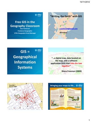
- 1. 10/11/2012 “Writing the Earth” with GIS Free GIS in the Geography Classroom Alan Parkinson a.parkinson@gmail.com Freelance Geographer VITAL Geography Portal Manager @GeoBlogs GIS = Geographical “…a digital map, data located on the map, and a software Information application (GIS) that links the two together” Systems Diana Freeman (2004) First GIS ? Source: ESRI Bringing your maps to life... 1
- 2. 10/11/2012 Why use GIS ? 1 Why use GIS ? 2 • Pupils need to learn what GIS is, but • Highlighted within the relevant as a way of exploring geography. This specifications should be through using it, rather • A need for pupils to be skilled in than learning about the software. this area (‘vocational’) • Ideally start with something that the • Natural link to enquiry, and use pupils are already confident (and of ICT to display and interrogate competent) in using data • There should be some plan for progression GI = Geographical Information Start with the questions that you want to answer... What information do you have ? If GIS can help, then this might be an opportunity to What do you want to use it... do with it ? Teachers were seen to promote creative learning most purposefully and effectively when encouraging pupils to question and challenge, make connections and see relationships, speculate, keep options open while pursuing a line of enquiry, and reflect critically on ideas, actions and results. OFSTED Geography Subject Report 2
- 3. 10/11/2012 ONLINE CPD course… GIS at all key stages in geography... CPD & Events section of GA website disaster management / planning / water / land reclamation / energy / resources = more VISUALISATION 1: Google Earth • 1 billion FREE downloads • Historical imagery • Millions of files shared by users • Placemarks can hold text, images, video or audio – also produce graphs with embed code – = ‘full’ GIS recording fieldwork… • http://dexautomation.com/googlechartgenerator.php https://sites.google.com/site/ncge2011/ 3
- 4. 10/11/2012 http://www.merkador.com Gavin Brock’s OS Layer • Quiz – introduces the tools that you can use… 2: Many Eyes World Maps available... Many Eyes Visualisation Tool Uses ESRI map data A project of IBM http://manyeyes.alphaworks.ibm.com/manyeyes How it works Data entry is in Excel format 1. Login – free and very quick.... Web sourced or “student derived”... 2. Click CREATE VISUALISATION 3. Upload or choose data set 4
- 5. 10/11/2012 Selecting regions on world map Zoom into the maps to see detail shows data... using mouse scroll wheel... Can show multiple maps if there are Sample UK Map... multiple columns of data... 3: Hurricanes NOAA: http://www.csc.noaa.gov/hurricanes • In Hurricane season, so now is the time to teach about them… • Natural Hazards – link with management / resilience / flooding / longer term impacts e.g. Katrina • Naming conventions 5
- 6. 10/11/2012 Data on map Questions • Queries – ask questions (answer questions..) • Which GIS do you use ? • Layers – images / polygons / images • What are the barriers to embedding GIS that • Stories – recording voices and embedding you have come up against ? them into bookmarks • What solutions have you found that haven’t been mentioned ? Keep in touch and I will do what I can to source appropriate data for you… 6