How Geography and Climate Affect Southeast Asia
•Transferir como KEY, PDF•
6 gostaram•1,830 visualizações

The document discusses how geography and climate affect countries in Southeast Asia. It describes the various physical features of countries in the region, including mountains, rivers, coastal areas, and islands. It also explains how monsoon winds and seasonal rainfall patterns impact the climate and agriculture of Southeast Asian nations. Key geographical features mentioned include the Mekong River, Irrawaddy River, islands of Indonesia, and tropical rainforest and monsoon climate across much of the region.

Recomendados
Mais conteúdo relacionado
Destaque
Destaque (20)
Mais de Tuke Ingkhaninan
Mais de Tuke Ingkhaninan (20)
Último
Último (20)
How Geography and Climate Affect Southeast Asia
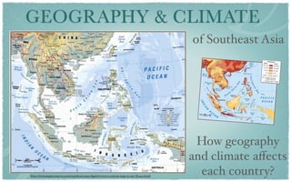
- 1. GEOGRAPHY & CLIMATE of Southeast Asia How geography and climate affects http://www.mapresources.com/southeast-asia-digital-vector-contour-map-se-asi-782423.html each country?
- 2. What are we going to do? 1. Look at the maps of Southeast Asia - try to pick out as many geographical features and other information as you can. - focus on country that you select for colonial history research and take some notes 2. Share your answer to the class, extra information will be given by teacher 3. Fill in the most important features on your Study Guide, using color pencils for different features.
- 4. Land Use Map
- 5. Agriculture http://www.roebuckclasses.com/105/regions/seasiaspac/seasia/seasiaphys/physseasia.htm
- 6. What is a monsoon? • a seasonal shift in the prevailing wind direction • Asian monsoon (India to Southeast Asia • Winter Monsoon (NE) (Nov-Mar) • cool, dry weather in mainland countries • heavy rainfall in insular region • Summer Monsoon (SW) (May-Sep) • heavy rian • Insular region = evergreen rainforest • Mainland = tropical rainforests
- 7. Population Density http://www.roebuckclasses.com/maps/placemap/seasia/seasiapopdensity.JPG
- 8. MYANMAR
- 9. MYANMAR • Lower/ Upper Myanmar • Lower: coastal area with thick forest (teak) • Irrawaddy River • Valuable hard wood accounts for 50% of the country • SW monsoon wind
- 10. MYANMAR • Lower/ Upper Myanmar • Lower: coastal area with thick forest (teak) • Irrawaddy River • Valuable hard wood accounts for 50% of the country • SW monsoon wind
- 11. MYANMAR • Lower/ Upper Myanmar • Lower: coastal area with thick forest (teak) • Irrawaddy River • Valuable hard wood accounts for 50% of the country • SW monsoon wind
- 12. MYANMAR • Lower/ Upper Myanmar • Lower: coastal area with thick forest (teak) • Irrawaddy River • Valuable hard wood accounts for 50% of the country • SW monsoon wind
- 13. THAILAND http://upload.wikimedia.org/wikipedia/commons/thumb/c/c1/Thailand_Topography.png/433px- Thailand_Topography.png
- 14. THAILAND •Northern high mountains •Central plain with Chao Praya River (rice) •Northeast plateau (cotton and cattle) •SW monsoon = heavy rain •NE monsoon = cool, dry season http://upload.wikimedia.org/wikipedia/commons/thumb/c/c1/Thailand_Topography.png/433px- Thailand_Topography.png
- 15. THAILAND mountains •Northern high mountains plateau •Central plain with Chao plain Praya River (rice) •Northeast plateau (cotton and cattle) •SW monsoon = heavy rain •NE monsoon = cool, dry season http://upload.wikimedia.org/wikipedia/commons/thumb/c/c1/Thailand_Topography.png/433px- Thailand_Topography.png
- 16. THAILAND •Northern high mountains •Central plain with Chao Praya River (rice) •Northeast plateau (cotton and cattle) •SW monsoon = heavy rain •NE monsoon = cool, dry season http://upload.wikimedia.org/wikipedia/commons/thumb/c/c1/Thailand_Topography.png/433px- Thailand_Topography.png
- 17. THAILAND •Northern high mountains •Central plain with Chao Praya River (rice) •Northeast plateau (cotton and cattle) •SW monsoon = heavy rain •NE monsoon = cool, dry season http://upload.wikimedia.org/wikipedia/commons/thumb/c/c1/Thailand_Topography.png/433px- Thailand_Topography.png
- 18. THAILAND •Northern high mountains •Central plain with Chao Praya River (rice) •Northeast plateau (cotton and cattle) •SW monsoon = heavy rain •NE monsoon = cool, dry season http://upload.wikimedia.org/wikipedia/commons/thumb/c/c1/Thailand_Topography.png/433px- Thailand_Topography.png
- 19. THAILAND •Northern high mountains •Central plain with Chao Praya River (rice) •Northeast plateau (cotton and cattle) •SW monsoon = heavy rain •NE monsoon = cool, dry season http://upload.wikimedia.org/wikipedia/commons/thumb/c/c1/Thailand_Topography.png/433px- Thailand_Topography.png
- 20. THAILAND •Northern high mountains •Central plain with Chao Praya River (rice) •Northeast plateau (cotton and cattle) •SW monsoon = heavy rain •NE monsoon = cool, dry season http://upload.wikimedia.org/wikipedia/commons/thumb/c/c1/Thailand_Topography.png/433px- Thailand_Topography.png
- 21. THAILAND •Northern high mountains Korat Plateau •Central plain with Chao Praya River (rice) •Northeast plateau (cotton and cattle) •SW monsoon = heavy rain •NE monsoon = cool, dry season http://upload.wikimedia.org/wikipedia/commons/thumb/c/c1/Thailand_Topography.png/433px- Thailand_Topography.png
- 22. THAILAND •Northern high mountains •Central plain with Chao Praya River (rice) •Northeast plateau (cotton and cattle) •SW monsoon = heavy rain •NE monsoon = cool, dry season http://upload.wikimedia.org/wikipedia/commons/thumb/c/c1/Thailand_Topography.png/433px- Thailand_Topography.png
- 23. CAMBODIA http://elitechoice.org/wp-content/uploads/2010/02/Cambodia-Map.jpg http://image.shutterstock.com/display_pic_with_logo/116302/116302,1245503705,1/stock-photo-cambodia-shaded-relief-map-colored- according-to-vegetation-with-major-urban-areas-includes-clip-32367316.jpg
- 24. CAMBODIA http://elitechoice.org/wp-content/uploads/2010/02/Cambodia-Map.jpg • alluvial plain • Mekong River in the East • Tonele Sap • Mountains block way out to the sea • SW monsoon = heavy rain • NE monsoon = cool, dry season http://image.shutterstock.com/display_pic_with_logo/116302/116302,1245503705,1/stock-photo-cambodia-shaded-relief-map-colored- according-to-vegetation-with-major-urban-areas-includes-clip-32367316.jpg
- 25. CAMBODIA http://elitechoice.org/wp-content/uploads/2010/02/Cambodia-Map.jpg • alluvial plain • Mekong River in the East • Tonele Sap • Mountains block way out to the sea • SW monsoon = heavy rain • NE monsoon = cool, dry season http://image.shutterstock.com/display_pic_with_logo/116302/116302,1245503705,1/stock-photo-cambodia-shaded-relief-map-colored- according-to-vegetation-with-major-urban-areas-includes-clip-32367316.jpg
- 26. CAMBODIA http://elitechoice.org/wp-content/uploads/2010/02/Cambodia-Map.jpg • alluvial plain • Mekong River in the East • Tonele Sap • Mountains block way out to the sea • SW monsoon = heavy rain • NE monsoon = cool, dry season http://image.shutterstock.com/display_pic_with_logo/116302/116302,1245503705,1/stock-photo-cambodia-shaded-relief-map-colored- according-to-vegetation-with-major-urban-areas-includes-clip-32367316.jpg
- 27. VIETNAM
- 28. VIETNAM •Low land, hills, densely forested highland • Red River Delta •more populated •rice planting •Central mountains •Coastal lowland- rice planting •Mekong River Delta •Alluvial deposit •Rice growing area •SW- rainfall, NE - cool, dry
- 29. VIETNAM Red River Delta •Low land, hills, densely forested highland • Red River Delta Coastal plain •more populated •rice planting •Central mountains Central mountains •Coastal lowland- rice planting •Mekong River Delta •Alluvial deposit Mekong River Delta •Rice growing area •SW- rainfall, NE - cool, dry
- 30. VIETNAM •Low land, hills, densely forested highland • Red River Delta •more populated •rice planting •Central mountains •Coastal lowland- rice planting •Mekong River Delta •Alluvial deposit •Rice growing area •SW- rainfall, NE - cool, dry
- 31. VIETNAM •Low land, hills, densely forested highland • Red River Delta •more populated •rice planting •Central mountains •Coastal lowland- rice planting •Mekong River Delta •Alluvial deposit •Rice growing area •SW- rainfall, NE - cool, dry
- 32. VIETNAM •Low land, hills, densely forested highland • Red River Delta •more populated •rice planting •Central mountains •Coastal lowland- rice planting •Mekong River Delta •Alluvial deposit •Rice growing area •SW- rainfall, NE - cool, dry
- 33. VIETNAM •Low land, hills, densely forested highland • Red River Delta •more populated •rice planting •Central mountains •Coastal lowland- rice planting •Mekong River Delta •Alluvial deposit •Rice growing area •SW- rainfall, NE - cool, dry
- 34. LAOS
- 35. LAOS •Mountainous Area •Steep terrain •Narrow river valley •not suitable for agriculture •Farming in the south •only 4% of land area is suitable for farming • SW monsoon = heavy rain • NE monsoon = cool, dry season
- 36. LAOS •Mountainous Area •Steep terrain •Narrow river valley •not suitable for agriculture •Farming in the south •only 4% of land area is suitable for farming • SW monsoon = heavy rain • NE monsoon = cool, dry season
- 37. LAOS •Mountainous Area •Steep terrain •Narrow river valley •not suitable for agriculture •Farming in the south •only 4% of land area is suitable for farming • SW monsoon = heavy rain • NE monsoon = cool, dry season
- 38. LAOS •Mountainous Area •Steep terrain •Narrow river valley •not suitable for agriculture •Farming in the south •only 4% of land area is suitable for farming • SW monsoon = heavy rain • NE monsoon = cool, dry season
- 39. SINGAPORE
- 40. SINGAPORE • 646 sq km • 15 meters asl • Bukit Timah, highest point • tropical rainforest climate • 32/90 degree • 90% lives in flats and high building
- 41. SINGAPORE • 646 sq km • 15 meters asl • Bukit Timah, highest point • tropical rainforest Bukit Timah climate 165 m. • 32/90 degree • 90% lives in flats and high building
- 44. BRUNEI •flat coastal plain •eastern mountain •hilly lowland in the west •export crude oil and gas •NE monsoon= rainfall •SW monsoon = rainfall
- 45. INDONESIA
- 46. INDONESIA •13,677 islands •two continental shelves •lots of volcanic mountains •50 active volcanos on Java •NE and SW monsoons bring heavy rain •western and northern receive heaviest rain
- 47. INDONESIA •13,677 islands •two continental shelves •lots of volcanic mountains •50 active volcanos on Java •NE and SW monsoons bring heavy rain •western and northern receive heaviest rain
- 48. INDONESIA •13,677 islands •two continental shelves •lots of volcanic mountains •50 active volcanos on Java •NE and SW monsoons bring heavy rain •western and northern receive heaviest rain
- 49. MALAYSIA
- 50. MALAYSIA •4/5 rainforest, swamp •Malay Peninsula •mountainous area •people live on the west •Borneo Island •plain and mountains •rainforest •NE and SW brings rain all year round
- 51. MALAYSIA •4/5 rainforest, swamp •Malay Peninsula •mountainous area •people live on the west •Borneo Island •plain and mountains •rainforest •NE and SW brings rain all year round
- 52. MALAYSIA •4/5 rainforest, swamp •Malay Peninsula •mountainous area •people live on the west •Borneo Island •plain and mountains •rainforest •NE and SW brings rain all year round
- 53. THE PHILIPPINES
- 54. THE PHILIPPINES •7,107 islands •Luzon, Vasayas, Mindanao •three stars on the flag •tropical marine climate •heavy rain from May- Oct (SW)
- 55. THE PHILIPPINES Luzon •7,107 islands •Luzon, Vasayas, Visayas Mindanao •three stars on the flag •tropical marine climate •heavy rain from May- Oct (SW) Mindanao
- 56. EAST TIMOR •surrounded by flat plain •High mountains in the central •source of all rivers of East Timor •Lakla River, Lies River and Seical River •tropical monsoon climate • July-Nov = cool, dry •Dec-Mar = rainy
- 57. Assignments •Complete your Study Guides by filling in main geographical features and coloring them properly according to its features
- 58. REFERENCES http://www.mapresources.com/media/catalog/product/cache/1/image/9df78eab33525d08d6e5#8d27136e95/S/E/SE-ASI-782423_comp.jpg http://image.shutterstock.com/display_pic_with_logo/116302/116302,1245503705,1/stock- photo-cambodia-shaded-relief-map-colored-according-to-vegetation-with-major-urban- areas-includes-clip-32367316.jpg http://elitechoice.org/wp-content/uploads/2010/02/Cambodia-Map.jpg http://upload.wikimedia.org/wikipedia/commons/thumb/c/c1/ Thailand_Topography.png/433px-Thailand_Topography.png http://countrystudies.us/philippines/32.htm http://www.roebuckclasses.com/maps/placemap/seasia/seasiapopdensity.JPG http://countrystudies.us/indonesia/29.htm http://www.vietnamembassy.org.uk/climate.html http://www.worldscibooks.com/etextbook/4689/4689_chap1_2.pdf http://www.weatherquestions.com/What_is_a_monsoon.htm http://www.bruneiweather.com.bn/images/bruneiClimate.pdf http://www.roebuckclasses.com/105/regions/seasiaspac/seasia/seasiaphys/physseasia.htm http://www.worldatlas.com/webimage/countrys/asia/etimor.htm#landforms
Notas do Editor
- Alright, today we are going to look at the main geographical features and see how geography affects each country of Southeast Asia. \n
- First of all, you are going to look at the map of Southeast Asia and try to pick out as many geographical features as you can. Different kind of map will be shown and try to take notes in your study guides. Share your answer to the class. After that fill in the most important features on your Study Guide, using color pencils for different features so that you have general understanding what the area is like. \n
- Here is topography map of this region. Try to take some notes, focusing on your country first and other countries later on. Don’t worry if you cannot see the features clearly because there will be bigger map of each country later on. \n
- Land use map\n
- Now here is agriculture map of this region. Each of you please focus on your country. Do you know why rice is grown enormously in northern Vietnam, and central Thailand? What about rubber? Why does rubber plantation exist in vast area of Malaysia and Indonesia? \nWell,that is because the influence of Monsoon wind of this region. \n
- \nWhat is a monsoon?\nA monsoon is a seasonal shift in the prevailing wind direction, that usually brings with it a different kind of weather. It almost always refers to the Asian monsoon, a large region extending from India to Southeast Asia where monsoon conditions prevail. Two types of monsoon prevail Southeast Asia region\nthe winter monsoon or the North-east monsoon, and summer monsoon or the Southwest monsoon. \n\n\nFrom November to March, the North-East monsoon prevails, bringing cold dry air towards the Indochina Peninsula. As the cold, dry wind blows across the South China Sea, it absorbs moisture along the way. When it reaches insular Southeast Asia, it results in heavy rainfall. Therefore mainland Southeast Asia (except for some coastal areas in \nVietnam and parts of Southern Thailand) will experience very little rainfall. On the other hand, it will be a wet season for most countries in insular Southeast Asia. \n\nThe South-West monsoon occurs from May to September. \nDuring this period, prevailing wind blows from the southwest direction, carrying a lot of moisture with it. The wind brings plenty of rain to the Indonesian Archipelago, countries in mainland Southeast Asia. In insular Southeast Asia, evergreen rainforests grow enormously especially on Borneo island of Indonesia. In mainland Southeast Asia, tropical rainforest are more common because of an uneven rainfall and a longer dry season. \n\n\n\n
- Now population density map\n
- Have a look at this map of Myanmar \nThe country itself is divided into two sections, Lower Myanmar and Upper Myanmar. Lower Myanmar is comprised of coastal areas with thick tropical forests that have valuable trees, such as teak forests, oil-bearing and timber trees. \nIrrawaddy River is the major river of this country as it provides fertile sediment to the area, making the river delta suitable for rice cultivation.  Almost half of Myanmar is covered in forests that are comprised of valuable hard wood. Myanmar has been influenced by southeastern monsoon wind, receiving heavy rainfall during June-September. \n\n
- Have a look at this map of Myanmar \nThe country itself is divided into two sections, Lower Myanmar and Upper Myanmar. Lower Myanmar is comprised of coastal areas with thick tropical forests that have valuable trees, such as teak forests, oil-bearing and timber trees. \nIrrawaddy River is the major river of this country as it provides fertile sediment to the area, making the river delta suitable for rice cultivation.  Almost half of Myanmar is covered in forests that are comprised of valuable hard wood. Myanmar has been influenced by southeastern monsoon wind, receiving heavy rainfall during June-September. \n\n
- Have a look at this map of Myanmar \nThe country itself is divided into two sections, Lower Myanmar and Upper Myanmar. Lower Myanmar is comprised of coastal areas with thick tropical forests that have valuable trees, such as teak forests, oil-bearing and timber trees. \nIrrawaddy River is the major river of this country as it provides fertile sediment to the area, making the river delta suitable for rice cultivation.  Almost half of Myanmar is covered in forests that are comprised of valuable hard wood. Myanmar has been influenced by southeastern monsoon wind, receiving heavy rainfall during June-September. \n\n
- Have a look at this map of Myanmar \nThe country itself is divided into two sections, Lower Myanmar and Upper Myanmar. Lower Myanmar is comprised of coastal areas with thick tropical forests that have valuable trees, such as teak forests, oil-bearing and timber trees. \nIrrawaddy River is the major river of this country as it provides fertile sediment to the area, making the river delta suitable for rice cultivation.  Almost half of Myanmar is covered in forests that are comprised of valuable hard wood. Myanmar has been influenced by southeastern monsoon wind, receiving heavy rainfall during June-September. \n\n
- Have a look at Thailand map. \nThe most important features of Thailand's terrain are high mountains in the north, a central plain, and a northeast plateau. \nMountains cover much of northern Thailand and extend along the Myanmar border down through the south. \nThe central plain is a lowland area drained by the Chao Phraya River and its tributaries. The Chao Praya River is the principal river, flowing to the see to the gulf of Thailand. The Chao Phraya system drains about one-third of the nation's territory, making the area suitable for growing rice.\nIn the northeastern part of the country the Khorat Plateau, a region of gently rolling low hills and shallow lakes, drains into the Mekong through the Mun River. The area is suitable for raising cattle and cotton plantation. \nTogether, the Chao Phraya and Mekong systems sustain Thailand's agricultural economy by supporting wet-rice cultivation and providing waterways for the transport of goods and people. Thailand is influenced by Southwest monsoon, resulting in heavy rain during June to September, and by Northeast monsoon, making the area cool and dry during November to February. \n\n
- Have a look at Thailand map. \nThe most important features of Thailand's terrain are high mountains in the north, a central plain, and a northeast plateau. \nMountains cover much of northern Thailand and extend along the Myanmar border down through the south. \nThe central plain is a lowland area drained by the Chao Phraya River and its tributaries. The Chao Praya River is the principal river, flowing to the see to the gulf of Thailand. The Chao Phraya system drains about one-third of the nation's territory, making the area suitable for growing rice.\nIn the northeastern part of the country the Khorat Plateau, a region of gently rolling low hills and shallow lakes, drains into the Mekong through the Mun River. The area is suitable for raising cattle and cotton plantation. \nTogether, the Chao Phraya and Mekong systems sustain Thailand's agricultural economy by supporting wet-rice cultivation and providing waterways for the transport of goods and people. Thailand is influenced by Southwest monsoon, resulting in heavy rain during June to September, and by Northeast monsoon, making the area cool and dry during November to February. \n\n
- Have a look at Thailand map. \nThe most important features of Thailand's terrain are high mountains in the north, a central plain, and a northeast plateau. \nMountains cover much of northern Thailand and extend along the Myanmar border down through the south. \nThe central plain is a lowland area drained by the Chao Phraya River and its tributaries. The Chao Praya River is the principal river, flowing to the see to the gulf of Thailand. The Chao Phraya system drains about one-third of the nation's territory, making the area suitable for growing rice.\nIn the northeastern part of the country the Khorat Plateau, a region of gently rolling low hills and shallow lakes, drains into the Mekong through the Mun River. The area is suitable for raising cattle and cotton plantation. \nTogether, the Chao Phraya and Mekong systems sustain Thailand's agricultural economy by supporting wet-rice cultivation and providing waterways for the transport of goods and people. Thailand is influenced by Southwest monsoon, resulting in heavy rain during June to September, and by Northeast monsoon, making the area cool and dry during November to February. \n\n
- Have a look at Thailand map. \nThe most important features of Thailand's terrain are high mountains in the north, a central plain, and a northeast plateau. \nMountains cover much of northern Thailand and extend along the Myanmar border down through the south. \nThe central plain is a lowland area drained by the Chao Phraya River and its tributaries. The Chao Praya River is the principal river, flowing to the see to the gulf of Thailand. The Chao Phraya system drains about one-third of the nation's territory, making the area suitable for growing rice.\nIn the northeastern part of the country the Khorat Plateau, a region of gently rolling low hills and shallow lakes, drains into the Mekong through the Mun River. The area is suitable for raising cattle and cotton plantation. \nTogether, the Chao Phraya and Mekong systems sustain Thailand's agricultural economy by supporting wet-rice cultivation and providing waterways for the transport of goods and people. Thailand is influenced by Southwest monsoon, resulting in heavy rain during June to September, and by Northeast monsoon, making the area cool and dry during November to February. \n\n
- Have a look at Thailand map. \nThe most important features of Thailand's terrain are high mountains in the north, a central plain, and a northeast plateau. \nMountains cover much of northern Thailand and extend along the Myanmar border down through the south. \nThe central plain is a lowland area drained by the Chao Phraya River and its tributaries. The Chao Praya River is the principal river, flowing to the see to the gulf of Thailand. The Chao Phraya system drains about one-third of the nation's territory, making the area suitable for growing rice.\nIn the northeastern part of the country the Khorat Plateau, a region of gently rolling low hills and shallow lakes, drains into the Mekong through the Mun River. The area is suitable for raising cattle and cotton plantation. \nTogether, the Chao Phraya and Mekong systems sustain Thailand's agricultural economy by supporting wet-rice cultivation and providing waterways for the transport of goods and people. Thailand is influenced by Southwest monsoon, resulting in heavy rain during June to September, and by Northeast monsoon, making the area cool and dry during November to February. \n\n
- Have a look at Thailand map. \nThe most important features of Thailand's terrain are high mountains in the north, a central plain, and a northeast plateau. \nMountains cover much of northern Thailand and extend along the Myanmar border down through the south. \nThe central plain is a lowland area drained by the Chao Phraya River and its tributaries. The Chao Praya River is the principal river, flowing to the see to the gulf of Thailand. The Chao Phraya system drains about one-third of the nation's territory, making the area suitable for growing rice.\nIn the northeastern part of the country the Khorat Plateau, a region of gently rolling low hills and shallow lakes, drains into the Mekong through the Mun River. The area is suitable for raising cattle and cotton plantation. \nTogether, the Chao Phraya and Mekong systems sustain Thailand's agricultural economy by supporting wet-rice cultivation and providing waterways for the transport of goods and people. Thailand is influenced by Southwest monsoon, resulting in heavy rain during June to September, and by Northeast monsoon, making the area cool and dry during November to February. \n\n
- Have a look at Thailand map. \nThe most important features of Thailand's terrain are high mountains in the north, a central plain, and a northeast plateau. \nMountains cover much of northern Thailand and extend along the Myanmar border down through the south. \nThe central plain is a lowland area drained by the Chao Phraya River and its tributaries. The Chao Praya River is the principal river, flowing to the see to the gulf of Thailand. The Chao Phraya system drains about one-third of the nation's territory, making the area suitable for growing rice.\nIn the northeastern part of the country the Khorat Plateau, a region of gently rolling low hills and shallow lakes, drains into the Mekong through the Mun River. The area is suitable for raising cattle and cotton plantation. \nTogether, the Chao Phraya and Mekong systems sustain Thailand's agricultural economy by supporting wet-rice cultivation and providing waterways for the transport of goods and people. Thailand is influenced by Southwest monsoon, resulting in heavy rain during June to September, and by Northeast monsoon, making the area cool and dry during November to February. \n\n
- Have a look at Thailand map. \nThe most important features of Thailand's terrain are high mountains in the north, a central plain, and a northeast plateau. \nMountains cover much of northern Thailand and extend along the Myanmar border down through the south. \nThe central plain is a lowland area drained by the Chao Phraya River and its tributaries. The Chao Praya River is the principal river, flowing to the see to the gulf of Thailand. The Chao Phraya system drains about one-third of the nation's territory, making the area suitable for growing rice.\nIn the northeastern part of the country the Khorat Plateau, a region of gently rolling low hills and shallow lakes, drains into the Mekong through the Mun River. The area is suitable for raising cattle and cotton plantation. \nTogether, the Chao Phraya and Mekong systems sustain Thailand's agricultural economy by supporting wet-rice cultivation and providing waterways for the transport of goods and people. Thailand is influenced by Southwest monsoon, resulting in heavy rain during June to September, and by Northeast monsoon, making the area cool and dry during November to February. \n\n
- Have a look at Thailand map. \nThe most important features of Thailand's terrain are high mountains in the north, a central plain, and a northeast plateau. \nMountains cover much of northern Thailand and extend along the Myanmar border down through the south. \nThe central plain is a lowland area drained by the Chao Phraya River and its tributaries. The Chao Praya River is the principal river, flowing to the see to the gulf of Thailand. The Chao Phraya system drains about one-third of the nation's territory, making the area suitable for growing rice.\nIn the northeastern part of the country the Khorat Plateau, a region of gently rolling low hills and shallow lakes, drains into the Mekong through the Mun River. The area is suitable for raising cattle and cotton plantation. \nTogether, the Chao Phraya and Mekong systems sustain Thailand's agricultural economy by supporting wet-rice cultivation and providing waterways for the transport of goods and people. Thailand is influenced by Southwest monsoon, resulting in heavy rain during June to September, and by Northeast monsoon, making the area cool and dry during November to February. \n\n
- have a look at Cambodia map \nCambodia consists chiefly of a large low-lying alluvial plain surrounded by mountains with the Mekong River to the east. The plain is centered around Lake Tonle Sap, which is a natural storage basin of the Mekong. \nAlthough Cambodia also has a coastline on the Gulf of Thailand, the coast is separated from the central flood plain by mountains. Only since the 1950s railroads and roads were built to provide access to the coastal port towns. Cambodia's most important river is the Mekong, the longest river in Southeast Asia and the tenth largest in the world.\nLike Thailand, Cambodia is influenced by Southwest monsoon, resulting in heavy rain during June to September, and by Northeast monsoon, making the area cool and dry during November to February.\n\n
- have a look at Cambodia map \nCambodia consists chiefly of a large low-lying alluvial plain surrounded by mountains with the Mekong River to the east. The plain is centered around Lake Tonle Sap, which is a natural storage basin of the Mekong. \nAlthough Cambodia also has a coastline on the Gulf of Thailand, the coast is separated from the central flood plain by mountains. Only since the 1950s railroads and roads were built to provide access to the coastal port towns. Cambodia's most important river is the Mekong, the longest river in Southeast Asia and the tenth largest in the world.\nLike Thailand, Cambodia is influenced by Southwest monsoon, resulting in heavy rain during June to September, and by Northeast monsoon, making the area cool and dry during November to February.\n\n
- have a look at Cambodia map \nCambodia consists chiefly of a large low-lying alluvial plain surrounded by mountains with the Mekong River to the east. The plain is centered around Lake Tonle Sap, which is a natural storage basin of the Mekong. \nAlthough Cambodia also has a coastline on the Gulf of Thailand, the coast is separated from the central flood plain by mountains. Only since the 1950s railroads and roads were built to provide access to the coastal port towns. Cambodia's most important river is the Mekong, the longest river in Southeast Asia and the tenth largest in the world.\nLike Thailand, Cambodia is influenced by Southwest monsoon, resulting in heavy rain during June to September, and by Northeast monsoon, making the area cool and dry during November to February.\n\n
- Vietnam is a country of tropical lowlands, hills, and densely forested highlands. The country is divided into the highlands and the Red River delta in the north; the central mountains, the coastal lowlands, and the Mekong River Delta in the south.\nThe Red River Delta (also known as the Sông Hồng), is a flat, triangular region of 15,000 square kilometers. This delta is smaller but more intensely developed and more densely populated than the Mekong River Delta. Alluvial deposits of the river over a thousand years make this delta suitable for farming, making it a rich rice-growing area of Vietnam. \n\nThe highlands and mountain plateaus in the north and northwest are inhabited mainly by tribal minority groups. \nThe narrow, flat coastal lowlands extend from south of the Red River Delta to the Mekong River basin. Generally the coastal strip is fertile and rice is cultivated intensively.\nThe Mekong river delta or Mekong delta, covering about 40,000 square kilometers, is a low-level plain and criss-crossed by a maze of canals and rivers. The amount of sediment deposited annually here is nearly 13 times more than the amount deposited by the Red River. About 10,000 square kilometers of the delta are under rice cultivation, making the area one of the major rice-growing regions of the world. \nThe southwest monsoon primarily effects Southern Vietnam -- warming up the Mekong Delta through Saigon and all along the coastal strip as far north as between Qui Nhon and Da Nang. It also influences the Central Highlands region.\nThe northeast monsoon effects the north bringing lower temperatures to Hanoi, Ha Long Bay, Sapa and the the coastal strip as far south as around Hue.\n\n
- Vietnam is a country of tropical lowlands, hills, and densely forested highlands. The country is divided into the highlands and the Red River delta in the north; the central mountains, the coastal lowlands, and the Mekong River Delta in the south.\nThe Red River Delta (also known as the Sông Hồng), is a flat, triangular region of 15,000 square kilometers. This delta is smaller but more intensely developed and more densely populated than the Mekong River Delta. Alluvial deposits of the river over a thousand years make this delta suitable for farming, making it a rich rice-growing area of Vietnam. \n\nThe highlands and mountain plateaus in the north and northwest are inhabited mainly by tribal minority groups. \nThe narrow, flat coastal lowlands extend from south of the Red River Delta to the Mekong River basin. Generally the coastal strip is fertile and rice is cultivated intensively.\nThe Mekong river delta or Mekong delta, covering about 40,000 square kilometers, is a low-level plain and criss-crossed by a maze of canals and rivers. The amount of sediment deposited annually here is nearly 13 times more than the amount deposited by the Red River. About 10,000 square kilometers of the delta are under rice cultivation, making the area one of the major rice-growing regions of the world. \nThe southwest monsoon primarily effects Southern Vietnam -- warming up the Mekong Delta through Saigon and all along the coastal strip as far north as between Qui Nhon and Da Nang. It also influences the Central Highlands region.\nThe northeast monsoon effects the north bringing lower temperatures to Hanoi, Ha Long Bay, Sapa and the the coastal strip as far south as around Hue.\n\n
- Vietnam is a country of tropical lowlands, hills, and densely forested highlands. The country is divided into the highlands and the Red River delta in the north; the central mountains, the coastal lowlands, and the Mekong River Delta in the south.\nThe Red River Delta (also known as the Sông Hồng), is a flat, triangular region of 15,000 square kilometers. This delta is smaller but more intensely developed and more densely populated than the Mekong River Delta. Alluvial deposits of the river over a thousand years make this delta suitable for farming, making it a rich rice-growing area of Vietnam. \n\nThe highlands and mountain plateaus in the north and northwest are inhabited mainly by tribal minority groups. \nThe narrow, flat coastal lowlands extend from south of the Red River Delta to the Mekong River basin. Generally the coastal strip is fertile and rice is cultivated intensively.\nThe Mekong river delta or Mekong delta, covering about 40,000 square kilometers, is a low-level plain and criss-crossed by a maze of canals and rivers. The amount of sediment deposited annually here is nearly 13 times more than the amount deposited by the Red River. About 10,000 square kilometers of the delta are under rice cultivation, making the area one of the major rice-growing regions of the world. \nThe southwest monsoon primarily effects Southern Vietnam -- warming up the Mekong Delta through Saigon and all along the coastal strip as far north as between Qui Nhon and Da Nang. It also influences the Central Highlands region.\nThe northeast monsoon effects the north bringing lower temperatures to Hanoi, Ha Long Bay, Sapa and the the coastal strip as far south as around Hue.\n\n
- Vietnam is a country of tropical lowlands, hills, and densely forested highlands. The country is divided into the highlands and the Red River delta in the north; the central mountains, the coastal lowlands, and the Mekong River Delta in the south.\nThe Red River Delta (also known as the Sông Hồng), is a flat, triangular region of 15,000 square kilometers. This delta is smaller but more intensely developed and more densely populated than the Mekong River Delta. Alluvial deposits of the river over a thousand years make this delta suitable for farming, making it a rich rice-growing area of Vietnam. \n\nThe highlands and mountain plateaus in the north and northwest are inhabited mainly by tribal minority groups. \nThe narrow, flat coastal lowlands extend from south of the Red River Delta to the Mekong River basin. Generally the coastal strip is fertile and rice is cultivated intensively.\nThe Mekong river delta or Mekong delta, covering about 40,000 square kilometers, is a low-level plain and criss-crossed by a maze of canals and rivers. The amount of sediment deposited annually here is nearly 13 times more than the amount deposited by the Red River. About 10,000 square kilometers of the delta are under rice cultivation, making the area one of the major rice-growing regions of the world. \nThe southwest monsoon primarily effects Southern Vietnam -- warming up the Mekong Delta through Saigon and all along the coastal strip as far north as between Qui Nhon and Da Nang. It also influences the Central Highlands region.\nThe northeast monsoon effects the north bringing lower temperatures to Hanoi, Ha Long Bay, Sapa and the the coastal strip as far south as around Hue.\n\n
- Vietnam is a country of tropical lowlands, hills, and densely forested highlands. The country is divided into the highlands and the Red River delta in the north; the central mountains, the coastal lowlands, and the Mekong River Delta in the south.\nThe Red River Delta (also known as the Sông Hồng), is a flat, triangular region of 15,000 square kilometers. This delta is smaller but more intensely developed and more densely populated than the Mekong River Delta. Alluvial deposits of the river over a thousand years make this delta suitable for farming, making it a rich rice-growing area of Vietnam. \n\nThe highlands and mountain plateaus in the north and northwest are inhabited mainly by tribal minority groups. \nThe narrow, flat coastal lowlands extend from south of the Red River Delta to the Mekong River basin. Generally the coastal strip is fertile and rice is cultivated intensively.\nThe Mekong river delta or Mekong delta, covering about 40,000 square kilometers, is a low-level plain and criss-crossed by a maze of canals and rivers. The amount of sediment deposited annually here is nearly 13 times more than the amount deposited by the Red River. About 10,000 square kilometers of the delta are under rice cultivation, making the area one of the major rice-growing regions of the world. \nThe southwest monsoon primarily effects Southern Vietnam -- warming up the Mekong Delta through Saigon and all along the coastal strip as far north as between Qui Nhon and Da Nang. It also influences the Central Highlands region.\nThe northeast monsoon effects the north bringing lower temperatures to Hanoi, Ha Long Bay, Sapa and the the coastal strip as far south as around Hue.\n\n
- Vietnam is a country of tropical lowlands, hills, and densely forested highlands. The country is divided into the highlands and the Red River delta in the north; the central mountains, the coastal lowlands, and the Mekong River Delta in the south.\nThe Red River Delta (also known as the Sông Hồng), is a flat, triangular region of 15,000 square kilometers. This delta is smaller but more intensely developed and more densely populated than the Mekong River Delta. Alluvial deposits of the river over a thousand years make this delta suitable for farming, making it a rich rice-growing area of Vietnam. \n\nThe highlands and mountain plateaus in the north and northwest are inhabited mainly by tribal minority groups. \nThe narrow, flat coastal lowlands extend from south of the Red River Delta to the Mekong River basin. Generally the coastal strip is fertile and rice is cultivated intensively.\nThe Mekong river delta or Mekong delta, covering about 40,000 square kilometers, is a low-level plain and criss-crossed by a maze of canals and rivers. The amount of sediment deposited annually here is nearly 13 times more than the amount deposited by the Red River. About 10,000 square kilometers of the delta are under rice cultivation, making the area one of the major rice-growing regions of the world. \nThe southwest monsoon primarily effects Southern Vietnam -- warming up the Mekong Delta through Saigon and all along the coastal strip as far north as between Qui Nhon and Da Nang. It also influences the Central Highlands region.\nThe northeast monsoon effects the north bringing lower temperatures to Hanoi, Ha Long Bay, Sapa and the the coastal strip as far south as around Hue.\n\n
- The topography of Laos is largely mountainous, with elevations above 500 meters typically characterized by steep terrain, narrow river valleys, and low agricultural potential. This mountainous landscape extends across most of the north of the country, except for the plain of Vientiane and the Plain of Jars in Xiangkhoang Province. The southern "panhandle" of the country contains large level areas in Savannakhét and Champasak provinces that are well suited for extensive paddy rice cultivation and livestock raising. Much of Khammouan Province and the eastern part of all the southern provinces are mountainous. Together, the alluvial plains and terraces of the Mekong and its tributaries cover only about 20% of the land area.\nOnly about 4% of the total land area is classified as arable. The forested land area has declined significantly since the 1970s as a result of commercial logging and expanded slash-and-burn farming.\nLike other nations in the mainland, Laos has a tropical monsoon climate, with a pronounced rainy season from May through October, a cool dry season from November through February, and a hot dry season in March and April. \n\n
- The topography of Laos is largely mountainous, with elevations above 500 meters typically characterized by steep terrain, narrow river valleys, and low agricultural potential. This mountainous landscape extends across most of the north of the country, except for the plain of Vientiane and the Plain of Jars in Xiangkhoang Province. The southern "panhandle" of the country contains large level areas in Savannakhét and Champasak provinces that are well suited for extensive paddy rice cultivation and livestock raising. Much of Khammouan Province and the eastern part of all the southern provinces are mountainous. Together, the alluvial plains and terraces of the Mekong and its tributaries cover only about 20% of the land area.\nOnly about 4% of the total land area is classified as arable. The forested land area has declined significantly since the 1970s as a result of commercial logging and expanded slash-and-burn farming.\nLike other nations in the mainland, Laos has a tropical monsoon climate, with a pronounced rainy season from May through October, a cool dry season from November through February, and a hot dry season in March and April. \n\n
- The topography of Laos is largely mountainous, with elevations above 500 meters typically characterized by steep terrain, narrow river valleys, and low agricultural potential. This mountainous landscape extends across most of the north of the country, except for the plain of Vientiane and the Plain of Jars in Xiangkhoang Province. The southern "panhandle" of the country contains large level areas in Savannakhét and Champasak provinces that are well suited for extensive paddy rice cultivation and livestock raising. Much of Khammouan Province and the eastern part of all the southern provinces are mountainous. Together, the alluvial plains and terraces of the Mekong and its tributaries cover only about 20% of the land area.\nOnly about 4% of the total land area is classified as arable. The forested land area has declined significantly since the 1970s as a result of commercial logging and expanded slash-and-burn farming.\nLike other nations in the mainland, Laos has a tropical monsoon climate, with a pronounced rainy season from May through October, a cool dry season from November through February, and a hot dry season in March and April. \n\n
- The topography of Laos is largely mountainous, with elevations above 500 meters typically characterized by steep terrain, narrow river valleys, and low agricultural potential. This mountainous landscape extends across most of the north of the country, except for the plain of Vientiane and the Plain of Jars in Xiangkhoang Province. The southern "panhandle" of the country contains large level areas in Savannakhét and Champasak provinces that are well suited for extensive paddy rice cultivation and livestock raising. Much of Khammouan Province and the eastern part of all the southern provinces are mountainous. Together, the alluvial plains and terraces of the Mekong and its tributaries cover only about 20% of the land area.\nOnly about 4% of the total land area is classified as arable. The forested land area has declined significantly since the 1970s as a result of commercial logging and expanded slash-and-burn farming.\nLike other nations in the mainland, Laos has a tropical monsoon climate, with a pronounced rainy season from May through October, a cool dry season from November through February, and a hot dry season in March and April. \n\n
- Singapore is an island of 646 sq. km, about the size of Chicago. Most of Singapore is no more than 15 meters above sea level. The highest point of Singapore is Bukit Timah, with a height of 165 m (538 ft) It is located at one of the crossroads of the world. Singapore's strategic position has helped it grow into a major center for trade, communications, and tourism. Singapore is often perceived as a concrete jungle with close to 90% of the population living in flats and an ever-changing skyline of monumental buildings.\nSingapore has a more or less tropical rain forest climate. There aren’t many fluctuations in the overall temperatures. Singapore is very close to the Equator, therefore it tends have hot and humid climate. Its proximity to the equator tends to present a hot and humid climate during the year. Average temperature is about 32 degree Celsius or 90 degree Farenhie.\n\n
- Singapore is an island of 646 sq. km, about the size of Chicago. Most of Singapore is no more than 15 meters above sea level. The highest point of Singapore is Bukit Timah, with a height of 165 m (538 ft) It is located at one of the crossroads of the world. Singapore's strategic position has helped it grow into a major center for trade, communications, and tourism. Singapore is often perceived as a concrete jungle with close to 90% of the population living in flats and an ever-changing skyline of monumental buildings.\nSingapore has a more or less tropical rain forest climate. There aren’t many fluctuations in the overall temperatures. Singapore is very close to the Equator, therefore it tends have hot and humid climate. Its proximity to the equator tends to present a hot and humid climate during the year. Average temperature is about 32 degree Celsius or 90 degree Farenhie.\n\n
- \n
- Brunei is located on the Borneo Island, bordering Malaysia to the south. It covers an area of 5,265 square kilometers with flat coastal plain, mountain in the east and hilly lowland in the west. Brunei's economy is almost totally supported by exports of crude oil and natural gas, which account for over 90% of GDP and over 50% of exports. \n\nThe northeast monsoon covers the country from December through March, and the southwest monsoon blows from June through October, resulting in high precipitation. The wettest months are December and January. \n
- Indonesia is the world's largest archipelago with 13,677 islands (6,000 of which are inhabited). \n\nThe topography of Indonesia's islands varies but it consists mainly of coastal lowlands. Some of Indonesia's larger islands (Sumatra and Java for example) have large interior mountains. Because the 13,677 islands that make up Indonesia are located on the two continental shelves, many of these mountains are volcanic and there are several crater lakes on the islands. Java for example has 50 active volcanoes.Because of its location, natural disasters, especially earthquakes, are common in Indonesia. On December 26, 2004 for example, a 9.1 to 9.3 magnitude earthquake struck in the Indian Ocean which triggered a large tsunami that devastated many Indonesian islands (images).\nthe archipelago is almost entirely tropical in climate, with temperature ranging from 26-28 degree Celcius with influence from NE and SW monsoons, resulting in high precipitation. The western and northern part of the country receive heaviest rain. \n
- Indonesia is the world's largest archipelago with 13,677 islands (6,000 of which are inhabited). \n\nThe topography of Indonesia's islands varies but it consists mainly of coastal lowlands. Some of Indonesia's larger islands (Sumatra and Java for example) have large interior mountains. Because the 13,677 islands that make up Indonesia are located on the two continental shelves, many of these mountains are volcanic and there are several crater lakes on the islands. Java for example has 50 active volcanoes.Because of its location, natural disasters, especially earthquakes, are common in Indonesia. On December 26, 2004 for example, a 9.1 to 9.3 magnitude earthquake struck in the Indian Ocean which triggered a large tsunami that devastated many Indonesian islands (images).\nthe archipelago is almost entirely tropical in climate, with temperature ranging from 26-28 degree Celcius with influence from NE and SW monsoons, resulting in high precipitation. The western and northern part of the country receive heaviest rain. \n
- Indonesia is the world's largest archipelago with 13,677 islands (6,000 of which are inhabited). \n\nThe topography of Indonesia's islands varies but it consists mainly of coastal lowlands. Some of Indonesia's larger islands (Sumatra and Java for example) have large interior mountains. Because the 13,677 islands that make up Indonesia are located on the two continental shelves, many of these mountains are volcanic and there are several crater lakes on the islands. Java for example has 50 active volcanoes.Because of its location, natural disasters, especially earthquakes, are common in Indonesia. On December 26, 2004 for example, a 9.1 to 9.3 magnitude earthquake struck in the Indian Ocean which triggered a large tsunami that devastated many Indonesian islands (images).\nthe archipelago is almost entirely tropical in climate, with temperature ranging from 26-28 degree Celcius with influence from NE and SW monsoons, resulting in high precipitation. The western and northern part of the country receive heaviest rain. \n
- Malaysia consists of two areas: one on the Malay Peninsula and the other is one Borneo Island. Malaysia is covered by rainforest and swamp. The northern regions are divided by a series of mountain ranges Most of the population live on the western coastal plain and the main seaports, George Town and Kelang. \nSarawak consists of an alluvial and swampy coastal plain, an area of rolling country mixed together with mountain ranges, and a mountainous interior. Rain forests cover the greater part of Sarawak. The western coastal area consists of alluvial flats making up the main rubber and rice land.\nClimate of Malaysia is influenced by both NE and SW monsoon winds, resulting heavy rainfall all year, suitable for rubber plantation.\n
- Malaysia consists of two areas: one on the Malay Peninsula and the other is one Borneo Island. Malaysia is covered by rainforest and swamp. The northern regions are divided by a series of mountain ranges Most of the population live on the western coastal plain and the main seaports, George Town and Kelang. \nSarawak consists of an alluvial and swampy coastal plain, an area of rolling country mixed together with mountain ranges, and a mountainous interior. Rain forests cover the greater part of Sarawak. The western coastal area consists of alluvial flats making up the main rubber and rice land.\nClimate of Malaysia is influenced by both NE and SW monsoon winds, resulting heavy rainfall all year, suitable for rubber plantation.\n
- Malaysia consists of two areas: one on the Malay Peninsula and the other is one Borneo Island. Malaysia is covered by rainforest and swamp. The northern regions are divided by a series of mountain ranges Most of the population live on the western coastal plain and the main seaports, George Town and Kelang. \nSarawak consists of an alluvial and swampy coastal plain, an area of rolling country mixed together with mountain ranges, and a mountainous interior. Rain forests cover the greater part of Sarawak. The western coastal area consists of alluvial flats making up the main rubber and rice land.\nClimate of Malaysia is influenced by both NE and SW monsoon winds, resulting heavy rainfall all year, suitable for rubber plantation.\n
- The Philippines is an archipelago comprising 7,107 islands. \nThe islands are divided into three groups: Luzon, Visayas, and Mindanao. The Luzon islands are in the north. The Visayas is the group of islands in the central Philippines and the Mindanao islands in the south. They represent the three principal regions of the archipelago that are identified by the three stars on the Philippine flag. \n\nThe Philippines has a tropical marine climate dominated by a rainy season and a dry season. The summer monsoon brings heavy rains to most of the archipelago from May to October, whereas the winter monsoon brings cooler and drier air from December to February. \n
- The Philippines is an archipelago comprising 7,107 islands. \nThe islands are divided into three groups: Luzon, Visayas, and Mindanao. The Luzon islands are in the north. The Visayas is the group of islands in the central Philippines and the Mindanao islands in the south. They represent the three principal regions of the archipelago that are identified by the three stars on the Philippine flag. \n\nThe Philippines has a tropical marine climate dominated by a rainy season and a dry season. The summer monsoon brings heavy rains to most of the archipelago from May to October, whereas the winter monsoon brings cooler and drier air from December to February. \n
- \nThe country is surrounded by a flat plain that rises into the foothills of the rugged mountains that run through its middle. Many rivers originate from the central mountains. \nThe most significant rivers are the Lakla, Lies and Seical. In addition, dozens of smaller rivers drain the land. \nEast timor has a Tropical monsoon climate. It is very hot and dry from July to November with the western monsoon bringing the rains from December to March. It is cooler and more humid in the mountain region\n\n
- TO FURTHER YOUR UNDERSTANDING ON GEOGRAPHY AND CLIMATE OF SEA, \n
- \n