
Recomendados
Recomendados
Mais conteúdo relacionado
Semelhante a Télémesure-Télécommande [Mode de compatibilité].pdf
Semelhante a Télémesure-Télécommande [Mode de compatibilité].pdf (20)
Último
Último (20)
Télémesure-Télécommande [Mode de compatibilité].pdf
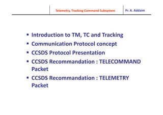
- 1. Pr. A. Addaim Telemetry, Tracking Command Subsystem Introduction to TM, TC and Tracking Communication Protocol concept Communication Protocol concept CCSDS Protocol Presentation CCSDS Recommandation : TELECOMMAND Packet Packet CCSDS Recommandation : TELEMETRY P k Packet
- 2. Pr. A. Addaim Telemetry, Tracking Command Subsystem UIR/SAE Different flight altitude of a TT&C system
- 3. Pr. A. Addaim UIR/SAE Telemetry, Tracking Command Subsystem Introduction to TM, TC and Tracking Telemetry, Tracking Command Subsystem functions allow dialog between the satellite and the ground stations using the following functions: Telemetry = TM T l d TC Telecommand = TC Measure of distance = TR The TELEMETRY allows the knowledge of the satellite state (platform and g (p payload). It transmits the thermal, electric and mechanical parameters The TELECOMMAND allows the modification of the satellite state. The TRACKING allows the knowledge of the position of the satellite in space. It can be carried out by measurement of travel time (information of radial distance satellite/station), by Doppler measurement, or angular measurement .
- 4. Pr. A. Addaim UIR/SAE Telemetry, Tracking Command Subsystem TM/TC link The TM/TC link consists of the transmission of Telecommand from Earth to the satellite including instructions intended to be carried out on board the satellite and the transmission of the telemetry from the satellite to Earth including data information transmission of the telemetry from the satellite to Earth including data information about the health of the satellite. The TM/TC link must be established very reliably during all phases of the life of a satellite e can globall disting ish fo r phases satellite; we can globally distinguish four phases: Launch phase, which corresponds to the period from injection by the launcher until the final position of the satellite is reached; Station-Keeping phase, which corresponds to the nominal operating phase of the satellite; Safe mode phase, which corresponds to a failure or detection of operating conditions considered dangerously out of the normal range; Deactivation or deorbitation phase, during which the satellite is sent into a so- called Graveyard orbit. .
- 5. Pr. A. Addaim UIR/SAE Telemetry, Tracking Command Subsystem The TM, TC and Tracking System It consists of two fundamental segments Segment Ground Space segment Space segment The ground segment uses the national networks of ground stations deployed worldwide The space segment included the whole Embedded equipments in direct interface The space segment included the whole Embedded equipments in direct interface with the ground stations On board satellite, we find: Antennas of emission/receiving Receiving transmitter or transponder Decoder of Telecommand E d f T l t Encoder of Telemetry
- 6. Pr. A. Addaim UIR/SAE Telemetry, Tracking Command Subsystem For the LEO or MEO satellites in orbit, the following frequencies can be used (service of space operations): The frequencies for TM, TC and Tracking (service of space operations): SPACE > EARTHdownlink 137-138 MHZ 137 138 MHZ 272-273 MHZ 401-402 MHZ 1525-1535 MHZ 5 5 535 2200-2290 MHz EARTH > SPACE uplink p 148-149 MHZ 449.75-450.25 MHZ 1427-1429 MHZ 1427-1429 MHZ 2015-2110 MHZ For the telecommunications satellites in the GEO orbit For the telecommunications satellites in the GEO orbit Frequency = bands of service (4/6 Ghz or 12/14 Ghz for example)
- 7. Pr. A. Addaim UIR/SAE Telemetry, Tracking Command Subsystem The antennas of the satellite are characterized by a quasi-isotrope radiation The antennas characteristics y q p in order to cover the various attitudes taken by the satellite with respect to the Ground station : Launching and orbital phases Losses of attitude Critical Situations in the event of faults The antennas of the ground stations are characterized by a very high gain The antennas of the ground stations are characterized by a very high gain (very directive). They are able to automaticaly track the satellite during the fastest passages, i.e. in the vicinity of the ground station zenith. The used Polarization (station ground) The used Polarization (station ground) TELECOMMAND: circular polarization TELEMETRY: circular polarization On the ground station, we use a combiner of polarization in order to increase the level of the received signal.
- 8. Pr. A. Addaim UIR/SAE Telemetry, Tracking Command Subsystem Geostationary satellites: position in orbit must be maintained in a window of 0.1 wide in latitude and longitude; Tracking satellite by ground stations wide, in latitude and longitude; An offset of approximately 60 km along and across the plane of orbit. TRACKING can be done in different ways: BY MEASUREMENT OF DISTANCES: measurement of propagation time (round trip) of the radio wave emitted by the ground station. (round trip) of the radio wave emitted by the ground station. BY DOPPLER MEASUREMENT: the transponder on board must be capable of re-transmitting the telemetry carrier in coherence of frequency with the telecommand carrier transmitted by the ground station (Coherent the telecommand carrier transmitted by the ground station. (Coherent transponder). BY ANGULAR MEASUREMENT: from the directivity characteristics of the tracking network stations. BY INTERFEROMETRY: this process is used to locate the probes distant from a network of earth stations as distant as possible from each other (very o a et o o ea t stat o s as d sta t as poss b e o eac ot e ( e y wide base interferometry) likewise that previously, it is also a method of angular localization.
- 9. Pr. A. Addaim UIR/SAE Telemetry, Tracking Command Subsystem DISTANCE Measurement Principle Principle 1. Emission on the ground of several tons (pure sinusoid) with FM modulation 2. Satellite retransmission of received tones 3 Cl bi it i l th d i i t 3. Clear ambiguity progressively on the ground using minor tones 4. Fine measurement on the ground of the delay time between the major tone emitted and the major tone received. D: outward distance = return distance C: 3.108 m / s TM: measured delay time TB: delay time on board TS: ground delay time TS TD TM C D 2 PRECISION ON THE DISTANCE MEASUREMENT Precision of an elementary measurement Precision of an elementary measurement SYSTEMATIC ERROR: If TB = TS = 100 ns precision +/- 30 m on the distance
- 10. Pr. A. Addaim UIR/SAE Telemetry, Tracking Command Subsystem DISTANCE MEASUREMENT METHODS 1. ANGULAR MEASUREMENT Used for stationary geostationary satellites y g y Too expensive for LEO or MEO satellites 2. DISTANCE MEASUREMENT Used for stationary geostationary satellites Delicate for LEO or MEO satellites 3. DOPPLER MEASUREMENT Used for LEO or MEO satellites : f = 400MHz Doppler of 10KHz Not suitable for geostationary satellites Not suitable for geostationary satellites
- 11. Pr. A. Addaim UIR/SAE Telemetry, Tracking Command Subsystem Telecommand decoder functions (ground-to-space Link): : Telecommand decoder/Telemetry encoder Receive the demodulated RF signal from communication susbsyetm Ensure bit synchronization Ensure frame synchronization Ensure frame decoding and validation validation and distribution of Telecommands towards the on-board computer Encrypted Telecommands Encrypted Telecommands Encrypted telecommands can be used for make the uplink safer Authentication of the encrypted message The basic telecommand decoder is kept and additional circuits are The basic telecommand decoder is kept and additional circuits are introduced to ensure encryption and authentication functions of the message received (depending on the mission) Telemetry Encoder functions (space-to-ground Link): Telemetry data acquisition in platform subsystems and payloads. Data compression (preprocessing) and coding; Formatting and transmission of the stream bit to the Communication subsystem.
- 12. Pr. A. Addaim UIR/SAE Telemetry, Tracking Command Subsystem Classification of telemetry data Housekeeping ouse eep g Monitoring the health status of the satellite, and the operating mode. Temperatures Voltages and currents Voltages and currents Operating state Redundancy status Deployment of mechanism Deployment of mechanism Attitude Sun sensor Earth horizon sensor Star sensor Gyroscopes A l t Accelerometers Payload : it varies by mission Technological data, g , Scientific data from an instrument, etc.
- 14. Pr. A. Addaim Telemetry, Tracking Command Subsystem Protocoles de communication entre le bord et le sol L'objet ici est de décrire les principes, les formats numériques et protocoles associés, utilisés q p , dans la transmission des données entre le bord et le sol. Ces formats numériques font l'objet de q j recommandations du comité international CCSDS (CCSDS : Consultative Committee for Space Data ( p Systems) et de standards établis par les deux principales agences spatiales : la NASA et l'ESA. p p g p
- 22. Pr. A. Addaim Telemetry, Tracking Command Subsystem Les Les principes principes de de transmission transmission de de la la TM TM Les Les principes principes de de transmission transmission de de la la TM TM Types de télémesures susceptibles d'être utilisés sont é t ié répertoriées: suivant le délai entre l'acquisition à bord et la transmission suivant le délai entre l acquisition à bord et la transmission au sol, on distingue : les TM temps réel, les TM enregistrées (transmises en temps différé lors des périodes de isibilité) des périodes de visibilité)
- 30. Pr. A. Addaim Telemetry, Tracking Command Subsystem Trois structures de données principales : le paquet (TC packet), la trame (frame) et le message (CL TU). La hiérarchie des structures de données en TC par paquets
- 33. Pr. A. Addaim Telemetry, Tracking Command Subsystem F t d t CCSDS (TC TM) Format du paquet CCSDS (TC ou TM)