
Recomendados
Mais conteúdo relacionado
Mais procurados
Mais procurados (16)
Destaque
Destaque (20)
Semelhante a Willacy count master plan combined
Semelhante a Willacy count master plan combined (20)
Willacy count master plan combined
- 1. WILLACY COUNTY PARK, RECREATION AND OPEN SPACE MASTER PLAN, 2010-2020 Willacy County Park, Recreation and Open Space Master Plan, 2010 - 2020 DRAFT PAGE 1 OF 65
- 2. WILLACY COUNTY PARK, RECREATION AND OPEN SPACE MASTER PLAN, 2010-2020 DRAFT RESOLUTION RESOLUTION NO. __________ A RESOLUTION OF THE COMMISSIONERS COURT OF WILLACY COUNTY, TEXAS ADOPTING THE 2010-2020 PARKS, RECREATION AND OPEN SPACE MASTER PLAN; FINDING AND DETERMINING THAT THE MEETING AT WHICH THIS RESOLUTION WAS PASSED WAS OPEN TO THE PUBLIC AS REQUIRED BY LAW. WHEREAS, the Commissioners Court of Willacy County recognizes the need for a 2010-2020 Parks, Recreation and Open Space Master Plan (the “Plan”) to provide goals, assessments, standards, recommendations and strategies for implementation over a ten-year period in an effort to provide for and continually improve park and recreational facilities, provide trail opportunities, preserve open spaces and rehabilitate existing parks in Willacy County; and WHEREAS, the primary objective of the “Plan” is to provide recreational services desired by the citizens of Willacy County, acquire needed open spaces, and preserve natural resources; and WHEREAS, in order to address recreational needs in the future, Willacy County has sought input from the citizens of the County through a printed and Internet survey, public input meetings, including meetings of the Coastal Conservation and Ecotourism Task Force; and that input has been incorporated into the “Plan”; and WHEREAS, the “Plan” complies with Texas Parks and Wildlife Department master plan guidelines which require parks and recreation needs to be prioritized and addressed in an action plan format; and WHEREAS, the Commissioners Court determines that the “Plan” is reasonable; NOW THEREFORE, BE IT RESOLVED BY THE COMMISSIONER’S COURT OF WILLACY COUNTY, TEXAS: I. That the 2010-2020 Parks, Recreation and Open Space Master Plan for Willacy County, Texas is hereby officially adopted, as attached hereto and incorporated herein for all intents and purposes. II. A ten-year Action Plan has been developed to prioritize implementation of the 2010-2020 Parks, Recreation and Open Space Master Plan, guide the rehabilitation of existing parks, provide guidance in the application of funding, and suggest alternative funding mechanisms. Adoption of the 2010-2020 Parks, Recreation and Open Space Master Plan shall not commit Willacy County, or any jurisdiction within Willacy County, to specific funding levels or implementation strategies, but shall provide a guidance plan for the County’s vision for availability and growth of park and recreational services. PRESENTED AND PASSED on this the __________ day of __________ 2010, by a vote of __________ yeas and __________ nays at a regular meeting of the Commissioners Court of Willacy County, Texas. _________________________ County Judge ATTEST _________________________ County Administrative Assistant APPROVED AS TO FORM AND CONTENT: _________________________ County Attorney PAGE 2 OF 65
- 3. WILLACY COUNTY PARK, RECREATION AND OPEN SPACE MASTER PLAN, 2010-2020 TABLE OF CONTENTS ACKNOWLEDGEMENTS.......................................................................................................................5! Willacy County Commissioner’s Court.........................................................................................................5! Members of the Willacy County Coastal Conservation and Ecotourism Task Force...........................6! INTRODUCTION .....................................................................................................................................7! Importance of Parks and Recreation .................................................................................... 7! Purpose of the Comprehensive Master Plan ........................................................................ 7! Willacy County’s and Other Jurisdiction’s Roles in Providing Recreation Opportunities............................................................................................................................ 8! County Overview ..................................................................................................................... 8! Location................................................................................................................................................................9! History..................................................................................................................................................................9! Climate ...............................................................................................................................................................10! Geology..............................................................................................................................................................10! Vegetation and Animal Life ..........................................................................................................................11! Demographics...................................................................................................................................................11! Economy ............................................................................................................................................................13! Education ...........................................................................................................................................................13! Jurisdiction and Planning Areas...................................................................................................................13! GOALS AND OBJECTIVES ..................................................................................................................14! Plan Development Process ................................................................................................... 18! Public Meetings ...............................................................................................................................................18! Survey of Area Needs .....................................................................................................................................18! AREA AND FACILITY CONCEPTS AND STANDARDS .............................................................20! INVENTORY OF AREAS AND FACILITIES ....................................................................................22! Inventory ................................................................................................................................. 22! Willacy County Schools Facilities ...................................................................................... 23! Sports Programs and Participation .................................................................................... 24! Other Recreation Options .................................................................................................... 24! NEEDS ASSESSMENT AND IDENTIFICATION ...........................................................................25! Overview of the Approaches to Determine Need .............................................................. 25! Demand-based Approach: the Community Survey and Community Meetings............ 25! Standards-based Approach: A Comparison of Existing Infrastructure to Locally- Adopted Standards................................................................................................................. 26! Community Parks ............................................................................................................................................26! Special Use Areas.............................................................................................................................................27! Sports & Recreation Complex .......................................................................................................................27! Resource-based Approach: Recognizing the County’s Coastal Environment and Unique Natural Resources .................................................................................................... 27! PLAN IMPLEMENTATION & PRIORITIZATION OF NEEDS ...................................................28! Plan Implementation............................................................................................................. 28! Priority Rankings.............................................................................................................................................28! PAGE 3 OF 65
- 4. WILLACY COUNTY PARK, RECREATION AND OPEN SPACE MASTER PLAN, 2010-2020 Outdoor Facility Priority Ranking ...............................................................................................................28! Indoor Facility Priority Ranking...................................................................................................................28! Renovation and Replacement .............................................................................................. 28! Recreational Programming................................................................................................... 28! Recognizing the Needs of Seniors and Youth..................................................................... 29! Seniors................................................................................................................................................................29! Youth ..................................................................................................................................................................29! Financing ................................................................................................................................. 29! Local Government Funding ...........................................................................................................................30! State & Federal Financing ..............................................................................................................................30! Private Sector Funding....................................................................................................................................32! APPENDICES ...........................................................................................................................................33! Appendix A .............................................................................................................................. 34! Map of Willacy County...................................................................................................................................34! Appendix B .............................................................................................................................. 35! Map of Raymondville .....................................................................................................................................35! Appendix C .............................................................................................................................. 36! Map of Lasara ...................................................................................................................................................36! Appendix D.............................................................................................................................. 37! Map of Lyford...................................................................................................................................................37! Appendix E............................................................................................................................... 38! Map of Port Mansfield....................................................................................................................................38! Appendix F............................................................................................................................... 39! Map of San Perlita ...........................................................................................................................................39! Appendix G.............................................................................................................................. 40! Map of Sebastian .............................................................................................................................................40! Appendix H.............................................................................................................................. 41! Willacy County Parks and Recreation Community Survey ....................................................................41! Appendix I ............................................................................................................................... 43! Encuesta de Condado de Willacy..................................................................................................................43! Appendix J ............................................................................................................................... 45! TPWD Park, Recreation and Open Space Master Plan Guidelines.......................................................45! Appendix K .............................................................................................................................. 50! Survey Results ..................................................................................................................................................50! PAGE 4 OF 65
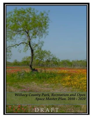
- 5. WILLACY COUNTY PARK, RECREATION AND OPEN SPACE MASTER PLAN, 2010-2020 ACKNOWLEDGEMENTS Willacy County Commissioner’s Court Hon. Aurelio “Keter” Guerra, Acting County Judge Hon. Eliberto “Beto” Guerra, County Commissioner Precinct 1 Hon. Eddie Chapa, County Commissioner Precinct 2 Hon. Fred Serrato, County Commissioner Precinct 3 Hon. Aurelio “Keter” Guerra, County Commissioner Precinct 4 Prepared by: Peter A Ravella Consultant, LLC 4107 Wildwood Road • Austin, TX 78722 512.784.3565 (Ph) • 866.784.3959 (Fax) Frank Fuller, Consultant, Project Manager Kay Pils, Project Coordinator Peter A. Ravella, Principle Cover Page: Photo of Willacy County Wildflowers, March 2010 All photographs copyright ! Kay Pils March 2010 PAGE 5 OF 65
- 6. WILLACY COUNTY PARK, RECREATION AND OPEN SPACE MASTER PLAN, 2010-2020 Members of the Willacy County Coastal Conservation and Ecotourism Task Force Task Force Co-Chairs & Staff Aurelio Guerra, Co-Chair, Willacy County Acting County Judge Mike Wilson, Co-Chair, Director Willacy County Navigation District Rebecca Chapa, Task Force Secretary, Willacy County Administrative Assistant Ida Martinez, Willacy County Auditor Task Force Consultants Peter A. Ravella, Task Force Project Manager Frank R. Fuller, Task Force Project Coordinator M. Kay Pils, Task Force Project Specialist Task Force Members Eleazar “Yogi” Garcia, City Manager, City of Raymondville Oscar De Luna, Mayor, City of San Perlita Lydia Moreno, City Secretary, City of Lyford Eliberto Guerra, Willacy County Commissioner, Precinct 1 Johnny I. Piñeda, Superintendent, Raymondville ISD Rolando Peña, Superintendent, Lasara ISD Albert Peña, Superintendent, San Perlita ISD Eduardo Infante, Superintendent, Lyford CISC Tommie Martin, Operations Manager Sebastian MUD Gabe Guzman, Raymondville Chamber of Commerce Robert Hulen, Port Mansfield Chamber of Commerce Terry Neal, Port Mansfield Chamber of Commerce Elma Chavez, Director Raymondville Chamber of Commerce PAGE 6 OF 65
- 7. WILLACY COUNTY PARK, RECREATION AND OPEN SPACE MASTER PLAN, 2010-2020 INTRODUCTION Importance of Parks and Recreation Parks play a critical role in defining communities. They are places to recreate, socialize, and relax. If developed and maintained appropriately, they can offer additional benefits to a community. An adequate park system can: • Promote a conservation ethic; • Entice businesses to locate within a community; • Unify communities within a county around recreational and health goals; • Offer a forum for personal interaction, community-building and play; • Connect youth and adults to nature; • Present a consistent community image; • Serve as a venue for both youth and adult environmental education; and • Enhance community economic development through ecotourism. Well-maintained parks, natural areas, and open space are often the first things visitors will notice about a community. Parks provide a visible example of how well communities are functioning, both through efficient and engaged governments and private sector support. Purpose of the Comprehensive Master Plan Governments at all levels recognize that taxpayers demand both the efficient delivery of services and wise expenditures of limited financial resources. A Park, Recreation and Open Space Master Plan (Master Plan), based on locally-identified needs and priorities, will help ensure that a park system is maintained, developed, and, when necessary, rehabilitated in a manner that ensures a community’s long term support. A Master Plan presents a list of options for park development and rehabilitation based on community input, ranks those options in terms of need and priority, establishes a timeline for implementing elements of the Master Plan, and identifies funding sources to accomplish Master Plan goals. The County’s last Master Plan was completed and adopted by the Commissioner’s Court in June 2003. The Willacy County 2010-2020 Parks, Recreation and Open Space Master Plan will provide guidance to the County and communities within the County as they work together to improve and maintain park infrastructure, conserve and interpret unique natural areas, provide for recreational programming, and promote ecotourism. In developing the Master Plan, the County is aware that multiple jurisdictions within it are also interested in developing recreation facilities. To assist those communities, the County has developed its Master Plan in a manner that will allow other jurisdictions to identify their unique local needs, rank local 1 priorities, and then adopt the County’s Master Plan with an addendum that reflects local priorities . The Master Plan fulfills the requirements of Texas Parks and Wildlife Department’s (TPWD) Local Park Grant Program. Plan components are presented in a format that tracks TPWD’s requirements. Additionally, the plan is intended to assist with the implementation of the state’s Coastal Management Program (CMP). Portions of Willacy County east of State Highway 77 are within the state’s coastal 1 For more information see Texas Parks and Wildlife Department’s “Outdoor Recreation Grant Application, Appendix G: Master Plan Guidelines” (revised February 2008/corrections May 2008), page 75. INTRODUCTION PAGE 7 OF 65
- 8. WILLACY COUNTY PARK, RECREATION AND OPEN SPACE MASTER PLAN, 2010-2020 management boundary. The CMP is intended to protect, enhance and provide public access to Coastal Natural Resource Areas such as wetlands, beaches, sand flats, seagrass beds, and the open waters of the Laguna Madre and Gulf of Mexico. Park and conservation projects falling within the coastal management boundary may be eligible for CMP grants. The plan will: • Give an overview of Willacy County’s history, providing background information such as its history, geography, and socio-economic data; • Discuss the County’s role in providing for parks and recreation opportunities; • Present the County’s park, recreation, conservation, and ecotourism goals; • Inventory existing park, recreation, and conservation facilities; • Rank the needs for outdoor and indoor recreational opportunities based on citizen and community group input; and • Help community leaders determine where and how park, recreation and conservation funding should be allocated over the next 10 years. Willacy County’s and Other Jurisdiction’s Roles in Providing Recreation Opportunities Park and recreation opportunities within Willacy County are offered by multiple jurisdictions. The County maintains one county park in Port Mansfield on Willacy County Navigation District property. The City of Raymondville, which is both the county seat and its largest community, maintains the bulk of the park infrastructure within the County. Park infrastructure is also found in Lyford and Sebastian. Schools provide additional park infrastructure, but these facilities are not generally available for public use. Some school districts, during the plan development process, have expressed an interest in partnering with the County to provide publically accessible park infrastructure. A portion of the Padre Island National Seashore is located within Willacy County. However, with the exception of private boat access, the National Seashore and the beaches of the Gulf of Mexico on both North and South Padre Island are not accessible to the general public from within the County. The Willacy County 2010-2020 Parks and Figure 1 Photo of Coast at Port Mansfield Recreation Master Plan includes the County’s entire jurisdiction. Because multiple jurisdictions play a significant role in the delivery of park, recreation and open space programming, Willacy County has designed the plan so that it can be modified and adopted through addendums by jurisdictions within the County. County Overview The information provided under the section titled “County Overview” (below) is intended to provide general information that may be beneficial in the development of the Master Plan and future park, recreation, and conservation efforts. In some cases, the reader may wish to research an area in more INTRODUCTION PAGE 8 OF 65
- 9. WILLACY COUNTY PARK, RECREATION AND OPEN SPACE MASTER PLAN, 2010-2020 detail. To facilitate further research efforts that go beyond the scope of this Master Plan, the document cites sources of information and, in some cases, suggests references for further exploration. Location Willacy County is located in South Texas, some 30 miles north of the Texas-Mexico border and adjacent to the Gulf of Mexico. It is bordered to the north by Kenedy County, to the west by Hidalgo County, to the south by Cameron County, and to the east by the Gulf of Mexico. State Highway 77 is the major transportation artery running north/south through the county, providing a transportation linkage between the Corpus Christi/Kingsville area and the communities of the Lower Rio Grande Valley. The county seat of Raymondville is approximately 21 miles from Harlingen. Figure 2 Photo of "Santa Maria de Yciar, San Esteban, Esperitu Santa" Mural by Ramon Claudio History 2 Willacy County’s history is rooted in ranching and agriculture. The County was formed out of parts of Cameron and Hidalgo Counties in 1911. At the time, the county included portions of what is now Kenedy County. In 1921, Willacy County was reorganized with the northern portion of the County, dominated by ranching interests, becoming Kenedy County, while the southern portion of the County, known for agricultural products, remained Willacy County. Key historical events or locations, among others, that may be relevant to park development and interpretation include: • The Padre Island Spanish Shipwrecks of 1554. The Mansfield Cut Underwater Archeological 3 4 District contains the scattered remains of three shipwrecks near Mansfield cut; 2 Much of the historical discussion is excerpted from the Handbook of Texas Online, s.v. "," http://www.tshaonline.org/handbook/online/articles/WW/hcw10.html (accessed April 13, 2010). 3 Wikipedia contributors, "Mansfield Cut Underwater Archeological District," Wikipedia, The Free Encyclopedia, http://en.wikipedia.org/w/index.php?title=Mansfield_Cut_Underwater_Archeological_District&oldid=353014132 (accessed April 13, 2010). 4 Handbook of Texas Online, s.v. "," http://www.tshaonline.org/handbook/online/articles/PP/etpfe.html (accessed April 13, 2010). INTRODUCTION PAGE 9 OF 65
- 10. WILLACY COUNTY PARK, RECREATION AND OPEN SPACE MASTER PLAN, 2010-2020 5 • Native American history, including the presence of nomadic Coahuiltecan Indians for nearly 6 11,000 years, and the Karankawa Indians living along the coast; • Spanish exploration in the area; • The history of the Texas Ranch Country and agricultural development in the County and the Lower Rio Grande Valley; • The development of Port Mansfield and the Gulf Intracoastal Waterway; • The use of La Sal Vieja, a saltwater lake, now part of the Rio Grande National Wildlife Refuge, 7 that supplied salt to much of northern Mexico and the Confederacy; and • The creation of the Padre Island National Seashore. An excellent resource for further study of Willacy County history is The Handbook to Texas, published by the Texas Historical Association. An online version is available at http://www.tshaonline.org/handbook/online/. Climate Willacy County is located in semi-arid South Texas. According to The Handbook to Texas, Willacy County’s climate is subtropical-humid; tropical storms and hurricanes are possible from June through October. Temperatures range from an average low of 48° F to a high of 69° in January and from 74° to 95° 8 in July. Rainfall averages twenty-seven inches a year, and the growing season lasts for 318 days. Tropical storms, hurricanes, and coastal flooding must be considered when developing and maintaining park infrastructure. Willacy County was hit by Hurricane Dolly, a Category 1 storm, near the Cameron/Willacy County border on July 23, 2008. The storm caused extensive damage in Port Mansfield, including damage to the public fishing pier at the County’s Fred Stone Park. The pier and other park facilities damaged by the hurricane are now undergoing repair or restoration. Port Mansfield was hit by Hurricane Allen as a Category 3 storm in 1980, and the area was affected by Hurricane Beulah, 9 which hit Brownsville in 1967. Geology Willacy County is generally flat with a slight rise from the coast to the western part of the County. Soils are primarily comprised of sands and clays. Some of the soils types, especially those dominated by fine sands, like those associated with dune complexes near the coast, are inappropriate for recreational infrastructure, but may be appropriate for environmental and geological interpretation. Soil types, like other significant factors such as flood zones, should be considered prior to construction of recreational facilities. Detailed soil maps, along with explanations of Willacy County soil surveys can be obtained from: Natural Resources Conservation Service Attention: Soils Section!101 S. Main Street Temple, TX 76501 or online at The Cooperative Soil Survey http://soils.missouri.edu/survey/texas.asp# . Figure 3 Photo of a Couch's Kingbird at La Sal del Rey, Willacy County 5 Handbook of Texas Online, s.v. "," http://www.tshaonline.org/handbook/online/articles/CC/bmcah.html (accessed April 13, 2010). 6 Handbook of Texas Online, s.v. http://www.tshaonline.org/handbook/online/articles/WW/hcw10.html (accessed April 13, 2010). 7 Handbook of Texas Online, s.v. http://www.tshaonline.org/handbook/online/articles/LL/rol1.html (accessed April 13, 2010). 8 Handbook of Texas Online, s.v. http://www.tshaonline.org/handbook/online/articles/WW/hcw10.html (accessed April 13, 2010). 9 “Texas Worst Hurricanes in the 20th Century,” Texas Department of Insurance, http://www.tdi.state.tx.us/consumer/storms/hsplash.html (accessed April 13, 2010) INTRODUCTION PAGE 10 OF 65
- 11. WILLACY COUNTY PARK, RECREATION AND OPEN SPACE MASTER PLAN, 2010-2020 Vegetation and Animal Life According to the Texas Parks and Wildlife Department “2005 Land and Water Resources Conservation and Recreation Plan,” Willacy County is located in the South Texas Plains Ecoregion. TPWD notes that the area consists of level to rolling terrain characterized by dense brush. Overtime, much of the native brush habitat has been converted to agricultural use, making conservation and restoration of the native brush habitat a relatively high conservation priority. Plant life in the area is characterized by thorn-scrub habitat found through much of South Texas and includes species such as mesquite (Prosopis glandulosa), acacias (Acacia spp.), granjeno (Celtis pallida), and cacti. According to TPWD, rare plants and communities found in the area include the Texas ebony-anacua, Texas palmetto and Texas ebony-snake- eyes assemblages. Rare species include Walker’s manioc, star cactus, Texas ayenia and Zapata bladderpod. North and South Padre Islands contain vegetation types, such as sea oats, typical of barrier island dune/swell complexes. Port Mansfield and other areas of the County adjacent to the Laguna Madre contain a mix of vegetation that is typified by salt tolerant wetland species in depressional areas and thorn/scrub in upland areas. Willacy County, like the rest of the Lower Rio Grande Valley is particularly rich in bird and butterfly life. Willacy County also contains habitat for the endangered ocelot. The area is known for its large mammals including white tailed dear and javelina. Demographics Willacy County is one of the most economically challenged in the nation, and is the poorest coastal county in the country based on federal poverty rates. The U.S. Census Bureau estimates Willacy County’s population in 2009 at 20,395. The Census reported the County’s population in 2000 as 20,082. Willacy County has a population density of 33.6 people per square mile compared to the state average of 10 79.6 people per square mile. 11 The populations for the County’s population centers in 2000 were: • Raymondville: 9,733 • Lasara: 1,024 • Lyford: 1,973 • Port Mansfield: 415 • San Perlita: 680 • Sebastian: 1,864 The Texas State Demographer provides population projections by County. Table 1 illustrates the anticipated population growth to 2040. Between 2010 and 2040, the County’s population is expected to grow approximately 25 percent. These growth projections do not take into account recent economic developments (discussed below) that may impact population growth. 10 “Willacy County MapStats from FedStats,” Note: FedStats is a federal government website that compiles statistical information from various federal agencies. It can be accessed at www.fedstats.gov 11 U.S. Census Bureau, 2000 INTRODUCTION PAGE 11 OF 65
- 12. WILLACY COUNTY PARK, RECREATION AND OPEN SPACE MASTER PLAN, 2010-2020 12 13 TABLE 1: WILLACY COUNTY POPULATION PROJECTIONS Year Estimated Population 2010 23,011 2015 24,510 2020 25,876 2025 27,190 2030 28,450 2035 29,587 2040 30,512 Table 2, below, provides a summary of the County’s key demographic statistics, based on the 2000 Census Bureau. The Table provides, as appropriate, summary information for the nation for comparison purposes. TABLE 2: SOCIO-ECONOMIC PROFILE OF WILLACY COUNTY (2000 CENSUS) Willacy County Willacy County by U.S. Population Population Percentage by Percentage Total Population 20,082 White and Hispanic 14,132 70.4% 75.1% Black or African American 439 2.2% 12.3% American Indian and Native Alaskan 101 .5% .9% Asian 22 .1% 3.6% Native Indian/Pacific Islander 6 0.0% .1% Some other race 4,912 24.5% 5.5% Two or more races 470 2.3% 2.4% Hispanic or Latino (of any race) 17,209 85.71% 12.5% High School Graduate or higher 5,524 48.7% 80.4% Bachelor’s Degree or higher 850 7.5% 24.4% Speaks Language Other Than English at 14 14,376 78.1% 17.9% Home Vacant Housing Units 1,143 17.0% 9.0% Median Age 29.8 years N/A 35.5 years Under 5 years 1,645 8.2% 6.8% 18 years or older 13,730 68.4% 74.3% 65 years or older 2,328 11.6% 12.4% Per capita income (1999 dollars) $9,421 N/A $21,587 Families Below Federal Poverty Level 1,341 29.2% 9.2% Individuals Below Federal Poverty Level 6,300 33.2% 12.4% 12 Texas State Data Center and the Office of the State Demographer, “Population Projections for Counties, 2008 Population Projections.” 14 According to the 2000 Census, 14,329 individuals spoke Spanish at home. The Census notes that approximately 83 percent of this group spoke English “very well” or “well,” while approximately 11 percent of the group reported speaking English as “not well,” with 6 percent reporting speaking English “not at all.” INTRODUCTION PAGE 12 OF 65
- 13. WILLACY COUNTY PARK, RECREATION AND OPEN SPACE MASTER PLAN, 2010-2020 The socio-economic summary above provides information that may help guide park and recreation development and maintenance, and programming. The economic situation of individuals living within the county may limit somewhat the ability to pay additional taxes or user fees to support park development and maintenance, or to participate in recreational programs (sports leagues, after school recreation programs, etc.). Additionally, the County’s age distribution is lower than the national average, indicating that there might be a higher need for facilities and programming catering specifically to youth. The County’s low population density and the relatively small size of many of the County’s communities may also help guide the development of park and recreation infrastructure and programming. Economy Agricultural and ranching are the largest economic sectors in Willacy County. According to the federal government, in 2007, the County had 338,048 acres of farmland that produced approximately $51,200,000 15 worth of agricultural products. Other important economic sectors include transportation and warehousing, construction, retail trade, real estate and leasing, professional services, healthcare and 16 social services, art, entertainment and recreation, and accommodations and food services. The major employers in the County include: Willacy County Regional Processing Center (520 employees), Raymondville ISD (400 employees), Wal-Mart (200 employees), Willacy County Regional Detention Facility (220 employees), United States Department of Homeland Security (350 employees). Recently, Willacy County has experienced economic development associated with the construction and operation of a new prison. The County is also in negotiation with a firm that may construct and operate a large wind electric generation farm in the County. The addition of the prison, and a large wind electric generation facility, could significantly enhance and diversify the County’s economic base. Education Approximately 49 percent of Willacy County residents over 25 years of age are high school graduates or higher, with 7.5 percent of the population having a bachelor’s degree or higher. The County is served by Lasara Independent School District, the Lyford Consolidated Independent School District, the Raymondville Independent School District, and the San Perlita Independent School District. Jurisdiction and Planning Areas Willacy County covers an area of approximately 784 square miles of which 597 square miles is land and 188 square miles is water/submerged land. Willacy County falls within the planning area for Lower Rio Grande Valley Development Council (LRGVDC). The entire county was considered the planning area for the Master Plan. 15 U.S. Department of Agriculture, The Census of Agriculture, 2007 16 U.S. Census Bureau, 2007. INTRODUCTION PAGE 13 OF 65
- 14. WILLACY COUNTY PARK, RECREATION AND OPEN SPACE MASTER PLAN, 2010-2020 GOALS AND OBJECTIVES The goals in the Master Plan were developed in coordination with County officials, and the members of the Willacy County Coastal Conservation and Ecotourism Task Force, which includes school district superintendents, representatives of incorporated and unincorporated communities within Willacy County, representatives of the Willacy County Navigation District, the Raymondville and Port Mansfield Chambers of Commerce, and other community stakeholders. The goals are also reflective of the community survey, the area’s unique natural resources, and the availability of coastal-specific grant funding sources, such as the Coastal Impact Assistance Program (CIAP) and the state Coastal Management Program (CMP) grants, that allow enhanced recreational development, conservation activities, and environmental education programs in coastal portions of the County. The County expects that as the work of the Willacy County Coastal Conservation and Ecotourism Task Force continues, and community needs change over time, new goals and objectives will arise. Timeframes for achieving existing goals and objectives may also change. The goals and objectives outlined in this plan span the 10-year time frame required of TPWD Parks, Recreation and Open Space Master Plan, however, it is anticipated that the plan will be updated well before 10 years has elapsed. Note on Timing: At the time of the Adoption of the Willacy County Park, Recreation and Master Plan 2010-2020, federal Coastal Impact Assistance Program funds are being made available to the state. Approximately $35 million (estimated) is expected to be awarded to Texas coastal counties through a grant competitive process administered by the Governor’s Coastal Land Advisory Board made up of the General Land Office, the Texas Commission on Environmental Quality, and the Railroad Commission of Texas. The timing of CIAP grant solicitation and awards may run well into 2011 and the expenditure of CIAP funds may extend through 2014. Under federal law, CIAP funds must be used for the following purposes: • Projects and activities for the conservation, or restoration of coastal areas, including wetlands • Mitigation of damage to fish, wildlife, or natural resources • Planning assistance and the administrative costs • Implementation of a federally-approved marine, coastal, or comprehensive conservation management plan Mitigation of the impact of Outer Continental Shelf oil and gas activities through funding of onshore infrastructure projects and public service needs While not specifically mentioned, CIAP funded projects can include park infrastructure such as nature trails, wildlife viewing stations, and boardwalks that are protective of coastal resources and other conservation initiatives. Additionally, the funds can be used for habitat acquisition and restoration, and environmental education programs. Depending on state and federal grant solicitation and administrative requirements, and Willacy County’s (and jurisdictions within Willacy County) success in competing for CIAP funds, the timing of some goals, objectives, and projects may change substantially. GOALS AND OBJECTIVES PAGE 14 OF 14
- 15. WILLACY COUNTY PARK, RECREATION AND OPEN SPACE MASTER PLAN, 2010-2020 TABLE 3: GOALS & OBJECTIVES IMPLEMENTATION SCHEDULE 2010 2011 2012 2013 2014 2015 2016 2017 2018 2019 2020 Goal 1: Inventory, Rehabilitate, and Develop Park Infrastructure To Accommodate the Needs of Willacy County’s Population Centers Objective 1.1: Develop a Park, Recreation and Open Space Master Plan X consistent with TPWD requirements Objective 1.2: Develop community parks in population centers without them X Objective 1.3: Add additional park facilities within existing community parks that X X X fulfill additional needs Objective 1.4: Identify funding sources for both park infrastructure and operations X X X X and maintenance Goal 2: Significantly Enhance Recreation, Water Access, and Environmental Education Opportunities in Port Mansfield Objective 2.1: Develop an on-the-ground Conceptual Plan for implementation of X Port Mansfield recreational, conservation, and educational enhancements Objective 2.2: Implement Phase I of on-the-ground improvements at the Laguna Point location at Port Mansfield with funds already awarded by the state’s Coastal X X Management Program and the federal Coastal Impact Assistance Program Objective 2.3: Develop additional facilities at Port Mansfield specifically-designed X X X X to enhance outdoor public environmental education and increase ecotourism Objective 2.4: Work with the State’s Coastal Management Program to more clearly define ways in which the Willacy County Navigation District can protect X X X and enhance Coastal Natural Resource Areas while increasing public access to coastal waters Objective 2.5: Develop and implement a phased grant/funding plan aimed at X X X X X X X X X X using CMP grants to implement Objective 2.4 Objective 2.6: Evaluate the possibility of providing free or low-cost transportation X X from Port Mansfield to the Gulf Beaches of North or South Padre Island Objective 2.7: Develop and implement an Operations and Maintenance Plan for X park and conservation infrastructure at Port Mansfield Objective 2.8: Evaluate the feasibility of developing an indoor environmental X learning/nature center at Port Mansfield (see also Objective 4.5) GOALS AND OBJECTIVES PAGE 15 OF 20
- 16. WILLACY COUNTY PARK, RECREATION AND OPEN SPACE MASTER PLAN, 2010-2020 2010 2011 2012 2013 2014 2015 2016 2017 2018 2019 2020 Goal 3: Develop a County Sports Complex Objective 3.1: Conduct a Feasibility Plan to assist with the assessment of need, recommend facility types, and evaluate land acquisition, construction, and X maintenance costs. Objective 3.2: Develop a funding strategy for the construction, and operation and X maintenance of the Sports Complex Objective 3.3: Seek Funding for Sports Complex Development X Objective 3.4: Construct Sports Complex X Objective 3.5: Maintain and operate the Sport Complex and associated X X X X X X X programming (sport’s leagues, etc.) Goal 4: Work to Increase Environmental Education and Ecotourism Opportunities Objective 4.1: Inventory existing publically-owned sites that would benefit from X environmental interpretation Objective 4.2: Work with state and federal natural resource managers to identify acquisition or conservation activities that would enhance both conservation and X X ecotourism Objective 4.3: Develop a coordinated ecotourism and implement campaign X X Objective 4.4: Develop an environmental education program for area youth X X Objective 4.5: Evaluate the feasibility of developing an indoor environmental learning/nature center at Port Mansfield OR elsewhere in the County (See X Objective 2.8) Goal 5: Enhance Recreational Programming Objective 5.1: Determine demand for programming such as additional sport X leagues and organized senior activities Objective 5.2: Implement recreational programs if demand exists and funding X sources can be found GOALS AND OBJECTIVES PAGE 16 OF 20
- 17. WILLACY COUNTY PARK, RECREATION AND OPEN SPACE MASTER PLAN, 2010-2020 2010 2011 2012 2013 2014 2015 2016 2017 2018 2019 2020 Goal 6: Promote Intergovernmental Coordination and Community Involvement in the Implementation and Review of Park, Recreation, Conservation and Ecotourism Activities Objective 6.1: Continue to Coastal and Recreational Ecotourism Task Force to X X X guide implementation of the Coastal Impact Assistance Program (CIAP) Objective 6.2: Consider using the Task Force for continued intergovernmental X X X X X X X X X cooperation and community input after CIAP funds have been expended Objective 6.3: Establish a fund development subcommittee of the Task Force to help evaluate financing options for both park infrastructure, and operations and X X X maintenance Objective 6.4: Update the Park, Recreation and Open Space Master Plan every 5 X X years to ensure eligibility for TPWD funding GOALS AND OBJECTIVES PAGE 17 OF 20
- 18. WILLACY COUNTY PARK, RECREATION AND OPEN SPACE MASTER PLAN, 2010-2020 Plan Development Process Willacy County’s first master plan was adopted in 2003. The following year, the City of Raymondville developed a master plan. Since that time, little recreational development has occurred and some of the needs identified by the County and the City are not being met. The County and other jurisdictions began working informally with the staff of the Coastal Management Program (CMP) and the Coastal Impact Assistance Program (CIAP), both coordinated by the General Land Office, to develop natural area conservation and park-related projects for Port Mansfield and other areas projects within the County that would benefit from funds provided the CIAP and CMP programs. Those informal meeting took place in 2008 and 2009. PARC joined those conversations in 2009 as a contractor to the Willacy County Navigation District on issues related to the state’s coastal funding sources. The County hired PARC in January 2010 to: • Assist in the programming and administration of the Coastal Impact Assistance Program funds; • Establish the Coastal Conservation and Ecotourism Task Force, and • Develop the Park, Recreation and Open Space Master Plan • Undertake other related tasks. Public Meetings PARC and the County used the Coastal Conservation and Ecotourism Task Force as the coordinating entity for the development of the Master Plan. The County and members of the Task Force believe that the multi-jurisdictional, cooperative approach fostered by the Task Force will ensure efficient expenditures of local and grant funds through coordinated planning and implementation of park and conservation projects. The Task Force met five times during the Master Plan development process on January 14, 2010 (11 attendees), January 22, 2010 (13 attendees), February 8, 2010 (35 attendees), March 23, 2010 (40 attendees), and May 21, 2010 (40 attendees). A list of Task Force members can be found in the preface. At the March 23, 2010 meeting, participants, which included county and city officials, school districts superintendents, members from local chambers of commerce, among others, reviewed Master Plan elements. They discussed and agreed to “Area and Facility Concepts and Standards.” Survey of Area Needs Concurrent with the input of the Coastal Conservation and Ecotourism Task Force, the County and PARC developed, in English and Spanish, a park, open space and recreational survey to gauge the community’s interest in park and recreation programs and facilities, and natural area conservation. The survey was available online and distributed in hard copy form at restaurants, local government offices, and through the County’s school districts. The Reber Memorial Library in Raymondville displayed flyers at public computers located within the library to direct users to the online survey. The County advertised the survey in the Raymondville Chronicle/Willacy County News on March 31, 2010. On March 19th and 20th, 2010 PARC also conducted in-person surveys at local restaurants, Smiley Park in Raymondville during the Little League Opening Ceremony Day and at a community fish fry. The Raymondville Chamber of Commerce, all of the Willacy County school districts, Port Mansfield Chamber of Commerce and the Willacy County Navigation District sent out surveys to community members. Finally, in support of the survey, PARC conducted informal interviews with key stakeholders and decision-makers including local clergy, elected officials, school district superintendents, Willacy County Navigation District personnel, a TPWD game warden, and anglers in Port Mansfield. GOALS AND OBJECTIVES PAGE 18 OF 19
- 19. WILLACY COUNTY PARK, RECREATION AND OPEN SPACE MASTER PLAN, 2010-2020 A copy of the survey, in Spanish and English, the newspaper announcement, and the survey results are included in the Appendices. More than 340 individuals completed the survey, a high response rate, and among the notable results were the following: • 98% said the county should work to improve OUTDOOR recreation facilities, especially by adding playgrounds, picnic and bar-b-que areas, hike and bike trails, and baseball fields • 94% said the county should improve INDOOR recreation facilities, especially fitness and aerobic rooms, and basketball, bowling, and swimming pool facilities • More than 70% of respondents said they would participate in recreational programs if more facilities were available • 77% of respondents said they would like to see park improvements in Port Mansfield, such as fishing piers, bird watching areas, trail improvements, and kayak launches. GOALS AND OBJECTIVES PAGE 19 OF 19
- 20. WILLACY COUNTY PARK, RECREATION AND OPEN SPACE MASTER PLAN, 2010-2020 AREA AND FACILITY CONCEPTS AND STANDARDS The recognized guide for establishing area and facility concept and standards is Park, Recreation, Open Space and Greenway Guidelines developed jointly by the National Recreation and Park Association and the 17 American Academy for Park and Recreation Standards. Both the published guidelines and the Texas Parks and Wildlife Department encourage local communities to develop their own standards based on local geography, demographic information, local capacity, identified recreation and open space needs, among other factors. In approaching the development of local area concepts and standards, Willacy County and the Coastal Conservation and Ecotourism Task Force considered a number of factors. These included: • The nature of ownership and management of existing park systems within the county. Willacy County operates one park within the County at Port Mansfield called Fred Stone Park. The bulk of the County’s park and recreation needs are served by the City of Raymondville, other local communities, and area school districts. In promoting parks, recreation, and open space opportunities in the community, the County seeks to support and enhance the capacity of existing park providers to meet community needs through partnerships with municipalities, the Willacy County Navigation District, and local school districts. The County recognizes that the communities and potential local partners face multiple challenges and limited resources. However, cooperative partnerships present the greatest opportunity for the County to efficiently provide for the acquisition, development, and maintenance of additional park and recreational facilities. • The County’s geography and location of existing parks. The County has a low population density, with the population centered in Raymondville and a handful of smaller communities. The County seeks to ensure that each of the population centers has park facilities, and in doing so, focus its limited resources. • The County, while having an extensive coastline, has little coastal access. The County seeks to develop public access to the shorelines in order to provide recreational opportunities for local citizens and promote tourism. Additionally, the County recognized that funds from program such as the state’s Coastal Management Program and the federal Coastal Impact Assistance Program could enhance the County’s capacity to develop park services in the Port Mansfield area. Based on the Park, Recreation, Open Space and Greenway Guidelines, the demographic, geographic and funding concepts discussed above, and community input, the County defined and adopted three park types that it would like to support, enhance, and/or develop. The area and facility concepts and standards were reviewed and discussed at the March 23, 2010 meeting of the Coastal Conservation and Ecotourism Task Force. The three park types are: • Community Parks: parks, ranging in size from approximately one acre to 50 acres, serve a specific geographic region. The parks provide a variety of recreational opportunities that may include ball fields, basketball courts, picnic areas, playgrounds, and swimming pools. While the Park, Recreation, Open Space and Greenway Guidelines recommend that these parks serve a population living between one to 17 Mertes, James D. and Hall, James R. Hall; Park Recreation, Open Space and Greenway Guidelines; National Recreation and Park Association; 1996. AREA AND FACILITY CONCEPTS AND STANDARDS PAGE 20 OF 21
- 21. WILLACY COUNTY PARK, RECREATION AND OPEN SPACE MASTER PLAN, 2010-2020 three miles, this criteria of the guideline is not practicable in Willacy County due to the distance that many residents live away from publically-owned property and the County’s relatively low population density. The County anticipates that each community will further define the specific infrastructure / recreational opportunities located within a community park based on locally identified needs. • Special Use Parks: parks that are oriented to a single purpose. As adopted by these standards, the County considers the recreational facilities on the approximately 1,800 acres owned by the Willacy County Navigation District (which contains the unincorporated development of Port Mansfield) as a special use park. The facilities within Port Mansfield, including Fred Stone Park, are largely geared to coastal recreation. They provide access to the Laguna Madre through a pier at Fred Stone Park and unimproved shore access elsewhere and, through the use of private boats, the waters of the Gulf of Mexico. A looped nature trail, approximately 500 feet in length, provides both opportunities for exercise such as walking or running, and wildlife viewing. To date, general public access has been limited. • Sports & Recreation Complex: consolidates heavily programmed athletic fields and associated 18 facilities into one location that serves a larger community need. The County is considering promoting the development of a Sport & Recreation Complex in Raymondville. A smaller field complex within a larger park does exist in Sebastian, but its location in the southern portion of the County makes it difficult for the majority of county residents living in the Raymondville area and in northern Willacy County, to access it. Figure 4 Photo of SMUD Sports Facility in Sebastian 18 Mertes, James D. and Hall, James R. Hall; Park Recreation, Open Space and Greenway Guidelines; National Recreation and Park Association; 1996; p. 95 and pp. 105 -107. AREA AND FACILITY CONCEPTS AND STANDARDS PAGE 21 OF 21
- 22. WILLACY COUNTY PARK, RECREATION AND OPEN SPACE MASTER PLAN, 2010-2020 INVENTORY OF AREAS AND FACILITIES Inventory A facility inventory is instrumental in analyzing and determining recreation facility needs for existing and forecasted populations. Willacy County maintains one park, Fred Stone Park in Port Mansfield and relies on partnerships with other entities to provide park and recreational opportunities to citizen. The following two tables illustrate the publically accessible, publically owned park inventory in the County. TABLE 4: PARK INVENTORY BY LOCATION NAME LOCATION PARK SIZE FACILITIES AVAILABLE Lyford City Park Lyford 3 Acres 1 covered and lit basketball court w/ restroom facilities, 6 park benches, 2 picnic tables, 8 swings, 3 seesaws, 2 tower gyms w/curve slide, no lights or covers in park proper Lyford High Lyford 8 Acres Open schoolyard adjacent to High School, 1 high school School track w/ adjoining field, football stadium (not available to public), modern fenced playscape w/climbing wall, swings, geodesic jungle gym, 4 swings, 3 chin-up bars, climbing gym, hand ladder, double slide, 2 tables, 3 benches, fall zone Pony League Raymondville 3 Acres 1 fenced baseball field with some bleachers, open ball Park field/no bleachers, restrooms, 8 swings, gym w/slide, monkey bars, water fountain, lights Fred Stone Park Port >1 acre 5,360 Square Foot Pier, which includes a 1,400 Square Mansfield Foot “T-Head.” 1 restroom facility, 6 uncovered picnic tables with bbq pits, one swing set, jungle gym and one seesaw Willacy County Port 500’ concrete nature trail, 150 public boat stalls, 2 public Navigation Mansfield boat ramps, City Park with dilapidated basketball court and District playscape with no public restroom Smiley Face Raymondville 4 Acres 1 baseball field w/bleachers and dugouts, covered lit Park basketball court, water fountains, restrooms, tower gym w/3 slides, 16 swings, trash receptacles, 25 picnic tables and benches Swimming Pool Raymondville 5 Acres 1 swimming pool w/diving board, changing & restrooms, 1 Park basketball court, 4 picnic tables, 16 swings, tower gym, fall zone, water fountains, well lit SMUD Regional Sebastian 6 Acres Large park fully lit, 2 baseball fields, 2 tennis courts, track, Sports Facility jogging trail, 1 lit & covered basketball court, outdoor exercise bars, 1-tower playscape w/ slide, 2-tower playscape w/2 slides, 16 swings, 4 open air picnic tables, 8 picnic tables covered, pavilion, concession stand, handicapped facilities INVENTORY OF AREAS AND FACILITIES PAGE 22 OF 25
- 23. WILLACY COUNTY PARK, RECREATION AND OPEN SPACE MASTER PLAN, 2010-2020 TABLE 5: PARK FACILITIES Picnic Tables/Benches Community Center Trash Receptacles Hiking-Biking Trail Basketball Courts Softball/Baseball Swimming Pools Water Fountain Football Fields Tennis Courts Soccer Fields Playground Volleyball Lighting Lyford City Park 1 1 N N Y 8 1 N N Lyford High School 1 1 1 1 N N N 5 1 N N Pony League Park 1 Y N N 3 1 Y N Fred Stone Park/Port Y Mansfield City Park/Port Mansfield 1 Smiley Face Park 1 1 1 Y Y N 25 2 Y N Swimming Pool Park 1 1 Y Y N 4 1 Y N SMUD Regional Sports 2 1 2 Y Y 12 3 Y Y Facility TOTAL 6 5 2 1 2 1 0 10 Willacy County Schools Facilities While school facilities are not usually available to the general public during school hours, they are critical to providing recreational opportunities to youth, and the school districts will occasionally make their facilities available to sports leagues and for public functions. Five schools from Lasara ISD, Lyford ISD, Raymondville ISD, and San Perlita ISD are located within Willacy County. Additionally, some school districts have expressed an interest in partnering with the County to provide recreational opportunities to the general public. Table 6 lists the youth served by each school. Figure 5 Photo of the City Park in Lyford INVENTORY OF AREAS AND FACILITIES PAGE 23 OF 25
- 24. WILLACY COUNTY PARK, RECREATION AND OPEN SPACE MASTER PLAN, 2010-2020 19 TABLE 6: YOUTH SERVED BY SCHOOL SCHOOL STUDENTS GRADE Lasara Elementary 358 PK-8 Lasara High School 24 9-12 Lyford Elementary 756 PK-5 Lyford Middle School 352 6-8 Lyford High School 430 9-12 Pittman Elementary Raymondville 632 PK-5 Smith Elementary Raymondville 526 PK-5 Myra Green Middle School 483 6-8 Raymondville Raymondville High School 663 9-12 San Perlita Elementary 135 PK-5 San Perlita Middle School 71 6-8 San Perlita High School 135 PK-5 Sports Programs and Participation The County does not sponsor organized recreational activities, however there are several sports league operating by other organizations within the County. Willacy County Little League (956-383-1901) (39 teams) with 450-500 children, Sebastian Pony Express (which covers T-Ball) in Sebastian with 175-200 children, Pony League (which comes under the in Raymondville with 100 children, Raymondville Sports Foundation which sponsors flag football in the fall with 300 children. Other Recreation Options Several other recreational resources are located within Willacy County: including wildlife viewing opportunities at La Sal Vieja, Las Palomas Wildlife Management Area, a private golf course in Raymondville, and the gulf beaches of Padre Island National Seashore. Figure 6 Photo of People Fishing at Fred Stone Park in Port Mansfield 19 National Center for Education Statistics, Common Core Data, Public School Data 2007-2008 school year INVENTORY OF AREAS AND FACILITIES PAGE 24 OF 25
- 25. WILLACY COUNTY PARK, RECREATION AND OPEN SPACE MASTER PLAN, 2010-2020 NEEDS ASSESSMENT AND IDENTIFICATION Overview of the Approaches to Determine Need The County recognizes that a needs assessment is critical to efficient allocation of the limited resources for parks, recreation and open space facility planning. The Texas Parks and Wildlife Department recommends that communities consider one or more of the following approaches to identify needs: • A demand-based approach relies on needs identified by communities. Arriving a demand-based assessment is often accomplished through the use of surveys. Willacy County conducted a community survey to evaluate demand. • A standards-based approach relies on nationally or locally identified standards and concepts. Some communities adopt the national standards found in the Park, Recreation, Open Space and Greenway Guidelines, while others develop more localized standards. As discussed in the section “Area and Facility Concepts and Standards,” Willacy County adapted the national standards to local conditions. • A resource-based approach relies on an area’s unique geography, ecology and natural features. In developing Willacy County’s goals and priorities, the County considered such things as the area’s unique coastal environment, an interest in ocelot and bird conservation, and ecotourism (wildlife viewing opportunities). Willacy County used a combination of the three approaches to arrive at the “Goals and Objectives” discussed previously and the plan priorities discussed in the following section. Demand-based Approach: the Community Survey and Community Meetings Willacy County conducted a community survey to in order to obtain public input on park-related issues. The survey was available both online and in paper form at locations throughout the County. Some school districts sent the survey home with students to be completed by parents. Citizen response was high with approximately 1.7 percent of county residents or 340 individuals participating in the survey. A copy of the survey can be found in the Appendices. The survey covered outdoor and indoor needs, and recreational programming. In addition, the survey asked about current use of Port Mansfield (the Willacy County Navigation District property) and whether citizens would make greater use of the area if additional park amenities were located in port area. In summary, 281 residents supported park improvements, while five did not. (Note: some individuals did not answer specific questions, hence the total number of responses for any one question may be less than 340, total number of individuals taking the survey.) The five highest-ranking outdoor recreation facilities identified by residents as a need were: 1. Playgrounds 2. Picnic areas and barbeque pits 3. Trails 4. Swimming pools / spray parks 5. Baseball fields The five highest-ranking indoor priorities were: 1. Fitness rooms (yoga, aerobics, martial arts) 2. Bowling NEEDS ASSESSMENT AND IDENTIFICATION PAGE 25 OF 28
- 26. WILLACY COUNTY PARK, RECREATION AND OPEN SPACE MASTER PLAN, 2010-2020 3. Indoor swimming pool 4. Weight room 5. Indoor basketball court Residents were surveyed regarding a variety of recreational programming areas. By well over a two to one margin, residents indicated a need for recreational programming including fitness classes, sports leagues, swim lessons and water fitness, and arts and crafts (see the Appendices for entire survey results). When asked about access to and use of Port Mansfield, 37 respondents indicated that they never go, 97 indicated that they rarely go, 100 indicated that they sometimes go, and 30 indicated that they often go. When asked if they would go to Port Mansfield more often if improved park facilities, like fishing piers, nature trails, and new playgrounds were installed, 205 individuals – or 77% of respondents – indicated that they would make greater use of Port Mansfield facilities if they were improved, while 45 indicated that they might go, and 16 individuals indicated they would not go. The park survey asked individuals what town – Lasara, Lyford, Port Mansfield, Raymondville, San Perlita, and Sebastian – they lived near. These questions helped determine parks and recreation needs by population center or geographic area. While this plan will not summarize survey responses by town, the responses sorted by location have been provided to County, local government, and school district officials so they can use the results in future planning efforts. Additionally, it is expected that some governmental entities, such as the Willacy County Navigation District (Port Mansfield), will, by addendum that reflect local priorities, adopt the County plan. Providing information by community area will help those communities examine and establish their own priorities. Finally, in addition to the survey, as discussed in the section “Plan Development Process,” the County and PARC conducted public meetings and informal interviews that also serve as part of a demand-based understanding of community need. Standards-based Approach: A Comparison of Existing Infrastructure to Locally- Adopted Standards In the section titled “Area and Facility Concepts and Standards,” the County identified three park types that it would like to support. Those types were community parks, special use parks, and a sports complex. Community Parks The County wants to provide or assist in the development and maintenance of community parks in each of the County’s population centers of Lasara, Lyford, Port Mansfield, Raymondville, San Perlita, and Sebastian. Table 7, below, illustrates the publically accessible park infrastructure by population center. TABLE 7: ACCESSIBLE PARK INFRASTRUCTURE BY CITY Population Center Community Park(s) Lasara None Lyford Lyford City Park Port Mansfield Fred Stone County Park, and port-owned basketball court and playground Raymondville Smiley Face Park, Pony League Park, Swimming Pool Park San Perlita None Sebastian SMUD Regional Sports Facility NEEDS ASSESSMENT AND IDENTIFICATION PAGE 26 OF 28
- 27. WILLACY COUNTY PARK, RECREATION AND OPEN SPACE MASTER PLAN, 2010-2020 Special Use Areas The County has identified the coastal resources of Port Mansfield, all of which are located on property owned by the Willacy County Navigation District, as a special use area. While there is a small, poorly developed county park in Port Mansfield and other ancillary Port amenities, the larger Willacy County community has limited access to the coastal natural resource areas and waters of the Laguna Madre. The County and the Navigation District have recognized this deficiency and have allocated Coastal Impact Assistance Program funding to develop a conceptual plan for public access improvements, conservation, and nature tourism on port-owned land. The conceptual planning process is expected to be completed by the end of 2010. Sports & Recreation Complex The County has indentified the need to develop a sports & recreation complex in Raymondville in the north portion of the county. The SMUD Regional Sports Complex does contain several ball fields, among other park amenities. However, it is located in the southern portion of the County. There are ball fields located at parks in Raymondville and other communities. The concept underpinning a sport complex --- centralization of ball fields and other sports facilities (as well as potentially indoor recreational facilities) to encourage efficiencies in construction, maintenance, and programming --- may be beneficial to the communities in Willacy County. Resource-based Approach: Recognizing the County’s Coastal Environment and Unique Natural Resources Willacy County is endowed with a variety of unique natural resources, including the Laguna Madre and North and South Padre Islands. The County contains parts of the Laguna Atascosa National Wildlife Refuge on South Padre Island, the Padre Island National Seashore on North Padre Island, and salt lakes that are units of the Lower Rio Grande National Wildlife Refuge. The County has six sites listed on the Great Texas Coastal Birding Trail. Aside from its marina operation, Port Mansfield provides limited public access to the Laguna Madre for non-boaters with a single fishing pier at Fred Stone Park and unimproved and unmarked wade fishing areas along the shore. The Willacy County Navigation District property contains a variety of sand flats, wetlands, sand dune complexes, and other unique habitats that would benefit from interpretation, protection, and, where necessary, restoration. With proper planning and improvements, public use of the Port’s natural land and resource areas could be provided while protecting and conserving the resources. There is no established public access to the beaches of the Gulf of Mexico in Willacy County. Currently, a county resident can get to gulf beaches from Port Mansfield only through the use of a private boat and by making landfall and undesignated and unimproved points along the island shore. Alternatively, local Willacy County residents must leave the County to access gulf beaches, relying primarily upon beach access areas in Cameron County and within the Town of South Padre Island. Paradoxically, Willacy County, while blessed with an extensive and beautiful gulf beach shoreline, offers no improved public access to them. Figure 7 Photo of Laguna Point in Port Mansfield NEEDS ASSESSMENT AND IDENTIFICATION PAGE 27 OF 28
- 28. WILLACY COUNTY PARK, RECREATION AND OPEN SPACE MASTER PLAN, 2010-2020 PLAN IMPLEMENTATION & PRIORITIZATION OF NEEDS Plan Implementation The County intends to implement the plan according to the schedule established in the “Goals and Objectives” section (see Table ###: Goals and Objectives Implementation Schedule on page 16). Additionally, the County anticipates using a Task Force, like the existing Coastal Conservation and Ecotourism Task Force, to act as the coordinating body for park implementation. Implementation financing is discussed later in this section. Priority Rankings In developing the facility rankings, the County considered a combination of the assessment approaches identified and described in the previous section. Additionally, the County anticipates that the Willacy County Navigation District, through addendum, will adopt the County plan and establish its own set of priorities that benefit county residents but are more closely tied to the recreational opportunities found within the Port’s coastal areas. Outdoor Facility Priority Ranking 1. Ball fields 2. Playgrounds 3. Trails 4. Picnic Areas 5. Natural Area Conservation/Open Space Indoor Facility Priority Ranking 1. Fitness Room 2. Game Room 3. Gymnasium (multi-use for basketball, volleyball, performances, etc.) 4. Weight Room 5. Meeting Rooms Renovation and Replacement In 2008, the County’s Fred Stone Park in Port Mansfield suffered extensive damage from Hurricane Dolly. The park’s pier is being replaced by a new 5,360 square foot pier, which includes a 1,400 square foot “T- Head.” The playground equipment and picnic facilities at the park are in dilapidated and unsafe conditions and in immediate need of replacement but no funds or plans for these improvements have been identified. Recreational Programming Individuals responding to the parks survey indicated that there is an insufficient supply of recreational programming across age ranges. Several respondents noted the lack of a Boys and Girls Club in Willacy County and no organized parks or recreation programs for elderly residents are provided by the County at any facility. PLAN IMPLEMENTATION & PRIORITIZATION OF NEEDS PAGE 28 OF 32
- 29. WILLACY COUNTY PARK, RECREATION AND OPEN SPACE MASTER PLAN, 2010-2020 Recognizing the Needs of Seniors and Youth Seniors Senior citizens identified as priorities in the survey bird watching, trails, open space, and outdoor pavilions. Additionally, they identified the need for playgrounds for youth, likely their children or grandchildren, as a community need. Included in the Appendices is a summary of the responses obtained to the community survey question: What can local governments do to increase the park and recreational opportunities available to senior citizens? Youth Youth participated in the survey. They identified as priorities playgrounds, rock climbing walls, skateboard parks, and swimming pools/spray parks. During the development of the Master Plan, some county youth were simultaneously organizing a petition drive to the Raymondville City Council for the development of a skateboard park within Raymondville. At the March 21, 2010 meeting of the Coastal Conservation and Ecotourism Task Force, the Raymondville City Manager presented a youth-produced video documenting their petition drive. Financing Funding park maintenance, infrastructure improvements, and new park development is becoming difficult for local governments and other organizations. Communities throughout the state are often interested in large, regional parks that serve multiple purposes. Efforts to develop such facilities are partly driven by state and federal grant programs that encourage regional solutions to infrastructure-related issues. Development of large parks is expensive and often requires multiple funding sources. Concurrent with the demand for large, regional parks, park and recreation departments continue to confront request for well- maintained community parks that are within easy walking distance of residents and other traditional park infrastructure such as ball fields. Recently there appears to have been a slight shift in what the public demands of a parks system. The Introduction notes that parks are increasingly becoming mechanisms that communities use to define themselves. While ball fields, playgrounds, and traditional park infrastructure continue to largely define park systems, communities often want new types of park infrastructure. Within the past decade, new park elements, such as spray parks, skateboard parks, dog parks (leash free zones), large open spaces and trails along water courses, and nature tourism, are beginning to play prominent roles in park development. Willacy County has seen such a change as other counties in the Rio Grande Valley have sought to portray themselves collectively as world birding centers, and the County, with its tremendous natural resources and access to the Laguna Madre at Port Mansfield has yet to fully capitalize or develop natured-based tourism or park facilities. Communities also confront the increasing costs of maintenance and policing. Many parks are typically “high use” facilities. Like most highly used public infrastructure, park facilities wear out, increasing the cost of maintenance. Parks infrastructure located in coastal environments are subject to the added stress of weathering and the corrosive environment of sea spray, high humidity, and an atmosphere sometimes laden with salt. Governments are recognizing that policing parks in order to keep them free of graffiti, vandalism, and drug-use is a cost that that strain even well funded police and park departments. Securing the necessary funding for new park infrastructure and operations and maintenance is difficult at best. Despite Willacy County being on of the most economically challenged coastal counties in the country, the presence of the Willacy County Navigation District and its location on the Laguna Madre offers unique funding options not available to inland counties. Thus the County and the Willacy County Navigation District may be able to develop a blend of funding streams or a “funding quilt” that takes advantage of public grants and other resources not generally available to other inland communities. PLAN IMPLEMENTATION & PRIORITIZATION OF NEEDS PAGE 29 OF 32