
Recomendados
Recomendados
Mais conteúdo relacionado
Destaque
Destaque (6)
Semelhante a Pilot Smart Mapping Documentation
Semelhante a Pilot Smart Mapping Documentation (20)
Mais de iBoP Asia
Mais de iBoP Asia (20)
Último
Último (20)
Pilot Smart Mapping Documentation
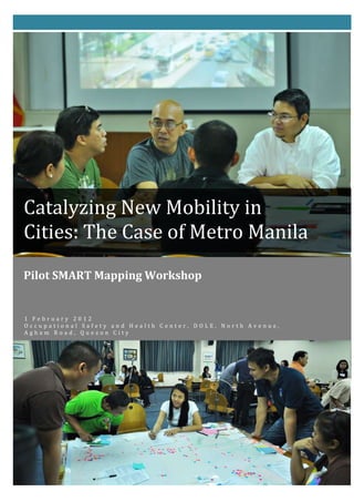
- 1. Catalyzing New Mobility in Cities: The Case of Metro Manila Pilot SMART Mapping Workshop 1 February 2012 Occupational Safety and Health Center, DOLE, North Avenue, Agham Road, Quezon City
- 2. Catalyzing New Mobility in Cities: The Case of Metro Manila Pilot SMART Mapping Workshop 1 February 2012 Occupational Safety and Health Center, DOLE, North Avenue, Agham Road Quezon City, Philippines
- 3. Table of Contents Executive Summary I. Opening Program A. Welcome Remarks by Dean Antonio La Viña, ASoG II. Introduction of the participants III. SMART Mapping Overview IV. Walking Tour of Quezon City North Central Business District: Trinoma – SM North Area V. SMART Mapping Workshop Process Briefing VI. Mapping Workshop and Group Presentations VII. Synthesis and Next Steps Forward VIII. Annexes A. List of participants for Pilot SMART Mapping Workshop B. SMART Mapping Workshop Guide C. Transcript of Note Takers D. Summary of Group Outputs E. Photo Documentation F. Certificate of Completion i
- 4. Executive Summary This pilot mapping workshop on Catalyzing New Mobility in Cities is a half-day activity co-organized with the University of Michigan-SMART Centre held last 1 February 2012 at the Occupational Safety and Health Center, DOLE, North Avenue, Agham Road, Quezon City. It was attended by various 38 individuals from 25 private organizations, government and academic institutions, and individuals working on transportation in Metro Manila namely ASEAN GTZ Clean Air for Small Cities Project, CAI-ASIA, OSHC DOLE, Ayala Land Inc., Parasatabi, The Nature Group, NEDA, OpenStreetMap Philippines, Philippine Science High School, ASCENT, Department of Transportation and Communications (DOTC), Metropolitan Manila Development Authority (MMDA), Barangay South Triangle, Palafox Associates, Entrepreneur Society of the Philippines, League of Cities of the Philippines, INNOVENSY, GTVSP Philippines. With support from the Rockefeller Foundation, this undertaking was organized by the Innovations at the Base of the Pyramid in Southeast Asia (iBoP Asia) Program of the Ateneo School of Government in partnership with SMART Center of the University of Michigan. Following a new mobility forum the previous day, the New Mobility mapping workshop’s primary objectives were: 1) reveal existing and potential transport mobility grid including informal hubs and other uncharted transport system features; 2) provide stakeholders an opportunity to work together in accelerating and advancing implementation of sustainable, connected, inclusive transport and generating and sharing related information, and policy initiatives; and 3) build on and further extend the shareable knowledge base of inclusive mobility-enhancing features of the informal transport system. The mapping exercise was deemed necessary because of the existing complex and diverse transportation modes in Metro Manila. In addition, the growing number of unaccounted public transport terminals and hubs hinders the walkability and sometimes obstruct the flow of transport. The country lacks readily available and accessible information where they are. LGUs and other government agencies lack capability to produce up-to-date map and mapping requires much time and resources. In this exercise, Ms. Susan Zielinski, Managing Director of SMART, explained that the participants would reveal the existing New Mobility Grid of the Quezon City North business district area. The grid they would come up with will be very useful, customized and special to everyone. This process allowed them to see what they got, what they are working with and together come up with collective solutions. Regarded not just a brainstorming activity, two possible outcomes were expected from this exercise: one was to share this experience to others and second use the map as a tool. The participants were divided into 4 groups and during the workshop proper, the following were some of the things observed in terms of group dynamics, group process, strengths and weaknesses: Group members were actively engaged and attentive to one another. The groups had a great mix of technical and creative minds in the presence of planners, researchers, entrepreneurs, IT specialists, policy makers, private sector representatives, writers and concerned citizens. The variety of experiences from each member provided very vast information and details on each map.
- 5. Each group member had a story to share. The entire exercise was based on not only the things they saw or observed during the walking tour but it also consisted of their own experience while commuting or traversing the metro. Some of their innovative ideas were based on their positive personal experiences in other cities that they wanted to replicate. The good thing about this exercise was the creative juices kept flowing and it probed each participant to raise queries especially at times when they feel like an idea will be challenging or if they have a different opinion. There were a number of healthy arguments that made the groups active. Some of the common themes that came out during the plenary presentations were: Bike lanes, single ticketing, commuter friendly stuff, walkways, improve communication, and need of better signage. In general, the participants found the mapping workshop very useful and they learned a lot from it. Their main concern was how to make the map more accessible to target users. The participants are envisaged to eventually form a more permanent group, like an e-forum that tackles the issue on mobility. They acknowledge current government initiatives, but they prefer a more visionary approach rather than solution finding. They all have high hopes for new mobility in Metro Manila and so the workshop ended on a high note.
- 6. Catalyzing New Mobility in Cities: The Case of Metro Manila Pilot SMART Mapping Workshop 1 February 2012 I. Welcome Remarks Dr. Antonio La Viña, Dean, Ateneo School of Government The Pilot Mapping Workshop of Catalyzing New Mobility in Cities in Metro Manila co-organized by ASoG with University of Michigan-SMART Centerheld at the Occupational Safety and Health Center of DOLE in North Avenue corner Agham Road, Quezon City started at around 9:00 a.m. with Ms. Cddyqa Rogel leading the Invocation and National Anthem. She welcomed the various participants in the event. She then called Dean La Viña to give the welcome remarks. Dean La Viña thanked her and greeted the participants a pleasant morning. He said that the project launch the day before was heightened by the quality of participation. Aside from technical research activities with an overall objective of a better city, it is time to catalyze a coalition of individuals and organizations that advocates and push for a more livable city. He shared that every time he meets Chairman Tolentino, the good Chair always speak out that the agency automatically gets sued once they take action because of the nature of the law that created MMDA. Dean La Viña personally noted the he was almost sure that MMDA would get sued in the unified ticketing system being proposes. He also shared that Chairman Tolentino also said that when they get sued no one is behind them, and that there is no citizen organization to back them up. This does not go for MMDA only but also for other government institutions and LGUs who begin to think of innovative things being implement. Therefore, he called for everyone to catalyze and organize their efforts to support good projects being implemented by government agencies like MMDA. This activity is in line with that approach, where a group of individuals and organizations from all parts and discipline could help, guide and also learn. He expressed his excitement to learn a new approach to mapping in transportation. As to why the mapping exercise was done at the Occupational Safety and Health Center, Dean La Viña said because it is an area where all could have a short walking tour of a central business district and discover possibilities in transportation. This activity would bring minds together to bring innovative solutions to problems that are centered to why transportation immobility is experienced in the metropolis. Other responsibilities hindered him to stay for the mapping activity but he wished everyone to have a fruitful time. II. Introduction of Participants Dr. Segundo Joaquin Romero, Director, iBoP Asia Dr. Romero mentioned that this is already the fourth activity of the New Mobility project. They started with a forum in Ayala, followed by the inception meeting then the project launch yesterday. These are not unrelated events but they all lead to hopefully a more permanent 1
- 7. Catalyzing New Mobility in Cities: The Case of Metro Manila Pilot SMART Mapping Workshop 1 February 2012 group that will advocate for new mobility. He hopes that New Mobility could be one of the innovations of ASoG similar to how Transparency and Accountability (TAN), the biggest anti-corruption group in the Philippines, was formed. This could be New Mobility’s vision or goal especially since the people from yesterday’s project launch were pushing to have more discussion in new mobility. A huge map, as big as the billboards found in malls is being hoped at the end of the project. But before producing such, they should begin with this SMART approach in mapping exercise and in connecting the dots. After which, he then asked each participant to introduce themselves by stating their name, occupation and affiliation. (See Annex A for Attendance Sheets) III. SMART Mapping Overview Ms. Susan Zielinski, Managing Director, SMART Centre University of Michigan Numbers and words on new mobility were presented yesterday and they were all great, but today Ms. Zielinski said the participants would be taking a different toll by going around the room and getting physical. With that she did a little exercise with the participants. She made them stand up and raise their right arm. Then asked them to put their left hand on their right wrist and move their left hand up to right arm. Next she asked them to raise their left arm, put their left hand on their right wrist and move left hand to right arm. What happened was, they all rolled up their sleeves which was what today’s mapping activity was about. The participants were encouraged to stand beside each other and interact. Each participant had colored dots on their nametag and the idea was to have as many colors per table as possible. The more they were next to someone they did not know was a great thing. They were given a workshop guide in case they got off track. (See Annex B) In this exercise, Ms. Zielinski said that the participants would reveal the existing New Mobility Grid of the area. The grid they would come up is expected to be very 2
- 8. Catalyzing New Mobility in Cities: The Case of Metro Manila Pilot SMART Mapping Workshop 1 February 2012 useful, customized and special to everyone. This process allowed them to see what they got, what they are working with and together come up with collective solutions. She informed the group that she had done similar mapping process to different communities and maps come out unique every time. She then reminded everyone the three things they were aiming for: connecting the dots, moving minds and moving money. This exercise is not just a brainstorming activity. Two possible outcomes were expected from this exercise, one was to share this experience to others and second use the map as a tool. Ms. Zielinski instructed the participants to take this mapping as a dry run and way of learning together in the process. The map could be made into something that would be useful by combining different things. Maps were placed on each table and all materials were provided. This activity aimed for knowledge, connectivity and implementation. In the walking tour, she asked the participants to think of the following guide questions: How things are connected to each other? How things might have economic or innovation opportunities? Describe the transformation of the sights in a new way? They should be able to tell a story. Question from Benjie dela Peña: what are we looking for when we go out? What are we paying attention to? Response from Susan: Looking at all the different modes of transportation, the way information is given out, the juxtaposition, is it easy to get off and get in? How do people use the transportation and connectivity of the system? Economic opportunities and tell a new story about it. When is it going to be enhanced? What works, what doesn’t and what would you do better? 3
- 9. Catalyzing New Mobility in Cities: The Case of Metro Manila Pilot SMART Mapping Workshop 1 February 2012 IV. Walking Tour of QC North CBD: Trinoma-SM North Area The participants walked along the sidewalk of North Avenue, crossed the street using the overpass, passed through the North Avenue terminal station, crossed the pedestrian crossing area and back to the venue. Aside from the formal transport terminal found in SM North EDSA, there was also an informal transport terminal of pedicabs along the North Avenue road. The different modes of transport seen plying along the North Avenue road were private vehicles, two-wheeled MVs, Public Utility Jeepneys (PUJs), Pedicabs, Taxi cabs, AUVs, Van shuttles going from one point to another, and the Metro Rail Transit (MRT) train. But despite this, it is interesting to observe a lot of people are seen walking along the road or crossing the road. V. SMART Mapping Workshop Process Briefing Ms. Susan Zielinski, Managing Director, SMART Centre University of Michigan Ms. Zielinski reminded everyone that each table should have a good mix of colors representing different sectors and join people that they do not know. She said that enough tools and supplies were made available for each working group. The participants should not be constraint to only one plan and asked to feel free to take more tracing paper from the workshop team in case they needed more. Less tangible resources were also present at the participants’ disposal such as: Group members Knowledge of some of the transport features of the selected focus map segment Some knowledge of what is connected 4
- 10. Catalyzing New Mobility in Cities: The Case of Metro Manila Pilot SMART Mapping Workshop 1 February 2012 Sense of humor and creativity Sense of civic duty/ passion for improvement She then enumerated the workshop tasks. First she instructed the group to find a note taker to take down crucial discussion points. The group should also select a reporter to present the group output at the end of the workshop. Everyone gets 12 minutes to present their output after 2 hours. A facilitator was also required but the discussion may start without it. Then she instructed each one to introduce themselves to their group mates by saying their name followed by what they are hopeful about, something positive or what they love in Manila’s transportation. The first step is revealing the new mobility grid. Look at the maps on their table and identify connection points. Find places you can connect using small or big ideas (e.g. Signboards to understand the system or an application for iPhone). Second is to identify the area where you can start working with your idea. Then think about what economic benefits activities you can think of? How can you save money? How could you invent new businesses/ services/ innovation to connect the dots? What are the economic ideas that can create job, save money, invest in business? Third is moving minds, where participants portrayed their project. How do you put the signage up? How do you tell a story of the integrated system? It involves marketing, finding a way and helping people figure out how things are connected. She instructed the note takers to tally at least five research questions needed in order to serve the project. Note takers were also instructed to jot down policies that are needed to implement the innovation project. The groups were also asked to identify people that they believe should be at the table with them. Then the groups will come back in plenary and report their outputs. They were instructed that if they are stuck on one thing, they should try moving to another just to keep the flow going. VI. Mapping Workshop The room was divided into 4 groups. In the workshop proper, the following were some of the things observed in terms of group dynamics, group process, strengths and weaknesses: (See Annex C for transcript of note takers) 5
- 11. Catalyzing New Mobility in Cities: The Case of Metro Manila Pilot SMART Mapping Workshop 1 February 2012 Most groups were very active where the group members actively engaged and attentive to one another. The activity was done with almost everyone from the group standing up and doing their share in mapping. Most groups also used all the tools available for them but the most commonly used tool was the colored dots to represent various transport terminals. The groups assigned legends to describe what they saw during the walking tour. The groups had a great mix of technical and creative minds in the presence of planners, researchers, writers and concerned citizens. The variety of experiences from each member provided very vast information and details on each map. Each group member almost had a story to share. The entire exercise was based on not only the things they saw or observed during the walking tour but also consisted of their own experience while commuting or traversing the metro. Some of their innovative ideas were based on their positive personal experiences in other cities that they wanted to replicate. The good thing about this exercise was the creative juices kept flowing and it probed each participant to raise queries especially at times when they feel like an idea will be challenging or if they have a different opinion. There were a number of healthy arguments that made the groups active. In each group, there was always one that stood out as a natural facilitator without having to volunteer or be chosen and this is usually someone who has technical knowledge on the various transport systems. After lunch, each group was called to present to plenary what they have discussed. (See Annex D for summary of the group outputs in order of presentation and Annex E for photos of actual group outputs) 6
- 12. Catalyzing New Mobility in Cities: The Case of Metro Manila Pilot SMART Mapping Workshop 1 February 2012 During plenary, everyone was intently listening to each other’s output. Ms. Zielinski said that this was the quietest group that she had handled. Common themes that came out from the presentations were: Bike lanes, single ticketing, commuter friendly stuff, walkways, improve communication, and need of better signage. VII. Awarding of Certificates Certificates were awarded to all who attended the workshop. The certificate, signed by Dean La Viña and Ms. Zielinski read (See Annex F): SMART New Mobility Mapping and Implementation Seminar. <Name of Participant> has completed the University of Michigan SMART Program’s New Mobility Mapping and Implementation Seminar and has gained skills related to advancing and accelerating integrated and sustainable transportation systems in communities and regions. VIII. Synthesis and Next Steps Forward Dr. Marie Danielle Guillen, Project Manager Finding New Mobility in Metro Manila Dr. Guillen thanked everyone for participating and encouraged all to be part of a catalyzing project. She was interested to see that people learned something new and inspired by their optimism. She posed finding new mobility as a challenge for all. That in order for Metro Manila to be livable, they need to help each other. The issue is not really competition but complementing and finding innovative ideas to improve the current situation. The event ended at around 1:00 pm. 7
- 13. ANNEX A List of Participants
- 17. ANNEX B Pilot SMART Mapping Workshop Guide
- 18. connectivity maps can be easily made into door-to-door transport maps for users and distributed in print or online. This both provides a tool for users CATALYZING NEW MOBILITY IN CITIES PROJECT for the short-term, and a tool for identifying future enhancements for the long term. PILOT METRO MANILA SMARTMAPPING Objectives of the Exercise In Brief UNIVERSITY OF MICHIGAN-SMART (Sustainable Mobility, Accessibility, Research and Transformation) Centre 1. Reveal existing and potential transport connectivity grid including with informal hubs and other uncharted transport system features. Innovations at the Base of the Pyramid in Asia (iBoP Asia) Program 2. Provide stakeholders an opportunity to work together in ATENEO SCHOOL OF GOVERNMENT accelerating and advancing implementation of sustainable, connected, inclusive transport and generating and sharing related information, and policy initiatives WORKSHOP GUIDE 3. Build on and further extend the shareable knowledge base of inclusive mobility-enhancing features of the informal transport system WELCOME to the Pilot Metro Manila SMART Mapping Workshop, a half-day event that gives participants the opportunity to collaboratively improve transportation in Metro Manila. AVAILABLE TOOLS We do this specifically today by “revealing the existing New Mobility Grid” Mapping Tools and Supplies generating hitherto unrecorded information about the location and interconnectivity of transport facilities and features within a selected slice The following workshop tools and supplies are available for each workshop of Metro Manila – the Quezon City North Central Business District (around group: the Trinoma and SM North EDSA Area). 1. An easel or flipchart for documenting discussions We are taking an approach developed by SMART at the University of 2. Tracing paper for providing information without marking the base Michigan to identify, reveal and enhance the multi-modal/New Mobility focus map (to increase its reusability). Grid in communities and regions around the world. The approach also 3. Round colored sticker dots (0.5 inch and 0.25 inch in diameter in facilitates exploration of economic development, employment, and red, blue, green, purple, orange, yellow, and white colors) innovation opportunity as well as approaches to marketing and 4. Color markers for labeling added map features onto post-it notes communicating about the enhanced system. 5. Post-it notes 6. Masking Tape for general use Today’s Pilot SMART Mapping demonstrates process which if, relevant and 7. Scissors for general use applicable can be replicated in other areas of Metro Manila by other 8. Magnifying glass for general use stakeholders, the resulting maps of which can be consolidated with the incremental database of sectional SMART Maps. At the same time, the
- 19. Less tangible Resources You have at Your Disposal money, boosting business (new innovations, new markets), and revitalizing local economies. 1. Diverse colleagues/group members 4. Identify opportunities for “moving minds”. Identify at least three 2. Knowledge of some of the transport features of the selected focus key strategies for “moving minds” of both users and decision- map segment makers. 3. Some knowledge of what is connected 5. Raise queries to enhance grid. Identify at least 5 research questions 4. Sense of humour and creativity or areas of knowledge or data pursuit that will help you enhance 5. Sense of civic duty/passion for improvement your New Mobility Grid. Finding Your Group (as you Find NeMo) 6. Shape policy. Identify policies that will remove barriers to (or provide incentives to) integrated innovation and implementation. You will be in one of four workshop groups. Look at the colour of your name Note that they don’t all have to be transportation policies. They tag dot. It tells whether you represent government, and NGO, big business, may be policies relating to land use, energy, economic and finance, a small venture, or academe. Please make sure that in your group every information and communications, innovation, social, tourism, and colour is represented. Please also favour group in which you know the least other policies. number of people. Workshop Output Presentation Getting Started 1. Each group will be given 10-12 minutes to report on the results of *First, please identify a rapporteur to take notes. their performance on the six tasks. * Next, please identify a volunteer to report back to the larger group. 2. In plenary, the groups identify * Next, please identify, a group chair or facilitator to organize and steer the Common Themes across the 4 tables work of the group according to the steps below. Common Ground across the 4 tables Points of innovation and variation across the 4 tables Workshop Tasks: Next Steps 1. Reveal your new mobility grid. Using your focus map, use the red dot stickers to identify the New Mobility Grid by marking as many The workshop working in plenary identify the following: connection points as possible between two or more modes and services. Strategy for more SMART Mapping 2. Identify implementation opportunities. Using your revealed grid, Strategy for organizing for implementing identified initiatives identify immediate, short-term, and long term opportunities for enhancing the grid. 3. Identify opportunities for “moving money” (economic benefit). Using your revealed grid, identify economic benefits and opportunities specific to your grid including creating jobs, saving
- 20. ANNEX C Transcript of Note Takers
- 21. Annex C Transcript of Note Takers GROUP MEMBERS NOTES NO. ONE Ronald Cartagena Legend Third Espero Blue – challenge spots Tieza Santos Yellow – infrastructure/ facility Bert Suansing Pink – information/ billboards Buddy Tan Orange – economic development Art Cacdac Green line - employment opportunity Fuchsia – housing Green rectangle – major transportation terminal TWO Dinna Dayaw Who should be at the table? Daniel Ngilay MMDA Chairman Tolentino Jay-R Cordova DPWH Secretary Singson Cristy Llacer-Oreta Persons with disabilities Elisa Del Rosario QC Mayor Herbert Bautista Glynda Bathan Bus operators Kimleye Ng COSE elderly Department of Public Order and Safety of QC SM and Trinoma Mall Managers TODA Barangay officials JODA Cycling advocates and entrepreneurs Quezon Avenue Connectivity Bus stop before and after flyover, for Metro Manila buses MRT Quezon Avenue Centris jeepney and taxi terminal, AUV for provincial trips 1
- 22. Annex C Transcript of Note Takers Q. Avenue jeepney stops Provincial bus stop under Q. Avenue flyover Tricycle line, Panay Avenue Taxi line (informal) near MRT Q. Avenue Central terminal, EDSA Legend Purple dot – formal modes of transport/ terminals Purple rectangle – informal modes of transport/ terminals Yellow dot – business models Orange line – bicycle lanes Blue line – overhead pedestrians Black line – informal pedestrians Research questions Are there policies regulating pedicabs? How are they to be located? How do you ease the congestion of jeepneys lining up along streets occupying some of the pathways? o How do you make drivers more productive during non-peak hours? o How do they get formal terminals? How do you establish formal terminals? What are the necessary permits needed? Study n the “Bandera System”, a monitoring and regulatory mechanism among organized jeepney and tricycle groups. What are its features that can be replicated to be used in formal organizations? Business Models Charging stations in terminals Establish cooperatives for financing 2
- 23. Annex C Transcript of Note Takers Livelihood activities for organized groups of drivers Bike parking, shower and locker Greening the roads like nurseries and gardeners, landscapers Facilities: Protected bicycle lanes along major roads Covered walkways and overpasses Policy Establish color coding of tricycles and pedicabs by their routes and destinations Unified ticketing system for the trains Regulations regarding pedicab routes and design pedestrian friendly crossings at street levels Traffic calming: traffic signals) timed for cars and pedestrians Creative Flash mobbing to model desired behavior, like falling in line, obeying traffic rules THREE Doc Jun Castro Something Positive Nordy Pimentel "ONE STOP AREA" Marty Abuzo o hospital, school, shopping mall, work opportunities, hotel, etc. Michelle Ann Available spaces for future development expansion Santillan Intermodal transfer area Caroline Mendoza o jeep, MRT, bus, UV Express, tricycle Rosemarie Pariñas Policy/Project we can do right away Central Bus Terminal --- maximize its use Unified vendor stalls similar to Makati (Jupiter St. area) o small booth for vendors, create economic activity (e.g. food deliveries, loading center), assign to them the cleanliness of the area and 3
- 24. Annex C Transcript of Note Takers minimization of trash Park n' Bike o be bicycle friendly o to be located at MRT, shopping malls, offices, etc. o bike lanes connecting QC Circle, malls, major stations Provide info maps and signage o important locations, contact numbers, etc. Integration of terminals (FX, Jeep, Tricycle) Research Questions Public Transport Terminal (one place to another) o Trip characteristics o Users, user's needs o Trip chain o Modes o Trip fare o Trip purpose Bike lanes o Feasibility o Background of transport users Policies No politicking ---- Political will Coordination of Public/Private stakeholders thru Private Public Partnership Who should be at the table? Government group Business group 4
- 25. Annex C Transcript of Note Takers Public Utility Vehicle operators (Jeep, Tricycle, Pedicab, FX, Taxi, Bus) FOUR Gabriel Catapang Suggestions Hailey Meriel Color code for vehicles (PUVs) Rally de Leon o Labeling Elma Arboleras Route labels for jeepneys, bus (same with trains/ subways) Dexter Cardenas o Visible (way finding) Cholo Asis Data map of routs (start- end) Benjamin Dela Peña Road network for pedicabs Andre Quintos Additional walk bridge (Mcdo/ Trinoms) Uniform sidewalk specifications Less stops (unloading/ loading) o One bus (BRT) Like a light rail transit Prevents loading/ unloading practices in the middle of the road Positive SM/ Trinoma transport terminals o Multi-modal hubs MRT 7 – Commonwealth/ Fairview o Via North Avenue Pedicab stop (near OSHC) Two main malls – employment hub MRT 3 – North Avenue Station Food stalls in transport terminal Construction o Economic activity o Employment (local) Mix of institutions: schools, malls, hospitals 5
- 26. Annex C Transcript of Note Takers Partnership (e.g. malls) in terms of establishment of facilities: walkways, terminals Connectivity Organized route map Business opportunity Single ticketing system (central) o Chip/ MRT style o Tap to pay concept Marketing Route map (available/ customizable) o Attractions Payment from advertisers e.g. malls, parks Policy/ research LTFRB- assignment of codes/ per route Frequency/ traffic projections Travel time 6
- 27. ANNEX D Summary of Group Outputs
- 28. Annex D Summary of Group Outputs GROUPS IDEAS/ LEGENDS BUSINESS FACILITIES POLICIES RESEARCH WHO SHOULD OPPORTUNITIES QUESTIONS BE SITTING HERE? The Learned a lot of Bike stations located Protected bike Color-coding How do you DPWH head Mobilizers new things about very near train lanes scheme for ease congestion Singson Presented what was available stations that have Covered tricycles and of PUJs along PWDs by Dinna and what was not lockers and showers. walkways and pedicabs to streets? Often Mayor of QC, Dayaw Drew a wish list of Charging stations overpasses. know which occupying a Herbert things they wished (phone, electronic Senior citizen grounds or lane Bautista to see gadgets) friendly. area they How do you MMDA Chair LRT users are more Livelihood activities Currently, cover. Make make drivers Tolentino disciplined to line and organizing overpass is sure that all more Bus operators up. Flash mobbing – group of drivers of not covered, areas will be productive Coalition of carry a certain TODA and JODA. dark at night sufficiently during non- services for the behavior at a Pedicab drivers can and vendors covered peak hours? Can elderly certain time, which do the same things. occupy space. Unified they be taught SM and appears as a normal Coop benefits, micro ticketing other skills and Trinoma, Mall behavior. Can be business system for businesses? Managers used in cycling. opportunities and trains. Connect How do they get Dept of Public Legend: health, learn skills of or close the formal Order and o Purple dots: vehicle maintenance, loop. One terminals? Safety of QC formal modes of micro lending ticket system Possibly asking Barangay transport and Greening the roads for all three veterans officials terminals for landscapers and lines. memorial to Different o Purple gardeners. Little Pedicabs give or lend drivers rectangles: nurseries to be supposed to space to associations informal maintained by the obey traffic jeepney Cycling o Orange lines: nearby communities rules and terminal advocates and bicycle lanes. design How do you entrepreneurs They almost Allow establish formal placed it pedestrian terminals in the everywhere friendly first place? Who imagining crossing at do you talk to? 1
- 29. Annex D Summary of Group Outputs GROUPS IDEAS/ LEGENDS BUSINESS FACILITIES POLICIES RESEARCH WHO SHOULD OPPORTUNITIES QUESTIONS BE SITTING HERE? protected bike street level What facilities lanes from North are required? o Yellow dots: Ave station all Permits? business along EDSA. Use of bandera models Not everyone system, o Blue lines: can go up the monitoring and pedestrians steps. Putting regulatory walkways traffic signals mechanisms. above the on EDSA. What are its streets feautres that o Black lines: can be informal or replicated and non-existent use in formal pedestrian orgs? walkways Presented Color coded based Formalize and If there is a by Tieza on thematic issues replicate Informal way to Santos and Several transport modes translate into Bert opportunities such as pedicabs not a more useful Suansing designed does not registered by public suit metro manila providing transport information, which we can turn services to people then that is around and door-to-door one way of Blue: challenged service. Make it educating spots, major more formal and people and transport spots that more efficient pedestrian are not connected mobility structure Corner of but can be Develop north Mindanao Ave improved to help triangle. Incorporate and North 2
- 30. Annex D Summary of Group Outputs GROUPS IDEAS/ LEGENDS BUSINESS FACILITIES POLICIES RESEARCH WHO SHOULD OPPORTUNITIES QUESTIONS BE SITTING HERE? improve mobility of a dwelling place for Ave, pedxing people the people settling for PWDs Yellow: facilities there, dormitory Turn Agham that can either help type. road into a of facilitate. Golf course: pedestrian Recurring in areas Veteran’s way where there are major transportation hubs Pink: information and education materials. Irony is that public information materials have huge discrepancy in design and location. Orange: economic areas/ commercial areas/ economic development/ enterprise opportunities. Green: major employment opportunities that surround economic centers Fuchsia (rectangle): major residential 3
- 31. Annex D Summary of Group Outputs GROUPS IDEAS/ LEGENDS BUSINESS FACILITIES POLICIES RESEARCH WHO SHOULD OPPORTUNITIES QUESTIONS BE SITTING HERE? areas. To see how far they are to areas where they need to access goods and services Green (rectangle): major transportation terminals Green lines: major employment opportunities Presented Blue dots: Attraction Lessen informal Bikelines to Zero waste What mode of Business by Marty Transport and people terminals by connect existing program transport do groups Abuzo go centralizing them bike lanes. Apolitical the Transport Formal and informal from one place to Connected to policies passengers operators transport terminals another malls and major Public private use everyday? Place small uniform roads. partnership Purpose of stalls similar to the travelling? kiosks in Makati Travel cost? Recycle bins to be Travelling placed near these time incurred stalls everyday? One stop area: schools, hospital, park, shopping centers, intermodal transport terminals can be found. There 4
- 32. Annex D Summary of Group Outputs GROUPS IDEAS/ LEGENDS BUSINESS FACILITIES POLICIES RESEARCH WHO SHOULD OPPORTUNITIES QUESTIONS BE SITTING HERE? is still space for improvement and development Presented Positive things in Route map should Information Give codes to How to help by Andre the area mapped be made publicly kiosk for buses to easily people Quintos o SM trinoma available paid for by commuters identify their navigate the multi-modal a mall or private Map posted in route area? transport establishment. Map terminal to Establish road Frequency provides a that will highlight identify which network for and traffic lotof choices certain attractions. public pedicabs projections o Pedicab stop transport to Uniform and travel o Two main use from point sidewalk time from one malls to point specifications area to o Food stalls Additional Less stops for another? o Mixed of walkbridge unloading and institutions from McDo to loading. BRT. present: Trinoma LTFRB to schools, malls establish color etc. coded routes for every type of transportation Single ticketing system using chip or MRT style 5
- 33. ANNEX E Photo Documentation
- 41. ANNEX F Certificate of Completion
- 42. Certificate of Completion SMART New Mobility Mapping and Implementation Seminar has completed the University of Michigan SMART Program’s New Mobility Mapping and Implementation Seminar and has gained skills related to advancing and accelerating integrated and sustainable transportation systems in communities and regions. On this ______ day of ______ in _______. Susan Zielinski Segundo Romero Managing Director, SMART Director, iBoP Asia University of Michigan Ateneo School of Government