Lessons learned on the achievement of the Joint Program of Climate Change Adaption in the Colombian Massif [Luis Alfonso Ortega]
•
0 gostou•264 visualizações

Lessons learned on the achievement of the Joint Program of Climate Change Adaption in the Colombian Massif (Andean Belt Constellation Biosphere Reserve - Cauca Basin) with indigenous and peasant communities to affront the effects of climate change. Presented by Luis Alfonso Ortega at the "Perth II: Global Change and the World's Mountains" conference in Perth, Scotland in September 2010.

Recomendados
Recomendados
Mais conteúdo relacionado
Mais procurados
Mais procurados (20)
Destaque
Semelhante a Lessons learned on the achievement of the Joint Program of Climate Change Adaption in the Colombian Massif [Luis Alfonso Ortega]
Semelhante a Lessons learned on the achievement of the Joint Program of Climate Change Adaption in the Colombian Massif [Luis Alfonso Ortega] (20)
Mais de University of the Highlands and Islands
Mais de University of the Highlands and Islands (20)
Último
Último (20)
Lessons learned on the achievement of the Joint Program of Climate Change Adaption in the Colombian Massif [Luis Alfonso Ortega]
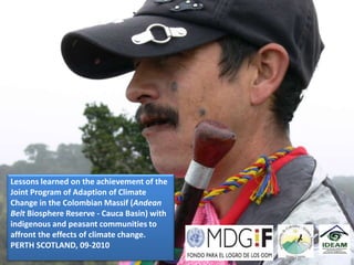
- 1. Lessons learned on the achievement of the Joint Program of Adaption of Climate Change in the Colombian Massif (Andean Belt Biosphere Reserve - Cauca Basin) with indigenous and peasant communities to affront the effects of climate change. PERTH SCOTLAND, 09-2010
- 2. The object of study is the analysis of the interactions between climatic conditions, population and socio-environmental system Ecosystems productive Risk systems and Management food security Water Healthy Resource Environments Management
- 3. Biosphere Reserve CINTURON ANDINO DEL MACIZO COLOMBIANO Range Altitud: 1,800 – 5,750 m Area: 5,250 Km2 Core area: 3,750 ( 3 National Natural Parks) Provide 70 per cent of the national population with water COLOMBIA SUR AMERICA
- 4. 60,000 hectareas Biosphere Reserve HIGH BASIN CINTURON ANDINO DEL CAUCA RIVER MACIZO COLOMBIANO Colombian Massif
- 5. Territory - Social Organizations
- 6. Indigenous and Peasant Organization Regional and Program United Local Partners Nations Government National Government
- 7. Vulnerability Assessment Objectives This project has a duration of three years and ends in February 2011. But only three months ago, we began the implementation of measures. For this reason we need to plan a route, so that communities can continue to lead the process 1. Establish a participatory manner based on the 2. Develop a participatory identification of climate manner to the implementation hazards and levels of climate of a transition route for variability, to prioritize adaptation. adaptation measures whit the communities.
- 8. Project Strategies Joint agendas, learning - doing, Intercultural teams, training of trainers respect for organizational forms agreement of Exchange of confidentiality of experience information. building and strengthening networks.
- 9. • Socialization and consultation with local and regional actors Activity 1: • Structuring the evaluation of vulnerability: definitions, frameworks and objectives “construct languages – Activity 2: DIALOGO DE SABERES” Participatory methodology for vulnerability analysis and Activity 3: • Sensitivity assessment: Current Vulnerability definition of adaptation strategies Activity 4: • Future vulnerability assessment Activity 5: • Linking the results of vulnerability assessment and adaptation with strategies policies For example. The indigenous authorities require to the families, plant at least 3 food species resistant to climate change (quinoa, amaranth, wild beans) and also establish windbreaks, etc
- 10. Knowing the baseline of 52 villages (in Systematization: the current vulnerability to degrees of municipalities climate change vulnerability and Popayan What we look? Puracé) Where? Community Vulnerability to climate surveys With what? Limited presence change and variability of actions and (Consensus statistics) Why? policies related and to climate household change surveys For what? How? A Develop Based on what? With a system of indicators strategies to (scientific and empirical) increase resilience Four axis of focus (production systems, health, water and natural risk)
- 12. % Of Veredas, according perceception levels events Grafico 1. Percecion de intensidad de eventos How? you have received in the last 5 years the intensity of rainfall, wind, hail, drought, frost? (In relation to impacts on crops, forest, water resource, livestock, diseases, etc.) Much stronger Stronger Less strong Weaker
- 13. La tendencia de sostenibilidad de los Promedios de los Sistemas Productivos sistemas productivos en la cuenca alta del río Cauca es de predominantes en la cuenca alta del río Cauca Significado: La situación ambiental, económica y PROMEDIO MIXTO TRADICIONAL socio cultural es crítica para la PROMEDIO PROMEDIO PROMEDIO INTENSIVO GENERAL sostenibilidad integral de las comunidades El sistema intensivo y el mixto tienden a ser más insostenibles en relación con el sistema tradicional AGUA 2,5 2,3 2,4 2,4 SUELO 2,4 2,7 3,5 2,8 BOSQUE Y FAUNA SILVESTRE 3,2 2,9 3,5 3,2 BIODIVERSIDAD DEL AGROECOSISTEMA 2,0 3,1 4,0 3,0 INDICE SOSTENIBILIDAD AMBIENTAL 2,5 2,7 3,3 2,8 INGRESOS 1,8 3,2 2,9 2,6 NIVEL DE AUTOSUFICIENCIA 2,5 2,8 3,8 3,0 MERCADO Y COMERCIALIZACION 2,5 2,8 2,6 2,6 POSTCOSECHA, AGROTRANSFORMACION 2,9 2,5 2,5 2,6 INDICE SOSTENIBILIDAD ECONOMICO 2,4 2,8 2,9 2,7 PARTICIPACIÓN Y ORGANIZACIÓN 2,4 3,1 3,2 2,9 SEGURIDAD Y SOBERANIA ALIMENTARIA 2,8 3,0 3,5 3,1 SALUD Y NUTRICION 2,7 3,0 3,5 3,0 INDICE SOSTENIBILIDAD SOCIO-CULTURAL 2,6 3,0 3,4 2,9 INDICE SOSTENIBILIDAD PROMEDIO 2,5 2,8 3,2 2,8
- 14. The results of surveys were presented in maps:
- 17. Then the results fueron integrados en dos mapas: a) Sensitivity map b) adaptation capacity map Adaptation capacity axies: Sensitivity axies: V= ƒ (S, CA) ecosystems, production Donde: ecosystems, production systems and water V= Vulnerability systems and water resources for the study S= Sensitivity resources for the study CA=Adaptacion Capacity area area
- 18. Levels of vulnerability In this way we obtained the level of vulnerability for each village The levels of vulnerability are the basis for the design of adaptation measures and the route of adaptation
- 19. Transition route for adaptation "Safe water and safe food in a healthy territory"
- 20. Transition path for Adaptation This strategy comprising a series of actions focused on the design and planning of actions to generate ability to adapt to climate change.
- 21. Strategies Focused capacity building and gender differential population Development actions in priority areas Field Schools to multiplication and replication activities Communication of progress and results Sustainability of the adaptation process
- 22. To develop measures, the communities identified 5 corridors , with representation spiritual, cultural, political and environmental
- 23. Field schools for adaptation to climate change Each school is composed of: 1. One Plot Mother : Food Security. Sustainable livestock Conservation. Water solutions. 2. 19 Plots Daughters Food Security Sustainable livestock. Conservation. Water solutions. 3. Plots granddaughters: Food Security Each family with a daughter plot, must teach a group of plots granddaughters. TOTAL: 844 Mother School: 6. The appropriation of these results, will allow Daughter Plots: 114. replicate the schools in other areas Granddaughter Plots: 724.
- 24. Adaptation measures for conservation Expanding Farm management Establishment of Plots of Habitats for agricultural seed banks in situ acclimatization (Corridors) production and and ex situ and exchange of release of areas agricultural seeds for conservation and water production
- 25. Adaptation measures for food security and production Establishment of Strengthening of the network of food ancestral practices and security and knowledge to management of agro diversification of biodiversity production systems The TRUEQUE is an ancient adaptation measure for the exchange of seeds, food and products from different climatic zones
- 26. Pagina web: www.cambioclimaticomacizo.org Teléfono: (0928) 319488 – 8319499 Popayán - Colombia