Verlichte boerderijenroute Bodegraven-Reeuwijk - 2011 Sophie Visser
Elk jaar worden 's winters in Zuid-Holland Verlichte boerderijenroutes door de Boerderijenstichting georganiseerd. Dan kunnen mensen 's avonds langs verlichte karakteristieke boerderijen (en kerken e.d.) rijden, en ook een aantal bezoeken en bezichtigen. Deze in Bodegraven-Reeuwijk was ter gelegenheid van de fusie van beide gemeenten en was deels in hun vroegere grensgebied..
Korte samenvatting van het kwaliteitskader Noordelijke Rijn en Lekdijk. In deze brochure ligt de nadruk op de cultuurhistorie. De brochure is gepresenteerd op het Nationale Deltacongres 2016
Landschap, geschiedenis en cultuurhistorie in informatie & communicatie van...Sophie Visser
Informatie over het cultuurhistorische landschap - veelal met name gemaakt voor gebruik in ruimtelijke ordening - blijkt nogal eens vragen op te roepen. Niet alleen is de informatie vaak onvolledig en summier, maar ook klopt deze lang niet altijd. In het kader van de cursus 'Filosofie en wandelen' van HOVO Utrecht kwam naast de rol van kunst ook de rol van informatie af en toe ter sprake. Dit leidde tot een extra bijeenkomst die op dezelfde leest was geschoeid als andere bijeenkomsten: een bespreking en toelichting gevolgd of voorafgegaan door een wandeling. Dat betrof het kleine landgoed Duivecate en omgeving bij Nijverdal (gemeente Hellendoorn, Overijssel), vlakbij de rivier de Regge.
Informatie en informatiesystemen over het (cultuur)historische landschap: wat...Sophie Visser
Zoals bekend krijgt het (cultuur)historische landschap de laatste decennia veel aandacht. Het maken van informatie daarover is dan ook inmiddels een vanzelfsprekende zaak. Het rijk heeft dat al diverse malen gedaan, de provincies hebben het gedaan (en vaak herhaaldelijk), gemeenten hebben het gedaan of zijn er nog mee bezig. Maar waarom is dan toch vaak aanvullend onderzoek nodig, in ruimtelijke projecten of anderszins? Blijkbaar ligt (die) informatie vaak toch complexer. Eén oorzaak is dat gebruikssituaties toch steeds weer anders zijn terwijl men bij de informatie - zoals in cultuurhistorische (waarden)kaarten en andere vormen van (GIS-)informatiesystemen - bepaalde standaardsituaties voor ogen had. Ook kan de kijk op landschap en erfgoed en de onderzoeksbenadering die altijd in informatie schuilgaan wringen. Logischerwijs zou bij verandering daarvan - zoals door de landschapsbiografie, het meenemen van beleving, 'the ordinary landscape', etc. - ook de informatie moeten veranderen. Maar is dat ook altijd zo? En hoe zit het met de kijk op informatie en op ICT zelf en de manier waarop men daarmee omgaat, wat gewoonlijk eveneens gevolgen heeft? Informatie is er dus niet zomaar en is evenmin neutraal . De vraag naar waar informatie voor staat en wat deze betekent is daarmee voor hedendaagse informatiebronnen even belangrijk voor die uit het verleden. Dergelijke aspecten en vragen (en meer) zijn het onderwerp van deze lezing.
De Oud Bodegraafseweg - een 'aparte' geschiedenis Sophie Visser
Bebouwingslinten vormen een bekend en belangrijk aspect van het landschap van de veenontginningen zoals in het Groene Hart. De vraag hoe de kwaliteiten ervan - zowel de cultuurhistorische als de 'groene'- behouden kunnen blijven zonder er een openluchtmuseum van te maken is dan eveneens belangrijk. In 2011 organiseerde Landschapsbeheer Zuid-Holland samen met de gemeente Bodegraven-Reeuwijk op enkele plekken meedenkavonden voor de bewoners. Een van die plekken is de Oud Bodegraafseweg, ten zuidwesten van het dorp Bodegraven. Deze presentatie ging in op de cultuurhistorie van die plek en hoe deze is ontstaan.
Vormen in veelvoud: bebouwingslinten in Waarder - Lange Weide Sophie Visser
Bebouwingslinten vormen een bekend en belangrijk aspect van het landschap van de veenontginningen zoals in het Groene Hart. De vraag hoe de kwaliteiten ervan - zowel de cultuurhistorische als de 'groene'- behouden kunnen blijven zonder er een openluchtmuseum van te maken is dan eveneens belangrijk. In 2011 organiseerde Landschapsbeheer Zuid-Holland samen met de gemeente Bodegraven-Reeuwijk op enkele plekken meedenkavonden voor de bewoners. Een van die plekken is Waarder - Lange Weide, in het oosten van de gemeente. Deze presentatie ging in op de cultuurhistorie en hoe deze was ontstaan.
Selective information from Historical Geographers: the case of the Dutch area...Sophie Visser
Selectivity is commonly built-in in information, hence as well in information on cultural landscape and heritage. Information selectivity is not trivial, as many information forms – for instance ´official´ and research-based GISs - are intended to serve as the informational basis for landscape and spatial policies, plans, designs and management. As these GISs foremost are made by landscape and heritage specialists, the information selectivity by specialists – resulting from personal, disciplinary, societal and technological backgrounds - is a main factor. So far, this hardly have been researched or discussed.
To study this among (mostly) historical geographers the rather unknown cultural landscape of the Dutch Piksen area (in the province of Overijssel) was chosen, thereby minimizing personal knowledge, values and perceptions. For the same reason an anonymous (no toponyms or other names) description, existing of text and some accompanying old maps, served as base document. The annual Dutch cultural landscape conference of 2009 – held in Overijssel - provided the research population. The respondents were asked to indicate which elements (words, sentences, and interrelationships) they find relevant or interesting to record either as knowledge or as values. The resulting data, description, and/or map would serve as base for local plans, landscape management, education, etcetera. The assignment was complemented by a small number of questions about the respondents backgrounds.
Despite the standardized conditions the variation was big, varying from just a few concepts or objects to all of the text, both in knowledge and in values. Generally speaking, what was seen as relevant for knowledge included more of the text than for values. The poster will present and discuss the results, both as such as well as in comparison with other, mostly official, information on the same area.
Putting digital historical geography into perspective(s)Sophie Visser
Digital historical geography might be expected to comprise a similar set of approaches and methods as in digital cartography, digital humanities - which includes digital history and may include digital heritage - and digital (historical) landscape. Apparently, though, it emerged as such only rather recently. In practice, it may use the results of these other disciplines or may apply the same kind of methods to make and communicate its own information results. This situation leads to several questions. Firstly, where does digital historical geography actually stand in this arena of digital disciplines? What then is specific for digital historical geography? Secondly, what does ’digital’ mean? Does only computerized information count in that respect, and more specifically GISses? Thirdly, is it foremost about data, inputs and/or outputs or also about the process of historical geography? For instance, digital humanities also includes the research process, while digital heritage or digital landscape focus on outputs and data. Fourthly, do purpose and audience make any difference? This presentation explores these questions briefly with the use of some examples.
The Right Information? A view from landscape, landscape management and afford...Sophie Visser
The document discusses the concept of "the right information" in the context of landscape management. It argues that the right information is information that has the appropriate affordances for the intended purpose, activity, context, level, person, time, and place. It provides several examples to illustrate this point. Specifically, it discusses how information may have different affordances depending on the level of steering (strategic, tactical, operational) and process (policy, management, implementation) it is intended for. The document also notes there are differences in affordances based on the personal characteristics and needs of the individual user.
The peat landscapes of Holland: a matter of opportunities and challenges Sophie Visser
Holland is well-known for its peat landscapes dating from the Middle Ages on. These landscapes are threatened now as the peat gets lower and lower. This presentation explained the general developments and present situation in the area of Gouda-Nieuwkoop - being a part of the Green Heart of Holland - and ends up with questions of what to do now. The presentation was part of the excursion program for a group of international geologists,
De gebruik(er)skant van informatie en informatiesystemen over het cultuurhist...Sophie Visser
Bij informatiesystemen met informatie over het cultuurhistorisch landschap is bruikbaarheid weinig een issue. De presentatie gaat aan de hand van voorbeelden in op wat bij bruikbaarheid van dergelijke informatie zoal een rol speelt.
Volunteers: the new challenge for the cultural heritage arena Sophie Visser
‘Volunteering is part of our social fabric. It supports fundamental values of inclusion and citizenship.’ These words from the European Commission also concern the role of the volunteers in the cultural heritage arena. With governments limiting their financial support, the contribution of the volunteers becomes even more vital. They play an extremely important part in preserving and presenting our cultural heritage. Nevertheless, infrastructure and tools are still largely being developed with professionals in mind. The two cases presented here offer a different perspective, putting the volunteer at the centre stage: his contribution and his needs.
A closer look at cultural landscape information - the case of Friesland Sophie Visser
Information made on a certain area or landscape - like here the Wadden island of Terschelling and Top & Twel in a low peat area, both in the province of Friesland in the Netherlands - is made up of objecttypes, objects, and information on both. The object types are crucial in that. In this poster, made for the PECSRL conference in 2012 in Friesland, the object types and the information are analysed on certain aspects like content and communication.
Knowledge and its organization as a matter of multiple facets, forms and func...Sophie Visser
This document discusses how knowledge organization and conceptual modeling can inform each other. It argues that conceptual modeling involves pre-structuring knowledge about a reality domain to facilitate recording and finding one's own knowledge, while knowledge organization involves post-structuring knowledge from other sources to enable searching and finding knowledge. Both start with conceptualizing relevant concepts and relationships. They can share structures like conceptual models, thesauri, and ontologies. The document uses the domain of cultural-historical landscapes and heritage as an example, discussing how their concepts have been modeled and organized in systems in both inclusive and selective ways. It concludes that both three P's (pragmatic, perception, process knowledge) and three S's (sciences-based, systematic thinking,
The good, the bad and the ignorant: ethics and landscape heritage maps Sophie Visser
The document discusses landscape heritage maps and their usefulness. It analyzes examples from the Netherlands that show selective representations of cultural heritage with little object names or information. A framework is proposed for evaluating such maps based on levels from visualization to societal impacts. The framework reveals issues like non-mapped cultural history for some maps. Mapping is framed as a context-dependent process involving actors, representations, and impacts on uses and landscape. There is a need for more discussion of expertise, awareness, and balancing representation with needed views and information for different users and scales.
OP zoek naar het (verborgen) erfgoed Goudse Hout e.o. - Deel IISophie Visser
In het tweede deel van de presentatie ging het om vragen over de omgang met erfgoed en kennis, zoals:
- welk historisch erfgoed is nog aanwezig en zichtbaar in de Goudse Hout en omgeving, of beter gezegd, in Willens?
- Beseffen gebiedsbeheerders en overheden wel welk erfgoed er zoal is? En in welke plannen en nota's komt erfgoed aan de orde?
- Hoe hangt dat erfgoed samen met kennis over de landschapsgeschiedenis? Op welke keuzes en veronderstellingen is het 'erkende' erfgoed eventueel gebaseerd?
- Welke rol speelt lokale kennis en welke rol kan deze spelen? En wat zijn 'aanraders' in de manier van omgang met kennis, ondersteuning en publiciteit?
Op zoek naar (verborgen) erfgoed Goudse Hout e.o. Sophie Visser
De Goudse Hout is een recreatiegebied in veenweidegebied vlakbij de stad Gouda en de Reeuwijkse plassen. Het eerste deel van de presentatie (dit deel) gaat over de landschapsgeschiedenis van de Goudse Hout e.o. Omdat dit in de vroegere ontginning, polder, ambacht en (kort) gemeente Willens ligt, staat Willens centraal, maar wel in samenhang met de omgeving.
Back to basics - cultural landscape analysis from an informational & perceptu...Sophie Visser
This document summarizes a presentation on analyzing cultural landscapes from an informational and perceptual perspective. It discusses:
1) Problems identified in previous master's research analyzing a local historic landscape using existing information systems, which included a lack of detailed and usable data.
2) A proposed solution of building information systems based on shared landscape history knowledge, separate from values, and making values and criteria more explicit.
3) How perception influences analysis in many ways, including perception of information needs, concepts included, and who is included.
Informing in participation: a one- or two-way street?Sophie Visser
(1) The document discusses different concepts related to participation in informing landscapes, including information, communication, expertise, and participation. It questions whose information is being communicated and for what goals.
(2) It examines different types of participation and power dynamics, from systems created just by professionals for their own uses, to empowering others to create their own systems. This includes a discussion of "ladders of participation".
(3) The document poses whether participation relates to landscape research, decision making, or both. It provides examples of different categories of systems from only professional-driven to co-developed between professionals and others. The conclusion is that participation needs a two-way approach rather than just informing people.
Knowledge lost in information, meanings lost in semantics?Sophie Visser
Knowledge and meaning are complex concepts that are impacted by information systems. As knowledge is codified into information and formalized for computer systems, some meanings may be lost. Three key issues are: (1) meanings are restricted by what can be expressed in language and formalized for machines, (2) formalization requirements of semantics limit the scope of represented meanings, and (3) predefined concepts, definitions and ontologies impose standardized meanings rather than supporting individual interpretations. Representing complex domains like cultural landscapes in information systems thus risks oversimplifying the knowledge and reducing the diversity of meanings.
Knowledge lost in information, meanings lost in semantics?
Veen(weide)gebied in continue verandering
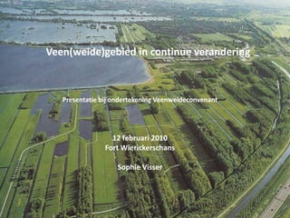
1. Veen(weide)gebied in continue verandering Presentatie bij ondertekening Veenweideconvenant 12 februari 2010 Fort Wierickerschans Sophie Visser
2. Persoonlijke achtergrond: waarom sta ik hier? Gouwe Wiericke Afstudeeronderzoek 2004-06 LandZijVeen(weide)gebied in continue verandering Veenweideconvenant 12-2-2010
3. Inhoud De landschapsontwikkeling in hoofdlijnen De Veenweidethema’s in de historie Cultuurhistorische informatie LandZijVeen(weide)gebied in continue verandering Veenweideconvenant 12-2-2010
4. De ondergrond: water, variatie en gelaagdheid 1.1 ‘Grondsoortenkaart’ Diepere ondergrond -Pleistocenezand : tot 10.000 vC (12-15 m diep) -Hollandveen : vanaf 2400 vC -zeeklei (tot Enkele Wiericke) : tot 1000 vC LandZijVeen(weide)gebied in continue verandering Veenweideconvenant 12-2-2010
5.
6. Veenriviertjes : na ontstaan veenKleiruggen(Vink, < 1940) -stevigheid: boerderijen -afglijden dijken -klei door het veen LandZijVeen(weide)gebied in continue verandering Veenweideconvenant 12-2-2010
7. Ontginningen tot ca. 1150: vanuit de rivieren 1.3 ‘De Burcht’ Bekenes Oude Bodegrave LandZijVeen(weide)gebied in continue verandering Veenweideconvenant 12-2-2010
12. 1100: grens langs Oude Bodegrave-1295/96: langs Voirburch (= Wiltenburg?): ‘Hoek van Holland’ LandZijVeen(weide)gebied in continue verandering Veenweideconvenant 12-2-2010
13. Ca. 1300: het hele gebied ontgonnen 1.6 Ontginningen 1220-1300: (1) Van randen naar midden: vorm rivier ‘op afstand’ (2) Restontginningen LandZijVeen(weide)gebied in continue verandering Veenweideconvenant 12-2-2010
14. Onregelmatigheden in het veen(weide)landschap 1.7 Waarder Oeverwal Speciale plek (archeologie) Restontginningen Oukoop LandZijVeen(weide)gebied in continue verandering Veenweideconvenant 12-2-2010
19. opsplitsing land LandZijVeen(weide)gebied in continue verandering Veenweideconvenant 12-2-2010
20. Vanaf 15e eeuw: afwatering met molens (en boezems) 1.10 Reeuwijk naar Oude Rijn - Over en door elkaars grondgebied! - Mee-/samenwerken eigen belangen LandZijVeen(weide)gebied in continue verandering Veenweideconvenant 12-2-2010
21. Het ‘dubbele’ verleden van de Enkele Wiericke OHWL 1.11 Enkele Wiericke en Prinsendijk 1679 en nu Prinsendijk => slaperdijk voor Holland => samenwerking HH’s! + Schansen in het achterland:Boskoop, Gouwesluis LandZijVeen(weide)gebied in continue verandering Veenweideconvenant 12-2-2010
37. ‘Vogelen en vissen’: toenemend met vervening! Hennepakker Kievitenvangst LandZijVeen(weide)gebied in continue verandering Veenweideconvenant 12-2-2010
38. Landbouw en ‘natuur’: bomen en bosjes open landschap? 2.2 Langs de Oude Rijn (oeverwallen): -bomen/boomgaarden van oudsher -graan: afname in 17e/18e eeuw (tenzij veepest) -kleiafgraving: meestal teveel => ‘bos’ of weidegrond => t.z.t. vooral weide Zuidzijde Oude Rijn 1762 Veengebied: -verkoopbeschrijvingen: bomen, bosjes, boomgaarden -overige beschrijvingen: “gekapt i.v.m. wegenverbreding, oorlog, etc”. -berekeningen: energie, houtbehoeften => meer hout dan verondersteld! -Open landschap: deels beeld van na gas/electriciteit, fabrieksgereedschappen, ……? LandZijVeen(weide)gebied in continue verandering Veenweideconvenant 12-2-2010
46. juiste uitgangspunten aan selectie(s)LandZijVeen(weide)gebied in continue verandering Veenweideconvenant 12-2-2010
47. Twee Cultuurhistorische (waarden) kaarten van het gebied ….. 3.1 LandZijVeen(weide)gebied in continue verandering Veenweideconvenant 12-2-2010
48. …….. of lokaal deelgebied (Oukoop) in meer detail ….. 3.2 LandZijVeen(weide)gebied in continue verandering Veenweideconvenant 12-2-2010
49. CH (waarden) kaarten op verschillend bestuurlijk schaalniveau! 3.3 Nationale KICH-kaart Jaren ‘90 (uit: RPB-rapport Het gedeelde land van de Randstad, 2005) Gem. Reeuwijk ‘Landschaps- kwaliteiten’ 2008 Provinciale CHS waardenkaart Ca. 2003 LandZijVeen(weide)gebied in continue verandering Veenweideconvenant 12-2-2010
50. Top-downbeleidskaarten 3.4 Beleidskaarten waarden op (inter)nationaal niveau waarden op provinciaal niveau” waarden op regionaal niveau Landschappelijke kwaliteiten per lokaal deelgebied LandZijVeen(weide)gebied in continue verandering Veenweideconvenant 12-2-2010
51. Top-down beleidskaarten versus bottom-up gebiedskennis! 3.5 Beleidskaarten waarden op (inter)nationaal niveau waarden op provinciaal niveau” waarden op regionaal niveau Gebiedskennis (inter)nationaal niveau provinciaal niveau” regionaal niveau - Landschappelijke kwaliteiten per lokaaldeelgebied - Lokale kennis/bewoners! LandZijVeen(weide)gebied in continue verandering Veenweideconvenant 12-2-2010
52. Conclusies -(nog)veel oude elementen en structuren, in grote delen van het gebied -veranderingen door de eeuwen heen => ‘gelaagd landschap’ -mate en soort veranderingen in ‘gelaagdheid’ uiteenlopend: -vroege bewoning (Oude Rijn) -ontginningen -waterhuishouding 14eeeuw -overgang naar veenweidegebied : in ca. 4 eeuwen -vervening en evt. droogmaking -natuur en recreatie -elke periode en plek kent eigen veranderingen, afhankelijk van -de dan aanwezige uitgangssituatie -de mogelijkheden en behoeften => keuzes! -omgang met cultuurhistorie: keuze voor gelaagdheid en variatie in tijd en ruimte - de ´hoofdlijnen´ of (ook) ’de plek´? - alleen ´officieel erfgoed´ of ook lokale geschiedenis? - alleen waarden, of ook beleving? => recreatie!’ LandZijVeen(weide)gebied in continue verandering Veenweideconvenant 12-2-2010