SlideShare uma empresa Scribd logo
1 de 28
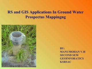
RS and GIS Applications In Ground Water
Prospectus Mappingng

BY:
MANUMOHAN V.H
SECOND SEM
GEOINFORATICS
KSRSAC
CONTENTS:
• Objective.
• Major factors controling ground water regime.
• Methodology
• Case study.
• Conclusion.
Ground Water
OBJECTIVE
•Preparing ground water prospectus mapping of study
area
•Demarcation of zones having different groundwater
potentiality is an important task in overall water
resources development, planning and management.
• The groundwater exploration approach using i remote
sensing, geological and GIS techniques.
MAJOR FACTORS CONTROLING
GROUND WATER REGIME

• Geology / Lithology
• Geological structures
• Geomorphology / Landform
• Weather conditions
• Recharge Conditions
METHODOLOGY
The study area is
situated in Mirzapur
district
of
Uttar
Pradesh.
DATA USED
The followings data were used for the study :
•Remotely sensed data, viz. IRS 1B LISS II, of
scale
1:50,000
CASE STUDY:

SATELLITE IMAGE OF STUDY AREA

IRS LISS III IMAGE
SCALE 1:50,000
TABLE – 1
GEOELECTRICAL PARAMETERS AND THEIR HYDROGEOLOGICAL SIGNIFICANCE
Resistivity Stratification

Inferred Lithology

Hydrogeological Significance

Resistivity (Ωm)

Thickness (m)

4 – 29

2 – 43

Predominantly
Clay/Clay with
Kankar

Generally lies in unsaturated
zone; very poor aquifer at
depth.

30 – 200

6 – 57

Sandstone,
weathered and / or
hard

Non-water bearing, poorly
fractured, very poor aquifer.

40 – 300

0 – 47

Sandstone, hard and
fractured

Main aquifer saturated with
potable water.

> 300

Indeterminate
(Bottom layer)

Sandstone, hard &
compact, occ.
Fractured

Bedrock, poorly fractured;
very poor aquifer.
TABLE – 2
WEIGHTAGE OF DIFFERENT PARAMETER FOR GROUNDWATER PROSPECTS
Sl.No.

Criteria

Classes

Weight

1.

Hydrogeomorphology

VF

5

BPP-M

3

BPP-S

2

DPT, P(PT) & RA

1

0 – 0.5

5

0.6 – 2.0

4

2.1 – 5.0

3

5.1 – 10.0

2

> 10.0

1

Present

2

Absent

1

Vth order ( around 500 m)

3

IVth order (around 400 m) &
IIIrd order (around 300 m )

2

IInd order (around 200 m) &
Ist order (around 100m )

1

> 25 m

3

6.0 – 25.0 m

2

< 6.0 m

1

> 35 m

5

26.0 - 35.0 m

4

16.0 – 25.0 m

3

6.0 – 15.0 m

2

< 6.0 m

1

2.

3.

4.

5.

6.

Slope (degree)

Lineament (around 200 m )

Drainage

Overburden thickness

Aquifer thickness
TABLE – 3
INTEGRATED GROUNDWATER CATEGORIES FOR GROUNDWATER PROSPECTS WITH
LOWER AND UPPER WEIGHT VALUE
(Integration of hydrogeomorphology, lineament, slope, drainage and
overburden thickness)

Sl. No.

Groundwater Category

Lower & Upper weight
Value

Area (Sq.km)

1.

Very Good

18 - 20

0.20

2.

Good to very good

15 – 17

10.8

3.

Good

13 – 14

24.1

4.

Moderate to good

11 – 12

67.9

5.

Moderate

9 -10

49.3

7.

Poor to moderate

7–8

50.5

8.

Poor

>7

45.2
TABLE - 4
INTEGRATED GROUNDWATER CATEGORIES FOR GROUNDWATER POTENTIAL WITH LOWER AND
UPPER WEIGHT VALUE
(Integration of aquifer thickness with other parameters incorporated in Table 3

Sl. No.

Groundwater Category

Lower & Upper weight
Value

Area (Sq.km)

1.

Very Good

20 – 22

3.2

2.

Good to very good

17 – 19

32.3

3.

Good

15 – 16

38.0

4.

Moderate to good

13 – 14

26.1

5.

Moderate

11 – 12

34.1

6.

Poor to moderate

9 – 10

43.1

7.

Poor

>9

71.2
TABLE - 5
Model Evaluation and Results

The validity of the m
odel
developed was checked against
the bore well y
ield data which
reflects the actual groundwater
potential.
Groundwater
potential
zones
prepared
through this m
odel are in good
agreem with y
ent
ield data. Y
ield
of drilled sites covered in this
m
odel have ranges from 793 to
1160 lpm in good to very good
zone, 300 to 1160 lpm in good
zone, 100 to 300 lpm in
m
oderate to good zone, 50 to
100 lpmin m
oderate zone, 25 to
50 lpm in poor to m
oderate
zone and less than 25 lpm in
poor zone.

VALIDATION OF MODEL WITH ACTUAL BOREWELL YIELD DATA
Sl. No.

Category of
Groundwater
prospect

Category of
Groundwater
potential

Site
location
No.

Village

Actual
yield
(in lpm)

1.

Moderate to Good

Good to V. Good

5

Amoi

793

2.

Good

Good to V. Good

17

Sirsigaharwar

1160

3.

Moderate to Good

Good to V. Good

21

Vindhyachal

1160

4.

Moderate to Good

Good to V. Good

22

Ghamahapur

1160

5.

Moderate to Good

Good to V. Good

23

Ghamahapur

1160

6.

Good

Good to V. Good

25

Amoi

1160

7.

Moderate

Good

8

Bhawanaipur

1008

8.

Poor to Moderate

Good

11

Vindhyachal

1160

9.

Poor to Moderate

Good

20

Tulsitalia

793

10.

Poor to Moderate

Good

24

Tulsitalia

793

11.

Good

Good

27

Sirsigaharwar

315

12.

Moderate

Good

46

Bhawanipur

1160

13.

Moderate to Good

Good

58

Sirsigaharwar

505

14.

Moderate to Good

Moderate to Good

38

Hinauti

100

15.

Moderate to Good

Moderate to Good

40

Hinauti Sarupur

130

16.

Poor to Moderate

Moderate

34

Sirsigaharwar

80

17.

Moderate

Poor to Moderate

28

Sirsigaharwar

25

18.

Poor

Poor

47

Amrawati

24
CONCLUSION
In order to delineate the groundwater potential zones, in general,
different thematic layers viz: hydrogeomorphology, lineaments, slope,
drainage .
The groundwater potential zone map generated through this model
was verified with the yield data to ascertain the validity of the model
developed and found that it is in agreement with the bore wells yield data.
The present study has demonstrated the capabilities of using remote
sensing, geophysical data and Geographical Information System for
demarcation of different ground water potential zones.
Gnd water

Mais conteúdo relacionado

Mais procurados

Using GIS for Water Resources Management – Selected U.S. and International Ap...
Using GIS for Water Resources Management – Selected U.S. and International Ap...Using GIS for Water Resources Management – Selected U.S. and International Ap...
Using GIS for Water Resources Management – Selected U.S. and International Ap...Michael Baker Jr., Inc.
 
Flood risk mapping using GIS and remote sensing
Flood risk mapping using GIS and remote sensingFlood risk mapping using GIS and remote sensing
Flood risk mapping using GIS and remote sensingRohan Tuteja
 
GIS application in Natural Resource Management
GIS application in Natural Resource ManagementGIS application in Natural Resource Management
GIS application in Natural Resource ManagementAchal Gupta
 
IDENTIFICATION OF GROUNDWATER POTENTIAL ZONES USING REMOTE SENSING AND GEOGRA...
IDENTIFICATION OF GROUNDWATER POTENTIAL ZONES USING REMOTE SENSING AND GEOGRA...IDENTIFICATION OF GROUNDWATER POTENTIAL ZONES USING REMOTE SENSING AND GEOGRA...
IDENTIFICATION OF GROUNDWATER POTENTIAL ZONES USING REMOTE SENSING AND GEOGRA...IAEME Publication
 
Wasteland assessment using remotesensing and gis
Wasteland assessment using remotesensing and gisWasteland assessment using remotesensing and gis
Wasteland assessment using remotesensing and gisaakvd
 
Identification of Groundwater Potential Zones in Vaippar Basin, Tamil Nadu, I...
Identification of Groundwater Potential Zones in Vaippar Basin, Tamil Nadu, I...Identification of Groundwater Potential Zones in Vaippar Basin, Tamil Nadu, I...
Identification of Groundwater Potential Zones in Vaippar Basin, Tamil Nadu, I...SagarChougule11
 
Applications of gis in irrigation
Applications of gis in irrigationApplications of gis in irrigation
Applications of gis in irrigationvenkateshreddypala
 
Site Suitability For Construction(Dam)
Site Suitability For Construction(Dam)Site Suitability For Construction(Dam)
Site Suitability For Construction(Dam)Luv Singh
 
Assessment of Ground Water Potential Zones by GIS – Perundurai Taluk
Assessment of Ground Water  Potential Zones  by GIS – Perundurai TalukAssessment of Ground Water  Potential Zones  by GIS – Perundurai Taluk
Assessment of Ground Water Potential Zones by GIS – Perundurai TalukIRJET Journal
 
IUKWC Workshop Nov16: Developing Hydro-climatic Services for Water Security –...
IUKWC Workshop Nov16: Developing Hydro-climatic Services for Water Security –...IUKWC Workshop Nov16: Developing Hydro-climatic Services for Water Security –...
IUKWC Workshop Nov16: Developing Hydro-climatic Services for Water Security –...India UK Water Centre (IUKWC)
 
Mulla - Precision Conservation
Mulla - Precision ConservationMulla - Precision Conservation
Mulla - Precision ConservationJose A. Hernandez
 
Assesment of groundwater_potential_zones_for_bruhat_bangalore_mahanagara_pali...
Assesment of groundwater_potential_zones_for_bruhat_bangalore_mahanagara_pali...Assesment of groundwater_potential_zones_for_bruhat_bangalore_mahanagara_pali...
Assesment of groundwater_potential_zones_for_bruhat_bangalore_mahanagara_pali...Mohammed Badiuddin Parvez
 
Physically Based Runoff and Sediment Modelling of Rawal Watershed
Physically Based Runoff and Sediment Modelling of Rawal WatershedPhysically Based Runoff and Sediment Modelling of Rawal Watershed
Physically Based Runoff and Sediment Modelling of Rawal WatershedIRJET Journal
 
Demarcation of ground water potential zones using remote sensing &amp; gis
Demarcation of ground water potential zones using remote sensing &amp; gisDemarcation of ground water potential zones using remote sensing &amp; gis
Demarcation of ground water potential zones using remote sensing &amp; gisDebabrata Nandi
 
2. VULNERABILITY ASSESSMENT OF SOIL EROSION USING GEOSPATIAL TECHNIQUES
2. VULNERABILITY ASSESSMENT OF SOIL EROSION USING GEOSPATIAL TECHNIQUES2. VULNERABILITY ASSESSMENT OF SOIL EROSION USING GEOSPATIAL TECHNIQUES
2. VULNERABILITY ASSESSMENT OF SOIL EROSION USING GEOSPATIAL TECHNIQUESDr. Ravinder Jangra
 

Mais procurados (20)

Using GIS for Water Resources Management – Selected U.S. and International Ap...
Using GIS for Water Resources Management – Selected U.S. and International Ap...Using GIS for Water Resources Management – Selected U.S. and International Ap...
Using GIS for Water Resources Management – Selected U.S. and International Ap...
 
Flood risk mapping using GIS and remote sensing
Flood risk mapping using GIS and remote sensingFlood risk mapping using GIS and remote sensing
Flood risk mapping using GIS and remote sensing
 
GIS application in Natural Resource Management
GIS application in Natural Resource ManagementGIS application in Natural Resource Management
GIS application in Natural Resource Management
 
IDENTIFICATION OF GROUNDWATER POTENTIAL ZONES USING REMOTE SENSING AND GEOGRA...
IDENTIFICATION OF GROUNDWATER POTENTIAL ZONES USING REMOTE SENSING AND GEOGRA...IDENTIFICATION OF GROUNDWATER POTENTIAL ZONES USING REMOTE SENSING AND GEOGRA...
IDENTIFICATION OF GROUNDWATER POTENTIAL ZONES USING REMOTE SENSING AND GEOGRA...
 
Wasteland assessment using remotesensing and gis
Wasteland assessment using remotesensing and gisWasteland assessment using remotesensing and gis
Wasteland assessment using remotesensing and gis
 
RS & GIS applications to manage irrigated agriculture
RS & GIS applications to manage irrigated agricultureRS & GIS applications to manage irrigated agriculture
RS & GIS applications to manage irrigated agriculture
 
Identification of Groundwater Potential Zones in Vaippar Basin, Tamil Nadu, I...
Identification of Groundwater Potential Zones in Vaippar Basin, Tamil Nadu, I...Identification of Groundwater Potential Zones in Vaippar Basin, Tamil Nadu, I...
Identification of Groundwater Potential Zones in Vaippar Basin, Tamil Nadu, I...
 
Applications of gis in irrigation
Applications of gis in irrigationApplications of gis in irrigation
Applications of gis in irrigation
 
Site Suitability For Construction(Dam)
Site Suitability For Construction(Dam)Site Suitability For Construction(Dam)
Site Suitability For Construction(Dam)
 
Evaluating soil erosion using gis
Evaluating soil erosion using gisEvaluating soil erosion using gis
Evaluating soil erosion using gis
 
Landscape agro-hydrological modeling: opportunities from remote sensing
Landscape agro-hydrological modeling: opportunities from remote sensingLandscape agro-hydrological modeling: opportunities from remote sensing
Landscape agro-hydrological modeling: opportunities from remote sensing
 
Assessment of Ground Water Potential Zones by GIS – Perundurai Taluk
Assessment of Ground Water  Potential Zones  by GIS – Perundurai TalukAssessment of Ground Water  Potential Zones  by GIS – Perundurai Taluk
Assessment of Ground Water Potential Zones by GIS – Perundurai Taluk
 
IUKWC Workshop Nov16: Developing Hydro-climatic Services for Water Security –...
IUKWC Workshop Nov16: Developing Hydro-climatic Services for Water Security –...IUKWC Workshop Nov16: Developing Hydro-climatic Services for Water Security –...
IUKWC Workshop Nov16: Developing Hydro-climatic Services for Water Security –...
 
Mulla - Precision Conservation
Mulla - Precision ConservationMulla - Precision Conservation
Mulla - Precision Conservation
 
Assesment of groundwater_potential_zones_for_bruhat_bangalore_mahanagara_pali...
Assesment of groundwater_potential_zones_for_bruhat_bangalore_mahanagara_pali...Assesment of groundwater_potential_zones_for_bruhat_bangalore_mahanagara_pali...
Assesment of groundwater_potential_zones_for_bruhat_bangalore_mahanagara_pali...
 
Physically Based Runoff and Sediment Modelling of Rawal Watershed
Physically Based Runoff and Sediment Modelling of Rawal WatershedPhysically Based Runoff and Sediment Modelling of Rawal Watershed
Physically Based Runoff and Sediment Modelling of Rawal Watershed
 
Wetland mapping
Wetland mappingWetland mapping
Wetland mapping
 
Demarcation of ground water potential zones using remote sensing &amp; gis
Demarcation of ground water potential zones using remote sensing &amp; gisDemarcation of ground water potential zones using remote sensing &amp; gis
Demarcation of ground water potential zones using remote sensing &amp; gis
 
Intrinsic vulnerability
Intrinsic vulnerabilityIntrinsic vulnerability
Intrinsic vulnerability
 
2. VULNERABILITY ASSESSMENT OF SOIL EROSION USING GEOSPATIAL TECHNIQUES
2. VULNERABILITY ASSESSMENT OF SOIL EROSION USING GEOSPATIAL TECHNIQUES2. VULNERABILITY ASSESSMENT OF SOIL EROSION USING GEOSPATIAL TECHNIQUES
2. VULNERABILITY ASSESSMENT OF SOIL EROSION USING GEOSPATIAL TECHNIQUES
 

Destaque

Application of RS and GIS in Groundwater Prospects Zonation
Application of RS and GIS in Groundwater Prospects ZonationApplication of RS and GIS in Groundwater Prospects Zonation
Application of RS and GIS in Groundwater Prospects ZonationVishwanath Awati
 
Btp presentation
Btp presentationBtp presentation
Btp presentationRohan Jain
 
JHydro - an implementation of the digital watershed
JHydro - an implementation of the digital watershedJHydro - an implementation of the digital watershed
JHydro - an implementation of the digital watershedsilli
 
Impacts of landuse change on sediment transport in the yali reservoir catchment
Impacts of landuse change on sediment transport in the yali reservoir catchmentImpacts of landuse change on sediment transport in the yali reservoir catchment
Impacts of landuse change on sediment transport in the yali reservoir catchmentCPWF Mekong
 
Thesis Presentation
Thesis PresentationThesis Presentation
Thesis Presentationgawump
 
Climate Smart Landscape-Based Integrated Watershed Management: Experiences fr...
Climate Smart Landscape-Based Integrated Watershed Management: Experiences fr...Climate Smart Landscape-Based Integrated Watershed Management: Experiences fr...
Climate Smart Landscape-Based Integrated Watershed Management: Experiences fr...CIFOR-ICRAF
 
Presentation on Aerosols, cloud properties
Presentation on Aerosols, cloud properties Presentation on Aerosols, cloud properties
Presentation on Aerosols, cloud properties Esayas Meresa
 
Mapping of ground water quality using geographical information system
Mapping of ground water quality using geographical information systemMapping of ground water quality using geographical information system
Mapping of ground water quality using geographical information systemAmul Patwal
 
Analysis of runoff for vishwamitri river watershed using scs cn method and ge...
Analysis of runoff for vishwamitri river watershed using scs cn method and ge...Analysis of runoff for vishwamitri river watershed using scs cn method and ge...
Analysis of runoff for vishwamitri river watershed using scs cn method and ge...vishvam Pancholi
 
Presentation on remote sensing &amp; gis and watershed copy
Presentation on remote sensing &amp; gis and watershed   copyPresentation on remote sensing &amp; gis and watershed   copy
Presentation on remote sensing &amp; gis and watershed copydivya sahgal
 
Estimation of Groundwater Potential
Estimation of Groundwater PotentialEstimation of Groundwater Potential
Estimation of Groundwater PotentialC. P. Kumar
 
Iirs overview -Remote sensing and GIS application in Water Resources Management
Iirs overview -Remote sensing and GIS application in Water Resources ManagementIirs overview -Remote sensing and GIS application in Water Resources Management
Iirs overview -Remote sensing and GIS application in Water Resources ManagementTushar Dholakia
 
Application of gis and remote sensing in agriculture
Application of gis and remote sensing in agricultureApplication of gis and remote sensing in agriculture
Application of gis and remote sensing in agricultureRehana Qureshi
 
Application of Remote Sensing in Agriculture
Application of Remote Sensing in AgricultureApplication of Remote Sensing in Agriculture
Application of Remote Sensing in AgricultureUTTAM KUMAR
 
Introduction to remote sensing and gis
Introduction to remote sensing and gisIntroduction to remote sensing and gis
Introduction to remote sensing and gisMohsin Siddique
 

Destaque (20)

Application of RS and GIS in Groundwater Prospects Zonation
Application of RS and GIS in Groundwater Prospects ZonationApplication of RS and GIS in Groundwater Prospects Zonation
Application of RS and GIS in Groundwater Prospects Zonation
 
Dcjhariya india
Dcjhariya indiaDcjhariya india
Dcjhariya india
 
Jaysukh C Songara
Jaysukh C SongaraJaysukh C Songara
Jaysukh C Songara
 
Spatial Earth Profile2
Spatial Earth Profile2Spatial Earth Profile2
Spatial Earth Profile2
 
Btp presentation
Btp presentationBtp presentation
Btp presentation
 
JHydro - an implementation of the digital watershed
JHydro - an implementation of the digital watershedJHydro - an implementation of the digital watershed
JHydro - an implementation of the digital watershed
 
Impacts of landuse change on sediment transport in the yali reservoir catchment
Impacts of landuse change on sediment transport in the yali reservoir catchmentImpacts of landuse change on sediment transport in the yali reservoir catchment
Impacts of landuse change on sediment transport in the yali reservoir catchment
 
Thesis Presentation
Thesis PresentationThesis Presentation
Thesis Presentation
 
Climate Smart Landscape-Based Integrated Watershed Management: Experiences fr...
Climate Smart Landscape-Based Integrated Watershed Management: Experiences fr...Climate Smart Landscape-Based Integrated Watershed Management: Experiences fr...
Climate Smart Landscape-Based Integrated Watershed Management: Experiences fr...
 
Intergrated Water Resourcses system
Intergrated Water Resourcses systemIntergrated Water Resourcses system
Intergrated Water Resourcses system
 
Presentation on Aerosols, cloud properties
Presentation on Aerosols, cloud properties Presentation on Aerosols, cloud properties
Presentation on Aerosols, cloud properties
 
Mapping of ground water quality using geographical information system
Mapping of ground water quality using geographical information systemMapping of ground water quality using geographical information system
Mapping of ground water quality using geographical information system
 
Analysis of runoff for vishwamitri river watershed using scs cn method and ge...
Analysis of runoff for vishwamitri river watershed using scs cn method and ge...Analysis of runoff for vishwamitri river watershed using scs cn method and ge...
Analysis of runoff for vishwamitri river watershed using scs cn method and ge...
 
Presentation on remote sensing &amp; gis and watershed copy
Presentation on remote sensing &amp; gis and watershed   copyPresentation on remote sensing &amp; gis and watershed   copy
Presentation on remote sensing &amp; gis and watershed copy
 
Ground Water (Unit-V)
Ground Water (Unit-V)Ground Water (Unit-V)
Ground Water (Unit-V)
 
Estimation of Groundwater Potential
Estimation of Groundwater PotentialEstimation of Groundwater Potential
Estimation of Groundwater Potential
 
Iirs overview -Remote sensing and GIS application in Water Resources Management
Iirs overview -Remote sensing and GIS application in Water Resources ManagementIirs overview -Remote sensing and GIS application in Water Resources Management
Iirs overview -Remote sensing and GIS application in Water Resources Management
 
Application of gis and remote sensing in agriculture
Application of gis and remote sensing in agricultureApplication of gis and remote sensing in agriculture
Application of gis and remote sensing in agriculture
 
Application of Remote Sensing in Agriculture
Application of Remote Sensing in AgricultureApplication of Remote Sensing in Agriculture
Application of Remote Sensing in Agriculture
 
Introduction to remote sensing and gis
Introduction to remote sensing and gisIntroduction to remote sensing and gis
Introduction to remote sensing and gis
 

Semelhante a Gnd water

Soil mapping of Mongolia by Ochirbat Batkhishig and Sodnomdarjaa Iderjavhklhan
Soil mapping of Mongolia by Ochirbat Batkhishig and Sodnomdarjaa IderjavhklhanSoil mapping of Mongolia by Ochirbat Batkhishig and Sodnomdarjaa Iderjavhklhan
Soil mapping of Mongolia by Ochirbat Batkhishig and Sodnomdarjaa IderjavhklhanFAO
 
Digital soil mapping
Digital soil mappingDigital soil mapping
Digital soil mappingCIAT
 
How to Interpret Hydraulic Conductivity Data
How to Interpret Hydraulic Conductivity DataHow to Interpret Hydraulic Conductivity Data
How to Interpret Hydraulic Conductivity DataMETER Group, Inc. USA
 
Geohydrological study of weathered basement aquifers in Oban Massif and envir...
Geohydrological study of weathered basement aquifers in Oban Massif and envir...Geohydrological study of weathered basement aquifers in Oban Massif and envir...
Geohydrological study of weathered basement aquifers in Oban Massif and envir...iosrjce
 
Modelling Water & Salinity in the Kulin Catchment
Modelling Water & Salinity in the Kulin CatchmentModelling Water & Salinity in the Kulin Catchment
Modelling Water & Salinity in the Kulin CatchmentGraeme Cox
 
REMOTE SENSING IN GROUNDWATER.pptx
REMOTE SENSING IN GROUNDWATER.pptxREMOTE SENSING IN GROUNDWATER.pptx
REMOTE SENSING IN GROUNDWATER.pptxImposter7
 
Rums floating Omkareshwar FSPV IM_16112021.pdf
Rums floating Omkareshwar FSPV IM_16112021.pdfRums floating Omkareshwar FSPV IM_16112021.pdf
Rums floating Omkareshwar FSPV IM_16112021.pdfsmsksolar
 
Surface and subsurface investigations for groundwater
Surface and subsurface investigations for groundwaterSurface and subsurface investigations for groundwater
Surface and subsurface investigations for groundwaterPrabinBimali
 
Bhadhla report geotechnical layout contour survey
Bhadhla report geotechnical layout contour surveyBhadhla report geotechnical layout contour survey
Bhadhla report geotechnical layout contour surveySanman Rajput
 
IUKWC Workshop Nov16: Developing Hydro-climatic Services for Water Security –...
IUKWC Workshop Nov16: Developing Hydro-climatic Services for Water Security –...IUKWC Workshop Nov16: Developing Hydro-climatic Services for Water Security –...
IUKWC Workshop Nov16: Developing Hydro-climatic Services for Water Security –...India UK Water Centre (IUKWC)
 
Watershed management: Role of Geospatial Technology
Watershed management: Role of Geospatial TechnologyWatershed management: Role of Geospatial Technology
Watershed management: Role of Geospatial Technologyamritpaldigra30
 
Dam Break Study-Hunza River by NESPAK
Dam Break Study-Hunza River by NESPAKDam Break Study-Hunza River by NESPAK
Dam Break Study-Hunza River by NESPAKAdil Latif
 
Watershed charecteristics
Watershed charecteristicsWatershed charecteristics
Watershed charecteristicsVipin Mishra
 
EIA REPORT :Renuka dam project
EIA REPORT :Renuka dam project  EIA REPORT :Renuka dam project
EIA REPORT :Renuka dam project Saurabh Gupta
 

Semelhante a Gnd water (20)

16 Aug-2013 - Ary van der Lely - A stratigraphic model of the MIA
16 Aug-2013 - Ary van der Lely - A stratigraphic model of the MIA16 Aug-2013 - Ary van der Lely - A stratigraphic model of the MIA
16 Aug-2013 - Ary van der Lely - A stratigraphic model of the MIA
 
Soil mapping of Mongolia by Ochirbat Batkhishig and Sodnomdarjaa Iderjavhklhan
Soil mapping of Mongolia by Ochirbat Batkhishig and Sodnomdarjaa IderjavhklhanSoil mapping of Mongolia by Ochirbat Batkhishig and Sodnomdarjaa Iderjavhklhan
Soil mapping of Mongolia by Ochirbat Batkhishig and Sodnomdarjaa Iderjavhklhan
 
Digital soil mapping
Digital soil mappingDigital soil mapping
Digital soil mapping
 
How to Interpret Hydraulic Conductivity Data
How to Interpret Hydraulic Conductivity DataHow to Interpret Hydraulic Conductivity Data
How to Interpret Hydraulic Conductivity Data
 
Geohydrological study of weathered basement aquifers in Oban Massif and envir...
Geohydrological study of weathered basement aquifers in Oban Massif and envir...Geohydrological study of weathered basement aquifers in Oban Massif and envir...
Geohydrological study of weathered basement aquifers in Oban Massif and envir...
 
Modelling Water & Salinity in the Kulin Catchment
Modelling Water & Salinity in the Kulin CatchmentModelling Water & Salinity in the Kulin Catchment
Modelling Water & Salinity in the Kulin Catchment
 
REMOTE SENSING IN GROUNDWATER.pptx
REMOTE SENSING IN GROUNDWATER.pptxREMOTE SENSING IN GROUNDWATER.pptx
REMOTE SENSING IN GROUNDWATER.pptx
 
Groundwater Salinity and Zoning in the Southwestern Coastal Region of Bangladesh
Groundwater Salinity and Zoning in the Southwestern Coastal Region of BangladeshGroundwater Salinity and Zoning in the Southwestern Coastal Region of Bangladesh
Groundwater Salinity and Zoning in the Southwestern Coastal Region of Bangladesh
 
July 31-930-Stephen Anderson
July 31-930-Stephen AndersonJuly 31-930-Stephen Anderson
July 31-930-Stephen Anderson
 
Rums floating Omkareshwar FSPV IM_16112021.pdf
Rums floating Omkareshwar FSPV IM_16112021.pdfRums floating Omkareshwar FSPV IM_16112021.pdf
Rums floating Omkareshwar FSPV IM_16112021.pdf
 
Surface and subsurface investigations for groundwater
Surface and subsurface investigations for groundwaterSurface and subsurface investigations for groundwater
Surface and subsurface investigations for groundwater
 
Brochure_PIEDRA_EN
Brochure_PIEDRA_ENBrochure_PIEDRA_EN
Brochure_PIEDRA_EN
 
Bhadhla report geotechnical layout contour survey
Bhadhla report geotechnical layout contour surveyBhadhla report geotechnical layout contour survey
Bhadhla report geotechnical layout contour survey
 
IUKWC Workshop Nov16: Developing Hydro-climatic Services for Water Security –...
IUKWC Workshop Nov16: Developing Hydro-climatic Services for Water Security –...IUKWC Workshop Nov16: Developing Hydro-climatic Services for Water Security –...
IUKWC Workshop Nov16: Developing Hydro-climatic Services for Water Security –...
 
geopintro
geopintrogeopintro
geopintro
 
Watershed management: Role of Geospatial Technology
Watershed management: Role of Geospatial TechnologyWatershed management: Role of Geospatial Technology
Watershed management: Role of Geospatial Technology
 
Dam Break Study-Hunza River by NESPAK
Dam Break Study-Hunza River by NESPAKDam Break Study-Hunza River by NESPAK
Dam Break Study-Hunza River by NESPAK
 
Watershed charecteristics
Watershed charecteristicsWatershed charecteristics
Watershed charecteristics
 
EIA REPORT :Renuka dam project
EIA REPORT :Renuka dam project  EIA REPORT :Renuka dam project
EIA REPORT :Renuka dam project
 
NEC_presentation
NEC_presentationNEC_presentation
NEC_presentation
 

Último

AWS Community Day CPH - Three problems of Terraform
AWS Community Day CPH - Three problems of TerraformAWS Community Day CPH - Three problems of Terraform
AWS Community Day CPH - Three problems of TerraformAndrey Devyatkin
 
Axa Assurance Maroc - Insurer Innovation Award 2024
Axa Assurance Maroc - Insurer Innovation Award 2024Axa Assurance Maroc - Insurer Innovation Award 2024
Axa Assurance Maroc - Insurer Innovation Award 2024The Digital Insurer
 
"I see eyes in my soup": How Delivery Hero implemented the safety system for ...
"I see eyes in my soup": How Delivery Hero implemented the safety system for ..."I see eyes in my soup": How Delivery Hero implemented the safety system for ...
"I see eyes in my soup": How Delivery Hero implemented the safety system for ...Zilliz
 
TrustArc Webinar - Stay Ahead of US State Data Privacy Law Developments
TrustArc Webinar - Stay Ahead of US State Data Privacy Law DevelopmentsTrustArc Webinar - Stay Ahead of US State Data Privacy Law Developments
TrustArc Webinar - Stay Ahead of US State Data Privacy Law DevelopmentsTrustArc
 
Powerful Google developer tools for immediate impact! (2023-24 C)
Powerful Google developer tools for immediate impact! (2023-24 C)Powerful Google developer tools for immediate impact! (2023-24 C)
Powerful Google developer tools for immediate impact! (2023-24 C)wesley chun
 
Apidays New York 2024 - Scaling API-first by Ian Reasor and Radu Cotescu, Adobe
Apidays New York 2024 - Scaling API-first by Ian Reasor and Radu Cotescu, AdobeApidays New York 2024 - Scaling API-first by Ian Reasor and Radu Cotescu, Adobe
Apidays New York 2024 - Scaling API-first by Ian Reasor and Radu Cotescu, Adobeapidays
 
Boost Fertility New Invention Ups Success Rates.pdf
Boost Fertility New Invention Ups Success Rates.pdfBoost Fertility New Invention Ups Success Rates.pdf
Boost Fertility New Invention Ups Success Rates.pdfsudhanshuwaghmare1
 
ICT role in 21st century education and its challenges
ICT role in 21st century education and its challengesICT role in 21st century education and its challenges
ICT role in 21st century education and its challengesrafiqahmad00786416
 
Apidays New York 2024 - Accelerating FinTech Innovation by Vasa Krishnan, Fin...
Apidays New York 2024 - Accelerating FinTech Innovation by Vasa Krishnan, Fin...Apidays New York 2024 - Accelerating FinTech Innovation by Vasa Krishnan, Fin...
Apidays New York 2024 - Accelerating FinTech Innovation by Vasa Krishnan, Fin...apidays
 
Ransomware_Q4_2023. The report. [EN].pdf
Ransomware_Q4_2023. The report. [EN].pdfRansomware_Q4_2023. The report. [EN].pdf
Ransomware_Q4_2023. The report. [EN].pdfOverkill Security
 
Emergent Methods: Multi-lingual narrative tracking in the news - real-time ex...
Emergent Methods: Multi-lingual narrative tracking in the news - real-time ex...Emergent Methods: Multi-lingual narrative tracking in the news - real-time ex...
Emergent Methods: Multi-lingual narrative tracking in the news - real-time ex...Zilliz
 
Repurposing LNG terminals for Hydrogen Ammonia: Feasibility and Cost Saving
Repurposing LNG terminals for Hydrogen Ammonia: Feasibility and Cost SavingRepurposing LNG terminals for Hydrogen Ammonia: Feasibility and Cost Saving
Repurposing LNG terminals for Hydrogen Ammonia: Feasibility and Cost SavingEdi Saputra
 
Navi Mumbai Call Girls 🥰 8617370543 Service Offer VIP Hot Model
Navi Mumbai Call Girls 🥰 8617370543 Service Offer VIP Hot ModelNavi Mumbai Call Girls 🥰 8617370543 Service Offer VIP Hot Model
Navi Mumbai Call Girls 🥰 8617370543 Service Offer VIP Hot ModelDeepika Singh
 
Apidays Singapore 2024 - Building Digital Trust in a Digital Economy by Veron...
Apidays Singapore 2024 - Building Digital Trust in a Digital Economy by Veron...Apidays Singapore 2024 - Building Digital Trust in a Digital Economy by Veron...
Apidays Singapore 2024 - Building Digital Trust in a Digital Economy by Veron...apidays
 
FWD Group - Insurer Innovation Award 2024
FWD Group - Insurer Innovation Award 2024FWD Group - Insurer Innovation Award 2024
FWD Group - Insurer Innovation Award 2024The Digital Insurer
 
MS Copilot expands with MS Graph connectors
MS Copilot expands with MS Graph connectorsMS Copilot expands with MS Graph connectors
MS Copilot expands with MS Graph connectorsNanddeep Nachan
 
Automating Google Workspace (GWS) & more with Apps Script
Automating Google Workspace (GWS) & more with Apps ScriptAutomating Google Workspace (GWS) & more with Apps Script
Automating Google Workspace (GWS) & more with Apps Scriptwesley chun
 
Connector Corner: Accelerate revenue generation using UiPath API-centric busi...
Connector Corner: Accelerate revenue generation using UiPath API-centric busi...Connector Corner: Accelerate revenue generation using UiPath API-centric busi...
Connector Corner: Accelerate revenue generation using UiPath API-centric busi...DianaGray10
 
Data Cloud, More than a CDP by Matt Robison
Data Cloud, More than a CDP by Matt RobisonData Cloud, More than a CDP by Matt Robison
Data Cloud, More than a CDP by Matt RobisonAnna Loughnan Colquhoun
 
Real Time Object Detection Using Open CV
Real Time Object Detection Using Open CVReal Time Object Detection Using Open CV
Real Time Object Detection Using Open CVKhem
 

Último (20)

AWS Community Day CPH - Three problems of Terraform
AWS Community Day CPH - Three problems of TerraformAWS Community Day CPH - Three problems of Terraform
AWS Community Day CPH - Three problems of Terraform
 
Axa Assurance Maroc - Insurer Innovation Award 2024
Axa Assurance Maroc - Insurer Innovation Award 2024Axa Assurance Maroc - Insurer Innovation Award 2024
Axa Assurance Maroc - Insurer Innovation Award 2024
 
"I see eyes in my soup": How Delivery Hero implemented the safety system for ...
"I see eyes in my soup": How Delivery Hero implemented the safety system for ..."I see eyes in my soup": How Delivery Hero implemented the safety system for ...
"I see eyes in my soup": How Delivery Hero implemented the safety system for ...
 
TrustArc Webinar - Stay Ahead of US State Data Privacy Law Developments
TrustArc Webinar - Stay Ahead of US State Data Privacy Law DevelopmentsTrustArc Webinar - Stay Ahead of US State Data Privacy Law Developments
TrustArc Webinar - Stay Ahead of US State Data Privacy Law Developments
 
Powerful Google developer tools for immediate impact! (2023-24 C)
Powerful Google developer tools for immediate impact! (2023-24 C)Powerful Google developer tools for immediate impact! (2023-24 C)
Powerful Google developer tools for immediate impact! (2023-24 C)
 
Apidays New York 2024 - Scaling API-first by Ian Reasor and Radu Cotescu, Adobe
Apidays New York 2024 - Scaling API-first by Ian Reasor and Radu Cotescu, AdobeApidays New York 2024 - Scaling API-first by Ian Reasor and Radu Cotescu, Adobe
Apidays New York 2024 - Scaling API-first by Ian Reasor and Radu Cotescu, Adobe
 
Boost Fertility New Invention Ups Success Rates.pdf
Boost Fertility New Invention Ups Success Rates.pdfBoost Fertility New Invention Ups Success Rates.pdf
Boost Fertility New Invention Ups Success Rates.pdf
 
ICT role in 21st century education and its challenges
ICT role in 21st century education and its challengesICT role in 21st century education and its challenges
ICT role in 21st century education and its challenges
 
Apidays New York 2024 - Accelerating FinTech Innovation by Vasa Krishnan, Fin...
Apidays New York 2024 - Accelerating FinTech Innovation by Vasa Krishnan, Fin...Apidays New York 2024 - Accelerating FinTech Innovation by Vasa Krishnan, Fin...
Apidays New York 2024 - Accelerating FinTech Innovation by Vasa Krishnan, Fin...
 
Ransomware_Q4_2023. The report. [EN].pdf
Ransomware_Q4_2023. The report. [EN].pdfRansomware_Q4_2023. The report. [EN].pdf
Ransomware_Q4_2023. The report. [EN].pdf
 
Emergent Methods: Multi-lingual narrative tracking in the news - real-time ex...
Emergent Methods: Multi-lingual narrative tracking in the news - real-time ex...Emergent Methods: Multi-lingual narrative tracking in the news - real-time ex...
Emergent Methods: Multi-lingual narrative tracking in the news - real-time ex...
 
Repurposing LNG terminals for Hydrogen Ammonia: Feasibility and Cost Saving
Repurposing LNG terminals for Hydrogen Ammonia: Feasibility and Cost SavingRepurposing LNG terminals for Hydrogen Ammonia: Feasibility and Cost Saving
Repurposing LNG terminals for Hydrogen Ammonia: Feasibility and Cost Saving
 
Navi Mumbai Call Girls 🥰 8617370543 Service Offer VIP Hot Model
Navi Mumbai Call Girls 🥰 8617370543 Service Offer VIP Hot ModelNavi Mumbai Call Girls 🥰 8617370543 Service Offer VIP Hot Model
Navi Mumbai Call Girls 🥰 8617370543 Service Offer VIP Hot Model
 
Apidays Singapore 2024 - Building Digital Trust in a Digital Economy by Veron...
Apidays Singapore 2024 - Building Digital Trust in a Digital Economy by Veron...Apidays Singapore 2024 - Building Digital Trust in a Digital Economy by Veron...
Apidays Singapore 2024 - Building Digital Trust in a Digital Economy by Veron...
 
FWD Group - Insurer Innovation Award 2024
FWD Group - Insurer Innovation Award 2024FWD Group - Insurer Innovation Award 2024
FWD Group - Insurer Innovation Award 2024
 
MS Copilot expands with MS Graph connectors
MS Copilot expands with MS Graph connectorsMS Copilot expands with MS Graph connectors
MS Copilot expands with MS Graph connectors
 
Automating Google Workspace (GWS) & more with Apps Script
Automating Google Workspace (GWS) & more with Apps ScriptAutomating Google Workspace (GWS) & more with Apps Script
Automating Google Workspace (GWS) & more with Apps Script
 
Connector Corner: Accelerate revenue generation using UiPath API-centric busi...
Connector Corner: Accelerate revenue generation using UiPath API-centric busi...Connector Corner: Accelerate revenue generation using UiPath API-centric busi...
Connector Corner: Accelerate revenue generation using UiPath API-centric busi...
 
Data Cloud, More than a CDP by Matt Robison
Data Cloud, More than a CDP by Matt RobisonData Cloud, More than a CDP by Matt Robison
Data Cloud, More than a CDP by Matt Robison
 
Real Time Object Detection Using Open CV
Real Time Object Detection Using Open CVReal Time Object Detection Using Open CV
Real Time Object Detection Using Open CV
 

Gnd water

  • 1. RS and GIS Applications In Ground Water Prospectus Mappingng BY: MANUMOHAN V.H SECOND SEM GEOINFORATICS KSRSAC
  • 2. CONTENTS: • Objective. • Major factors controling ground water regime. • Methodology • Case study. • Conclusion.
  • 4. OBJECTIVE •Preparing ground water prospectus mapping of study area •Demarcation of zones having different groundwater potentiality is an important task in overall water resources development, planning and management. • The groundwater exploration approach using i remote sensing, geological and GIS techniques.
  • 5. MAJOR FACTORS CONTROLING GROUND WATER REGIME • Geology / Lithology • Geological structures • Geomorphology / Landform • Weather conditions • Recharge Conditions
  • 7. The study area is situated in Mirzapur district of Uttar Pradesh.
  • 8. DATA USED The followings data were used for the study : •Remotely sensed data, viz. IRS 1B LISS II, of scale 1:50,000
  • 9. CASE STUDY: SATELLITE IMAGE OF STUDY AREA IRS LISS III IMAGE SCALE 1:50,000
  • 10.
  • 11.
  • 12.
  • 13.
  • 14.
  • 15.
  • 16.
  • 17. TABLE – 1 GEOELECTRICAL PARAMETERS AND THEIR HYDROGEOLOGICAL SIGNIFICANCE Resistivity Stratification Inferred Lithology Hydrogeological Significance Resistivity (Ωm) Thickness (m) 4 – 29 2 – 43 Predominantly Clay/Clay with Kankar Generally lies in unsaturated zone; very poor aquifer at depth. 30 – 200 6 – 57 Sandstone, weathered and / or hard Non-water bearing, poorly fractured, very poor aquifer. 40 – 300 0 – 47 Sandstone, hard and fractured Main aquifer saturated with potable water. > 300 Indeterminate (Bottom layer) Sandstone, hard & compact, occ. Fractured Bedrock, poorly fractured; very poor aquifer.
  • 18.
  • 19.
  • 20.
  • 21. TABLE – 2 WEIGHTAGE OF DIFFERENT PARAMETER FOR GROUNDWATER PROSPECTS Sl.No. Criteria Classes Weight 1. Hydrogeomorphology VF 5 BPP-M 3 BPP-S 2 DPT, P(PT) & RA 1 0 – 0.5 5 0.6 – 2.0 4 2.1 – 5.0 3 5.1 – 10.0 2 > 10.0 1 Present 2 Absent 1 Vth order ( around 500 m) 3 IVth order (around 400 m) & IIIrd order (around 300 m ) 2 IInd order (around 200 m) & Ist order (around 100m ) 1 > 25 m 3 6.0 – 25.0 m 2 < 6.0 m 1 > 35 m 5 26.0 - 35.0 m 4 16.0 – 25.0 m 3 6.0 – 15.0 m 2 < 6.0 m 1 2. 3. 4. 5. 6. Slope (degree) Lineament (around 200 m ) Drainage Overburden thickness Aquifer thickness
  • 22.
  • 23. TABLE – 3 INTEGRATED GROUNDWATER CATEGORIES FOR GROUNDWATER PROSPECTS WITH LOWER AND UPPER WEIGHT VALUE (Integration of hydrogeomorphology, lineament, slope, drainage and overburden thickness) Sl. No. Groundwater Category Lower & Upper weight Value Area (Sq.km) 1. Very Good 18 - 20 0.20 2. Good to very good 15 – 17 10.8 3. Good 13 – 14 24.1 4. Moderate to good 11 – 12 67.9 5. Moderate 9 -10 49.3 7. Poor to moderate 7–8 50.5 8. Poor >7 45.2
  • 24.
  • 25. TABLE - 4 INTEGRATED GROUNDWATER CATEGORIES FOR GROUNDWATER POTENTIAL WITH LOWER AND UPPER WEIGHT VALUE (Integration of aquifer thickness with other parameters incorporated in Table 3 Sl. No. Groundwater Category Lower & Upper weight Value Area (Sq.km) 1. Very Good 20 – 22 3.2 2. Good to very good 17 – 19 32.3 3. Good 15 – 16 38.0 4. Moderate to good 13 – 14 26.1 5. Moderate 11 – 12 34.1 6. Poor to moderate 9 – 10 43.1 7. Poor >9 71.2
  • 26. TABLE - 5 Model Evaluation and Results The validity of the m odel developed was checked against the bore well y ield data which reflects the actual groundwater potential. Groundwater potential zones prepared through this m odel are in good agreem with y ent ield data. Y ield of drilled sites covered in this m odel have ranges from 793 to 1160 lpm in good to very good zone, 300 to 1160 lpm in good zone, 100 to 300 lpm in m oderate to good zone, 50 to 100 lpmin m oderate zone, 25 to 50 lpm in poor to m oderate zone and less than 25 lpm in poor zone. VALIDATION OF MODEL WITH ACTUAL BOREWELL YIELD DATA Sl. No. Category of Groundwater prospect Category of Groundwater potential Site location No. Village Actual yield (in lpm) 1. Moderate to Good Good to V. Good 5 Amoi 793 2. Good Good to V. Good 17 Sirsigaharwar 1160 3. Moderate to Good Good to V. Good 21 Vindhyachal 1160 4. Moderate to Good Good to V. Good 22 Ghamahapur 1160 5. Moderate to Good Good to V. Good 23 Ghamahapur 1160 6. Good Good to V. Good 25 Amoi 1160 7. Moderate Good 8 Bhawanaipur 1008 8. Poor to Moderate Good 11 Vindhyachal 1160 9. Poor to Moderate Good 20 Tulsitalia 793 10. Poor to Moderate Good 24 Tulsitalia 793 11. Good Good 27 Sirsigaharwar 315 12. Moderate Good 46 Bhawanipur 1160 13. Moderate to Good Good 58 Sirsigaharwar 505 14. Moderate to Good Moderate to Good 38 Hinauti 100 15. Moderate to Good Moderate to Good 40 Hinauti Sarupur 130 16. Poor to Moderate Moderate 34 Sirsigaharwar 80 17. Moderate Poor to Moderate 28 Sirsigaharwar 25 18. Poor Poor 47 Amrawati 24
  • 27. CONCLUSION In order to delineate the groundwater potential zones, in general, different thematic layers viz: hydrogeomorphology, lineaments, slope, drainage . The groundwater potential zone map generated through this model was verified with the yield data to ascertain the validity of the model developed and found that it is in agreement with the bore wells yield data. The present study has demonstrated the capabilities of using remote sensing, geophysical data and Geographical Information System for demarcation of different ground water potential zones.