SlideShare uma empresa Scribd logo
1 de 17
Baixar para ler offline
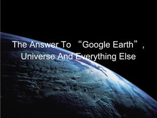
The Answer To “Google Earth”,
  Universe And Everything Else
No It's Not 42 ;)
It's Marble
Marble is a Virtual Globe and World Atlas that you can use to learn
more about Earth: You can pan and zoom around and you can
look up places and roads. Get wikipedia Articles of places of
interest , Plan Your Journey using detailed Maps .

In opposite to other virtual globes Marble also features multiple
projections: Choose between a Flat Map ("Plate carré"), Mercator
or the Globe.

The best of all: Marble is Free Software / Open Source Software
and promotes the usage of free maps. And it's available for all
major operating systems (Linux/Unix, MS Windows and Mac OS
X).
Marble and Geo Content


 Wikipedia Defines GeoContent as “It's is an
   abbreviation of geographic content. Geo-
   content is information that is valuable to a
 specific audience based on their location, and
  is generated by integrating data stored in a
Geographic Information System (GIS) database
  with data stored in a non-spatial database”
Geo-Content

● Open Content
● Closed Content
Open-Content


● Geo Rss & KML
● Wikipedia
● NASA Blue Marble
● Open Street Map
Closed Geo-Content


● Panoramio
● Twitter
● Social Networks
Demo
Panoramio
Twitter
Identi.ca
Features of Marble Widget


● Marble uses a decent minimal free dataset that
  can be used offline ( 10 MB )
● Download data from the internet on demand,
  Wikipedia integration, OpenStreetMap
● Runs well without hardware acceleration (no
● OpenGL so far)
● No dependency except for Qt4.3
● Startup time about 25 secs, fast
Join Us :)

marbledevel@kde.org
IRC: #kdeedu
on irc.freenode.org
http://edu.kde.org/marble

Special Thanks to Torsten Rahn , inge wallin & Patrick
Spendrin for helping me :)

Mais conteúdo relacionado

Mais procurados

OSGeo Live - DokuTech
OSGeo Live - DokuTechOSGeo Live - DokuTech
OSGeo Live - DokuTechBesfort Guri
 
Mapping in Drupal using OpenLayers
Mapping in Drupal using OpenLayersMapping in Drupal using OpenLayers
Mapping in Drupal using OpenLayersPeter Vanhee
 
AGIT 2017: Cesium 1.35, WebGL Virtual Globe and Map Engine
AGIT 2017: Cesium 1.35, WebGL Virtual Globe and Map EngineAGIT 2017: Cesium 1.35, WebGL Virtual Globe and Map Engine
AGIT 2017: Cesium 1.35, WebGL Virtual Globe and Map EngineCamptocamp
 
Mapping in Drupal 7 using OpenLayers
Mapping in Drupal 7 using OpenLayersMapping in Drupal 7 using OpenLayers
Mapping in Drupal 7 using OpenLayersPeter Vanhee
 
Status of WorldMap, 2016
Status of WorldMap, 2016Status of WorldMap, 2016
Status of WorldMap, 2016Paolo Corti
 
FOSS4G 2017 - Geonotebook: an extension to the jupyter notebook for explora...
FOSS4G 2017 - Geonotebook:   an extension to the jupyter notebook for explora...FOSS4G 2017 - Geonotebook:   an extension to the jupyter notebook for explora...
FOSS4G 2017 - Geonotebook: an extension to the jupyter notebook for explora...Christopher Kotfila
 
EGU 2012 ESSI: The FOSS GIS Workbench on the GFZ Load Sharing Facility compu...
EGU 2012 ESSI:  The FOSS GIS Workbench on the GFZ Load Sharing Facility compu...EGU 2012 ESSI:  The FOSS GIS Workbench on the GFZ Load Sharing Facility compu...
EGU 2012 ESSI: The FOSS GIS Workbench on the GFZ Load Sharing Facility compu...Peter Löwe
 
Finding direction marble goes mobile
Finding direction marble goes mobileFinding direction marble goes mobile
Finding direction marble goes mobileMarble Virtual Globe
 
OpenStreetMap : Open Licensed GeoData
OpenStreetMap : Open Licensed GeoDataOpenStreetMap : Open Licensed GeoData
OpenStreetMap : Open Licensed GeoDataHarry Wood
 
geoserver-rest in Web-GIS
geoserver-rest in Web-GISgeoserver-rest in Web-GIS
geoserver-rest in Web-GISTek Kshetri
 
Neo4j Spatial - Backing a GIS with a true graph database
Neo4j Spatial - Backing a GIS with a true graph databaseNeo4j Spatial - Backing a GIS with a true graph database
Neo4j Spatial - Backing a GIS with a true graph databaseCraig Taverner
 
An Introduction to OpenStreetMap
An Introduction to OpenStreetMapAn Introduction to OpenStreetMap
An Introduction to OpenStreetMapdbdean
 
Visualization and Level-of-detail of Metadata for Interactive Exploration of ...
Visualization and Level-of-detail of Metadata for Interactive Exploration of ...Visualization and Level-of-detail of Metadata for Interactive Exploration of ...
Visualization and Level-of-detail of Metadata for Interactive Exploration of ...Cybera Inc.
 
Integrating Geospatial Data to your Applications
Integrating Geospatial Data to your ApplicationsIntegrating Geospatial Data to your Applications
Integrating Geospatial Data to your ApplicationsIan Panganiban
 
Geoprocessing with Neo4j-Spatial and OSM
Geoprocessing with Neo4j-Spatial and OSMGeoprocessing with Neo4j-Spatial and OSM
Geoprocessing with Neo4j-Spatial and OSMCraig Taverner
 
Where in the world is Franz Kafka? | Will LaForest, Confluent
Where in the world is Franz Kafka? | Will LaForest, ConfluentWhere in the world is Franz Kafka? | Will LaForest, Confluent
Where in the world is Franz Kafka? | Will LaForest, ConfluentHostedbyConfluent
 
Google map and navigation
Google map and navigation Google map and navigation
Google map and navigation Shalikram Patel
 

Mais procurados (20)

OSGeo Live - DokuTech
OSGeo Live - DokuTechOSGeo Live - DokuTech
OSGeo Live - DokuTech
 
Mapping in Drupal using OpenLayers
Mapping in Drupal using OpenLayersMapping in Drupal using OpenLayers
Mapping in Drupal using OpenLayers
 
OpenLayer's basics
OpenLayer's basicsOpenLayer's basics
OpenLayer's basics
 
AGIT 2017: Cesium 1.35, WebGL Virtual Globe and Map Engine
AGIT 2017: Cesium 1.35, WebGL Virtual Globe and Map EngineAGIT 2017: Cesium 1.35, WebGL Virtual Globe and Map Engine
AGIT 2017: Cesium 1.35, WebGL Virtual Globe and Map Engine
 
Mapping in Drupal 7 using OpenLayers
Mapping in Drupal 7 using OpenLayersMapping in Drupal 7 using OpenLayers
Mapping in Drupal 7 using OpenLayers
 
Status of WorldMap, 2016
Status of WorldMap, 2016Status of WorldMap, 2016
Status of WorldMap, 2016
 
FOSS4G 2017 - Geonotebook: an extension to the jupyter notebook for explora...
FOSS4G 2017 - Geonotebook:   an extension to the jupyter notebook for explora...FOSS4G 2017 - Geonotebook:   an extension to the jupyter notebook for explora...
FOSS4G 2017 - Geonotebook: an extension to the jupyter notebook for explora...
 
EGU 2012 ESSI: The FOSS GIS Workbench on the GFZ Load Sharing Facility compu...
EGU 2012 ESSI:  The FOSS GIS Workbench on the GFZ Load Sharing Facility compu...EGU 2012 ESSI:  The FOSS GIS Workbench on the GFZ Load Sharing Facility compu...
EGU 2012 ESSI: The FOSS GIS Workbench on the GFZ Load Sharing Facility compu...
 
Finding direction marble goes mobile
Finding direction marble goes mobileFinding direction marble goes mobile
Finding direction marble goes mobile
 
OpenStreetMap : Open Licensed GeoData
OpenStreetMap : Open Licensed GeoDataOpenStreetMap : Open Licensed GeoData
OpenStreetMap : Open Licensed GeoData
 
geoserver-rest in Web-GIS
geoserver-rest in Web-GISgeoserver-rest in Web-GIS
geoserver-rest in Web-GIS
 
Neo4j Spatial - Backing a GIS with a true graph database
Neo4j Spatial - Backing a GIS with a true graph databaseNeo4j Spatial - Backing a GIS with a true graph database
Neo4j Spatial - Backing a GIS with a true graph database
 
An Introduction to OpenStreetMap
An Introduction to OpenStreetMapAn Introduction to OpenStreetMap
An Introduction to OpenStreetMap
 
Visualization and Level-of-detail of Metadata for Interactive Exploration of ...
Visualization and Level-of-detail of Metadata for Interactive Exploration of ...Visualization and Level-of-detail of Metadata for Interactive Exploration of ...
Visualization and Level-of-detail of Metadata for Interactive Exploration of ...
 
Integrating Geospatial Data to your Applications
Integrating Geospatial Data to your ApplicationsIntegrating Geospatial Data to your Applications
Integrating Geospatial Data to your Applications
 
Marble talk at akademy 2009
Marble talk at akademy 2009Marble talk at akademy 2009
Marble talk at akademy 2009
 
Geoprocessing with Neo4j-Spatial and OSM
Geoprocessing with Neo4j-Spatial and OSMGeoprocessing with Neo4j-Spatial and OSM
Geoprocessing with Neo4j-Spatial and OSM
 
Where in the world is Franz Kafka? | Will LaForest, Confluent
Where in the world is Franz Kafka? | Will LaForest, ConfluentWhere in the world is Franz Kafka? | Will LaForest, Confluent
Where in the world is Franz Kafka? | Will LaForest, Confluent
 
Google map and navigation
Google map and navigation Google map and navigation
Google map and navigation
 
Lecture OSSIM
Lecture OSSIM Lecture OSSIM
Lecture OSSIM
 

Semelhante a Answer togoogleearthuniverseandevrythingelse abbreviated

An introduction to OpenStreetMap (HUMBUG)
An introduction to OpenStreetMap (HUMBUG)An introduction to OpenStreetMap (HUMBUG)
An introduction to OpenStreetMap (HUMBUG)dbdean
 
An Introduction to OpenStreetMap (UQ GIS Students)
An Introduction to OpenStreetMap (UQ GIS Students)An Introduction to OpenStreetMap (UQ GIS Students)
An Introduction to OpenStreetMap (UQ GIS Students)dbdean
 
Open Historical Map: Vector Tiles & Other Updates
Open Historical Map: Vector Tiles & Other UpdatesOpen Historical Map: Vector Tiles & Other Updates
Open Historical Map: Vector Tiles & Other Updatesgwhathistory
 
BCS Workshop: Old Maps Online
BCS Workshop: Old Maps OnlineBCS Workshop: Old Maps Online
BCS Workshop: Old Maps OnlinePetr Pridal
 
Web Mapping with Drupal
Web Mapping with DrupalWeb Mapping with Drupal
Web Mapping with DrupalRanel Padon
 
The role of geospatial information in a hyper connected society
The role of geospatial information in a hyper connected societyThe role of geospatial information in a hyper connected society
The role of geospatial information in a hyper connected societyMaria Antonia Brovelli
 
The role of geospatial information in a hyper connected society
The role of geospatial information in a hyper connected societyThe role of geospatial information in a hyper connected society
The role of geospatial information in a hyper connected societyMaria Antonia Brovelli
 
The role of geospatial information in a hyper connected society
The role of geospatial information in a hyper connected societyThe role of geospatial information in a hyper connected society
The role of geospatial information in a hyper connected societyMaria Antonia Brovelli
 
OpenStreetMap integration into Wikimedia projects
OpenStreetMap integration into Wikimedia projectsOpenStreetMap integration into Wikimedia projects
OpenStreetMap integration into Wikimedia projectsavarab
 
Sharing the Openness of the Maps via FOSS4G and the Web
Sharing the Openness of the Maps via FOSS4G and the WebSharing the Openness of the Maps via FOSS4G and the Web
Sharing the Openness of the Maps via FOSS4G and the WebHidenori Fujimura
 
The User-participated Geospatial Web as Open Platform
The User-participated Geospatial Web as Open PlatformThe User-participated Geospatial Web as Open Platform
The User-participated Geospatial Web as Open PlatformChanny Yun
 
PoliMappers - Introduction to OpenStreetMap
PoliMappers - Introduction to OpenStreetMapPoliMappers - Introduction to OpenStreetMap
PoliMappers - Introduction to OpenStreetMapFederica Gaspari
 
Open Source GeoSpatial
Open Source GeoSpatialOpen Source GeoSpatial
Open Source GeoSpatialarno974
 
Gisruk2013 addy edit2
Gisruk2013 addy edit2Gisruk2013 addy edit2
Gisruk2013 addy edit2Addy Pope
 
OldMapsOnline.org: Open Source & Online Tools for Old Maps
OldMapsOnline.org: Open Source & Online Tools for Old MapsOldMapsOnline.org: Open Source & Online Tools for Old Maps
OldMapsOnline.org: Open Source & Online Tools for Old MapsPetr Pridal
 

Semelhante a Answer togoogleearthuniverseandevrythingelse abbreviated (20)

An introduction to OpenStreetMap (HUMBUG)
An introduction to OpenStreetMap (HUMBUG)An introduction to OpenStreetMap (HUMBUG)
An introduction to OpenStreetMap (HUMBUG)
 
An Introduction to OpenStreetMap (UQ GIS Students)
An Introduction to OpenStreetMap (UQ GIS Students)An Introduction to OpenStreetMap (UQ GIS Students)
An Introduction to OpenStreetMap (UQ GIS Students)
 
Open Historical Map: Vector Tiles & Other Updates
Open Historical Map: Vector Tiles & Other UpdatesOpen Historical Map: Vector Tiles & Other Updates
Open Historical Map: Vector Tiles & Other Updates
 
BCS Workshop: Old Maps Online
BCS Workshop: Old Maps OnlineBCS Workshop: Old Maps Online
BCS Workshop: Old Maps Online
 
Marble Goes MeeGo
Marble Goes MeeGoMarble Goes MeeGo
Marble Goes MeeGo
 
Web Mapping with Drupal
Web Mapping with DrupalWeb Mapping with Drupal
Web Mapping with Drupal
 
The role of geospatial information in a hyper connected society
The role of geospatial information in a hyper connected societyThe role of geospatial information in a hyper connected society
The role of geospatial information in a hyper connected society
 
The role of geospatial information in a hyper connected society
The role of geospatial information in a hyper connected societyThe role of geospatial information in a hyper connected society
The role of geospatial information in a hyper connected society
 
The role of geospatial information in a hyper connected society
The role of geospatial information in a hyper connected societyThe role of geospatial information in a hyper connected society
The role of geospatial information in a hyper connected society
 
Marble talk at akademy 2008
Marble talk  at akademy 2008Marble talk  at akademy 2008
Marble talk at akademy 2008
 
OpenStreetMap integration into Wikimedia projects
OpenStreetMap integration into Wikimedia projectsOpenStreetMap integration into Wikimedia projects
OpenStreetMap integration into Wikimedia projects
 
Sharing the Openness of the Maps via FOSS4G and the Web
Sharing the Openness of the Maps via FOSS4G and the WebSharing the Openness of the Maps via FOSS4G and the Web
Sharing the Openness of the Maps via FOSS4G and the Web
 
The User-participated Geospatial Web as Open Platform
The User-participated Geospatial Web as Open PlatformThe User-participated Geospatial Web as Open Platform
The User-participated Geospatial Web as Open Platform
 
PoliMappers - Introduction to OpenStreetMap
PoliMappers - Introduction to OpenStreetMapPoliMappers - Introduction to OpenStreetMap
PoliMappers - Introduction to OpenStreetMap
 
Open Source GeoSpatial
Open Source GeoSpatialOpen Source GeoSpatial
Open Source GeoSpatial
 
Google earth
Google earthGoogle earth
Google earth
 
Gisruk2013 addy edit2
Gisruk2013 addy edit2Gisruk2013 addy edit2
Gisruk2013 addy edit2
 
OldMapsOnline.org: Open Source & Online Tools for Old Maps
OldMapsOnline.org: Open Source & Online Tools for Old MapsOldMapsOnline.org: Open Source & Online Tools for Old Maps
OldMapsOnline.org: Open Source & Online Tools for Old Maps
 
Geonode 2.0
Geonode 2.0Geonode 2.0
Geonode 2.0
 
Open geo data - technical issue
Open geo data  - technical issueOpen geo data  - technical issue
Open geo data - technical issue
 

Answer togoogleearthuniverseandevrythingelse abbreviated

  • 1. The Answer To “Google Earth”, Universe And Everything Else
  • 2. No It's Not 42 ;)
  • 3. It's Marble Marble is a Virtual Globe and World Atlas that you can use to learn more about Earth: You can pan and zoom around and you can look up places and roads. Get wikipedia Articles of places of interest , Plan Your Journey using detailed Maps . In opposite to other virtual globes Marble also features multiple projections: Choose between a Flat Map ("Plate carré"), Mercator or the Globe. The best of all: Marble is Free Software / Open Source Software and promotes the usage of free maps. And it's available for all major operating systems (Linux/Unix, MS Windows and Mac OS X).
  • 4.
  • 5. Marble and Geo Content Wikipedia Defines GeoContent as “It's is an abbreviation of geographic content. Geo- content is information that is valuable to a specific audience based on their location, and is generated by integrating data stored in a Geographic Information System (GIS) database with data stored in a non-spatial database”
  • 7. Open-Content ● Geo Rss & KML ● Wikipedia ● NASA Blue Marble ● Open Street Map
  • 8. Closed Geo-Content ● Panoramio ● Twitter ● Social Networks
  • 11.
  • 13.
  • 15.
  • 16. Features of Marble Widget ● Marble uses a decent minimal free dataset that can be used offline ( 10 MB ) ● Download data from the internet on demand, Wikipedia integration, OpenStreetMap ● Runs well without hardware acceleration (no ● OpenGL so far) ● No dependency except for Qt4.3 ● Startup time about 25 secs, fast
  • 17. Join Us :) marbledevel@kde.org IRC: #kdeedu on irc.freenode.org http://edu.kde.org/marble Special Thanks to Torsten Rahn , inge wallin & Patrick Spendrin for helping me :)