Crowd2Map Northampton university mapping session
•Transferir como PPTX, PDF•
1 gostou•183 visualizações

Remote mapping session for Crowd2Map Tanzania - project to end FGM in Tanzania, with Northampton university student group on OpenStreetMap.

Recomendados
Recomendados
Mais conteúdo relacionado
Semelhante a Crowd2Map Northampton university mapping session
Semelhante a Crowd2Map Northampton university mapping session (20)
Mais de Egle Marija Ramanauskaite
Mais de Egle Marija Ramanauskaite (13)
Último
Último (20)
Crowd2Map Northampton university mapping session
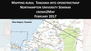
- 1. MAPPING RURAL TANZANIA INTO OPENSTREETMAP NORTHAMPTON UNIVERSITY SEMINAR CROWD2MAP FEBRUARY 2017
- 3. SAFE HOUSE FOR GIRLS REFUSING FGM IN MUGUMU SERENGETI
- 4. SOME MAPPING INITIATIVES IN TANZANIA • MapAction – earthquake damage in Bukoba • Tanzania Bird Atlas • Jane Goodall Institute, Carbon Tanzania – mapping tree cover • John Snow Institute – road mapping using sensors in Medical Supplies Trucks • Ramani Huria – flood resilience in Dar es Salaam • Flowminder – mapping access to mobile financial services • Crowd2Map – volunteer mapping of rural Tanzania, initially to protect girls from Female Genital Mutilation
- 5. MAPACTION MapAction deployed to Tanzania to support the Government of Tanzania in partnership with the United Nations Disaster Assessment Coordination team (UNDAC) to understand needs presented after the earthquake of the 11th September 2016 in Bukoba. The mapping teams supported the coordinated needs assessment, mapping population coverage, affected areas and damage assessments.
- 7. MAPACTION
- 9. JANE GOODALL INSTITUTE, GOMBE, KIGOMA Work with local villages to develop land use plans to protect environment that are then monitored by forest wardens and by satellite.
- 10. JANE GOODALL INSTITUTE, GOMBE, KIGOMA Using DigitalGlobe satellite data from 2005 (left) and 2014 (right), JGI staff can see that Kigalye Village has implemented a land-use plan that allows Miombo woodlands to regenerate naturally.
- 11. JANE GOODALL INSTITUTE, GOMBE, KIGOMA With the Community Forest Monitoring Dashboard, decision-makers can see how thoroughly the Kigalye Forest Reserve is being patrolled and how frequently illegal activities take place.
- 12. CARBONTANZANIA Carbon Tanzania develop REDD Projects (Reduced Emissions from Deforestation & forest Degradation) in conjunction with Tanzania’s indigenous communities. They then sell the certified, forest carbon offsets generated by the project to companies and individuals wanting to offset their emissions with the revenue flowing back to the forest communities, and monitor via satellite images and local wardens.
- 13. JOHN SNOW INSTITUTE, TRACKING MEDICAL DELIVERIES Added sensors to track Medical Stores delivery vehicles to monitor deliveries. Used data to also improve road maps.
- 14. JOHN SNOW INSTITUTE, TRACKING MEDICAL DELIVERIES Volunteer mappers imported the data into Openstreetmap.
- 15. JOHN SNOW INSTITUTE, TRACKING MEDICAL DELIVERIES
- 16. USING LOCAL & SATELLITE MAPPING TO MAP RURAL TANZANIA CROWD2MAP TANZANIA Janet Chapman Egle Marija Ramanauskaite
- 17. WE’RE MAPPING RURAL TANZANIA. WHY? • The remote villages where TDT works are EXTREMELY poorly mapped. • Local officials lack maps of their area. • This makes navigation and planning difficult. • We are mapping onto Openstreetmap that is accessible to everyone online and on phones.
- 18. WE’RE MAPPING RURAL TANZANIA. WHY? • Rural Tanzania is blank in Google Maps. MOST RURAL TANZANIA LOOKED LIKE THIS WHEN WE STARTED - AND MUCH OF IT STILL DOES.. Zeze village, Kigoma, population 8200
- 19. WE’RE MAPPING RURAL TANZANIA. WHY? LOCALS HAVE BEEN MAPPING POINTS OF IMPORTANCE, WORSHIP PLACES, SHOPS, SCHOOLS, COMMUNITY LIBRARY …
- 20. FOCUS: FIGHTING FGM IN MUGUMU Rhobi at a roadshow against FGM in a village near Mugumu.
- 21. TRANSFERRING GOV OPEN DATA TO OSM data from http://opendata.go.tz/
- 22. TRANSFERRING GOV OPEN DATA TO OSM Over 600 online volunteers manually added schools and clinics.
- 23. MAPPING ON MAPS.ME When new version of Maps.Me allowed users to add points directly to OSM we started using that instead of Epicollect.
- 24. MAPPING ON MAPS.ME Now also have a Swahili version.
- 25. MAPPING COMPETITION! Sharing the leader board on What’s App groups was good at increasing motivation
- 26. REMOTE VILLAGES ARE STILL MISSING FROM MAPS … Posting questions on Facebook group
- 27. COMMUNICATION: WHATSAPP Posting of updates about monthly competition increased motivation.
- 28. SATELLITE MAPPING VIA HOT TASK MANAGER /project/1788 http://tasks.hotosm.org/ project/1788# Now 100% mapped, 80% validated – thanks Sophie! https://vimeo.com/199314736
- 29. SATELLITE MAPPING VIA HOT TASK MANAGER /project/1788 Online volunteers trace roads and villages from satellite images.
- 30. TRIPLE MAPPING PARTY, MAY 2016!
- 31. SATELLITE MAPPING EVENTS BY VOLUNTEERS Ramani Huria volunteers mapping Mugumu on May 7th 2016 in Dar es Salaam.
- 32. MUGUMU SAFE HOUSE GIRLS ENGAGING IN MAPPING THEMSELVES Rhobi and some of the girls at the Safe House mapping in OSM on May 7th after initial training when I visited.
- 33. WINS • Reaching more girls in Mara via Mugumu Safe House Discovery of remote villages Reaching remote villages (limited roads, bridges) Fuel planning Better maps will help girls reach the Safe House on their own “We’re reaching places that we’ve never reached before”
- 34. ADDING WATER POINT, SCHOOL AND CLINIC DATA
- 36. WHAT WE’VE ACHIEVED.. • We’ve now recruited over 900 online volunteers and 199 local mappers. • In our 2 HOT tasks in Mara region 696 mappers have mapped an area of 14,248 square kilometres and added 5 towns and 169 villages and hamlets. • We’ve also added 42,128 km of roads and tracks and 700,000 buildings.. • Countrywide we have added 12,294 schools and 162 clinics to Openstreetmap from government open data.
- 38. EFFECT ON FGM Having better maps helped prevent 2257 girls from being cut this year. However change is a slow process. 1076 girls were still cut, down from 3700 the previous year, and 4 girls died, down from 12 last year.
- 40. HOW YOU CAN HELP.. • Start mapping! Anyone with an internet connection can get involved! • Tell people you know with an interest in mapping and/or FGM • Use Maps.Me if you visitTanzania to add places to the map. • Access to smartphones is the limiting factor, so if you have any unwanted phones we can make very good use of them! • Any comments, questions or suggestions always welcome! • Thank you • Janet j.chapman@tanzdevtrust.org Egle emramanauskaite@gmail.com
Notas do Editor
- Works in rural areas of Tanzania that are very poorly mapped, making navigation and development difficult
- Our largest project is a Safe House for girls refusing Female Genital Mutilation. The outreach work in the surrounding villages was hampered by the lack of maps.
- Sometime hand drawn map on wall, often not. Getting lost driving through rivers in the rain. Asked local reps to draw map of where village was, they couldn’t
- When told Egle she didn’t believe me how bad the maps were. Most still looks like this – need stats for points added..
- Points added in OSM and Maps.Me
- Rhobi at a roadshow against FGM in a village near Mugumu. Challenge in outreach in villages, no maps
- EMR: prepare for Qs about open data. Where did you get it from? Was it government-collected? Are you sure it is usable? Did you consider importing it straight to OSM (not manual)? Is that all the data you got? How recent is it? Are you still accessing other open data from elshwere ?
- Over 900 volunteers largely through UN online volunteers, regular contact via email.
- Moved to maps.me Tried OSMAND, but difficult for novice users
- Maps me brilliant now you can add points, but list not that suitable for rural Africa..
- say more on Mapping competition how much are people contributing EMR: how many people? How well are they engaging? Are the points accurate? Reliable ?
- Via Facebook, Whats app
- Set up project on HOT for area around Mugumu,
- Set up project on HOT for area around Mugumu,
- Dar EMR: how did they come to be? How did these volunteers find you? Decide to map? Who trained them?
- Safe house EMR: who trained them? How did they do? Do they continue mapping after the event?
- Now lets get mapping!