

Recomendados
Mais conteúdo relacionado
Destaque
Destaque (10)
Semelhante a Miriam Sturdee - Xray vision
Semelhante a Miriam Sturdee - Xray vision (20)
Último
Último (20)
Miriam Sturdee - Xray vision
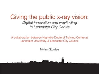
- 1. Giving the public x-ray vision: Digital innovation and wayfinding in Lancaster City Centre A collaboration between Highwire Doctoral Training Centre at Lancaster University, & Lancaster City Council Miriam Sturdee
- 2. Identifying the issues: Public thoroughfares / routes through the city centre are not always clear The ‘physical’ space does not match the ‘digital space’ Poor / outdated signposting ! Low footfall to prime tourist areas such as St George’s Quay ! Barriers caused by building developments and traffic flow
- 3. Other considerations: Multiple council-led projects overlap and operate independently - no ‘roadmap’ of how they interlink Transient stage for the council in terms of planning and branding Perceived low levels of engagement from ‘native’ Lancastrians ‘seen it all already’ ! Low relative budget for new signage - funding part of a wider regeneration project ! ‘Visibility’ of areas from a perspective on the ground is limited
- 4. Previous work Lucid Lancaster investigation set the stage for increasing legibility in the city Identified areas of improvement, perceived steepness, barrier of China Street Identified importance of visibility of the horizon in orientation in unfamiliar places ! Interested in creating a cohesive strategy with multiple local groups !
- 5. Current digital projects Pivotpan - Augmented Reality itineraries, mapping the pedestrian areas of the city and the inside of local business and tourist sites World Around Me - Augmented Reality business-finding app PROUD working group / Beyond The Castle - Co-Design ! Google Maps - creation of a Heritage Map / personalised
- 6. Four stage approach Bring together council/local groups via digital means to establish clear game plan and bring strength in numbers, as well as diversity of ideas Create a novel ‘physical’ signage system to engage locals and visitors alike and reach out to non-smart phone users Create an app with which smartphone users can orientate themselves within the city centre and tourist sites ! Devise a symbol/icon with which areas of interest and extra content (digital) can be pinpointed, linking to proposed branding activity and bringing together different groups
- 7. 1. Lancaster City Council Projects & Partners (Initial Draft) NESTING OF LANCASTER CITY COUNCIL PROJECTS AND PARTNERS INTEGRATED APP AND DIGITAL/PROJECTED SIGNAGE SYSTEM: PROPOSED BENEFICIARIES AND PARTNERS BRANDING SQUARE ROOTS BEYOND THE CASTLE QUAY CONNECTIONS LIGHT UP LANCASTER SECRET GARDENS CONSULTANTS & PARTNERS (INFOTECH/ PIVOTPAN/ CAIRN CONSULTING/ LANCASTER ARTS CITY) LANCASTER VISION 2020 LANCASTER UNIVERSITY (CATALYST /HIGHWIRE) CAMPUS IN THE CITY BUISNESS IMPROVEMENT DISTRICT (BID)
- 8. 1. A digital solution? Hosting on council website difficult - i.e. bandwidth, CMS support, autonomy Forum based platform? Using ‘tags’ to highlight relevant content to groups working on different parts of the whole Creating a ‘living’ neural network of connections in real time
- 9. 1. A physical solution? 0.5 FT Projects Officer to track and map multiple council led / involved projects and ensure working to one common goal Volunteer project officers from each working group - working 3 month rotations Funding…
- 10. 2. Where am I? Lancaster 1824 Lancaster 2014
- 11. Wouldn’t it be helpful if we could see through walls?
- 12. 2. Opportunities for innovation Seeing beyond the bricks and mortar - what lies beneath/behind? Making sense of ‘dead ends’ Accidental Iconography Potential for projection
- 13. 2. X-ray specs Merging the digital with the physical Icons signposting digital world? The story continues… Using existing structures
- 14. 2. Projections Prototyping #1 Extended bracket from wall creating angle for 4000-6500 lumens architectural projector Lancaster ‘walking cat’ icon to indicate interactivity and city quarter Specialist screen paint to create large scale outdoor projection surface Bollard connected to projector allowing visitors to select which depth they wish to see to 1 2 3 4
- 15. 2. Projections Prototyping #2 1. China Street Google view 2. Lancaster Castle Google view 3. China Street Sketch view (with map) 4. Lancaster Castle Sketch view (with map) 1 2 3 4
- 16. 2. Projections Prototyping #3 1. China Street Google view 2. Lancaster Castle Google view 3. China Street Sketch view (with map) 4. Lancaster Castle Sketch view (with map) 1 2 3 4
- 17. 2. Projections Prototyping #4 1. China Street Google view 2. Lancaster Castle Google view 3. China Street Sketch view (with map) 4. Lancaster Castle Sketch view (with map) 1 2 3 4
- 18. 2. Evaluation Logistics - crime / cost / daylight projection limitations? Opportunities to crowd-source photo data - public ownership ! Publicity for the city Could be used by other groups - e.g. local business, arts (Light Up Lancaster), theatre, school/college projects Idea could be developed to see ‘under’ castle to Roman site or through walls into ‘secret’ gardens / businesses (advertising potential)
- 19. 3. Digital versioning Limited sites for projections? Smartphone proliferation ! Augmented Reality - overlaying digital onto physical space in real time
- 20. 3. App Prototyping #1
- 21. 3. App Prototyping #2
- 22. 3. Evaluation Can link to existing Google Maps database / business location AR apps Portable X-ray vision ! Uses other than way finding possible - heritage / storytelling
- 23. 3. Thoughts on Apps VS Projectors Development costs VS Equipment costs Daylight projection - £4000 bulb - BUT, relatively low crime in Lancaster, longevity possible Combination approach? Visibility around the city for visitors and residents is important, but so is the INSIDE of the city and its people / projects Funding available - digital high street / lottery / others?
- 24. 4. An icon for Lancaster The city can be divided into areas / quarters Link everything with an emblem - witch = limiting ! Physical icon can be painted onto walls to assist way finding, show areas of interest, treasure hunt for children Business buy-in e.g. coffee quarter, stickers in window, icon indicates presence of digital content (website / historical interest / Google Maps content) Can tie in to the overarching Lancaster City ‘brand’
- 25. Iconographic signposts to content Creating a sub-brand for signage based on Lancaster’s heritage - witch already in use… familiar?
- 26. 4. Evaluation Cats are natural explorers and curious - ties in with Pendle Witches but more subtle ! Easily recognisable, non-intrusive Smartphones can ‘recognise’ shapes (like facial recognition) Could be used across all council led projects
- 27. Thank you!