Homeland Security C4I Pragati Maidan
•
2 gostaram•1,960 visualizações

Homeland Security and Fire Technology Bangalore, Oct 2009

Recomendados
Mais conteúdo relacionado
Mais procurados
Mais procurados (20)
Semelhante a Homeland Security C4I Pragati Maidan
Semelhante a Homeland Security C4I Pragati Maidan (20)
Mais de ADGP, Public Grivences, Bangalore
Mais de ADGP, Public Grivences, Bangalore (20)
Último
Último (20)
Homeland Security C4I Pragati Maidan
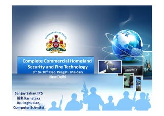
- 1. Complete Commercial HomelandComplete Commercial Homeland Security and Fire Technology 8th to 10th Dec. Pragati Maidan New Delhi Sanjay Sahay, IPS IGP, Karnataka Dr. Raghu Rao, Computer Scientist
- 2. Homeland SecurityHomeland Security C4I and CCTNS Sanjay Sahay, IPS IGP, Karnataka Dr. Raghu Rao, Computer Scientist
- 3. Command and Control Communication C4I AND CCTNS Ingredients for C4I Communication Computers Interoperability
- 4. C4I is a reasonably old concept by now and has seen multiple upgrades but has failed to C4I AND CCTNS Ingredients for C4I has seen multiple upgrades but has failed to have a widespread footprint in this country!!!
- 5. Events may come and go but the problems persist. A solution based think tank across all C4I AND CCTNS Homeland Security persist. A solution based think tank across all stakeholders is the need of the hour
- 6. ERP Solution Command and Control Center Interception Systems Homeland Security Suggestive Components Interception Systems TETRA Radio Network Video Surveillance System AVLS Geo-Spatial Technology AWACS- Air/Naval
- 7. Homeland Security- C4I and CCTNS Command and Control Command Needs – Master Control Center- City Based Master Control Center – 4.5 ++ GenerationMaster Control Center – 4.5 ++ Generation Master Control Center – Screens, Dispatchers, Vehicle Controllers Computers on Open source Software Command Center software needs Legacy Systems
- 8. Homeland Security- C4I and CCTNS Command and Control - Issues City Based Comprehensive Command Centers Rural Areas don’t figure in our scheme of things Integration into a State Level c4i Regional Integrations-7 c4i Integration of Regional Level c4is into one National c4i- complete response to all grave situations
- 9. Homeland Security- C4I and CCTNS Control Pyramid National c4i StateState Regional c4is Base level c4is
- 10. Homeland Security- C4I and CCTNS Vulnerability Assessment Threats CITY • City Based Threats • Organized Crime, Acts of Terror STATE • White Terror • Large Amounts of Money Laundering NATIONAL • Destruction of Critical Infrastructure • Illegal landing of weaponry/merchandise
- 11. Homeland Security-C4I and CCTNS Communications Communication Equipment Needs Communication National Back Bone Communication State Back Bone Communication National Grid Communication State Grid Communication in Free to Air mode
- 12. Homeland Security-C4I and CCTNS Communications- Proposed National Framework-CCTNS Mission Mode Project under the National eGovernance Plan Intends to connect 14,000 Police Stations and 6000Intends to connect 14,000 Police Stations and 6000 higher Police Offices across the nation Concept of State and National Data Centers Creation of a Core Application Software for the nation Synchronization of Nationwide communication equipment
- 13. Homeland Security-C4I and CCTNS Communications- Proposed National Framework-CCTNS One Standard One India Comprehensive guide to procure and deploy hardware, connectivity and services
- 14. Homeland Security-C4I and CCTNS CCTNS- Police IT- Final Output Front of CCTNS Project in Karnataka Police IT is an ERP backbone for all policing requirements in the Staterequirements in the State It has 12 modules from Crime to MIS Deployment across all 906 Police Stations and 500 other Police Offices Messaging is already a part of the Police IT
- 15. Homeland Security-C4I and CCTNS CCTNS- Police IT- Final Output Its gone live across Karnataka and all functionalities of Crime Modules would be in use another month Intends to integrate all legacy to this software on the concept of single sign in In principle integration of TETRA is possible with this network
- 16. Homeland Security-C4I and CCTNS CCTNS- Police IT- Final Output All components of the c4i can be seamlessly integrated to this software thus providing an integrated solution toto this software thus providing an integrated solution to peacetime and crisis situations through the same system, providing the ease of usage so necessary to the end user C4I thus becomes the Command/ Control/ Response Module of the ERP Solution
- 17. Homeland Security-C4I and CCTNS ISSUES No learning curve- institutional or individual Undue importance to Hardware Adhoc integration and adhoc deployment Non-availability of near machine software Present operability is at Layer 7.
- 18. Homeland Security-C4I and CCTNS ISSUES- C4I- Institutional Limitations Cross connectivity- Never heard of Solutions imposed by VendorsSolutions imposed by Vendors Vendor and User- Unwilling to bridge the gap Lack of understanding of user requirements and infrastructure demands Obsolete equipments proposed for majority of RFPs
- 19. Homeland Security-C4I and CCTNS ISSUES- C4I- Institutional Limitations Trade restrictions by Technology leaders ITAR issues
- 20. Homeland Security-C4I and CCTNS ISSUES- C4I- Roadmap State of art equipment Shorter procurement cyclesShorter procurement cycles Demonstrated capability of the Vendor and SI in Indian conditions SRS/FRS/USER Requirements to be correctly mapped Project Management Mode for all stakeholders
- 21. Homeland Security-C4I and CCTNS ISSUES- C4I- Roadmap Integration is the key for real product and service delivery RDBMS and finally the ERP is the final solution All tasks for an organization emanates out of an ERP and all data is keyed in the ERP for multidimensional use.
- 22. Homeland Security-C4I and CCTNS ISSUES- C4I- Roadmap A survey by the vendors of the AS IS in Delhi, Mumbai and Bengaluru with a roadmap ofMumbai and Bengaluru with a roadmap of integration and proposed upgradation in a phased manner would be the initiation of a positive process in the right direction, likely to yield results sooner than later
- 23. Homeland Security-C4I and CCTNS Any questions!!! We will deliver together. Thanks for being a great listener
- 24. Historical system architectures Historically, companies created “islands of automation”. A hodge-podge of various systems that operated or managed various divergent business processes. Framework for Safe & Secure City ERP Solution managed various divergent business processes. Sometimes these systems were integrated with each other and sometimes they weren’t. Sometimes they were loosely interfaced and sometimes they were more tightly interfaced.
- 25. Integration What is an ERP – Key Characteristics Framework for Safe & Secure City ERP Solution Seamless integration of all the information flowing through a company – financial and accounting, human resource information, supply chain information, and customer information.
- 26. Packages Enterprise systems are not developed in-house • Information System life cycle is different What is an ERP – Key Characteristics Framework for Safe & Secure City ERP Solution • Information System life cycle is different 1. Mapping organizational requirements to the processes and terminology employed by the vendor and 2. Making informed choices about the parameter setting • Organizations that purchase enterprise systems enter into long-term relationships with vendors. • Organizations no longer control their own destiny.
- 27. What is an ERP – Key Characteristics Best Practices • ERP vendors talk to many different businesses within a given industry as well as academics to determine the best and most Framework for Safe & Secure City ERP Solution industry as well as academics to determine the best and most efficient way of accounting for various transactions and managing different processes. The result is claimed to be “industry best practices”. • The general consensus is that business process change adds considerably to the expense and risk of an enterprise systems implementation. Some organizations rebel against the inflexibility of these imposed business practices.
- 28. Some Assembly Required Only the software is integrated, not the computing platform on which it runs. Most companies have great difficulty integrating What is an ERP – Key Characteristics Framework for Safe & Secure City ERP Solution which it runs. Most companies have great difficulty integrating their enterprise software with a package of hardware, operating systems, database management systems software, and telecommunications suited to their specific needs. • Interfaces to legacy systems • Third-party bolt-on applications • Best of Breed Strategy
- 29. Evolving Enterprise Systems are changing rapidly What is an ERP – Key Characteristics Framework for Safe & Secure City ERP Solution • Architecturally: Mainframe, Client/Server, Web-enabled, Object-oriented, Componentization • Functionally: front-office (i.e. sales management), supply chain (advanced planning and scheduling), data warehousing, specialized vertical industry solutions, etc.
- 30. • To support business goals – Integrated, on-line, secure, self-service processes for business Why implement an ERP System? Framework for Safe & Secure City ERP Solution for business – Eliminate costly mainframe/fragmented technologies • Improved Integration of Systems and Processes • Lower Costs • Empower Employees • Enable Partners, Customers and Suppliers
- 31. How should we implement ERP systems Framework for Safe & Secure City ERP Solution Obtain the right mix of people, processes and technology!!
- 32. How should we implement ERP Systems? • People – Project Structure – Should be aligned to processes Framework for Safe & Secure City ERP Solution – Should be aligned to processes • Process – Implementation Process (outlined in detail) – Adapt your processes to those of the ERP. • Technology – Hardware – Software – Integrated Systems
- 33. INTRODUCTION TO GEOGRAPHIC INFORMATION SYSTEM:- TH GIS SOURCES ARE GENERALLY MAPS, IMAGES, DATASETS, GPS INPUT,TEXT DATA, TABULAR DATA. MAPS: SPATIAL DATA WHICH OCCUPIES CARTOGRAPHIC SPACE AND THAT USUALLY HAS SPECIFIC LOCATION TO SOME GEOGRAPHIC REFERENCING SYSTEM (EX:-LATTITUDE, LONGITUDE) IMAGES: PICTURES PRODUCED BY SATELLITES (REMOTE SENSING DATA) Framework for Safe & Secure City GIS based G-CARE IMAGES: PICTURES PRODUCED BY SATELLITES (REMOTE SENSING DATA) GPS DATA: GPS DEICES WHICH DIRECTLY GIVES THE LATTITUDE AND LONGITUDE ( THE POINT OF A LOCATION ) TEXT DATA : REPORTS IN THE FORM OF TEST DEALING WITH SPATIAL SUBJECT. TABULAR DATA: GENERALLY NUMERIC SUCH AS CENSUS DATA AND RDBMS DATA. GIS PLATFORM : GIS SOFTWARE : ARC GIS (ARC VIEW, MAP OBJECTS ETC.,) OPERATING SYSTEM : WINDOWS 2003 FOR SERVER AND MAP OBJECT FOR SERVER AND WINDOWS FOR CLIENTS WITH MAP OBJECTS , ARCVIEW . ALL THE ABOVE COMPONENTS CONSTITUTES A GEOGRAPHIC INFORMATION SYSTEM
- 34. Representation Of A Complete GIS Module MAPS/GPS DATA TABULAR DATA IMAGERY Framework for Safe & Secure City GIS based G-CARE GIS DATABASE MAPS/GPS DATAMAPS/GPS DATAMAPS/GPS DATA
- 35. The State Crime Records Bureau , Karnataka State Police has entrusted the Development of Geographical Information System based Crime Analysis and Reporting Engine (GCARE) Introduction to G-CARE Framework for Safe & Secure City GIS based G-CARE System based Crime Analysis and Reporting Engine (GCARE) project in the year 2003 to Karnataka State Remote Sensing Application Centre ( KSRSAC), a Division of Dept of IT and BT , Govt. of Karnataka, the Nodal Agency for Remote Sensing and GIS.
- 36. The salient features of the G-CARE software are :- • Show the locations of Crime by time, modus operandi and other characteristics • Determine the Crime ‘hot spots’ GIS based G-CARE Framework for Safe & Secure City • Determine the Crime ‘hot spots’ • Reveal patterns or trends • Show census data and correlate the crime data • Determine the statistics in graphic mode for any Crime type (heinous and non heinous)
- 37. • Digitisation of Police Station boundary from village maps and integration with road and administrative boundaries with the latest available scale). The objectives of the project is as follows:- Framework for Safe & Secure City GIS based G-CARE the latest available scale). • Spatial database creation(Police station wise, Circle wise, Sub Division wise and District Wise • Customization of the requirements as per SCRB and deployment of the package at the District Head Quarters. • Training of officers and the operating staff to use GCARE.
- 38. GCARE MODULES 1. Crime Module 2. Village Module Framework for Safe & Secure City GIS based G-CARE 2. Village Module Crime Module For Bangalore City Latest Large Scale Map(1:2000)and Districts The Maps Of Small Scale Village Module Is Integrated Into Gcare For The Districts To Retrieve The Village Information Of Any Village Of Police Station . This Will Help In Organising The Security Arrangements During Elections/Fairs And Festivals.
- 39. • Software requirement specification (SRS) • Crime-criminal database (CCIS) Requirements And Inputs Provided By SCRB Karnataka Framework for Safe & Secure City GIS based G-CARE • Sketch maps of 876 Police Station jurisdictions • Latitude and longitude data of all police stations • Village information as per the requirement were collected for the entire state
- 40. Roles and responsibilities of KSRSA CARE • Design and Development of Spatial and Non-spatial database • Development of customised GIS application with querying and analysis tools Framework for Safe & Secure City GIS based G-CARE and analysis tools • Deployment of G-CARE at DCRB at all district HQs. • Required manpower and technical expertise during implementation. • Training on G-CARE for districts/State(approx 60) • Technical support for a year after implementation
- 41. Roles and responsibilities of SCRB are • SCRB will provide all the crime data in digital format (presently CCIS data) Framework for Safe & Secure City GIS based G-CARE format (presently CCIS data) • Police station location and jurisdiction limits will be provided by SCRB • Liasioning and coordinating • Periodically review and monitor the progress of GCARE
- 42. Benefits of the project G-CARE • Analyse and display the crime trends and crime patterns Framework for Safe & Secure City GIS based G-CARE patterns • Relate crime data to socio economic and other spatial factors • Better decision making • Strategy for Crime Prevention
- 43. Features Of G-CARE • Crime Plotting • Identify The Hot Spots Of A Given Crime • Date Range /Time Of Occurrence Of Crime For Police Framework for Safe & Secure City GIS based G-CARE • Date Range /Time Of Occurrence Of Crime For Police Station, circle, Sub Division And District • Property Crimes • Heinous And Non Heinous Crimes • Road Accidents • Display Village Data For Analysis
- 44. Output: Generations Of Charts And Statistics Dynamically Aggregated At Various Administrative Levels (PS, Circle, District, State Framework for Safe & Secure City GIS based G-CARE At Various Administrative Levels (PS, Circle, District, State wise) For The Crime Heads As Per CCIS.
- 45. GEOGRAPHICAL ANALYSIS FOR THE FOLLOWING • Heinous Crimes • Non Heinous Crimes Framework for Safe & Secure City GIS based G-CARE • Non Heinous Crimes • Other IPC Offences • Mob Criminals Operating In An Area • Age, sex, profession wise Criminals / Victims Analysis Crime Pattern In Different Ps Limits Analysis For Village Data And Co-relating The Crime Data
- 46. GIS Application GUI • Menu Driven And Ease Of Use • Password For Security • Pop Up Menus For Easy Retrieval Framework for Safe & Secure City GIS based G-CARE • Pop Up Menus For Easy Retrieval • Graphs, Charts, Pinpointed Maps, shaded Maps • Linking Of Appropriate CCIS Data • Display Of Maps With Legend And Statistics • Good Colour Selection And Colour , Contrast Adjustment With Zoom In And Out Facility • Point Information Displayed On A Mouse Click
- 47. Single Portal Access to C4i Framework for Safe & Secure City Command and Control Center Single Portal Access to C4i A web-based Solution that integrates surveillance CCTV feeds, Emergency Response, AVTS, ITS, Coastal Security, TETRA & GPS Location data on GIS Map
- 48. Integrated Command Control Coordination And Communication System Multi Vendor Video Management Integrated Situation Management Framework for Safe & Secure City Command and Control Center
- 49. Incident Flow ALERT Framework for Safe & Secure City Command and Control Center- a PCR Ambulance Fire Video DataMap Data Incident Data Response Procedure Activated Task Completed & Incident Closed Reports C4i Operator
- 50. Framework for Safe & Secure City
- 51. Framework for Safe & Secure City
- 52. C4i Functionalities • Incident Management • Video Management • Training and Simulation • Recording, Debriefing and Analysis Framework for Safe & Secure City Command and Control Center • Integrated 2D GIS • Sensor Management • Situation at a Glance • Sounds and Announcements • Threat level Management • Mobility • VOIP Integration Analysis • Reports • Administration and Authorization • Video Wall Management • Skill Set Management • Work flow/Business Process
- 53. Where Are We Looking? Framework for Safe & Secure City Interception Systems
- 54. What Do We Intercept? Voice Fax Framework for Safe & Secure City Interception Systems Voice Fax SMS Data
- 55. Framework for Safe & Secure City Command and Control Center
- 56. Mass Interception Architecture Networks Mobile ILD Fixed Sat IP Framework for Safe & Secure City Interception Systems Mediation Storage & Archival Processing – Demod & Speech VerbaPSV WS 6WS 1 WS 2 WS 3 WS 4 WS 5 WS 7 WS 8 Management
- 57. Advantages Of Mass Interception Systems • Completely passive • Undetectable by GSM/CDMA/PSTN Subscriber • Undetectable by Network Operator • Same system can be configured to work with Framework for Safe & Secure City Interception Systems • Same system can be configured to work with GSM CDMA Fixed Line • Accurate acquisition of network data • Can be used with Speaker ID systems • No interaction with network equipment • Small size, complete system can be mounted in a small truck/van
- 58. Framework for Safe & Secure City Interception Systems
- 59. What Can The Verbacentre Do? • Connects to multiple service providers • Intercepts Voice, Fax and SMS • Records all CRI/IRI • Processes and correlates Call Content and CRI data Framework for Safe & Secure City Interception Systems • Processes and correlates Call Content and CRI data • Demodulates Fax • Decodes SMS • Reconstructs GPRS/EDGE and 1xRTT Sessions • Provides Location Cell ID • Provides IMSI, IMEI etc..
- 60. User Interface Framework for Safe & Secure City Interception Systems
- 61. GSM Identity Interrogator And Geo-locator Framework for Safe & Secure City Interception Systems Interception Systems
- 62. Harrier- Applications Key Applications • Identification of Targets’ unknown mobile • Detecting Targets’ Presence Framework for Safe & Secure City Interception Systems • Detecting Targets’ Presence • Direction Finding to locate Target Other Applications • Detection GSM Activity in a secure zone • Profiling Targets • Denial of Service
- 63. How It Works GSM Network Framework for Safe & Secure City Interception Systems • Mobiles monitor up to 6 BTSs • Harrier clones neighbour BTS • Entices mobile to register, captures mobile identity IMSI, IMEI and TMSI etc. Network Harrier
- 64. Geo-locating A Target 1 • Harrier team deployed to this cell location • Once located Target is locked to Harrier and Silent Call initiated. • Target’s phone begins transmitting Framework for Safe & Secure City Interception Systems 3 2 • Target’s phone begins transmitting and DF teams move in to track and locate phone • Multiple DF can be deployed for rapid target location. Covert Handheld & Body-worn DF available
- 65. Exposes the invisible ReveaLinx Framework for Safe & Secure City Interception Systems Exposes the invisible links hidden in your data
- 66. What is ReveaLinx • Create nodes and links from source data – “bottom up” Link and Network Analysis Framework for Safe & Secure City Interception Systems – “bottom up” – disparate sources • Visualize – for analyst to interpret and communicate – harness the human mind • Unique analytical methods – Relationships – Patterns – Networks
- 67. You see data today in the form of records, tables, graphs, reports Ref# Name Address Phone ID# XXX101 BILL JONES 999 WEST 4TH ST 999-666-8888 234-56-7890 Source Data Framework for Safe & Secure City Interception Systems XXX101 BILL JONES 999 WEST 4TH ST 999-666-8888 234-56-7890 YYY202 SAM SMITH 888 OAK STREET 888-999-0000 111-11-1234
- 68. Nodes Ref# Name Address Phone ID# XXX101 BILL JONES 999 WEST 4TH ST 999-666-8888 234-56-7890 ReveaLinks breaks these records into the smallest relevant elements - “Nodes” Framework for Safe & Secure City Interception Systems XXX101 BILL JONES 999 WEST 4TH ST 999-666-8888 234-56-7890 YYY202 SAM SMITH 888 OAK STREET 888-999-0000 111-11-1234 BILL JONES 999 WEST 4TH ST 999-666-8888 234-56-7890 XXX101
- 69. Links Ref# Name Address Phone ID# Then shows how these individual elements of data are connected to each other – “Links” Framework for Safe & Secure City Interception Systems Ref# Name Address Phone ID# XXX101 BILL JONES 999 WEST 4TH ST 999-666-8888 234-56-7890 YYY202 SAM SMITH 888 OAK STREET 888-999-0000 111-11-1234 BILL JONES 999 WEST 4TH ST 999-666-8888 234-56-7890 XXX101
- 70. Relationships Using both nodes and links, complex indirect relationships can be ‘discovered’ in large volumes of data Framework for Safe & Secure City Interception Systems - BILL JONES 999 WEST 4TH ST 999-666-8888 234-56-7890 XXX101 PHIL CLARK 848-090-9904 JOE PAGE 459-89-9986 ROB JONES
- 71. Nodes Framework for Safe & Secure City Interception Systems
- 72. Nodes Framework for Safe & Secure City Interception Systems
- 73. Nodes Framework for Safe & Secure City Interception Systems
- 74. Nodes Framework for Safe & Secure City Interception Systems
- 75. Nodes Framework for Safe & Secure City Interception Systems
- 76. Nodes Framework for Safe & Secure City Interception Systems
- 77. Attributes Address Node Attributes Dwelling Type: Unit Year built: 1964 Bedrooms: 2 Title: Torrens Total Occupants: 1 Vehicle Node Attributes Make: Mazda Model: Astina Year: 1998 Engine Size: 1800 Framework for Safe & Secure City Interception Systems - Person / Address Link Attributes Years at Address: 5 Status: Owner Joint Ownership: No Other Occupants: No Total Occupants: 1
- 78. ReveaLinx Architecture DB1 Data Servers Analyst 1 Data Modelling and Analysis Investigation Presentation Case A Framework for Safe & Secure City Interception Systems Develop Applications DB1 DB2 Deploy Applications Direct connection to systems to retrieve data ReveaLinks Analyst 2 Workstation Workstation Workstation Analyst 3Results Delivery Data Files Presenter Presenter Case B Case Delivery
- 79. TETRA • Radio systems are still the backbone in a modern public safety and security network, because the field operations Framework for Safe & Secure City rely entirely on its functionality and reliability. • TETRA = TErrestrial Trunked RAdio • Mobile Telephony : GSM : : Radio Communication: TETRA
- 80. TETRA Is Purpose-built Technology For Mission Critical Communication Specialized group communication • one-to-many communication High availability • Redundancy Framework for Safe & Secure City TETRA • Push-to-talk, instant call connection in less than 0.5 sec • Redundancy • Priorities • Direct Mode Operation • Base station fallback Uncompromising security • Authentication • Air interface encryption • End-to-end encryption • Disabling of stolen radios Advanced data services • Status and text messaging • IP packet data • High speed data - TEDS
- 81. In The Past Agencies Used To Have Their Own Private, Isolated Radio Communication Systems Fire dept.Rescue Framework for Safe & Secure City TETRA Fire dept. Traffic police Crime unit Rescue Public transport ation Power generation & distribution Ambulance
- 82. TETRA Enables Sharing Of A Common Infrastructure Between All Mission Critical Users Fire Dept. Framework for Safe & Secure City TETRA TETRA Fire Dept. Traffic Police Power Generation & Distribution Ambulance Public Transportation Crime Unit Rescue
- 83. TETRA enabling services • No technical communication barriers between organizations • Enables efficient co-operation between authorities Framework for Safe & Secure City TETRA • Enables efficient co-operation between authorities especially in large incidents • Seamless communication readiness everywhere, while VPNs retain inter-agency privacy • Connecting independent networks together
- 84. TETRA enabling services… Enables new data-intensive applications: high quality images multimedia video clips Framework for Safe & Secure City TETRA multimedia video clips access to intra/internet field command systems Sharing a common TETRA infrastructure by all authorities improves inter-agency cooperation in large incidents
- 85. Components Securing AccessTransmitting Video Capture Video Managing Video Framework for Safe & Secure City Video Surveillance System - Firewall Intrusion Detection Wireless Transmission for Cameras WAN transmission to NOC Capture Video Control Solution View and Store Video Response
- 86. Video Management Framework for Safe & Secure City Video Surveillance System -
- 87. Response Management Enables Communications Between Multiple Devices VHF RADIO PSTN Framework for Safe & Secure City Video Surveillance System - IPICS UHF RADIO PTT over Cellular VoIP PTTCell Mgmt. Softwar e IP Phone
- 88. Secure Access Application Security System Management Policy—Reputation—Identity Protect the core applications from attack Protect the video content from Framework for Safe & Secure City Video Surveillance System - Network Security Endpoint Security Content Security Self-Defending Network: Best of Breed Security in a Systems Approach content from misuse and abuse Ensure no attacks or malfunction in the network Ensure end users cannot abuse the system
- 89. Features Of Proposed Architecture • Hierarchical Architecture Video endpoints/Police stations and Control rooms • Easily Scalable : Add more video Surveillance points/Police stations and Control rooms Framework for Safe & Secure City Video Surveillance System and Control rooms • Redundancy: In an emergency, control and monitoring can be easily transferred to any other point on the network • Secured IP based Network enables Anywhere, Anytime, Any Device, access • Easy to Manage: Management/Administration and Configuration through Web clients • Third party Integration: Integration of 3rd party Video Analytics, Storage .. etc
- 90. Next Steps • Determine the Type of Camera’s required at each video Surveillance points • Determine the bandwidth required at each video Surveillance Framework for Safe & Secure City Video Surveillance System • Determine the bandwidth required at each video Surveillance points • Conduct the feasibility study to determine the Type of Connectivity media ( Ethernet/Leased line/Wireless) required between video Surveillance points to Police stations and to Control room and DGP office and work closely with service providers. • Finalize on 3rd party application Integration • Finalize the Architecture
- 91. Technology Position In Adoption Cycle In Vehicle Display Terminals OCC Systems Offline Vehicle Tracking Fleet Management Solution Online Vehicle Tracking Framework for Safe & Secure City AVLS I Innovators EA Early Adopters EM Pragmatists Early Majority LM Pragmatists Late Majority T Traditionalists I EA EM LM T C h a s m Live Video Streaming OCC Systems Offline Vehicle Tracking Driver Identification System Mobile Application Occupancy Monitoring System Passenger Identification Systems Driver Assistance System In Vehicle Computers Estimated Time of Arrival Systems Navigation Systems
- 92. GPS Technology Server Geostationary Satellite OverLAN ProtectedbyFirewall&IDS Framework for Safe & Secure City AVLS - Mobile Service Provider Network Mobile Tower GPS/GPRS Module Reports Security Team Over Private APN OverLAN ProtectedbyFirewall&IDS
- 93. Technology & Benefits Framework for Safe & Secure City AVLS
- 94. Key Functionalities Locating Closest First Responder On An Incident Report Using Fleetcheck Once an incident information is Framework for Safe & Secure City AVLS - Once an incident information is received at the control room, then can navigate in the map to that report and identify the closest police officer to that location. This can closely integrate with Dial 100 solution aswell.
- 95. Directing The Officer To The Right Incident Spot When a police officer has to Key Functionalities Framework for Safe & Secure City AVLS When a police officer has to be sent to a particular location, the control room staff can advice on the directions to be taken by the vehicle using the live vehicle movement data on the maps.
- 96. Key Functionalities Automated Trip Sheet Generation The man power spent on report generation and Framework for Safe & Secure City AVLS report generation and maintenance can be reduced with the help of automated trip sheet generation. Data includes vehicle on nightly basis, with starting location and all the other locations covered by the vehicle.
- 97. Key Functionalities Efficient Fuel Disbursement Framework for Safe & Secure City Fuel level can be monitored live across vehicles and the usage can be monitored and controlled efficiently.
- 98. Key Functionalities Feature to provide vehicle service alerts at every programmed km interval Framework for Safe & Secure City AVLS programmed km interval The vehicle maintenance schedules can be fed to the system to generate alerts at periodic intervals.
- 99. Key Functionalities Creating Active Geofences To Track Critical Vehicle Movement If a particular police vehicle is Framework for Safe & Secure City AVLS If a particular police vehicle is on a predetermined trip such as moving prisoners, etc, a virtual fence may be created which can be used to detect any violations to the prescribed route.
- 100. Key Functionalities Capability To Track All Idling Locations, Idling Durations Framework for Safe & Secure City AVLS All the locations where the vehicle was stopped including for traffic lights will be tracked and will be available in the control room.
- 101. Key Functionalities Ability To Look At The Path Traveled By The Vehicle For Any Given Timeframe Framework for Safe & Secure City AVLS Any Given Timeframe From one location, i.e. the control room, the tracking members can identify the trace of route or path taken by the vehicle in any given timeframe. The coverage of the patrol to various points can be tracked using the system.
- 102. GPS Enabled Departments GPS Enabled Departments Bangalore police had adopted GPS for about 750 four wheelers which is monitored from central Framework for Safe & Secure City AVLS four wheelers which is monitored from central command and control center. Now the Bangalore police is expanding to two wheeler tracking as well. Delhi police had adopted GPS technology for about 640 two and four wheelers, which are monitored and operated from central command and control center.
- 103. • Live tracking of the first responder vehicles • State of the art control room for monitoring the operations • Dial 100, emergency call handling system Key Functionalities AVLS Framework for Safe & Secure City • Dial 100, emergency call handling system • Officer & Team identification and coordination • Estimated time of arrival to the destination • Alert and Communicate with the officers on the move • Log of exact activity by individual officers. • Control over unauthorized and unscheduled stoppages. • Faster response time by better coordination with traffic department
- 104. Live View Screenshot Framework for Safe & Secure City AVLS
- 106. Geo-Spatial Technology DHS Mission Statement According to the National Strategy for Homeland Security and DHS’S mission statement, homeland security covers prevention, protection, response, and recovery.recovery. Geospatial products and intelligence play a key role in departments’ preparation for disasters and its response to them and support incident management
- 107. Sun Synchronous Imaging Satellites RRRR EEEE QQQQ UUUU IIII RRRR EEEE MMMM EEEE Spectral Bands EEEE TTTT SSSS Swath Ortho Pan
- 109. Geo-Spatial Technology Geospatial Information Stages Geo Techno- Specialty Core Ideas Techno- logies Data Specialty Fields
- 110. Geospatial Technology Some applications in Homeland Security Geospatial Technology provides enhanced geospatial understanding of a facilities vulnerabilities and speed up detection and response time in the event of a security breach Rapid access to extensive data, displayed in a geospatial medium helps protect critical assets and infrastructure and ensures public safety
- 111. Geo-Spatial Technology DHS Spatial Data Infrastructure DHS Spatial Data Infrastructure (SDI),a subset of Enterprise Architecture, consists of geographic system software and hardware, geospatial applications, data, standards, policies,hardware, geospatial applications, data, standards, policies, programs, and the human resources necessary to acquire, process, analyze, store, maintain, distribute, and otherwise use geospatial data as a strategic asset for the DHS and the nation
- 112. Geo-Spatial Technology Geospatial Preparedness The Final Destination Means the level of overall capability and capacity necessary to enable all levels of the Dept to use geospatial data, geographic information systems software and hardware, and geospatial applications to perform essential functions such as prevention,applications to perform essential functions such as prevention, detection, planning, mitigation, response, and recovery in order to minimize loss of life and property from weapons of mass destruction, terrorist threats, major threats, major man made accidents, and natural disasters
- 113. We owe it to every INDIAN
- 114. You guys have been good to me Thank You