An Introduction to CityGRID
•
1 gostou•589 visualizações

An introduction to the 3D digital city model data management solution CityGRID. From Met GeoInfo, this true 3D RDBMS software provides tools for creation, management and visualisation of 3D city models.

Recomendados
Recomendados
Mais conteúdo relacionado
Mais procurados
Mais procurados (20)
Destaque
Destaque (20)
Semelhante a An Introduction to CityGRID
Semelhante a An Introduction to CityGRID (20)
Último
Último (20)
An Introduction to CityGRID
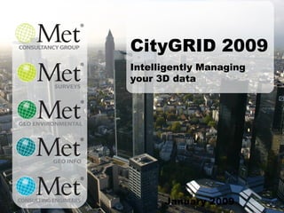
- 1. January 2009 CityGRID 2009 Intelligently Managing your 3D data
- 2. City Modelling: What is it? City modelling as a concept in Europe is well established, to the point of almost being a legal pre-requisite for any significant development project. In the UK, the use of massive 3D models is still going through a process of acceptance with only a few key examples (London, Glasgow and Manchester) with others actively investigating. So what are we really talking about? A City Model is the digital representation of an entire city in 3D…
- 4. City Modelling: What is it? ..to LoD 4 We can even handle interiors. This example is from Wiener Linien who modelled the entire sub-way network of Vienna. Most of the network was constructed before 1989, and no digital records existed. Rather than produce 2D information from hand-drawings, they opted to move straight to 3D, from which they can profile and produce 2D cross-sections at will. Being an underground structure, the exterior is not of interest. The internal layouts and interaction with the city above (shown here integrated with data from the City of Vienna) is vital.
- 6. Information Management 1 Use the model as a record of the built environment. There is no better means of recording the structure and fabric of a city than in 3D. It is more intuitive than a map and certainly more interactive – and this means that it can be used as a baseline for other applications such as disaster management. These images show CityGRID being used live in an emergency command centre (exercise prior to the European Cup). Detailed information of buildings (above and below ground) were relayed to ground teams who otherwise would have been acting blind.
- 8. Urban Planning 1 Urban Planning is obviously a massive ‘catch-all’ description that covers many issues and disciplines, but we thought we could show you some examples of CityGRID being used actively to assist the decision making process of planners. In this case it is shadow analysis. Not for a ‘right to light’ as we might expect in the UK, but for animal welfare – in particular for assessing the amount of time spent in the shade by Vienna's famous horse-drawn taxi’s. The yellow indicates the taxi-stands!
- 9. Urban Planning 2 In this example an Impact Assessment (Visual Intrusion and Line of Site analysis) study is being undertaken on the tower highlighted. This particular development was causing such controversy that it was actually threatening the World Heritage Site status of the city of Vienna. This image illustrated the visual impact of the tower, and with other data, gave the City the justification for imposing the decision that they wanted – i.e. to reduce the height of the development.
- 11. Public Consultation 2 … or we can interact with the wider community via information booths. This example was a demonstration based on the ESRI ArcExplorer technology for the city of Oslo.
- 12. Public Consultation 3 … Or via the WWW, in this case Google Earth. While a useful tool for reaching a mass audience it is typically not preferred for consultation process which generally requires a more ‘controlled’ environment. It would however be a very useful delivery tool for Tourist focused applications.
- 15. CityGRID: What is it? The CityGRID modules: CityGRID Manager, the core module that provides the true functionality of a design tool . The modules can be used in isolation. CityGRID Modeler provides fast and efficient construction tools from a number of surveyed data formats. CityGRID Planner provides planners analysis tools for the assessment of design concepts. CityGRID Viewer gives non-technical audience access to high quality, interactive virtual reality simulations as a stand-alone viewer.. CityGRID Modeler CityGRID Planner CityGRID Explorer CityGRID Manager
- 17. CityGRID: The advantage Off-the-shelf model: faces CityGRID: line model CityGRID: faces generated on the fly The CityGRID data structure: 3D city models are typically constructed using faces: independent planes without topological structure. The finished article can be impressive when presented in a viewer, but examination of the structure typically reveals problems. Without a topological structure it becomes difficult to modify a building. Multiply that problem across a city, and you have an a significant burden to address errors. In contrast CityGRID Manager uses a 3D line-structure to store building information, with the faces generated on-the-fly.
- 18. CityGRID Manager model structure Input line structure Corresponding 3D Model CityGRID: The advantage The CityGRID data structure: This structure is also very effecient in terms of data storage. The image on the left shows the information required to produce the model on the right. The data is structured with a heirarchy of element types – indicated by the different colours in this image. All this gives us the ability to maintain a city scale model using database type procedures (i.e. en mass and homogeneously)
- 19. CityGRID: The advantage CityGRID Modeler tool: The CityGRID data structure: For example we can use the structured information to ensure an accurate fit of the 3D model with a base map, using automatica database procedures. In this example a roof-protrustion is generated by having the faces conform to an external foot-print data-set. You now have a detailed model derived from aerail photogrammetry that conforms to ground plan data A common request is for data to tie in with cadastral records – which are not necessarily postionally accurate!
- 21. CityGRID: The advantage … .by allowing the maximum level of integration with a clients decision support processes (as represented on the left hand side of the image). In the centre CityGRID Manager provides the administration for all the buildings and takes advantage of everything that the database (shown at the bottom ) has to offer…..
- 23. LoD 1 LoD 2 LoD 3 The Logic of CityGRID Level of Detail (LoD): CityGRID is also able to manage multiple versions of buildings, which is useful both for historical ‘tracking’ and multiple representation of structures; i.e. different Levels of Detail (LoD) for use at different scales. LoD is an indication of the precision that the building has been modelled to (and independent of any positional issues). The scale goes from 1 – 3 and there is emerging acceptance of these levels. We use the CityGML definition as our basis - broadly represented in this sequence.
- 24. The Logic of CityGRID LOD: Scalable solutions according need Why is this important? Because a model needs to serves many purposes In order to represent complex realities we need to manage a building at various levels of complexity consistently (change at one LoD will be represented, where appropriate, at another) and efficiently. Note: We’ve added a LOD 1.5 to indicate that in general parlance these terms are flexible. Some models are described as having generalised roof-models. This means that they are applying a best-fit model from a library. This is typical of (semi) automated processes using LiDAR. Application: Data Source: Topographic mapping Aerial photogrammetry or airborne laser scanning LoD 1.5 Generalised Roof Model LoD 1 Block Model LoD 2 Roof Model LoD 3 Detailed Roof Model LoD 4 Interiors Aerial photogrammetry or airborne laser scanning Detailed aerial photogrammetry Façade photographs and 3D TLS of complex buildings Construction plans or surveying Noise protection, large area city planning Local area city planning, project development Project development, architectural documentation, cultural heritage. Homeland security, asset management
- 25. The Logic of CityGRID 3 Levels of hierarchy of a City GRID building CityGRID manages a building in units with a hierarchical structure extending below, made of objects , elements and then faces . As the faces are generated on the fly from the line structure, we are able to create a model at the appropriate LoD based on the defining components – and not by storing multiple current versions of the building. Unit Object 2 Object 1 Object 3 Detail element complex Main element complex facade roof
- 26. The Logic of CityGRID 4 Units, Objects and Elements: Again, you have to ask why? Well, if you think about it the definition of a building can become quite abstract. In this example (left image) the geometric unit is well defined (city block), but the number of addressed locations is harder to define. There are horizontal and vertical (flats) splits. Within CityGRID, the building (Unit) can be sub-divided into Objects, with the various Elements being used to define the form of the buildings further (balcony, dormers, etc.)
- 27. The Logic of CityGRID 5 Historical versions: Change within an urban core is rapid and needs to be represented in the model. Change in the model however can also result from operational issues – e.g. units are upgraded to higher LoD’s in line with project requirements. CityGRID enables a piece-meal approach to modelling as budgets or requirements demand. In this example an editing change has been made (new roof) that results in a new version of a building. CityGRID uses ‘partial persistency’ (i.e. only the current version is editable) to keep records of all changes to that building.
Notas do Editor
- An introduction to CityGRID and the advantages of using a relational database to manage your 3D data.