SlideShare uma empresa Scribd logo
1 de 22
Baixar para ler offline
STATE REMOTE SENSING APPLICATION CENTRE,
JODHPUR
• SRSAC earlier known as “Aerial Photo Interpretation
Laboratory (APIL)” established in 1979 as part of Desert
Development Programme to assist soil and water
Conservation Planning in the State.
• In 1985 looking to multi-disciplinary utility of the Remote
sensing Technology, the laboratory was transferred with staff
to State Department of science and Technology and renamed
as “State Remote Sensing Application Centre (SRSAC).”
1
Objectives :
• Generation of number of database related to natural resources for
developmental planning activities in the state using remote sensing
techniques (Aerial Photo Interpretation and Satellite data
interpretation both visually as well as digital mode).
• To generate data bank consisting of temporal and spatial data
products and to generate information system on natural resources.
• To interact with various user agencies for the formulation and
implementation of Remote Sensing Projects for development
planning.
• To undertake short term and long term experimental and operational
remote sensing studies to identify, and manage various natural
resources such as soil, water, forest, agriculture, minerals,
settlement, town planning, drainage, roads and geology for
monitoring changes due to natural calamities such as drought, flood
and also to evaluate land use changes.
• Human Resource Development in the field of remote sensing by
organizing short term appraisal courses / seminars or workshop /
exhibitions on remote sensing application for the user departments,
agencies, NGO’s and students.
• To interact with National Remote sensing Institute like National
Remote Sensing agency (NRSA), Hyderabad, Space Application
Centre (SAC), Ahmedabad, Regional Remote Sensing Service Centre
(RRSSC), Jodhpur to carry out joint projects.
2
Database Created for Various Line Departments:
Centre has created larger number of database on natural resources of
the state on requisition from various user departments, agencies, etc.
as a part of nation wide policy of department Space by participating in
technology transfer strategy.
3
Few among these are –
Watershed Development and Soil Conservation Department :-
Watershed Delineation :
• All natural resources development planning is based on watershed
approach.
• This requires spatial distribution and characterization of watershed at
micro level.
• Watershed delineation has been done using satellite data as well as
aerial photographs for all the Panchayat samiti blocks of the State.
• Using remote sensing inputs characterization up to micro level depicts
slope direction, extent, land use characterization – cultivated area,
wasteland, drainage density, based on per cent cultivated area and
drainage density priotisation has also been done.
These have proved to be valuable data base for taking up watershed
development works, based on which huge funding is being received from
Government of India under various schemes.
4
Watershed Management Information System (WMIS) :
Under World Bank aided “Watershed Development Programme
A computerized GIS based “Watershed Management Information System”
on ARC / INFO Platform has been developed at the Centre.
The model comprises of extent, nature characterization of watershed, land
ownership, erosion extent, cropping pattern, irrigation status, inputs for
development various treatment model, etc.
It also incorporates query based retrieval of any information about watershed
including characterization and development.
5
Water Harvesting Structures –
Anicut –
By virtue of stereoscopic view through aerial photographs taking existence of
firm banks along stream, sufficient submergence area, less than 2 % slope at
site, medium to heavy textured soils in submergence area into consideration
suitable sites for structures locally known as Anicut have been identified.
Panchayat Samitiwise Master Plan for all the such sites prepared for entire
State.
In all 2120 such sites were proposed-
Khadeens –
Rajasthan, especially north western part of the state is prone to occurrence of
frequent droughts, which, consequently has adverse affects on the economy and
living standards of habitants of the area. Rainfall is meager as well as erratic,
Hence, whatever the quantity of water available through rains, is of significant
importance so all attempts are made to conserve for drinking and growing
crops on conserved soil moisture.
Khadeen is most appropriate water conservation device for this area to conserve
runoff water right in cultivated fields to have a rabi crops.
Number of such sites have been identified in different part of the State.
6
BLOCK - KOLAYAT
DISTRICT - BIKANER
Ravinous Area Delineation –
In east and south eastern part of Rajasthan, along Chambal and its tributaries
large tract of ravinous area exist.
Ravines have very adverse effect on the agro-economical activities of the
area. Conversion of fertile cultivated lands into un productive ravine land.
These are known to provide good hiding place for dacoits.
Its spread had been enchroaching adjoining good arable land and thus area
under ravines has increased considerably over the years.
To check their expansion correct distribution and extent of ravines is
required.
Delineation of spatial distribution of ravines have been delineated and their
depth wise classification has also been done.
District covered under this are Kota, Jhalawar, Baran, Bundi, Sawai
Madhopur, Karauli, Dausa, Bharatpur, Dhaulpur, Jaipur and Jhunjhunun..
This is an important database for reclamation and monitoring expansion of
growth so as to increase agricultural productivity.
7
Besides all above work for –
• Village wise Wasteland Mapping for entire state.
• Integrated Mission for Sustainable Development
• Panchayat samiti -wise Land and Water Resource Development Plan.
• Natural and Livestock Resource Development Plan.
• Identification of source of Siltation Pushkar Sarovar also completed.
8
Forest Department :
• Forest area mapping, their distribution and classification completed
for Sirohi and Bundi districts of the state (Panchayat Samiti wise).
• Forest development monitoring and evaluation along Aravallis in
Jaipur, Alwar and Chittaurgarh districts done using multi-date satellite
data in digital mode (1996-2002).
• Data also envisages encroachments in forest areas for agriculture or
mining.
• Forest range map for desert districts in GIS environment also
prepared.
• Work for Bio-diversity conservation in Wet Land in Keoladev
National Park.
9
Irrigation Department :
Master Plan for Lift Irrigation sites -
South east Rajasthan has flow of periniel rivers, which have water
availability during rabi crop season also.
The water can be used for irrigation in Rabi season also, by lifting from
appropriate sites.
Under a special scheme organization sponsored project, using two season
satellite data site selection for suitable sites for Lift Irrigation was done.
Panchayat Samiti wise Master Plan of Lift Irrigation Sites prepared for 102
Panchayat Samiti blocks of the state.
This data base is being intensively used under community lift Irrigation
Schemes.
Sites Selection for Fisheries Development :
Identification and selection of suitable sites for fisheries development for
entire state done using multi - date satellite data.
Catchment Charactetrization of Major Dams :
It is a department of Irrigation sponsored project under the project catchment
characterization of 100 major and minor dams have been completed and
encroachment in catchment is also identified.
As per direction of Hon’ble Rajasthan High Court Catchment
characterization of Pichola and Rajsamand Lake also completed.
10
Besides the above, work on –
o Wet Land Mapping entire State.
o Biodiversity conservation in Wet Land.
o Integrated Resource Survey
o River course behaviour studies over a period
o Monitoring of surface water bodies
also completed.
Agriculture Department :
Under Space Application Centre (SAC), Department of Space, Government
of India, Ahmedabad Collaborative Project.
Forecaste estimates of acreage and Preharvest Production, Wheat-22,
Mustard 16, cotton 2 and Village level study for two villages of Pali district
continuous since 1987 using analysis of satellite data through digital image
processing techniques.
Arable Land use / Land cover mapping – Completed for entire state.
Besides these work on
• Overview of Kharif and Rabi crops.
• Integrated Resource Survey
• Soyabean Acreage Estimation in CAD, Kota
• Panchayat Samiti wise Land Degradation studies also completed.
11
Drought Assessment studies –
Using multi-date satellite data, based on vegetation cover and water
availability in surface water bodies, drought assessment study was made at
the centre.
12
Site Selection for Fodder Development along IGNP
Along IGNP sites for fodder development using soil moisture are identified
at the part of Jaisalmer and Bikaner districts.
13
National (Natural) Resources Inforamtion System (NRIS)
It is a Department of Space Collaborative Project under which district level
planning database on natural resources and infrastructure resources in GIS
environment through computer being generated.
NRIS is visualized as a network of GIS based nodes covering the districts
and states and the entire country.
These nodes will be the repositories of resource information in the spatial
domain and will provide vital inputs to decision making at district level.
The Prime objective of NRIS Project is to provide information to planners
for sustainable development both for land and waer resources in the district.
The detailed objective of this project are to create digital database of thematic
map on 1:50,000 scale for the district nodes and link them through suitable
network; integrate thematic information in GIS environment to draw local
specific action for land / water resources and socio economic development in
the district / State.
And generate query shall for data retrieval and generation of action plans
interactively for decision making.
14
Database also created for
• Land Resource Department
• Zila Parishads and DRDA’s
• Town Planning, UITs and Municipalities
• TADA & MADA
• Public Health and Engineering Department (PHED)
• Ground Water Department
• Settlement department
• Revenue, Relief, Economics and Statistics
• Jaipur Development Authority (JDA)
• Rajasthan Rajya Vidut Prasaran Nigam
• Public Works Department
• State Land use Board
• Rajasthan State Industrial Development & Investment Corporation
• District Planning.
• Ayurvedic Department
• Defence Laboratory
• Water and Power Consultancy Service- ( A Govt. of India undertaking).
• National Productivity Council, (New Delhi).
• Cairn Energy Pvt. Ltd., Chennai (Incorporation in New South Wales,
Australia)
• Director, General Mines Safety, Government of India, Jabalpur
• Election Department
And many more.
15
Some of the Important Project –
World Bank sponsored
- Watershed Management Information System (WMIS)
- Agriculture Development Project (ADP)
Department of Space sponsored
- Wet Land Mapping
- Land use / Land cover Mapping
- Integrated Mission for Sustainable Development (IMSD)
- Rajeev Gandhi National Drinking Water Mission (RGNDWM)
- Integrated Resource Survey
Government of India sponsored
• Natural and Livestock Resource Appraisal Project 10 DDP districts
(Ministry of Rural Development, Government of India, New Delhi)
• Site Selection for Desalinization plants in Barmer district (Defence
Laboratory, government of India, Jodhpur)
16
Unique attempts (Maiden in country at Sate Level)
• Resource Atlas of Rajasthan
• Watershed Atlas of Rajasthan
• Ground Water Atlas of Rajasthan
• Ayurvedic Medicinal Plant Atlas of Rajasthan ( in Hindi)
• Election Atlas.
17
Satellite based Communication Network (SATCOM) :
In the year 2004 Government of Rajasthan had decided to establish Satellite
based communication network (SATCOM) connecting all the district Head
Quarters and Panchayat Samiti Head Quarters.
• The network will be useful for training, distance education, extension
programmes various state departments.
• Studio is established at IGPRS Sansthan, Jaipur.
• All Zila Parishads and Panchayat Samiti Head Quarters will have one way
Video and two way audio facilities.
• Integrated Hub at IGPRS has been established and operational being used for
telemedicine, GRAMSAT and EDUSAT activities.
• Satellite Interactive Terminals (SITs ) at Zila Parishads and Receive only
Terminals (ROTs) at Panchayat Samitis Head Quarters installed.
• All Gram Panchayats are planned to be covered with ROT installation under
next five year plan.
18
Video film on
• Remote Sensing
• Resource Atlas of Rajasthan
• Watershed Management
There were telecasted on Doordarshan Network under UGC Programme.
Institutional Mechanism –
Variety of database is being generated on Natural Resource Management
Planning. Efforts are being simultaneously made for their effective utilization.
Project Director, SRSAC is member of state Watershed Committee and also
Member secretary of National Natural Resources Management Board.
Representative of Centre are members of District Watershed Committees where
availability of all sort of data on Land and Water Resource Development
planning is interacted. Regular training courses for user departments are also
organized.
Human Resources Development in Remote Sensing :-
Centre regularly organized training programmes for the officer’s of user
departments, teachers of Universities, colleges and others ( 4 Programmes in a
year) since 1990.
Besides number of Engineering and MCA students from all over the Country
completed their project work as a part of their degree courses and taken training
on Remote Sensing.
S. No. Year Number of students
1 2000 10
2 2001 25
3 2002 55
4 2003 125
5 2004 160
6 2005 180
7 2006 185
19
Infrastructural Facilities :
The Centre is one of the oldest State Remote Sensing Centre at State level in the
country equipped with following infrastructure.
Data inputs :
• Survey of India toposheets on 1:50,000 and 1:2,50,000 scale for entire State.
• Satellite data FCC on 1:50,000 and 1:250,000 scale at varied intervals.
• Computer compatible Tapes (CCT) of varied period covering entire State.
Visual Interpretation :
• PROCOM-2
• Large Format Optical Enlarger
• Additive Colour Viewer
• Art-O-Graph
• Optical Pantograph
• Stereo Zoom Transferscope
• Optical Reflecting Projector
• Mirror Stereoscope
• NC Scriber
• Digital Plannimeter
• Roto meter
Digital Image Processing and GIS :
• Workstation HCL/HP-9000/712 (3 – Terminals )
• Operating System – UNIX (HP –UX)
• Windows 2000 based Machines.
20
APPLICATIONS SOFTWARE –
• Image Analysis - ERDAS (2 Licenses)
• GIS – ARC/INFO (8 –Licenses)
• Indy Machines (3) with ARC/INFO Licenses.
PERIPHERALS –
• 42” Colouor Inkjet Plotter (2)
• AO-Size Digitizer (2)
• A3 Size Colour Thermal Printer
• AO-Size Colour Raster Plotter
• 42” Colour Scanner
COMPUTER :
• 35 Pentium IV (including two servers)
• 3 Numbers Pentium PRO-III
• Pentium PRO II with A 4 Size Colour Printer
• Pentium III WIPRO with A 3 Size Colour Inkjet Printer
GPS
• GPS –2 in number
21
22

Mais conteúdo relacionado

Mais procurados

PP No 46/2016 : TATA CARA PENYELENGGARAAN KAJIAN LINGKUNGAN HIDUP STRATEGIS
PP No 46/2016 : TATA CARA PENYELENGGARAAN KAJIAN LINGKUNGAN HIDUP STRATEGISPP No 46/2016 : TATA CARA PENYELENGGARAAN KAJIAN LINGKUNGAN HIDUP STRATEGIS
PP No 46/2016 : TATA CARA PENYELENGGARAAN KAJIAN LINGKUNGAN HIDUP STRATEGISAchmad Wahid
 
Geospatial solutions for creating a smart city
Geospatial solutions for creating a smart cityGeospatial solutions for creating a smart city
Geospatial solutions for creating a smart cityShristi Paudel
 
Introduction to remote sensing
Introduction to remote sensingIntroduction to remote sensing
Introduction to remote sensingNambi Harish
 
Dokumen perencanaan-proyek-perangkat-lunak
Dokumen perencanaan-proyek-perangkat-lunakDokumen perencanaan-proyek-perangkat-lunak
Dokumen perencanaan-proyek-perangkat-lunakWinda Dwiastini
 
Geographical information system
Geographical information systemGeographical information system
Geographical information systemBipin Karki
 
Hyderabad LISS III Image Interpretation (Using ERDAS Imagine)
Hyderabad LISS III Image Interpretation (Using ERDAS Imagine)Hyderabad LISS III Image Interpretation (Using ERDAS Imagine)
Hyderabad LISS III Image Interpretation (Using ERDAS Imagine)Prachi Mehta
 
Permen PU 01 2014 Standar Pelayanan Minimal Bidang Pekerjaan Umum dan Penataa...
Permen PU 01 2014 Standar Pelayanan Minimal Bidang Pekerjaan Umum dan Penataa...Permen PU 01 2014 Standar Pelayanan Minimal Bidang Pekerjaan Umum dan Penataa...
Permen PU 01 2014 Standar Pelayanan Minimal Bidang Pekerjaan Umum dan Penataa...infosanitasi
 
Pola Pengelolaan Sumber Daya Air WS Brantas
Pola Pengelolaan Sumber Daya Air WS BrantasPola Pengelolaan Sumber Daya Air WS Brantas
Pola Pengelolaan Sumber Daya Air WS BrantasDe Dwi Saptarahadi
 
Arsitektur perkotaan
Arsitektur perkotaanArsitektur perkotaan
Arsitektur perkotaanVega Adhistya
 
Kerangka Acuan Kerja (KAK) Sistem Aplikasi Pelaporan Keluhan
Kerangka Acuan Kerja (KAK) Sistem Aplikasi Pelaporan KeluhanKerangka Acuan Kerja (KAK) Sistem Aplikasi Pelaporan Keluhan
Kerangka Acuan Kerja (KAK) Sistem Aplikasi Pelaporan Keluhansafiravanillia
 
Tnd - Pengantar Manajemen Proyek Sistem Informasi - Temu 3
Tnd - Pengantar Manajemen Proyek Sistem Informasi - Temu 3Tnd - Pengantar Manajemen Proyek Sistem Informasi - Temu 3
Tnd - Pengantar Manajemen Proyek Sistem Informasi - Temu 3Tino Dwiantoro
 
Spatial data analysis 1
Spatial data analysis 1Spatial data analysis 1
Spatial data analysis 1Johan Blomme
 
GIS enabled eGovernance
GIS enabled eGovernanceGIS enabled eGovernance
GIS enabled eGovernanceEsri India
 
Tata Cara Rekomendasi BIG pada Lampiran Peta RDTR
Tata Cara Rekomendasi BIG pada Lampiran Peta RDTRTata Cara Rekomendasi BIG pada Lampiran Peta RDTR
Tata Cara Rekomendasi BIG pada Lampiran Peta RDTRKhalid Adam
 
Pedoman Penyusunan Rencana Detail Tata Ruang dan Peraturan Zonasi Kabupaten/K...
Pedoman Penyusunan Rencana Detail Tata Ruang dan Peraturan Zonasi Kabupaten/K...Pedoman Penyusunan Rencana Detail Tata Ruang dan Peraturan Zonasi Kabupaten/K...
Pedoman Penyusunan Rencana Detail Tata Ruang dan Peraturan Zonasi Kabupaten/K...Penataan Ruang
 
A case study on GIS application
A case study on GIS applicationA case study on GIS application
A case study on GIS applicationAxay Sharma
 

Mais procurados (20)

PP No 46/2016 : TATA CARA PENYELENGGARAAN KAJIAN LINGKUNGAN HIDUP STRATEGIS
PP No 46/2016 : TATA CARA PENYELENGGARAAN KAJIAN LINGKUNGAN HIDUP STRATEGISPP No 46/2016 : TATA CARA PENYELENGGARAAN KAJIAN LINGKUNGAN HIDUP STRATEGIS
PP No 46/2016 : TATA CARA PENYELENGGARAAN KAJIAN LINGKUNGAN HIDUP STRATEGIS
 
Project charter
Project charterProject charter
Project charter
 
Geospatial solutions for creating a smart city
Geospatial solutions for creating a smart cityGeospatial solutions for creating a smart city
Geospatial solutions for creating a smart city
 
Introduction to remote sensing
Introduction to remote sensingIntroduction to remote sensing
Introduction to remote sensing
 
Dokumen perencanaan-proyek-perangkat-lunak
Dokumen perencanaan-proyek-perangkat-lunakDokumen perencanaan-proyek-perangkat-lunak
Dokumen perencanaan-proyek-perangkat-lunak
 
Geographical information system
Geographical information systemGeographical information system
Geographical information system
 
Hyderabad LISS III Image Interpretation (Using ERDAS Imagine)
Hyderabad LISS III Image Interpretation (Using ERDAS Imagine)Hyderabad LISS III Image Interpretation (Using ERDAS Imagine)
Hyderabad LISS III Image Interpretation (Using ERDAS Imagine)
 
Permen PU 01 2014 Standar Pelayanan Minimal Bidang Pekerjaan Umum dan Penataa...
Permen PU 01 2014 Standar Pelayanan Minimal Bidang Pekerjaan Umum dan Penataa...Permen PU 01 2014 Standar Pelayanan Minimal Bidang Pekerjaan Umum dan Penataa...
Permen PU 01 2014 Standar Pelayanan Minimal Bidang Pekerjaan Umum dan Penataa...
 
Pola Pengelolaan Sumber Daya Air WS Brantas
Pola Pengelolaan Sumber Daya Air WS BrantasPola Pengelolaan Sumber Daya Air WS Brantas
Pola Pengelolaan Sumber Daya Air WS Brantas
 
Introduction To GIS
Introduction To GISIntroduction To GIS
Introduction To GIS
 
Arsitektur perkotaan
Arsitektur perkotaanArsitektur perkotaan
Arsitektur perkotaan
 
Kerangka Acuan Kerja (KAK) Sistem Aplikasi Pelaporan Keluhan
Kerangka Acuan Kerja (KAK) Sistem Aplikasi Pelaporan KeluhanKerangka Acuan Kerja (KAK) Sistem Aplikasi Pelaporan Keluhan
Kerangka Acuan Kerja (KAK) Sistem Aplikasi Pelaporan Keluhan
 
Tnd - Pengantar Manajemen Proyek Sistem Informasi - Temu 3
Tnd - Pengantar Manajemen Proyek Sistem Informasi - Temu 3Tnd - Pengantar Manajemen Proyek Sistem Informasi - Temu 3
Tnd - Pengantar Manajemen Proyek Sistem Informasi - Temu 3
 
Spatial data analysis 1
Spatial data analysis 1Spatial data analysis 1
Spatial data analysis 1
 
GIS enabled eGovernance
GIS enabled eGovernanceGIS enabled eGovernance
GIS enabled eGovernance
 
Tata Cara Rekomendasi BIG pada Lampiran Peta RDTR
Tata Cara Rekomendasi BIG pada Lampiran Peta RDTRTata Cara Rekomendasi BIG pada Lampiran Peta RDTR
Tata Cara Rekomendasi BIG pada Lampiran Peta RDTR
 
Pedoman Penyusunan Rencana Detail Tata Ruang dan Peraturan Zonasi Kabupaten/K...
Pedoman Penyusunan Rencana Detail Tata Ruang dan Peraturan Zonasi Kabupaten/K...Pedoman Penyusunan Rencana Detail Tata Ruang dan Peraturan Zonasi Kabupaten/K...
Pedoman Penyusunan Rencana Detail Tata Ruang dan Peraturan Zonasi Kabupaten/K...
 
GIS
GISGIS
GIS
 
A case study on GIS application
A case study on GIS applicationA case study on GIS application
A case study on GIS application
 
GIS
GISGIS
GIS
 

Semelhante a Srsac ppt

Application of remote sensing
Application of remote sensingApplication of remote sensing
Application of remote sensingAnurag Kumar
 
Water resources planning and development m5
Water resources planning and development m5Water resources planning and development m5
Water resources planning and development m5Bibhabasu Mohanty
 
Mh sw optimisation of g&d stations network of maharashtra
Mh sw optimisation of g&d stations network of maharashtraMh sw optimisation of g&d stations network of maharashtra
Mh sw optimisation of g&d stations network of maharashtrahydrologyproject0
 
INTEGRATED STUDIES FOR WATERSHED DEVELOPMENT USING GIS: A CASE STUDY IN BASUH...
INTEGRATED STUDIES FOR WATERSHED DEVELOPMENT USING GIS: A CASE STUDY IN BASUH...INTEGRATED STUDIES FOR WATERSHED DEVELOPMENT USING GIS: A CASE STUDY IN BASUH...
INTEGRATED STUDIES FOR WATERSHED DEVELOPMENT USING GIS: A CASE STUDY IN BASUH...IRJET Journal
 
Groundwater management strategy by Dr S K Jain, CGWB
Groundwater management strategy by Dr S K Jain, CGWBGroundwater management strategy by Dr S K Jain, CGWB
Groundwater management strategy by Dr S K Jain, CGWBIndia Water Portal
 
Application of Remote Sensing & GIS Techniques in Watershed Management
Application of Remote Sensing  &  GIS Techniques in Watershed ManagementApplication of Remote Sensing  &  GIS Techniques in Watershed Management
Application of Remote Sensing & GIS Techniques in Watershed ManagementAjeet Jakhad
 
Mr.Singh IEWP @ Workshop on River Basin Management Planning and Governance,14...
Mr.Singh IEWP @ Workshop on River Basin Management Planning and Governance,14...Mr.Singh IEWP @ Workshop on River Basin Management Planning and Governance,14...
Mr.Singh IEWP @ Workshop on River Basin Management Planning and Governance,14...India-EU Water Partnership
 
Generation of information system for water resource management in Indo Ganget...
Generation of information system for water resource management in Indo Ganget...Generation of information system for water resource management in Indo Ganget...
Generation of information system for water resource management in Indo Ganget...Barnava Chatterjee
 
Vision for ground water management
Vision for ground water managementVision for ground water management
Vision for ground water managementhydrologyproject2
 
Identification of Groundwater Potential Zones in Vaippar Basin, Tamil Nadu, I...
Identification of Groundwater Potential Zones in Vaippar Basin, Tamil Nadu, I...Identification of Groundwater Potential Zones in Vaippar Basin, Tamil Nadu, I...
Identification of Groundwater Potential Zones in Vaippar Basin, Tamil Nadu, I...SagarChougule11
 
Empowering institutions and stakeholders for spatial planning - Dr. Nagaraj R...
Empowering institutions and stakeholders for spatial planning - Dr. Nagaraj R...Empowering institutions and stakeholders for spatial planning - Dr. Nagaraj R...
Empowering institutions and stakeholders for spatial planning - Dr. Nagaraj R...NeGD Capacity Building
 
23 - NRSC - Remote Satellite Imgae - Hydrology and Water Management-Sep-17
23 - NRSC - Remote Satellite Imgae - Hydrology and Water Management-Sep-1723 - NRSC - Remote Satellite Imgae - Hydrology and Water Management-Sep-17
23 - NRSC - Remote Satellite Imgae - Hydrology and Water Management-Sep-17indiawrm
 
Geo-spatial analysis for effective technology targeting
Geo-spatial analysis for effective technology targetingGeo-spatial analysis for effective technology targeting
Geo-spatial analysis for effective technology targetingICRISAT
 
Applications of Land Tools to Realise Land and Natural Resource Rights in Kenya
Applications of Land Tools to Realise Land and Natural Resource Rights in KenyaApplications of Land Tools to Realise Land and Natural Resource Rights in Kenya
Applications of Land Tools to Realise Land and Natural Resource Rights in KenyaGlobal Land Tool Network
 
Water-Balance-Pakistan
Water-Balance-PakistanWater-Balance-Pakistan
Water-Balance-PakistanRaza Farrukh
 
Tamil nadu wb review tn_hpii_delhi_may2014
Tamil nadu wb review tn_hpii_delhi_may2014Tamil nadu wb review tn_hpii_delhi_may2014
Tamil nadu wb review tn_hpii_delhi_may2014hydrologyproject0
 
Shankaraiah N:Rural Sociology Record
Shankaraiah N:Rural Sociology RecordShankaraiah N:Rural Sociology Record
Shankaraiah N:Rural Sociology Recordshankaraiah, N
 
NSDF_SANBI CONFERENCE 3 AUG.pptx
NSDF_SANBI CONFERENCE 3 AUG.pptxNSDF_SANBI CONFERENCE 3 AUG.pptx
NSDF_SANBI CONFERENCE 3 AUG.pptxSheena Satikge
 

Semelhante a Srsac ppt (20)

Application of remote sensing
Application of remote sensingApplication of remote sensing
Application of remote sensing
 
Water resources planning and development m5
Water resources planning and development m5Water resources planning and development m5
Water resources planning and development m5
 
Mh sw optimisation of g&d stations network of maharashtra
Mh sw optimisation of g&d stations network of maharashtraMh sw optimisation of g&d stations network of maharashtra
Mh sw optimisation of g&d stations network of maharashtra
 
INTEGRATED STUDIES FOR WATERSHED DEVELOPMENT USING GIS: A CASE STUDY IN BASUH...
INTEGRATED STUDIES FOR WATERSHED DEVELOPMENT USING GIS: A CASE STUDY IN BASUH...INTEGRATED STUDIES FOR WATERSHED DEVELOPMENT USING GIS: A CASE STUDY IN BASUH...
INTEGRATED STUDIES FOR WATERSHED DEVELOPMENT USING GIS: A CASE STUDY IN BASUH...
 
Groundwater management strategy by Dr S K Jain, CGWB
Groundwater management strategy by Dr S K Jain, CGWBGroundwater management strategy by Dr S K Jain, CGWB
Groundwater management strategy by Dr S K Jain, CGWB
 
Application of Remote Sensing & GIS Techniques in Watershed Management
Application of Remote Sensing  &  GIS Techniques in Watershed ManagementApplication of Remote Sensing  &  GIS Techniques in Watershed Management
Application of Remote Sensing & GIS Techniques in Watershed Management
 
Mr.Singh IEWP @ Workshop on River Basin Management Planning and Governance,14...
Mr.Singh IEWP @ Workshop on River Basin Management Planning and Governance,14...Mr.Singh IEWP @ Workshop on River Basin Management Planning and Governance,14...
Mr.Singh IEWP @ Workshop on River Basin Management Planning and Governance,14...
 
Decentralized surface water irrigation as a pathway for sustainable intensifi...
Decentralized surface water irrigation as a pathway for sustainable intensifi...Decentralized surface water irrigation as a pathway for sustainable intensifi...
Decentralized surface water irrigation as a pathway for sustainable intensifi...
 
Generation of information system for water resource management in Indo Ganget...
Generation of information system for water resource management in Indo Ganget...Generation of information system for water resource management in Indo Ganget...
Generation of information system for water resource management in Indo Ganget...
 
Vision for ground water management
Vision for ground water managementVision for ground water management
Vision for ground water management
 
Aquifer Mapping Programme
Aquifer Mapping ProgrammeAquifer Mapping Programme
Aquifer Mapping Programme
 
Identification of Groundwater Potential Zones in Vaippar Basin, Tamil Nadu, I...
Identification of Groundwater Potential Zones in Vaippar Basin, Tamil Nadu, I...Identification of Groundwater Potential Zones in Vaippar Basin, Tamil Nadu, I...
Identification of Groundwater Potential Zones in Vaippar Basin, Tamil Nadu, I...
 
Empowering institutions and stakeholders for spatial planning - Dr. Nagaraj R...
Empowering institutions and stakeholders for spatial planning - Dr. Nagaraj R...Empowering institutions and stakeholders for spatial planning - Dr. Nagaraj R...
Empowering institutions and stakeholders for spatial planning - Dr. Nagaraj R...
 
23 - NRSC - Remote Satellite Imgae - Hydrology and Water Management-Sep-17
23 - NRSC - Remote Satellite Imgae - Hydrology and Water Management-Sep-1723 - NRSC - Remote Satellite Imgae - Hydrology and Water Management-Sep-17
23 - NRSC - Remote Satellite Imgae - Hydrology and Water Management-Sep-17
 
Geo-spatial analysis for effective technology targeting
Geo-spatial analysis for effective technology targetingGeo-spatial analysis for effective technology targeting
Geo-spatial analysis for effective technology targeting
 
Applications of Land Tools to Realise Land and Natural Resource Rights in Kenya
Applications of Land Tools to Realise Land and Natural Resource Rights in KenyaApplications of Land Tools to Realise Land and Natural Resource Rights in Kenya
Applications of Land Tools to Realise Land and Natural Resource Rights in Kenya
 
Water-Balance-Pakistan
Water-Balance-PakistanWater-Balance-Pakistan
Water-Balance-Pakistan
 
Tamil nadu wb review tn_hpii_delhi_may2014
Tamil nadu wb review tn_hpii_delhi_may2014Tamil nadu wb review tn_hpii_delhi_may2014
Tamil nadu wb review tn_hpii_delhi_may2014
 
Shankaraiah N:Rural Sociology Record
Shankaraiah N:Rural Sociology RecordShankaraiah N:Rural Sociology Record
Shankaraiah N:Rural Sociology Record
 
NSDF_SANBI CONFERENCE 3 AUG.pptx
NSDF_SANBI CONFERENCE 3 AUG.pptxNSDF_SANBI CONFERENCE 3 AUG.pptx
NSDF_SANBI CONFERENCE 3 AUG.pptx
 

Último

Strategies for Unlocking Knowledge Management in Microsoft 365 in the Copilot...
Strategies for Unlocking Knowledge Management in Microsoft 365 in the Copilot...Strategies for Unlocking Knowledge Management in Microsoft 365 in the Copilot...
Strategies for Unlocking Knowledge Management in Microsoft 365 in the Copilot...Drew Madelung
 
HTML Injection Attacks: Impact and Mitigation Strategies
HTML Injection Attacks: Impact and Mitigation StrategiesHTML Injection Attacks: Impact and Mitigation Strategies
HTML Injection Attacks: Impact and Mitigation StrategiesBoston Institute of Analytics
 
Bajaj Allianz Life Insurance Company - Insurer Innovation Award 2024
Bajaj Allianz Life Insurance Company - Insurer Innovation Award 2024Bajaj Allianz Life Insurance Company - Insurer Innovation Award 2024
Bajaj Allianz Life Insurance Company - Insurer Innovation Award 2024The Digital Insurer
 
What Are The Drone Anti-jamming Systems Technology?
What Are The Drone Anti-jamming Systems Technology?What Are The Drone Anti-jamming Systems Technology?
What Are The Drone Anti-jamming Systems Technology?Antenna Manufacturer Coco
 
Strategies for Landing an Oracle DBA Job as a Fresher
Strategies for Landing an Oracle DBA Job as a FresherStrategies for Landing an Oracle DBA Job as a Fresher
Strategies for Landing an Oracle DBA Job as a FresherRemote DBA Services
 
AWS Community Day CPH - Three problems of Terraform
AWS Community Day CPH - Three problems of TerraformAWS Community Day CPH - Three problems of Terraform
AWS Community Day CPH - Three problems of TerraformAndrey Devyatkin
 
From Event to Action: Accelerate Your Decision Making with Real-Time Automation
From Event to Action: Accelerate Your Decision Making with Real-Time AutomationFrom Event to Action: Accelerate Your Decision Making with Real-Time Automation
From Event to Action: Accelerate Your Decision Making with Real-Time AutomationSafe Software
 
Finology Group – Insurtech Innovation Award 2024
Finology Group – Insurtech Innovation Award 2024Finology Group – Insurtech Innovation Award 2024
Finology Group – Insurtech Innovation Award 2024The Digital Insurer
 
🐬 The future of MySQL is Postgres 🐘
🐬  The future of MySQL is Postgres   🐘🐬  The future of MySQL is Postgres   🐘
🐬 The future of MySQL is Postgres 🐘RTylerCroy
 
Understanding Discord NSFW Servers A Guide for Responsible Users.pdf
Understanding Discord NSFW Servers A Guide for Responsible Users.pdfUnderstanding Discord NSFW Servers A Guide for Responsible Users.pdf
Understanding Discord NSFW Servers A Guide for Responsible Users.pdfUK Journal
 
TrustArc Webinar - Stay Ahead of US State Data Privacy Law Developments
TrustArc Webinar - Stay Ahead of US State Data Privacy Law DevelopmentsTrustArc Webinar - Stay Ahead of US State Data Privacy Law Developments
TrustArc Webinar - Stay Ahead of US State Data Privacy Law DevelopmentsTrustArc
 
04-2024-HHUG-Sales-and-Marketing-Alignment.pptx
04-2024-HHUG-Sales-and-Marketing-Alignment.pptx04-2024-HHUG-Sales-and-Marketing-Alignment.pptx
04-2024-HHUG-Sales-and-Marketing-Alignment.pptxHampshireHUG
 
Workshop - Best of Both Worlds_ Combine KG and Vector search for enhanced R...
Workshop - Best of Both Worlds_ Combine  KG and Vector search for  enhanced R...Workshop - Best of Both Worlds_ Combine  KG and Vector search for  enhanced R...
Workshop - Best of Both Worlds_ Combine KG and Vector search for enhanced R...Neo4j
 
Mastering MySQL Database Architecture: Deep Dive into MySQL Shell and MySQL R...
Mastering MySQL Database Architecture: Deep Dive into MySQL Shell and MySQL R...Mastering MySQL Database Architecture: Deep Dive into MySQL Shell and MySQL R...
Mastering MySQL Database Architecture: Deep Dive into MySQL Shell and MySQL R...Miguel Araújo
 
Automating Google Workspace (GWS) & more with Apps Script
Automating Google Workspace (GWS) & more with Apps ScriptAutomating Google Workspace (GWS) & more with Apps Script
Automating Google Workspace (GWS) & more with Apps Scriptwesley chun
 
Real Time Object Detection Using Open CV
Real Time Object Detection Using Open CVReal Time Object Detection Using Open CV
Real Time Object Detection Using Open CVKhem
 
GenAI Risks & Security Meetup 01052024.pdf
GenAI Risks & Security Meetup 01052024.pdfGenAI Risks & Security Meetup 01052024.pdf
GenAI Risks & Security Meetup 01052024.pdflior mazor
 
Connector Corner: Accelerate revenue generation using UiPath API-centric busi...
Connector Corner: Accelerate revenue generation using UiPath API-centric busi...Connector Corner: Accelerate revenue generation using UiPath API-centric busi...
Connector Corner: Accelerate revenue generation using UiPath API-centric busi...DianaGray10
 
Strategize a Smooth Tenant-to-tenant Migration and Copilot Takeoff
Strategize a Smooth Tenant-to-tenant Migration and Copilot TakeoffStrategize a Smooth Tenant-to-tenant Migration and Copilot Takeoff
Strategize a Smooth Tenant-to-tenant Migration and Copilot Takeoffsammart93
 
Histor y of HAM Radio presentation slide
Histor y of HAM Radio presentation slideHistor y of HAM Radio presentation slide
Histor y of HAM Radio presentation slidevu2urc
 

Último (20)

Strategies for Unlocking Knowledge Management in Microsoft 365 in the Copilot...
Strategies for Unlocking Knowledge Management in Microsoft 365 in the Copilot...Strategies for Unlocking Knowledge Management in Microsoft 365 in the Copilot...
Strategies for Unlocking Knowledge Management in Microsoft 365 in the Copilot...
 
HTML Injection Attacks: Impact and Mitigation Strategies
HTML Injection Attacks: Impact and Mitigation StrategiesHTML Injection Attacks: Impact and Mitigation Strategies
HTML Injection Attacks: Impact and Mitigation Strategies
 
Bajaj Allianz Life Insurance Company - Insurer Innovation Award 2024
Bajaj Allianz Life Insurance Company - Insurer Innovation Award 2024Bajaj Allianz Life Insurance Company - Insurer Innovation Award 2024
Bajaj Allianz Life Insurance Company - Insurer Innovation Award 2024
 
What Are The Drone Anti-jamming Systems Technology?
What Are The Drone Anti-jamming Systems Technology?What Are The Drone Anti-jamming Systems Technology?
What Are The Drone Anti-jamming Systems Technology?
 
Strategies for Landing an Oracle DBA Job as a Fresher
Strategies for Landing an Oracle DBA Job as a FresherStrategies for Landing an Oracle DBA Job as a Fresher
Strategies for Landing an Oracle DBA Job as a Fresher
 
AWS Community Day CPH - Three problems of Terraform
AWS Community Day CPH - Three problems of TerraformAWS Community Day CPH - Three problems of Terraform
AWS Community Day CPH - Three problems of Terraform
 
From Event to Action: Accelerate Your Decision Making with Real-Time Automation
From Event to Action: Accelerate Your Decision Making with Real-Time AutomationFrom Event to Action: Accelerate Your Decision Making with Real-Time Automation
From Event to Action: Accelerate Your Decision Making with Real-Time Automation
 
Finology Group – Insurtech Innovation Award 2024
Finology Group – Insurtech Innovation Award 2024Finology Group – Insurtech Innovation Award 2024
Finology Group – Insurtech Innovation Award 2024
 
🐬 The future of MySQL is Postgres 🐘
🐬  The future of MySQL is Postgres   🐘🐬  The future of MySQL is Postgres   🐘
🐬 The future of MySQL is Postgres 🐘
 
Understanding Discord NSFW Servers A Guide for Responsible Users.pdf
Understanding Discord NSFW Servers A Guide for Responsible Users.pdfUnderstanding Discord NSFW Servers A Guide for Responsible Users.pdf
Understanding Discord NSFW Servers A Guide for Responsible Users.pdf
 
TrustArc Webinar - Stay Ahead of US State Data Privacy Law Developments
TrustArc Webinar - Stay Ahead of US State Data Privacy Law DevelopmentsTrustArc Webinar - Stay Ahead of US State Data Privacy Law Developments
TrustArc Webinar - Stay Ahead of US State Data Privacy Law Developments
 
04-2024-HHUG-Sales-and-Marketing-Alignment.pptx
04-2024-HHUG-Sales-and-Marketing-Alignment.pptx04-2024-HHUG-Sales-and-Marketing-Alignment.pptx
04-2024-HHUG-Sales-and-Marketing-Alignment.pptx
 
Workshop - Best of Both Worlds_ Combine KG and Vector search for enhanced R...
Workshop - Best of Both Worlds_ Combine  KG and Vector search for  enhanced R...Workshop - Best of Both Worlds_ Combine  KG and Vector search for  enhanced R...
Workshop - Best of Both Worlds_ Combine KG and Vector search for enhanced R...
 
Mastering MySQL Database Architecture: Deep Dive into MySQL Shell and MySQL R...
Mastering MySQL Database Architecture: Deep Dive into MySQL Shell and MySQL R...Mastering MySQL Database Architecture: Deep Dive into MySQL Shell and MySQL R...
Mastering MySQL Database Architecture: Deep Dive into MySQL Shell and MySQL R...
 
Automating Google Workspace (GWS) & more with Apps Script
Automating Google Workspace (GWS) & more with Apps ScriptAutomating Google Workspace (GWS) & more with Apps Script
Automating Google Workspace (GWS) & more with Apps Script
 
Real Time Object Detection Using Open CV
Real Time Object Detection Using Open CVReal Time Object Detection Using Open CV
Real Time Object Detection Using Open CV
 
GenAI Risks & Security Meetup 01052024.pdf
GenAI Risks & Security Meetup 01052024.pdfGenAI Risks & Security Meetup 01052024.pdf
GenAI Risks & Security Meetup 01052024.pdf
 
Connector Corner: Accelerate revenue generation using UiPath API-centric busi...
Connector Corner: Accelerate revenue generation using UiPath API-centric busi...Connector Corner: Accelerate revenue generation using UiPath API-centric busi...
Connector Corner: Accelerate revenue generation using UiPath API-centric busi...
 
Strategize a Smooth Tenant-to-tenant Migration and Copilot Takeoff
Strategize a Smooth Tenant-to-tenant Migration and Copilot TakeoffStrategize a Smooth Tenant-to-tenant Migration and Copilot Takeoff
Strategize a Smooth Tenant-to-tenant Migration and Copilot Takeoff
 
Histor y of HAM Radio presentation slide
Histor y of HAM Radio presentation slideHistor y of HAM Radio presentation slide
Histor y of HAM Radio presentation slide
 

Srsac ppt

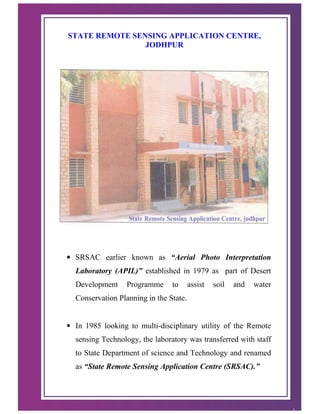
  • 1. STATE REMOTE SENSING APPLICATION CENTRE, JODHPUR • SRSAC earlier known as “Aerial Photo Interpretation Laboratory (APIL)” established in 1979 as part of Desert Development Programme to assist soil and water Conservation Planning in the State. • In 1985 looking to multi-disciplinary utility of the Remote sensing Technology, the laboratory was transferred with staff to State Department of science and Technology and renamed as “State Remote Sensing Application Centre (SRSAC).” 1
  • 2. Objectives : • Generation of number of database related to natural resources for developmental planning activities in the state using remote sensing techniques (Aerial Photo Interpretation and Satellite data interpretation both visually as well as digital mode). • To generate data bank consisting of temporal and spatial data products and to generate information system on natural resources. • To interact with various user agencies for the formulation and implementation of Remote Sensing Projects for development planning. • To undertake short term and long term experimental and operational remote sensing studies to identify, and manage various natural resources such as soil, water, forest, agriculture, minerals, settlement, town planning, drainage, roads and geology for monitoring changes due to natural calamities such as drought, flood and also to evaluate land use changes. • Human Resource Development in the field of remote sensing by organizing short term appraisal courses / seminars or workshop / exhibitions on remote sensing application for the user departments, agencies, NGO’s and students. • To interact with National Remote sensing Institute like National Remote Sensing agency (NRSA), Hyderabad, Space Application Centre (SAC), Ahmedabad, Regional Remote Sensing Service Centre (RRSSC), Jodhpur to carry out joint projects. 2
  • 3. Database Created for Various Line Departments: Centre has created larger number of database on natural resources of the state on requisition from various user departments, agencies, etc. as a part of nation wide policy of department Space by participating in technology transfer strategy. 3
  • 4. Few among these are – Watershed Development and Soil Conservation Department :- Watershed Delineation : • All natural resources development planning is based on watershed approach. • This requires spatial distribution and characterization of watershed at micro level. • Watershed delineation has been done using satellite data as well as aerial photographs for all the Panchayat samiti blocks of the State. • Using remote sensing inputs characterization up to micro level depicts slope direction, extent, land use characterization – cultivated area, wasteland, drainage density, based on per cent cultivated area and drainage density priotisation has also been done. These have proved to be valuable data base for taking up watershed development works, based on which huge funding is being received from Government of India under various schemes. 4
  • 5. Watershed Management Information System (WMIS) : Under World Bank aided “Watershed Development Programme A computerized GIS based “Watershed Management Information System” on ARC / INFO Platform has been developed at the Centre. The model comprises of extent, nature characterization of watershed, land ownership, erosion extent, cropping pattern, irrigation status, inputs for development various treatment model, etc. It also incorporates query based retrieval of any information about watershed including characterization and development. 5
  • 6. Water Harvesting Structures – Anicut – By virtue of stereoscopic view through aerial photographs taking existence of firm banks along stream, sufficient submergence area, less than 2 % slope at site, medium to heavy textured soils in submergence area into consideration suitable sites for structures locally known as Anicut have been identified. Panchayat Samitiwise Master Plan for all the such sites prepared for entire State. In all 2120 such sites were proposed- Khadeens – Rajasthan, especially north western part of the state is prone to occurrence of frequent droughts, which, consequently has adverse affects on the economy and living standards of habitants of the area. Rainfall is meager as well as erratic, Hence, whatever the quantity of water available through rains, is of significant importance so all attempts are made to conserve for drinking and growing crops on conserved soil moisture. Khadeen is most appropriate water conservation device for this area to conserve runoff water right in cultivated fields to have a rabi crops. Number of such sites have been identified in different part of the State. 6 BLOCK - KOLAYAT DISTRICT - BIKANER
  • 7. Ravinous Area Delineation – In east and south eastern part of Rajasthan, along Chambal and its tributaries large tract of ravinous area exist. Ravines have very adverse effect on the agro-economical activities of the area. Conversion of fertile cultivated lands into un productive ravine land. These are known to provide good hiding place for dacoits. Its spread had been enchroaching adjoining good arable land and thus area under ravines has increased considerably over the years. To check their expansion correct distribution and extent of ravines is required. Delineation of spatial distribution of ravines have been delineated and their depth wise classification has also been done. District covered under this are Kota, Jhalawar, Baran, Bundi, Sawai Madhopur, Karauli, Dausa, Bharatpur, Dhaulpur, Jaipur and Jhunjhunun.. This is an important database for reclamation and monitoring expansion of growth so as to increase agricultural productivity. 7
  • 8. Besides all above work for – • Village wise Wasteland Mapping for entire state. • Integrated Mission for Sustainable Development • Panchayat samiti -wise Land and Water Resource Development Plan. • Natural and Livestock Resource Development Plan. • Identification of source of Siltation Pushkar Sarovar also completed. 8
  • 9. Forest Department : • Forest area mapping, their distribution and classification completed for Sirohi and Bundi districts of the state (Panchayat Samiti wise). • Forest development monitoring and evaluation along Aravallis in Jaipur, Alwar and Chittaurgarh districts done using multi-date satellite data in digital mode (1996-2002). • Data also envisages encroachments in forest areas for agriculture or mining. • Forest range map for desert districts in GIS environment also prepared. • Work for Bio-diversity conservation in Wet Land in Keoladev National Park. 9
  • 10. Irrigation Department : Master Plan for Lift Irrigation sites - South east Rajasthan has flow of periniel rivers, which have water availability during rabi crop season also. The water can be used for irrigation in Rabi season also, by lifting from appropriate sites. Under a special scheme organization sponsored project, using two season satellite data site selection for suitable sites for Lift Irrigation was done. Panchayat Samiti wise Master Plan of Lift Irrigation Sites prepared for 102 Panchayat Samiti blocks of the state. This data base is being intensively used under community lift Irrigation Schemes. Sites Selection for Fisheries Development : Identification and selection of suitable sites for fisheries development for entire state done using multi - date satellite data. Catchment Charactetrization of Major Dams : It is a department of Irrigation sponsored project under the project catchment characterization of 100 major and minor dams have been completed and encroachment in catchment is also identified. As per direction of Hon’ble Rajasthan High Court Catchment characterization of Pichola and Rajsamand Lake also completed. 10
  • 11. Besides the above, work on – o Wet Land Mapping entire State. o Biodiversity conservation in Wet Land. o Integrated Resource Survey o River course behaviour studies over a period o Monitoring of surface water bodies also completed. Agriculture Department : Under Space Application Centre (SAC), Department of Space, Government of India, Ahmedabad Collaborative Project. Forecaste estimates of acreage and Preharvest Production, Wheat-22, Mustard 16, cotton 2 and Village level study for two villages of Pali district continuous since 1987 using analysis of satellite data through digital image processing techniques. Arable Land use / Land cover mapping – Completed for entire state. Besides these work on • Overview of Kharif and Rabi crops. • Integrated Resource Survey • Soyabean Acreage Estimation in CAD, Kota • Panchayat Samiti wise Land Degradation studies also completed. 11
  • 12. Drought Assessment studies – Using multi-date satellite data, based on vegetation cover and water availability in surface water bodies, drought assessment study was made at the centre. 12
  • 13. Site Selection for Fodder Development along IGNP Along IGNP sites for fodder development using soil moisture are identified at the part of Jaisalmer and Bikaner districts. 13
  • 14. National (Natural) Resources Inforamtion System (NRIS) It is a Department of Space Collaborative Project under which district level planning database on natural resources and infrastructure resources in GIS environment through computer being generated. NRIS is visualized as a network of GIS based nodes covering the districts and states and the entire country. These nodes will be the repositories of resource information in the spatial domain and will provide vital inputs to decision making at district level. The Prime objective of NRIS Project is to provide information to planners for sustainable development both for land and waer resources in the district. The detailed objective of this project are to create digital database of thematic map on 1:50,000 scale for the district nodes and link them through suitable network; integrate thematic information in GIS environment to draw local specific action for land / water resources and socio economic development in the district / State. And generate query shall for data retrieval and generation of action plans interactively for decision making. 14
  • 15. Database also created for • Land Resource Department • Zila Parishads and DRDA’s • Town Planning, UITs and Municipalities • TADA & MADA • Public Health and Engineering Department (PHED) • Ground Water Department • Settlement department • Revenue, Relief, Economics and Statistics • Jaipur Development Authority (JDA) • Rajasthan Rajya Vidut Prasaran Nigam • Public Works Department • State Land use Board • Rajasthan State Industrial Development & Investment Corporation • District Planning. • Ayurvedic Department • Defence Laboratory • Water and Power Consultancy Service- ( A Govt. of India undertaking). • National Productivity Council, (New Delhi). • Cairn Energy Pvt. Ltd., Chennai (Incorporation in New South Wales, Australia) • Director, General Mines Safety, Government of India, Jabalpur • Election Department And many more. 15
  • 16. Some of the Important Project – World Bank sponsored - Watershed Management Information System (WMIS) - Agriculture Development Project (ADP) Department of Space sponsored - Wet Land Mapping - Land use / Land cover Mapping - Integrated Mission for Sustainable Development (IMSD) - Rajeev Gandhi National Drinking Water Mission (RGNDWM) - Integrated Resource Survey Government of India sponsored • Natural and Livestock Resource Appraisal Project 10 DDP districts (Ministry of Rural Development, Government of India, New Delhi) • Site Selection for Desalinization plants in Barmer district (Defence Laboratory, government of India, Jodhpur) 16
  • 17. Unique attempts (Maiden in country at Sate Level) • Resource Atlas of Rajasthan • Watershed Atlas of Rajasthan • Ground Water Atlas of Rajasthan • Ayurvedic Medicinal Plant Atlas of Rajasthan ( in Hindi) • Election Atlas. 17
  • 18. Satellite based Communication Network (SATCOM) : In the year 2004 Government of Rajasthan had decided to establish Satellite based communication network (SATCOM) connecting all the district Head Quarters and Panchayat Samiti Head Quarters. • The network will be useful for training, distance education, extension programmes various state departments. • Studio is established at IGPRS Sansthan, Jaipur. • All Zila Parishads and Panchayat Samiti Head Quarters will have one way Video and two way audio facilities. • Integrated Hub at IGPRS has been established and operational being used for telemedicine, GRAMSAT and EDUSAT activities. • Satellite Interactive Terminals (SITs ) at Zila Parishads and Receive only Terminals (ROTs) at Panchayat Samitis Head Quarters installed. • All Gram Panchayats are planned to be covered with ROT installation under next five year plan. 18
  • 19. Video film on • Remote Sensing • Resource Atlas of Rajasthan • Watershed Management There were telecasted on Doordarshan Network under UGC Programme. Institutional Mechanism – Variety of database is being generated on Natural Resource Management Planning. Efforts are being simultaneously made for their effective utilization. Project Director, SRSAC is member of state Watershed Committee and also Member secretary of National Natural Resources Management Board. Representative of Centre are members of District Watershed Committees where availability of all sort of data on Land and Water Resource Development planning is interacted. Regular training courses for user departments are also organized. Human Resources Development in Remote Sensing :- Centre regularly organized training programmes for the officer’s of user departments, teachers of Universities, colleges and others ( 4 Programmes in a year) since 1990. Besides number of Engineering and MCA students from all over the Country completed their project work as a part of their degree courses and taken training on Remote Sensing. S. No. Year Number of students 1 2000 10 2 2001 25 3 2002 55 4 2003 125 5 2004 160 6 2005 180 7 2006 185 19
  • 20. Infrastructural Facilities : The Centre is one of the oldest State Remote Sensing Centre at State level in the country equipped with following infrastructure. Data inputs : • Survey of India toposheets on 1:50,000 and 1:2,50,000 scale for entire State. • Satellite data FCC on 1:50,000 and 1:250,000 scale at varied intervals. • Computer compatible Tapes (CCT) of varied period covering entire State. Visual Interpretation : • PROCOM-2 • Large Format Optical Enlarger • Additive Colour Viewer • Art-O-Graph • Optical Pantograph • Stereo Zoom Transferscope • Optical Reflecting Projector • Mirror Stereoscope • NC Scriber • Digital Plannimeter • Roto meter Digital Image Processing and GIS : • Workstation HCL/HP-9000/712 (3 – Terminals ) • Operating System – UNIX (HP –UX) • Windows 2000 based Machines. 20
  • 21. APPLICATIONS SOFTWARE – • Image Analysis - ERDAS (2 Licenses) • GIS – ARC/INFO (8 –Licenses) • Indy Machines (3) with ARC/INFO Licenses. PERIPHERALS – • 42” Colouor Inkjet Plotter (2) • AO-Size Digitizer (2) • A3 Size Colour Thermal Printer • AO-Size Colour Raster Plotter • 42” Colour Scanner COMPUTER : • 35 Pentium IV (including two servers) • 3 Numbers Pentium PRO-III • Pentium PRO II with A 4 Size Colour Printer • Pentium III WIPRO with A 3 Size Colour Inkjet Printer GPS • GPS –2 in number 21
  • 22. 22