SlideShare uma empresa Scribd logo
1 de 21
Baixar para ler offline
Contents

•    A Brief History
•    Around the World
•    Contributing
•    Mapping Parties
•    Companies
•    State of the Map
•    Special Versions
A Brief History

•  OSM is a “Wikipedia” of map data
  –  Also a website displaying particular renders
     of the data – http://osm.org/
•  Started by Steve Coast in July 2004
  –  While doing an MSc here at UCL
•  Anyone can edit
  –  Data under a Creative Commons licence
•  OpenStreetMap Foundation
A Brief History
OSM Around the World

•  UK – Fairly rapid growth
  –  Lack of free data (pre-April 2010)
•  US – Growth has been more recent
  –  Import of TIGER dataset
•  Holland
  –  1st “complete” country (AND data donation)
•  Germany
  –  Very detailed – most active community
Forbidden City, China
Contributing

•  The best data is your own data
  –  GPS tracklogs
  –  Yahoo aerial imagery
  –  Historic (out-of-copyright) mapping
  –  Ordnance Survey Open Data
•  Editing
  –  Potlatch
•  Minutely updates
Scottish Popular Edition
Mapping Parties

•  Get the community working together
Milton Keynes Animation


                          Link
Atlanta Mapping Party

•  Over 3 Days in October 2009
•  Coverage on FOX News
Atlanta vs Buffalo
Project Haiti

•  12 January 2010
  –  Copyright-free high-res
     aerial imagery made
     available very quickly
     afterwards by providers
  –  Overseas volunteers traced
     what they could see and
     packaged the data
  –  Used by disaster relief
     teams on the ground
Companies

•  Cloudmade (U.S.)
  –  Developer APIs and custom renders
•  Geofabrik (Germany)
  –  Regularly updated per-country shapefiles
•  ITO World (UK)
  –  Provides some useful tools to detect and
     fix missing data in the UK
State of the Map

•  The OpenStreetMap Conference
  –  Three so far, all in Europe
  –  StateOfTheMap U.S. takes place in Atlanta
     this weekend
    •  http://www.sotm.us/
Special Versions

•  Get the data
  –  XML to PostgreSQL, or as shapefiles
•  Build a map
  –  Mapnik, or in a GIS
•  Show it to the world
  –  OpenLayers, or a printed map
OpenCycleMap

•  http://www.opencyclemap.org/
  –  Signposted cycle routes
  –  Cycle shops
  –  Cycle parking
  –  Contours
  –  Toilets
  –  Pubs
OpenOrienteeringMap
Some More Uses of OSM Data
Best of OSM

•  http://bestofosm.org/
Contact

•  http://www.oliverobrien.co.uk/
  –  My research blog
•  @oobr on Twitter
•  o.obrien@ucl.ac.uk

Mais conteúdo relacionado

Mais procurados

The NLS Historical Maps API - Chris Fleet
The NLS Historical Maps API - Chris FleetThe NLS Historical Maps API - Chris Fleet
The NLS Historical Maps API - Chris FleetJISC GECO
 
Christensen dunlop dublin_core
Christensen dunlop dublin_coreChristensen dunlop dublin_core
Christensen dunlop dublin_coredunlopd.si
 
Learning like Pokémon Go at ETH?
Learning like Pokémon Go at ETH?Learning like Pokémon Go at ETH?
Learning like Pokémon Go at ETH?Christian Sailer
 
Kings presentation nov 2012
Kings presentation nov 2012Kings presentation nov 2012
Kings presentation nov 2012johnkayebl
 
Introduction to OpenStreetMap
Introduction to OpenStreetMapIntroduction to OpenStreetMap
Introduction to OpenStreetMapKate Chapman
 
OpenHIstoricalMap - HIstorical Geography Wiki Style
OpenHIstoricalMap - HIstorical Geography Wiki StyleOpenHIstoricalMap - HIstorical Geography Wiki Style
OpenHIstoricalMap - HIstorical Geography Wiki Stylenfgusedautoparts
 
OpenStreetMap Mapping Party - Boston
OpenStreetMap Mapping Party - BostonOpenStreetMap Mapping Party - Boston
OpenStreetMap Mapping Party - BostonDavid Zwarg
 
Future Library Unconference 2013 - Panos charitos
Future Library Unconference 2013 - Panos charitosFuture Library Unconference 2013 - Panos charitos
Future Library Unconference 2013 - Panos charitosDimitris Protopsaltou
 
03 ariadn eplus_caa_2019_inrap
03 ariadn eplus_caa_2019_inrap03 ariadn eplus_caa_2019_inrap
03 ariadn eplus_caa_2019_inrapariadnenetwork
 
Making the Leap Towards Linked Data
Making the Leap Towards Linked DataMaking the Leap Towards Linked Data
Making the Leap Towards Linked DataIris Lee
 
How the Web of Data Will be Won
How the Web of Data Will be WonHow the Web of Data Will be Won
How the Web of Data Will be WonJeni Tennison
 
Reconciliation is a Necessity – IIIF Meeting, Edinburgh 2018
Reconciliation is a Necessity – IIIF Meeting, Edinburgh 2018 Reconciliation is a Necessity – IIIF Meeting, Edinburgh 2018
Reconciliation is a Necessity – IIIF Meeting, Edinburgh 2018 Stefano Cossu
 
Reading creationism in the web archive: a utopian dream, a conspiracy theory ...
Reading creationism in the web archive: a utopian dream, a conspiracy theory ...Reading creationism in the web archive: a utopian dream, a conspiracy theory ...
Reading creationism in the web archive: a utopian dream, a conspiracy theory ...Peter Webster
 
National Library of Australia -Trove
National Library of Australia -TroveNational Library of Australia -Trove
National Library of Australia -Troveshare_s
 

Mais procurados (20)

The NLS Historical Maps API - Chris Fleet
The NLS Historical Maps API - Chris FleetThe NLS Historical Maps API - Chris Fleet
The NLS Historical Maps API - Chris Fleet
 
Christensen dunlop dublin_core
Christensen dunlop dublin_coreChristensen dunlop dublin_core
Christensen dunlop dublin_core
 
New osm backgrounder
New osm backgrounderNew osm backgrounder
New osm backgrounder
 
Learning like Pokémon Go at ETH?
Learning like Pokémon Go at ETH?Learning like Pokémon Go at ETH?
Learning like Pokémon Go at ETH?
 
Kings presentation nov 2012
Kings presentation nov 2012Kings presentation nov 2012
Kings presentation nov 2012
 
Introduction to OpenStreetMap
Introduction to OpenStreetMapIntroduction to OpenStreetMap
Introduction to OpenStreetMap
 
OpenHIstoricalMap - HIstorical Geography Wiki Style
OpenHIstoricalMap - HIstorical Geography Wiki StyleOpenHIstoricalMap - HIstorical Geography Wiki Style
OpenHIstoricalMap - HIstorical Geography Wiki Style
 
OpenStreetMap Mapping Party - Boston
OpenStreetMap Mapping Party - BostonOpenStreetMap Mapping Party - Boston
OpenStreetMap Mapping Party - Boston
 
Community leveraging of archive map data: cooperative opportunities to build ...
Community leveraging of archive map data: cooperative opportunities to build ...Community leveraging of archive map data: cooperative opportunities to build ...
Community leveraging of archive map data: cooperative opportunities to build ...
 
Future Library Unconference 2013 - Panos charitos
Future Library Unconference 2013 - Panos charitosFuture Library Unconference 2013 - Panos charitos
Future Library Unconference 2013 - Panos charitos
 
03 ariadn eplus_caa_2019_inrap
03 ariadn eplus_caa_2019_inrap03 ariadn eplus_caa_2019_inrap
03 ariadn eplus_caa_2019_inrap
 
Observing the Earth
Observing the EarthObserving the Earth
Observing the Earth
 
Making the Leap Towards Linked Data
Making the Leap Towards Linked DataMaking the Leap Towards Linked Data
Making the Leap Towards Linked Data
 
How the Web of Data Will be Won
How the Web of Data Will be WonHow the Web of Data Will be Won
How the Web of Data Will be Won
 
DARPA/NASA Joint Efforts
DARPA/NASA Joint EffortsDARPA/NASA Joint Efforts
DARPA/NASA Joint Efforts
 
Andy Robinson on OpenStreetMap
Andy Robinson on OpenStreetMapAndy Robinson on OpenStreetMap
Andy Robinson on OpenStreetMap
 
ENERGIC-OD workshop GWF 2016
ENERGIC-OD workshop GWF 2016ENERGIC-OD workshop GWF 2016
ENERGIC-OD workshop GWF 2016
 
Reconciliation is a Necessity – IIIF Meeting, Edinburgh 2018
Reconciliation is a Necessity – IIIF Meeting, Edinburgh 2018 Reconciliation is a Necessity – IIIF Meeting, Edinburgh 2018
Reconciliation is a Necessity – IIIF Meeting, Edinburgh 2018
 
Reading creationism in the web archive: a utopian dream, a conspiracy theory ...
Reading creationism in the web archive: a utopian dream, a conspiracy theory ...Reading creationism in the web archive: a utopian dream, a conspiracy theory ...
Reading creationism in the web archive: a utopian dream, a conspiracy theory ...
 
National Library of Australia -Trove
National Library of Australia -TroveNational Library of Australia -Trove
National Library of Australia -Trove
 

Destaque (9)

Crowdsource the Map! And Intro to OpenStreetMap - Sargent McDonald
Crowdsource the Map! And Intro to OpenStreetMap - Sargent McDonaldCrowdsource the Map! And Intro to OpenStreetMap - Sargent McDonald
Crowdsource the Map! And Intro to OpenStreetMap - Sargent McDonald
 
Connecting the government with the governed, and the governed with each other...
Connecting the government with the governed, and the governed with each other...Connecting the government with the governed, and the governed with each other...
Connecting the government with the governed, and the governed with each other...
 
OpenStreetMap Workshop, Accra
OpenStreetMap Workshop, AccraOpenStreetMap Workshop, Accra
OpenStreetMap Workshop, Accra
 
Collaboration – One Piece of the Puzzle - Tammi Dorsey
Collaboration – One Piece of the Puzzle - Tammi DorseyCollaboration – One Piece of the Puzzle - Tammi Dorsey
Collaboration – One Piece of the Puzzle - Tammi Dorsey
 
Beyond Technology: Strategies to effectively engage citizens online - Chris H...
Beyond Technology: Strategies to effectively engage citizens online - Chris H...Beyond Technology: Strategies to effectively engage citizens online - Chris H...
Beyond Technology: Strategies to effectively engage citizens online - Chris H...
 
What would happen if... - Karen Suhaka
What would happen if... - Karen SuhakaWhat would happen if... - Karen Suhaka
What would happen if... - Karen Suhaka
 
State of Colorado, Data Sharing - Case Studies - Barrett Blank
State of Colorado, Data Sharing - Case Studies - Barrett BlankState of Colorado, Data Sharing - Case Studies - Barrett Blank
State of Colorado, Data Sharing - Case Studies - Barrett Blank
 
Connecting Citizens and Policy - Scott Primeau
Connecting Citizens and Policy - Scott PrimeauConnecting Citizens and Policy - Scott Primeau
Connecting Citizens and Policy - Scott Primeau
 
Gpsデータをosmデータに変換する方法
Gpsデータをosmデータに変換する方法Gpsデータをosmデータに変換する方法
Gpsデータをosmデータに変換する方法
 

Semelhante a OpenStreetMap 101

OpenStreetMap Sri Lanka
OpenStreetMap Sri LankaOpenStreetMap Sri Lanka
OpenStreetMap Sri LankaJeff Haack
 
THE WIKIPEDIA OF MAPPING: Open- streetmaps!
THE WIKIPEDIA OF MAPPING: Open- streetmaps! THE WIKIPEDIA OF MAPPING: Open- streetmaps!
THE WIKIPEDIA OF MAPPING: Open- streetmaps! kerrygallivan
 
Talk: "Using Open Data and Crowdsourcing to develop CycleStreets"
Talk: "Using Open Data and Crowdsourcing to develop CycleStreets"Talk: "Using Open Data and Crowdsourcing to develop CycleStreets"
Talk: "Using Open Data and Crowdsourcing to develop CycleStreets"CycleStreets
 
Analytic Journalism: Digital Evolution in the Datasphere
Analytic Journalism: Digital Evolution in the DatasphereAnalytic Journalism: Digital Evolution in the Datasphere
Analytic Journalism: Digital Evolution in the DatasphereJ T "Tom" Johnson
 
OSM for Wikimedians
OSM for WikimediansOSM for Wikimedians
OSM for Wikimedianstommorris
 
Barcelona oldmapsonline
Barcelona oldmapsonlineBarcelona oldmapsonline
Barcelona oldmapsonlinePetr Pridal
 
Web@rchive Austria (Archiving Online Media)
Web@rchive Austria (Archiving Online Media)Web@rchive Austria (Archiving Online Media)
Web@rchive Austria (Archiving Online Media)Web@rchive Austria
 
OpenStreetMap and CycleStreets: collaborative map-making and cartography in t...
OpenStreetMap and CycleStreets: collaborative map-making and cartography in t...OpenStreetMap and CycleStreets: collaborative map-making and cartography in t...
OpenStreetMap and CycleStreets: collaborative map-making and cartography in t...CycleStreets
 
Humanitarian OpenStreetMap Team [H.O.T.] Training for SBTF
Humanitarian OpenStreetMap Team [H.O.T.] Training for SBTFHumanitarian OpenStreetMap Team [H.O.T.] Training for SBTF
Humanitarian OpenStreetMap Team [H.O.T.] Training for SBTFStandby Task Force
 
GA 2015 Digital Earth Workshop
GA 2015 Digital Earth WorkshopGA 2015 Digital Earth Workshop
GA 2015 Digital Earth WorkshopKarl Donert
 
Discovery, Reuse, Research and Crowdsourcing: IIIF experiences from the NLW
Discovery, Reuse, Research and Crowdsourcing: IIIF experiences from the NLWDiscovery, Reuse, Research and Crowdsourcing: IIIF experiences from the NLW
Discovery, Reuse, Research and Crowdsourcing: IIIF experiences from the NLWGlen Robson
 
Beyond journals and books
Beyond journals and booksBeyond journals and books
Beyond journals and booksJamie Bisset
 
Africa4u
Africa4uAfrica4u
Africa4uxivk
 
“If you build it, they will come (if you invite them thoughtfully): Instituti...
“If you build it, they will come (if you invite them thoughtfully): Instituti...“If you build it, they will come (if you invite them thoughtfully): Instituti...
“If you build it, they will come (if you invite them thoughtfully): Instituti...Leslie Christianson
 
Beyond Journals and Books: Newspapers
Beyond Journals and Books: NewspapersBeyond Journals and Books: Newspapers
Beyond Journals and Books: NewspapersJamie Bisset
 
Digital archaeology and museums
Digital archaeology and museumsDigital archaeology and museums
Digital archaeology and museumsdejp3
 

Semelhante a OpenStreetMap 101 (20)

OpenStreetMap Sri Lanka
OpenStreetMap Sri LankaOpenStreetMap Sri Lanka
OpenStreetMap Sri Lanka
 
THE WIKIPEDIA OF MAPPING: Open- streetmaps!
THE WIKIPEDIA OF MAPPING: Open- streetmaps! THE WIKIPEDIA OF MAPPING: Open- streetmaps!
THE WIKIPEDIA OF MAPPING: Open- streetmaps!
 
Talk: "Using Open Data and Crowdsourcing to develop CycleStreets"
Talk: "Using Open Data and Crowdsourcing to develop CycleStreets"Talk: "Using Open Data and Crowdsourcing to develop CycleStreets"
Talk: "Using Open Data and Crowdsourcing to develop CycleStreets"
 
Analytic Journalism: Digital Evolution in the Datasphere
Analytic Journalism: Digital Evolution in the DatasphereAnalytic Journalism: Digital Evolution in the Datasphere
Analytic Journalism: Digital Evolution in the Datasphere
 
OSM for Wikimedians
OSM for WikimediansOSM for Wikimedians
OSM for Wikimedians
 
Barcelona oldmapsonline
Barcelona oldmapsonlineBarcelona oldmapsonline
Barcelona oldmapsonline
 
Web@rchive Austria (Archiving Online Media)
Web@rchive Austria (Archiving Online Media)Web@rchive Austria (Archiving Online Media)
Web@rchive Austria (Archiving Online Media)
 
News resources
News resourcesNews resources
News resources
 
OSM HOT SBTF 2013_03_16
OSM HOT SBTF 2013_03_16OSM HOT SBTF 2013_03_16
OSM HOT SBTF 2013_03_16
 
OpenStreetMap
OpenStreetMapOpenStreetMap
OpenStreetMap
 
OpenStreetMap and CycleStreets: collaborative map-making and cartography in t...
OpenStreetMap and CycleStreets: collaborative map-making and cartography in t...OpenStreetMap and CycleStreets: collaborative map-making and cartography in t...
OpenStreetMap and CycleStreets: collaborative map-making and cartography in t...
 
Humanitarian OpenStreetMap Team [H.O.T.] Training for SBTF
Humanitarian OpenStreetMap Team [H.O.T.] Training for SBTFHumanitarian OpenStreetMap Team [H.O.T.] Training for SBTF
Humanitarian OpenStreetMap Team [H.O.T.] Training for SBTF
 
GA 2015 Digital Earth Workshop
GA 2015 Digital Earth WorkshopGA 2015 Digital Earth Workshop
GA 2015 Digital Earth Workshop
 
Discovery, Reuse, Research and Crowdsourcing: IIIF experiences from the NLW
Discovery, Reuse, Research and Crowdsourcing: IIIF experiences from the NLWDiscovery, Reuse, Research and Crowdsourcing: IIIF experiences from the NLW
Discovery, Reuse, Research and Crowdsourcing: IIIF experiences from the NLW
 
Beyond journals and books
Beyond journals and booksBeyond journals and books
Beyond journals and books
 
NYGeoCon2023.pdf
NYGeoCon2023.pdfNYGeoCon2023.pdf
NYGeoCon2023.pdf
 
Africa4u
Africa4uAfrica4u
Africa4u
 
“If you build it, they will come (if you invite them thoughtfully): Instituti...
“If you build it, they will come (if you invite them thoughtfully): Instituti...“If you build it, they will come (if you invite them thoughtfully): Instituti...
“If you build it, they will come (if you invite them thoughtfully): Instituti...
 
Beyond Journals and Books: Newspapers
Beyond Journals and Books: NewspapersBeyond Journals and Books: Newspapers
Beyond Journals and Books: Newspapers
 
Digital archaeology and museums
Digital archaeology and museumsDigital archaeology and museums
Digital archaeology and museums
 

Mais de CASA, UCL

London’s Barclays Cycle Hire: Innovative Usages of Data by Third-Party Devel...
London’s Barclays Cycle Hire:  Innovative Usages of Data by Third-Party Devel...London’s Barclays Cycle Hire:  Innovative Usages of Data by Third-Party Devel...
London’s Barclays Cycle Hire: Innovative Usages of Data by Third-Party Devel...CASA, UCL
 
Visualising Bike Share (#geomob 21 October 2010)
Visualising Bike Share (#geomob 21 October 2010)Visualising Bike Share (#geomob 21 October 2010)
Visualising Bike Share (#geomob 21 October 2010)CASA, UCL
 
OpenStreetMap - The Quality Issue
OpenStreetMap - The Quality IssueOpenStreetMap - The Quality Issue
OpenStreetMap - The Quality IssueCASA, UCL
 
CASA Conference - Spatial Interaction Modelling, Geodemographics for Higher E...
CASA Conference - Spatial Interaction Modelling, Geodemographics for Higher E...CASA Conference - Spatial Interaction Modelling, Geodemographics for Higher E...
CASA Conference - Spatial Interaction Modelling, Geodemographics for Higher E...CASA, UCL
 
OpenOrienteeringMap
OpenOrienteeringMapOpenOrienteeringMap
OpenOrienteeringMapCASA, UCL
 
CensusGIV - Geographic Information Visualisation of Census Data
CensusGIV - Geographic Information Visualisation of Census DataCensusGIV - Geographic Information Visualisation of Census Data
CensusGIV - Geographic Information Visualisation of Census DataCASA, UCL
 
Higher Education Profiling using Open Source GIS - A Primer on OpenStreetMap ...
Higher Education Profiling using Open Source GIS - A Primer on OpenStreetMap ...Higher Education Profiling using Open Source GIS - A Primer on OpenStreetMap ...
Higher Education Profiling using Open Source GIS - A Primer on OpenStreetMap ...CASA, UCL
 

Mais de CASA, UCL (7)

London’s Barclays Cycle Hire: Innovative Usages of Data by Third-Party Devel...
London’s Barclays Cycle Hire:  Innovative Usages of Data by Third-Party Devel...London’s Barclays Cycle Hire:  Innovative Usages of Data by Third-Party Devel...
London’s Barclays Cycle Hire: Innovative Usages of Data by Third-Party Devel...
 
Visualising Bike Share (#geomob 21 October 2010)
Visualising Bike Share (#geomob 21 October 2010)Visualising Bike Share (#geomob 21 October 2010)
Visualising Bike Share (#geomob 21 October 2010)
 
OpenStreetMap - The Quality Issue
OpenStreetMap - The Quality IssueOpenStreetMap - The Quality Issue
OpenStreetMap - The Quality Issue
 
CASA Conference - Spatial Interaction Modelling, Geodemographics for Higher E...
CASA Conference - Spatial Interaction Modelling, Geodemographics for Higher E...CASA Conference - Spatial Interaction Modelling, Geodemographics for Higher E...
CASA Conference - Spatial Interaction Modelling, Geodemographics for Higher E...
 
OpenOrienteeringMap
OpenOrienteeringMapOpenOrienteeringMap
OpenOrienteeringMap
 
CensusGIV - Geographic Information Visualisation of Census Data
CensusGIV - Geographic Information Visualisation of Census DataCensusGIV - Geographic Information Visualisation of Census Data
CensusGIV - Geographic Information Visualisation of Census Data
 
Higher Education Profiling using Open Source GIS - A Primer on OpenStreetMap ...
Higher Education Profiling using Open Source GIS - A Primer on OpenStreetMap ...Higher Education Profiling using Open Source GIS - A Primer on OpenStreetMap ...
Higher Education Profiling using Open Source GIS - A Primer on OpenStreetMap ...
 

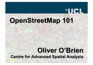
OpenStreetMap 101

  • 1.
  • 2. Contents •  A Brief History •  Around the World •  Contributing •  Mapping Parties •  Companies •  State of the Map •  Special Versions
  • 3. A Brief History •  OSM is a “Wikipedia” of map data –  Also a website displaying particular renders of the data – http://osm.org/ •  Started by Steve Coast in July 2004 –  While doing an MSc here at UCL •  Anyone can edit –  Data under a Creative Commons licence •  OpenStreetMap Foundation
  • 5. OSM Around the World •  UK – Fairly rapid growth –  Lack of free data (pre-April 2010) •  US – Growth has been more recent –  Import of TIGER dataset •  Holland –  1st “complete” country (AND data donation) •  Germany –  Very detailed – most active community
  • 7. Contributing •  The best data is your own data –  GPS tracklogs –  Yahoo aerial imagery –  Historic (out-of-copyright) mapping –  Ordnance Survey Open Data •  Editing –  Potlatch •  Minutely updates
  • 9. Mapping Parties •  Get the community working together
  • 11. Atlanta Mapping Party •  Over 3 Days in October 2009 •  Coverage on FOX News
  • 13. Project Haiti •  12 January 2010 –  Copyright-free high-res aerial imagery made available very quickly afterwards by providers –  Overseas volunteers traced what they could see and packaged the data –  Used by disaster relief teams on the ground
  • 14. Companies •  Cloudmade (U.S.) –  Developer APIs and custom renders •  Geofabrik (Germany) –  Regularly updated per-country shapefiles •  ITO World (UK) –  Provides some useful tools to detect and fix missing data in the UK
  • 15. State of the Map •  The OpenStreetMap Conference –  Three so far, all in Europe –  StateOfTheMap U.S. takes place in Atlanta this weekend •  http://www.sotm.us/
  • 16. Special Versions •  Get the data –  XML to PostgreSQL, or as shapefiles •  Build a map –  Mapnik, or in a GIS •  Show it to the world –  OpenLayers, or a printed map
  • 17. OpenCycleMap •  http://www.opencyclemap.org/ –  Signposted cycle routes –  Cycle shops –  Cycle parking –  Contours –  Toilets –  Pubs
  • 19. Some More Uses of OSM Data
  • 20. Best of OSM •  http://bestofosm.org/
  • 21. Contact •  http://www.oliverobrien.co.uk/ –  My research blog •  @oobr on Twitter •  o.obrien@ucl.ac.uk