
Recomendados
Mais conteúdo relacionado
Mais procurados
Mais procurados (9)
Destaque
Semelhante a Wildfire Air Attack IR+GIS
Semelhante a Wildfire Air Attack IR+GIS (20)
Último
Último (20)
Wildfire Air Attack IR+GIS
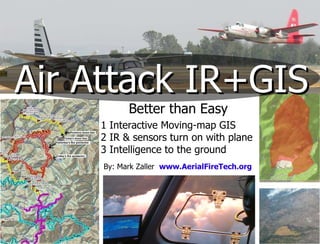
- 1. Air Attack IR+GIS Better than Easy 1 Interactive Moving-map GIS 2 IR & sensors turn on with plane 3 Intelligence to the ground By: Mark Zaller www.AerialFireTech.org
- 2. Paper fire maps Difficulties on Project Fires Fire Camp Incident Command Dispatch Headquarters Tanker Base Heli-base FM Voice No Data Air Attack Doesn’t do mapping Doesn’t always get paper maps Often can’t see ground due to smoke Smoke
- 3. Air Attack Transmit Spot Fire drawings IR+ GIS Moving-Map Instant Situational Awareness Low cost Changes Fire Camp Incident Command Dispatch Headquarters Tanker Base Heli-base Continuous operations over Smoke & Dark Improves Safety Offline Moving-Map with GIS FM Voice Satellite Data
- 7. Click here for Youtube of this moving
- 10. “ IR equipped air attack aircraft reduced the need to withdraw firefighters from the fireline” “ crews costing many thousands of dollars per day, disengagement, and the resulting loss of productivity, can represent a significant cost.” -Large Fire Cost Review for FY2009 IR coupled with GIS has become a most powerful set of tools for the air attack platform, and without those capabilities I have almost forgotten how I did it any other way “ Tom Bagwell, ATGS ORCA Team
- 15. Here to make it happen in 2011 By: Mark Zaller AeiralFireTech.org [email_address]