SlideShare uma empresa Scribd logo
1 de 9
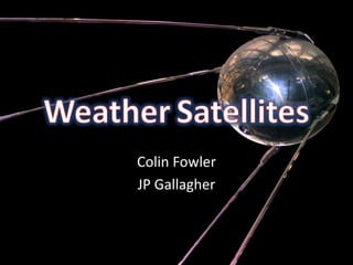
WeatherSatellites Colin Fowler JP Gallagher
Inventor/History The first weather satellite was called the TIROS-1, or Television InfraRed Observation Satellite.   TIROS-1 was created by a team of NASA scientists and engineers and therefore has no single inventor. TIROS-1 was invented in
How It Works Weather satellites take images with devices called radiometers.  These usually have a telescope or antenna, a scanner, and various detectors such as those for infrared, microwave, and visible electromagnetic radiation. They are designed to work for 3-7 years but tend to work for longer periods of time.
How It Works Satellites orbit the earth in a sun-synchronus orbit, which allows them to image every area on the Earth’s surface every twelve hours. Most satellites are powered by solar panels.
What Weather Satellites Do Visible Spectrum – satellites that observe the visible spectrum of light are used for capturing images of clouds, fronts, smaller storms, bodies of water, geological formations, and pollution such as smoke, smog, and dust. Infrared Spectrum – infrared satellites are used for determining cloud heights, calculating surface temperatures, and detecting tropical cyclones.  Fisherman and farmers benefit from this information by predicting weather and temperature.
Physical Characteristics All weather satellites have some sort of exterior imaging device, be it a radiometer or other sensor. Many weather satellites also have solar panels, generally in the form of winglike projections.
Works Cited http://passingparade-2009.blogspot.com/2010/11/president-john-f-kennedy-father-of.html http://chandrakantha.com/articles/indian_music/filmi_sangeet/film_song_1960_world.html http://wiki.answers.com/Q/Who_invented_a_weather_satellite http://en.wikipedia.org/wiki/TIROS-1 http://www.weatherquestions.com/How_do_weather_satellites_work.htm http://en.wikipedia.org/wiki/Weather_satellite
Works Cited http://www.dailymail.co.uk/home/moslive/article-1208979/Stevenage-The-final-frontier-space-technology.html http://www.newswx.com/weather/forecast/ny/syracuse/ http://www.global-greenhouse-warming.com/measuring-precipitation.html

Mais conteúdo relacionado

Mais procurados

A Brief Introduction to Remote Sensing Satellites
A Brief Introduction to Remote Sensing Satellites A Brief Introduction to Remote Sensing Satellites
A Brief Introduction to Remote Sensing Satellites Alireza Rahimzadeganasl
 
Band Combination of Landsat 8 Earth-observing Satellite Images
Band Combination of Landsat 8 Earth-observing Satellite ImagesBand Combination of Landsat 8 Earth-observing Satellite Images
Band Combination of Landsat 8 Earth-observing Satellite ImagesKabir Uddin
 
Tools for weather forecasting
Tools for weather forecastingTools for weather forecasting
Tools for weather forecastingammulachu
 
Radar Powerpoint
Radar PowerpointRadar Powerpoint
Radar PowerpointRyan rice
 
Doppler weather radar
Doppler weather radarDoppler weather radar
Doppler weather radarPawankumarm65
 
Introduction to Landsat
Introduction to LandsatIntroduction to Landsat
Introduction to LandsatNizam GIS
 
History of remote sensing
History of remote sensingHistory of remote sensing
History of remote sensingSumant Diwakar
 
Types of satellite metrological & resource satellites
Types of satellite metrological & resource satellitesTypes of satellite metrological & resource satellites
Types of satellite metrological & resource satellitesManish Kothe
 
STAGES OF REMOTE SENSING.
STAGES OF REMOTE SENSING.STAGES OF REMOTE SENSING.
STAGES OF REMOTE SENSING.SrimantaKarak
 
mateorological and ocean monitoring satellite (2).pptx
mateorological and ocean monitoring satellite (2).pptxmateorological and ocean monitoring satellite (2).pptx
mateorological and ocean monitoring satellite (2).pptxsapna kinattinkara
 
Fundamentals of Remote Sensing
Fundamentals of Remote Sensing Fundamentals of Remote Sensing
Fundamentals of Remote Sensing Pallab Jana
 
Applications of space technology
Applications of space technologyApplications of space technology
Applications of space technologyNabeel Khalid
 
Lecture for landsat
Lecture for landsatLecture for landsat
Lecture for landsatGeoMedeelel
 
Chapter 3: Remote sensing Technology
Chapter 3: Remote sensing TechnologyChapter 3: Remote sensing Technology
Chapter 3: Remote sensing TechnologyShankar Gangaju
 
Microwave remote sensing
Microwave remote sensingMicrowave remote sensing
Microwave remote sensingRohit Kumar
 

Mais procurados (20)

A Brief Introduction to Remote Sensing Satellites
A Brief Introduction to Remote Sensing Satellites A Brief Introduction to Remote Sensing Satellites
A Brief Introduction to Remote Sensing Satellites
 
Band Combination of Landsat 8 Earth-observing Satellite Images
Band Combination of Landsat 8 Earth-observing Satellite ImagesBand Combination of Landsat 8 Earth-observing Satellite Images
Band Combination of Landsat 8 Earth-observing Satellite Images
 
Tools for weather forecasting
Tools for weather forecastingTools for weather forecasting
Tools for weather forecasting
 
Radar Powerpoint
Radar PowerpointRadar Powerpoint
Radar Powerpoint
 
Oceansat
OceansatOceansat
Oceansat
 
Doppler weather radar
Doppler weather radarDoppler weather radar
Doppler weather radar
 
Introduction-of-GNSS-2
Introduction-of-GNSS-2Introduction-of-GNSS-2
Introduction-of-GNSS-2
 
Introduction to Landsat
Introduction to LandsatIntroduction to Landsat
Introduction to Landsat
 
Gps ppt
Gps pptGps ppt
Gps ppt
 
History of remote sensing
History of remote sensingHistory of remote sensing
History of remote sensing
 
Types of satellite metrological & resource satellites
Types of satellite metrological & resource satellitesTypes of satellite metrological & resource satellites
Types of satellite metrological & resource satellites
 
STAGES OF REMOTE SENSING.
STAGES OF REMOTE SENSING.STAGES OF REMOTE SENSING.
STAGES OF REMOTE SENSING.
 
mateorological and ocean monitoring satellite (2).pptx
mateorological and ocean monitoring satellite (2).pptxmateorological and ocean monitoring satellite (2).pptx
mateorological and ocean monitoring satellite (2).pptx
 
Fundamentals of Remote Sensing
Fundamentals of Remote Sensing Fundamentals of Remote Sensing
Fundamentals of Remote Sensing
 
Applications of space technology
Applications of space technologyApplications of space technology
Applications of space technology
 
Lecture for landsat
Lecture for landsatLecture for landsat
Lecture for landsat
 
Chapter 3: Remote sensing Technology
Chapter 3: Remote sensing TechnologyChapter 3: Remote sensing Technology
Chapter 3: Remote sensing Technology
 
Microwave remote sensing
Microwave remote sensingMicrowave remote sensing
Microwave remote sensing
 
( G . i . s )
( G . i . s )( G . i . s )
( G . i . s )
 
remote sensing
remote sensingremote sensing
remote sensing
 

Destaque (20)

Weather forecasting technology
Weather forecasting technologyWeather forecasting technology
Weather forecasting technology
 
Satellites presentation
Satellites presentationSatellites presentation
Satellites presentation
 
Satellitespp
SatellitesppSatellitespp
Satellitespp
 
Communication satellite
Communication satelliteCommunication satellite
Communication satellite
 
Aspects of the weather
Aspects of the weatherAspects of the weather
Aspects of the weather
 
Basic Principles and Design of The Antenna in Mobile Communications
Basic Principles and Design of The Antenna in Mobile CommunicationsBasic Principles and Design of The Antenna in Mobile Communications
Basic Principles and Design of The Antenna in Mobile Communications
 
Weather Forecasting
Weather ForecastingWeather Forecasting
Weather Forecasting
 
Radar
RadarRadar
Radar
 
sun
sunsun
sun
 
Phased-Array Radar Talk Jorge Salazar
Phased-Array Radar Talk Jorge SalazarPhased-Array Radar Talk Jorge Salazar
Phased-Array Radar Talk Jorge Salazar
 
Data analysis of weather forecasting
Data analysis of weather forecastingData analysis of weather forecasting
Data analysis of weather forecasting
 
Cell Phone Antennas
Cell Phone AntennasCell Phone Antennas
Cell Phone Antennas
 
Multi-Funtion Phased Array Radar
Multi-Funtion Phased Array RadarMulti-Funtion Phased Array Radar
Multi-Funtion Phased Array Radar
 
Antenna types
Antenna typesAntenna types
Antenna types
 
Global positioning system ppt
Global positioning system pptGlobal positioning system ppt
Global positioning system ppt
 
Global Positioning System (GPS)
Global Positioning System (GPS) Global Positioning System (GPS)
Global Positioning System (GPS)
 
"GPS" Global Positioning System [PDF]
"GPS" Global Positioning System  [PDF]"GPS" Global Positioning System  [PDF]
"GPS" Global Positioning System [PDF]
 
Global Positioning System
Global Positioning System Global Positioning System
Global Positioning System
 
Global positioning System
Global positioning SystemGlobal positioning System
Global positioning System
 
Remote sensing ppt
Remote sensing pptRemote sensing ppt
Remote sensing ppt
 

Semelhante a Weather satellites pd. 5

Remote Sensing - by Ashwini
Remote Sensing - by AshwiniRemote Sensing - by Ashwini
Remote Sensing - by AshwiniSanthosh Sundar
 
Weather satellites period 3
Weather satellites period 3Weather satellites period 3
Weather satellites period 3FC Meteorology
 
Satellite Applications
Satellite ApplicationsSatellite Applications
Satellite ApplicationsSerhan
 
Meteorological satellites and their types
Meteorological satellites and their typesMeteorological satellites and their types
Meteorological satellites and their typesAnnamalai University
 
2ND ONLINE ACTIVITY
2ND ONLINE ACTIVITY2ND ONLINE ACTIVITY
2ND ONLINE ACTIVITYrubenqu
 
Activity 2
Activity 2Activity 2
Activity 2rubenqu
 
Artificial satellites
Artificial satellitesArtificial satellites
Artificial satellitesMoona Kanwal
 
Shreyas S. Patil(Science).ppt
Shreyas S. Patil(Science).pptShreyas S. Patil(Science).ppt
Shreyas S. Patil(Science).pptBillyGaytes
 
rsgis-unitii-160731062950.pdf
rsgis-unitii-160731062950.pdfrsgis-unitii-160731062950.pdf
rsgis-unitii-160731062950.pdfBSuresh26
 
The Satellite applications in telecommunication
The Satellite applications in telecommunicationThe Satellite applications in telecommunication
The Satellite applications in telecommunicationnovrain7111
 
Terra presentation
Terra presentationTerra presentation
Terra presentationNimra Butt
 
Louis: TIROS-1
Louis: TIROS-1Louis: TIROS-1
Louis: TIROS-1jtrip
 

Semelhante a Weather satellites pd. 5 (20)

Remote Sensing - by Ashwini
Remote Sensing - by AshwiniRemote Sensing - by Ashwini
Remote Sensing - by Ashwini
 
Sem 44.pptx
Sem 44.pptxSem 44.pptx
Sem 44.pptx
 
Weather satellites period 3
Weather satellites period 3Weather satellites period 3
Weather satellites period 3
 
Satellite Applications
Satellite ApplicationsSatellite Applications
Satellite Applications
 
Envisat
EnvisatEnvisat
Envisat
 
Meteorological satellites and their types
Meteorological satellites and their typesMeteorological satellites and their types
Meteorological satellites and their types
 
intro.pptx
intro.pptxintro.pptx
intro.pptx
 
2ND ONLINE ACTIVITY
2ND ONLINE ACTIVITY2ND ONLINE ACTIVITY
2ND ONLINE ACTIVITY
 
Activity 2
Activity 2Activity 2
Activity 2
 
Egm 2008
Egm 2008Egm 2008
Egm 2008
 
Remote sensing for
Remote sensing forRemote sensing for
Remote sensing for
 
Artificial satellites
Artificial satellitesArtificial satellites
Artificial satellites
 
Shreyas S. Patil(Science).ppt
Shreyas S. Patil(Science).pptShreyas S. Patil(Science).ppt
Shreyas S. Patil(Science).ppt
 
Remote sensing
Remote sensing Remote sensing
Remote sensing
 
Introduction to Remote Sensing
Introduction to Remote SensingIntroduction to Remote Sensing
Introduction to Remote Sensing
 
rsgis-unitii-160731062950.pdf
rsgis-unitii-160731062950.pdfrsgis-unitii-160731062950.pdf
rsgis-unitii-160731062950.pdf
 
The Satellite applications in telecommunication
The Satellite applications in telecommunicationThe Satellite applications in telecommunication
The Satellite applications in telecommunication
 
Terra presentation
Terra presentationTerra presentation
Terra presentation
 
Louis: TIROS-1
Louis: TIROS-1Louis: TIROS-1
Louis: TIROS-1
 
Remote sense
Remote senseRemote sense
Remote sense
 

Mais de FC Meteorology (20)

Ari pd 3 ppt
Ari pd 3 pptAri pd 3 ppt
Ari pd 3 ppt
 
Science project
Science projectScience project
Science project
 
Clouds and precipitation
Clouds and precipitationClouds and precipitation
Clouds and precipitation
 
Clouds and precipitation
Clouds and precipitationClouds and precipitation
Clouds and precipitation
 
4aklee
4aklee4aklee
4aklee
 
4jpfleger
4jpfleger4jpfleger
4jpfleger
 
2Kcoldren
2Kcoldren2Kcoldren
2Kcoldren
 
3qrogers
3qrogers3qrogers
3qrogers
 
3jeannine
3jeannine3jeannine
3jeannine
 
5fmartin
5fmartin5fmartin
5fmartin
 
2JessB
2JessB2JessB
2JessB
 
Clouds and precipitation by Ian Slavin
Clouds and precipitation by Ian SlavinClouds and precipitation by Ian Slavin
Clouds and precipitation by Ian Slavin
 
Clouds and precipitation
Clouds and precipitationClouds and precipitation
Clouds and precipitation
 
Clouds and percipitation powerpoint
Clouds and percipitation powerpointClouds and percipitation powerpoint
Clouds and percipitation powerpoint
 
1jschan
1jschan1jschan
1jschan
 
1kspieker
1kspieker1kspieker
1kspieker
 
3jlaubach
3jlaubach3jlaubach
3jlaubach
 
Clouds and precipitation19
Clouds and precipitation19Clouds and precipitation19
Clouds and precipitation19
 
5nmann
5nmann5nmann
5nmann
 
Clouds and precipitation-nate mann
Clouds and precipitation-nate mannClouds and precipitation-nate mann
Clouds and precipitation-nate mann
 

Weather satellites pd. 5

  • 2. Inventor/History The first weather satellite was called the TIROS-1, or Television InfraRed Observation Satellite. TIROS-1 was created by a team of NASA scientists and engineers and therefore has no single inventor. TIROS-1 was invented in
  • 3. How It Works Weather satellites take images with devices called radiometers. These usually have a telescope or antenna, a scanner, and various detectors such as those for infrared, microwave, and visible electromagnetic radiation. They are designed to work for 3-7 years but tend to work for longer periods of time.
  • 4. How It Works Satellites orbit the earth in a sun-synchronus orbit, which allows them to image every area on the Earth’s surface every twelve hours. Most satellites are powered by solar panels.
  • 5.
  • 6. What Weather Satellites Do Visible Spectrum – satellites that observe the visible spectrum of light are used for capturing images of clouds, fronts, smaller storms, bodies of water, geological formations, and pollution such as smoke, smog, and dust. Infrared Spectrum – infrared satellites are used for determining cloud heights, calculating surface temperatures, and detecting tropical cyclones. Fisherman and farmers benefit from this information by predicting weather and temperature.
  • 7. Physical Characteristics All weather satellites have some sort of exterior imaging device, be it a radiometer or other sensor. Many weather satellites also have solar panels, generally in the form of winglike projections.
  • 8. Works Cited http://passingparade-2009.blogspot.com/2010/11/president-john-f-kennedy-father-of.html http://chandrakantha.com/articles/indian_music/filmi_sangeet/film_song_1960_world.html http://wiki.answers.com/Q/Who_invented_a_weather_satellite http://en.wikipedia.org/wiki/TIROS-1 http://www.weatherquestions.com/How_do_weather_satellites_work.htm http://en.wikipedia.org/wiki/Weather_satellite
  • 9. Works Cited http://www.dailymail.co.uk/home/moslive/article-1208979/Stevenage-The-final-frontier-space-technology.html http://www.newswx.com/weather/forecast/ny/syracuse/ http://www.global-greenhouse-warming.com/measuring-precipitation.html