SlideShare uma empresa Scribd logo
1 de 16
Basic cartography activities IES Concepción Arenal
What is a map?  A map shows a scaled representation of any real-world location or object on a two-dimensional surface. A map must show the scale to which it was made. Scale is the relationship between distance on the map and distance on the ground. A map scale is usually given as a fraction or a ratio, for example 1:25,000. This means that one unit of measurement on the map represents 25, 000 units of the same units on the ground. Classification of maps according to scale: Small-scale maps Small-scale maps cover a large area and have fewer details than large-scale maps. (The larger the denominator is, the smaller the scale). Small-scale maps are used to depict large areas. Large-scale maps Large-scale maps cover a small area in great detail. Scales between 1:5,000 and 1:20,000 are used in street maps. Scales between 1:20,000 and 1:50,000 are used in maps depicting small regions.
What is a topographic map ? A topographic map   represents the three-dimensional configuration of the land by using contour lines and symbols. It shows the location and shape of mountains, valleys, plains, streams, wooded areas, roads, buildings, and many other features.  A  contour line  joins points of equal elevation above a given level. In Spain, the reference level is the sea level in Alicante.  The difference in elevation between two consecutive contour lines is called  contour interval . Contour lines are usually drawn at 10 metre intervals on a 1:25,000 scale map. Every fifth contour line is printed as a bold line and labelled with heights.  The contour line bounding an elevation may become indefinitely small and ultimately reduce itself to a point, which is a summit.  STUDYING THE NATIONAL TOPOGRAPHIC MAP
 
A topographic map also shows the  steepness  of the land. The closer the contour lines are the steeper the land is. A description of some of the  symbols used on topographic maps : Where a  contour line crosses a stream, a river or a valley , the contour lines  are bent sharply, forming a “V”.  The point of the “V” points uphill or upstream. Ridges  are shown by contour lines that bend downhill. A  mountain pass  is usually depicted with a “bridge like” symbol. A map legend  is a key to all the symbols used on a map.
Contour lines  (or isohypses) are isolines showing equal elevation
Escala 1:25.000     Contour lines  (or isohypses) are isolines showing equal elevation. To determine differences in elevation between two points, the contour interval, or distance in altitude between two adjacent contour lines, must be known, and this is given at the bottom of the map
The rule of O's : closed loops are normally uphill on the inside and downhill on the outside, and the innermost loop is the highest area.  Spacing of contours : close contours indicate a steep slope; distant contours a shallow slope. Two or more contour lines merging indicates a cliff.
stream The rule of V's : sharp-pointed vees usually are in stream valleys, with the drainage channel passing through the point of the vee, with the vee pointing upstream. This is a consequence of  erosion .
Ridges  are shown by contour lines that bend downhill. A  mountain pass  is usually depicted with a “bridge like” symbol. Ridget Mountain pass
[object Object],[object Object],[object Object],[object Object],[object Object],Activity 1:
Activity 2: Use an arrow to match each drawing on the left with its topographic representation.
Draw the  symbols  used on maps and  identify  them on the topographic map. Activity 3:
Use the drawings and pictures to practise what you have studied and answer the following questions. Which image shows the steepest slope? Which one shows a valley? Which one shows a hill? Which one shows a beach? Pay attention to the distance between the contour lines in the four images and say which one represents the highest elevation and which one represents the lowest elevation. Activity 4:
Activity 4: Fig. 1 Fig. 3 Fig. 2 Fig. 4
http://www.ign.es/iberpix/visoriberpix/visorign.html   Identify the symbols in the map  legend of the topographic map and draw them on your copy using the right colours.  For example a road, river, lighthouse...etc. Activity 4:

Mais conteúdo relacionado

Mais procurados

Basic topographic mapping
Basic topographic mappingBasic topographic mapping
Basic topographic mappingBhok Millare
 
Erosional & depositional glacial landforms
Erosional & depositional glacial landformsErosional & depositional glacial landforms
Erosional & depositional glacial landformsNeha Gupta
 
Distortions and displacement on aerial photograph
Distortions and displacement on aerial photographDistortions and displacement on aerial photograph
Distortions and displacement on aerial photographchandan00781
 
Aerial photographs and their interpretation
Aerial photographs and their interpretationAerial photographs and their interpretation
Aerial photographs and their interpretationSumant Diwakar
 
Types of aerial photographs
Types of aerial photographsTypes of aerial photographs
Types of aerial photographsHARITHANAIR15
 
Aerial photography- Concept and Terminologies
Aerial photography- Concept and Terminologies Aerial photography- Concept and Terminologies
Aerial photography- Concept and Terminologies UTTIYACHATTOPADHYAY2
 
Geometry and types of aerial photographs
Geometry and types of aerial photographsGeometry and types of aerial photographs
Geometry and types of aerial photographsPooja Kumari
 
Topographic maps presentation_mine
Topographic maps presentation_mineTopographic maps presentation_mine
Topographic maps presentation_minemisterbatroms
 
Types of aerial cameras - photogrammetry
Types of aerial cameras - photogrammetry Types of aerial cameras - photogrammetry
Types of aerial cameras - photogrammetry prasenjit bhowmick
 
Vertical Exaggeration
Vertical ExaggerationVertical Exaggeration
Vertical ExaggerationRob Marchetto
 
Morphology of ocean floor
Morphology of ocean floorMorphology of ocean floor
Morphology of ocean floorPramoda Raj
 
Karst topography
Karst topographyKarst topography
Karst topographyPramoda Raj
 

Mais procurados (20)

Basic topographic mapping
Basic topographic mappingBasic topographic mapping
Basic topographic mapping
 
Erosional & depositional glacial landforms
Erosional & depositional glacial landformsErosional & depositional glacial landforms
Erosional & depositional glacial landforms
 
Cartography
CartographyCartography
Cartography
 
Map Projection
Map ProjectionMap Projection
Map Projection
 
Types of Map Scales
Types of Map ScalesTypes of Map Scales
Types of Map Scales
 
Themating maping
Themating mapingThemating maping
Themating maping
 
Toposheet indexing .
Toposheet indexing .Toposheet indexing .
Toposheet indexing .
 
Distortions and displacement on aerial photograph
Distortions and displacement on aerial photographDistortions and displacement on aerial photograph
Distortions and displacement on aerial photograph
 
Aerial photographs and their interpretation
Aerial photographs and their interpretationAerial photographs and their interpretation
Aerial photographs and their interpretation
 
Types of aerial photographs
Types of aerial photographsTypes of aerial photographs
Types of aerial photographs
 
Aerial photography- Concept and Terminologies
Aerial photography- Concept and Terminologies Aerial photography- Concept and Terminologies
Aerial photography- Concept and Terminologies
 
Geometry and types of aerial photographs
Geometry and types of aerial photographsGeometry and types of aerial photographs
Geometry and types of aerial photographs
 
Topographic maps
Topographic mapsTopographic maps
Topographic maps
 
Map projections
Map projectionsMap projections
Map projections
 
Topographic maps presentation_mine
Topographic maps presentation_mineTopographic maps presentation_mine
Topographic maps presentation_mine
 
Types of aerial cameras - photogrammetry
Types of aerial cameras - photogrammetry Types of aerial cameras - photogrammetry
Types of aerial cameras - photogrammetry
 
Introduction to Maps
Introduction to MapsIntroduction to Maps
Introduction to Maps
 
Vertical Exaggeration
Vertical ExaggerationVertical Exaggeration
Vertical Exaggeration
 
Morphology of ocean floor
Morphology of ocean floorMorphology of ocean floor
Morphology of ocean floor
 
Karst topography
Karst topographyKarst topography
Karst topography
 

Destaque

Reading a topographic map
Reading a topographic mapReading a topographic map
Reading a topographic mapRachael Hubbard
 
Secondary 1 Geography-Topographic Map
Secondary 1 Geography-Topographic MapSecondary 1 Geography-Topographic Map
Secondary 1 Geography-Topographic MapMarioSonic54
 
Contour line drawing warhol
Contour line drawing warholContour line drawing warhol
Contour line drawing warholrcompton1
 
Chapter 1 principle of geology 1 meeting
Chapter 1 principle of geology 1 meetingChapter 1 principle of geology 1 meeting
Chapter 1 principle of geology 1 meetingHary Death
 
Folding mechanisms
Folding mechanismsFolding mechanisms
Folding mechanismsGEOLOGY
 
height on maps contours
 height on maps contours height on maps contours
height on maps contourslavenderbongo
 
Lesson 12 - How to draw a cross section?
Lesson 12 - How to draw a cross section?Lesson 12 - How to draw a cross section?
Lesson 12 - How to draw a cross section?Missws Choi
 
Session 1 introductory notes (Film Appreciation)
Session 1 introductory notes (Film Appreciation)Session 1 introductory notes (Film Appreciation)
Session 1 introductory notes (Film Appreciation)Jeremy Eliab
 
Map reading (1)
Map reading (1)Map reading (1)
Map reading (1)Yanjie Luo
 
Copy of open pit mining
Copy of open pit miningCopy of open pit mining
Copy of open pit miningiAppreciateYou
 
45038163 geological-map-interpretation
45038163 geological-map-interpretation45038163 geological-map-interpretation
45038163 geological-map-interpretationShahnawaz Mustafa
 
Contouring pdf
Contouring pdfContouring pdf
Contouring pdfGokul Saud
 
Draw Contours Worksheet
Draw Contours WorksheetDraw Contours Worksheet
Draw Contours WorksheetNatalie Tan
 

Destaque (20)

Reading a topographic map
Reading a topographic mapReading a topographic map
Reading a topographic map
 
Topographic Maps
Topographic MapsTopographic Maps
Topographic Maps
 
Secondary 1 Geography-Topographic Map
Secondary 1 Geography-Topographic MapSecondary 1 Geography-Topographic Map
Secondary 1 Geography-Topographic Map
 
Topography powerpoint
Topography powerpointTopography powerpoint
Topography powerpoint
 
Contour line drawing warhol
Contour line drawing warholContour line drawing warhol
Contour line drawing warhol
 
Chapter 1 principle of geology 1 meeting
Chapter 1 principle of geology 1 meetingChapter 1 principle of geology 1 meeting
Chapter 1 principle of geology 1 meeting
 
Folding
FoldingFolding
Folding
 
Folding mechanisms
Folding mechanismsFolding mechanisms
Folding mechanisms
 
height on maps contours
 height on maps contours height on maps contours
height on maps contours
 
Lesson 12 - How to draw a cross section?
Lesson 12 - How to draw a cross section?Lesson 12 - How to draw a cross section?
Lesson 12 - How to draw a cross section?
 
Session 1 introductory notes (Film Appreciation)
Session 1 introductory notes (Film Appreciation)Session 1 introductory notes (Film Appreciation)
Session 1 introductory notes (Film Appreciation)
 
Map reading (1)
Map reading (1)Map reading (1)
Map reading (1)
 
Copy of open pit mining
Copy of open pit miningCopy of open pit mining
Copy of open pit mining
 
Contour diagrams
Contour diagramsContour diagrams
Contour diagrams
 
45038163 geological-map-interpretation
45038163 geological-map-interpretation45038163 geological-map-interpretation
45038163 geological-map-interpretation
 
Fold their geometry and classifications
Fold their geometry and classificationsFold their geometry and classifications
Fold their geometry and classifications
 
Contouring pdf
Contouring pdfContouring pdf
Contouring pdf
 
Topomaps
TopomapsTopomaps
Topomaps
 
Contouring
ContouringContouring
Contouring
 
Draw Contours Worksheet
Draw Contours WorksheetDraw Contours Worksheet
Draw Contours Worksheet
 

Semelhante a Topographic Map

Topographic maps for UDL lesson
Topographic maps for UDL lessonTopographic maps for UDL lesson
Topographic maps for UDL lessonrbritton24
 
Topographic maps for UDL lesson
Topographic maps for UDL lessonTopographic maps for UDL lesson
Topographic maps for UDL lessonrbritton24
 
Isolines and contour lines
Isolines and contour linesIsolines and contour lines
Isolines and contour lineslschmidt1170
 
Topographic Map Presentation
Topographic Map PresentationTopographic Map Presentation
Topographic Map Presentationdwinter1
 
12 s080702 e_topography-1
12 s080702 e_topography-112 s080702 e_topography-1
12 s080702 e_topography-1Jenny Dixon
 
Orienteering 101
Orienteering 101Orienteering 101
Orienteering 101rsintobin
 
Maps-and-map-interpretation.docx
Maps-and-map-interpretation.docxMaps-and-map-interpretation.docx
Maps-and-map-interpretation.docxshucaybcabdi
 
Topographic maps
Topographic mapsTopographic maps
Topographic mapsllaub
 
Maps-and-map-interpretation.pdf
Maps-and-map-interpretation.pdfMaps-and-map-interpretation.pdf
Maps-and-map-interpretation.pdfshucaybcabdi
 
Reading Topographic Maps
Reading Topographic MapsReading Topographic Maps
Reading Topographic Mapsduncanpatti
 
topographicmapsnotes-130930200052-phpapp01.pdf
topographicmapsnotes-130930200052-phpapp01.pdftopographicmapsnotes-130930200052-phpapp01.pdf
topographicmapsnotes-130930200052-phpapp01.pdfshucaybcabdi
 
About Topgrapic Map Details & know how to study topograpic map.
About Topgrapic Map Details & know how to study topograpic map.About Topgrapic Map Details & know how to study topograpic map.
About Topgrapic Map Details & know how to study topograpic map.Shahid Hussain
 
Chapter 3 gateway 123
Chapter 3 gateway 123Chapter 3 gateway 123
Chapter 3 gateway 123MissST
 
Contours on OS Maps
Contours on OS MapsContours on OS Maps
Contours on OS MapsMr Dowdican
 

Semelhante a Topographic Map (20)

Topographic maps for UDL lesson
Topographic maps for UDL lessonTopographic maps for UDL lesson
Topographic maps for UDL lesson
 
Topographic maps for UDL lesson
Topographic maps for UDL lessonTopographic maps for UDL lesson
Topographic maps for UDL lesson
 
Topo maps
Topo mapsTopo maps
Topo maps
 
Mapwork
MapworkMapwork
Mapwork
 
Isolines and contour lines
Isolines and contour linesIsolines and contour lines
Isolines and contour lines
 
Mapping
MappingMapping
Mapping
 
Topographic Map Presentation
Topographic Map PresentationTopographic Map Presentation
Topographic Map Presentation
 
12 s080702 e_topography-1
12 s080702 e_topography-112 s080702 e_topography-1
12 s080702 e_topography-1
 
kegy305.pdf
kegy305.pdfkegy305.pdf
kegy305.pdf
 
kegy305.pdf
kegy305.pdfkegy305.pdf
kegy305.pdf
 
Orienteering 101
Orienteering 101Orienteering 101
Orienteering 101
 
Maps-and-map-interpretation.docx
Maps-and-map-interpretation.docxMaps-and-map-interpretation.docx
Maps-and-map-interpretation.docx
 
Topographic maps
Topographic mapsTopographic maps
Topographic maps
 
Maps-and-map-interpretation.pdf
Maps-and-map-interpretation.pdfMaps-and-map-interpretation.pdf
Maps-and-map-interpretation.pdf
 
Reading Topographic Maps
Reading Topographic MapsReading Topographic Maps
Reading Topographic Maps
 
topographicmapsnotes-130930200052-phpapp01.pdf
topographicmapsnotes-130930200052-phpapp01.pdftopographicmapsnotes-130930200052-phpapp01.pdf
topographicmapsnotes-130930200052-phpapp01.pdf
 
About Topgrapic Map Details & know how to study topograpic map.
About Topgrapic Map Details & know how to study topograpic map.About Topgrapic Map Details & know how to study topograpic map.
About Topgrapic Map Details & know how to study topograpic map.
 
Chapter 3 gateway 123
Chapter 3 gateway 123Chapter 3 gateway 123
Chapter 3 gateway 123
 
Contours on OS Maps
Contours on OS MapsContours on OS Maps
Contours on OS Maps
 
Contour lines
Contour linesContour lines
Contour lines
 

Mais de mjcnavarro

Romance sonámbulo
Romance sonámbuloRomance sonámbulo
Romance sonámbulomjcnavarro
 
Personajesfamosos
PersonajesfamososPersonajesfamosos
Personajesfamososmjcnavarro
 
Web report generator: What our students eat?
Web report generator: What our students eat?Web report generator: What our students eat?
Web report generator: What our students eat?mjcnavarro
 
Switch it off
Switch it off Switch it off
Switch it off mjcnavarro
 
Environmental Study of The RíA
Environmental Study of The RíAEnvironmental Study of The RíA
Environmental Study of The RíAmjcnavarro
 

Mais de mjcnavarro (6)

Romance sonámbulo
Romance sonámbuloRomance sonámbulo
Romance sonámbulo
 
Personajesfamosos
PersonajesfamososPersonajesfamosos
Personajesfamosos
 
Web report generator: What our students eat?
Web report generator: What our students eat?Web report generator: What our students eat?
Web report generator: What our students eat?
 
Switch it off
Switch it off Switch it off
Switch it off
 
Our trees
Our treesOur trees
Our trees
 
Environmental Study of The RíA
Environmental Study of The RíAEnvironmental Study of The RíA
Environmental Study of The RíA
 

Último

size separation d pharm 1st year pharmaceutics
size separation d pharm 1st year pharmaceuticssize separation d pharm 1st year pharmaceutics
size separation d pharm 1st year pharmaceuticspragatimahajan3
 
會考英聽會考英聽會考英聽會考英聽會考英聽會考英聽會考英聽會考英聽會考英聽會考英聽
會考英聽會考英聽會考英聽會考英聽會考英聽會考英聽會考英聽會考英聽會考英聽會考英聽會考英聽會考英聽會考英聽會考英聽會考英聽會考英聽會考英聽會考英聽會考英聽會考英聽
會考英聽會考英聽會考英聽會考英聽會考英聽會考英聽會考英聽會考英聽會考英聽會考英聽中 央社
 
[GDSC YCCE] Build with AI Online Presentation
[GDSC YCCE] Build with AI Online Presentation[GDSC YCCE] Build with AI Online Presentation
[GDSC YCCE] Build with AI Online PresentationGDSCYCCE
 
Pragya Champions Chalice 2024 Prelims & Finals Q/A set, General Quiz
Pragya Champions Chalice 2024 Prelims & Finals Q/A set, General QuizPragya Champions Chalice 2024 Prelims & Finals Q/A set, General Quiz
Pragya Champions Chalice 2024 Prelims & Finals Q/A set, General QuizPragya - UEM Kolkata Quiz Club
 
Mbaye_Astou.Education Civica_Human Rights.pptx
Mbaye_Astou.Education Civica_Human Rights.pptxMbaye_Astou.Education Civica_Human Rights.pptx
Mbaye_Astou.Education Civica_Human Rights.pptxnuriaiuzzolino1
 
REPRODUCTIVE TOXICITY STUDIE OF MALE AND FEMALEpptx
REPRODUCTIVE TOXICITY  STUDIE OF MALE AND FEMALEpptxREPRODUCTIVE TOXICITY  STUDIE OF MALE AND FEMALEpptx
REPRODUCTIVE TOXICITY STUDIE OF MALE AND FEMALEpptxmanishaJyala2
 
Matatag-Curriculum and the 21st Century Skills Presentation.pptx
Matatag-Curriculum and the 21st Century Skills Presentation.pptxMatatag-Curriculum and the 21st Century Skills Presentation.pptx
Matatag-Curriculum and the 21st Century Skills Presentation.pptxJenilouCasareno
 
2024_Student Session 2_ Set Plan Preparation.pptx
2024_Student Session 2_ Set Plan Preparation.pptx2024_Student Session 2_ Set Plan Preparation.pptx
2024_Student Session 2_ Set Plan Preparation.pptxmansk2
 
TỔNG HỢP HƠN 100 ĐỀ THI THỬ TỐT NGHIỆP THPT VẬT LÝ 2024 - TỪ CÁC TRƯỜNG, TRƯ...
TỔNG HỢP HƠN 100 ĐỀ THI THỬ TỐT NGHIỆP THPT VẬT LÝ 2024 - TỪ CÁC TRƯỜNG, TRƯ...TỔNG HỢP HƠN 100 ĐỀ THI THỬ TỐT NGHIỆP THPT VẬT LÝ 2024 - TỪ CÁC TRƯỜNG, TRƯ...
TỔNG HỢP HƠN 100 ĐỀ THI THỬ TỐT NGHIỆP THPT VẬT LÝ 2024 - TỪ CÁC TRƯỜNG, TRƯ...Nguyen Thanh Tu Collection
 
Application of Matrices in real life. Presentation on application of matrices
Application of Matrices in real life. Presentation on application of matricesApplication of Matrices in real life. Presentation on application of matrices
Application of Matrices in real life. Presentation on application of matricesRased Khan
 
The basics of sentences session 4pptx.pptx
The basics of sentences session 4pptx.pptxThe basics of sentences session 4pptx.pptx
The basics of sentences session 4pptx.pptxheathfieldcps1
 
Basic Civil Engineering notes on Transportation Engineering, Modes of Transpo...
Basic Civil Engineering notes on Transportation Engineering, Modes of Transpo...Basic Civil Engineering notes on Transportation Engineering, Modes of Transpo...
Basic Civil Engineering notes on Transportation Engineering, Modes of Transpo...Denish Jangid
 
Open Educational Resources Primer PowerPoint
Open Educational Resources Primer PowerPointOpen Educational Resources Primer PowerPoint
Open Educational Resources Primer PowerPointELaRue0
 
The Ultimate Guide to Social Media Marketing in 2024.pdf
The Ultimate Guide to Social Media Marketing in 2024.pdfThe Ultimate Guide to Social Media Marketing in 2024.pdf
The Ultimate Guide to Social Media Marketing in 2024.pdfdm4ashexcelr
 
Basic Civil Engg Notes_Chapter-6_Environment Pollution & Engineering
Basic Civil Engg Notes_Chapter-6_Environment Pollution & EngineeringBasic Civil Engg Notes_Chapter-6_Environment Pollution & Engineering
Basic Civil Engg Notes_Chapter-6_Environment Pollution & EngineeringDenish Jangid
 
Danh sách HSG Bộ môn cấp trường - Cấp THPT.pdf
Danh sách HSG Bộ môn cấp trường - Cấp THPT.pdfDanh sách HSG Bộ môn cấp trường - Cấp THPT.pdf
Danh sách HSG Bộ môn cấp trường - Cấp THPT.pdfQucHHunhnh
 
Removal Strategy _ FEFO _ Working with Perishable Products in Odoo 17
Removal Strategy _ FEFO _ Working with Perishable Products in Odoo 17Removal Strategy _ FEFO _ Working with Perishable Products in Odoo 17
Removal Strategy _ FEFO _ Working with Perishable Products in Odoo 17Celine George
 
Morse OER Some Benefits and Challenges.pptx
Morse OER Some Benefits and Challenges.pptxMorse OER Some Benefits and Challenges.pptx
Morse OER Some Benefits and Challenges.pptxjmorse8
 
INU_CAPSTONEDESIGN_비밀번호486_업로드용 발표자료.pdf
INU_CAPSTONEDESIGN_비밀번호486_업로드용 발표자료.pdfINU_CAPSTONEDESIGN_비밀번호486_업로드용 발표자료.pdf
INU_CAPSTONEDESIGN_비밀번호486_업로드용 발표자료.pdfbu07226
 

Último (20)

size separation d pharm 1st year pharmaceutics
size separation d pharm 1st year pharmaceuticssize separation d pharm 1st year pharmaceutics
size separation d pharm 1st year pharmaceutics
 
會考英聽會考英聽會考英聽會考英聽會考英聽會考英聽會考英聽會考英聽會考英聽會考英聽
會考英聽會考英聽會考英聽會考英聽會考英聽會考英聽會考英聽會考英聽會考英聽會考英聽會考英聽會考英聽會考英聽會考英聽會考英聽會考英聽會考英聽會考英聽會考英聽會考英聽
會考英聽會考英聽會考英聽會考英聽會考英聽會考英聽會考英聽會考英聽會考英聽會考英聽
 
[GDSC YCCE] Build with AI Online Presentation
[GDSC YCCE] Build with AI Online Presentation[GDSC YCCE] Build with AI Online Presentation
[GDSC YCCE] Build with AI Online Presentation
 
Pragya Champions Chalice 2024 Prelims & Finals Q/A set, General Quiz
Pragya Champions Chalice 2024 Prelims & Finals Q/A set, General QuizPragya Champions Chalice 2024 Prelims & Finals Q/A set, General Quiz
Pragya Champions Chalice 2024 Prelims & Finals Q/A set, General Quiz
 
Mbaye_Astou.Education Civica_Human Rights.pptx
Mbaye_Astou.Education Civica_Human Rights.pptxMbaye_Astou.Education Civica_Human Rights.pptx
Mbaye_Astou.Education Civica_Human Rights.pptx
 
REPRODUCTIVE TOXICITY STUDIE OF MALE AND FEMALEpptx
REPRODUCTIVE TOXICITY  STUDIE OF MALE AND FEMALEpptxREPRODUCTIVE TOXICITY  STUDIE OF MALE AND FEMALEpptx
REPRODUCTIVE TOXICITY STUDIE OF MALE AND FEMALEpptx
 
Matatag-Curriculum and the 21st Century Skills Presentation.pptx
Matatag-Curriculum and the 21st Century Skills Presentation.pptxMatatag-Curriculum and the 21st Century Skills Presentation.pptx
Matatag-Curriculum and the 21st Century Skills Presentation.pptx
 
2024_Student Session 2_ Set Plan Preparation.pptx
2024_Student Session 2_ Set Plan Preparation.pptx2024_Student Session 2_ Set Plan Preparation.pptx
2024_Student Session 2_ Set Plan Preparation.pptx
 
TỔNG HỢP HƠN 100 ĐỀ THI THỬ TỐT NGHIỆP THPT VẬT LÝ 2024 - TỪ CÁC TRƯỜNG, TRƯ...
TỔNG HỢP HƠN 100 ĐỀ THI THỬ TỐT NGHIỆP THPT VẬT LÝ 2024 - TỪ CÁC TRƯỜNG, TRƯ...TỔNG HỢP HƠN 100 ĐỀ THI THỬ TỐT NGHIỆP THPT VẬT LÝ 2024 - TỪ CÁC TRƯỜNG, TRƯ...
TỔNG HỢP HƠN 100 ĐỀ THI THỬ TỐT NGHIỆP THPT VẬT LÝ 2024 - TỪ CÁC TRƯỜNG, TRƯ...
 
Application of Matrices in real life. Presentation on application of matrices
Application of Matrices in real life. Presentation on application of matricesApplication of Matrices in real life. Presentation on application of matrices
Application of Matrices in real life. Presentation on application of matrices
 
The basics of sentences session 4pptx.pptx
The basics of sentences session 4pptx.pptxThe basics of sentences session 4pptx.pptx
The basics of sentences session 4pptx.pptx
 
Basic Civil Engineering notes on Transportation Engineering, Modes of Transpo...
Basic Civil Engineering notes on Transportation Engineering, Modes of Transpo...Basic Civil Engineering notes on Transportation Engineering, Modes of Transpo...
Basic Civil Engineering notes on Transportation Engineering, Modes of Transpo...
 
Open Educational Resources Primer PowerPoint
Open Educational Resources Primer PowerPointOpen Educational Resources Primer PowerPoint
Open Educational Resources Primer PowerPoint
 
The Ultimate Guide to Social Media Marketing in 2024.pdf
The Ultimate Guide to Social Media Marketing in 2024.pdfThe Ultimate Guide to Social Media Marketing in 2024.pdf
The Ultimate Guide to Social Media Marketing in 2024.pdf
 
Basic Civil Engg Notes_Chapter-6_Environment Pollution & Engineering
Basic Civil Engg Notes_Chapter-6_Environment Pollution & EngineeringBasic Civil Engg Notes_Chapter-6_Environment Pollution & Engineering
Basic Civil Engg Notes_Chapter-6_Environment Pollution & Engineering
 
Danh sách HSG Bộ môn cấp trường - Cấp THPT.pdf
Danh sách HSG Bộ môn cấp trường - Cấp THPT.pdfDanh sách HSG Bộ môn cấp trường - Cấp THPT.pdf
Danh sách HSG Bộ môn cấp trường - Cấp THPT.pdf
 
Removal Strategy _ FEFO _ Working with Perishable Products in Odoo 17
Removal Strategy _ FEFO _ Working with Perishable Products in Odoo 17Removal Strategy _ FEFO _ Working with Perishable Products in Odoo 17
Removal Strategy _ FEFO _ Working with Perishable Products in Odoo 17
 
Morse OER Some Benefits and Challenges.pptx
Morse OER Some Benefits and Challenges.pptxMorse OER Some Benefits and Challenges.pptx
Morse OER Some Benefits and Challenges.pptx
 
Post Exam Fun(da) Intra UEM General Quiz - Finals.pdf
Post Exam Fun(da) Intra UEM General Quiz - Finals.pdfPost Exam Fun(da) Intra UEM General Quiz - Finals.pdf
Post Exam Fun(da) Intra UEM General Quiz - Finals.pdf
 
INU_CAPSTONEDESIGN_비밀번호486_업로드용 발표자료.pdf
INU_CAPSTONEDESIGN_비밀번호486_업로드용 발표자료.pdfINU_CAPSTONEDESIGN_비밀번호486_업로드용 발표자료.pdf
INU_CAPSTONEDESIGN_비밀번호486_업로드용 발표자료.pdf
 

Topographic Map

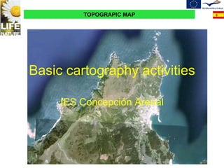
  • 1. Basic cartography activities IES Concepción Arenal
  • 2. What is a map? A map shows a scaled representation of any real-world location or object on a two-dimensional surface. A map must show the scale to which it was made. Scale is the relationship between distance on the map and distance on the ground. A map scale is usually given as a fraction or a ratio, for example 1:25,000. This means that one unit of measurement on the map represents 25, 000 units of the same units on the ground. Classification of maps according to scale: Small-scale maps Small-scale maps cover a large area and have fewer details than large-scale maps. (The larger the denominator is, the smaller the scale). Small-scale maps are used to depict large areas. Large-scale maps Large-scale maps cover a small area in great detail. Scales between 1:5,000 and 1:20,000 are used in street maps. Scales between 1:20,000 and 1:50,000 are used in maps depicting small regions.
  • 3. What is a topographic map ? A topographic map represents the three-dimensional configuration of the land by using contour lines and symbols. It shows the location and shape of mountains, valleys, plains, streams, wooded areas, roads, buildings, and many other features. A contour line joins points of equal elevation above a given level. In Spain, the reference level is the sea level in Alicante. The difference in elevation between two consecutive contour lines is called contour interval . Contour lines are usually drawn at 10 metre intervals on a 1:25,000 scale map. Every fifth contour line is printed as a bold line and labelled with heights. The contour line bounding an elevation may become indefinitely small and ultimately reduce itself to a point, which is a summit. STUDYING THE NATIONAL TOPOGRAPHIC MAP
  • 4.  
  • 5. A topographic map also shows the steepness of the land. The closer the contour lines are the steeper the land is. A description of some of the symbols used on topographic maps : Where a contour line crosses a stream, a river or a valley , the contour lines are bent sharply, forming a “V”. The point of the “V” points uphill or upstream. Ridges are shown by contour lines that bend downhill. A mountain pass is usually depicted with a “bridge like” symbol. A map legend is a key to all the symbols used on a map.
  • 6. Contour lines (or isohypses) are isolines showing equal elevation
  • 7. Escala 1:25.000     Contour lines (or isohypses) are isolines showing equal elevation. To determine differences in elevation between two points, the contour interval, or distance in altitude between two adjacent contour lines, must be known, and this is given at the bottom of the map
  • 8. The rule of O's : closed loops are normally uphill on the inside and downhill on the outside, and the innermost loop is the highest area. Spacing of contours : close contours indicate a steep slope; distant contours a shallow slope. Two or more contour lines merging indicates a cliff.
  • 9. stream The rule of V's : sharp-pointed vees usually are in stream valleys, with the drainage channel passing through the point of the vee, with the vee pointing upstream. This is a consequence of erosion .
  • 10. Ridges are shown by contour lines that bend downhill. A mountain pass is usually depicted with a “bridge like” symbol. Ridget Mountain pass
  • 11.
  • 12. Activity 2: Use an arrow to match each drawing on the left with its topographic representation.
  • 13. Draw the symbols used on maps and identify them on the topographic map. Activity 3:
  • 14. Use the drawings and pictures to practise what you have studied and answer the following questions. Which image shows the steepest slope? Which one shows a valley? Which one shows a hill? Which one shows a beach? Pay attention to the distance between the contour lines in the four images and say which one represents the highest elevation and which one represents the lowest elevation. Activity 4:
  • 15. Activity 4: Fig. 1 Fig. 3 Fig. 2 Fig. 4
  • 16. http://www.ign.es/iberpix/visoriberpix/visorign.html Identify the symbols in the map legend of the topographic map and draw them on your copy using the right colours. For example a road, river, lighthouse...etc. Activity 4: