
Recomendados
Recomendados
Mais conteúdo relacionado
Mais procurados
Mais procurados (6)
Destaque
Destaque (7)
Semelhante a Open Data IOM Haiti, State of the Map
Semelhante a Open Data IOM Haiti, State of the Map (20)
Mais de mikel_maron
Mais de mikel_maron (20)
Último
Último (20)
Open Data IOM Haiti, State of the Map
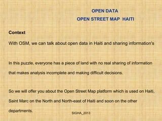
- 1. OPEN DATA OPEN STREET MAP HAITI Context With OSM, we can talk about open data in Haiti and sharing information's In this puzzle, everyone has a piece of land with no real sharing of information that makes analysis incomplete and making difficult decisions. So we will offer you about the Open Street Map platform which is used on Haiti, Saint Marc on the North and North-east of Haiti and soon on the other departments. SIGHA_2013
- 2. Tags/attributs Les données attributaires OSM sont stockées sous forme d’une paire associant une clé (key) à des valeurs (values). Le système de tagging est complètement flexible, permettant de créer des clés et de nouvelles valeurs ad hoc selon les besoins. Il est néanmoins recommandé de s’appuyer quand c’est possible sur les tags déjà existants pour assurer une compatibilité de la donnée OSM. Le détail du système de tags OSM (clés/ valeurs) est accessible sur le wiki à cette adresse : http://wiki.openstreetmap.org/wiki/Map_Features OPEN DATA OPEN STREET MAP HAITI SIGHA_2013
- 3. OPEN DATA OPEN STREET MAP HAITI 2 - Participatory GIS in risk reduction (Cite Soleil) with OSM platform 2.1 – Discussion with Focus group Training 2.2 – Survey with walking paper and form 2.3 – Editing JOSM SIGHA_2013
- 4. OPEN DATA OPEN STREET MAP HAITI JOSM - validation SIGHA_2013
- 5. • Step 1: in the field • 1- Delimitation of the affected with GPS ( track On) • 2- Taking geo localized picture from a fixed point and scan the entire area. • 3- With Open Street Map team we mapped the area (humanitarian Object, road name). OPEN DATA OPEN STREET MAP HAITI SIGHA_2013
- 6. OPEN DATA OPEN STREET MAP HAITI • Step 3: UAV flight With a swinglet cam de Sensefly • 1- Image post processing (mosaic) • 2- Analysis of aerial images before and after the disaster. • 3- - Digitize polygons houses and classification of damage (destroyed houses, damaged houses). SIGHA_2013
- 7. • Extraction Of DEM in UAV Imagery SIGHA_2013
- 8. Step 2: at the office or in meeting • 1- Identification of stakeholders: Local actors: Responsible relief in the area: City of Tabarre COOPI, DPC, NGOs and UN. Search for information on the Census area in connection with the IHSI (office of statistic) and if possible pre-cadastre. CNIGS (national Geographical Center) • International actors: OCHA and Unosat to activate the international Charter. • Activate Open Street Map community for pre building digitalisation. OPEN DATA OPEN STREET MAP HAITI SIGHA_2013
- 9. • Damage assessment with UAV OPEN DATA OPEN STREET MAP HAITI SIGHA_2013
- 10. OPEN DATA OPEN STREET MAP HAITI SIGHA_2013
- 11. OPEN DATA OPEN STREET MAP HAITI BASELINE DATA : Admin, Road-OSM, settlement, damage assessment, flood, Enumeration Section, Image Sat and UAV… TOOL & PROCESS & DIGITIZING: Methodology, ModelBuilder , Customize toolbar MAPPING : Atlas + Codification -Digitizing building -Adjusting Enumeration Section 1.1 DATA PREPARATION SIGHA_2013
- 12. OPEN DATA OPEN STREET MAP HAITI 1.4 COMMUNITY VALIDATION Result SIGHA_2013
- 13. IDP from champs de Mars (street of origin) OPEN DATA OPEN STREET MAP HAITI SIGHA_2013
- 14. Risk reduction mapping in Cite Soleil OPEN DATA OPEN STREET MAP HAITI SIGHA_2013
- 15. OPEN DATA OPEN STREET MAP HAITI SIGHA_2013
- 16. OPEN DATA OPEN STREET MAP HAITI SIGHA_2013
- 17. OPEN DATA OPEN STREET MAP HAITI SIGHA_2013
- 18. • Link Imagery UAV • Limonade (The North Area) http://osm.arkemie.org/haiti/? zoom=18&lat=19.67044&lon=- 72.12435&layers=00000BFFFFFF • Métropolitain Area http://osm.arkemie.org/haiti/? zoom=12&lat=18.57894&lon=- 72.31673&layers=0B0000TTTTFF OPEN DATA OPEN STREET MAP HAITI SIGHA_2013
- 19. OPEN DATA OPEN STREET MAP HAITI SIGHA_2013
- 20. OPEN DATA OPEN STREET MAP HAITI SIGHA_2013
- 21. • Thank you Presented by: Michel-Ange COMPERE and Presler JEAN Email: myahwehc@yahoo.fr preslerjean@gmail.com SIGHA_2013
Notas do Editor
- 4. Hydrologic analysis : Data created : With PostFlight Terra 3D software, data generated are : DEM (Digital Elevation Model) of 10 cm (depending on quality of flights) Mosaic of 4 cm per pixel or more (depending on altitude of flights From DEM we can extract with ArcGIS : Slopes, TIN (Triangular Irregular Networks), watershed, contour lines, hillshade model, DEM 3D model, …