SlideShare uma empresa Scribd logo
1 de 34
Citizen Science, VGI, Geo-
CrowdSourcing, Big Geo Data: how
they matter to the FOSS4G Community
Maria Antonia Brovelli
Politecnico di Milano – Como Campus
Dept. of Civil and Environmental Engineering (DICA) - Italy
K Seoul Hotel
Grand Ballroom B
18 September 2015
POLITECNICO DI MILANO
GEOlab - COMO Campus
2Citizen science
Citizen science: scientific work
undertaken by members of the
general public, often in
collaboration with or under the
direction of professional scientists
and scientific institutions.
June 2014
It is a fairly new name but an old practice
3Volunteered Geographic Information
The name was coined in 2007 (Goodchild),
but it was already a real practice.
Geopaparazzi. Because not all paparazzis are evil!
4
OSM
Streets and
Buildings
Milan and
Seoul
2006-2015
Volunteered Geographic Information
5OpenStreetMap at FOSS4G Europe 2015
Peter Mooney , Luca Delucchi and Marco Minghini
6Checking the quality
Comparison of OpenStreetMap and authoritative road
network datasets
http://131.175.143.84/WPS/
7Indoor Mapping at FOSS4G Europe
Nicola Dorigatti and
Ludovico Biagi
http://www.i-locate.eu/the-open-source-toolkit/
8Emotional Maps: participatory sensing
How do we feel the city?
Photo by Thomas Leuthard Haosheng Huang
9Emotional Mapping at FOSS4G Europe 2015
Haosheng Huang and Eleonora Ciceri
Available at Google Play or Apple Store: emomap
Download the code:
https://github.com/cartogroup/emomap
10Other participatory sensing applications
Architectural barriersArchitectural barriers
Cultural elementsCultural elements
Street furnitureStreet furniture BiodiversityBiodiversity
11
12OSAKA Bike Parking Report
Available at Google Play : ODKCollect
To connect ODK Collect to the ODK Aggregate
server:
• hit the Options device button, then select General
Settings
• select Configure platform settings and insert:
– URL: http://131.175.143.49/ODKAggregate
– Username: maria - Password: osaka2015
132D viewer
http://geomobile.como.polimi.it/Osaka/
14Policrowd2.0 Osaka
http://viaregina2.como.polimi.it/Osaka/
http://geomobile.como.polimi.it/policrowd2.0/
15Architecture (Policrowd2.0)
16Volunteer thinking
Vijay Charan Venkatachalam and Irene Celino
http://bit.ly/foss4game
DUSAF (Lombardy)
17
1. Look at
the pixel
within the
blue
border
2. For that
pixel, choose
the most
suitable land
cover
category
3. Watch
the time!
4. Win scores and
badges and beat
your friends!
18Geocrowdsourced information
19
DATA AND INFORMATION
BELONG TO PEOPLE!
20Geo Big Data: Satellites
21
Sensors are everywhere and they are the
electronic skin of the Earth
Geo Big Data: Sensors
Citizens as
sensors
22Example 1: EarthServer
 Agile Analytics on 1+ Petabyte space/time
datacubes
• Earth Science (3D sat image timeseries, 4D weather);
Planetary Science
 Open standards, open source
• OGC WCS + WCPS, integrated data/
metadata search
• rasdaman + NASA WorldWind + more
 Intercontinental initiative:
EU+US+AUS
 www.earthserver.eu
EarthServer: Datacubes at Your Fingertips
Peter Baumann & al,
Jacobs Univ. Bremen -Germany
23Example 2: support for massive datasets in GRASS
Moderate-resolution Imaging
Spectroradiometer (MODIS)
Land Surface Temperature:
Data from 2000-today
4 Earth coverages per day
Processing of 17,000 maps of 415
million pixels each (250 m size)
●
In total 300 nodes with 600 Gb RAM
●
132 TB of raw disk space, XFS,
GlusterFS
●
Circa 2 Tflops/s
●
Scientific Linux operating system,
blades headless
●
Queue system for job management
(Grid Engine), used for GRASS jobs
●
Computational time for all data:
1 month with LST-algorithm V2.0
●
Computational time for one LST day:
3 hours on 2 nodes
Markus Neteler & al,
FEM-Italy
24Geo Big Data: social media
http://www.internetlivestats.com/
9,890 Tweets sent in 1 second
2,528 Instagram photos uploaded in 1 second
2,153 Tumblr posts in 1 second
1,843 Skype calls in 1 second
29,290 GB of Internet traffic in 1 second
50,232 Google searches in 1 second
106,299 YouTube videos viewed in 1 second
2,420,172 Emails sent in 1 second
25Geo Big Data: the example of Milano GRID
●
Two months of data, with a temporal step of 10
minutes
●
Grid of 100 x 100 cells with size = 235 m
https://dandelion.eu/datamine/open-big-data/
26
●
Received SMS: a Call Detail Record (CDR) is generated each
time a user receives an SMS
●
Sent SMS: a CDR is generated each time a user sends an SMS
●
Incoming Calls: a CDR is generated each time a user receives
a call
●
Outgoing Calls: CDR is generated each time a user issues a
call
●
Internet connections: a CDR is generate each time
– a user starts an internet connection
– a user ends an internet connection
– during the same connection one of the following limits
is reached:​
• 15 minutes from the last generated CDR
• 5 MB from the last generated CDR
●
Geolocalized Tweets (Anonymized twitter users)
Geo Big Data: Milano GRID
27Sensing the City - 1
28Sensing the City - 1
Students: Emanuele Mariani, Jacopo Mossina;
Supervisors: Giorgio Zamboni, Maria A Brovelli
http://131.175.143.84/BGDV/
29Sensing the City - 2
Student: Anna Trofimova
Supervisors: Carolina Arias, Maria A Brovelli
http://landcover.como.polimi.it/socialmedia_rasdaman/
30Sensing the City - 2
Filtering with date and land coverage classes
31Sensing the City - 3
NETCDF
Carolina Arias, Maria A Brovelli,
Simone Corti, Giorgio Zamboni
http://landcover.como.polimi.it/BigNetCDF/
EST-WA
32GeoForAll Geocrowd
Geocrowdsourcing CitizenScience FOSS4G
Peter Mooney & Maria A Brovelli
http://www.geoforall.org/http://www.geoforall.org/
http://wiki.osgeo.org/wiki/Geocrowdsourcing_CitizenScience_FOSS4G
33
Thanks to all people of my team contributing on these
topics: Carolina Arias, Ludovico Biagi, Marco Brambilla,
Eleonora Ciceri, Simone Corti, Eylul Candan Kilsedar,
Emanuele Mariani, Marco Minghini, Monia Molinari,
Jacopo Mossina,Gabriele Prestifilippo, Anna Trofimova,
Vijay Charan Venkatachalam, Giorgio Zamboni
Thanks to Peter Baumann, Irene Celino, Luca De Lucchi,
Nicola Dorigatti, Haosheng Huang, Hayashi Hirofumi,
Yoshida Daisuke, Peter Mooney, Markus Neteler,
Venkathes Raghavan
maria.brovelli@polimi.it
Thanks for your attention!
34
현지 조직위원회 에게 감사
당신은 중대하다 !

Mais conteúdo relacionado

Mais procurados

Geospatial innovation along four dimensions
Geospatial innovation along four dimensionsGeospatial innovation along four dimensions
Geospatial innovation along four dimensionsGeorge Percivall
 
Big Data for Local Context
Big Data for Local ContextBig Data for Local Context
Big Data for Local ContextGeorge Percivall
 
Open Standards Role in EarthCube (AGU 2013)
 Open Standards Role in EarthCube (AGU 2013) Open Standards Role in EarthCube (AGU 2013)
Open Standards Role in EarthCube (AGU 2013)George Percivall
 
SDSC Technology Forum: Increasing the Impact of High Resolution Topography Da...
SDSC Technology Forum: Increasing the Impact of High Resolution Topography Da...SDSC Technology Forum: Increasing the Impact of High Resolution Topography Da...
SDSC Technology Forum: Increasing the Impact of High Resolution Topography Da...OpenTopography Facility
 
Progress towards Open Standards-Based Agro-Geoinformatics
Progress towards Open Standards-Based Agro-GeoinformaticsProgress towards Open Standards-Based Agro-Geoinformatics
Progress towards Open Standards-Based Agro-GeoinformaticsGeorge Percivall
 
Scientific Knowledge from Geospatial Observations
Scientific Knowledge from Geospatial ObservationsScientific Knowledge from Geospatial Observations
Scientific Knowledge from Geospatial Observations George Percivall
 
6 Stories of Maps and FOSS4G Korea
6 Stories of Maps and FOSS4G Korea6 Stories of Maps and FOSS4G Korea
6 Stories of Maps and FOSS4G KoreaSANGHEE SHIN
 
IMED 2018: Innovations and Challenges in the Use of Open-source Remote Sensin...
IMED 2018: Innovations and Challenges in the Use of Open-source Remote Sensin...IMED 2018: Innovations and Challenges in the Use of Open-source Remote Sensin...
IMED 2018: Innovations and Challenges in the Use of Open-source Remote Sensin...Louisa Diggs
 
Time, Change and Habits in Geospatial-Temporal Information Standards
Time, Change and Habits in Geospatial-Temporal Information StandardsTime, Change and Habits in Geospatial-Temporal Information Standards
Time, Change and Habits in Geospatial-Temporal Information StandardsGeorge Percivall
 
IMED 2018: An intro to Remote Sensing and Machine Learning
IMED 2018: An intro to Remote Sensing and Machine LearningIMED 2018: An intro to Remote Sensing and Machine Learning
IMED 2018: An intro to Remote Sensing and Machine LearningLouisa Diggs
 
Taking Citizen Science to Extremes: from the Arctic to the Rainforest
Taking Citizen Science to Extremes:  from the Arctic to the RainforestTaking Citizen Science to Extremes:  from the Arctic to the Rainforest
Taking Citizen Science to Extremes: from the Arctic to the Rainforestmichalis_vitos
 
Using deep learning in remote sensing
Using deep learning in remote sensingUsing deep learning in remote sensing
Using deep learning in remote sensingMohamed Yousif
 
Common Approach for UAS Data Geoprocessing
Common Approach for UAS Data GeoprocessingCommon Approach for UAS Data Geoprocessing
Common Approach for UAS Data GeoprocessingGeorge Percivall
 
Open standards: A success factor for smart cities
Open standards: A success factor for smart citiesOpen standards: A success factor for smart cities
Open standards: A success factor for smart citiesIngo Simonis
 
Unfolding Library for Interactive Maps
Unfolding Library for Interactive MapsUnfolding Library for Interactive Maps
Unfolding Library for Interactive MapsTill Nagel
 
Neocartography: the crowd and the cloud
Neocartography: the crowd and the cloudNeocartography: the crowd and the cloud
Neocartography: the crowd and the cloudSteve Chilton
 
Unfolding - A Simple Library for Interactive Maps and Geovisualizations in Pr...
Unfolding - A Simple Library for Interactive Maps and Geovisualizations in Pr...Unfolding - A Simple Library for Interactive Maps and Geovisualizations in Pr...
Unfolding - A Simple Library for Interactive Maps and Geovisualizations in Pr...Till Nagel
 

Mais procurados (18)

Geospatial innovation along four dimensions
Geospatial innovation along four dimensionsGeospatial innovation along four dimensions
Geospatial innovation along four dimensions
 
Big Data for Local Context
Big Data for Local ContextBig Data for Local Context
Big Data for Local Context
 
Open Standards Role in EarthCube (AGU 2013)
 Open Standards Role in EarthCube (AGU 2013) Open Standards Role in EarthCube (AGU 2013)
Open Standards Role in EarthCube (AGU 2013)
 
SDSC Technology Forum: Increasing the Impact of High Resolution Topography Da...
SDSC Technology Forum: Increasing the Impact of High Resolution Topography Da...SDSC Technology Forum: Increasing the Impact of High Resolution Topography Da...
SDSC Technology Forum: Increasing the Impact of High Resolution Topography Da...
 
Progress towards Open Standards-Based Agro-Geoinformatics
Progress towards Open Standards-Based Agro-GeoinformaticsProgress towards Open Standards-Based Agro-Geoinformatics
Progress towards Open Standards-Based Agro-Geoinformatics
 
Scientific Knowledge from Geospatial Observations
Scientific Knowledge from Geospatial ObservationsScientific Knowledge from Geospatial Observations
Scientific Knowledge from Geospatial Observations
 
6 Stories of Maps and FOSS4G Korea
6 Stories of Maps and FOSS4G Korea6 Stories of Maps and FOSS4G Korea
6 Stories of Maps and FOSS4G Korea
 
IMED 2018: Innovations and Challenges in the Use of Open-source Remote Sensin...
IMED 2018: Innovations and Challenges in the Use of Open-source Remote Sensin...IMED 2018: Innovations and Challenges in the Use of Open-source Remote Sensin...
IMED 2018: Innovations and Challenges in the Use of Open-source Remote Sensin...
 
Time, Change and Habits in Geospatial-Temporal Information Standards
Time, Change and Habits in Geospatial-Temporal Information StandardsTime, Change and Habits in Geospatial-Temporal Information Standards
Time, Change and Habits in Geospatial-Temporal Information Standards
 
IMED 2018: An intro to Remote Sensing and Machine Learning
IMED 2018: An intro to Remote Sensing and Machine LearningIMED 2018: An intro to Remote Sensing and Machine Learning
IMED 2018: An intro to Remote Sensing and Machine Learning
 
Taking Citizen Science to Extremes: from the Arctic to the Rainforest
Taking Citizen Science to Extremes:  from the Arctic to the RainforestTaking Citizen Science to Extremes:  from the Arctic to the Rainforest
Taking Citizen Science to Extremes: from the Arctic to the Rainforest
 
Using deep learning in remote sensing
Using deep learning in remote sensingUsing deep learning in remote sensing
Using deep learning in remote sensing
 
DfT data
DfT dataDfT data
DfT data
 
Common Approach for UAS Data Geoprocessing
Common Approach for UAS Data GeoprocessingCommon Approach for UAS Data Geoprocessing
Common Approach for UAS Data Geoprocessing
 
Open standards: A success factor for smart cities
Open standards: A success factor for smart citiesOpen standards: A success factor for smart cities
Open standards: A success factor for smart cities
 
Unfolding Library for Interactive Maps
Unfolding Library for Interactive MapsUnfolding Library for Interactive Maps
Unfolding Library for Interactive Maps
 
Neocartography: the crowd and the cloud
Neocartography: the crowd and the cloudNeocartography: the crowd and the cloud
Neocartography: the crowd and the cloud
 
Unfolding - A Simple Library for Interactive Maps and Geovisualizations in Pr...
Unfolding - A Simple Library for Interactive Maps and Geovisualizations in Pr...Unfolding - A Simple Library for Interactive Maps and Geovisualizations in Pr...
Unfolding - A Simple Library for Interactive Maps and Geovisualizations in Pr...
 

Destaque

The State of Big Data for Geo - ESRI Big Data Meetup
The State of Big Data for Geo - ESRI Big Data MeetupThe State of Big Data for Geo - ESRI Big Data Meetup
The State of Big Data for Geo - ESRI Big Data Meetupseagor
 
Crowdsourcing and Risk Management
Crowdsourcing and Risk ManagementCrowdsourcing and Risk Management
Crowdsourcing and Risk ManagementCrowdsourcing Week
 
Data mining in big databases with geo reference and easy web publishing and s...
Data mining in big databases with geo reference and easy web publishing and s...Data mining in big databases with geo reference and easy web publishing and s...
Data mining in big databases with geo reference and easy web publishing and s...MapWindow GIS
 
Enrich Gis With Social Media And Open Data
Enrich Gis With Social Media And Open DataEnrich Gis With Social Media And Open Data
Enrich Gis With Social Media And Open DataJan Willem van Eck
 
The role of geospatial information in a hyper connected society
The role of geospatial information in a hyper connected societyThe role of geospatial information in a hyper connected society
The role of geospatial information in a hyper connected societyMaria Antonia Brovelli
 
USING VGI IN DESIGN FOR ONLINE USABILITY
USING VGI IN DESIGN FOR ONLINE USABILITY USING VGI IN DESIGN FOR ONLINE USABILITY
USING VGI IN DESIGN FOR ONLINE USABILITY Christopher J. Parker
 
GITA PNW 2015 Peter Batty
GITA PNW 2015 Peter BattyGITA PNW 2015 Peter Batty
GITA PNW 2015 Peter BattyPeter Batty
 
Intro to free and open source software for geospatial
Intro to free and open source software for geospatialIntro to free and open source software for geospatial
Intro to free and open source software for geospatialLluís Vicens
 
Palestra OSGEO e QGIS
Palestra OSGEO e QGIS Palestra OSGEO e QGIS
Palestra OSGEO e QGIS Ayr Gonçalves
 
OSGeo Live - DokuTech
OSGeo Live - DokuTechOSGeo Live - DokuTech
OSGeo Live - DokuTechBesfort Guri
 
DSD-INT 2015 - Datacubes understanding big eo data better - Peter baumann
DSD-INT 2015 - Datacubes understanding big eo data better - Peter baumannDSD-INT 2015 - Datacubes understanding big eo data better - Peter baumann
DSD-INT 2015 - Datacubes understanding big eo data better - Peter baumannDeltares
 
Rise of the scientific database
Rise of the scientific databaseRise of the scientific database
Rise of the scientific databaseJohn De Goes
 
GeoAlberta keynote
GeoAlberta keynoteGeoAlberta keynote
GeoAlberta keynotePeter Batty
 
Geo Analytics Tutorial - Where 2.0 2011
Geo Analytics Tutorial - Where 2.0 2011Geo Analytics Tutorial - Where 2.0 2011
Geo Analytics Tutorial - Where 2.0 2011Peter Skomoroch
 

Destaque (20)

The State of Big Data for Geo - ESRI Big Data Meetup
The State of Big Data for Geo - ESRI Big Data MeetupThe State of Big Data for Geo - ESRI Big Data Meetup
The State of Big Data for Geo - ESRI Big Data Meetup
 
Get Big Geo Data
Get Big Geo DataGet Big Geo Data
Get Big Geo Data
 
Geo Big Data 2015
Geo Big Data 2015 Geo Big Data 2015
Geo Big Data 2015
 
Crowdsourcing and Risk Management
Crowdsourcing and Risk ManagementCrowdsourcing and Risk Management
Crowdsourcing and Risk Management
 
Data mining in big databases with geo reference and easy web publishing and s...
Data mining in big databases with geo reference and easy web publishing and s...Data mining in big databases with geo reference and easy web publishing and s...
Data mining in big databases with geo reference and easy web publishing and s...
 
Enrich Gis With Social Media And Open Data
Enrich Gis With Social Media And Open DataEnrich Gis With Social Media And Open Data
Enrich Gis With Social Media And Open Data
 
The role of geospatial information in a hyper connected society
The role of geospatial information in a hyper connected societyThe role of geospatial information in a hyper connected society
The role of geospatial information in a hyper connected society
 
USING VGI IN DESIGN FOR ONLINE USABILITY
USING VGI IN DESIGN FOR ONLINE USABILITY USING VGI IN DESIGN FOR ONLINE USABILITY
USING VGI IN DESIGN FOR ONLINE USABILITY
 
Understanding the Volunteer in VGI
Understanding the Volunteer in VGIUnderstanding the Volunteer in VGI
Understanding the Volunteer in VGI
 
GITA PNW 2015 Peter Batty
GITA PNW 2015 Peter BattyGITA PNW 2015 Peter Batty
GITA PNW 2015 Peter Batty
 
Intro to free and open source software for geospatial
Intro to free and open source software for geospatialIntro to free and open source software for geospatial
Intro to free and open source software for geospatial
 
Lesson3 esa summer_school_brovelli
Lesson3 esa summer_school_brovelliLesson3 esa summer_school_brovelli
Lesson3 esa summer_school_brovelli
 
Palestra OSGEO e QGIS
Palestra OSGEO e QGIS Palestra OSGEO e QGIS
Palestra OSGEO e QGIS
 
OSGeo Live - DokuTech
OSGeo Live - DokuTechOSGeo Live - DokuTech
OSGeo Live - DokuTech
 
DSD-INT 2015 - Datacubes understanding big eo data better - Peter baumann
DSD-INT 2015 - Datacubes understanding big eo data better - Peter baumannDSD-INT 2015 - Datacubes understanding big eo data better - Peter baumann
DSD-INT 2015 - Datacubes understanding big eo data better - Peter baumann
 
Rise of the scientific database
Rise of the scientific databaseRise of the scientific database
Rise of the scientific database
 
GeoAlberta keynote
GeoAlberta keynoteGeoAlberta keynote
GeoAlberta keynote
 
UN Open GIS Capacity Building
UN Open GIS Capacity BuildingUN Open GIS Capacity Building
UN Open GIS Capacity Building
 
Crowdsourcing: A Geographic Approach to Identifying Policy Opportunities and ...
Crowdsourcing: A Geographic Approach to Identifying Policy Opportunities and ...Crowdsourcing: A Geographic Approach to Identifying Policy Opportunities and ...
Crowdsourcing: A Geographic Approach to Identifying Policy Opportunities and ...
 
Geo Analytics Tutorial - Where 2.0 2011
Geo Analytics Tutorial - Where 2.0 2011Geo Analytics Tutorial - Where 2.0 2011
Geo Analytics Tutorial - Where 2.0 2011
 

Semelhante a Citizen science, vgi, geo crowd sourcing, big geo data how they matter to the foss4g community

The role of geospatial information in a hyper connected society
The role of geospatial information in a hyper connected societyThe role of geospatial information in a hyper connected society
The role of geospatial information in a hyper connected societyMaria Antonia Brovelli
 
From Digital Earth to the Internet of Places for Management of Risks and Emer...
From Digital Earth to the Internet of Places for Management of Risks and Emer...From Digital Earth to the Internet of Places for Management of Risks and Emer...
From Digital Earth to the Internet of Places for Management of Risks and Emer...Maria Antonia Brovelli
 
Qualità dei dati OpenStreetMap: sperimentazioni sulla città di Milano e risul...
Qualità dei dati OpenStreetMap: sperimentazioni sulla città di Milano e risul...Qualità dei dati OpenStreetMap: sperimentazioni sulla città di Milano e risul...
Qualità dei dati OpenStreetMap: sperimentazioni sulla città di Milano e risul...Marco Minghini
 
FOSS4G in Europe; Italy and the Politecnico de Milano
FOSS4G in Europe; Italy and the Politecnico de MilanoFOSS4G in Europe; Italy and the Politecnico de Milano
FOSS4G in Europe; Italy and the Politecnico de MilanoCarolina Arias Muñoz
 
NextGEOSS: The Next Generation European Data Hub and Cloud Platform for Earth...
NextGEOSS: The Next Generation European Data Hub and Cloud Platform for Earth...NextGEOSS: The Next Generation European Data Hub and Cloud Platform for Earth...
NextGEOSS: The Next Generation European Data Hub and Cloud Platform for Earth...Wolfgang Ksoll
 
Stories from the FME Grant Program
Stories from the FME Grant ProgramStories from the FME Grant Program
Stories from the FME Grant ProgramSafe Software
 
Visual Information Analysis for Crisis and Natural Disasters Management and R...
Visual Information Analysis for Crisis and Natural Disasters Management and R...Visual Information Analysis for Crisis and Natural Disasters Management and R...
Visual Information Analysis for Crisis and Natural Disasters Management and R...Yiannis Kompatsiaris
 
GA 2015 Digital Earth Workshop
GA 2015 Digital Earth WorkshopGA 2015 Digital Earth Workshop
GA 2015 Digital Earth WorkshopKarl Donert
 
Big Data, Data and Information Mining for Earth Observation
Big Data, Data and Information Mining for Earth ObservationBig Data, Data and Information Mining for Earth Observation
Big Data, Data and Information Mining for Earth ObservationPier Giorgio Marchetti
 
IoT Meets Geo
IoT Meets GeoIoT Meets Geo
IoT Meets GeoRaj Singh
 
A Data Scientist Exploration in the World of Heterogeneous Open Geospatial Data
A Data Scientist Exploration in the World of Heterogeneous Open Geospatial DataA Data Scientist Exploration in the World of Heterogeneous Open Geospatial Data
A Data Scientist Exploration in the World of Heterogeneous Open Geospatial DataGloria Re Calegari
 
SC7 Workshop 3: The BDE pilot for secure societies
SC7 Workshop 3: The BDE pilot for secure societiesSC7 Workshop 3: The BDE pilot for secure societies
SC7 Workshop 3: The BDE pilot for secure societiesBigData_Europe
 
BigDataEurope 1st SC5 Workshop, Project Teleios & LEO, by M. Koubarakis, Univ...
BigDataEurope 1st SC5 Workshop, Project Teleios & LEO, by M. Koubarakis, Univ...BigDataEurope 1st SC5 Workshop, Project Teleios & LEO, by M. Koubarakis, Univ...
BigDataEurope 1st SC5 Workshop, Project Teleios & LEO, by M. Koubarakis, Univ...BigData_Europe
 
Big Data, Open data, IOT
Big Data, Open data, IOTBig Data, Open data, IOT
Big Data, Open data, IOTPaolo Nesi
 
Alberto Bielsa (Libelium) - Conférence TechnoArk 2013
Alberto Bielsa (Libelium) - Conférence TechnoArk 2013Alberto Bielsa (Libelium) - Conférence TechnoArk 2013
Alberto Bielsa (Libelium) - Conférence TechnoArk 2013TechnoArk
 
SC7 Workshop 2: Big Data Challenges in building GEOSS
SC7 Workshop 2: Big Data Challenges in building GEOSSSC7 Workshop 2: Big Data Challenges in building GEOSS
SC7 Workshop 2: Big Data Challenges in building GEOSSBigData_Europe
 
Handling Uncertainty in Geo-Spatial Data.
Handling Uncertainty in Geo-Spatial Data.Handling Uncertainty in Geo-Spatial Data.
Handling Uncertainty in Geo-Spatial Data.Andreas Zuefle
 

Semelhante a Citizen science, vgi, geo crowd sourcing, big geo data how they matter to the foss4g community (20)

The role of geospatial information in a hyper connected society
The role of geospatial information in a hyper connected societyThe role of geospatial information in a hyper connected society
The role of geospatial information in a hyper connected society
 
From Digital Earth to the Internet of Places for Management of Risks and Emer...
From Digital Earth to the Internet of Places for Management of Risks and Emer...From Digital Earth to the Internet of Places for Management of Risks and Emer...
From Digital Earth to the Internet of Places for Management of Risks and Emer...
 
Qualità dei dati OpenStreetMap: sperimentazioni sulla città di Milano e risul...
Qualità dei dati OpenStreetMap: sperimentazioni sulla città di Milano e risul...Qualità dei dati OpenStreetMap: sperimentazioni sulla città di Milano e risul...
Qualità dei dati OpenStreetMap: sperimentazioni sulla città di Milano e risul...
 
FOSS4G in Europe; Italy and the Politecnico de Milano
FOSS4G in Europe; Italy and the Politecnico de MilanoFOSS4G in Europe; Italy and the Politecnico de Milano
FOSS4G in Europe; Italy and the Politecnico de Milano
 
Lesson1 esa summer_school_brovelli
Lesson1 esa summer_school_brovelliLesson1 esa summer_school_brovelli
Lesson1 esa summer_school_brovelli
 
NextGEOSS: The Next Generation European Data Hub and Cloud Platform for Earth...
NextGEOSS: The Next Generation European Data Hub and Cloud Platform for Earth...NextGEOSS: The Next Generation European Data Hub and Cloud Platform for Earth...
NextGEOSS: The Next Generation European Data Hub and Cloud Platform for Earth...
 
Stories from the FME Grant Program
Stories from the FME Grant ProgramStories from the FME Grant Program
Stories from the FME Grant Program
 
Visual Information Analysis for Crisis and Natural Disasters Management and R...
Visual Information Analysis for Crisis and Natural Disasters Management and R...Visual Information Analysis for Crisis and Natural Disasters Management and R...
Visual Information Analysis for Crisis and Natural Disasters Management and R...
 
HIC_2014
HIC_2014HIC_2014
HIC_2014
 
GA 2015 Digital Earth Workshop
GA 2015 Digital Earth WorkshopGA 2015 Digital Earth Workshop
GA 2015 Digital Earth Workshop
 
Big Data, Data and Information Mining for Earth Observation
Big Data, Data and Information Mining for Earth ObservationBig Data, Data and Information Mining for Earth Observation
Big Data, Data and Information Mining for Earth Observation
 
HIC2014
HIC2014HIC2014
HIC2014
 
IoT Meets Geo
IoT Meets GeoIoT Meets Geo
IoT Meets Geo
 
A Data Scientist Exploration in the World of Heterogeneous Open Geospatial Data
A Data Scientist Exploration in the World of Heterogeneous Open Geospatial DataA Data Scientist Exploration in the World of Heterogeneous Open Geospatial Data
A Data Scientist Exploration in the World of Heterogeneous Open Geospatial Data
 
SC7 Workshop 3: The BDE pilot for secure societies
SC7 Workshop 3: The BDE pilot for secure societiesSC7 Workshop 3: The BDE pilot for secure societies
SC7 Workshop 3: The BDE pilot for secure societies
 
BigDataEurope 1st SC5 Workshop, Project Teleios & LEO, by M. Koubarakis, Univ...
BigDataEurope 1st SC5 Workshop, Project Teleios & LEO, by M. Koubarakis, Univ...BigDataEurope 1st SC5 Workshop, Project Teleios & LEO, by M. Koubarakis, Univ...
BigDataEurope 1st SC5 Workshop, Project Teleios & LEO, by M. Koubarakis, Univ...
 
Big Data, Open data, IOT
Big Data, Open data, IOTBig Data, Open data, IOT
Big Data, Open data, IOT
 
Alberto Bielsa (Libelium) - Conférence TechnoArk 2013
Alberto Bielsa (Libelium) - Conférence TechnoArk 2013Alberto Bielsa (Libelium) - Conférence TechnoArk 2013
Alberto Bielsa (Libelium) - Conférence TechnoArk 2013
 
SC7 Workshop 2: Big Data Challenges in building GEOSS
SC7 Workshop 2: Big Data Challenges in building GEOSSSC7 Workshop 2: Big Data Challenges in building GEOSS
SC7 Workshop 2: Big Data Challenges in building GEOSS
 
Handling Uncertainty in Geo-Spatial Data.
Handling Uncertainty in Geo-Spatial Data.Handling Uncertainty in Geo-Spatial Data.
Handling Uncertainty in Geo-Spatial Data.
 

Mais de Maria Antonia Brovelli

Academic Network Strategy on implementing UN IGIF
Academic Network Strategy on implementing UN IGIFAcademic Network Strategy on implementing UN IGIF
Academic Network Strategy on implementing UN IGIFMaria Antonia Brovelli
 
Side Event 31 July - Academic Network.pdf
Side Event 31 July - Academic Network.pdfSide Event 31 July - Academic Network.pdf
Side Event 31 July - Academic Network.pdfMaria Antonia Brovelli
 
ANALYSIS OF THE REMOTELY SENSED WATER QUALITY PARAMETERS OF THE INSUBRIC LAKE...
ANALYSIS OF THE REMOTELY SENSED WATER QUALITY PARAMETERS OF THE INSUBRIC LAKE...ANALYSIS OF THE REMOTELY SENSED WATER QUALITY PARAMETERS OF THE INSUBRIC LAKE...
ANALYSIS OF THE REMOTELY SENSED WATER QUALITY PARAMETERS OF THE INSUBRIC LAKE...Maria Antonia Brovelli
 
GIS e Climate Change nelle scuole superiori in Europa: il progetto GIS4Schools
GIS e Climate Change nelle scuole superiori in Europa: il progetto GIS4SchoolsGIS e Climate Change nelle scuole superiori in Europa: il progetto GIS4Schools
GIS e Climate Change nelle scuole superiori in Europa: il progetto GIS4SchoolsMaria Antonia Brovelli
 
Global Land Cover and Intelligent Analysis of Remote Sensed Images
Global  Land Cover and Intelligent Analysis of Remote Sensed ImagesGlobal  Land Cover and Intelligent Analysis of Remote Sensed Images
Global Land Cover and Intelligent Analysis of Remote Sensed ImagesMaria Antonia Brovelli
 
EO in Society: Open Science and Innovation
EO in Society: Open Science and InnovationEO in Society: Open Science and Innovation
EO in Society: Open Science and InnovationMaria Antonia Brovelli
 
From OpenStreetMap data to Land Use/Land Cover maps: experiments and first re...
From OpenStreetMap data to Land Use/Land Cover maps: experiments and first re...From OpenStreetMap data to Land Use/Land Cover maps: experiments and first re...
From OpenStreetMap data to Land Use/Land Cover maps: experiments and first re...Maria Antonia Brovelli
 
GeoForAll: a successful OSGeo Initiative
GeoForAll: a successful OSGeo InitiativeGeoForAll: a successful OSGeo Initiative
GeoForAll: a successful OSGeo InitiativeMaria Antonia Brovelli
 
Geo4All: a successful OSGeo Initiative
Geo4All: a successful OSGeo InitiativeGeo4All: a successful OSGeo Initiative
Geo4All: a successful OSGeo InitiativeMaria Antonia Brovelli
 

Mais de Maria Antonia Brovelli (20)

Academic Network Strategy on implementing UN IGIF
Academic Network Strategy on implementing UN IGIFAcademic Network Strategy on implementing UN IGIF
Academic Network Strategy on implementing UN IGIF
 
Side Event 31 July - Academic Network.pdf
Side Event 31 July - Academic Network.pdfSide Event 31 July - Academic Network.pdf
Side Event 31 July - Academic Network.pdf
 
ANALYSIS OF THE REMOTELY SENSED WATER QUALITY PARAMETERS OF THE INSUBRIC LAKE...
ANALYSIS OF THE REMOTELY SENSED WATER QUALITY PARAMETERS OF THE INSUBRIC LAKE...ANALYSIS OF THE REMOTELY SENSED WATER QUALITY PARAMETERS OF THE INSUBRIC LAKE...
ANALYSIS OF THE REMOTELY SENSED WATER QUALITY PARAMETERS OF THE INSUBRIC LAKE...
 
ISDE 2023 Brovelli.pdf
ISDE 2023 Brovelli.pdfISDE 2023 Brovelli.pdf
ISDE 2023 Brovelli.pdf
 
GIS e Climate Change nelle scuole superiori in Europa: il progetto GIS4Schools
GIS e Climate Change nelle scuole superiori in Europa: il progetto GIS4SchoolsGIS e Climate Change nelle scuole superiori in Europa: il progetto GIS4Schools
GIS e Climate Change nelle scuole superiori in Europa: il progetto GIS4Schools
 
GIS4Schools
GIS4SchoolsGIS4Schools
GIS4Schools
 
Mobile tools for community scientists
Mobile tools for community scientistsMobile tools for community scientists
Mobile tools for community scientists
 
Open technologies for United Nations
Open technologies for United NationsOpen technologies for United Nations
Open technologies for United Nations
 
Global Land Cover and Intelligent Analysis of Remote Sensed Images
Global  Land Cover and Intelligent Analysis of Remote Sensed ImagesGlobal  Land Cover and Intelligent Analysis of Remote Sensed Images
Global Land Cover and Intelligent Analysis of Remote Sensed Images
 
EO in Society: Open Science and Innovation
EO in Society: Open Science and InnovationEO in Society: Open Science and Innovation
EO in Society: Open Science and Innovation
 
Smart Citizens
Smart CitizensSmart Citizens
Smart Citizens
 
Smart Citizens
Smart CitizensSmart Citizens
Smart Citizens
 
From OpenStreetMap data to Land Use/Land Cover maps: experiments and first re...
From OpenStreetMap data to Land Use/Land Cover maps: experiments and first re...From OpenStreetMap data to Land Use/Land Cover maps: experiments and first re...
From OpenStreetMap data to Land Use/Land Cover maps: experiments and first re...
 
Lesson2 esa summer_school_brovelli
Lesson2 esa summer_school_brovelliLesson2 esa summer_school_brovelli
Lesson2 esa summer_school_brovelli
 
Land cover game lps16.ppt
Land cover game lps16.pptLand cover game lps16.ppt
Land cover game lps16.ppt
 
Lps16 nasa
Lps16  nasaLps16  nasa
Lps16 nasa
 
Minimapathons
MinimapathonsMinimapathons
Minimapathons
 
Grass gl30
Grass gl30Grass gl30
Grass gl30
 
GeoForAll: a successful OSGeo Initiative
GeoForAll: a successful OSGeo InitiativeGeoForAll: a successful OSGeo Initiative
GeoForAll: a successful OSGeo Initiative
 
Geo4All: a successful OSGeo Initiative
Geo4All: a successful OSGeo InitiativeGeo4All: a successful OSGeo Initiative
Geo4All: a successful OSGeo Initiative
 

Último

Freegle User Survey as visual display - BH
Freegle User Survey as visual display - BHFreegle User Survey as visual display - BH
Freegle User Survey as visual display - BHbill846304
 
Russian Call Girls Nashik Anjali 7001305949 Independent Escort Service Nashik
Russian Call Girls Nashik Anjali 7001305949 Independent Escort Service NashikRussian Call Girls Nashik Anjali 7001305949 Independent Escort Service Nashik
Russian Call Girls Nashik Anjali 7001305949 Independent Escort Service Nashikranjana rawat
 
(ANAYA) Call Girls Hadapsar ( 7001035870 ) HI-Fi Pune Escorts Service
(ANAYA) Call Girls Hadapsar ( 7001035870 ) HI-Fi Pune Escorts Service(ANAYA) Call Girls Hadapsar ( 7001035870 ) HI-Fi Pune Escorts Service
(ANAYA) Call Girls Hadapsar ( 7001035870 ) HI-Fi Pune Escorts Serviceranjana rawat
 
(NANDITA) Hadapsar Call Girls Just Call 7001035870 [ Cash on Delivery ] Pune ...
(NANDITA) Hadapsar Call Girls Just Call 7001035870 [ Cash on Delivery ] Pune ...(NANDITA) Hadapsar Call Girls Just Call 7001035870 [ Cash on Delivery ] Pune ...
(NANDITA) Hadapsar Call Girls Just Call 7001035870 [ Cash on Delivery ] Pune ...ranjana rawat
 
DENR EPR Law Compliance Updates April 2024
DENR EPR Law Compliance Updates April 2024DENR EPR Law Compliance Updates April 2024
DENR EPR Law Compliance Updates April 2024itadmin50
 
VVIP Pune Call Girls Koregaon Park (7001035870) Pune Escorts Nearby with Comp...
VVIP Pune Call Girls Koregaon Park (7001035870) Pune Escorts Nearby with Comp...VVIP Pune Call Girls Koregaon Park (7001035870) Pune Escorts Nearby with Comp...
VVIP Pune Call Girls Koregaon Park (7001035870) Pune Escorts Nearby with Comp...Call Girls in Nagpur High Profile
 
Booking open Available Pune Call Girls Parvati Darshan 6297143586 Call Hot I...
Booking open Available Pune Call Girls Parvati Darshan  6297143586 Call Hot I...Booking open Available Pune Call Girls Parvati Darshan  6297143586 Call Hot I...
Booking open Available Pune Call Girls Parvati Darshan 6297143586 Call Hot I...Call Girls in Nagpur High Profile
 
NO1 Verified kala jadu karne wale ka contact number kala jadu karne wale baba...
NO1 Verified kala jadu karne wale ka contact number kala jadu karne wale baba...NO1 Verified kala jadu karne wale ka contact number kala jadu karne wale baba...
NO1 Verified kala jadu karne wale ka contact number kala jadu karne wale baba...Amil baba
 
Call Girl Nagpur Roshni Call 7001035870 Meet With Nagpur Escorts
Call Girl Nagpur Roshni Call 7001035870 Meet With Nagpur EscortsCall Girl Nagpur Roshni Call 7001035870 Meet With Nagpur Escorts
Call Girl Nagpur Roshni Call 7001035870 Meet With Nagpur EscortsCall Girls in Nagpur High Profile
 
The Most Attractive Pune Call Girls Shirwal 8250192130 Will You Miss This Cha...
The Most Attractive Pune Call Girls Shirwal 8250192130 Will You Miss This Cha...The Most Attractive Pune Call Girls Shirwal 8250192130 Will You Miss This Cha...
The Most Attractive Pune Call Girls Shirwal 8250192130 Will You Miss This Cha...ranjana rawat
 
Call Girls In Okhla DELHI ~9654467111~ Short 1500 Night 6000
Call Girls In Okhla DELHI ~9654467111~ Short 1500 Night 6000Call Girls In Okhla DELHI ~9654467111~ Short 1500 Night 6000
Call Girls In Okhla DELHI ~9654467111~ Short 1500 Night 6000Sapana Sha
 
Call Girls South Delhi Delhi reach out to us at ☎ 9711199012
Call Girls South Delhi Delhi reach out to us at ☎ 9711199012Call Girls South Delhi Delhi reach out to us at ☎ 9711199012
Call Girls South Delhi Delhi reach out to us at ☎ 9711199012sapnasaifi408
 
VIP Call Girls Mahadevpur Colony ( Hyderabad ) Phone 8250192130 | ₹5k To 25k ...
VIP Call Girls Mahadevpur Colony ( Hyderabad ) Phone 8250192130 | ₹5k To 25k ...VIP Call Girls Mahadevpur Colony ( Hyderabad ) Phone 8250192130 | ₹5k To 25k ...
VIP Call Girls Mahadevpur Colony ( Hyderabad ) Phone 8250192130 | ₹5k To 25k ...Suhani Kapoor
 
Sustainable Clothing Strategies and Challenges
Sustainable Clothing Strategies and ChallengesSustainable Clothing Strategies and Challenges
Sustainable Clothing Strategies and ChallengesDr. Salem Baidas
 

Último (20)

Freegle User Survey as visual display - BH
Freegle User Survey as visual display - BHFreegle User Survey as visual display - BH
Freegle User Survey as visual display - BH
 
Russian Call Girls Nashik Anjali 7001305949 Independent Escort Service Nashik
Russian Call Girls Nashik Anjali 7001305949 Independent Escort Service NashikRussian Call Girls Nashik Anjali 7001305949 Independent Escort Service Nashik
Russian Call Girls Nashik Anjali 7001305949 Independent Escort Service Nashik
 
(ANAYA) Call Girls Hadapsar ( 7001035870 ) HI-Fi Pune Escorts Service
(ANAYA) Call Girls Hadapsar ( 7001035870 ) HI-Fi Pune Escorts Service(ANAYA) Call Girls Hadapsar ( 7001035870 ) HI-Fi Pune Escorts Service
(ANAYA) Call Girls Hadapsar ( 7001035870 ) HI-Fi Pune Escorts Service
 
Sustainable Packaging
Sustainable PackagingSustainable Packaging
Sustainable Packaging
 
(NANDITA) Hadapsar Call Girls Just Call 7001035870 [ Cash on Delivery ] Pune ...
(NANDITA) Hadapsar Call Girls Just Call 7001035870 [ Cash on Delivery ] Pune ...(NANDITA) Hadapsar Call Girls Just Call 7001035870 [ Cash on Delivery ] Pune ...
(NANDITA) Hadapsar Call Girls Just Call 7001035870 [ Cash on Delivery ] Pune ...
 
DENR EPR Law Compliance Updates April 2024
DENR EPR Law Compliance Updates April 2024DENR EPR Law Compliance Updates April 2024
DENR EPR Law Compliance Updates April 2024
 
Gandhi Nagar (Delhi) 9953330565 Escorts, Call Girls Services
Gandhi Nagar (Delhi) 9953330565 Escorts, Call Girls ServicesGandhi Nagar (Delhi) 9953330565 Escorts, Call Girls Services
Gandhi Nagar (Delhi) 9953330565 Escorts, Call Girls Services
 
VVIP Pune Call Girls Koregaon Park (7001035870) Pune Escorts Nearby with Comp...
VVIP Pune Call Girls Koregaon Park (7001035870) Pune Escorts Nearby with Comp...VVIP Pune Call Girls Koregaon Park (7001035870) Pune Escorts Nearby with Comp...
VVIP Pune Call Girls Koregaon Park (7001035870) Pune Escorts Nearby with Comp...
 
Booking open Available Pune Call Girls Parvati Darshan 6297143586 Call Hot I...
Booking open Available Pune Call Girls Parvati Darshan  6297143586 Call Hot I...Booking open Available Pune Call Girls Parvati Darshan  6297143586 Call Hot I...
Booking open Available Pune Call Girls Parvati Darshan 6297143586 Call Hot I...
 
young Whatsapp Call Girls in Delhi Cantt🔝 9953056974 🔝 escort service
young Whatsapp Call Girls in Delhi Cantt🔝 9953056974 🔝 escort serviceyoung Whatsapp Call Girls in Delhi Cantt🔝 9953056974 🔝 escort service
young Whatsapp Call Girls in Delhi Cantt🔝 9953056974 🔝 escort service
 
NO1 Verified kala jadu karne wale ka contact number kala jadu karne wale baba...
NO1 Verified kala jadu karne wale ka contact number kala jadu karne wale baba...NO1 Verified kala jadu karne wale ka contact number kala jadu karne wale baba...
NO1 Verified kala jadu karne wale ka contact number kala jadu karne wale baba...
 
Call Girl Nagpur Roshni Call 7001035870 Meet With Nagpur Escorts
Call Girl Nagpur Roshni Call 7001035870 Meet With Nagpur EscortsCall Girl Nagpur Roshni Call 7001035870 Meet With Nagpur Escorts
Call Girl Nagpur Roshni Call 7001035870 Meet With Nagpur Escorts
 
Call Girls In Pratap Nagar꧁❤ 🔝 9953056974🔝❤꧂ Escort ServiCe
Call Girls In Pratap Nagar꧁❤ 🔝 9953056974🔝❤꧂ Escort ServiCeCall Girls In Pratap Nagar꧁❤ 🔝 9953056974🔝❤꧂ Escort ServiCe
Call Girls In Pratap Nagar꧁❤ 🔝 9953056974🔝❤꧂ Escort ServiCe
 
The Most Attractive Pune Call Girls Shirwal 8250192130 Will You Miss This Cha...
The Most Attractive Pune Call Girls Shirwal 8250192130 Will You Miss This Cha...The Most Attractive Pune Call Girls Shirwal 8250192130 Will You Miss This Cha...
The Most Attractive Pune Call Girls Shirwal 8250192130 Will You Miss This Cha...
 
E Waste Management
E Waste ManagementE Waste Management
E Waste Management
 
Call Girls In Okhla DELHI ~9654467111~ Short 1500 Night 6000
Call Girls In Okhla DELHI ~9654467111~ Short 1500 Night 6000Call Girls In Okhla DELHI ~9654467111~ Short 1500 Night 6000
Call Girls In Okhla DELHI ~9654467111~ Short 1500 Night 6000
 
Call Girls South Delhi Delhi reach out to us at ☎ 9711199012
Call Girls South Delhi Delhi reach out to us at ☎ 9711199012Call Girls South Delhi Delhi reach out to us at ☎ 9711199012
Call Girls South Delhi Delhi reach out to us at ☎ 9711199012
 
VIP Call Girls Mahadevpur Colony ( Hyderabad ) Phone 8250192130 | ₹5k To 25k ...
VIP Call Girls Mahadevpur Colony ( Hyderabad ) Phone 8250192130 | ₹5k To 25k ...VIP Call Girls Mahadevpur Colony ( Hyderabad ) Phone 8250192130 | ₹5k To 25k ...
VIP Call Girls Mahadevpur Colony ( Hyderabad ) Phone 8250192130 | ₹5k To 25k ...
 
Sustainable Clothing Strategies and Challenges
Sustainable Clothing Strategies and ChallengesSustainable Clothing Strategies and Challenges
Sustainable Clothing Strategies and Challenges
 
Model Call Girl in Rajiv Chowk Delhi reach out to us at 🔝9953056974🔝
Model Call Girl in Rajiv Chowk Delhi reach out to us at 🔝9953056974🔝Model Call Girl in Rajiv Chowk Delhi reach out to us at 🔝9953056974🔝
Model Call Girl in Rajiv Chowk Delhi reach out to us at 🔝9953056974🔝
 

Citizen science, vgi, geo crowd sourcing, big geo data how they matter to the foss4g community

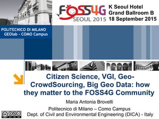
  • 1. Citizen Science, VGI, Geo- CrowdSourcing, Big Geo Data: how they matter to the FOSS4G Community Maria Antonia Brovelli Politecnico di Milano – Como Campus Dept. of Civil and Environmental Engineering (DICA) - Italy K Seoul Hotel Grand Ballroom B 18 September 2015 POLITECNICO DI MILANO GEOlab - COMO Campus
  • 2. 2Citizen science Citizen science: scientific work undertaken by members of the general public, often in collaboration with or under the direction of professional scientists and scientific institutions. June 2014 It is a fairly new name but an old practice
  • 3. 3Volunteered Geographic Information The name was coined in 2007 (Goodchild), but it was already a real practice. Geopaparazzi. Because not all paparazzis are evil!
  • 5. 5OpenStreetMap at FOSS4G Europe 2015 Peter Mooney , Luca Delucchi and Marco Minghini
  • 6. 6Checking the quality Comparison of OpenStreetMap and authoritative road network datasets http://131.175.143.84/WPS/
  • 7. 7Indoor Mapping at FOSS4G Europe Nicola Dorigatti and Ludovico Biagi http://www.i-locate.eu/the-open-source-toolkit/
  • 8. 8Emotional Maps: participatory sensing How do we feel the city? Photo by Thomas Leuthard Haosheng Huang
  • 9. 9Emotional Mapping at FOSS4G Europe 2015 Haosheng Huang and Eleonora Ciceri Available at Google Play or Apple Store: emomap Download the code: https://github.com/cartogroup/emomap
  • 10. 10Other participatory sensing applications Architectural barriersArchitectural barriers Cultural elementsCultural elements Street furnitureStreet furniture BiodiversityBiodiversity
  • 11. 11
  • 12. 12OSAKA Bike Parking Report Available at Google Play : ODKCollect To connect ODK Collect to the ODK Aggregate server: • hit the Options device button, then select General Settings • select Configure platform settings and insert: – URL: http://131.175.143.49/ODKAggregate – Username: maria - Password: osaka2015
  • 16. 16Volunteer thinking Vijay Charan Venkatachalam and Irene Celino http://bit.ly/foss4game DUSAF (Lombardy)
  • 17. 17 1. Look at the pixel within the blue border 2. For that pixel, choose the most suitable land cover category 3. Watch the time! 4. Win scores and badges and beat your friends!
  • 20. 20Geo Big Data: Satellites
  • 21. 21 Sensors are everywhere and they are the electronic skin of the Earth Geo Big Data: Sensors Citizens as sensors
  • 22. 22Example 1: EarthServer  Agile Analytics on 1+ Petabyte space/time datacubes • Earth Science (3D sat image timeseries, 4D weather); Planetary Science  Open standards, open source • OGC WCS + WCPS, integrated data/ metadata search • rasdaman + NASA WorldWind + more  Intercontinental initiative: EU+US+AUS  www.earthserver.eu EarthServer: Datacubes at Your Fingertips Peter Baumann & al, Jacobs Univ. Bremen -Germany
  • 23. 23Example 2: support for massive datasets in GRASS Moderate-resolution Imaging Spectroradiometer (MODIS) Land Surface Temperature: Data from 2000-today 4 Earth coverages per day Processing of 17,000 maps of 415 million pixels each (250 m size) ● In total 300 nodes with 600 Gb RAM ● 132 TB of raw disk space, XFS, GlusterFS ● Circa 2 Tflops/s ● Scientific Linux operating system, blades headless ● Queue system for job management (Grid Engine), used for GRASS jobs ● Computational time for all data: 1 month with LST-algorithm V2.0 ● Computational time for one LST day: 3 hours on 2 nodes Markus Neteler & al, FEM-Italy
  • 24. 24Geo Big Data: social media http://www.internetlivestats.com/ 9,890 Tweets sent in 1 second 2,528 Instagram photos uploaded in 1 second 2,153 Tumblr posts in 1 second 1,843 Skype calls in 1 second 29,290 GB of Internet traffic in 1 second 50,232 Google searches in 1 second 106,299 YouTube videos viewed in 1 second 2,420,172 Emails sent in 1 second
  • 25. 25Geo Big Data: the example of Milano GRID ● Two months of data, with a temporal step of 10 minutes ● Grid of 100 x 100 cells with size = 235 m https://dandelion.eu/datamine/open-big-data/
  • 26. 26 ● Received SMS: a Call Detail Record (CDR) is generated each time a user receives an SMS ● Sent SMS: a CDR is generated each time a user sends an SMS ● Incoming Calls: a CDR is generated each time a user receives a call ● Outgoing Calls: CDR is generated each time a user issues a call ● Internet connections: a CDR is generate each time – a user starts an internet connection – a user ends an internet connection – during the same connection one of the following limits is reached:​ • 15 minutes from the last generated CDR • 5 MB from the last generated CDR ● Geolocalized Tweets (Anonymized twitter users) Geo Big Data: Milano GRID
  • 28. 28Sensing the City - 1 Students: Emanuele Mariani, Jacopo Mossina; Supervisors: Giorgio Zamboni, Maria A Brovelli http://131.175.143.84/BGDV/
  • 29. 29Sensing the City - 2 Student: Anna Trofimova Supervisors: Carolina Arias, Maria A Brovelli http://landcover.como.polimi.it/socialmedia_rasdaman/
  • 30. 30Sensing the City - 2 Filtering with date and land coverage classes
  • 31. 31Sensing the City - 3 NETCDF Carolina Arias, Maria A Brovelli, Simone Corti, Giorgio Zamboni http://landcover.como.polimi.it/BigNetCDF/ EST-WA
  • 32. 32GeoForAll Geocrowd Geocrowdsourcing CitizenScience FOSS4G Peter Mooney & Maria A Brovelli http://www.geoforall.org/http://www.geoforall.org/ http://wiki.osgeo.org/wiki/Geocrowdsourcing_CitizenScience_FOSS4G
  • 33. 33 Thanks to all people of my team contributing on these topics: Carolina Arias, Ludovico Biagi, Marco Brambilla, Eleonora Ciceri, Simone Corti, Eylul Candan Kilsedar, Emanuele Mariani, Marco Minghini, Monia Molinari, Jacopo Mossina,Gabriele Prestifilippo, Anna Trofimova, Vijay Charan Venkatachalam, Giorgio Zamboni Thanks to Peter Baumann, Irene Celino, Luca De Lucchi, Nicola Dorigatti, Haosheng Huang, Hayashi Hirofumi, Yoshida Daisuke, Peter Mooney, Markus Neteler, Venkathes Raghavan maria.brovelli@polimi.it Thanks for your attention!
  • 34. 34 현지 조직위원회 에게 감사 당신은 중대하다 !

Notas do Editor

  1. each Earth Science partner will host datacubes worth at least 1 PB, consisting of 3D satellite image timeseries and 4D weather data. The Mars service (Moon & others to be added) naturally don't reveal so many data, it will be 20+ TB. Following "Any query, any time", requests will get distributed in clouds and across data centers. A brand new feature of open-source rasdaman community, coming from the rasdaman GmbH company, to be released next week! Tested with 1,000+ Amazon nodes.
  2. Slide 1: Support for massive spatial datasets in GRASS GIS GRASS GIS 7 has been notably improved for the processing of massive spatial datasets. This includes improvement of the vector and raster data engines. Slide 2: EuroLST: MODIS LST daily time series Temperature is a main driver for most ecological processes, and temperature time series provide key environmental indicators for various applications and research fields. High spatial and temporal resolution are crucial for detailed analyses in various fields of research. The problem of optical and thermal remote sensing are clouds which often obscure parts or even the entirety of satellite images (see upper left map, showing the mosaik of land surface temperature (LST) data of a particular day in Europe). The team of Markus Neteler at Fondazione Edmund Mach in Italy developed a new method to reconstruct the complete time series for land surface temperature (LST) at continental scale from daily MODIS LST products, flown onboard the Terra and Aqua NASA satellites. These two satellites are generating four Earth coverages per day! The reconstruction, i.e. gap filling of the data is done by outlier detection, then a temporal gap filling (upper right picture) trying to find pixels in time by looking back and forth for a few days. This is followed by a multiple regression with auxiliary maps in order to generate a synthetic LST map for each satellite overpass (lower right image). All done in GRASS GIS 7, about 5 billion pixels are involved for each map reconstruction. Eventually, both the temporary results (upper and lower right images) are merged into the final LST map (lower left image). In total 17,000 daily LST maps of each 415 million pixels have been generated and then aggregated to daily averages, monthly, seasonal and annual means. Slide 3: EuroLST: MODIS LST daily time series Example for a single reconstructed mosaik out of the 17,000 maps. .... as per slide ... Slide 4: EuroLST: MODIS LST daily time series Another example: the hot summer of 2003 in Europe is still reflected in the overly warmed up big lakes in January 2004. The temperature excess leads to better overwintering conditions for parasites and disease vectors which are studied by the team at Fondazione Edmund Mach. Slide 5: BIOCLIM from reconstructed MODIS LST at 250m pixel resolution Example for BIOCLIM data derived from the daily reconstructed LST data. These BIOCLIM-like European LST maps following the “Bioclim” definition (Hutchinson et al., 2009) were derived from 10 years of reconstructed MODIS LST as GeoTIFF files, 250m pixel resolution, in EU LAEA projection. The data are available online at http://gis.cri.fmach.it/eurolst-bioclim/ Slide 6: FEM-GIS Cluster overview This machine is used for the MODIS LST processing. The I/O is so high that the internal 10Gb/s network cannot handle more than 20 jobs in parallel (since each job processes more than 5 billion pixels). GRASS GIS 7 has been optimized to be able to handle this amount of data easily. Slide 7: FEM-GIS Cluster architecture The FEM-GIS Cluster has been created over several years which explains its heterogeneous structure. In the lower right part there is distributed low cost storage system consisting of 8 microservers with 4 disks each, which are seen as a single storage through the GlusterFS file system.