SlideShare uma empresa Scribd logo
1 de 18
Geographical Information Systems Presentation for Summit Networking Group July 6, 2010 Coordinated Digital Mapping Services, LLC
Geographical Information Systems enable the viewing of data in reference to some geographical location.  At the core of a good GIS system lies an extraordinary ability to process large quantities of data. What is GIS?
GIS Example 1 Washington County Texas – County Outline
GIS Example 1 Washington County Texas – County Appraisal District Parcels Included
GIS Example 1 Washington County Texas – Cities
GIS Example 1 Washington County Texas – Hydrology Included (Lakes, Rivers, etc.)
GIS Example 1 Washington County Texas – Weiss Family Parcels
GIS Example 1 Washington County Texas – Zooming In to See Labels
GIS Example 1 Washington County Texas – FEMA Flood Zones Shaded Dark Green
GIS Example 1 Washington County Texas – Location of Entrances
GIS Example 2 Top of the Mark in San Francisco – Imagery with Streets Represented
GIS Example 3 BNSF Tarrant County Texas– PDF File with Layers
GIS Example 3 BNSF Tarrant County Texas– PDF File with Layers Turned Off
GIS Example 4 Whitehead Ranch– Oil and Gas Example with Lease Expiration
GIS Example 4 Whitehead Ranch– Layers Turned Off to Simplify Viewing
GIS Example 5 Market Segmentation
Government Oil & Gas Insurance Conservationists Everyone Who uses GIS?
How could these principles be applied to your business?  Is this possibly new intelligence to solve real world business problems?  If so, why are you not investigating the options right now! What can GIS do for you?

Mais conteúdo relacionado

Destaque

MILSPACE 2012 Conference R. Paris Presentation 27 March 12
MILSPACE 2012 Conference R. Paris Presentation 27 March 12MILSPACE 2012 Conference R. Paris Presentation 27 March 12
MILSPACE 2012 Conference R. Paris Presentation 27 March 12Paris Rodolphe
 
MILSPACE 2011 R. Paris Presentation
MILSPACE 2011 R. Paris PresentationMILSPACE 2011 R. Paris Presentation
MILSPACE 2011 R. Paris PresentationParis Rodolphe
 
IM2 Company Presentation
IM2 Company Presentation IM2 Company Presentation
IM2 Company Presentation IM2ENERGIASOLAR
 
Job search & marketing
Job search & marketingJob search & marketing
Job search & marketingfruitc
 
Gc Outsoursing Presentation
Gc Outsoursing PresentationGc Outsoursing Presentation
Gc Outsoursing Presentationgvizca
 
Global MILSATCOM Conference 2011 R. Paris
Global MILSATCOM Conference 2011 R. ParisGlobal MILSATCOM Conference 2011 R. Paris
Global MILSATCOM Conference 2011 R. ParisParis Rodolphe
 

Destaque (6)

MILSPACE 2012 Conference R. Paris Presentation 27 March 12
MILSPACE 2012 Conference R. Paris Presentation 27 March 12MILSPACE 2012 Conference R. Paris Presentation 27 March 12
MILSPACE 2012 Conference R. Paris Presentation 27 March 12
 
MILSPACE 2011 R. Paris Presentation
MILSPACE 2011 R. Paris PresentationMILSPACE 2011 R. Paris Presentation
MILSPACE 2011 R. Paris Presentation
 
IM2 Company Presentation
IM2 Company Presentation IM2 Company Presentation
IM2 Company Presentation
 
Job search & marketing
Job search & marketingJob search & marketing
Job search & marketing
 
Gc Outsoursing Presentation
Gc Outsoursing PresentationGc Outsoursing Presentation
Gc Outsoursing Presentation
 
Global MILSATCOM Conference 2011 R. Paris
Global MILSATCOM Conference 2011 R. ParisGlobal MILSATCOM Conference 2011 R. Paris
Global MILSATCOM Conference 2011 R. Paris
 

Semelhante a Coordinated Digital Mapping Services, Llc Sng

Semelhante a Coordinated Digital Mapping Services, Llc Sng (7)

Building the Utah Cadastre Through Partnerships (UGIC 2011)
Building the Utah Cadastre Through Partnerships (UGIC 2011)Building the Utah Cadastre Through Partnerships (UGIC 2011)
Building the Utah Cadastre Through Partnerships (UGIC 2011)
 
U.S. Substate District-Regional Council as a Geospatial Unit of Analytical Ge...
U.S. Substate District-Regional Council as a Geospatial Unit of Analytical Ge...U.S. Substate District-Regional Council as a Geospatial Unit of Analytical Ge...
U.S. Substate District-Regional Council as a Geospatial Unit of Analytical Ge...
 
Ccawv 2011 a
Ccawv 2011 aCcawv 2011 a
Ccawv 2011 a
 
Gis
GisGis
Gis
 
9C – COOPERATIVE DATA SHARING: ASSEMBLING A STATE-WIDE COUNTY PUBLIC LAYER
9C – COOPERATIVE DATA SHARING: ASSEMBLING A STATE-WIDE COUNTY PUBLIC LAYER9C – COOPERATIVE DATA SHARING: ASSEMBLING A STATE-WIDE COUNTY PUBLIC LAYER
9C – COOPERATIVE DATA SHARING: ASSEMBLING A STATE-WIDE COUNTY PUBLIC LAYER
 
GIS DATA IN.pptx
GIS DATA IN.pptxGIS DATA IN.pptx
GIS DATA IN.pptx
 
A Journey to the World of GIS
A Journey to the World of GISA Journey to the World of GIS
A Journey to the World of GIS
 

Coordinated Digital Mapping Services, Llc Sng

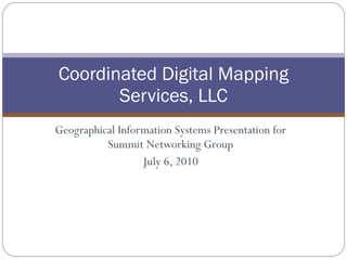
  • 1. Geographical Information Systems Presentation for Summit Networking Group July 6, 2010 Coordinated Digital Mapping Services, LLC
  • 2. Geographical Information Systems enable the viewing of data in reference to some geographical location. At the core of a good GIS system lies an extraordinary ability to process large quantities of data. What is GIS?
  • 3. GIS Example 1 Washington County Texas – County Outline
  • 4. GIS Example 1 Washington County Texas – County Appraisal District Parcels Included
  • 5. GIS Example 1 Washington County Texas – Cities
  • 6. GIS Example 1 Washington County Texas – Hydrology Included (Lakes, Rivers, etc.)
  • 7. GIS Example 1 Washington County Texas – Weiss Family Parcels
  • 8. GIS Example 1 Washington County Texas – Zooming In to See Labels
  • 9. GIS Example 1 Washington County Texas – FEMA Flood Zones Shaded Dark Green
  • 10. GIS Example 1 Washington County Texas – Location of Entrances
  • 11. GIS Example 2 Top of the Mark in San Francisco – Imagery with Streets Represented
  • 12. GIS Example 3 BNSF Tarrant County Texas– PDF File with Layers
  • 13. GIS Example 3 BNSF Tarrant County Texas– PDF File with Layers Turned Off
  • 14. GIS Example 4 Whitehead Ranch– Oil and Gas Example with Lease Expiration
  • 15. GIS Example 4 Whitehead Ranch– Layers Turned Off to Simplify Viewing
  • 16. GIS Example 5 Market Segmentation
  • 17. Government Oil & Gas Insurance Conservationists Everyone Who uses GIS?
  • 18. How could these principles be applied to your business? Is this possibly new intelligence to solve real world business problems? If so, why are you not investigating the options right now! What can GIS do for you?