SlideShare uma empresa Scribd logo
1 de 1
Baixar para ler offline
LJT & Associates, Inc.


    Geospatial Consulting Services

     LJT & Associates, Inc. offers a wide range of geospatial consulting services to help deliver accurate spatial
     information and analysis. From client needs assessments, through the data acquisition process, to end user application
     development, LJT can provide end-to-end geospatial services and solutions to our customers. Our solutions assist end
     users, such as facilities engineers and planners, to visualize spatial information and analyze events. These activities
     enable them to make educated decisions and develop plans of action based on accurate, reliable information.

          Our services include:

              •Project Management
              •Site Assessments
              •GPS Surveys
              •Aerial Data Collection
              •Digital Orthophotography
              •Photogrammetry
              •Geodatabase Development and
               Migration
              •Integration of GIS Technology
               with Enterprise Applications and
               Databases


     LJT has an impressive track record of successful GIS (Geographic Information Systems) projects. Our experience began
     nearly a decade ago when we deployed some of the first GIS applications. Since then we have successfully migrated
     multiple facilities to SDSFIE (Spatial Data Standard for Facilities, Infrastructure, and Environment) compliant
     Geodatabases and mapped numerous government installations worldwide. Some of our experience is described below.

     Project Management
     LJT has been managing multiple, large-scale GIS projects worldwide for nearly ten years. Due to the truly global nature
     of our work, the many logistical challenges involved with data collection and processing, and the fact that many
     individual skill sets are needed to produce a GIS from start to finish (e.g., surveyors, pilots, architects, GIS analysts,
     application programmers), good project management is of paramount importance to a successful GIS implementation.
     LJT has excelled at providing overall project management to several GIS projects. Our clients rely upon us to ensure
     that, no matter how complex the work or how remote the location, their GIS efforts are completed successfully on time
     and within budget.

     Site Assessments
     LJT has deep experience defining specifications for aerial data collection missions, data extraction, QA/QC performance
     on delivered data (imagery and extracted features), and the development and delivery of final data in required formats.
     These are often the product of detailed site assessments and planning efforts.


     LJT & Associates, Inc.
     512 Herndon Parkway
     Herndon, VA 20171
     Tel: (703) 481-3000 x12
      http://www.ljtinc.com /   Copyright © 1994-2006 LJT & Associates, Inc. All rights reserved.

Mais conteúdo relacionado

Mais procurados

Impac Geosteering Services updated Dylan
Impac Geosteering Services updated DylanImpac Geosteering Services updated Dylan
Impac Geosteering Services updated DylanBill Williamson
 
GWT 2014: Emergency Conference - 03 la gestione del processo di acquisizione ...
GWT 2014: Emergency Conference - 03 la gestione del processo di acquisizione ...GWT 2014: Emergency Conference - 03 la gestione del processo di acquisizione ...
GWT 2014: Emergency Conference - 03 la gestione del processo di acquisizione ...Planetek Italia Srl
 
Robert_M_Collins_resume_January2016
Robert_M_Collins_resume_January2016Robert_M_Collins_resume_January2016
Robert_M_Collins_resume_January2016Rob Collins
 
gis project planning and management
gis project planning and managementgis project planning and management
gis project planning and managementAbhiram Kanigolla
 
Savills - Smart Data - Esri UK Annual Conference 2017
Savills - Smart Data - Esri UK Annual Conference 2017Savills - Smart Data - Esri UK Annual Conference 2017
Savills - Smart Data - Esri UK Annual Conference 2017Esri UK
 
Speer resume 7 10-19
Speer resume 7 10-19Speer resume 7 10-19
Speer resume 7 10-19Micheal Speer
 

Mais procurados (11)

Flightline Geo Imagery Info Sheet
Flightline Geo Imagery Info SheetFlightline Geo Imagery Info Sheet
Flightline Geo Imagery Info Sheet
 
Position Navigation and Timing Applications | Chaz Dixon | March 2015
Position Navigation and Timing Applications | Chaz Dixon | March 2015Position Navigation and Timing Applications | Chaz Dixon | March 2015
Position Navigation and Timing Applications | Chaz Dixon | March 2015
 
Impac Geosteering Services updated Dylan
Impac Geosteering Services updated DylanImpac Geosteering Services updated Dylan
Impac Geosteering Services updated Dylan
 
GWT 2014: Emergency Conference - 03 la gestione del processo di acquisizione ...
GWT 2014: Emergency Conference - 03 la gestione del processo di acquisizione ...GWT 2014: Emergency Conference - 03 la gestione del processo di acquisizione ...
GWT 2014: Emergency Conference - 03 la gestione del processo di acquisizione ...
 
Robert_M_Collins_resume_January2016
Robert_M_Collins_resume_January2016Robert_M_Collins_resume_January2016
Robert_M_Collins_resume_January2016
 
Evolution of soil surveys - Anderson
Evolution of soil surveys - AndersonEvolution of soil surveys - Anderson
Evolution of soil surveys - Anderson
 
GITA2002
GITA2002GITA2002
GITA2002
 
gis project planning and management
gis project planning and managementgis project planning and management
gis project planning and management
 
Savills - Smart Data - Esri UK Annual Conference 2017
Savills - Smart Data - Esri UK Annual Conference 2017Savills - Smart Data - Esri UK Annual Conference 2017
Savills - Smart Data - Esri UK Annual Conference 2017
 
Speer resume 7 10-19
Speer resume 7 10-19Speer resume 7 10-19
Speer resume 7 10-19
 
Resume
ResumeResume
Resume
 

Destaque (9)

Touchstone of Theology
Touchstone of TheologyTouchstone of Theology
Touchstone of Theology
 
HTC Development Environment Configuration
HTC Development Environment ConfigurationHTC Development Environment Configuration
HTC Development Environment Configuration
 
2 mine
2 mine2 mine
2 mine
 
Expo Agrícola Jalisco 2014
Expo Agrícola Jalisco 2014Expo Agrícola Jalisco 2014
Expo Agrícola Jalisco 2014
 
ESTADOS UNIDOS: A DIMENSÃO ECONÔMICA
ESTADOS UNIDOS: A DIMENSÃO ECONÔMICAESTADOS UNIDOS: A DIMENSÃO ECONÔMICA
ESTADOS UNIDOS: A DIMENSÃO ECONÔMICA
 
Chukys
ChukysChukys
Chukys
 
05 medeiros
05 medeiros05 medeiros
05 medeiros
 
Raízes Industriais da Crise Financeira Asiática e o Enquadramento da Coréia
Raízes Industriais da Crise Financeira Asiática e o Enquadramento da CoréiaRaízes Industriais da Crise Financeira Asiática e o Enquadramento da Coréia
Raízes Industriais da Crise Financeira Asiática e o Enquadramento da Coréia
 
Estimação do teorema da paridade descoberta da taxa de juros para o Brasil
Estimação do teorema da paridade descoberta da taxa de juros para o BrasilEstimação do teorema da paridade descoberta da taxa de juros para o Brasil
Estimação do teorema da paridade descoberta da taxa de juros para o Brasil
 

Semelhante a Geospatial Consulting Services

MCS GEOTECH (P) LTD gis solutions
MCS GEOTECH (P) LTD gis solutionsMCS GEOTECH (P) LTD gis solutions
MCS GEOTECH (P) LTD gis solutionsMCS GEOTECH (P) LTD
 
Gis applications in ce eric from chsm
Gis applications in ce   eric from chsmGis applications in ce   eric from chsm
Gis applications in ce eric from chsmsr_jaya88
 
Gis applications in civil engineering
Gis applications in civil engineeringGis applications in civil engineering
Gis applications in civil engineeringShanake Dissanayake
 
Gis applications in ce eric
Gis applications in ce   ericGis applications in ce   eric
Gis applications in ce ericsunil hg
 
Gis application in civil engineering
Gis application in civil engineeringGis application in civil engineering
Gis application in civil engineeringAmal C Varghese
 
Gisapplicationincivilengineering 140227110022-phpapp02
Gisapplicationincivilengineering 140227110022-phpapp02Gisapplicationincivilengineering 140227110022-phpapp02
Gisapplicationincivilengineering 140227110022-phpapp02Antriksh Vatsyayana
 
Max Bolen Resume 12202016
Max Bolen Resume 12202016Max Bolen Resume 12202016
Max Bolen Resume 12202016Max Bolen
 
Adavanced GIS Solution
Adavanced GIS SolutionAdavanced GIS Solution
Adavanced GIS SolutionJenifer Robert
 
3DGIS company profile ENGLISH
3DGIS company profile ENGLISH3DGIS company profile ENGLISH
3DGIS company profile ENGLISH3DGIS
 
Moving to Web GIS: Transforming an Organization
Moving to Web GIS: Transforming an OrganizationMoving to Web GIS: Transforming an Organization
Moving to Web GIS: Transforming an OrganizationAndrew Valenski
 
GIS Project Management Web
GIS Project Management WebGIS Project Management Web
GIS Project Management WebJoshua Clemens
 
TechM GIS Competency
TechM GIS CompetencyTechM GIS Competency
TechM GIS CompetencyTechM-GIS
 
AABSyS Information Technology Private Limited - A GIS, CAD and Software Company
AABSyS Information Technology Private Limited - A GIS, CAD and Software CompanyAABSyS Information Technology Private Limited - A GIS, CAD and Software Company
AABSyS Information Technology Private Limited - A GIS, CAD and Software Companywebaabsys
 
Introduction to gis and its application
Introduction to gis and its application Introduction to gis and its application
Introduction to gis and its application gandhinagar
 
Leveraging ArcGIS Platform & CityEngine for GIS based Master Plans
Leveraging ArcGIS Platform & CityEngine for GIS based Master PlansLeveraging ArcGIS Platform & CityEngine for GIS based Master Plans
Leveraging ArcGIS Platform & CityEngine for GIS based Master PlansEsri India
 

Semelhante a Geospatial Consulting Services (20)

JA SERVICES PROFILE
JA SERVICES PROFILEJA SERVICES PROFILE
JA SERVICES PROFILE
 
RIQ LLC
RIQ LLCRIQ LLC
RIQ LLC
 
MCS GEOTECH (P) LTD gis solutions
MCS GEOTECH (P) LTD gis solutionsMCS GEOTECH (P) LTD gis solutions
MCS GEOTECH (P) LTD gis solutions
 
Gis applications in ce eric from chsm
Gis applications in ce   eric from chsmGis applications in ce   eric from chsm
Gis applications in ce eric from chsm
 
Gis applications in civil engineering
Gis applications in civil engineeringGis applications in civil engineering
Gis applications in civil engineering
 
Gis applications in ce eric
Gis applications in ce   ericGis applications in ce   eric
Gis applications in ce eric
 
Gis application in civil engineering
Gis application in civil engineeringGis application in civil engineering
Gis application in civil engineering
 
Gisapplicationincivilengineering 140227110022-phpapp02
Gisapplicationincivilengineering 140227110022-phpapp02Gisapplicationincivilengineering 140227110022-phpapp02
Gisapplicationincivilengineering 140227110022-phpapp02
 
Max Bolen Resume 12202016
Max Bolen Resume 12202016Max Bolen Resume 12202016
Max Bolen Resume 12202016
 
A revolution for a better management
A revolution for a better managementA revolution for a better management
A revolution for a better management
 
kCube_combined
kCube_combinedkCube_combined
kCube_combined
 
Adavanced GIS Solution
Adavanced GIS SolutionAdavanced GIS Solution
Adavanced GIS Solution
 
3DGIS company profile ENGLISH
3DGIS company profile ENGLISH3DGIS company profile ENGLISH
3DGIS company profile ENGLISH
 
Moving to Web GIS: Transforming an Organization
Moving to Web GIS: Transforming an OrganizationMoving to Web GIS: Transforming an Organization
Moving to Web GIS: Transforming an Organization
 
GIS Project Management Web
GIS Project Management WebGIS Project Management Web
GIS Project Management Web
 
TechM GIS Competency
TechM GIS CompetencyTechM GIS Competency
TechM GIS Competency
 
AABSyS Information Technology Private Limited - A GIS, CAD and Software Company
AABSyS Information Technology Private Limited - A GIS, CAD and Software CompanyAABSyS Information Technology Private Limited - A GIS, CAD and Software Company
AABSyS Information Technology Private Limited - A GIS, CAD and Software Company
 
Introduction to gis and its application
Introduction to gis and its application Introduction to gis and its application
Introduction to gis and its application
 
David Miller Retired
David Miller RetiredDavid Miller Retired
David Miller Retired
 
Leveraging ArcGIS Platform & CityEngine for GIS based Master Plans
Leveraging ArcGIS Platform & CityEngine for GIS based Master PlansLeveraging ArcGIS Platform & CityEngine for GIS based Master Plans
Leveraging ArcGIS Platform & CityEngine for GIS based Master Plans
 

Geospatial Consulting Services

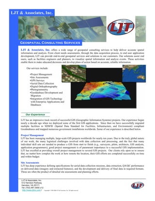
  • 1. LJT & Associates, Inc. Geospatial Consulting Services LJT & Associates, Inc. offers a wide range of geospatial consulting services to help deliver accurate spatial information and analysis. From client needs assessments, through the data acquisition process, to end user application development, LJT can provide end-to-end geospatial services and solutions to our customers. Our solutions assist end users, such as facilities engineers and planners, to visualize spatial information and analyze events. These activities enable them to make educated decisions and develop plans of action based on accurate, reliable information. Our services include: •Project Management •Site Assessments •GPS Surveys •Aerial Data Collection •Digital Orthophotography •Photogrammetry •Geodatabase Development and Migration •Integration of GIS Technology with Enterprise Applications and Databases LJT has an impressive track record of successful GIS (Geographic Information Systems) projects. Our experience began nearly a decade ago when we deployed some of the first GIS applications. Since then we have successfully migrated multiple facilities to SDSFIE (Spatial Data Standard for Facilities, Infrastructure, and Environment) compliant Geodatabases and mapped numerous government installations worldwide. Some of our experience is described below. Project Management LJT has been managing multiple, large-scale GIS projects worldwide for nearly ten years. Due to the truly global nature of our work, the many logistical challenges involved with data collection and processing, and the fact that many individual skill sets are needed to produce a GIS from start to finish (e.g., surveyors, pilots, architects, GIS analysts, application programmers), good project management is of paramount importance to a successful GIS implementation. LJT has excelled at providing overall project management to several GIS projects. Our clients rely upon us to ensure that, no matter how complex the work or how remote the location, their GIS efforts are completed successfully on time and within budget. Site Assessments LJT has deep experience defining specifications for aerial data collection missions, data extraction, QA/QC performance on delivered data (imagery and extracted features), and the development and delivery of final data in required formats. These are often the product of detailed site assessments and planning efforts. LJT & Associates, Inc. 512 Herndon Parkway Herndon, VA 20171 Tel: (703) 481-3000 x12 http://www.ljtinc.com / Copyright © 1994-2006 LJT & Associates, Inc. All rights reserved.