

Recomendados
Recomendados
Mais conteúdo relacionado
Mais procurados
Mais procurados (20)
Semelhante a Final presentation
Semelhante a Final presentation (20)
Último
Último (20)
Final presentation
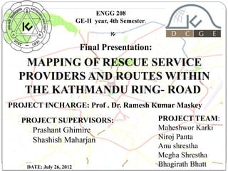
- 1. ENGG 208 GE-II year, 4th Semester. Final Presentation: MAPPING OF RESCUE SERVICE PROVIDERS AND ROUTES WITHIN THE KATHMANDU RING- ROAD PROJECT INCHARGE: Prof . Dr. Ramesh Kumar Maskey PROJECT SUPERVISORS: Prashant Ghimire Shashish Maharjan 1 DATE: July 26, 2012 PROJECT TEAM: Maheshwor Karki Niroj Panta Anu shrestha Megha Shrestha 11/8/13 Bhagirath Bhatt
- 2. INTRODUCTION Mapping of Rescue Service providers and Routes Within the Kathmandu Ring Road means : Preparing a special map with the following features, needed for Rescue. *Rescue ( Emergency) Service providers: - Hospitals -Fire Brigades (Fire Fighters) -Police -Metropolitan police -Traffic Police *Traffic Congested areas *One way Traffic *Black Spots *Petrol Pumps 2
- 3. OBJECTIVES • To prepare the rescue map with the information of rescue service providers and rescue routes within the Kathmandu Ring-Road. • To locate the High Accident Prone Places. • To present the information(Phone no. and locations with name) of Rescue( Emergency) service providers on the same map. • 3 To learn, how the rescue operation is done and provide necessary information in map if any.
- 4. SCOPE OF THE WORK
- 5. PROJECT SITE vKathmandu Ring- Road Kathmandu Metropolitan Kathmandu Nepal. 5 City , Facts And Figures: Ø Length of Ring Road: 27.6 km ØArea Enclose by Ring- Road: 50.67 square kilometers. Ø Population: 671,846 residents living in 235,387 house holds Ø Emergency Service providers: § Hospitals § Health Centers § Ambulance Source § Fire Fighters(1) #www.kathmandu.gov.np § Police Posts
- 6. RATIONALAE One of the busiest centers of the Nepal. High Traffic Volume , less roads networks Poor Traffic management. Lack of Traffic awareness in people. Frequent accidents Source:Google Image 6 According to Metropolitan Traffic Police Division, on an average 15 accidents occur in Kathmandu everyday many of them fatal. Last month alone 454 accidents occurred and 12 persons were killed.
- 7. METHEDOLOGIES Literature Review • Desk Study Data Acquisition • Primary Data Using GPS • Secondary Data from concerned authorities • GPS will be used if secondary data is not available. • GIS/Catrtographic work 7 • Classification of the details(Black Spots , One Way Traffic , congested areas etc) • Selection and Omission of Data • Making Geodatabase and Different Layers • Digitization • Symbolization • Name placement
- 8. MAPPING PROCESS PLANNING Need of Study Project Management specification DATA ACQUISITION Georeferencing Surveying* Remote sensing* Photogrammetry* Scan Digitizing* CARTOGRAPHIC PRODUCTION Cartographic Works and Design Proof Reading Printing Drafting *Works not performed by us. 8 PRODUCT DELIVERY Yes User Needs Satisfied? No
- 9. MATERIALS USED Instruments, Soft wares and Resources Used § Instrument: GPS (Garmin) § Soft wares: § ArcGIS Resources: § § § 9 § Topographical Digital map of Survey Department(1:50,000) Satellite Image ( taken in 1994 Source Unknown) Google Earth (www.googleearth.com)
- 11. MAP FEATURES Map features Primary (Rescue) features The features that are concerned with the rescue operation is called the rescue features. These features include Hospitals , Police Stations, Fire Brigade and One way traffic. The rescue features are highlighted in the 11 map. Secondary features All the other contents which would make the map more readable and user-friendly are the secondary features. The secondary features include the local place names, important buildings name, water bodies and other prominent features 11/8/13 of the map.
- 12. Rescue Features Traffic Police Post Hospital No Entry Police Office/ Post Fire Brigade One Way Traffic Black Spot 12
- 14. MAP SCALE Scale: The scale to which a map is drawn represents the ratio of the distance between two points on the map and the distance between the two corresponding points on the earth. The rescue map is printed in: Ø1: 12,000 14 Projection Information: Ø MUTM, 84 Ø Everest 1937 Ø Longitude 84 East, Latitude 0 North Ø False Coordinate: 500000m Easting, 0 Northing Ø Scale factor at central meridian 0.999900
- 16. LOCATION OF POLICE AND TRAFFIC POLICE STATIONS: 16 Kathmandu University PP – Police Post TP – Traffic Post 11/8/13
- 17. LIST OF BLACK SPOTS AND CONGESTED AREAS 17
- 18. FACTS AND CAUTIONS FOUND DURING OUR STUDY Ø Heavy vehicles are not allowed to enter inside ring road between 8 am to 8 pm. Ø One way traffic rules are obligatory for Rescue Vehicles. Ø CRV or TCRV or both would reach any place of emergency within 5- 8 minutes within ring road. So best 18 way to seek for quick rescue is police. 11/8/13
- 19. Accident Spot RESCUE OPERATION PROCEDURE Information to InformationOF NEPAL POLICE the Control convey to the room( Accidental detail briefing is nearest police post( information then forwarded to the required service providers) 19 taken as much as possible and work according to the accidental case.) Control room sends vehicle and the rescue team and also inform other rescue 11/8/13 providers service
- 20. PROJECT SCHEDULE
- 22. SUMMARY AND CONCLUSION § “Mapping of Rescue Service providers and Routes Within the Kathmandu Ring- Road” means, Preparing a special map with the following features, needed for Rescue. § Rescue service providers ( hospitals, Police, firefighters,ambulance, Petrol Pumps) § The project work has been completed within the specific timeframe. § The project has achieved its objective throughout the working time. § The project is found to be one of the most important work because there is no any such informative map, even the sensitive organization like fire brigade also works on the basis of guess 22 and driver’s skill.
- 23. RECOMMENDATION q The concerned authority of the fire brigade should make its operational map for the quick access for the fire casualties. q q This project has made an effort to show the one way traffic, but also there are many technical shortcomings. This should be done by the Traffic Police force in precise and effective way. q q The policy makers should think of blackspots and take necessary steps to find the causes of the accidents and necessary stops. q q The map can be more useful and dynamic as: The map is only limited with accidents and traffic system we can include the rescue features for other hazards such as landslide, 23erosions etc.
- 24. ACKNOWLEDGEMENTS Together we’re very thankful to: - Asst.Prof. Subash Ghimire(Program co-ordinator , Geomatics Engineering ) - Mr. Prashant Ghimire (Project Supervisor) - Mr. Shashish Maharjan (Project Supervisor) - D.S.P Basanta Panta, Traffic headquarter, Ktm Metropolitan. - Ins. K.D Bhatta, Traffic headquarter, Ktm Metropolitan -Prakash Ghimire (GE-3rd year) -Sabin Dhital(GE-3rd year) For their kind support and co-operation. We’d also like to express our gratitude to the other persons who have given their invaluable support during our field study. 24
- 25. REFERENCES I. http://www.kathmandu.gov.np/index.php?cid=6&pr_id=6. Retrieved on 2012-06-21. II. "Census Nepal 2001". http://www.cbs.gov.np/Population/National%20Report%202001/V on 2012-06-27 III."History and problem". Firefighters Volunteer Association of Nepal (FAN). http://www.fan.org.np/. Retrieved on 2012-0627. IV. www.opensteetmap.org 25 Kathmandu University V. www.googleearth.com 11/8/13
- 26. 26
Notas do Editor
- 5
- 16
- 24
- 26