
Recomendados
Mais conteúdo relacionado
Destaque
Destaque (10)
Semelhante a About this Map (NCSS 2013)
Semelhante a About this Map (NCSS 2013) (20)
Último
Último (20)
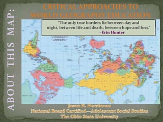
About this Map (NCSS 2013)
- 1. “The only true borders lie between day and night, between life and death, between hope and loss.” –Erin Hunter
- 2. Warm-up Framing the work of critical geography The imagined world The experienced world Views and Voices in Our World
- 3. EQ: Is there an equitable way to (re)present people in the world? Objectives: o Establish a working conceptualization of what we mean by critical geography. o Analyze and reflect upon how we imagine the world came to be. o Use Turkey as a case study to help inform our evaluation of geography instruction in the social studies.
- 4. Map A: Identify the location of the world’s major religions. Map B: Identify the location of the world’s major languages. Pair up with someone who had a different task (A find B and B find A. Numbers do not matter).
- 6. Working with multiple texts & multiple representations of information. Comparing texts for different perspectives. Working with academic language. CCSS.ELA-Literacy.RH.9-10.7 Integrate quantitative or technical analysis (e.g., charts, research data) with qualitative analysis in print or digital text. CCSS.ELA-Literacy.RH.9-10.5 Analyze how a text uses structure to emphasize key points or advance an explanation or analysis. CCSS.ELA-Literacy.RH.9-10.9 Compare and contrast treatments of the same topic in several primary and secondary sources. CCSS.ELA-Literacy.RH.9-10.4 Determine the meaning of words and phrases as they are used in a text, including vocabulary describing political, social, or economic aspects of history/social science.
- 7. Label the cities Label the physical features Label the states Color the map OR MAKE THE MAP INTERACTIVE AS A WORK IN PROGRESS
- 8. “I'll start with the most obvious point: teaching the “Other” immediately creates a double bind. On the one hand, people can say you lack qualifications to teach about an “Other” unless you belong to that group. On the other hand, one can say that you are something-centric (or racist, sexist, homophobic, or whatever), if you don't include the “Other” in your teaching. I think that the only ethical thing to do is just acknowledge the double bind. Kleinhans, C. (1993).Teaching the "other," being white, male, and middle class. Jump Cut: A Review of Contemporary Media, 38(2), 127-130.
- 9. CRITICAL GLOBAL GEOGRAPHY Metageography: the set of spatial structures through which we order our knowledge of the world (Lewis & Wigen,1997). Association of place and culture construction of what/who belongs in certain places (Anderson, 1991; Schmidt, 2010). Combating geographical determinism with a approach emphasis upon fluidity, multiplicity, movement, and flexibility (Kenreich, 2013). Teacher education and professional development: o Teacher as “gatekeeper” (Thornton, 1991). o A future oriented education (Hicks, 2002; Kirkwood, 2001). o Critical history and social studies (Segall, 2004).
- 10. A Travel Blog About Rome For those of you who got our Peru trip travel log you will be happy to know this trip is not the hair raising puke fest depth defining experience. For me this has been what great travel is all about Pastry shops on every corner, cool historic sites, and studying art. First of all it is not just Layl and I traveling we brought Daycia our 10 year old and Terry McDill Layl's Aunt. We left Elliot with my parents who are taking her on a Disney Cruise. So don't feel sorry for her. Rome is amazing! At first it seemed overwhelming but very charming. We walked the streets the first night and ran into a half a dozen ruins and took night pictures of them. We were very excited for daybreak. Our first thing on the list was the Vatican. But when we got there they were closing for the day and it was only 11 am. Some how they are only open for 2 hours a day and have a weird schedule to try to keep tourist confused. It worked. We have plans to try to make it back on our last day in Italy. Read more: http://www.travelpod.com/travel-blogentries/claysquared/1/1199391720/tpod.html#ixzz1Dl6I5c60
- 11. The nation, plagued for many centuries by factional feuds, has yet to overcome its regional chauvinism and, above all, close the wide gap between north and south. When Mount Etna in Sicily was going through one of its periodic sputters recently, graffiti reading ''Forza, Etna!'' blossomed on the mainland near Venice. The message, mysterious to foreigners, may be translated and amplified as ''Come on, Mount Etna, blow up real good and knock off a few thousand Sicilians!'' Southern Italians like to depict their countrymen in the industrial north as ''colonialists'' who owe their affluence to the protected markets of the deep south and the cheap labor they get from there. The Apulian auto worker in Turin thus describes the people in the area where he now lives as ''Piemontesi - falsi e cortesi.'’ (''Piedmontese - deceitful and polite''). The Genoese are represented by other Italians as tightwads, the Neapolitans as swindlers who will charm the shirt off your back, the Florentines as supercilious fops. There is a prejudice for every province. Most Italians, however, seem to agree on their professed distaste for their capital. The diffuse sense of a privilege undeservedly enjoyed by Rome is subliminally deepened by those ROMA license plates. Only the capital and its surroundings are allowed to spell out the fateful name; all other 94 Italian provinces have to content themselves with two letters - MI for Milan, NA for Naples, and so forth.
- 15. Resource Ideas for Teaching Geography Earth Cam ODT Maps Google Earth World Mapper
- 18. A.) Asia B.) Europe C.) Middle East
- 19. Where is Turkey located ? Do you teach Turkey as a European, Asian, or Middle Eastern country? What makes Turkey modern? Who or what do you compare Turkey to in order to define modernity? Who is Turkish? How do you develop understandings of national and global citizenship in relation to Turkey and its relation to the world?
- 38. “Herein lies the challenge: how do we conceive of the other, indeed the Other, outside of our inherited concepts and beliefs so as not to replicate the patterns of repression and subjugation we notice in the traditional conceptual frameworks?” Mohanty, S.P. (1989). “Us and Them: On the Philosophical Basis of Political Criticism,”Yale Journal of Criticism, (2), 2. Yale University Press, pp. 1-31.
- 39. A N D I N
Notas do Editor
- When we analyze statistics this way, what do we imagine in terms of where people practice these religions? For those of you who worked with a topographic map, what happens to our thinking when we remove the constructed borders?--As culture is constructed, so are borders. Thus, when we teach geography, we owe it to our students and the development of more globally minded, critically thinking students to move beyond political maps or labeling rivers and cities, but think in terms of cultural and human geography. Use a topographic map, but with a new objective for learning.
- What do maps like this mean for how we think and teach students to think about culture? Imagine places and people?—conflating place and culture(2) Is this the problem with majority rules?(3) Discuss EQ: Is there a more equitable way to (re)present people in the world? Yes, there is: We have to shift how we think and stop subscribing to how knowledge, including how the world has been organized and thus organized how we imagine places and people to be, has been constructed and is perpetuated as the only way.(4) What has this activity and discussion involved? If we break it down, what have we done?
- Working across the common core standards, focusing here on 9&10 grade.But also need to provide student with multiple opportunities apply and demonstrate this level of learning
- Is this the ultimate use of a map with students? Do these activities engage students in application and address the CCSS? Instead, give students an opportunity to create (inquiry based approach).Title=thinglink map of indiaTransition: As students construct these representations of peoples, places, and cultures, we as teachers must recognize and help students recognize that we are caught within a western biases re: how we represent the world an din how we choose perspectives.
- Think about what you know about this city map. The difference between the aerial view, the map of the United States or even Missouri, and bring on the ground. As you move through the city this weekend, how do spaces change?Now apply it to the rest of the world. Do not let students believe countries are landmasses associated with a color or that people “over there” do “this or that.” Signifiers such as “Old North” St. Louis and Midtown. The use of this type of map as still detached from lived reality of people; first person perspective, on the ground experiences.
- Earth Cam—major cities around the world, cameras set up to view in a voyeuristic manner. But why there? What and who is being left out of the shot? What if the camera moved? Google Earth—commonly used, helping with making geography more interactive. Used it with 6th graders to show them the number of pizza restaurants in Tehran. Cultural hybridity?globalization? Cultural imperialism?ODT maps—a range of world maps that can be used as images or purchased for the classroom.World mapper—great for integrating graphs, charts, statistics, and maps for students to work with multiple texts and multiple forms of information to construct positions and interpretations to align with the Common Core standards of
- You cannot talk about geography without talking about colonialism and the lingering effects.
- Issues of power: most populated vs. who is in control? Majorities? International institutions?Let’s use this image to think about and discuss the problem of a single story.
- Does geography limit our understanding of Turkey?Istanbul—one city, two continents
- Religion: Majority?Muslim 99.8% (mostly Sunni)—fair to say America is mostly Christian? Multiple denominations—Catholic or Protestant and then multiple beliefs that fall under Protestantism, so it is not equitable, nor accurate, to claim a nation is just Muslim. Gov’t learned that in Iraq.
- Our World: http://www.youtube.com/watch?v=n8zBC2dvERM&list=PLuReICiw4XPSJd4f1Gc5sw0kjW3C4f4Px&index=2 (West Wing)