Report - Green Infrastructure Frameworks for the UW Tacoma Campus
•
9 gostaram•3,220 visualizações

A report produced with Karen Kennedy summarizing the work of the University of Washington Landscape Architecture 504: Landscape Urbanism/Regional Planning studio from Fall 2007

Recomendados
Mais conteúdo relacionado
Destaque
Destaque (20)
Report - Green Infrastructure Frameworks for the UW Tacoma Campus
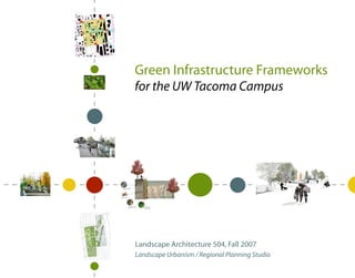
- 1. CE COMMER AY BROADW I705 F COURT_ 17TH 17TH C COURT_ T FAWCET E COURT_ MARKET 18TH PACIFIC G JEFFERSON 19TH D COURT_ TACOMA C 21ST 22ND G COURT_ HOOD 23RD 23RD CE COURT_E COMMER Green Infrastructure Frameworks for the UW Tacoma Campus existing hard pan glacial till possibly contaminated decomposers create healthy soil permeable gabion wall allows vegetation thrives in ow of air, moisture and wall pocktes, fed by the nutrients composting process S.15th St. Pacific Ave. St. S. 16th St. Commerce y Broadwa Market Ave. Court c Fawcett Ave. Court D Court East Tacoma Ave. Ave. S. 17th St. rson Jeffe S. 18 th St. S. 19 th St. S. 21 st St. Landscape Architecture 504, Fall 2007 S. 23rd St. Landscape Urbanism / Regional Planning Studio
- 2. Green Infrastructure Frameworks for the University of Washington Tacoma Campus Introduction 1 Analysis Context 5 Site 9 Precedents 15 Opportunities 19 Teams: Design Dynamic Balance 23 Pivotal Pedagogy 33 :generating Re :sources 41 Next Steps & Resources 49
- 3. Acknowledgments Kristine Kenny, RLA, LEED® AP Jim Ellingboe University Landscape Architect, University of Washington Karen Kennedy Brodie Bain, AIA, AICP, LEED® AP Principal, Mithun Report Preparers Lee Copeland, FAIA Consulting Principal, Mithun Architectural Advisor, University of Washington Elisabeth Goldstein, LEED® AP Carrie Barnes Planner & Programmer, Mithun Claire Beyer Judy Blanco Ken Pirie Margaret Chang Associate, Walker Macy Gia Clark Riisa Conklin Patricia Spakes Jim Ellingboe Chancellor, UWT Szu-yu Huang Tom Jamieson Beth Rushing Karen Kennedy Vice Chancellor for Academic Affairs, UWT Annika McIntosh Emily Miller Hugh Smith Andria Orejuela Supervisor, Facilities Services, UWT Danielle Pierce Milt Tremblay Liao, Kuei-Hsien, Teaching Assistant Director, Facilities & Campus Services, UWT Nancy Rottle, Professor Catherine Vogt Project Manager, Capital Projects Office, UWT Peter Huffman Landscape Architecture Division Manager, Planning Dept., City of Tacoma 504 Studio Participants Robert Levin Fall 2007 Manager, Economic Development Dept., City of Tacoma
- 4. Introduction Analysis -Context -Site -Precedents -Opportunities Design Teams: -Dynamic Balance -Pivotal Pedagogy :generating -RE :sources Next Steps
- 5. Foreword: INTRODUCTION “Natural systems take from their environment, but they also give something back. The cherry tree drops its blossoms and leaves while it cycles water and makes oxygen; the ant community redistributes its nutrients throughout the soil. We can follow their cue to create a more inspiring engagement- a partnership- with nature...Instead of using nature as a mere tool for human purposes, we can strive to become tools of nature that serve its agenda too.” -William McDonough & Michael Braungart, Cradle to Cradle All communities should be designed in such a way that they are able to function well while minimizing their ecological footprints, and better yet, able to regenerate local resources. Institutions such as the University of Washington Tacoma have a grand opportunity to be regenerative in multiple senses of the word. As it continues to grow, UWT will be in a position to enhance Tacoma economically, culturally and ecologically, thus being truly sustainable. Our studio envisioned the campus as such a consistent catalyst for regeneration in Tacoma. UW Tacoma is one of three University of Washington campuses, with the oldest in Seattle and the other branch in Bothell. The University of Washington Tacoma was founded in 1990 as a two-year upper division and graduate campus, designed to provide the next academic step for community college transfer students and serve adult and place-bound students with degree programs meeting demonstrated regional needs. UWT’s permanent campus opened in 1997 in the heart of downtown, leading the charge in Tacoma’s downtown revitalization. In 2005, the Washington State Legislature, seeking to boost college enrollment, approved UWT as a four-year university, requiring an update to the institution’s master plan. Significant master plans that have been completed for UWT’s 46-acre permanent campus include the first one developed in 1993 and a second in 2003. In 2007, Mithun, a Seattle-based architecture and landscape architecture firm, began updating the campus master plan, responding to the needs of the new freshman and sophomore student populations seeking an on-campus residential experience. This update to the master plan will include three phases: a near-term, a 10-year, and a long-term vision for the complete build-out of the campus footprint. In the fall of 2007, our University of Washington Landscape Architecture 504: Landscape Urbanism/Regional Planning Studio took on UWT as a project with the goal of exploring innovative and sustainable design ideas and typologies that might inform the 2008 master plan update. What follows are our studio’s three alternative green infrastructure visions for the campus, taking both short-term and long term views for its development. These are not prescriptive master plans or site designs, but rather a series of alternative frameworks and progressive design opportunities that can be applied not only to UWT, but also to other urban institutional campuses. In all three of these distinct approaches, the UWT campus expansion provides a timely opportunity to demonstrate how it can become an exemplar for sustainable campus planning. Nancy Rottle Associate Professor, Landscape Architecture Bothell Seattle Adjunct Assistant Professor, Architecture Tacoma Director, Green Futures Research and Design Lab University of Washington August 2008 www.tacoma.washington.edu/ chancellor/master plan/footprint.html 1
- 6. 2003 Campus Master Plan The 2003 campus master plan, completed by LMN and Jones & Jones, is a refinement and a further development of the 1993 master plan. The 2003 document presents a vision of a university campus that is academically sequestered, yet integrated Introduction with its city and visually linked to its regional context. The campus was to be centered on a central green, connected by public streets and pedestrian ways to numerous campus gateways. Outward and publicly oriented open spaces and inwardly-focused quadrangles were to be added, creating an open space structure which provides coherence and unity to the campus. The master plan update currently underway represents a further refinement of this 2003 master plan vision. Analysis -Context -Site -Precedents -Opportunities Design Teams: -Dynamic Balance -Pivotal Pedagogy :generating -RE :sources Build-out Limit Existing Building Next Steps N Proposed Building View Corridor
- 7. Existing Campus Conditions INTRODUCTION UWT is a thriving part of downtown Tacoma. When the permanent campus opened in1997, six buildings were in use. In 2004, UWT was awarded the U..S. Green Building Council’s Leadership in Energy and Environmental Design (LEED) silver certification for the renovation of five historic, loft warehouse brick buildings. The current campus utilizes 12 buildings, as shown in dark brown below. The University owns and maintains approximately 65% of the property within the 46-acre campus master plan. The remaining build-out will continue in phases. East view of WA State History Museum from the Hill Climb North view of the renovated Garrettson Woodruff Platt building Looking south down the decommissioned 2008 UWT campus map (www.tacoma.washington.edu/campus_map) Hood Railroad Corridor 3
- 8. Introduction Analysis Context Site Precedents Opportunities Drawing from the broader regional and local context, we performed our analysis through five areas of inquiry: 1) Spatial structure, cultural elements & open space for human use Existing open space components in the surrounding area Design & their relation to the existing and planned open spaces of the campus, primary destinations, cultural institutions & activity nodes. Teams: 2) Circulation & transportation Motorized & non arterials, transportation hubs & regional connections -Dynamic Balance -Pivotal Pedagogy 3) Habitat & ecological systems :generating Existing vegetation, eco-types, & wildlife; aquatic & terrestrial habitats, -RE :sources contamination, landscape ecology such as patches, corridors, and matrices. 4) Water Watershed(s), bodies & sources of water, storm & waste water conveyance. 5) Energy & climate Existing energy sources & regional climatic conditions, carbon sources and sinks, population estimates, biomass, waste systems, and recycling. Next Steps The following four maps represent a synthesis of these five areas from a regional perspective moving towards a focus on Tacoma and its immediate environs.
- 9. ANALYSIS Bothell Context Seattle Regional Context King County Bothell Seattle Tacoma Tacoma Tacoma, incorporated in 1884, is Washington state’s third-largest city, with approximately 203,000 residents. Known as the City of Destiny due to its 1873 designation as the Northern Pacific Railroad’s western terminus, Tacoma is located in Pierce County, roughly one hour south of Seattle, and one hour north of Olympia. The city sits at the foot of Mount Rainier and along the shores of Commencement Bay at the southern end Pierce County of Puget Sound. Easily accessible from the Sea-Tac airport, the I-5 corridor and the BNSF rail line, Tacoma is home to one of the most active commercial ports in the world. Mt. Rainier City of Tacoma The City of Tacoma’s primary source of UW Campuses drinking water is collected from the Green River Watershed, located in the Cascade Major Airports Mountains to the east. The remaining 15% Major Freeways of its annual water requirements are met Railroads through 24 local wells, which pump water N from underground aquifers. 5
- 10. The City of Tacoma Arsenic Concentration in soil 0-6 inches, 90th percentile (ppm) Tacoma is made up of nine sub-watersheds – or smaller subdivisions of larger surrounding Introduction watersheds - as indicated in the map below. Plans exist to develop several greenbelts and connective corridors, including the Thea Foss Esplanade which will connect downtown to Point Defiance Park. However, there currently exists a significant lack of open space downtown, presenting the University of Washington Tacoma with a grand opportunity. The City of Tacoma grew from the waterfront, where the deep-water port has attracted business and industry for over 100 years. This, however, has led to years of contamination, both of Commencement Bay and of the surrounding land. While the map to the right illustrates arsenic concentrations in the soil, many other contaminants are also present. Analysis to Seattle Puget Sound -Context -Site Point Defiance Park 1 mile 2 miles University of Washington Tacoma 40.1 ppm to 100.0 ppm -Precedents NE Tacoma City of Tacoma 100.1 ppm to 200.0 ppm -Opportunities Watershed Joe’s Creek Non-Detect to 20.0 ppm Greater than 200.0 ppm Non-Detect to 20.0 ppm; Max >20.0 ppm Ruston Superfund Site Watershed 20.1 ppm to 40.0 ppm Untested - Possible contamination Port of Tacoma to Gig Harbor Western Slopes University of Washington Tacoma Watershed North Tacoma Watershed Design Tideflats City of Tacoma Watershed Leach Creek Parks Teams: Watershed Water Bodies -Dynamic Balance Foss Waterway Watershed -Pivotal Pedagogy Connective Corridors - current & proposed :generating -RE :sources Lower Puyallup Watershed Flett Creek Watershed Next Steps to Mount Rainier 1 mile 2 miles N to Olympia
- 11. UW Tacoma in the Urban Context ANALYSIS Not only does UWT’s location place it at the center Context of the historic city, but also at the heart of the downtown’s recent revitalization. Currently zoned as mixed-use and close to many key cultural, civic & 1 open spaces in Tacoma, UWT is poised to become a 2 2 Thea’s Park vital community link. The lower, core area is located 3 across Pacific Avenue from the city’s restored Beaux 4 5 Arts railroad station and the new State Historical Evergreen State College- Tacoma Campus Neighbors Park Fireman Park Museum and is part of the Union Depot/Warehouse 7&8 7&8 4 Special Review District. People’s Park 9 9 Thea Foss Bates Technical College- Downtown Campus Waterway 6 UWT is just west of the Thea Foss Waterway, part of Lots for Tots the larger 12-acre Commencement Bay Superfund Franklin Park Pock Field Ferry Park 10 11 12 Site. In 1994, the City of Tacoma began a 12-year, $100 People’s 13 15 Community million clean-up effort. In addition to monitoring the Center 14 16 waterway sediment with both chemical & biological Stanley Playfield Foss Waterway Park methods, the City also monitors the habitat mitigation Bates Technical College- Mohler Campus sites to make sure they function as intended. The McCarver Primary challenge, however, continues to be both the steep I-5 14 Prep School topography as well as “non-point” source pollution Golf Club 17 18 from storm water runoff, fertilizers & oil which travel Irving Park McKinley Park from residential areas through the City’s 17,000 storm Roger’s Park drains and 500 miles of pipes and empty into the Thea Foss Waterway and other urban water bodies. 1/2 mile N Key Cultural, Civic & Open Spaces 1 mile Civic Spaces 1. University of Puget Sound 2 . Wr i g h t Pa r k & W. W. S e y m o u r B o t a n i c a l Cultural Spaces Conservatory 3. Karpeles Manuscript Library Museum Open Spaces 4. Grand Cinema 5. Work ing Water front Maritime Museum School Grounds 6. Thea Foss Esplanade (western shore) / Ruston Wa 7. Broadway Center for the Per forming Arts / Universities Theater District 8 . C h i l d r e n s ’ M u s e u m o f Ta c o m a UW Tacoma 9 . Ta c o m a M a i n P u b l i c L i b r a r y 1 0 . G r e a t e r Ta c o m a C o n v e n t i o n & Tr a d e C e n t e r 1 1 . To l l e f s o n P l a z Downtown Zoning Districts 1 2 . Ta c o m a A r t M u s e u m Residential 13. Union Station / Federal Cour ts 14. Washington State Histor y Museum Mixed Use 15. Chihuly Bridge of Glass 16. Museum of Glass: International Center for I-705 Contemporary Art Commercial 17. LeMay Museum Campus UWT footprint in downtown Tacoma N Warehouse & Residential 1 8 . Ta c o m a D o m e 7
- 12. Introduction Context Analysis Site Precedents Opportunities We used these same five system layers in analyzing the UWT campus site: 1) Spatial structure & open space for human use Quality & function of existing open space, both in and adjacent to the campus, view corridors, campus gateways, & topography. 2) Circulation & transportation Design Campus circulation for pedestrians, bicyclists & motorists, parking, & the campus’s relationship to the existing orthogonal grid. Teams: 3) Habitat & ecological systems -Dynamic Balance Existing vegetation and habitat, soil and/or water contamination -Pivotal Pedagogy from former uses of the site. :generating -RE :sources 4) Water Storm water flows, pipes, catch basins, & outfalls; waste water lines; and water bodies. 5) Energy & climate Liabilities for mitigation & potential qualities for energy use reduction, including sun orientation & wind patterns; greenhouse gas emissions, waste systems & recycling; adaptive reuse of existing facilities. Next Steps The base map used in the following maps represent 2008 conditions; all of the buildings in black currently exist within the campus footprint.
- 13. Spatial Structure & Open Space: RAMP A E 14TH COURT_ 15TH 15TH CE D COMMER O HO AY BROADW 16TH I705 F ANALYSIS COURT_ 17TH 17TH C COURT_ DOCK FAWCETT E Site RAMP I705 COURT_ MARKET 18TH YAKIMA PACIFIC G 05 RAMP I7 N 19TH JEFFERSO D COURT_ TACOMA C SR509 21ST 22ND G COURT_ 05 23R P I7 D (www.flickr.com: grundlepuck) A HOOD M RA 23RD 22ND 23RD 23RD DOCK CE I705 COURT_E HOLGATE COMMER I PUYALLUP YAKIMA 24TH Gateways View Corridors N (www.flickr.com: eststudios) Topography of the As of 2008, UWT has acquired roughly 70% of the 46 acres of property 19th Street Hill Climb within its eight-block master plan footprint and continues to work to acquire additional property as it becomes available. The current boundaries of the campus are 21st Street to the south, 17th Street to the north, Pacific Avenue on the east, & Tacoma Avenue on the west. The campus currently occupies approximately 1/3 of this footprint, concentrated on the eastern boundary. In contrast, the western side remains open and undeveloped. Many of the current gateways occur where a view corridor and major city street intersect. A steep 12% east/west slope across the campus footprint, as illustrated in the diagrams to the left, affords excellent views of downtown and Mt. Rainier. However, this slope makes east/west access difficult as well as open space creation. In contrast, all of the north/south routes are flat, with the exception of the two diagonals, Jefferson Avenue and the decommissioned Hood Railroad corridor. 9
- 14. Transportation & Circulation: RAMP A E 14TH COURT_ 15TH UWT’s eight-block campus is aligned with Tacoma’s orthogonal Introduction downtown street grid with six north/south and three east/west 15TH street arterials either cutting through or bordering campus. The CE D COMMER O heaviest automobile and bus traffic, as well as the Sound Transit HO AY BROADW Lightrail, occur on Pacific Avenue on the eastern edge of campus. 16TH I705 F COURT_ Market Street, which runs north/south through the center of 17TH campus receives overflow traffic from I-705, and S. 21st Street on 17TH C COURT_ DOCK FAWCETT the south border of campus is often backed up the hill for the I-705 onramp. Currently, off-street parking is limited to two larger lots in E RAMP I705 COURT_ MARKET the SE corner of campus and two smaller lots on the north side. 18TH YAKIMA PACIFIC Analysis G 05 The 19th Street Hillclimb is a two-block long corridor in the center RAMP I7 N JEFFERSO 19TH D of campus with eleven sets of stairs and an ADA accessible route COURT_ -Context featuring switchbacks. Navigating the ADA route is challenging TACOMA C -Site and takes considerable time, especially since one must cross the SR509 -Precedents main path of pedestrian traffic nine times. 21ST -Opportunities RAMP A E 14TH 22ND G COURT_ 15TH COURT_ 5 I70 23R D P A HOOD 15TH AM 23RD R 22ND 23RD 23RD CE DOCK OD COMMER CE I705 HO COURT_E AY HOLGATE COMMER BROADW I 16TH PUYALLUP YAKIMA 24TH I705 F COURT_ 17TH 17TH C COURT_ DOCK FAWCETT Design E RAMP I705 COURT_ MARKET 18TH Teams: YAKIMA PACIFIC G 05 -Dynamic Balance RAMP I7 N JEFFERSO 19TH D -Pivotal Pedagogy COURT_ :generating -RE :sources TACOMA C SR509 21ST 22ND G COURT_ 05 23R P I7 D A HOOD M RA 23RD 22ND 23RD 23RD DOCK CE I705 COURT_E HOLGATE COMMER Next Steps I PUYALLUP YAKIMA 24TH Looking west up the Hillclimb Pedestrian Paths Bus Routes Sound Transit Link Light Rail (www.flickr.com: time2flk) Bicycle Paths Light Rail N