SlideShare uma empresa Scribd logo
1 de 36
St. Kitts and Nevis
GeoNode Overview
SKNGIS - Physical Planning and Environment
Eduardo Mattenet
Senior GIS Officer - GIS/IT Consultant
IW:LEARN Regional ICT Workshop - LAC
May 21-25, 2012
Basseterre, St. Kitts, St. Kitts and Nevis
GIS Components
 Successfully
manage all
GIS
components
as a whole
PROFESSIONALS
(Human Factor)
8/21/2014 2
SKNGIS - Challenge
FP
DC
ENV
WD
DOA
DOLAH
IRD…
Others…
SKNGIS
Requests needs to be answered in a timely manner
Public
8/21/2014 3
How to improve local and regional
collaboration and data-sharing?
8/21/2014 4
GeoNode
GeoNode is an open source platform that
facilitates the creation, sharing, and
collaborative use of geospatial data.
GeoNode?
A new approach to spatial data
infrastructure focused around users and
collaboration
8/21/2014 5
Simple web-based tools
• Edit metadata in the same place
• Privacy controls to restrict access as
needed
Make Data Sharing Easy
8/21/2014 6
Make Data Sharing Useful
• Download data in a variety of formats
• Use existing datasets to create maps
• Export your maps to other websites or
PDF
Makes Data Sharing Useful
8/21/2014 7
Share Data and MetadataSearch Data and Metadata
8/21/2014 8
Search FeaturesSearch Features
8/21/2014 9
Where in the Region?
• Operational GeoNodes:
• Grenada
• Saint Lucia
• Saint Vincent and the Grenadines
• Saint Kitts and Nevis (Testing phase)
• GeoNode has been deployed at the University of
West Indies - Geo-Informatics Department led by
Dr. Opadeyi
• Soon to be deployed at the CCRIF
• Belize and Dominica next on the list
Geonode uses and users
• Geospatial data can be used for many purposes:
establishing baseline data, conducting risk assessments,
planning, project monitoring, and tracking progress.
• Access to high quality information is critical for project
mangers, planners, policy makers, stakeholders and
consultants involved in the development projects, as well
as students, and public sector.
• Composing, sharing and publishing geospatial data and
maps.
• Geonode lets you upload, manage, browse and search data.
8/21/2014 11
Implementation of
GeoNode SKN
8/21/2014 12
Geonode Project Goals
• Development, Implementation and maintenance of a
Geonode portal for local and regional collaboration,
geospatial data sharing and management, to support
evidence-based decision making.
• facilitate open access to related geo-spatial information,
data and knowledge sources, encouraging others to
collaborate and share spatial data.
• Address technical challenges of both national and regional
geospatial data management, including GSDI, data-sharing,
metadata policies, infrastructure, technological capacity,
and open-source data platforms.
8/21/2014 13
Resources required
8/21/2014 14
Resources
8/21/2014 15
Requirements (hardware)
• Server (hosting portal, serve data and maps)
at least 4 Gb of Ram, recommended 6+ Gb
• Workstation / PC (data access and production)
• Peripheral (IN / OUT)
8/21/2014 16
Requirements (GIS Software comp.)
O.S.
Server 200x /
Ubuntu 10.04+
TerraSync
GPS Pathfinder
Office
ArcGIS
10.1
9.X
3.x
Geoserver
OpenLayers
OpenGeo Suite
Comm. Ed.
gvGIS
QGIS
GRAS
…
8/21/2014 17
Requirements (software)
Software Open Source
• Virtualbox 4.0.16 or greater
• UBUNTU 10.04
• Geonode platform
• GeoServer (WMS, WCS, WFS)
• OpenLayes (dynamic map in any web
page)
• PostGIS
• OpenGeo Community edition (Production)
8/21/2014 18
Requirements (admin)
Experience with Linux or desire and
time to learn
Experience with GIS data
8/21/2014 19
Requirements (data)
• ESRI Shapefile format
• Geotiffs
• Projection information (recommended
GCS WGS84)
• Metadata (ISO TC211)
8/21/2014 20
Requirements (implementation)
• Data
• a GeoNode administrator
e.g. a tech person with a min 2 year contract
• a server located in a high bandwidth
location
• Regular trainings for end users by the local
admin.
8/21/2014 21
SKNGIS Geonode Portal
and data warehouse
8/21/2014 22
8/21/2014 23
Geonode Portal
8/21/2014 24
Geonode
a practical case study
Planning for a new cemetery
8/21/2014 25
New Cemetery for Basseterre
8/21/2014 26
New Cemetery (Basseterre) – Land use
8/21/2014 27
New Cemetery (Basseterre) – Flooding
risk
8/21/2014 28
Geonode Demo
http://demo.geonode.org
http://www.haitidata.org
http://worldmap.harvard.edu
8/21/2014 29
http://demo.geonode.org
8/21/2014 30
http://www.haitidata.org
8/21/2014 31
http://worldmap.harvard.edu
8/21/2014 32
Geonode SKN - Challenge
FP
DC
ENV
WD
DOA
DOLAH
IRD
…
Others…
SKNGIS
Requests needs to be answered in a timely manner
Public
8/21/2014 33
Questions?
• Does GeoNode attempt to replace ArcGIS, Mapinfo, Geomedia,
etc.?
• Does GeoNode support MrSID, ECW, Arcgrid, JPEG 2000, and
World Files?
• Does GeoNode work with MySQL, Oracle spatial, MS SQL, Arc
SDE?
• Does GeoNode support OGC standards? (eg. WMS, WFS, WCS,
CSW, TMS)
• Does GeoNode support uploading data in different
projections/datums?
• Is GeoNode really open source?
– You can find the source at: http://github.com/GeoNode/geonode
8/21/2014 34
Questions?
8/21/2014 35
Thank You
For more information on Geonode and applications
http://www.geonode.org
St. Kitts and Nevis
- Eduardo Mattenet GIS IT Consultant
Dept. Physical Planning and Environment, Min. of
Sustainable Development
ematenet@sisterisles.kn
World Bank
- Bradley Lyon Disaster Risk Management, LAC
blyon@worldbank.org
- Ariel Nunez Global Facility For Disaster Reduction & Recovery
GFDRR Labs
anunezgomez@worldbank.org
- Justin Locke Disaster Risk Management Specialist, LAC
jlocke@worldbank.org
8/21/2014 36

Mais conteúdo relacionado

Mais procurados

Firebase on Android: The Big Picture
Firebase on Android: The Big PictureFirebase on Android: The Big Picture
Firebase on Android: The Big PictureSriyank Siddhartha
 
Google Firebase
Google FirebaseGoogle Firebase
Google FirebaseAliZaidi94
 
오픈 소스 GIS와 OSGeo
오픈 소스 GIS와 OSGeo오픈 소스 GIS와 OSGeo
오픈 소스 GIS와 OSGeoSANGHEE SHIN
 
GeoServer on Steroids
GeoServer on SteroidsGeoServer on Steroids
GeoServer on SteroidsGeoSolutions
 
WEB GIS AND WEB MAP.pptx
WEB GIS AND WEB MAP.pptxWEB GIS AND WEB MAP.pptx
WEB GIS AND WEB MAP.pptxAsim Pt
 
QGIS for Park GIS (국립공원관리공단의 QGIS 활용사례)
QGIS for Park GIS (국립공원관리공단의 QGIS 활용사례)QGIS for Park GIS (국립공원관리공단의 QGIS 활용사례)
QGIS for Park GIS (국립공원관리공단의 QGIS 활용사례)Byeong-Hyeok Yu
 
Bridging Between CAD & GIS: 8 Ways to Automate Data Integration
Bridging Between CAD & GIS: 8 Ways to Automate Data IntegrationBridging Between CAD & GIS: 8 Ways to Automate Data Integration
Bridging Between CAD & GIS: 8 Ways to Automate Data IntegrationSafe Software
 
Introduction to Hadoop Technology
Introduction to Hadoop TechnologyIntroduction to Hadoop Technology
Introduction to Hadoop TechnologyManish Borkar
 
Developing Efficient Web-based GIS Applications
Developing Efficient Web-based GIS ApplicationsDeveloping Efficient Web-based GIS Applications
Developing Efficient Web-based GIS ApplicationsSwetha A
 
Introduction to Open Source GIS
Introduction to Open Source GISIntroduction to Open Source GIS
Introduction to Open Source GISSANGHEE SHIN
 
Open Source GIS
Open Source GISOpen Source GIS
Open Source GISJoe Larson
 
GIS Standards and Interoperability
GIS Standards and InteroperabilityGIS Standards and Interoperability
GIS Standards and InteroperabilityNasr Khashoggi
 
Firestore: The Basics
Firestore: The BasicsFirestore: The Basics
Firestore: The BasicsJielynn Diroy
 
Enterprise class deployment for GeoServer and GeoWebcache Optimizing perform...
Enterprise class deployment  for GeoServer and GeoWebcache Optimizing perform...Enterprise class deployment  for GeoServer and GeoWebcache Optimizing perform...
Enterprise class deployment for GeoServer and GeoWebcache Optimizing perform...GeoSolutions
 
Docker Swarm For High Availability | Docker Tutorial | DevOps Tutorial | Edureka
Docker Swarm For High Availability | Docker Tutorial | DevOps Tutorial | EdurekaDocker Swarm For High Availability | Docker Tutorial | DevOps Tutorial | Edureka
Docker Swarm For High Availability | Docker Tutorial | DevOps Tutorial | EdurekaEdureka!
 
HADOOP TECHNOLOGY ppt
HADOOP  TECHNOLOGY pptHADOOP  TECHNOLOGY ppt
HADOOP TECHNOLOGY pptsravya raju
 

Mais procurados (20)

Firebase on Android: The Big Picture
Firebase on Android: The Big PictureFirebase on Android: The Big Picture
Firebase on Android: The Big Picture
 
Google Firebase
Google FirebaseGoogle Firebase
Google Firebase
 
오픈 소스 GIS와 OSGeo
오픈 소스 GIS와 OSGeo오픈 소스 GIS와 OSGeo
오픈 소스 GIS와 OSGeo
 
GeoServer on Steroids
GeoServer on SteroidsGeoServer on Steroids
GeoServer on Steroids
 
WEB GIS AND WEB MAP.pptx
WEB GIS AND WEB MAP.pptxWEB GIS AND WEB MAP.pptx
WEB GIS AND WEB MAP.pptx
 
QGIS for Park GIS (국립공원관리공단의 QGIS 활용사례)
QGIS for Park GIS (국립공원관리공단의 QGIS 활용사례)QGIS for Park GIS (국립공원관리공단의 QGIS 활용사례)
QGIS for Park GIS (국립공원관리공단의 QGIS 활용사례)
 
Bridging Between CAD & GIS: 8 Ways to Automate Data Integration
Bridging Between CAD & GIS: 8 Ways to Automate Data IntegrationBridging Between CAD & GIS: 8 Ways to Automate Data Integration
Bridging Between CAD & GIS: 8 Ways to Automate Data Integration
 
70.mobile gis
70.mobile gis70.mobile gis
70.mobile gis
 
Introduction to Hadoop Technology
Introduction to Hadoop TechnologyIntroduction to Hadoop Technology
Introduction to Hadoop Technology
 
Developing Efficient Web-based GIS Applications
Developing Efficient Web-based GIS ApplicationsDeveloping Efficient Web-based GIS Applications
Developing Efficient Web-based GIS Applications
 
Active Directory
Active DirectoryActive Directory
Active Directory
 
Globus and Gridbus
Globus and GridbusGlobus and Gridbus
Globus and Gridbus
 
Introduction to Open Source GIS
Introduction to Open Source GISIntroduction to Open Source GIS
Introduction to Open Source GIS
 
Projeto do Sistema Cacti – Software Gerenciamento de Rede
Projeto do Sistema Cacti – Software Gerenciamento de RedeProjeto do Sistema Cacti – Software Gerenciamento de Rede
Projeto do Sistema Cacti – Software Gerenciamento de Rede
 
Open Source GIS
Open Source GISOpen Source GIS
Open Source GIS
 
GIS Standards and Interoperability
GIS Standards and InteroperabilityGIS Standards and Interoperability
GIS Standards and Interoperability
 
Firestore: The Basics
Firestore: The BasicsFirestore: The Basics
Firestore: The Basics
 
Enterprise class deployment for GeoServer and GeoWebcache Optimizing perform...
Enterprise class deployment  for GeoServer and GeoWebcache Optimizing perform...Enterprise class deployment  for GeoServer and GeoWebcache Optimizing perform...
Enterprise class deployment for GeoServer and GeoWebcache Optimizing perform...
 
Docker Swarm For High Availability | Docker Tutorial | DevOps Tutorial | Edureka
Docker Swarm For High Availability | Docker Tutorial | DevOps Tutorial | EdurekaDocker Swarm For High Availability | Docker Tutorial | DevOps Tutorial | Edureka
Docker Swarm For High Availability | Docker Tutorial | DevOps Tutorial | Edureka
 
HADOOP TECHNOLOGY ppt
HADOOP  TECHNOLOGY pptHADOOP  TECHNOLOGY ppt
HADOOP TECHNOLOGY ppt
 

Destaque

Status of WorldMap, 2016
Status of WorldMap, 2016Status of WorldMap, 2016
Status of WorldMap, 2016Paolo Corti
 
Introduction to Metadata
Introduction to MetadataIntroduction to Metadata
Introduction to MetadataEUDAT
 
Metadata gebruiken, wat komt er bij kijken
Metadata gebruiken, wat komt er bij kijkenMetadata gebruiken, wat komt er bij kijken
Metadata gebruiken, wat komt er bij kijkenovonder
 
metadata & open source #osgeonl dag 2012
metadata & open source #osgeonl dag 2012 metadata & open source #osgeonl dag 2012
metadata & open source #osgeonl dag 2012 pvangenuchten
 
Dublin Core Wereldwijd; Interoperabiliteit als een visie
Dublin Core Wereldwijd; Interoperabiliteit als een visieDublin Core Wereldwijd; Interoperabiliteit als een visie
Dublin Core Wereldwijd; Interoperabiliteit als een visieplatform meta-informatie
 
SEO bij Marketingfacts - 16 september 2014 Marketingfacts Updates
SEO bij Marketingfacts - 16 september 2014 Marketingfacts UpdatesSEO bij Marketingfacts - 16 september 2014 Marketingfacts Updates
SEO bij Marketingfacts - 16 september 2014 Marketingfacts UpdatesDanny Oosterveer
 
Het gemak van een Geoportaal, Esri Nederland
Het gemak van een Geoportaal, Esri NederlandHet gemak van een Geoportaal, Esri Nederland
Het gemak van een Geoportaal, Esri NederlandEsriGISConferentie
 
Optimaal inzetten van touchtables in ruimtelijke planvorming, Geodan
Optimaal inzetten van touchtables in ruimtelijke planvorming, GeodanOptimaal inzetten van touchtables in ruimtelijke planvorming, Geodan
Optimaal inzetten van touchtables in ruimtelijke planvorming, GeodanEsriGISConferentie
 
Metadata & Google: a love story
Metadata & Google: a love storyMetadata & Google: a love story
Metadata & Google: a love storyArne van Elk
 
Micro services and Containers
Micro services and ContainersMicro services and Containers
Micro services and ContainersRichard Harvey
 
Metadata an overview
Metadata an overviewMetadata an overview
Metadata an overviewrobin fay
 

Destaque (13)

Status of WorldMap, 2016
Status of WorldMap, 2016Status of WorldMap, 2016
Status of WorldMap, 2016
 
Introduction to Metadata
Introduction to MetadataIntroduction to Metadata
Introduction to Metadata
 
2 Ine De Visser Geonovum
2 Ine De Visser Geonovum2 Ine De Visser Geonovum
2 Ine De Visser Geonovum
 
Metadata gebruiken, wat komt er bij kijken
Metadata gebruiken, wat komt er bij kijkenMetadata gebruiken, wat komt er bij kijken
Metadata gebruiken, wat komt er bij kijken
 
Meta made in Gelderland
Meta made in GelderlandMeta made in Gelderland
Meta made in Gelderland
 
metadata & open source #osgeonl dag 2012
metadata & open source #osgeonl dag 2012 metadata & open source #osgeonl dag 2012
metadata & open source #osgeonl dag 2012
 
Dublin Core Wereldwijd; Interoperabiliteit als een visie
Dublin Core Wereldwijd; Interoperabiliteit als een visieDublin Core Wereldwijd; Interoperabiliteit als een visie
Dublin Core Wereldwijd; Interoperabiliteit als een visie
 
SEO bij Marketingfacts - 16 september 2014 Marketingfacts Updates
SEO bij Marketingfacts - 16 september 2014 Marketingfacts UpdatesSEO bij Marketingfacts - 16 september 2014 Marketingfacts Updates
SEO bij Marketingfacts - 16 september 2014 Marketingfacts Updates
 
Het gemak van een Geoportaal, Esri Nederland
Het gemak van een Geoportaal, Esri NederlandHet gemak van een Geoportaal, Esri Nederland
Het gemak van een Geoportaal, Esri Nederland
 
Optimaal inzetten van touchtables in ruimtelijke planvorming, Geodan
Optimaal inzetten van touchtables in ruimtelijke planvorming, GeodanOptimaal inzetten van touchtables in ruimtelijke planvorming, Geodan
Optimaal inzetten van touchtables in ruimtelijke planvorming, Geodan
 
Metadata & Google: a love story
Metadata & Google: a love storyMetadata & Google: a love story
Metadata & Google: a love story
 
Micro services and Containers
Micro services and ContainersMicro services and Containers
Micro services and Containers
 
Metadata an overview
Metadata an overviewMetadata an overview
Metadata an overview
 

Semelhante a Geonode Presentation (ppt)

2014 05-gwf geo-appathon_ogc_a_trakas
2014 05-gwf geo-appathon_ogc_a_trakas2014 05-gwf geo-appathon_ogc_a_trakas
2014 05-gwf geo-appathon_ogc_a_trakasdboi10
 
A step towards e governance - Mr. Vivek Chitale
A step towards e governance - Mr. Vivek ChitaleA step towards e governance - Mr. Vivek Chitale
A step towards e governance - Mr. Vivek ChitaleNeGD Capacity Building
 
20131030 baid nssi_briefing
20131030 baid nssi_briefing20131030 baid nssi_briefing
20131030 baid nssi_briefingProper Printshop
 
GSP Soil Data Facility
GSP Soil Data FacilityGSP Soil Data Facility
GSP Soil Data FacilityExternalEvents
 
GLOSIS: Progress and plans
GLOSIS: Progress and plansGLOSIS: Progress and plans
GLOSIS: Progress and plansExternalEvents
 
Facing data sharing in a heterogeneous research community: lights and shadows...
Facing data sharing in a heterogeneous research community: lights and shadows...Facing data sharing in a heterogeneous research community: lights and shadows...
Facing data sharing in a heterogeneous research community: lights and shadows...Research Data Alliance
 
NDGISUC2017 - New Lidar Technologies for 3DEP
NDGISUC2017 - New Lidar Technologies for 3DEPNDGISUC2017 - New Lidar Technologies for 3DEP
NDGISUC2017 - New Lidar Technologies for 3DEPNorth Dakota GIS Hub
 
The Whitebox Geospatial-Analyisis Tools Project and Open-Access GIS
The Whitebox Geospatial-Analyisis Tools Project and Open-Access GISThe Whitebox Geospatial-Analyisis Tools Project and Open-Access GIS
The Whitebox Geospatial-Analyisis Tools Project and Open-Access GISGolgi Alvarez
 
Introduction to FOSS GIS
Introduction to FOSS GISIntroduction to FOSS GIS
Introduction to FOSS GISMifan Careem
 
Geonetwork for Spatial Data
Geonetwork for Spatial DataGeonetwork for Spatial Data
Geonetwork for Spatial DataNizam GIS
 
GLOSIS vision | GSP Soil Data Facility, ISRIC - Bas Kempen
GLOSIS vision | GSP Soil Data Facility, ISRIC - Bas KempenGLOSIS vision | GSP Soil Data Facility, ISRIC - Bas Kempen
GLOSIS vision | GSP Soil Data Facility, ISRIC - Bas KempenExternalEvents
 
University of Ballarat Spatial Research
University of Ballarat Spatial ResearchUniversity of Ballarat Spatial Research
University of Ballarat Spatial ResearchHelen Thompson
 
Report of the Soil Data Facility
Report of the Soil Data Facility Report of the Soil Data Facility
Report of the Soil Data Facility FAO
 
ITEM 1. Cont. GloSIS – Spatial Data Infrastructure_Bas Kempen
ITEM 1. Cont. GloSIS – Spatial Data Infrastructure_Bas KempenITEM 1. Cont. GloSIS – Spatial Data Infrastructure_Bas Kempen
ITEM 1. Cont. GloSIS – Spatial Data Infrastructure_Bas KempenFAO
 
Analysis Ready Data workshop - OGC presentation
Analysis Ready Data workshop - OGC presentation Analysis Ready Data workshop - OGC presentation
Analysis Ready Data workshop - OGC presentation George Percivall
 
Gis powerpoint
Gis powerpointGis powerpoint
Gis powerpointkaushdave
 
Karnataka Geospatial Experience FME World Tour 2017 India
Karnataka Geospatial Experience FME World Tour 2017 IndiaKarnataka Geospatial Experience FME World Tour 2017 India
Karnataka Geospatial Experience FME World Tour 2017 IndiaRaghavendran S
 
Status of global soil information, Adopting new technology and rebuilding ins...
Status of global soil information, Adopting new technology and rebuilding ins...Status of global soil information, Adopting new technology and rebuilding ins...
Status of global soil information, Adopting new technology and rebuilding ins...FAO
 
DSD-INT 2015 - EO-related projects at deltares - Jaap Kwadijk
DSD-INT 2015 - EO-related projects at deltares - Jaap KwadijkDSD-INT 2015 - EO-related projects at deltares - Jaap Kwadijk
DSD-INT 2015 - EO-related projects at deltares - Jaap KwadijkDeltares
 

Semelhante a Geonode Presentation (ppt) (20)

2014 05-gwf geo-appathon_ogc_a_trakas
2014 05-gwf geo-appathon_ogc_a_trakas2014 05-gwf geo-appathon_ogc_a_trakas
2014 05-gwf geo-appathon_ogc_a_trakas
 
A step towards e governance - Mr. Vivek Chitale
A step towards e governance - Mr. Vivek ChitaleA step towards e governance - Mr. Vivek Chitale
A step towards e governance - Mr. Vivek Chitale
 
20131030 baid nssi_briefing
20131030 baid nssi_briefing20131030 baid nssi_briefing
20131030 baid nssi_briefing
 
GSP Soil Data Facility
GSP Soil Data FacilityGSP Soil Data Facility
GSP Soil Data Facility
 
GLOSIS: Progress and plans
GLOSIS: Progress and plansGLOSIS: Progress and plans
GLOSIS: Progress and plans
 
Facing data sharing in a heterogeneous research community: lights and shadows...
Facing data sharing in a heterogeneous research community: lights and shadows...Facing data sharing in a heterogeneous research community: lights and shadows...
Facing data sharing in a heterogeneous research community: lights and shadows...
 
NDGISUC2017 - New Lidar Technologies for 3DEP
NDGISUC2017 - New Lidar Technologies for 3DEPNDGISUC2017 - New Lidar Technologies for 3DEP
NDGISUC2017 - New Lidar Technologies for 3DEP
 
The Whitebox Geospatial-Analyisis Tools Project and Open-Access GIS
The Whitebox Geospatial-Analyisis Tools Project and Open-Access GISThe Whitebox Geospatial-Analyisis Tools Project and Open-Access GIS
The Whitebox Geospatial-Analyisis Tools Project and Open-Access GIS
 
Introduction to FOSS GIS
Introduction to FOSS GISIntroduction to FOSS GIS
Introduction to FOSS GIS
 
Geonetwork for Spatial Data
Geonetwork for Spatial DataGeonetwork for Spatial Data
Geonetwork for Spatial Data
 
NSDI_ Concepts and Components
NSDI_ Concepts and ComponentsNSDI_ Concepts and Components
NSDI_ Concepts and Components
 
GLOSIS vision | GSP Soil Data Facility, ISRIC - Bas Kempen
GLOSIS vision | GSP Soil Data Facility, ISRIC - Bas KempenGLOSIS vision | GSP Soil Data Facility, ISRIC - Bas Kempen
GLOSIS vision | GSP Soil Data Facility, ISRIC - Bas Kempen
 
University of Ballarat Spatial Research
University of Ballarat Spatial ResearchUniversity of Ballarat Spatial Research
University of Ballarat Spatial Research
 
Report of the Soil Data Facility
Report of the Soil Data Facility Report of the Soil Data Facility
Report of the Soil Data Facility
 
ITEM 1. Cont. GloSIS – Spatial Data Infrastructure_Bas Kempen
ITEM 1. Cont. GloSIS – Spatial Data Infrastructure_Bas KempenITEM 1. Cont. GloSIS – Spatial Data Infrastructure_Bas Kempen
ITEM 1. Cont. GloSIS – Spatial Data Infrastructure_Bas Kempen
 
Analysis Ready Data workshop - OGC presentation
Analysis Ready Data workshop - OGC presentation Analysis Ready Data workshop - OGC presentation
Analysis Ready Data workshop - OGC presentation
 
Gis powerpoint
Gis powerpointGis powerpoint
Gis powerpoint
 
Karnataka Geospatial Experience FME World Tour 2017 India
Karnataka Geospatial Experience FME World Tour 2017 IndiaKarnataka Geospatial Experience FME World Tour 2017 India
Karnataka Geospatial Experience FME World Tour 2017 India
 
Status of global soil information, Adopting new technology and rebuilding ins...
Status of global soil information, Adopting new technology and rebuilding ins...Status of global soil information, Adopting new technology and rebuilding ins...
Status of global soil information, Adopting new technology and rebuilding ins...
 
DSD-INT 2015 - EO-related projects at deltares - Jaap Kwadijk
DSD-INT 2015 - EO-related projects at deltares - Jaap KwadijkDSD-INT 2015 - EO-related projects at deltares - Jaap Kwadijk
DSD-INT 2015 - EO-related projects at deltares - Jaap Kwadijk
 

Mais de Iwl Pcu

Flood and Drought Management Tools (IWC8)
Flood and Drought Management Tools (IWC8)Flood and Drought Management Tools (IWC8)
Flood and Drought Management Tools (IWC8)Iwl Pcu
 
Caribbean Wastewater - Innovative Solutions (IWC8)
Caribbean Wastewater - Innovative Solutions (IWC8)Caribbean Wastewater - Innovative Solutions (IWC8)
Caribbean Wastewater - Innovative Solutions (IWC8)Iwl Pcu
 
Large Marine Ecosystems: Megaregional Best Practices for LME Assessment and M...
Large Marine Ecosystems: Megaregional Best Practices for LME Assessment and M...Large Marine Ecosystems: Megaregional Best Practices for LME Assessment and M...
Large Marine Ecosystems: Megaregional Best Practices for LME Assessment and M...Iwl Pcu
 
Understanding the audience (IWC8)
Understanding the audience (IWC8)Understanding the audience (IWC8)
Understanding the audience (IWC8)Iwl Pcu
 
Effective slide designing
Effective slide designingEffective slide designing
Effective slide designingIwl Pcu
 
How to communicate science effectively (IWC8 Presentation)
How to communicate science effectively (IWC8 Presentation)How to communicate science effectively (IWC8 Presentation)
How to communicate science effectively (IWC8 Presentation)Iwl Pcu
 
Presentation vs Publication
Presentation vs PublicationPresentation vs Publication
Presentation vs PublicationIwl Pcu
 
Introduction to Nutrient Roundtable (IWC8)
Introduction to Nutrient Roundtable (IWC8)Introduction to Nutrient Roundtable (IWC8)
Introduction to Nutrient Roundtable (IWC8)Iwl Pcu
 
GEF Oceanic Fisheries Management Project – Towards Transformation Change (IWC...
GEF Oceanic Fisheries Management Project – Towards Transformation Change (IWC...GEF Oceanic Fisheries Management Project – Towards Transformation Change (IWC...
GEF Oceanic Fisheries Management Project – Towards Transformation Change (IWC...Iwl Pcu
 
TDA/SAP Methodology Training Course Module 2 Section 1
TDA/SAP Methodology Training Course Module 2 Section 1TDA/SAP Methodology Training Course Module 2 Section 1
TDA/SAP Methodology Training Course Module 2 Section 1Iwl Pcu
 
TDA/SAP Methodology Training Course Module 2 Section 10
TDA/SAP Methodology Training Course Module 2 Section 10TDA/SAP Methodology Training Course Module 2 Section 10
TDA/SAP Methodology Training Course Module 2 Section 10Iwl Pcu
 
TDA/SAP Methodology Training Course Module 2 Section 10
TDA/SAP Methodology Training Course Module 2 Section 10TDA/SAP Methodology Training Course Module 2 Section 10
TDA/SAP Methodology Training Course Module 2 Section 10Iwl Pcu
 
TDA/SAP Methodology Training Course Module 2 Section 9
TDA/SAP Methodology Training Course Module 2 Section 9TDA/SAP Methodology Training Course Module 2 Section 9
TDA/SAP Methodology Training Course Module 2 Section 9Iwl Pcu
 
TDA/SAP Methodology Training Course Module 2 Section 5
TDA/SAP Methodology Training Course Module 2 Section 5TDA/SAP Methodology Training Course Module 2 Section 5
TDA/SAP Methodology Training Course Module 2 Section 5Iwl Pcu
 
TDA/SAP Methodology Training Course Module 2 Section 5
TDA/SAP Methodology Training Course Module 2 Section 5TDA/SAP Methodology Training Course Module 2 Section 5
TDA/SAP Methodology Training Course Module 2 Section 5Iwl Pcu
 
TDA/SAP Methodology Training Course Module 2 Section 5
TDA/SAP Methodology Training Course Module 2 Section 5TDA/SAP Methodology Training Course Module 2 Section 5
TDA/SAP Methodology Training Course Module 2 Section 5Iwl Pcu
 
TDA/SAP Methodology Training Course Module 2 Section 7
TDA/SAP Methodology Training Course Module 2 Section 7TDA/SAP Methodology Training Course Module 2 Section 7
TDA/SAP Methodology Training Course Module 2 Section 7Iwl Pcu
 
TDA/SAP Methodology Training Course Module 2 Section 5
TDA/SAP Methodology Training Course Module 2 Section 5TDA/SAP Methodology Training Course Module 2 Section 5
TDA/SAP Methodology Training Course Module 2 Section 5Iwl Pcu
 
TDA/SAP Methodology Training Course Module 2 Section 6
TDA/SAP Methodology Training Course Module 2 Section 6TDA/SAP Methodology Training Course Module 2 Section 6
TDA/SAP Methodology Training Course Module 2 Section 6Iwl Pcu
 
TDA/SAP Methodology Training Course Module 2 Section 5
TDA/SAP Methodology Training Course Module 2 Section 5TDA/SAP Methodology Training Course Module 2 Section 5
TDA/SAP Methodology Training Course Module 2 Section 5Iwl Pcu
 

Mais de Iwl Pcu (20)

Flood and Drought Management Tools (IWC8)
Flood and Drought Management Tools (IWC8)Flood and Drought Management Tools (IWC8)
Flood and Drought Management Tools (IWC8)
 
Caribbean Wastewater - Innovative Solutions (IWC8)
Caribbean Wastewater - Innovative Solutions (IWC8)Caribbean Wastewater - Innovative Solutions (IWC8)
Caribbean Wastewater - Innovative Solutions (IWC8)
 
Large Marine Ecosystems: Megaregional Best Practices for LME Assessment and M...
Large Marine Ecosystems: Megaregional Best Practices for LME Assessment and M...Large Marine Ecosystems: Megaregional Best Practices for LME Assessment and M...
Large Marine Ecosystems: Megaregional Best Practices for LME Assessment and M...
 
Understanding the audience (IWC8)
Understanding the audience (IWC8)Understanding the audience (IWC8)
Understanding the audience (IWC8)
 
Effective slide designing
Effective slide designingEffective slide designing
Effective slide designing
 
How to communicate science effectively (IWC8 Presentation)
How to communicate science effectively (IWC8 Presentation)How to communicate science effectively (IWC8 Presentation)
How to communicate science effectively (IWC8 Presentation)
 
Presentation vs Publication
Presentation vs PublicationPresentation vs Publication
Presentation vs Publication
 
Introduction to Nutrient Roundtable (IWC8)
Introduction to Nutrient Roundtable (IWC8)Introduction to Nutrient Roundtable (IWC8)
Introduction to Nutrient Roundtable (IWC8)
 
GEF Oceanic Fisheries Management Project – Towards Transformation Change (IWC...
GEF Oceanic Fisheries Management Project – Towards Transformation Change (IWC...GEF Oceanic Fisheries Management Project – Towards Transformation Change (IWC...
GEF Oceanic Fisheries Management Project – Towards Transformation Change (IWC...
 
TDA/SAP Methodology Training Course Module 2 Section 1
TDA/SAP Methodology Training Course Module 2 Section 1TDA/SAP Methodology Training Course Module 2 Section 1
TDA/SAP Methodology Training Course Module 2 Section 1
 
TDA/SAP Methodology Training Course Module 2 Section 10
TDA/SAP Methodology Training Course Module 2 Section 10TDA/SAP Methodology Training Course Module 2 Section 10
TDA/SAP Methodology Training Course Module 2 Section 10
 
TDA/SAP Methodology Training Course Module 2 Section 10
TDA/SAP Methodology Training Course Module 2 Section 10TDA/SAP Methodology Training Course Module 2 Section 10
TDA/SAP Methodology Training Course Module 2 Section 10
 
TDA/SAP Methodology Training Course Module 2 Section 9
TDA/SAP Methodology Training Course Module 2 Section 9TDA/SAP Methodology Training Course Module 2 Section 9
TDA/SAP Methodology Training Course Module 2 Section 9
 
TDA/SAP Methodology Training Course Module 2 Section 5
TDA/SAP Methodology Training Course Module 2 Section 5TDA/SAP Methodology Training Course Module 2 Section 5
TDA/SAP Methodology Training Course Module 2 Section 5
 
TDA/SAP Methodology Training Course Module 2 Section 5
TDA/SAP Methodology Training Course Module 2 Section 5TDA/SAP Methodology Training Course Module 2 Section 5
TDA/SAP Methodology Training Course Module 2 Section 5
 
TDA/SAP Methodology Training Course Module 2 Section 5
TDA/SAP Methodology Training Course Module 2 Section 5TDA/SAP Methodology Training Course Module 2 Section 5
TDA/SAP Methodology Training Course Module 2 Section 5
 
TDA/SAP Methodology Training Course Module 2 Section 7
TDA/SAP Methodology Training Course Module 2 Section 7TDA/SAP Methodology Training Course Module 2 Section 7
TDA/SAP Methodology Training Course Module 2 Section 7
 
TDA/SAP Methodology Training Course Module 2 Section 5
TDA/SAP Methodology Training Course Module 2 Section 5TDA/SAP Methodology Training Course Module 2 Section 5
TDA/SAP Methodology Training Course Module 2 Section 5
 
TDA/SAP Methodology Training Course Module 2 Section 6
TDA/SAP Methodology Training Course Module 2 Section 6TDA/SAP Methodology Training Course Module 2 Section 6
TDA/SAP Methodology Training Course Module 2 Section 6
 
TDA/SAP Methodology Training Course Module 2 Section 5
TDA/SAP Methodology Training Course Module 2 Section 5TDA/SAP Methodology Training Course Module 2 Section 5
TDA/SAP Methodology Training Course Module 2 Section 5
 

Geonode Presentation (ppt)

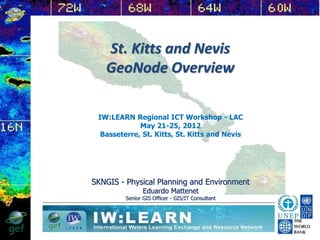
  • 1. St. Kitts and Nevis GeoNode Overview SKNGIS - Physical Planning and Environment Eduardo Mattenet Senior GIS Officer - GIS/IT Consultant IW:LEARN Regional ICT Workshop - LAC May 21-25, 2012 Basseterre, St. Kitts, St. Kitts and Nevis
  • 2. GIS Components  Successfully manage all GIS components as a whole PROFESSIONALS (Human Factor) 8/21/2014 2
  • 3. SKNGIS - Challenge FP DC ENV WD DOA DOLAH IRD… Others… SKNGIS Requests needs to be answered in a timely manner Public 8/21/2014 3
  • 4. How to improve local and regional collaboration and data-sharing? 8/21/2014 4
  • 5. GeoNode GeoNode is an open source platform that facilitates the creation, sharing, and collaborative use of geospatial data. GeoNode? A new approach to spatial data infrastructure focused around users and collaboration 8/21/2014 5
  • 6. Simple web-based tools • Edit metadata in the same place • Privacy controls to restrict access as needed Make Data Sharing Easy 8/21/2014 6
  • 7. Make Data Sharing Useful • Download data in a variety of formats • Use existing datasets to create maps • Export your maps to other websites or PDF Makes Data Sharing Useful 8/21/2014 7
  • 8. Share Data and MetadataSearch Data and Metadata 8/21/2014 8
  • 10. Where in the Region? • Operational GeoNodes: • Grenada • Saint Lucia • Saint Vincent and the Grenadines • Saint Kitts and Nevis (Testing phase) • GeoNode has been deployed at the University of West Indies - Geo-Informatics Department led by Dr. Opadeyi • Soon to be deployed at the CCRIF • Belize and Dominica next on the list
  • 11. Geonode uses and users • Geospatial data can be used for many purposes: establishing baseline data, conducting risk assessments, planning, project monitoring, and tracking progress. • Access to high quality information is critical for project mangers, planners, policy makers, stakeholders and consultants involved in the development projects, as well as students, and public sector. • Composing, sharing and publishing geospatial data and maps. • Geonode lets you upload, manage, browse and search data. 8/21/2014 11
  • 13. Geonode Project Goals • Development, Implementation and maintenance of a Geonode portal for local and regional collaboration, geospatial data sharing and management, to support evidence-based decision making. • facilitate open access to related geo-spatial information, data and knowledge sources, encouraging others to collaborate and share spatial data. • Address technical challenges of both national and regional geospatial data management, including GSDI, data-sharing, metadata policies, infrastructure, technological capacity, and open-source data platforms. 8/21/2014 13
  • 16. Requirements (hardware) • Server (hosting portal, serve data and maps) at least 4 Gb of Ram, recommended 6+ Gb • Workstation / PC (data access and production) • Peripheral (IN / OUT) 8/21/2014 16
  • 17. Requirements (GIS Software comp.) O.S. Server 200x / Ubuntu 10.04+ TerraSync GPS Pathfinder Office ArcGIS 10.1 9.X 3.x Geoserver OpenLayers OpenGeo Suite Comm. Ed. gvGIS QGIS GRAS … 8/21/2014 17
  • 18. Requirements (software) Software Open Source • Virtualbox 4.0.16 or greater • UBUNTU 10.04 • Geonode platform • GeoServer (WMS, WCS, WFS) • OpenLayes (dynamic map in any web page) • PostGIS • OpenGeo Community edition (Production) 8/21/2014 18
  • 19. Requirements (admin) Experience with Linux or desire and time to learn Experience with GIS data 8/21/2014 19
  • 20. Requirements (data) • ESRI Shapefile format • Geotiffs • Projection information (recommended GCS WGS84) • Metadata (ISO TC211) 8/21/2014 20
  • 21. Requirements (implementation) • Data • a GeoNode administrator e.g. a tech person with a min 2 year contract • a server located in a high bandwidth location • Regular trainings for end users by the local admin. 8/21/2014 21
  • 22. SKNGIS Geonode Portal and data warehouse 8/21/2014 22
  • 25. Geonode a practical case study Planning for a new cemetery 8/21/2014 25
  • 26. New Cemetery for Basseterre 8/21/2014 26
  • 27. New Cemetery (Basseterre) – Land use 8/21/2014 27
  • 28. New Cemetery (Basseterre) – Flooding risk 8/21/2014 28
  • 33. Geonode SKN - Challenge FP DC ENV WD DOA DOLAH IRD … Others… SKNGIS Requests needs to be answered in a timely manner Public 8/21/2014 33
  • 34. Questions? • Does GeoNode attempt to replace ArcGIS, Mapinfo, Geomedia, etc.? • Does GeoNode support MrSID, ECW, Arcgrid, JPEG 2000, and World Files? • Does GeoNode work with MySQL, Oracle spatial, MS SQL, Arc SDE? • Does GeoNode support OGC standards? (eg. WMS, WFS, WCS, CSW, TMS) • Does GeoNode support uploading data in different projections/datums? • Is GeoNode really open source? – You can find the source at: http://github.com/GeoNode/geonode 8/21/2014 34
  • 36. Thank You For more information on Geonode and applications http://www.geonode.org St. Kitts and Nevis - Eduardo Mattenet GIS IT Consultant Dept. Physical Planning and Environment, Min. of Sustainable Development ematenet@sisterisles.kn World Bank - Bradley Lyon Disaster Risk Management, LAC blyon@worldbank.org - Ariel Nunez Global Facility For Disaster Reduction & Recovery GFDRR Labs anunezgomez@worldbank.org - Justin Locke Disaster Risk Management Specialist, LAC jlocke@worldbank.org 8/21/2014 36