SlideShare uma empresa Scribd logo
1 de 27
Approaches to exploring drought using satellite data Charat  Mongkolsawat and Thapanee  Kamchai Geo-informatics Center for the Development of Northeast Thailand, Faculty of Science, Khon Kaen University, Khon Kaen 40002, Thailand
Content ,[object Object]
 Objective
 Study Area
 Method
 Results and Discussion
 ConclusionGeo-informatics Center for the Development of Northeast Thailand, Faculty of Science, Khon Kaen University, Khon Kaen 40002, Thailand
1. Introduction ,[object Object]
 Lack of water has profound impact on crop management particularly in the areas where irrigation is not available.Geo-informatics Center for the Development of Northeast Thailand, Faculty of Science, Khon Kaen University, Khon Kaen 40002, Thailand
1. Introduction (Cont.) ,[object Object]
 Satellite data offers effective opportunities instead of collecting huge volume of climatic data.Geo-informatics Center for the Development of Northeast Thailand, Faculty of Science, Khon Kaen University, Khon Kaen 40002, Thailand
2. Objective ,[object Object]
 To identify some of the satellite derived indicators best suited for the Northeast Thailand.Geo-informatics Center for the Development of Northeast Thailand, Faculty of Science, Khon Kaen University, Khon Kaen 40002, Thailand
3. Study Area ,[object Object],Area:170,000 km2. Rainfall:1,000-2,000 mm./year Forest:Deciduous and Evergreen forests Topography: Gently undulating terrain                         with small hills Geo-informatics Center for the Development of Northeast Thailand, Faculty of Science, Khon Kaen University, Khon Kaen 40002, Thailand
Geology Cassava Topography Soil Forest Sugarcane Paddy Field Rainfall Rubber 3. Study Area (Cont.) Landuse Geo-informatics Center for the Development of Northeast Thailand, Faculty of Science, Khon Kaen University, Khon Kaen 40002, Thailand
4. Method Data source: ,[object Object]
 Multitemporal Terra-Modis data of the 16 day composite image data at 250 m resolution during the period 2001-2008 and 2010 available from    WIST (https://wist.echo.nasa.gov) Geo-informatics Center for the Development of Northeast Thailand, Faculty of Science, Khon Kaen University, Khon Kaen 40002, Thailand
4. Method (Cont.) Rainfall Analysis: ,[object Object]
 The cumulative rainfalls summed over the preceding months and its slope gradient for each year.
 Spatial interpolation of mean annual rainfall for 8 years performed using Inverse Distance Weighted method.Geo-informatics Center for the Development of Northeast Thailand, Faculty of Science, Khon Kaen University, Khon Kaen 40002, Thailand
4. Method (Cont.) ,[object Object]
 Satellite-derived indices NDVI, NDWI and NDDI ,[object Object],Geo-informatics Center for the Development of Northeast Thailand, Faculty of Science, Khon Kaen University, Khon Kaen 40002, Thailand
4. Method (Cont.) Satellite derived indices: The Normalized Difference Vegetation Index NDVI= (ρNIR - ρRed) / (ρNIR + ρRed) Where ρNIR and ρRed are the reflectance values at 0.857 μm and 0.645 μm, respectively  The Normalized Difference Water Index NDWI= (ρNIR - ρSWIR) / (ρNIR + ρSWIR) Where ρNIR and ρSWIR are the reflectance values at 0.857 μm and 1.65 μm, respectively  Geo-informatics Center for the Development of Northeast Thailand, Faculty of Science, Khon Kaen University, Khon Kaen 40002, Thailand
4. Method (Cont.) Satellite derived indices: The Normalized Difference Drought Index NDDI= (NDVI- NDWI) / (NDVI + NDWI) Where NDVI  = The Normalized Difference Vegetation Index                                     NDWI = The Normalized Difference Water Index (Proposed by Gu et al 2007) Geo-informatics Center for the Development of Northeast Thailand, Faculty of Science, Khon Kaen University, Khon Kaen 40002, Thailand
4. Method (Cont.) ,[object Object]
dNDVI = NDVI1 - NDVI2
dNDWI= NDWI1- NDWI2

Mais conteúdo relacionado

Mais procurados

Groundwater and River Water Interaction at Ciromban and Cibeureum Riverbank, ...
Groundwater and River Water Interaction at Ciromban and Cibeureum Riverbank, ...Groundwater and River Water Interaction at Ciromban and Cibeureum Riverbank, ...
Groundwater and River Water Interaction at Ciromban and Cibeureum Riverbank, ...Dasapta Erwin Irawan
 
Kivekäs acp 2014 ship contribution to particle number (1)
Kivekäs acp 2014   ship contribution to particle number (1)Kivekäs acp 2014   ship contribution to particle number (1)
Kivekäs acp 2014 ship contribution to particle number (1)www.thiiink.com
 
Kecorius oceanologia 2016 ships to to n
Kecorius oceanologia 2016   ships to to nKecorius oceanologia 2016   ships to to n
Kecorius oceanologia 2016 ships to to nwww.thiiink.com
 
Bella et al 2015
Bella et al 2015Bella et al 2015
Bella et al 2015Jarret Ealy
 
Big data and remote sensing: A new software of ingestion
Big data and remote sensing: A new software of ingestion Big data and remote sensing: A new software of ingestion
Big data and remote sensing: A new software of ingestion IJECEIAES
 
Punkari mikko cv - ferc - eu-wb mar-2017
Punkari mikko   cv - ferc - eu-wb mar-2017Punkari mikko   cv - ferc - eu-wb mar-2017
Punkari mikko cv - ferc - eu-wb mar-2017Punkari Mikko
 
Global Carbon Budget 2020
Global Carbon Budget 2020Global Carbon Budget 2020
Global Carbon Budget 2020PatrickTanz
 
Algorithm for detecting deforestation and forest degradation using vegetation...
Algorithm for detecting deforestation and forest degradation using vegetation...Algorithm for detecting deforestation and forest degradation using vegetation...
Algorithm for detecting deforestation and forest degradation using vegetation...TELKOMNIKA JOURNAL
 
2016Sum_LaRC_AppalachianTrailHealthAQ_Presentation_FD
2016Sum_LaRC_AppalachianTrailHealthAQ_Presentation_FD2016Sum_LaRC_AppalachianTrailHealthAQ_Presentation_FD
2016Sum_LaRC_AppalachianTrailHealthAQ_Presentation_FDAmy Wolfe
 
acp-11-13061-2011
acp-11-13061-2011acp-11-13061-2011
acp-11-13061-2011asmiari
 

Mais procurados (13)

Groundwater and River Water Interaction at Ciromban and Cibeureum Riverbank, ...
Groundwater and River Water Interaction at Ciromban and Cibeureum Riverbank, ...Groundwater and River Water Interaction at Ciromban and Cibeureum Riverbank, ...
Groundwater and River Water Interaction at Ciromban and Cibeureum Riverbank, ...
 
Maxwell Omeje CV
Maxwell Omeje CVMaxwell Omeje CV
Maxwell Omeje CV
 
Kivekäs acp 2014 ship contribution to particle number (1)
Kivekäs acp 2014   ship contribution to particle number (1)Kivekäs acp 2014   ship contribution to particle number (1)
Kivekäs acp 2014 ship contribution to particle number (1)
 
Kecorius oceanologia 2016 ships to to n
Kecorius oceanologia 2016   ships to to nKecorius oceanologia 2016   ships to to n
Kecorius oceanologia 2016 ships to to n
 
Bella et al 2015
Bella et al 2015Bella et al 2015
Bella et al 2015
 
Big data and remote sensing: A new software of ingestion
Big data and remote sensing: A new software of ingestion Big data and remote sensing: A new software of ingestion
Big data and remote sensing: A new software of ingestion
 
Punkari mikko cv - ferc - eu-wb mar-2017
Punkari mikko   cv - ferc - eu-wb mar-2017Punkari mikko   cv - ferc - eu-wb mar-2017
Punkari mikko cv - ferc - eu-wb mar-2017
 
Global Carbon Budget 2020
Global Carbon Budget 2020Global Carbon Budget 2020
Global Carbon Budget 2020
 
Herbert cv july2016
Herbert cv july2016Herbert cv july2016
Herbert cv july2016
 
Algorithm for detecting deforestation and forest degradation using vegetation...
Algorithm for detecting deforestation and forest degradation using vegetation...Algorithm for detecting deforestation and forest degradation using vegetation...
Algorithm for detecting deforestation and forest degradation using vegetation...
 
2016Sum_LaRC_AppalachianTrailHealthAQ_Presentation_FD
2016Sum_LaRC_AppalachianTrailHealthAQ_Presentation_FD2016Sum_LaRC_AppalachianTrailHealthAQ_Presentation_FD
2016Sum_LaRC_AppalachianTrailHealthAQ_Presentation_FD
 
Forsvar_Michala Kristensen
Forsvar_Michala KristensenForsvar_Michala Kristensen
Forsvar_Michala Kristensen
 
acp-11-13061-2011
acp-11-13061-2011acp-11-13061-2011
acp-11-13061-2011
 

Semelhante a Approaches to exploring drought using satellite data

Time Series Analysis of Rainfall in North Bangalore Metropolitan Region using...
Time Series Analysis of Rainfall in North Bangalore Metropolitan Region using...Time Series Analysis of Rainfall in North Bangalore Metropolitan Region using...
Time Series Analysis of Rainfall in North Bangalore Metropolitan Region using...Dr Ramesh Dikpal
 
Extraction of Water-body Area from High-resolution Landsat Imagery
Extraction of Water-body Area from High-resolution  Landsat Imagery Extraction of Water-body Area from High-resolution  Landsat Imagery
Extraction of Water-body Area from High-resolution Landsat Imagery IJECEIAES
 
Monthly precipitation forecasting with Artificial Intelligence.
Monthly precipitation forecasting with Artificial Intelligence.Monthly precipitation forecasting with Artificial Intelligence.
Monthly precipitation forecasting with Artificial Intelligence.bouachahcene
 
Monitoring NDTI-River Temperature relationship along the river ganga in the s...
Monitoring NDTI-River Temperature relationship along the river ganga in the s...Monitoring NDTI-River Temperature relationship along the river ganga in the s...
Monitoring NDTI-River Temperature relationship along the river ganga in the s...IRJET Journal
 
Adding Confidence to Seasonal Drought Forecasts using reference evapotranspir...
Adding Confidence to Seasonal Drought Forecasts using reference evapotranspir...Adding Confidence to Seasonal Drought Forecasts using reference evapotranspir...
Adding Confidence to Seasonal Drought Forecasts using reference evapotranspir...DRIscience
 
Coupling of Surface water and Groundwater Models
Coupling of Surface water and Groundwater Models Coupling of Surface water and Groundwater Models
Coupling of Surface water and Groundwater Models TIPU SULTAN BADAGAN
 
Spatial variations of the flood and drought in the northern
Spatial variations of the flood and drought in the northernSpatial variations of the flood and drought in the northern
Spatial variations of the flood and drought in the northernAlexander Decker
 
Climate change perception: A case study of Bardiya National Park (BNP), Thaku...
Climate change perception: A case study of Bardiya National Park (BNP), Thaku...Climate change perception: A case study of Bardiya National Park (BNP), Thaku...
Climate change perception: A case study of Bardiya National Park (BNP), Thaku...Surendra Bam
 
Ionospheric Behaviour Analysis over Thailand Using Radio Occultation Technique
Ionospheric Behaviour Analysis over Thailand Using Radio Occultation TechniqueIonospheric Behaviour Analysis over Thailand Using Radio Occultation Technique
Ionospheric Behaviour Analysis over Thailand Using Radio Occultation TechniqueIJERA Editor
 
Effectiveness of the telemetric flood monitoring device
Effectiveness of the telemetric flood monitoring deviceEffectiveness of the telemetric flood monitoring device
Effectiveness of the telemetric flood monitoring deviceHarhar Caparida
 
Hydrogeology problems.pdf
Hydrogeology problems.pdfHydrogeology problems.pdf
Hydrogeology problems.pdfgirmaworku2
 
IRJET - Prediction of Ground Water Level based on Machine Learning
IRJET - Prediction of Ground Water Level based on Machine LearningIRJET - Prediction of Ground Water Level based on Machine Learning
IRJET - Prediction of Ground Water Level based on Machine LearningIRJET Journal
 
LAND SURFACE TEMPERATURE AND ITS CORRELATION WITH VEGETATION COVER USING LAND...
LAND SURFACE TEMPERATURE AND ITS CORRELATION WITH VEGETATION COVER USING LAND...LAND SURFACE TEMPERATURE AND ITS CORRELATION WITH VEGETATION COVER USING LAND...
LAND SURFACE TEMPERATURE AND ITS CORRELATION WITH VEGETATION COVER USING LAND...IRJET Journal
 
Paddy field classification with MODIS-terra multi-temporal image transformati...
Paddy field classification with MODIS-terra multi-temporal image transformati...Paddy field classification with MODIS-terra multi-temporal image transformati...
Paddy field classification with MODIS-terra multi-temporal image transformati...IJECEIAES
 
design_and_implementation_of_a_low_cost_weather_monitoring_system_nigerian_ge...
design_and_implementation_of_a_low_cost_weather_monitoring_system_nigerian_ge...design_and_implementation_of_a_low_cost_weather_monitoring_system_nigerian_ge...
design_and_implementation_of_a_low_cost_weather_monitoring_system_nigerian_ge...AtulMisal5
 
Global Climate Change: Drought Assessment + Impacts
Global Climate Change: Drought Assessment + ImpactsGlobal Climate Change: Drought Assessment + Impacts
Global Climate Change: Drought Assessment + ImpactsJenkins Macedo
 

Semelhante a Approaches to exploring drought using satellite data (20)

Time Series Analysis of Rainfall in North Bangalore Metropolitan Region using...
Time Series Analysis of Rainfall in North Bangalore Metropolitan Region using...Time Series Analysis of Rainfall in North Bangalore Metropolitan Region using...
Time Series Analysis of Rainfall in North Bangalore Metropolitan Region using...
 
Extraction of Water-body Area from High-resolution Landsat Imagery
Extraction of Water-body Area from High-resolution  Landsat Imagery Extraction of Water-body Area from High-resolution  Landsat Imagery
Extraction of Water-body Area from High-resolution Landsat Imagery
 
Monthly precipitation forecasting with Artificial Intelligence.
Monthly precipitation forecasting with Artificial Intelligence.Monthly precipitation forecasting with Artificial Intelligence.
Monthly precipitation forecasting with Artificial Intelligence.
 
Monitoring NDTI-River Temperature relationship along the river ganga in the s...
Monitoring NDTI-River Temperature relationship along the river ganga in the s...Monitoring NDTI-River Temperature relationship along the river ganga in the s...
Monitoring NDTI-River Temperature relationship along the river ganga in the s...
 
Adding Confidence to Seasonal Drought Forecasts using reference evapotranspir...
Adding Confidence to Seasonal Drought Forecasts using reference evapotranspir...Adding Confidence to Seasonal Drought Forecasts using reference evapotranspir...
Adding Confidence to Seasonal Drought Forecasts using reference evapotranspir...
 
Thailand flood v1
Thailand flood v1Thailand flood v1
Thailand flood v1
 
Coupling of Surface water and Groundwater Models
Coupling of Surface water and Groundwater Models Coupling of Surface water and Groundwater Models
Coupling of Surface water and Groundwater Models
 
Spatial variations of the flood and drought in the northern
Spatial variations of the flood and drought in the northernSpatial variations of the flood and drought in the northern
Spatial variations of the flood and drought in the northern
 
2014 STAR Program
2014 STAR Program2014 STAR Program
2014 STAR Program
 
Climate change perception: A case study of Bardiya National Park (BNP), Thaku...
Climate change perception: A case study of Bardiya National Park (BNP), Thaku...Climate change perception: A case study of Bardiya National Park (BNP), Thaku...
Climate change perception: A case study of Bardiya National Park (BNP), Thaku...
 
Ionospheric Behaviour Analysis over Thailand Using Radio Occultation Technique
Ionospheric Behaviour Analysis over Thailand Using Radio Occultation TechniqueIonospheric Behaviour Analysis over Thailand Using Radio Occultation Technique
Ionospheric Behaviour Analysis over Thailand Using Radio Occultation Technique
 
Effectiveness of the telemetric flood monitoring device
Effectiveness of the telemetric flood monitoring deviceEffectiveness of the telemetric flood monitoring device
Effectiveness of the telemetric flood monitoring device
 
Hydrogeology problems.pdf
Hydrogeology problems.pdfHydrogeology problems.pdf
Hydrogeology problems.pdf
 
IRJET - Prediction of Ground Water Level based on Machine Learning
IRJET - Prediction of Ground Water Level based on Machine LearningIRJET - Prediction of Ground Water Level based on Machine Learning
IRJET - Prediction of Ground Water Level based on Machine Learning
 
LAND SURFACE TEMPERATURE AND ITS CORRELATION WITH VEGETATION COVER USING LAND...
LAND SURFACE TEMPERATURE AND ITS CORRELATION WITH VEGETATION COVER USING LAND...LAND SURFACE TEMPERATURE AND ITS CORRELATION WITH VEGETATION COVER USING LAND...
LAND SURFACE TEMPERATURE AND ITS CORRELATION WITH VEGETATION COVER USING LAND...
 
Andy Fox DART
Andy Fox DARTAndy Fox DART
Andy Fox DART
 
Paddy field classification with MODIS-terra multi-temporal image transformati...
Paddy field classification with MODIS-terra multi-temporal image transformati...Paddy field classification with MODIS-terra multi-temporal image transformati...
Paddy field classification with MODIS-terra multi-temporal image transformati...
 
design_and_implementation_of_a_low_cost_weather_monitoring_system_nigerian_ge...
design_and_implementation_of_a_low_cost_weather_monitoring_system_nigerian_ge...design_and_implementation_of_a_low_cost_weather_monitoring_system_nigerian_ge...
design_and_implementation_of_a_low_cost_weather_monitoring_system_nigerian_ge...
 
Term paper.pptx
Term paper.pptxTerm paper.pptx
Term paper.pptx
 
Global Climate Change: Drought Assessment + Impacts
Global Climate Change: Drought Assessment + ImpactsGlobal Climate Change: Drought Assessment + Impacts
Global Climate Change: Drought Assessment + Impacts
 

Mais de Institute of Space Knowledge Development

Disease Epidemic and Severity of Rice Blast, Rice Brown Spot and Rice Narrow...
Disease Epidemic and Severity of  Rice Blast, Rice Brown Spot and Rice Narrow...Disease Epidemic and Severity of  Rice Blast, Rice Brown Spot and Rice Narrow...
Disease Epidemic and Severity of Rice Blast, Rice Brown Spot and Rice Narrow...Institute of Space Knowledge Development
 
An application of theos data for the encroachment of agriculture on forest re...
An application of theos data for the encroachment of agriculture on forest re...An application of theos data for the encroachment of agriculture on forest re...
An application of theos data for the encroachment of agriculture on forest re...Institute of Space Knowledge Development
 
Progress of land ecosystem studies with geo information and space technology ...
Progress of land ecosystem studies with geo information and space technology ...Progress of land ecosystem studies with geo information and space technology ...
Progress of land ecosystem studies with geo information and space technology ...Institute of Space Knowledge Development
 

Mais de Institute of Space Knowledge Development (20)

Spce technologies for disaster in thailand
Spce technologies for disaster in thailandSpce technologies for disaster in thailand
Spce technologies for disaster in thailand
 
Flood hazard mapping four provinces of cambodia
Flood hazard mapping four provinces of cambodiaFlood hazard mapping four provinces of cambodia
Flood hazard mapping four provinces of cambodia
 
Future direction of geoinfomatics
Future direction of geoinfomaticsFuture direction of geoinfomatics
Future direction of geoinfomatics
 
Drought risk and crisis management cambodia
Drought risk and crisis management cambodiaDrought risk and crisis management cambodia
Drought risk and crisis management cambodia
 
Rain triggered landslide hazard analysis
Rain triggered landslide hazard analysisRain triggered landslide hazard analysis
Rain triggered landslide hazard analysis
 
Natural disasters reduction in thailand
Natural disasters reduction in thailandNatural disasters reduction in thailand
Natural disasters reduction in thailand
 
Near real time automatic modis fire information
Near real time automatic modis fire informationNear real time automatic modis fire information
Near real time automatic modis fire information
 
Current trends of disasters in the asia pacific region
Current trends of disasters in the asia pacific regionCurrent trends of disasters in the asia pacific region
Current trends of disasters in the asia pacific region
 
Realixing a national disaster risk reduction program
Realixing a national disaster risk reduction programRealixing a national disaster risk reduction program
Realixing a national disaster risk reduction program
 
Summery of project outcome
Summery of project outcomeSummery of project outcome
Summery of project outcome
 
ADRC Activities & Project introduction
ADRC Activities & Project introductionADRC Activities & Project introduction
ADRC Activities & Project introduction
 
Geo informatics for land suitability in growing certain crops
Geo  informatics for land suitability in growing certain cropsGeo  informatics for land suitability in growing certain crops
Geo informatics for land suitability in growing certain crops
 
Accurate satellite mapping for government agricultural management
Accurate satellite mapping for government agricultural managementAccurate satellite mapping for government agricultural management
Accurate satellite mapping for government agricultural management
 
Application of satellite imagery
Application of satellite imageryApplication of satellite imagery
Application of satellite imagery
 
Disease Epidemic and Severity of Rice Blast, Rice Brown Spot and Rice Narrow...
Disease Epidemic and Severity of  Rice Blast, Rice Brown Spot and Rice Narrow...Disease Epidemic and Severity of  Rice Blast, Rice Brown Spot and Rice Narrow...
Disease Epidemic and Severity of Rice Blast, Rice Brown Spot and Rice Narrow...
 
The potential use of theos satellite image for land use survey
The potential use of theos satellite image for land use surveyThe potential use of theos satellite image for land use survey
The potential use of theos satellite image for land use survey
 
An application of theos data for the encroachment of agriculture on forest re...
An application of theos data for the encroachment of agriculture on forest re...An application of theos data for the encroachment of agriculture on forest re...
An application of theos data for the encroachment of agriculture on forest re...
 
Polarization signature analysis of paddy rice in southern china
Polarization signature analysis of paddy rice in southern chinaPolarization signature analysis of paddy rice in southern china
Polarization signature analysis of paddy rice in southern china
 
Agriculture drought with remote sensing
Agriculture drought with remote sensingAgriculture drought with remote sensing
Agriculture drought with remote sensing
 
Progress of land ecosystem studies with geo information and space technology ...
Progress of land ecosystem studies with geo information and space technology ...Progress of land ecosystem studies with geo information and space technology ...
Progress of land ecosystem studies with geo information and space technology ...
 

Último

My Hashitalk Indonesia April 2024 Presentation
My Hashitalk Indonesia April 2024 PresentationMy Hashitalk Indonesia April 2024 Presentation
My Hashitalk Indonesia April 2024 PresentationRidwan Fadjar
 
Powerpoint exploring the locations used in television show Time Clash
Powerpoint exploring the locations used in television show Time ClashPowerpoint exploring the locations used in television show Time Clash
Powerpoint exploring the locations used in television show Time Clashcharlottematthew16
 
Gen AI in Business - Global Trends Report 2024.pdf
Gen AI in Business - Global Trends Report 2024.pdfGen AI in Business - Global Trends Report 2024.pdf
Gen AI in Business - Global Trends Report 2024.pdfAddepto
 
WordPress Websites for Engineers: Elevate Your Brand
WordPress Websites for Engineers: Elevate Your BrandWordPress Websites for Engineers: Elevate Your Brand
WordPress Websites for Engineers: Elevate Your Brandgvaughan
 
Beyond Boundaries: Leveraging No-Code Solutions for Industry Innovation
Beyond Boundaries: Leveraging No-Code Solutions for Industry InnovationBeyond Boundaries: Leveraging No-Code Solutions for Industry Innovation
Beyond Boundaries: Leveraging No-Code Solutions for Industry InnovationSafe Software
 
Search Engine Optimization SEO PDF for 2024.pdf
Search Engine Optimization SEO PDF for 2024.pdfSearch Engine Optimization SEO PDF for 2024.pdf
Search Engine Optimization SEO PDF for 2024.pdfRankYa
 
Advanced Test Driven-Development @ php[tek] 2024
Advanced Test Driven-Development @ php[tek] 2024Advanced Test Driven-Development @ php[tek] 2024
Advanced Test Driven-Development @ php[tek] 2024Scott Keck-Warren
 
Kotlin Multiplatform & Compose Multiplatform - Starter kit for pragmatics
Kotlin Multiplatform & Compose Multiplatform - Starter kit for pragmaticsKotlin Multiplatform & Compose Multiplatform - Starter kit for pragmatics
Kotlin Multiplatform & Compose Multiplatform - Starter kit for pragmaticscarlostorres15106
 
SAP Build Work Zone - Overview L2-L3.pptx
SAP Build Work Zone - Overview L2-L3.pptxSAP Build Work Zone - Overview L2-L3.pptx
SAP Build Work Zone - Overview L2-L3.pptxNavinnSomaal
 
Nell’iperspazio con Rocket: il Framework Web di Rust!
Nell’iperspazio con Rocket: il Framework Web di Rust!Nell’iperspazio con Rocket: il Framework Web di Rust!
Nell’iperspazio con Rocket: il Framework Web di Rust!Commit University
 
Unraveling Multimodality with Large Language Models.pdf
Unraveling Multimodality with Large Language Models.pdfUnraveling Multimodality with Large Language Models.pdf
Unraveling Multimodality with Large Language Models.pdfAlex Barbosa Coqueiro
 
Tampa BSides - Chef's Tour of Microsoft Security Adoption Framework (SAF)
Tampa BSides - Chef's Tour of Microsoft Security Adoption Framework (SAF)Tampa BSides - Chef's Tour of Microsoft Security Adoption Framework (SAF)
Tampa BSides - Chef's Tour of Microsoft Security Adoption Framework (SAF)Mark Simos
 
Bun (KitWorks Team Study 노별마루 발표 2024.4.22)
Bun (KitWorks Team Study 노별마루 발표 2024.4.22)Bun (KitWorks Team Study 노별마루 발표 2024.4.22)
Bun (KitWorks Team Study 노별마루 발표 2024.4.22)Wonjun Hwang
 
Training state-of-the-art general text embedding
Training state-of-the-art general text embeddingTraining state-of-the-art general text embedding
Training state-of-the-art general text embeddingZilliz
 
New from BookNet Canada for 2024: BNC CataList - Tech Forum 2024
New from BookNet Canada for 2024: BNC CataList - Tech Forum 2024New from BookNet Canada for 2024: BNC CataList - Tech Forum 2024
New from BookNet Canada for 2024: BNC CataList - Tech Forum 2024BookNet Canada
 
Designing IA for AI - Information Architecture Conference 2024
Designing IA for AI - Information Architecture Conference 2024Designing IA for AI - Information Architecture Conference 2024
Designing IA for AI - Information Architecture Conference 2024Enterprise Knowledge
 
DevoxxFR 2024 Reproducible Builds with Apache Maven
DevoxxFR 2024 Reproducible Builds with Apache MavenDevoxxFR 2024 Reproducible Builds with Apache Maven
DevoxxFR 2024 Reproducible Builds with Apache MavenHervé Boutemy
 
Unleash Your Potential - Namagunga Girls Coding Club
Unleash Your Potential - Namagunga Girls Coding ClubUnleash Your Potential - Namagunga Girls Coding Club
Unleash Your Potential - Namagunga Girls Coding ClubKalema Edgar
 
SIP trunking in Janus @ Kamailio World 2024
SIP trunking in Janus @ Kamailio World 2024SIP trunking in Janus @ Kamailio World 2024
SIP trunking in Janus @ Kamailio World 2024Lorenzo Miniero
 

Último (20)

My Hashitalk Indonesia April 2024 Presentation
My Hashitalk Indonesia April 2024 PresentationMy Hashitalk Indonesia April 2024 Presentation
My Hashitalk Indonesia April 2024 Presentation
 
Powerpoint exploring the locations used in television show Time Clash
Powerpoint exploring the locations used in television show Time ClashPowerpoint exploring the locations used in television show Time Clash
Powerpoint exploring the locations used in television show Time Clash
 
Gen AI in Business - Global Trends Report 2024.pdf
Gen AI in Business - Global Trends Report 2024.pdfGen AI in Business - Global Trends Report 2024.pdf
Gen AI in Business - Global Trends Report 2024.pdf
 
WordPress Websites for Engineers: Elevate Your Brand
WordPress Websites for Engineers: Elevate Your BrandWordPress Websites for Engineers: Elevate Your Brand
WordPress Websites for Engineers: Elevate Your Brand
 
Beyond Boundaries: Leveraging No-Code Solutions for Industry Innovation
Beyond Boundaries: Leveraging No-Code Solutions for Industry InnovationBeyond Boundaries: Leveraging No-Code Solutions for Industry Innovation
Beyond Boundaries: Leveraging No-Code Solutions for Industry Innovation
 
Search Engine Optimization SEO PDF for 2024.pdf
Search Engine Optimization SEO PDF for 2024.pdfSearch Engine Optimization SEO PDF for 2024.pdf
Search Engine Optimization SEO PDF for 2024.pdf
 
Advanced Test Driven-Development @ php[tek] 2024
Advanced Test Driven-Development @ php[tek] 2024Advanced Test Driven-Development @ php[tek] 2024
Advanced Test Driven-Development @ php[tek] 2024
 
Kotlin Multiplatform & Compose Multiplatform - Starter kit for pragmatics
Kotlin Multiplatform & Compose Multiplatform - Starter kit for pragmaticsKotlin Multiplatform & Compose Multiplatform - Starter kit for pragmatics
Kotlin Multiplatform & Compose Multiplatform - Starter kit for pragmatics
 
DMCC Future of Trade Web3 - Special Edition
DMCC Future of Trade Web3 - Special EditionDMCC Future of Trade Web3 - Special Edition
DMCC Future of Trade Web3 - Special Edition
 
SAP Build Work Zone - Overview L2-L3.pptx
SAP Build Work Zone - Overview L2-L3.pptxSAP Build Work Zone - Overview L2-L3.pptx
SAP Build Work Zone - Overview L2-L3.pptx
 
Nell’iperspazio con Rocket: il Framework Web di Rust!
Nell’iperspazio con Rocket: il Framework Web di Rust!Nell’iperspazio con Rocket: il Framework Web di Rust!
Nell’iperspazio con Rocket: il Framework Web di Rust!
 
Unraveling Multimodality with Large Language Models.pdf
Unraveling Multimodality with Large Language Models.pdfUnraveling Multimodality with Large Language Models.pdf
Unraveling Multimodality with Large Language Models.pdf
 
Tampa BSides - Chef's Tour of Microsoft Security Adoption Framework (SAF)
Tampa BSides - Chef's Tour of Microsoft Security Adoption Framework (SAF)Tampa BSides - Chef's Tour of Microsoft Security Adoption Framework (SAF)
Tampa BSides - Chef's Tour of Microsoft Security Adoption Framework (SAF)
 
Bun (KitWorks Team Study 노별마루 발표 2024.4.22)
Bun (KitWorks Team Study 노별마루 발표 2024.4.22)Bun (KitWorks Team Study 노별마루 발표 2024.4.22)
Bun (KitWorks Team Study 노별마루 발표 2024.4.22)
 
Training state-of-the-art general text embedding
Training state-of-the-art general text embeddingTraining state-of-the-art general text embedding
Training state-of-the-art general text embedding
 
New from BookNet Canada for 2024: BNC CataList - Tech Forum 2024
New from BookNet Canada for 2024: BNC CataList - Tech Forum 2024New from BookNet Canada for 2024: BNC CataList - Tech Forum 2024
New from BookNet Canada for 2024: BNC CataList - Tech Forum 2024
 
Designing IA for AI - Information Architecture Conference 2024
Designing IA for AI - Information Architecture Conference 2024Designing IA for AI - Information Architecture Conference 2024
Designing IA for AI - Information Architecture Conference 2024
 
DevoxxFR 2024 Reproducible Builds with Apache Maven
DevoxxFR 2024 Reproducible Builds with Apache MavenDevoxxFR 2024 Reproducible Builds with Apache Maven
DevoxxFR 2024 Reproducible Builds with Apache Maven
 
Unleash Your Potential - Namagunga Girls Coding Club
Unleash Your Potential - Namagunga Girls Coding ClubUnleash Your Potential - Namagunga Girls Coding Club
Unleash Your Potential - Namagunga Girls Coding Club
 
SIP trunking in Janus @ Kamailio World 2024
SIP trunking in Janus @ Kamailio World 2024SIP trunking in Janus @ Kamailio World 2024
SIP trunking in Janus @ Kamailio World 2024
 

Approaches to exploring drought using satellite data

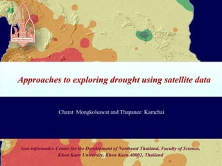
  • 1. Approaches to exploring drought using satellite data Charat Mongkolsawat and Thapanee Kamchai Geo-informatics Center for the Development of Northeast Thailand, Faculty of Science, Khon Kaen University, Khon Kaen 40002, Thailand
  • 2.
  • 6. Results and Discussion
  • 7. ConclusionGeo-informatics Center for the Development of Northeast Thailand, Faculty of Science, Khon Kaen University, Khon Kaen 40002, Thailand
  • 8.
  • 9. Lack of water has profound impact on crop management particularly in the areas where irrigation is not available.Geo-informatics Center for the Development of Northeast Thailand, Faculty of Science, Khon Kaen University, Khon Kaen 40002, Thailand
  • 10.
  • 11. Satellite data offers effective opportunities instead of collecting huge volume of climatic data.Geo-informatics Center for the Development of Northeast Thailand, Faculty of Science, Khon Kaen University, Khon Kaen 40002, Thailand
  • 12.
  • 13. To identify some of the satellite derived indicators best suited for the Northeast Thailand.Geo-informatics Center for the Development of Northeast Thailand, Faculty of Science, Khon Kaen University, Khon Kaen 40002, Thailand
  • 14.
  • 15. Geology Cassava Topography Soil Forest Sugarcane Paddy Field Rainfall Rubber 3. Study Area (Cont.) Landuse Geo-informatics Center for the Development of Northeast Thailand, Faculty of Science, Khon Kaen University, Khon Kaen 40002, Thailand
  • 16.
  • 17. Multitemporal Terra-Modis data of the 16 day composite image data at 250 m resolution during the period 2001-2008 and 2010 available from WIST (https://wist.echo.nasa.gov) Geo-informatics Center for the Development of Northeast Thailand, Faculty of Science, Khon Kaen University, Khon Kaen 40002, Thailand
  • 18.
  • 19. The cumulative rainfalls summed over the preceding months and its slope gradient for each year.
  • 20. Spatial interpolation of mean annual rainfall for 8 years performed using Inverse Distance Weighted method.Geo-informatics Center for the Development of Northeast Thailand, Faculty of Science, Khon Kaen University, Khon Kaen 40002, Thailand
  • 21.
  • 22.
  • 23. 4. Method (Cont.) Satellite derived indices: The Normalized Difference Vegetation Index NDVI= (ρNIR - ρRed) / (ρNIR + ρRed) Where ρNIR and ρRed are the reflectance values at 0.857 μm and 0.645 μm, respectively The Normalized Difference Water Index NDWI= (ρNIR - ρSWIR) / (ρNIR + ρSWIR) Where ρNIR and ρSWIR are the reflectance values at 0.857 μm and 1.65 μm, respectively Geo-informatics Center for the Development of Northeast Thailand, Faculty of Science, Khon Kaen University, Khon Kaen 40002, Thailand
  • 24. 4. Method (Cont.) Satellite derived indices: The Normalized Difference Drought Index NDDI= (NDVI- NDWI) / (NDVI + NDWI) Where NDVI = The Normalized Difference Vegetation Index NDWI = The Normalized Difference Water Index (Proposed by Gu et al 2007) Geo-informatics Center for the Development of Northeast Thailand, Faculty of Science, Khon Kaen University, Khon Kaen 40002, Thailand
  • 25.
  • 26. dNDVI = NDVI1 - NDVI2
  • 28. The step of SD from the mean dNDVI or dNDWI determines the magnitude of the change.
  • 29. -1SD to 1SD = no change
  • 30. The severity of drought can be derived from the SD step, the greater SD step the higher change.Geo-informatics Center for the Development of Northeast Thailand, Faculty of Science, Khon Kaen University, Khon Kaen 40002, Thailand
  • 31.
  • 32.
  • 33.
  • 34. Increase of NDDI values occurs during the dry period.Geo-informatics Center for the Development of Northeast Thailand, Faculty of Science, Khon Kaen University, Khon Kaen 40002, Thailand
  • 35.
  • 36. No distinction of NDVI values with increasing or decreasing water content can be observed.
  • 37. Greater response to drought is remarkably identified by NDWI and NDDI values.
  • 38. NDDI values are more sensitive and evident for drought identification as a result of greenness and water content.Geo-informatics Center for the Development of Northeast Thailand, Faculty of Science, Khon Kaen University, Khon Kaen 40002, Thailand
  • 39.
  • 40.
  • 41. NDWI Spatial NDWI over the Northeast Spatio-temporal NDWI for the years 2001-2008 and 2010
  • 42. Spatial NDDI over the Northeast Spatio-temporal NDDI for the years 2001-2008 and 2010
  • 43.
  • 44.
  • 45.
  • 46. Thank you for your attention Geo-informatics Center for the Development of Northeast Thailand, Faculty of Science, Khon Kaen University, Khon Kaen 40002, Thailand