SlideShare uma empresa Scribd logo
1 de 28
Baixar para ler offline
1
HSB meeting @ Offshore Energy 16
26th October 2016
Teledyne CARIS
Fast Forward the Future
Niels Nijhuis
Account Manager
Teledyne CARIS EMEA
Fast Forward The Future
This world keeps turning
And we're safe and sound
But there's more to life
More to expound
This world keeps learning
With a knowledge we're unbound
No more debate
That the earth is round ”
Simon Collins
“
2
CARIS Products
Processing
Production
Distribution
Analysis
Data
centricity
Interoperability
and
harmonization
New
products
and services
Multi-sensor
survey data
Crowd-
Sourcing
Autonomous
surveys
Process
automation
CARIS’ Software Vision
3
Inputs and outputs in a data centric workflow
Organizations are considering data centric workflows
• To realize efficiencies
– Quicker turn around of bigger survey datasets
– Increased automation in processing and product compilation
– Better utilization of human resources
– Change in the focus of human resources “Data Analysts”
• To support a broader user base
– New and ad hoc products and services
– Big Data possibilities
• To transition from producer to marine data provider
– In line with Open Government and Open Data policies
– Support principal of “collect once, use many times
Why data centric?
4
• Open data storage
• Connectivity to 3rd party tools
• Extensive scripting capabilities
• Cloud based processing potential
• Mobile data entry and access
Service orientated
and standards
based systems
Service orientated
and standards
based systems
• Rules-based workflows
• Survey processing and cartography
• Faster and better quality results
• Validation of data in field prior to loading into database
Process automationProcess automation
Software requirements for data centricity
Interoperability
and
harmonization
Data
centricity
New
products
and services
Multi-sensor
survey data
Crowd-
Sourcing
Autonomous
surveys
Process
automation
5
• Basic technical challenge of
interoperability has been solved
– Standards based technology and data
• Organizations need an interoperable
approach
– To maximize value from marine spatial
data,
– Through Open Geospatial Consortium
(OGC) and International Hydrographic
Organization (IHO) cooperation
Interoperability
Marine spatial
data
Data
plugins
(GDAL and
PDAL)
APIs
(Python)
Standards
(OGC)
• IHO and International Association of Oil and Gas Producers (IOGP)
– Members/contractors both collect data and produce products
– Data used for different purposes, but much of the data is the same
Harmonization
Product centric approach Data centric approach
6
• Seabed Survey Data Model
developed by the Oil and
Gas industry to standardize
survey deliverables
– GML application schema
– It is based on an ESRI data
model
– Now also supported in CARIS
solutions
– Allow hydrographic agencies
and oil and gas companies to
exchange data more easily
SSDM
Multi-sensor
survey data
Data
centricity
Interoperability
and
harmonization
New
products
and services
Crowd-
Sourcing
Autonomous
surveys
Process
automation
7
• The surveyors toolbox is constantly
expanding
• Sensors used are:
– Generating bigger and bigger datasets
– Many becoming more portable
Multiple sensors survey
Light
• Laser scanner
• LiDAR
• Camera
• Underwater laser
Sound
• Multibeam
• Side scan
• SAS
• Imaging sonar
Location
• GNSS
• INS
• USBL
2G Robotics
Kraken Sonar
SBG Systems
Elevation data from camera on Topcon Sirius Pro
CSAR Point Cloud = 82 million points
Area = 300m x 700m
8
Bathy LiDAR – Fugro LADS Mk II
CSAR Grid = 3m resolution
Topographic and bathymetric data
Data from Shallow
Survey 2005
Multibeam sonar – Kongsberg EM2040
Data from Shallow
Survey 2015
CSAR Grid = 20cm Resolution
9
Bathymetric sidescan – EdgeTech 6205
Data from Shallow
Survey 2015
10cm imagery
50cm bathymetry
Imagery resolution now maintained during draping
Satellite Derived Bathymetry
CARIS Bathy DataBASE
(CARIS & INAHINA)
Bathymetric &
Topographic Data
(BMT ARGOSS, ASTER, GEBCO)
Combined DEM
(INAM & INGC)
Satellite Data
Mozambique Pilot Project Workflow- Topobathy Database
10
Data
centricity
Interoperabilit
y and
harmonization
New
products
and services
Multi-sensor
survey data
Crowd-
Sourcing
Autonomous
surveys
Process
automation
• Increased number of platforms / sources
= increased data volume to be processed
– Autonomous and multi-sensor platforms
– Opportunistic multibeam surveys
– Crowd-Sourced Bathymetry
– Satellite Derived Bathymetry
• Can marine agencies cope with the influx of data?
– Need to reduce, not increase, the processing backlog
– Driving the need for automation, and near real-time processing
Process automation
• By automating data processing the platforms users can:
– Obtain repeatable results and real-time QC
– Optimize use of human resources (i.e. allow staff to focus on other survey and
GIS tasks)
– Reduce data collection to product time, and processing backlogs
• All of this will enable agencies to provide marine data to broader
customer base
11
Autonomous
surveys
Data
centricity
Interoperabilit
y and
harmonization
New
products
and services
Multi-sensor
survey data
Crowd-
Sourcing
Process
automation
3
Inputs and outputs in a data centric workflow
Organizations are considering data centric workflows
• To realize efficiencies
– Quicker turn around of bigger survey datasets
– Increased automation in processing and product compilation
– Better utilization of human resources
– Change in the focus of human resources “Data Analysts”
• To support a broader user base
– New and ad hoc products and services
– Big Data possibilities
• To transition from producer to marine data provider
– In line with Open Government and Open Data policies
– Support principal of “collect once, use many times
Why data centric?
14
Database
Discovery
Get a view of the
dataset prior to
downloading it
(provided by WCS
and encoded as
PNG)
Supported queries:
• Title
• Abstract
• Identifier
• Date
• Format
• Subject (keywords)
• Begin date
• End date
15
New
products
and services
Data
centricity
Interoperabilit
y and
harmonization
Multi-sensor
survey data
Crowd-
Sourcing
Autonomous
surveys
Process
automation
• S-100 Products
– S-101 ENC
– S-102 Bathymetric Surface
– S-111 Surface Currents
– S-112 Real Time Tidal Data Transfer
– S-121 Maritime Limits and Boundaries
– S-122 Marine Protected Areas
– S-401 Inland ENC
– S-411 Sea Ice
– S-412 Met-Ocean Forecasts
– ...
• Agencies can currently take a hands-on approach, and
experiment with creation of test datasets using existing
production tools
S-100
16
Pilot trials S-102
Non-Horizontal Gridding
17
Quaywall
Visualization
18
Variable Resolution Surface
Digital elevation model where the resolution varies
over different areas of the model
R2
R1
R3
Resolution Grid
19
NODE Computation
Surface Nodes
20
SURFACE MESH
Motivation – Current solution
• Divide model into depth range and resolution
– Have to manage multiple models
– Discontinuity near boundaries
• Use a TIN
– Limited in size
– Holidays
– Edge removal
21
• Allows multiple resolution areas to be defined
and data of varying density to be modelled in
single surface
– Density estimation tools determine most suitable
resolution(s) based on input data
• Better representation of real-life situation
– Better analysis
• Provides a single model for creation of contour
and other bathy products
– Use in charting and other GIS products
• Additional uses:
– Base layer for hydrography theme in Marine SDI (MSDI)
– Input to form Common Operating Pictures (COP)
Variable Resolution surfaces
VARIABLE RESOLUTION Surface CREATION & STORAGE
Ana
lyze
dat
a
Resolution
Map
Resolution
Map
22
VARIABLE RESOLUTION Surface CREATION & STORAGE
Ana
lyze
dat
a
Resolution
Map
Resolution
Map
Node
Computation
VARIABLE RESOLUTION Surface CREATION & STORAGE
Ana
lyze
dat
a
Resolution
Map
Resolution
Map
Node
Computation
CSAR
Storage
Level of Detail
Pyramid
Level of Detail
Pyramid
23
VR Storage: CSAR Framework
• CARIS Spatial ARchive (CSAR)
• Single file storage format for
DEMs, Point Clouds, Mosaïcs and
Variable Resolution data
• + Metadata
• Scalable to billions of grid nodes,
terabytes of data
• Level-of-detail pyramid
Level-of-Detail Pyramid
• Built in to Variable
Resolution surface
• Allows fast 2D and
3D visualization
24
VARIABLE RESOLUTION Surface CREATION & STORAGE
Ana
lyze
dat
a
Resolution
Map
Resolution
Map
Node
Computation
CSAR
Storage
Meshing +
Processing
Meshing +
Processing
Level of Detail
Pyramid
Level of Detail
Pyramid
VR Resolution methods
Depth Resolution
-20m 0.25m
5m 0.5m
10m 1.0m
20m 2.0m
40m 4.0m
80m 8.0m
VR Resolution from Density - CARIS
VR Resolution from Depth Range
25
VR computed by Depth
26
VR Contouring & Sounding Selection
27
VR First release
• CARIS HIPS and SIPS 10
• Includes:
– Depth/density creation tools
– Standard node computation (gridding) techniques
– Contouring/sounding selection
– Several raster tools (difference, shift, compute layer, etc.)
• CARIS Bathy DataBASE
– Early 2017
Data
centricity
Interoperabilit
y and
harmonization
New
products
and services
Multi-sensor
survey data
Crowd-
Sourcing
Autonomous
surveys
Process
automation
28
All written and image content in this document not protected by the copyrights of others is Copyright © 2016, Teledyne CARIS
All rights reserved. Reproduction and redistribution is strictly prohibited without the express prior written consent of Teledyne CARIS.
Niels.Nijhuis@Teledyne.com

Mais conteúdo relacionado

Mais procurados

Scientific Knowledge from Geospatial Observations
Scientific Knowledge from Geospatial ObservationsScientific Knowledge from Geospatial Observations
Scientific Knowledge from Geospatial Observations George Percivall
 
Severn Trent Water - Esri UK Annual Conference 2016
Severn Trent Water - Esri UK Annual Conference 2016Severn Trent Water - Esri UK Annual Conference 2016
Severn Trent Water - Esri UK Annual Conference 2016Esri UK
 
Golden Age of Geospatial Data Science
Golden Age of Geospatial Data ScienceGolden Age of Geospatial Data Science
Golden Age of Geospatial Data ScienceGeorge Percivall
 
Application packaging and systematic processing in earth observation exploita...
Application packaging and systematic processing in earth observation exploita...Application packaging and systematic processing in earth observation exploita...
Application packaging and systematic processing in earth observation exploita...terradue
 
DSD-INT 2015 -EU FP7 project “FAST” introduction - Mindert de Vries
DSD-INT 2015 -EU FP7 project “FAST” introduction - Mindert de VriesDSD-INT 2015 -EU FP7 project “FAST” introduction - Mindert de Vries
DSD-INT 2015 -EU FP7 project “FAST” introduction - Mindert de VriesDeltares
 
DSD-INT 2015 - Foreshore wave attenuation modelling with Xbeach using EO data...
DSD-INT 2015 - Foreshore wave attenuation modelling with Xbeach using EO data...DSD-INT 2015 - Foreshore wave attenuation modelling with Xbeach using EO data...
DSD-INT 2015 - Foreshore wave attenuation modelling with Xbeach using EO data...Deltares
 
Strahlendorff - Insitu searching challenges
Strahlendorff - Insitu searching challengesStrahlendorff - Insitu searching challenges
Strahlendorff - Insitu searching challengesMikko Strahlendorff
 
Big Data for Local Context
Big Data for Local ContextBig Data for Local Context
Big Data for Local ContextGeorge Percivall
 
NOAA Big Data Project Handout
NOAA Big Data Project HandoutNOAA Big Data Project Handout
NOAA Big Data Project HandoutAmy Gaskins
 
GLASS Overview 2016-06-01
GLASS Overview 2016-06-01GLASS Overview 2016-06-01
GLASS Overview 2016-06-01David Jarvis
 
Invasive species and climate change
Invasive species and climate changeInvasive species and climate change
Invasive species and climate changeBlue BRIDGE
 
Climate Data Sharing for Urban Resilience - OGC Testbed 11
Climate Data Sharing for Urban Resilience - OGC Testbed 11Climate Data Sharing for Urban Resilience - OGC Testbed 11
Climate Data Sharing for Urban Resilience - OGC Testbed 11George Percivall
 
Progress towards Open Standards-Based Agro-Geoinformatics
Progress towards Open Standards-Based Agro-GeoinformaticsProgress towards Open Standards-Based Agro-Geoinformatics
Progress towards Open Standards-Based Agro-GeoinformaticsGeorge Percivall
 
SDSC Technology Forum: Increasing the Impact of High Resolution Topography Da...
SDSC Technology Forum: Increasing the Impact of High Resolution Topography Da...SDSC Technology Forum: Increasing the Impact of High Resolution Topography Da...
SDSC Technology Forum: Increasing the Impact of High Resolution Topography Da...OpenTopography Facility
 
SEPA - Esri UK Annual Conference 2016
SEPA - Esri UK Annual Conference 2016SEPA - Esri UK Annual Conference 2016
SEPA - Esri UK Annual Conference 2016Esri UK
 
MapR 5.2: Getting More Value from the MapR Converged Data Platform
MapR 5.2: Getting More Value from the MapR Converged Data PlatformMapR 5.2: Getting More Value from the MapR Converged Data Platform
MapR 5.2: Getting More Value from the MapR Converged Data PlatformMapR Technologies
 
How Spark is Enabling the New Wave of Converged Cloud Applications
How Spark is Enabling the New Wave of Converged Cloud Applications How Spark is Enabling the New Wave of Converged Cloud Applications
How Spark is Enabling the New Wave of Converged Cloud Applications MapR Technologies
 
Open Standards Role in EarthCube (AGU 2013)
 Open Standards Role in EarthCube (AGU 2013) Open Standards Role in EarthCube (AGU 2013)
Open Standards Role in EarthCube (AGU 2013)George Percivall
 

Mais procurados (20)

Scientific Knowledge from Geospatial Observations
Scientific Knowledge from Geospatial ObservationsScientific Knowledge from Geospatial Observations
Scientific Knowledge from Geospatial Observations
 
Severn Trent Water - Esri UK Annual Conference 2016
Severn Trent Water - Esri UK Annual Conference 2016Severn Trent Water - Esri UK Annual Conference 2016
Severn Trent Water - Esri UK Annual Conference 2016
 
Golden Age of Geospatial Data Science
Golden Age of Geospatial Data ScienceGolden Age of Geospatial Data Science
Golden Age of Geospatial Data Science
 
Application packaging and systematic processing in earth observation exploita...
Application packaging and systematic processing in earth observation exploita...Application packaging and systematic processing in earth observation exploita...
Application packaging and systematic processing in earth observation exploita...
 
DSD-INT 2015 -EU FP7 project “FAST” introduction - Mindert de Vries
DSD-INT 2015 -EU FP7 project “FAST” introduction - Mindert de VriesDSD-INT 2015 -EU FP7 project “FAST” introduction - Mindert de Vries
DSD-INT 2015 -EU FP7 project “FAST” introduction - Mindert de Vries
 
DSD-INT 2015 - Foreshore wave attenuation modelling with Xbeach using EO data...
DSD-INT 2015 - Foreshore wave attenuation modelling with Xbeach using EO data...DSD-INT 2015 - Foreshore wave attenuation modelling with Xbeach using EO data...
DSD-INT 2015 - Foreshore wave attenuation modelling with Xbeach using EO data...
 
Strahlendorff - Insitu searching challenges
Strahlendorff - Insitu searching challengesStrahlendorff - Insitu searching challenges
Strahlendorff - Insitu searching challenges
 
Big Data for Local Context
Big Data for Local ContextBig Data for Local Context
Big Data for Local Context
 
NOAA Big Data Project Handout
NOAA Big Data Project HandoutNOAA Big Data Project Handout
NOAA Big Data Project Handout
 
Glasgow setting the standard for Europe: an innovative public-private partner...
Glasgow setting the standard for Europe: an innovative public-private partner...Glasgow setting the standard for Europe: an innovative public-private partner...
Glasgow setting the standard for Europe: an innovative public-private partner...
 
GLASS Overview 2016-06-01
GLASS Overview 2016-06-01GLASS Overview 2016-06-01
GLASS Overview 2016-06-01
 
Invasive species and climate change
Invasive species and climate changeInvasive species and climate change
Invasive species and climate change
 
Climate Data Sharing for Urban Resilience - OGC Testbed 11
Climate Data Sharing for Urban Resilience - OGC Testbed 11Climate Data Sharing for Urban Resilience - OGC Testbed 11
Climate Data Sharing for Urban Resilience - OGC Testbed 11
 
Progress towards Open Standards-Based Agro-Geoinformatics
Progress towards Open Standards-Based Agro-GeoinformaticsProgress towards Open Standards-Based Agro-Geoinformatics
Progress towards Open Standards-Based Agro-Geoinformatics
 
SDSC Technology Forum: Increasing the Impact of High Resolution Topography Da...
SDSC Technology Forum: Increasing the Impact of High Resolution Topography Da...SDSC Technology Forum: Increasing the Impact of High Resolution Topography Da...
SDSC Technology Forum: Increasing the Impact of High Resolution Topography Da...
 
SEPA - Esri UK Annual Conference 2016
SEPA - Esri UK Annual Conference 2016SEPA - Esri UK Annual Conference 2016
SEPA - Esri UK Annual Conference 2016
 
#FiaComit - Joining the Dots
#FiaComit - Joining the Dots#FiaComit - Joining the Dots
#FiaComit - Joining the Dots
 
MapR 5.2: Getting More Value from the MapR Converged Data Platform
MapR 5.2: Getting More Value from the MapR Converged Data PlatformMapR 5.2: Getting More Value from the MapR Converged Data Platform
MapR 5.2: Getting More Value from the MapR Converged Data Platform
 
How Spark is Enabling the New Wave of Converged Cloud Applications
How Spark is Enabling the New Wave of Converged Cloud Applications How Spark is Enabling the New Wave of Converged Cloud Applications
How Spark is Enabling the New Wave of Converged Cloud Applications
 
Open Standards Role in EarthCube (AGU 2013)
 Open Standards Role in EarthCube (AGU 2013) Open Standards Role in EarthCube (AGU 2013)
Open Standards Role in EarthCube (AGU 2013)
 

Destaque

De eerste GLONASS-K Satellieten en de CDMA formaten
De eerste GLONASS-K Satellieten en de CDMA formatenDe eerste GLONASS-K Satellieten en de CDMA formaten
De eerste GLONASS-K Satellieten en de CDMA formatenHydrographic Society Benelux
 
Drivers and uncertainties in past and future sea level changes
Drivers and uncertainties in past and future sea level changesDrivers and uncertainties in past and future sea level changes
Drivers and uncertainties in past and future sea level changesHydrographic Society Benelux
 
Opportunities for the Hydrographic Sector Using Satellite Observation Services
Opportunities for the Hydrographic Sector Using Satellite Observation ServicesOpportunities for the Hydrographic Sector Using Satellite Observation Services
Opportunities for the Hydrographic Sector Using Satellite Observation ServicesHydrographic Society Benelux
 
Galileo 6 satellieten gelanceerd. Een statusoverzicht.
Galileo 6 satellieten gelanceerd. Een statusoverzicht.Galileo 6 satellieten gelanceerd. Een statusoverzicht.
Galileo 6 satellieten gelanceerd. Een statusoverzicht.Hydrographic Society Benelux
 
Advantages of a combined sonar data acquisition system for AUVs and ASVs
Advantages of a combined sonar data acquisition system for AUVs and ASVsAdvantages of a combined sonar data acquisition system for AUVs and ASVs
Advantages of a combined sonar data acquisition system for AUVs and ASVsHydrographic Society Benelux
 
The unmanned system in hydrographic applications (Z-Boat)
The unmanned system in hydrographic applications (Z-Boat)The unmanned system in hydrographic applications (Z-Boat)
The unmanned system in hydrographic applications (Z-Boat)Hydrographic Society Benelux
 

Destaque (13)

Software for survey and engineering at sea
Software for survey and engineering at seaSoftware for survey and engineering at sea
Software for survey and engineering at sea
 
Hydrographic and marine software Solutions
Hydrographic and marine software SolutionsHydrographic and marine software Solutions
Hydrographic and marine software Solutions
 
G2+ worldwide positioning services
G2+ worldwide positioning servicesG2+ worldwide positioning services
G2+ worldwide positioning services
 
De eerste GLONASS-K Satellieten en de CDMA formaten
De eerste GLONASS-K Satellieten en de CDMA formatenDe eerste GLONASS-K Satellieten en de CDMA formaten
De eerste GLONASS-K Satellieten en de CDMA formaten
 
Made in China: BEIDOU.
Made in China: BEIDOU. Made in China: BEIDOU.
Made in China: BEIDOU.
 
GPS Status en Evolutie
GPS Status en EvolutieGPS Status en Evolutie
GPS Status en Evolutie
 
Positioning challenges on fallpipe vessels
Positioning challenges on fallpipe vesselsPositioning challenges on fallpipe vessels
Positioning challenges on fallpipe vessels
 
Drivers and uncertainties in past and future sea level changes
Drivers and uncertainties in past and future sea level changesDrivers and uncertainties in past and future sea level changes
Drivers and uncertainties in past and future sea level changes
 
Opportunities for the Hydrographic Sector Using Satellite Observation Services
Opportunities for the Hydrographic Sector Using Satellite Observation ServicesOpportunities for the Hydrographic Sector Using Satellite Observation Services
Opportunities for the Hydrographic Sector Using Satellite Observation Services
 
Galileo 6 satellieten gelanceerd. Een statusoverzicht.
Galileo 6 satellieten gelanceerd. Een statusoverzicht.Galileo 6 satellieten gelanceerd. Een statusoverzicht.
Galileo 6 satellieten gelanceerd. Een statusoverzicht.
 
Current developments in underwater autonomy
Current developments in underwater autonomyCurrent developments in underwater autonomy
Current developments in underwater autonomy
 
Advantages of a combined sonar data acquisition system for AUVs and ASVs
Advantages of a combined sonar data acquisition system for AUVs and ASVsAdvantages of a combined sonar data acquisition system for AUVs and ASVs
Advantages of a combined sonar data acquisition system for AUVs and ASVs
 
The unmanned system in hydrographic applications (Z-Boat)
The unmanned system in hydrographic applications (Z-Boat)The unmanned system in hydrographic applications (Z-Boat)
The unmanned system in hydrographic applications (Z-Boat)
 

Semelhante a Software for the Hydrographic ocean

Harnessing Big Data_UCLA
Harnessing Big Data_UCLAHarnessing Big Data_UCLA
Harnessing Big Data_UCLAPaul Barsch
 
MapR on Azure: Getting Value from Big Data in the Cloud -
MapR on Azure: Getting Value from Big Data in the Cloud -MapR on Azure: Getting Value from Big Data in the Cloud -
MapR on Azure: Getting Value from Big Data in the Cloud -MapR Technologies
 
22 - CSIRO - Water Data Management-Sep-17
22 - CSIRO - Water Data Management-Sep-1722 - CSIRO - Water Data Management-Sep-17
22 - CSIRO - Water Data Management-Sep-17indiawrm
 
Big data4businessusers
Big data4businessusersBig data4businessusers
Big data4businessusersBob Hardaway
 
Big Data Solutions on Cloud – The Way Forward by Kiththi Perera SLT
Big Data Solutions on Cloud – The Way Forward by Kiththi Perera SLTBig Data Solutions on Cloud – The Way Forward by Kiththi Perera SLT
Big Data Solutions on Cloud – The Way Forward by Kiththi Perera SLTKiththi Perera
 
Big data solutions on cloud – the way forward
Big data solutions on cloud – the way forwardBig data solutions on cloud – the way forward
Big data solutions on cloud – the way forwardKiththi Perera
 
20131111 - Santa Monica - BigDataCamp - Big Data Design Patterns
20131111 - Santa Monica - BigDataCamp - Big Data Design Patterns20131111 - Santa Monica - BigDataCamp - Big Data Design Patterns
20131111 - Santa Monica - BigDataCamp - Big Data Design PatternsAllen Day, PhD
 
IARE_BDBA_ PPT_0.pptx
IARE_BDBA_ PPT_0.pptxIARE_BDBA_ PPT_0.pptx
IARE_BDBA_ PPT_0.pptxAIMLSEMINARS
 
Webinar: ROI on Big Data - RDBMS, NoSQL or Both? A Simple Guide for Knowing H...
Webinar: ROI on Big Data - RDBMS, NoSQL or Both? A Simple Guide for Knowing H...Webinar: ROI on Big Data - RDBMS, NoSQL or Both? A Simple Guide for Knowing H...
Webinar: ROI on Big Data - RDBMS, NoSQL or Both? A Simple Guide for Knowing H...DataStax
 
Neo4j GraphTalks - Einführung in Graphdatenbanken
Neo4j GraphTalks - Einführung in GraphdatenbankenNeo4j GraphTalks - Einführung in Graphdatenbanken
Neo4j GraphTalks - Einführung in GraphdatenbankenNeo4j
 
Elastic in oil and gas
Elastic in oil and gasElastic in oil and gas
Elastic in oil and gasDiego Escobar
 
Getting started with Hadoop on the Cloud with Bluemix
Getting started with Hadoop on the Cloud with BluemixGetting started with Hadoop on the Cloud with Bluemix
Getting started with Hadoop on the Cloud with BluemixNicolas Morales
 
Geospatial Sensor Networks and Partitioning Data
Geospatial Sensor Networks and Partitioning DataGeospatial Sensor Networks and Partitioning Data
Geospatial Sensor Networks and Partitioning DataAlexMiowski
 
Geo Analytics Canada Overview - May 2020
Geo Analytics Canada Overview - May 2020Geo Analytics Canada Overview - May 2020
Geo Analytics Canada Overview - May 2020GEO Analytics Canada
 
Lecture1 BIG DATA and Types of data in details
Lecture1 BIG DATA and Types of data in detailsLecture1 BIG DATA and Types of data in details
Lecture1 BIG DATA and Types of data in detailsAbhishekKumarAgrahar2
 
How to scale your PaaS with OVH infrastructure?
How to scale your PaaS with OVH infrastructure?How to scale your PaaS with OVH infrastructure?
How to scale your PaaS with OVH infrastructure?OVHcloud
 
Neo4j GraphTalks - Einführung in Graphdatenbanken
Neo4j GraphTalks - Einführung in GraphdatenbankenNeo4j GraphTalks - Einführung in Graphdatenbanken
Neo4j GraphTalks - Einführung in GraphdatenbankenNeo4j
 

Semelhante a Software for the Hydrographic ocean (20)

Harnessing Big Data_UCLA
Harnessing Big Data_UCLAHarnessing Big Data_UCLA
Harnessing Big Data_UCLA
 
Big data.ppt
Big data.pptBig data.ppt
Big data.ppt
 
MapR on Azure: Getting Value from Big Data in the Cloud -
MapR on Azure: Getting Value from Big Data in the Cloud -MapR on Azure: Getting Value from Big Data in the Cloud -
MapR on Azure: Getting Value from Big Data in the Cloud -
 
Lecture1
Lecture1Lecture1
Lecture1
 
22 - CSIRO - Water Data Management-Sep-17
22 - CSIRO - Water Data Management-Sep-1722 - CSIRO - Water Data Management-Sep-17
22 - CSIRO - Water Data Management-Sep-17
 
Big data4businessusers
Big data4businessusersBig data4businessusers
Big data4businessusers
 
Big Data Solutions on Cloud – The Way Forward by Kiththi Perera SLT
Big Data Solutions on Cloud – The Way Forward by Kiththi Perera SLTBig Data Solutions on Cloud – The Way Forward by Kiththi Perera SLT
Big Data Solutions on Cloud – The Way Forward by Kiththi Perera SLT
 
Big data solutions on cloud – the way forward
Big data solutions on cloud – the way forwardBig data solutions on cloud – the way forward
Big data solutions on cloud – the way forward
 
20131111 - Santa Monica - BigDataCamp - Big Data Design Patterns
20131111 - Santa Monica - BigDataCamp - Big Data Design Patterns20131111 - Santa Monica - BigDataCamp - Big Data Design Patterns
20131111 - Santa Monica - BigDataCamp - Big Data Design Patterns
 
Baker - Evolution of Data Products and Designated Audiences
Baker - Evolution of Data Products and Designated AudiencesBaker - Evolution of Data Products and Designated Audiences
Baker - Evolution of Data Products and Designated Audiences
 
IARE_BDBA_ PPT_0.pptx
IARE_BDBA_ PPT_0.pptxIARE_BDBA_ PPT_0.pptx
IARE_BDBA_ PPT_0.pptx
 
Webinar: ROI on Big Data - RDBMS, NoSQL or Both? A Simple Guide for Knowing H...
Webinar: ROI on Big Data - RDBMS, NoSQL or Both? A Simple Guide for Knowing H...Webinar: ROI on Big Data - RDBMS, NoSQL or Both? A Simple Guide for Knowing H...
Webinar: ROI on Big Data - RDBMS, NoSQL or Both? A Simple Guide for Knowing H...
 
Neo4j GraphTalks - Einführung in Graphdatenbanken
Neo4j GraphTalks - Einführung in GraphdatenbankenNeo4j GraphTalks - Einführung in Graphdatenbanken
Neo4j GraphTalks - Einführung in Graphdatenbanken
 
Elastic in oil and gas
Elastic in oil and gasElastic in oil and gas
Elastic in oil and gas
 
Getting started with Hadoop on the Cloud with Bluemix
Getting started with Hadoop on the Cloud with BluemixGetting started with Hadoop on the Cloud with Bluemix
Getting started with Hadoop on the Cloud with Bluemix
 
Geospatial Sensor Networks and Partitioning Data
Geospatial Sensor Networks and Partitioning DataGeospatial Sensor Networks and Partitioning Data
Geospatial Sensor Networks and Partitioning Data
 
Geo Analytics Canada Overview - May 2020
Geo Analytics Canada Overview - May 2020Geo Analytics Canada Overview - May 2020
Geo Analytics Canada Overview - May 2020
 
Lecture1 BIG DATA and Types of data in details
Lecture1 BIG DATA and Types of data in detailsLecture1 BIG DATA and Types of data in details
Lecture1 BIG DATA and Types of data in details
 
How to scale your PaaS with OVH infrastructure?
How to scale your PaaS with OVH infrastructure?How to scale your PaaS with OVH infrastructure?
How to scale your PaaS with OVH infrastructure?
 
Neo4j GraphTalks - Einführung in Graphdatenbanken
Neo4j GraphTalks - Einführung in GraphdatenbankenNeo4j GraphTalks - Einführung in Graphdatenbanken
Neo4j GraphTalks - Einführung in Graphdatenbanken
 

Mais de Hydrographic Society Benelux

Toepassing van seismiek voor bepaling van de nautische bodem en detectie van ...
Toepassing van seismiek voor bepaling van de nautische bodem en detectie van ...Toepassing van seismiek voor bepaling van de nautische bodem en detectie van ...
Toepassing van seismiek voor bepaling van de nautische bodem en detectie van ...Hydrographic Society Benelux
 
Sedimentologisch en nautisch achtergrondonderzoek ten behoeve van baggerplann...
Sedimentologisch en nautisch achtergrondonderzoek ten behoeve van baggerplann...Sedimentologisch en nautisch achtergrondonderzoek ten behoeve van baggerplann...
Sedimentologisch en nautisch achtergrondonderzoek ten behoeve van baggerplann...Hydrographic Society Benelux
 
Enabling RTK-like positioning offshore using the global VERIPOS GNSS network
Enabling RTK-like positioning offshore using the global VERIPOS GNSS networkEnabling RTK-like positioning offshore using the global VERIPOS GNSS network
Enabling RTK-like positioning offshore using the global VERIPOS GNSS networkHydrographic Society Benelux
 
Gemini – Wind farm positioning beyond the horizon
Gemini – Wind farm positioning beyond the horizonGemini – Wind farm positioning beyond the horizon
Gemini – Wind farm positioning beyond the horizonHydrographic Society Benelux
 
Construction and survey accuracies for the execution of rockworks
Construction and survey accuracies for the execution of rockworksConstruction and survey accuracies for the execution of rockworks
Construction and survey accuracies for the execution of rockworksHydrographic Society Benelux
 
Dimensional Control of Construction works afloat. A view from 3 dimensions.
Dimensional Control of Construction works afloat. A view from 3 dimensions.Dimensional Control of Construction works afloat. A view from 3 dimensions.
Dimensional Control of Construction works afloat. A view from 3 dimensions.Hydrographic Society Benelux
 
Kalibratie en scheepsgeometrie met een historisch perspectief
Kalibratie en scheepsgeometrie met een historisch perspectiefKalibratie en scheepsgeometrie met een historisch perspectief
Kalibratie en scheepsgeometrie met een historisch perspectiefHydrographic Society Benelux
 

Mais de Hydrographic Society Benelux (16)

Toepassing van seismiek voor bepaling van de nautische bodem en detectie van ...
Toepassing van seismiek voor bepaling van de nautische bodem en detectie van ...Toepassing van seismiek voor bepaling van de nautische bodem en detectie van ...
Toepassing van seismiek voor bepaling van de nautische bodem en detectie van ...
 
Sedimentologisch en nautisch achtergrondonderzoek ten behoeve van baggerplann...
Sedimentologisch en nautisch achtergrondonderzoek ten behoeve van baggerplann...Sedimentologisch en nautisch achtergrondonderzoek ten behoeve van baggerplann...
Sedimentologisch en nautisch achtergrondonderzoek ten behoeve van baggerplann...
 
Slibvaren
SlibvarenSlibvaren
Slibvaren
 
Enabling RTK-like positioning offshore using the global VERIPOS GNSS network
Enabling RTK-like positioning offshore using the global VERIPOS GNSS networkEnabling RTK-like positioning offshore using the global VERIPOS GNSS network
Enabling RTK-like positioning offshore using the global VERIPOS GNSS network
 
Gemini – Wind farm positioning beyond the horizon
Gemini – Wind farm positioning beyond the horizonGemini – Wind farm positioning beyond the horizon
Gemini – Wind farm positioning beyond the horizon
 
Positioning the Solitaire
Positioning the SolitairePositioning the Solitaire
Positioning the Solitaire
 
Presentatie maak en meet nauwkeurigheden
Presentatie maak en meet nauwkeurighedenPresentatie maak en meet nauwkeurigheden
Presentatie maak en meet nauwkeurigheden
 
Construction and survey accuracies for the execution of rockworks
Construction and survey accuracies for the execution of rockworksConstruction and survey accuracies for the execution of rockworks
Construction and survey accuracies for the execution of rockworks
 
Gravity Expeditions at Sea
Gravity Expeditions at SeaGravity Expeditions at Sea
Gravity Expeditions at Sea
 
Drones, een overzicht
Drones, een overzichtDrones, een overzicht
Drones, een overzicht
 
Kongsberg Maritime AUVs
Kongsberg Maritime AUVs Kongsberg Maritime AUVs
Kongsberg Maritime AUVs
 
CARIS Lake Survey Using publicly available data
CARIS Lake Survey Using publicly available dataCARIS Lake Survey Using publicly available data
CARIS Lake Survey Using publicly available data
 
Dimensional Control of Construction works afloat. A view from 3 dimensions.
Dimensional Control of Construction works afloat. A view from 3 dimensions.Dimensional Control of Construction works afloat. A view from 3 dimensions.
Dimensional Control of Construction works afloat. A view from 3 dimensions.
 
Kalibratie en scheepsgeometrie met een historisch perspectief
Kalibratie en scheepsgeometrie met een historisch perspectiefKalibratie en scheepsgeometrie met een historisch perspectief
Kalibratie en scheepsgeometrie met een historisch perspectief
 
Deformation effects
Deformation effects Deformation effects
Deformation effects
 
Inverted heading calibration
Inverted heading calibrationInverted heading calibration
Inverted heading calibration
 

Último

Forensic Biology & Its biological significance.pdf
Forensic Biology & Its biological significance.pdfForensic Biology & Its biological significance.pdf
Forensic Biology & Its biological significance.pdfrohankumarsinghrore1
 
Unlocking the Potential: Deep dive into ocean of Ceramic Magnets.pptx
Unlocking  the Potential: Deep dive into ocean of Ceramic Magnets.pptxUnlocking  the Potential: Deep dive into ocean of Ceramic Magnets.pptx
Unlocking the Potential: Deep dive into ocean of Ceramic Magnets.pptxanandsmhk
 
Pests of cotton_Borer_Pests_Binomics_Dr.UPR.pdf
Pests of cotton_Borer_Pests_Binomics_Dr.UPR.pdfPests of cotton_Borer_Pests_Binomics_Dr.UPR.pdf
Pests of cotton_Borer_Pests_Binomics_Dr.UPR.pdfPirithiRaju
 
Physiochemical properties of nanomaterials and its nanotoxicity.pptx
Physiochemical properties of nanomaterials and its nanotoxicity.pptxPhysiochemical properties of nanomaterials and its nanotoxicity.pptx
Physiochemical properties of nanomaterials and its nanotoxicity.pptxAArockiyaNisha
 
CALL ON ➥8923113531 🔝Call Girls Kesar Bagh Lucknow best Night Fun service 🪡
CALL ON ➥8923113531 🔝Call Girls Kesar Bagh Lucknow best Night Fun service  🪡CALL ON ➥8923113531 🔝Call Girls Kesar Bagh Lucknow best Night Fun service  🪡
CALL ON ➥8923113531 🔝Call Girls Kesar Bagh Lucknow best Night Fun service 🪡anilsa9823
 
Nanoparticles synthesis and characterization​ ​
Nanoparticles synthesis and characterization​  ​Nanoparticles synthesis and characterization​  ​
Nanoparticles synthesis and characterization​ ​kaibalyasahoo82800
 
Chromatin Structure | EUCHROMATIN | HETEROCHROMATIN
Chromatin Structure | EUCHROMATIN | HETEROCHROMATINChromatin Structure | EUCHROMATIN | HETEROCHROMATIN
Chromatin Structure | EUCHROMATIN | HETEROCHROMATINsankalpkumarsahoo174
 
Green chemistry and Sustainable development.pptx
Green chemistry  and Sustainable development.pptxGreen chemistry  and Sustainable development.pptx
Green chemistry and Sustainable development.pptxRajatChauhan518211
 
9654467111 Call Girls In Raj Nagar Delhi Short 1500 Night 6000
9654467111 Call Girls In Raj Nagar Delhi Short 1500 Night 60009654467111 Call Girls In Raj Nagar Delhi Short 1500 Night 6000
9654467111 Call Girls In Raj Nagar Delhi Short 1500 Night 6000Sapana Sha
 
GBSN - Biochemistry (Unit 1)
GBSN - Biochemistry (Unit 1)GBSN - Biochemistry (Unit 1)
GBSN - Biochemistry (Unit 1)Areesha Ahmad
 
Presentation Vikram Lander by Vedansh Gupta.pptx
Presentation Vikram Lander by Vedansh Gupta.pptxPresentation Vikram Lander by Vedansh Gupta.pptx
Presentation Vikram Lander by Vedansh Gupta.pptxgindu3009
 
All-domain Anomaly Resolution Office U.S. Department of Defense (U) Case: “Eg...
All-domain Anomaly Resolution Office U.S. Department of Defense (U) Case: “Eg...All-domain Anomaly Resolution Office U.S. Department of Defense (U) Case: “Eg...
All-domain Anomaly Resolution Office U.S. Department of Defense (U) Case: “Eg...Sérgio Sacani
 
Labelling Requirements and Label Claims for Dietary Supplements and Recommend...
Labelling Requirements and Label Claims for Dietary Supplements and Recommend...Labelling Requirements and Label Claims for Dietary Supplements and Recommend...
Labelling Requirements and Label Claims for Dietary Supplements and Recommend...Lokesh Kothari
 
Pests of mustard_Identification_Management_Dr.UPR.pdf
Pests of mustard_Identification_Management_Dr.UPR.pdfPests of mustard_Identification_Management_Dr.UPR.pdf
Pests of mustard_Identification_Management_Dr.UPR.pdfPirithiRaju
 
Chemistry 4th semester series (krishna).pdf
Chemistry 4th semester series (krishna).pdfChemistry 4th semester series (krishna).pdf
Chemistry 4th semester series (krishna).pdfSumit Kumar yadav
 
Isotopic evidence of long-lived volcanism on Io
Isotopic evidence of long-lived volcanism on IoIsotopic evidence of long-lived volcanism on Io
Isotopic evidence of long-lived volcanism on IoSérgio Sacani
 
Botany 4th semester file By Sumit Kumar yadav.pdf
Botany 4th semester file By Sumit Kumar yadav.pdfBotany 4th semester file By Sumit Kumar yadav.pdf
Botany 4th semester file By Sumit Kumar yadav.pdfSumit Kumar yadav
 
TEST BANK For Radiologic Science for Technologists, 12th Edition by Stewart C...
TEST BANK For Radiologic Science for Technologists, 12th Edition by Stewart C...TEST BANK For Radiologic Science for Technologists, 12th Edition by Stewart C...
TEST BANK For Radiologic Science for Technologists, 12th Edition by Stewart C...ssifa0344
 
Biopesticide (2).pptx .This slides helps to know the different types of biop...
Biopesticide (2).pptx  .This slides helps to know the different types of biop...Biopesticide (2).pptx  .This slides helps to know the different types of biop...
Biopesticide (2).pptx .This slides helps to know the different types of biop...RohitNehra6
 
Spermiogenesis or Spermateleosis or metamorphosis of spermatid
Spermiogenesis or Spermateleosis or metamorphosis of spermatidSpermiogenesis or Spermateleosis or metamorphosis of spermatid
Spermiogenesis or Spermateleosis or metamorphosis of spermatidSarthak Sekhar Mondal
 

Último (20)

Forensic Biology & Its biological significance.pdf
Forensic Biology & Its biological significance.pdfForensic Biology & Its biological significance.pdf
Forensic Biology & Its biological significance.pdf
 
Unlocking the Potential: Deep dive into ocean of Ceramic Magnets.pptx
Unlocking  the Potential: Deep dive into ocean of Ceramic Magnets.pptxUnlocking  the Potential: Deep dive into ocean of Ceramic Magnets.pptx
Unlocking the Potential: Deep dive into ocean of Ceramic Magnets.pptx
 
Pests of cotton_Borer_Pests_Binomics_Dr.UPR.pdf
Pests of cotton_Borer_Pests_Binomics_Dr.UPR.pdfPests of cotton_Borer_Pests_Binomics_Dr.UPR.pdf
Pests of cotton_Borer_Pests_Binomics_Dr.UPR.pdf
 
Physiochemical properties of nanomaterials and its nanotoxicity.pptx
Physiochemical properties of nanomaterials and its nanotoxicity.pptxPhysiochemical properties of nanomaterials and its nanotoxicity.pptx
Physiochemical properties of nanomaterials and its nanotoxicity.pptx
 
CALL ON ➥8923113531 🔝Call Girls Kesar Bagh Lucknow best Night Fun service 🪡
CALL ON ➥8923113531 🔝Call Girls Kesar Bagh Lucknow best Night Fun service  🪡CALL ON ➥8923113531 🔝Call Girls Kesar Bagh Lucknow best Night Fun service  🪡
CALL ON ➥8923113531 🔝Call Girls Kesar Bagh Lucknow best Night Fun service 🪡
 
Nanoparticles synthesis and characterization​ ​
Nanoparticles synthesis and characterization​  ​Nanoparticles synthesis and characterization​  ​
Nanoparticles synthesis and characterization​ ​
 
Chromatin Structure | EUCHROMATIN | HETEROCHROMATIN
Chromatin Structure | EUCHROMATIN | HETEROCHROMATINChromatin Structure | EUCHROMATIN | HETEROCHROMATIN
Chromatin Structure | EUCHROMATIN | HETEROCHROMATIN
 
Green chemistry and Sustainable development.pptx
Green chemistry  and Sustainable development.pptxGreen chemistry  and Sustainable development.pptx
Green chemistry and Sustainable development.pptx
 
9654467111 Call Girls In Raj Nagar Delhi Short 1500 Night 6000
9654467111 Call Girls In Raj Nagar Delhi Short 1500 Night 60009654467111 Call Girls In Raj Nagar Delhi Short 1500 Night 6000
9654467111 Call Girls In Raj Nagar Delhi Short 1500 Night 6000
 
GBSN - Biochemistry (Unit 1)
GBSN - Biochemistry (Unit 1)GBSN - Biochemistry (Unit 1)
GBSN - Biochemistry (Unit 1)
 
Presentation Vikram Lander by Vedansh Gupta.pptx
Presentation Vikram Lander by Vedansh Gupta.pptxPresentation Vikram Lander by Vedansh Gupta.pptx
Presentation Vikram Lander by Vedansh Gupta.pptx
 
All-domain Anomaly Resolution Office U.S. Department of Defense (U) Case: “Eg...
All-domain Anomaly Resolution Office U.S. Department of Defense (U) Case: “Eg...All-domain Anomaly Resolution Office U.S. Department of Defense (U) Case: “Eg...
All-domain Anomaly Resolution Office U.S. Department of Defense (U) Case: “Eg...
 
Labelling Requirements and Label Claims for Dietary Supplements and Recommend...
Labelling Requirements and Label Claims for Dietary Supplements and Recommend...Labelling Requirements and Label Claims for Dietary Supplements and Recommend...
Labelling Requirements and Label Claims for Dietary Supplements and Recommend...
 
Pests of mustard_Identification_Management_Dr.UPR.pdf
Pests of mustard_Identification_Management_Dr.UPR.pdfPests of mustard_Identification_Management_Dr.UPR.pdf
Pests of mustard_Identification_Management_Dr.UPR.pdf
 
Chemistry 4th semester series (krishna).pdf
Chemistry 4th semester series (krishna).pdfChemistry 4th semester series (krishna).pdf
Chemistry 4th semester series (krishna).pdf
 
Isotopic evidence of long-lived volcanism on Io
Isotopic evidence of long-lived volcanism on IoIsotopic evidence of long-lived volcanism on Io
Isotopic evidence of long-lived volcanism on Io
 
Botany 4th semester file By Sumit Kumar yadav.pdf
Botany 4th semester file By Sumit Kumar yadav.pdfBotany 4th semester file By Sumit Kumar yadav.pdf
Botany 4th semester file By Sumit Kumar yadav.pdf
 
TEST BANK For Radiologic Science for Technologists, 12th Edition by Stewart C...
TEST BANK For Radiologic Science for Technologists, 12th Edition by Stewart C...TEST BANK For Radiologic Science for Technologists, 12th Edition by Stewart C...
TEST BANK For Radiologic Science for Technologists, 12th Edition by Stewart C...
 
Biopesticide (2).pptx .This slides helps to know the different types of biop...
Biopesticide (2).pptx  .This slides helps to know the different types of biop...Biopesticide (2).pptx  .This slides helps to know the different types of biop...
Biopesticide (2).pptx .This slides helps to know the different types of biop...
 
Spermiogenesis or Spermateleosis or metamorphosis of spermatid
Spermiogenesis or Spermateleosis or metamorphosis of spermatidSpermiogenesis or Spermateleosis or metamorphosis of spermatid
Spermiogenesis or Spermateleosis or metamorphosis of spermatid
 

Software for the Hydrographic ocean

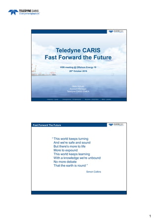
  • 1. 1 HSB meeting @ Offshore Energy 16 26th October 2016 Teledyne CARIS Fast Forward the Future Niels Nijhuis Account Manager Teledyne CARIS EMEA Fast Forward The Future This world keeps turning And we're safe and sound But there's more to life More to expound This world keeps learning With a knowledge we're unbound No more debate That the earth is round ” Simon Collins “
  • 3. 3 Inputs and outputs in a data centric workflow Organizations are considering data centric workflows • To realize efficiencies – Quicker turn around of bigger survey datasets – Increased automation in processing and product compilation – Better utilization of human resources – Change in the focus of human resources “Data Analysts” • To support a broader user base – New and ad hoc products and services – Big Data possibilities • To transition from producer to marine data provider – In line with Open Government and Open Data policies – Support principal of “collect once, use many times Why data centric?
  • 4. 4 • Open data storage • Connectivity to 3rd party tools • Extensive scripting capabilities • Cloud based processing potential • Mobile data entry and access Service orientated and standards based systems Service orientated and standards based systems • Rules-based workflows • Survey processing and cartography • Faster and better quality results • Validation of data in field prior to loading into database Process automationProcess automation Software requirements for data centricity Interoperability and harmonization Data centricity New products and services Multi-sensor survey data Crowd- Sourcing Autonomous surveys Process automation
  • 5. 5 • Basic technical challenge of interoperability has been solved – Standards based technology and data • Organizations need an interoperable approach – To maximize value from marine spatial data, – Through Open Geospatial Consortium (OGC) and International Hydrographic Organization (IHO) cooperation Interoperability Marine spatial data Data plugins (GDAL and PDAL) APIs (Python) Standards (OGC) • IHO and International Association of Oil and Gas Producers (IOGP) – Members/contractors both collect data and produce products – Data used for different purposes, but much of the data is the same Harmonization Product centric approach Data centric approach
  • 6. 6 • Seabed Survey Data Model developed by the Oil and Gas industry to standardize survey deliverables – GML application schema – It is based on an ESRI data model – Now also supported in CARIS solutions – Allow hydrographic agencies and oil and gas companies to exchange data more easily SSDM Multi-sensor survey data Data centricity Interoperability and harmonization New products and services Crowd- Sourcing Autonomous surveys Process automation
  • 7. 7 • The surveyors toolbox is constantly expanding • Sensors used are: – Generating bigger and bigger datasets – Many becoming more portable Multiple sensors survey Light • Laser scanner • LiDAR • Camera • Underwater laser Sound • Multibeam • Side scan • SAS • Imaging sonar Location • GNSS • INS • USBL 2G Robotics Kraken Sonar SBG Systems Elevation data from camera on Topcon Sirius Pro CSAR Point Cloud = 82 million points Area = 300m x 700m
  • 8. 8 Bathy LiDAR – Fugro LADS Mk II CSAR Grid = 3m resolution Topographic and bathymetric data Data from Shallow Survey 2005 Multibeam sonar – Kongsberg EM2040 Data from Shallow Survey 2015 CSAR Grid = 20cm Resolution
  • 9. 9 Bathymetric sidescan – EdgeTech 6205 Data from Shallow Survey 2015 10cm imagery 50cm bathymetry Imagery resolution now maintained during draping Satellite Derived Bathymetry CARIS Bathy DataBASE (CARIS & INAHINA) Bathymetric & Topographic Data (BMT ARGOSS, ASTER, GEBCO) Combined DEM (INAM & INGC) Satellite Data Mozambique Pilot Project Workflow- Topobathy Database
  • 10. 10 Data centricity Interoperabilit y and harmonization New products and services Multi-sensor survey data Crowd- Sourcing Autonomous surveys Process automation • Increased number of platforms / sources = increased data volume to be processed – Autonomous and multi-sensor platforms – Opportunistic multibeam surveys – Crowd-Sourced Bathymetry – Satellite Derived Bathymetry • Can marine agencies cope with the influx of data? – Need to reduce, not increase, the processing backlog – Driving the need for automation, and near real-time processing Process automation • By automating data processing the platforms users can: – Obtain repeatable results and real-time QC – Optimize use of human resources (i.e. allow staff to focus on other survey and GIS tasks) – Reduce data collection to product time, and processing backlogs • All of this will enable agencies to provide marine data to broader customer base
  • 12. 3 Inputs and outputs in a data centric workflow Organizations are considering data centric workflows • To realize efficiencies – Quicker turn around of bigger survey datasets – Increased automation in processing and product compilation – Better utilization of human resources – Change in the focus of human resources “Data Analysts” • To support a broader user base – New and ad hoc products and services – Big Data possibilities • To transition from producer to marine data provider – In line with Open Government and Open Data policies – Support principal of “collect once, use many times Why data centric?
  • 13. 3 Inputs and outputs in a data centric workflow Organizations are considering data centric workflows • To realize efficiencies – Quicker turn around of bigger survey datasets – Increased automation in processing and product compilation – Better utilization of human resources – Change in the focus of human resources “Data Analysts” • To support a broader user base – New and ad hoc products and services – Big Data possibilities • To transition from producer to marine data provider – In line with Open Government and Open Data policies – Support principal of “collect once, use many times Why data centric?
  • 14. 14 Database Discovery Get a view of the dataset prior to downloading it (provided by WCS and encoded as PNG) Supported queries: • Title • Abstract • Identifier • Date • Format • Subject (keywords) • Begin date • End date
  • 15. 15 New products and services Data centricity Interoperabilit y and harmonization Multi-sensor survey data Crowd- Sourcing Autonomous surveys Process automation • S-100 Products – S-101 ENC – S-102 Bathymetric Surface – S-111 Surface Currents – S-112 Real Time Tidal Data Transfer – S-121 Maritime Limits and Boundaries – S-122 Marine Protected Areas – S-401 Inland ENC – S-411 Sea Ice – S-412 Met-Ocean Forecasts – ... • Agencies can currently take a hands-on approach, and experiment with creation of test datasets using existing production tools S-100
  • 18. 18 Variable Resolution Surface Digital elevation model where the resolution varies over different areas of the model R2 R1 R3 Resolution Grid
  • 20. 20 SURFACE MESH Motivation – Current solution • Divide model into depth range and resolution – Have to manage multiple models – Discontinuity near boundaries • Use a TIN – Limited in size – Holidays – Edge removal
  • 21. 21 • Allows multiple resolution areas to be defined and data of varying density to be modelled in single surface – Density estimation tools determine most suitable resolution(s) based on input data • Better representation of real-life situation – Better analysis • Provides a single model for creation of contour and other bathy products – Use in charting and other GIS products • Additional uses: – Base layer for hydrography theme in Marine SDI (MSDI) – Input to form Common Operating Pictures (COP) Variable Resolution surfaces VARIABLE RESOLUTION Surface CREATION & STORAGE Ana lyze dat a Resolution Map Resolution Map
  • 22. 22 VARIABLE RESOLUTION Surface CREATION & STORAGE Ana lyze dat a Resolution Map Resolution Map Node Computation VARIABLE RESOLUTION Surface CREATION & STORAGE Ana lyze dat a Resolution Map Resolution Map Node Computation CSAR Storage Level of Detail Pyramid Level of Detail Pyramid
  • 23. 23 VR Storage: CSAR Framework • CARIS Spatial ARchive (CSAR) • Single file storage format for DEMs, Point Clouds, Mosaïcs and Variable Resolution data • + Metadata • Scalable to billions of grid nodes, terabytes of data • Level-of-detail pyramid Level-of-Detail Pyramid • Built in to Variable Resolution surface • Allows fast 2D and 3D visualization
  • 24. 24 VARIABLE RESOLUTION Surface CREATION & STORAGE Ana lyze dat a Resolution Map Resolution Map Node Computation CSAR Storage Meshing + Processing Meshing + Processing Level of Detail Pyramid Level of Detail Pyramid VR Resolution methods Depth Resolution -20m 0.25m 5m 0.5m 10m 1.0m 20m 2.0m 40m 4.0m 80m 8.0m VR Resolution from Density - CARIS VR Resolution from Density - CARIS VR Resolution from Depth Range
  • 26. 26 VR Contouring & Sounding Selection
  • 27. 27 VR First release • CARIS HIPS and SIPS 10 • Includes: – Depth/density creation tools – Standard node computation (gridding) techniques – Contouring/sounding selection – Several raster tools (difference, shift, compute layer, etc.) • CARIS Bathy DataBASE – Early 2017 Data centricity Interoperabilit y and harmonization New products and services Multi-sensor survey data Crowd- Sourcing Autonomous surveys Process automation
  • 28. 28 All written and image content in this document not protected by the copyrights of others is Copyright © 2016, Teledyne CARIS All rights reserved. Reproduction and redistribution is strictly prohibited without the express prior written consent of Teledyne CARIS. Niels.Nijhuis@Teledyne.com