SlideShare uma empresa Scribd logo
1 de 25
Baixar para ler offline
Intergraph & Dynamic GIS
Intergraph Corporation, Security, Government & Infrastructure Division (SG&I)

Joe Bob Penor
Staff Scientist
Geospatial Operations: GIS Product Line Specialist
The World is Changing


                     Rikuzentakata, Japan – March 11 2011
              Magnitude 9.0 earthquake. 15341 dead. 8298 missing.
              $300 Billion in damages. 125,000 buildings destroyed
The World is Changing


                        Tuscaloosa, Alabama – April 27 2011
          190 mph winds. 1.5 mile wide path of destruction. Path of 80.3 miles.
                                      61 dead.
The World is Changing


               Memphis, Shelby County, Tennessee – May 10 2011
                           1,300 buildings destroyed.
               13% of U.S petroleum refinery output was disrupted.
The World is Changing


                           Joplin, Missouri – May 22 2011
       225 mph winds. 138 dead. 25% of Joplin Destroyed. $1 Billion in damages.
The Hexagon Approach


    “Our rationale is to provide the
    entire measurement cycle and
    deliver real-time information to
    our customers about their business
    and associated activities”

                                       Ola Rollen
                  President and CEO – Hexagon AB
                                             6
GIS Market Development 2000 - 2010

High Accuracy


                     P
                    R
                    O          “Static GIS”
                     F
                     E
                     S
                     S
                     I
                  “Google”
                    O
                    N
                  GIS
                    A
                     L

                      G
                      I
                      S


Low Accuracy
                Slow updates                  Rapid Updates
GIS Market Development 2010 and Beyond

High Accuracy
                                                                    Moving FORWARD

                     P
                    R          Solutions * (Sensors + Software) =
                    O
                     F                “Dynamic GIS”
                     E
                     S
                     S
                     I
                  “Google”
                    O
                    N
                  GIS
                    A
                     L

                      G
                      I
                      S


Low Accuracy
                Slow Updates                                            Rapid Updates
„Dynamic GIS‟


                9
Recipe for Success = Sensors + Software + Solutions


   Sensors                                                 Software
  Data Feeds the               Information              Processes, extracts,
   Information                    Cloud                 manages and delivers
      Cloud                                              valuable information
                                                         from the information
                                                                cloud


                     Workflow Solutions
                        Rapidly deliver reliable and
                        actionable 5D information
                     to users across vertical markets
                       as cost effective solutions to
                          solve market problems
Lifecycle of Geo-Information

The Dynamic Earth:
                                                                        Sensors
• Drives demand for information
                                                              Satellite; Airborne; Terrestrial
• Drives demand for data
• Drives demand an integrated solution


                                  Produce or
                                                                   Desktop Software
                                         Buy
                                                      Data
                                                   Producers


             Search Performed;                                                      Server Software
               Information Not                      Data/IT
                   Available
                                                   Managers


        Request is Made                                                                          Web & Mobile
                                               Users & Consumers


                              The Earth Changes – New Information Required
Measuring and Understanding Our Dynamic Earth


                      Geospatial Information Value Chain


     Capture                   Process                Share   Deliver
Dynamic Information Lifecycle


        Capture            Process             Share               Deliver     Valuable
                                                                             Information


                                                                       Web
                                                        Server                                       High
                                                                                                     Value


                                                                              Return on Investment
                                               GIS

                            Remote Sensing

              Photogrammetry


    Sensors
                                                                                                     Low
                                                                                                     Value


                   Intergraph Geospatial Information Value Chain
Dynamic Information Lifecycle


 # of   A Few          Group         Department       Enterprise       World     Valuable
Users                                                                          Information


                                                                         Web
                                                            Server                                     High
                                                                                                       Value


                                                                                Return on Investment
                                                   GIS

                                Remote Sensing

                  Photogrammetry


        Sensors
                                                                                                       Low
                                                                                                       Value


                       Intergraph Geospatial Information Value Chain
Dynamic Information Lifecycle

                                  Land Cover
                   Stereo      Earth Information
       Pixels                      Analysis
Raw                Ortho                            Enterprise      GeoPortal     Valuable
        Point                        Maps
Data                DTM                             Workflows        Mobile     Information
       Clouds                     Databases
                  Features
                                    Reports


                                                                         Web
                                                           Server                                       High
                                                                                                        Value


                                                                                 Return on Investment
                                                   GIS

                               Remote Sensing

                 Photogrammetry


       Sensors
                                                                                                        Low
                                                                                                        Value


                      Intergraph Geospatial Information Value Chain
Dynamic GIS Description

   Geospatial data is the fuel that flows through the pipe of the information lifecycle.

   Change on the earth‟s surface is the „spark‟ that ignites the fuel.

   The fuel flows through the geospatial information lifecycle „pipe‟.

   The pipe is connects the four engines „capture – process – share – deliver‟ of the lifecycle

   Each engine pumps „value added date and information‟ through the pipe to the next engine.

   The results is „AAA‟ value added information.

   This process drives the Dynamic GIS


                                                                                                   16
DYNAMIC GIS INSIDE AN
       ORGANIZATION

                        17
The Geospatial Ecosystem

Field Mapping & Update               Users & Consumers
                                                                                      Airborne
                                                                                      Sensors

                                       Intranet/Internet


Satellite Sensor                    Information          Web
      Data                GIS        Products          Services
                                                                     Photogrammetry


                                   Data
                                                  IT          Data


                                                                                      Terrestrial
                                                                                       Sensors

                                   Data       Server          Data
                                                                        CAD
                         Remote                                      Engineering
                         Sensing                                       Utilities


                                          Spatial Database

   Geo-Portals
Geospatial Workflow


                 Data                Information


                                                    Delivering
   Dynamic              Geospatial                   Accurate
    Earth                Portfolio                 Authoritative
                                                    Actionable
                                                     Dynamic
                                                   Information

                                                                   19
The Triple „AAA‟ Standard for Success

„A‟ccurate

Using robust and rigorous mathematical and scientific approaches, geospatial products need to have the
capability to create and produce highly accurate geospatial data and information products. This includes
the use of rigorous sensor models and scientific remote sensing, photogrammetry and GIS modeling
techniques.


„A‟uthoritative

Geospatial data and information products produced need to be open and standard based making the
data more valuable, accessible, reliable and the foundation for making mission and life critical decisions.
Leading edge analysis tools drill into data to derive authoritative information.


„A‟ctionable

Your software products need to create „on demand‟ information, delivered directly to decision makers over
the web and to mobile devices. Data and information products created need to be „Vendor Neutral‟ using
OGC/ISO standards so that multiple software applications are „Decision Ready‟.


                                                                                                              20
Intergraph Geospatial Portfolio

                                                         Remote               Web                  Mobile
Clients           GIS              Photogrammetry
                                                         Sensing             Mapping              Mapping


Intranet/                                                   Intranet/
 Internet                                                   Internet


                                                                  Data Management
              Discovery Services        Delivery Services                                  Enterprise Services
                                                                      Services

                                                Security & Administration

                                                     Geospatial Server
Server
                Geospatial
                  Data                                                      Web Editing
                                                                                                     Geo-
               Management               SDI            Web Mapping          & Workflow
                                                                                                  Processing
                & Delivery                                                  Optimization


 Data &
  Web
Services
                Web Services                        Geospatial Database                  Geospatial Data
                                                                                                                   21
                                                                                    (Imagery, Features, Terrain)
Dynamic GIS In Action


                        22
Key Messages

   Our earth and its physical, human and social geography are changing at a rapid pace

   Our customers job is to rapidly understand, react and influence that change.

   Geospatial technologies are critical to obtaining accurate, authoritative and actionable
    information about our dynamic earth.

   Intergraph is the only company in the world that has ALL the geospatial products needed to
    address the entire Dynamic GIS information lifecycle.
QUESTIONS
25

Mais conteúdo relacionado

Semelhante a Hawaii Pacific GIS Conference 2012: Real-Time Data Acquisitions - Dynamic GIS

Big Data: A Big Trap for Product Development
Big Data: A Big Trap for Product DevelopmentBig Data: A Big Trap for Product Development
Big Data: A Big Trap for Product DevelopmentStrategy 2 Market, Inc,
 
IMGS Geospatial User Group 2014: Hexagon Geospatial Vision, Mission and Strategy
IMGS Geospatial User Group 2014: Hexagon Geospatial Vision, Mission and StrategyIMGS Geospatial User Group 2014: Hexagon Geospatial Vision, Mission and Strategy
IMGS Geospatial User Group 2014: Hexagon Geospatial Vision, Mission and StrategyIMGS
 
Integrating GIS to financial data
Integrating GIS to financial dataIntegrating GIS to financial data
Integrating GIS to financial dataeventspat
 
The New Paradigm Towards Geo Enabled Economy
 The New Paradigm Towards Geo Enabled Economy The New Paradigm Towards Geo Enabled Economy
The New Paradigm Towards Geo Enabled EconomyEsri India
 
MapGuide® OpenSource + iVAULT slim workflows, delivering web accessible mapping
MapGuide® OpenSource + iVAULT slim workflows, delivering web accessible mappingMapGuide® OpenSource + iVAULT slim workflows, delivering web accessible mapping
MapGuide® OpenSource + iVAULT slim workflows, delivering web accessible mappingeventspat
 
Open Data Open Innovation and The Cloud gayler berlin nov12
Open Data Open Innovation and The Cloud   gayler berlin nov12Open Data Open Innovation and The Cloud   gayler berlin nov12
Open Data Open Innovation and The Cloud gayler berlin nov12Mark Gayler
 
Dynamic GIS: On Demand Web Based Geo-Processing
Dynamic GIS: On Demand Web Based Geo-ProcessingDynamic GIS: On Demand Web Based Geo-Processing
Dynamic GIS: On Demand Web Based Geo-ProcessingACSG Section Montréal
 
Utilisation du cloud dans les systèmes intelligent
Utilisation du cloud dans les systèmes intelligentUtilisation du cloud dans les systèmes intelligent
Utilisation du cloud dans les systèmes intelligentMicrosoft Technet France
 
Augmented Reality: A New Geovisualisation Method for GIS
Augmented Reality: A New Geovisualisation Method for GISAugmented Reality: A New Geovisualisation Method for GIS
Augmented Reality: A New Geovisualisation Method for GISSung Hyun Jang
 
Icss 20130411 v2
Icss 20130411 v2Icss 20130411 v2
Icss 20130411 v2ISSIP
 
2012 GISCO Track, Emerging Technologies for Field Data Capture, Bill Timmins
2012 GISCO Track, Emerging Technologies for Field Data Capture, Bill Timmins2012 GISCO Track, Emerging Technologies for Field Data Capture, Bill Timmins
2012 GISCO Track, Emerging Technologies for Field Data Capture, Bill TimminsGIS in the Rockies
 
SAP HANA and Apache Hadoop for Big Data Management (SF Scalable Systems Meetup)
SAP HANA and Apache Hadoop for Big Data Management (SF Scalable Systems Meetup)SAP HANA and Apache Hadoop for Big Data Management (SF Scalable Systems Meetup)
SAP HANA and Apache Hadoop for Big Data Management (SF Scalable Systems Meetup)Will Gardella
 
Hadoop's Opportunity to Power Next-Generation Architectures
Hadoop's Opportunity to Power Next-Generation ArchitecturesHadoop's Opportunity to Power Next-Generation Architectures
Hadoop's Opportunity to Power Next-Generation ArchitecturesDataWorks Summit
 
Big Data, Hadoop, Hortonworks and Microsoft HDInsight
Big Data, Hadoop, Hortonworks and Microsoft HDInsightBig Data, Hadoop, Hortonworks and Microsoft HDInsight
Big Data, Hadoop, Hortonworks and Microsoft HDInsightHortonworks
 
Connecting UP Australia 2011 - Unlocking the Front Counter
Connecting UP Australia 2011 - Unlocking the Front CounterConnecting UP Australia 2011 - Unlocking the Front Counter
Connecting UP Australia 2011 - Unlocking the Front CounterGary Maguire
 
GIS platforms: the power of interoperability
GIS platforms: the power of interoperabilityGIS platforms: the power of interoperability
GIS platforms: the power of interoperabilityglobal
 

Semelhante a Hawaii Pacific GIS Conference 2012: Real-Time Data Acquisitions - Dynamic GIS (20)

Big Data: A Big Trap for Product Development
Big Data: A Big Trap for Product DevelopmentBig Data: A Big Trap for Product Development
Big Data: A Big Trap for Product Development
 
IMGS Geospatial User Group 2014: Hexagon Geospatial Vision, Mission and Strategy
IMGS Geospatial User Group 2014: Hexagon Geospatial Vision, Mission and StrategyIMGS Geospatial User Group 2014: Hexagon Geospatial Vision, Mission and Strategy
IMGS Geospatial User Group 2014: Hexagon Geospatial Vision, Mission and Strategy
 
Integrating GIS to financial data
Integrating GIS to financial dataIntegrating GIS to financial data
Integrating GIS to financial data
 
The New Paradigm Towards Geo Enabled Economy
 The New Paradigm Towards Geo Enabled Economy The New Paradigm Towards Geo Enabled Economy
The New Paradigm Towards Geo Enabled Economy
 
MapGuide® OpenSource + iVAULT slim workflows, delivering web accessible mapping
MapGuide® OpenSource + iVAULT slim workflows, delivering web accessible mappingMapGuide® OpenSource + iVAULT slim workflows, delivering web accessible mapping
MapGuide® OpenSource + iVAULT slim workflows, delivering web accessible mapping
 
16h30 p duff-big-data-final
16h30   p duff-big-data-final16h30   p duff-big-data-final
16h30 p duff-big-data-final
 
Open Data Open Innovation and The Cloud gayler berlin nov12
Open Data Open Innovation and The Cloud   gayler berlin nov12Open Data Open Innovation and The Cloud   gayler berlin nov12
Open Data Open Innovation and The Cloud gayler berlin nov12
 
Dynamic GIS: On Demand Web Based Geo-Processing
Dynamic GIS: On Demand Web Based Geo-ProcessingDynamic GIS: On Demand Web Based Geo-Processing
Dynamic GIS: On Demand Web Based Geo-Processing
 
Utilisation du cloud dans les systèmes intelligent
Utilisation du cloud dans les systèmes intelligentUtilisation du cloud dans les systèmes intelligent
Utilisation du cloud dans les systèmes intelligent
 
Augmented Reality: A New Geovisualisation Method for GIS
Augmented Reality: A New Geovisualisation Method for GISAugmented Reality: A New Geovisualisation Method for GIS
Augmented Reality: A New Geovisualisation Method for GIS
 
Secure Big Data Analytics - Hadoop & Intel
Secure Big Data Analytics - Hadoop & IntelSecure Big Data Analytics - Hadoop & Intel
Secure Big Data Analytics - Hadoop & Intel
 
Icss 20130411 v2
Icss 20130411 v2Icss 20130411 v2
Icss 20130411 v2
 
2012 GISCO Track, Emerging Technologies for Field Data Capture, Bill Timmins
2012 GISCO Track, Emerging Technologies for Field Data Capture, Bill Timmins2012 GISCO Track, Emerging Technologies for Field Data Capture, Bill Timmins
2012 GISCO Track, Emerging Technologies for Field Data Capture, Bill Timmins
 
SAP HANA and Apache Hadoop for Big Data Management (SF Scalable Systems Meetup)
SAP HANA and Apache Hadoop for Big Data Management (SF Scalable Systems Meetup)SAP HANA and Apache Hadoop for Big Data Management (SF Scalable Systems Meetup)
SAP HANA and Apache Hadoop for Big Data Management (SF Scalable Systems Meetup)
 
Hadoop's Opportunity to Power Next-Generation Architectures
Hadoop's Opportunity to Power Next-Generation ArchitecturesHadoop's Opportunity to Power Next-Generation Architectures
Hadoop's Opportunity to Power Next-Generation Architectures
 
Big Data, Hadoop, Hortonworks and Microsoft HDInsight
Big Data, Hadoop, Hortonworks and Microsoft HDInsightBig Data, Hadoop, Hortonworks and Microsoft HDInsight
Big Data, Hadoop, Hortonworks and Microsoft HDInsight
 
Connecting UP Australia 2011 - Unlocking the Front Counter
Connecting UP Australia 2011 - Unlocking the Front CounterConnecting UP Australia 2011 - Unlocking the Front Counter
Connecting UP Australia 2011 - Unlocking the Front Counter
 
Igcon 2011
Igcon 2011Igcon 2011
Igcon 2011
 
GIS platforms: the power of interoperability
GIS platforms: the power of interoperabilityGIS platforms: the power of interoperability
GIS platforms: the power of interoperability
 
Big Data on AWS
Big Data on AWSBig Data on AWS
Big Data on AWS
 

Mais de Hawaii Geographic Information Coordinating Council

Mais de Hawaii Geographic Information Coordinating Council (20)

Taking 3D to the next Level with 3D Streaming Maps
Taking 3D to the next Level with 3D Streaming MapsTaking 3D to the next Level with 3D Streaming Maps
Taking 3D to the next Level with 3D Streaming Maps
 
US Army Real Estate Holdings in Hawaii
US Army Real Estate Holdings in HawaiiUS Army Real Estate Holdings in Hawaii
US Army Real Estate Holdings in Hawaii
 
NOAA's Coastal Change Analysis Program
NOAA's Coastal Change Analysis ProgramNOAA's Coastal Change Analysis Program
NOAA's Coastal Change Analysis Program
 
Hawaii and US Pacific Basin Orthoimagery Update
Hawaii and US Pacific Basin Orthoimagery UpdateHawaii and US Pacific Basin Orthoimagery Update
Hawaii and US Pacific Basin Orthoimagery Update
 
The ArcGIS Platform: Appyling Geography Everywhere
The ArcGIS Platform: Appyling Geography EverywhereThe ArcGIS Platform: Appyling Geography Everywhere
The ArcGIS Platform: Appyling Geography Everywhere
 
Web based Data and Tools for Coastal Management
Web based Data and Tools for Coastal ManagementWeb based Data and Tools for Coastal Management
Web based Data and Tools for Coastal Management
 
Ecosystem Vulnerability and Cumulative Impacts on th eOceans of hawaii
Ecosystem Vulnerability and Cumulative Impacts on th eOceans of hawaiiEcosystem Vulnerability and Cumulative Impacts on th eOceans of hawaii
Ecosystem Vulnerability and Cumulative Impacts on th eOceans of hawaii
 
Using GIS to Connect Communities
Using GIS to Connect CommunitiesUsing GIS to Connect Communities
Using GIS to Connect Communities
 
Assessing Reef Health Using a Low Altitude Sensing Platform
Assessing Reef Health Using a Low Altitude Sensing PlatformAssessing Reef Health Using a Low Altitude Sensing Platform
Assessing Reef Health Using a Low Altitude Sensing Platform
 
Hawaii DOT Monitoring Stations Versus National Performance Measurement Resear...
Hawaii DOT Monitoring Stations Versus National Performance Measurement Resear...Hawaii DOT Monitoring Stations Versus National Performance Measurement Resear...
Hawaii DOT Monitoring Stations Versus National Performance Measurement Resear...
 
Use of GIS Technology to Inform Planning Efforts Through Visualization of Com...
Use of GIS Technology to Inform Planning Efforts Through Visualization of Com...Use of GIS Technology to Inform Planning Efforts Through Visualization of Com...
Use of GIS Technology to Inform Planning Efforts Through Visualization of Com...
 
Expanding GIS Access to Technical and Non-Technical Users to Enhance Project ...
Expanding GIS Access to Technical and Non-Technical Users to Enhance Project ...Expanding GIS Access to Technical and Non-Technical Users to Enhance Project ...
Expanding GIS Access to Technical and Non-Technical Users to Enhance Project ...
 
STEMworks: K12 Education in Hawaii in Science Technology Engineering and Math
STEMworks: K12 Education in Hawaii in Science Technology Engineering and MathSTEMworks: K12 Education in Hawaii in Science Technology Engineering and Math
STEMworks: K12 Education in Hawaii in Science Technology Engineering and Math
 
Planning for Technological Change
Planning for Technological ChangePlanning for Technological Change
Planning for Technological Change
 
Now & the Future of geodesy in Hawaii for the GIS Users
Now & the Future of geodesy in Hawaii for the GIS UsersNow & the Future of geodesy in Hawaii for the GIS Users
Now & the Future of geodesy in Hawaii for the GIS Users
 
314 woods- uav mapping history
314   woods- uav mapping history314   woods- uav mapping history
314 woods- uav mapping history
 
314 smith 2015 higicc-final
314  smith 2015 higicc-final314  smith 2015 higicc-final
314 smith 2015 higicc-final
 
Real Time Corrections for GNSS Receivers
Real Time Corrections for GNSS ReceiversReal Time Corrections for GNSS Receivers
Real Time Corrections for GNSS Receivers
 
Honolulu Board of Water Supply: Enterprise GIS
Honolulu Board of Water Supply: Enterprise GISHonolulu Board of Water Supply: Enterprise GIS
Honolulu Board of Water Supply: Enterprise GIS
 
State of Hawaii Digital Leveling Project
State of Hawaii Digital Leveling ProjectState of Hawaii Digital Leveling Project
State of Hawaii Digital Leveling Project
 

Último

Scaling API-first – The story of a global engineering organization
Scaling API-first – The story of a global engineering organizationScaling API-first – The story of a global engineering organization
Scaling API-first – The story of a global engineering organizationRadu Cotescu
 
Salesforce Community Group Quito, Salesforce 101
Salesforce Community Group Quito, Salesforce 101Salesforce Community Group Quito, Salesforce 101
Salesforce Community Group Quito, Salesforce 101Paola De la Torre
 
08448380779 Call Girls In Diplomatic Enclave Women Seeking Men
08448380779 Call Girls In Diplomatic Enclave Women Seeking Men08448380779 Call Girls In Diplomatic Enclave Women Seeking Men
08448380779 Call Girls In Diplomatic Enclave Women Seeking MenDelhi Call girls
 
Kalyanpur ) Call Girls in Lucknow Finest Escorts Service 🍸 8923113531 🎰 Avail...
Kalyanpur ) Call Girls in Lucknow Finest Escorts Service 🍸 8923113531 🎰 Avail...Kalyanpur ) Call Girls in Lucknow Finest Escorts Service 🍸 8923113531 🎰 Avail...
Kalyanpur ) Call Girls in Lucknow Finest Escorts Service 🍸 8923113531 🎰 Avail...gurkirankumar98700
 
Neo4j - How KGs are shaping the future of Generative AI at AWS Summit London ...
Neo4j - How KGs are shaping the future of Generative AI at AWS Summit London ...Neo4j - How KGs are shaping the future of Generative AI at AWS Summit London ...
Neo4j - How KGs are shaping the future of Generative AI at AWS Summit London ...Neo4j
 
TrustArc Webinar - Stay Ahead of US State Data Privacy Law Developments
TrustArc Webinar - Stay Ahead of US State Data Privacy Law DevelopmentsTrustArc Webinar - Stay Ahead of US State Data Privacy Law Developments
TrustArc Webinar - Stay Ahead of US State Data Privacy Law DevelopmentsTrustArc
 
Automating Google Workspace (GWS) & more with Apps Script
Automating Google Workspace (GWS) & more with Apps ScriptAutomating Google Workspace (GWS) & more with Apps Script
Automating Google Workspace (GWS) & more with Apps Scriptwesley chun
 
Data Cloud, More than a CDP by Matt Robison
Data Cloud, More than a CDP by Matt RobisonData Cloud, More than a CDP by Matt Robison
Data Cloud, More than a CDP by Matt RobisonAnna Loughnan Colquhoun
 
Boost PC performance: How more available memory can improve productivity
Boost PC performance: How more available memory can improve productivityBoost PC performance: How more available memory can improve productivity
Boost PC performance: How more available memory can improve productivityPrincipled Technologies
 
Factors to Consider When Choosing Accounts Payable Services Providers.pptx
Factors to Consider When Choosing Accounts Payable Services Providers.pptxFactors to Consider When Choosing Accounts Payable Services Providers.pptx
Factors to Consider When Choosing Accounts Payable Services Providers.pptxKatpro Technologies
 
CNv6 Instructor Chapter 6 Quality of Service
CNv6 Instructor Chapter 6 Quality of ServiceCNv6 Instructor Chapter 6 Quality of Service
CNv6 Instructor Chapter 6 Quality of Servicegiselly40
 
Handwritten Text Recognition for manuscripts and early printed texts
Handwritten Text Recognition for manuscripts and early printed textsHandwritten Text Recognition for manuscripts and early printed texts
Handwritten Text Recognition for manuscripts and early printed textsMaria Levchenko
 
Presentation on how to chat with PDF using ChatGPT code interpreter
Presentation on how to chat with PDF using ChatGPT code interpreterPresentation on how to chat with PDF using ChatGPT code interpreter
Presentation on how to chat with PDF using ChatGPT code interpreternaman860154
 
The 7 Things I Know About Cyber Security After 25 Years | April 2024
The 7 Things I Know About Cyber Security After 25 Years | April 2024The 7 Things I Know About Cyber Security After 25 Years | April 2024
The 7 Things I Know About Cyber Security After 25 Years | April 2024Rafal Los
 
Workshop - Best of Both Worlds_ Combine KG and Vector search for enhanced R...
Workshop - Best of Both Worlds_ Combine  KG and Vector search for  enhanced R...Workshop - Best of Both Worlds_ Combine  KG and Vector search for  enhanced R...
Workshop - Best of Both Worlds_ Combine KG and Vector search for enhanced R...Neo4j
 
Strategies for Unlocking Knowledge Management in Microsoft 365 in the Copilot...
Strategies for Unlocking Knowledge Management in Microsoft 365 in the Copilot...Strategies for Unlocking Knowledge Management in Microsoft 365 in the Copilot...
Strategies for Unlocking Knowledge Management in Microsoft 365 in the Copilot...Drew Madelung
 
From Event to Action: Accelerate Your Decision Making with Real-Time Automation
From Event to Action: Accelerate Your Decision Making with Real-Time AutomationFrom Event to Action: Accelerate Your Decision Making with Real-Time Automation
From Event to Action: Accelerate Your Decision Making with Real-Time AutomationSafe Software
 
EIS-Webinar-Prompt-Knowledge-Eng-2024-04-08.pptx
EIS-Webinar-Prompt-Knowledge-Eng-2024-04-08.pptxEIS-Webinar-Prompt-Knowledge-Eng-2024-04-08.pptx
EIS-Webinar-Prompt-Knowledge-Eng-2024-04-08.pptxEarley Information Science
 
IAC 2024 - IA Fast Track to Search Focused AI Solutions
IAC 2024 - IA Fast Track to Search Focused AI SolutionsIAC 2024 - IA Fast Track to Search Focused AI Solutions
IAC 2024 - IA Fast Track to Search Focused AI SolutionsEnterprise Knowledge
 
Top 5 Benefits OF Using Muvi Live Paywall For Live Streams
Top 5 Benefits OF Using Muvi Live Paywall For Live StreamsTop 5 Benefits OF Using Muvi Live Paywall For Live Streams
Top 5 Benefits OF Using Muvi Live Paywall For Live StreamsRoshan Dwivedi
 

Último (20)

Scaling API-first – The story of a global engineering organization
Scaling API-first – The story of a global engineering organizationScaling API-first – The story of a global engineering organization
Scaling API-first – The story of a global engineering organization
 
Salesforce Community Group Quito, Salesforce 101
Salesforce Community Group Quito, Salesforce 101Salesforce Community Group Quito, Salesforce 101
Salesforce Community Group Quito, Salesforce 101
 
08448380779 Call Girls In Diplomatic Enclave Women Seeking Men
08448380779 Call Girls In Diplomatic Enclave Women Seeking Men08448380779 Call Girls In Diplomatic Enclave Women Seeking Men
08448380779 Call Girls In Diplomatic Enclave Women Seeking Men
 
Kalyanpur ) Call Girls in Lucknow Finest Escorts Service 🍸 8923113531 🎰 Avail...
Kalyanpur ) Call Girls in Lucknow Finest Escorts Service 🍸 8923113531 🎰 Avail...Kalyanpur ) Call Girls in Lucknow Finest Escorts Service 🍸 8923113531 🎰 Avail...
Kalyanpur ) Call Girls in Lucknow Finest Escorts Service 🍸 8923113531 🎰 Avail...
 
Neo4j - How KGs are shaping the future of Generative AI at AWS Summit London ...
Neo4j - How KGs are shaping the future of Generative AI at AWS Summit London ...Neo4j - How KGs are shaping the future of Generative AI at AWS Summit London ...
Neo4j - How KGs are shaping the future of Generative AI at AWS Summit London ...
 
TrustArc Webinar - Stay Ahead of US State Data Privacy Law Developments
TrustArc Webinar - Stay Ahead of US State Data Privacy Law DevelopmentsTrustArc Webinar - Stay Ahead of US State Data Privacy Law Developments
TrustArc Webinar - Stay Ahead of US State Data Privacy Law Developments
 
Automating Google Workspace (GWS) & more with Apps Script
Automating Google Workspace (GWS) & more with Apps ScriptAutomating Google Workspace (GWS) & more with Apps Script
Automating Google Workspace (GWS) & more with Apps Script
 
Data Cloud, More than a CDP by Matt Robison
Data Cloud, More than a CDP by Matt RobisonData Cloud, More than a CDP by Matt Robison
Data Cloud, More than a CDP by Matt Robison
 
Boost PC performance: How more available memory can improve productivity
Boost PC performance: How more available memory can improve productivityBoost PC performance: How more available memory can improve productivity
Boost PC performance: How more available memory can improve productivity
 
Factors to Consider When Choosing Accounts Payable Services Providers.pptx
Factors to Consider When Choosing Accounts Payable Services Providers.pptxFactors to Consider When Choosing Accounts Payable Services Providers.pptx
Factors to Consider When Choosing Accounts Payable Services Providers.pptx
 
CNv6 Instructor Chapter 6 Quality of Service
CNv6 Instructor Chapter 6 Quality of ServiceCNv6 Instructor Chapter 6 Quality of Service
CNv6 Instructor Chapter 6 Quality of Service
 
Handwritten Text Recognition for manuscripts and early printed texts
Handwritten Text Recognition for manuscripts and early printed textsHandwritten Text Recognition for manuscripts and early printed texts
Handwritten Text Recognition for manuscripts and early printed texts
 
Presentation on how to chat with PDF using ChatGPT code interpreter
Presentation on how to chat with PDF using ChatGPT code interpreterPresentation on how to chat with PDF using ChatGPT code interpreter
Presentation on how to chat with PDF using ChatGPT code interpreter
 
The 7 Things I Know About Cyber Security After 25 Years | April 2024
The 7 Things I Know About Cyber Security After 25 Years | April 2024The 7 Things I Know About Cyber Security After 25 Years | April 2024
The 7 Things I Know About Cyber Security After 25 Years | April 2024
 
Workshop - Best of Both Worlds_ Combine KG and Vector search for enhanced R...
Workshop - Best of Both Worlds_ Combine  KG and Vector search for  enhanced R...Workshop - Best of Both Worlds_ Combine  KG and Vector search for  enhanced R...
Workshop - Best of Both Worlds_ Combine KG and Vector search for enhanced R...
 
Strategies for Unlocking Knowledge Management in Microsoft 365 in the Copilot...
Strategies for Unlocking Knowledge Management in Microsoft 365 in the Copilot...Strategies for Unlocking Knowledge Management in Microsoft 365 in the Copilot...
Strategies for Unlocking Knowledge Management in Microsoft 365 in the Copilot...
 
From Event to Action: Accelerate Your Decision Making with Real-Time Automation
From Event to Action: Accelerate Your Decision Making with Real-Time AutomationFrom Event to Action: Accelerate Your Decision Making with Real-Time Automation
From Event to Action: Accelerate Your Decision Making with Real-Time Automation
 
EIS-Webinar-Prompt-Knowledge-Eng-2024-04-08.pptx
EIS-Webinar-Prompt-Knowledge-Eng-2024-04-08.pptxEIS-Webinar-Prompt-Knowledge-Eng-2024-04-08.pptx
EIS-Webinar-Prompt-Knowledge-Eng-2024-04-08.pptx
 
IAC 2024 - IA Fast Track to Search Focused AI Solutions
IAC 2024 - IA Fast Track to Search Focused AI SolutionsIAC 2024 - IA Fast Track to Search Focused AI Solutions
IAC 2024 - IA Fast Track to Search Focused AI Solutions
 
Top 5 Benefits OF Using Muvi Live Paywall For Live Streams
Top 5 Benefits OF Using Muvi Live Paywall For Live StreamsTop 5 Benefits OF Using Muvi Live Paywall For Live Streams
Top 5 Benefits OF Using Muvi Live Paywall For Live Streams
 

Hawaii Pacific GIS Conference 2012: Real-Time Data Acquisitions - Dynamic GIS

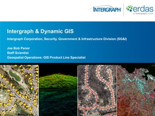
  • 1. Intergraph & Dynamic GIS Intergraph Corporation, Security, Government & Infrastructure Division (SG&I) Joe Bob Penor Staff Scientist Geospatial Operations: GIS Product Line Specialist
  • 2. The World is Changing Rikuzentakata, Japan – March 11 2011 Magnitude 9.0 earthquake. 15341 dead. 8298 missing. $300 Billion in damages. 125,000 buildings destroyed
  • 3. The World is Changing Tuscaloosa, Alabama – April 27 2011 190 mph winds. 1.5 mile wide path of destruction. Path of 80.3 miles. 61 dead.
  • 4. The World is Changing Memphis, Shelby County, Tennessee – May 10 2011 1,300 buildings destroyed. 13% of U.S petroleum refinery output was disrupted.
  • 5. The World is Changing Joplin, Missouri – May 22 2011 225 mph winds. 138 dead. 25% of Joplin Destroyed. $1 Billion in damages.
  • 6. The Hexagon Approach “Our rationale is to provide the entire measurement cycle and deliver real-time information to our customers about their business and associated activities” Ola Rollen President and CEO – Hexagon AB 6
  • 7. GIS Market Development 2000 - 2010 High Accuracy P R O “Static GIS” F E S S I “Google” O N GIS A L G I S Low Accuracy Slow updates Rapid Updates
  • 8. GIS Market Development 2010 and Beyond High Accuracy Moving FORWARD P R Solutions * (Sensors + Software) = O F “Dynamic GIS” E S S I “Google” O N GIS A L G I S Low Accuracy Slow Updates Rapid Updates
  • 10. Recipe for Success = Sensors + Software + Solutions Sensors Software Data Feeds the Information Processes, extracts, Information Cloud manages and delivers Cloud valuable information from the information cloud Workflow Solutions Rapidly deliver reliable and actionable 5D information to users across vertical markets as cost effective solutions to solve market problems
  • 11. Lifecycle of Geo-Information The Dynamic Earth: Sensors • Drives demand for information Satellite; Airborne; Terrestrial • Drives demand for data • Drives demand an integrated solution Produce or Desktop Software Buy Data Producers Search Performed; Server Software Information Not Data/IT Available Managers Request is Made Web & Mobile Users & Consumers The Earth Changes – New Information Required
  • 12. Measuring and Understanding Our Dynamic Earth Geospatial Information Value Chain Capture Process Share Deliver
  • 13. Dynamic Information Lifecycle Capture Process Share Deliver Valuable Information Web Server High Value Return on Investment GIS Remote Sensing Photogrammetry Sensors Low Value Intergraph Geospatial Information Value Chain
  • 14. Dynamic Information Lifecycle # of A Few Group Department Enterprise World Valuable Users Information Web Server High Value Return on Investment GIS Remote Sensing Photogrammetry Sensors Low Value Intergraph Geospatial Information Value Chain
  • 15. Dynamic Information Lifecycle Land Cover Stereo Earth Information Pixels Analysis Raw Ortho Enterprise GeoPortal Valuable Point Maps Data DTM Workflows Mobile Information Clouds Databases Features Reports Web Server High Value Return on Investment GIS Remote Sensing Photogrammetry Sensors Low Value Intergraph Geospatial Information Value Chain
  • 16. Dynamic GIS Description  Geospatial data is the fuel that flows through the pipe of the information lifecycle.  Change on the earth‟s surface is the „spark‟ that ignites the fuel.  The fuel flows through the geospatial information lifecycle „pipe‟.  The pipe is connects the four engines „capture – process – share – deliver‟ of the lifecycle  Each engine pumps „value added date and information‟ through the pipe to the next engine.  The results is „AAA‟ value added information.  This process drives the Dynamic GIS 16
  • 17. DYNAMIC GIS INSIDE AN ORGANIZATION 17
  • 18. The Geospatial Ecosystem Field Mapping & Update Users & Consumers Airborne Sensors Intranet/Internet Satellite Sensor Information Web Data GIS Products Services Photogrammetry Data IT Data Terrestrial Sensors Data Server Data CAD Remote Engineering Sensing Utilities Spatial Database Geo-Portals
  • 19. Geospatial Workflow Data Information Delivering Dynamic Geospatial Accurate Earth Portfolio Authoritative Actionable Dynamic Information 19
  • 20. The Triple „AAA‟ Standard for Success „A‟ccurate Using robust and rigorous mathematical and scientific approaches, geospatial products need to have the capability to create and produce highly accurate geospatial data and information products. This includes the use of rigorous sensor models and scientific remote sensing, photogrammetry and GIS modeling techniques. „A‟uthoritative Geospatial data and information products produced need to be open and standard based making the data more valuable, accessible, reliable and the foundation for making mission and life critical decisions. Leading edge analysis tools drill into data to derive authoritative information. „A‟ctionable Your software products need to create „on demand‟ information, delivered directly to decision makers over the web and to mobile devices. Data and information products created need to be „Vendor Neutral‟ using OGC/ISO standards so that multiple software applications are „Decision Ready‟. 20
  • 21. Intergraph Geospatial Portfolio Remote Web Mobile Clients GIS Photogrammetry Sensing Mapping Mapping Intranet/ Intranet/ Internet Internet Data Management Discovery Services Delivery Services Enterprise Services Services Security & Administration Geospatial Server Server Geospatial Data Web Editing Geo- Management SDI Web Mapping & Workflow Processing & Delivery Optimization Data & Web Services Web Services Geospatial Database Geospatial Data 21 (Imagery, Features, Terrain)
  • 22. Dynamic GIS In Action 22
  • 23. Key Messages  Our earth and its physical, human and social geography are changing at a rapid pace  Our customers job is to rapidly understand, react and influence that change.  Geospatial technologies are critical to obtaining accurate, authoritative and actionable information about our dynamic earth.  Intergraph is the only company in the world that has ALL the geospatial products needed to address the entire Dynamic GIS information lifecycle.
  • 25. 25