SlideShare uma empresa Scribd logo
1 de 29
Baixar para ler offline
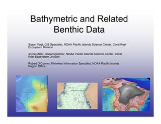
Bathymetric and Related
      Benthic Data
Susan Vogt, GIS Specialist, NOAA Pacific Islands Science Center, Coral Reef
Ecosystem Division

Joyce Miller, Oceanographer, NOAA Pacific Islands Science Center, Coral
Reef Ecosystem Division

Robert O’Conner, Fisheries Information Specialist, NOAA Pacific Islands
Region Office
Data Sources – Lots!
USGS 20-meter Main Hawaiian Islands bathy data
http://wrgis.wr.usgs.gov/dds/dds-55/pacmaps/hw_index.htm

USGS - US Pacific Territories DRGs
http://hbmp.hawaii.edu/website/pacific/
SOPAC Map Servers
http://www.sopac.org/tiki/tiki-index.php?page=Maps
Currents, SST, SSH, Opendap, etc
http://apdrc.soest.hawaii.edu/w_data/ocean3.htm

Shorelines and Habitat for US Pacific Territories
http://ccma.nos.noaa.gov/products/biogeography/us_pac_terr/h
tm/data.htm

 NWHI IKONOS, bathy, habitat
http://ccma.nos.noaa.gov/ecosystems/coralreef/nwhi/welcome.
html
CORIS - bathy and IKONOS
http://coris.noaa.gov/

Hawaii Bathy Grids (seamless) - ngdc
http://www.ngdc.noaa.gov/mgg/coastal/grddas10/grddas10.htm
Global Bathy Grids (etopo2 - smith and sandwell) - ngdc
http://www.ngdc.noaa.gov/mgg/fliers/01mgg04.html
Data Sources – Even More!
NOAA DEMs http://www.ngdc.noaa.gov/mgg/inundation/


NOAA Real Time Satellite Data IMS
   http://nowcoast.noaa.gov/

UH Coastal Geology Data- LIDAR, aerial photos,
    LANDSAT, DEMs
    http://www.soest.hawaii.edu/coasts/


Everything Nautical Charts - ENCs and RNCs
    http://www.csc.noaa.gov/products/enc/
    http://chartmaker.ncd.noaa.gov/mcd/enc/download.htm
    http://nauticalcharts.noaa.gov/mcd/Raster/Index.htm


NMFS GIS Committee Data
   http://www.nmfs.noaa.gov/gis/data/index.htm

BioGeo - habitat and imagery data
    http://ccma.nos.noaa.gov/about/biogeography/

NOS - bathy and remotely sensed data
   http://www.coralreef.noaa.gov/
   http://nosdataexplorer.noaa.gov/nosdataexplorer/
How to make sense of it all?
• Links will be up on HIGICC
  web site

• Highlight three useful sites
  today

   – Electronic Navigational Charts
   – NGDC GEODAS
   – HMRG Main Hawaiian Island
     Multibeam Synthesis

• Keep partnership opportunities
  in mind when scoping new
  projects
Electronic Navigational Charts
               (ENC®s)
• Produced by the
  Office of Coast
  Survey

• IHO S-57
  international
  exchange format
  (non-proprietary,
  publicly available)

• Not the same as a
  raster chart
Accessing and Using ENC®s
        Two step process:

  Select and       Download ENC
download ENC        Data Handler
     data           extension for
                       ArcGIS
Accessing and Using ENC®s
• Download ENCs
  from the Office of
  Coast Survey web
  site:
  http://nauticalcharts.noaa.go
  v/mcd/enc/download.htm


• Select graphically or
  by text

• Place, then collect
  order by
  downloading
Accessing and Using ENC®s
• ENC Data Handler
   extension from Coastal
   Services Center
http://www.csc.noaa.gov/
   products/enc/

• Easy to download

• Comes with easy to
  follow instruction PDF
Accessing and Using ENC®s
•   Follow ENC Data
    Handler instructions
    to import downloaded
    data into geodatabase

•   Use ENC Data
    Handler extension in
    Arc to apply special
    nautical chart
    symbology to each of
    the subtypes

•   Please note that
    these data are Not
    For Navigational
    Purposes!
National Geophysical Data Center
            (NGDC)
Global Bathy Data - ETOPO2v2
Data Sources:
• Smith & Sandwell
• GLOBE (Global Land
  One-kilometer Base
  Elevation)
• IBCAO (International
  Bathymetric Chart of
  the Arctic Ocean)
• NGDC Coastal Relief
  Model
• NGDC Great Lakes
  Bathymetric Data
• Caspian Sea
  Bathymetry
GEODAS (GEOphysical DAta
         System)


http://www.ngdc.noaa.gov/mgg/bathymetry/relief.html
Create Custom Grid
GEODAS - Create Custom Grid
Main Hawaiian Islands Multibeam
          Synthesis
                      •The Hawai‘i Undersea
                      Research Laboratory
                      (HURL)


                      •The Pacific Islands
                      Benthic Habitat Mapping
                      Center (PIBHMC)
Data Exploration - Microsoft's
       Virtual Earth
MHI Multibeam Bathymetric Synthesis
• available for download at www.soest.hawaii.edu/HMRG
• GMT netCDF and ArcGIS ASCII format


             Great, but how was it created???
www.ldeo.columbia.edu/res/pi/MB-System
                               • open source software package for the processing
                               and display of bathymetry data
                               • widely used in the seafloor mapping community


1. Two years of SOEST money allocated to create a data synthesis
   starting in 2004

2. Compile all existing multibeam bathymetry for the MHI
    • Contact all PI’s who have collected multibeam data
    • Permission to release these data in an online synthesis

3. Master list of all data in MB-System format

4. Quality control - which files are “good” enough to include?
    • Time intensive and still not complete
    • Troublesome data edited in XYZ space using SAIC’s SABER

5. Data broken down into 1x1 degree boxes to grid them at 50 m resolution

6. Ongoing data addition and quality control
Let’s do it for this small area off of the windward coast of Oahu!


                                             Coordinates
                                                 22 N
                                         158 W            157.5 W

                                                 21.5 N
Use MB-System to parse master list file based on coordinates:

        mbdatalist –Rcoordinates –Imasterlist >! parsed_list

A few examples from the parsed_list:

KM-em1002/km0302/jd070/gsf/KMMmbb030700356.d01 121 200.00000
Lidar/shoals/Oahu/Oahu01.pos.xyz               162 250.00000
JAMSTEC-nuuanu99/sb1999908131531.mb41           41   9.00000
USGS98/oahu_98/gsf/OA03-980330759.d01          121 250.00000


 FILE PATH AND NAME                    FILE FORMAT               WEIGHT

     Format 121 = SAIC’s Generic Sensor Format
     Format 162 = Longitude, Latitude, Positive Depth Format
     Format 41 = SeaBeam 2100 series Format

         The list for the small area off of windward Oahu contains:
         • 460 files
         • 10 different file format types
Gaussian Weighted Mean Gridding Alogrithm in MB-System

mbgrid –F1 –Rcoordinates –A2 –G3 –C2 –E50/50/meters –Iparse_list –Ooutput_file


                   negative          interpolation   grid size
                   bathymetry


Put computer processors to work:
62200 data points processed in KM-em1002/km0512/jd159/gsf/KMmba051590626.d01.fbt
55800 data points processed in KM-em1002/km0512/jd159/gsf/KMmba051590641.d01.fbt
30982 data points processed in KM-em1002/km0512/jd159/gsf/KMmba051590656.d01.fbt
65829 data points processed in KM-em1002/km0512/jd159/gsf/KMmba051591400.d01.fbt
11479 data points processed in KM-em1002/km0512/jd159/gsf/KMmba051591415.d01.fbt
69254 data points processed in KM-em1002/km0512/jd159/gsf/KMmba051591418.d01.fbt
68793 data points processed in KM-em1002/km0512/jd159/gsf/KMmba051591433.d01.fbt
67351 data points processed in KM-em1002/km0512/jd159/gsf/KMmba051591448.d01.fbt
65939 data points processed in KM-em1002/km0512/jd159/gsf/KMmba051591503.d01.fbt
24686 data points processed in KM-em1002/km0512/jd159/gsf/KMmba051591518.d01.fbt


…………Outputs a GMT netCDF grid file and a postscript image……….
…………convert netCDF grid to ASCII and import to ArcGIS……….


…download DEM’s and imagery from www.soest.hawaii.edu/coasts...
Issues – Filling in the Gaps

Mais conteúdo relacionado

Destaque

How to think like a startup
How to think like a startupHow to think like a startup
How to think like a startupLoic Le Meur
 
32 Ways a Digital Marketing Consultant Can Help Grow Your Business
32 Ways a Digital Marketing Consultant Can Help Grow Your Business32 Ways a Digital Marketing Consultant Can Help Grow Your Business
32 Ways a Digital Marketing Consultant Can Help Grow Your BusinessBarry Feldman
 
Teaching Students with Emojis, Emoticons, & Textspeak
Teaching Students with Emojis, Emoticons, & TextspeakTeaching Students with Emojis, Emoticons, & Textspeak
Teaching Students with Emojis, Emoticons, & TextspeakShelly Sanchez Terrell
 
Hype vs. Reality: The AI Explainer
Hype vs. Reality: The AI ExplainerHype vs. Reality: The AI Explainer
Hype vs. Reality: The AI ExplainerLuminary Labs
 

Destaque (6)

Icelandic Bathy model
Icelandic Bathy modelIcelandic Bathy model
Icelandic Bathy model
 
Inaugural Addresses
Inaugural AddressesInaugural Addresses
Inaugural Addresses
 
How to think like a startup
How to think like a startupHow to think like a startup
How to think like a startup
 
32 Ways a Digital Marketing Consultant Can Help Grow Your Business
32 Ways a Digital Marketing Consultant Can Help Grow Your Business32 Ways a Digital Marketing Consultant Can Help Grow Your Business
32 Ways a Digital Marketing Consultant Can Help Grow Your Business
 
Teaching Students with Emojis, Emoticons, & Textspeak
Teaching Students with Emojis, Emoticons, & TextspeakTeaching Students with Emojis, Emoticons, & Textspeak
Teaching Students with Emojis, Emoticons, & Textspeak
 
Hype vs. Reality: The AI Explainer
Hype vs. Reality: The AI ExplainerHype vs. Reality: The AI Explainer
Hype vs. Reality: The AI Explainer
 

Semelhante a Bathymetric and Benthic Data Sources

Download-manuals-surface water-manual-sw-volume9designmanualdatatransferstorage
 Download-manuals-surface water-manual-sw-volume9designmanualdatatransferstorage Download-manuals-surface water-manual-sw-volume9designmanualdatatransferstorage
Download-manuals-surface water-manual-sw-volume9designmanualdatatransferstoragehydrologyproject001
 
Nick - Benefits of Using Combined Bathymetry and Side Scan Sonar in Shallow W...
Nick - Benefits of Using Combined Bathymetry and Side Scan Sonar in Shallow W...Nick - Benefits of Using Combined Bathymetry and Side Scan Sonar in Shallow W...
Nick - Benefits of Using Combined Bathymetry and Side Scan Sonar in Shallow W...Codevintec Italiana srl
 
Base platform Bathymetry User Workshop 9 Feb 2017
Base platform Bathymetry User Workshop 9 Feb 2017Base platform Bathymetry User Workshop 9 Feb 2017
Base platform Bathymetry User Workshop 9 Feb 2017Tim Thornton
 
2017 ASPRS-RMR Big Data Track: Using NASA's AppEEARS to Slice and Dice Big Ea...
2017 ASPRS-RMR Big Data Track: Using NASA's AppEEARS to Slice and Dice Big Ea...2017 ASPRS-RMR Big Data Track: Using NASA's AppEEARS to Slice and Dice Big Ea...
2017 ASPRS-RMR Big Data Track: Using NASA's AppEEARS to Slice and Dice Big Ea...GIS in the Rockies
 
Directions OGC CHISP-1 Webinar Slides
Directions OGC CHISP-1 Webinar SlidesDirections OGC CHISP-1 Webinar Slides
Directions OGC CHISP-1 Webinar SlidesAlex Joseph
 
Free and open source software for remote sensing and GIS
Free and open source software for remote sensing and GISFree and open source software for remote sensing and GIS
Free and open source software for remote sensing and GISNopphawanTamkuan
 
Navigating the Marine Geophysical Data Life Cycle
Navigating the Marine Geophysical Data Life CycleNavigating the Marine Geophysical Data Life Cycle
Navigating the Marine Geophysical Data Life CycleVicki Ferrini
 
Ben Evans SPEDDEXES 2014
Ben Evans SPEDDEXES 2014Ben Evans SPEDDEXES 2014
Ben Evans SPEDDEXES 2014aceas13tern
 
GEO Analytics Canada Overview April 2020
GEO Analytics Canada Overview April 2020GEO Analytics Canada Overview April 2020
GEO Analytics Canada Overview April 2020GEO Analytics Canada
 
FME for Disaster Response
FME for Disaster ResponseFME for Disaster Response
FME for Disaster ResponseSafe Software
 
Accès ouvert aux données météorologiques d’Environnement Canada
Accès ouvert aux données météorologiques d’Environnement CanadaAccès ouvert aux données météorologiques d’Environnement Canada
Accès ouvert aux données météorologiques d’Environnement CanadaVisionGEOMATIQUE2014
 
DSD-SEA 2023 Global to local multi-hazard forecasting - Yan
DSD-SEA 2023 Global to local multi-hazard forecasting - YanDSD-SEA 2023 Global to local multi-hazard forecasting - Yan
DSD-SEA 2023 Global to local multi-hazard forecasting - YanDeltares
 
Global Multi-Resolution Topography (GMRT) - Making bathymetry data openly acc...
Global Multi-Resolution Topography (GMRT) - Making bathymetry data openly acc...Global Multi-Resolution Topography (GMRT) - Making bathymetry data openly acc...
Global Multi-Resolution Topography (GMRT) - Making bathymetry data openly acc...Vicki Ferrini
 
Generating validaded and harmonized temperature and salinity historical data ...
Generating validaded and harmonized temperature and salinity historical data ...Generating validaded and harmonized temperature and salinity historical data ...
Generating validaded and harmonized temperature and salinity historical data ...EUDAT
 
Metadata syncronisation with GeoNetwork - a users perspective
Metadata syncronisation with GeoNetwork - a users perspectiveMetadata syncronisation with GeoNetwork - a users perspective
Metadata syncronisation with GeoNetwork - a users perspectiveARDC
 
Geo Analytics Canada Overview - May 2020
Geo Analytics Canada Overview - May 2020Geo Analytics Canada Overview - May 2020
Geo Analytics Canada Overview - May 2020GEO Analytics Canada
 
Data Management and Applications at SOCIB
Data Management and Applications at SOCIBData Management and Applications at SOCIB
Data Management and Applications at SOCIBDavid March
 

Semelhante a Bathymetric and Benthic Data Sources (20)

Download-manuals-surface water-manual-sw-volume9designmanualdatatransferstorage
 Download-manuals-surface water-manual-sw-volume9designmanualdatatransferstorage Download-manuals-surface water-manual-sw-volume9designmanualdatatransferstorage
Download-manuals-surface water-manual-sw-volume9designmanualdatatransferstorage
 
Nick - Benefits of Using Combined Bathymetry and Side Scan Sonar in Shallow W...
Nick - Benefits of Using Combined Bathymetry and Side Scan Sonar in Shallow W...Nick - Benefits of Using Combined Bathymetry and Side Scan Sonar in Shallow W...
Nick - Benefits of Using Combined Bathymetry and Side Scan Sonar in Shallow W...
 
Base platform Bathymetry User Workshop 9 Feb 2017
Base platform Bathymetry User Workshop 9 Feb 2017Base platform Bathymetry User Workshop 9 Feb 2017
Base platform Bathymetry User Workshop 9 Feb 2017
 
2017 ASPRS-RMR Big Data Track: Using NASA's AppEEARS to Slice and Dice Big Ea...
2017 ASPRS-RMR Big Data Track: Using NASA's AppEEARS to Slice and Dice Big Ea...2017 ASPRS-RMR Big Data Track: Using NASA's AppEEARS to Slice and Dice Big Ea...
2017 ASPRS-RMR Big Data Track: Using NASA's AppEEARS to Slice and Dice Big Ea...
 
Directions OGC CHISP-1 Webinar Slides
Directions OGC CHISP-1 Webinar SlidesDirections OGC CHISP-1 Webinar Slides
Directions OGC CHISP-1 Webinar Slides
 
Earth Science Data and Information System (ESDIS) Project Update
Earth Science Data and Information System (ESDIS) Project UpdateEarth Science Data and Information System (ESDIS) Project Update
Earth Science Data and Information System (ESDIS) Project Update
 
Free and open source software for remote sensing and GIS
Free and open source software for remote sensing and GISFree and open source software for remote sensing and GIS
Free and open source software for remote sensing and GIS
 
Navigating the Marine Geophysical Data Life Cycle
Navigating the Marine Geophysical Data Life CycleNavigating the Marine Geophysical Data Life Cycle
Navigating the Marine Geophysical Data Life Cycle
 
Ben Evans SPEDDEXES 2014
Ben Evans SPEDDEXES 2014Ben Evans SPEDDEXES 2014
Ben Evans SPEDDEXES 2014
 
GEO Analytics Canada Overview April 2020
GEO Analytics Canada Overview April 2020GEO Analytics Canada Overview April 2020
GEO Analytics Canada Overview April 2020
 
FME for Disaster Response
FME for Disaster ResponseFME for Disaster Response
FME for Disaster Response
 
AUV based on EL - Copy
AUV based on EL - CopyAUV based on EL - Copy
AUV based on EL - Copy
 
Accès ouvert aux données météorologiques d’Environnement Canada
Accès ouvert aux données météorologiques d’Environnement CanadaAccès ouvert aux données météorologiques d’Environnement Canada
Accès ouvert aux données météorologiques d’Environnement Canada
 
DSD-SEA 2023 Global to local multi-hazard forecasting - Yan
DSD-SEA 2023 Global to local multi-hazard forecasting - YanDSD-SEA 2023 Global to local multi-hazard forecasting - Yan
DSD-SEA 2023 Global to local multi-hazard forecasting - Yan
 
Global Multi-Resolution Topography (GMRT) - Making bathymetry data openly acc...
Global Multi-Resolution Topography (GMRT) - Making bathymetry data openly acc...Global Multi-Resolution Topography (GMRT) - Making bathymetry data openly acc...
Global Multi-Resolution Topography (GMRT) - Making bathymetry data openly acc...
 
ArcGIS and Multi-D: Tools & Roadmap
ArcGIS and Multi-D: Tools & RoadmapArcGIS and Multi-D: Tools & Roadmap
ArcGIS and Multi-D: Tools & Roadmap
 
Generating validaded and harmonized temperature and salinity historical data ...
Generating validaded and harmonized temperature and salinity historical data ...Generating validaded and harmonized temperature and salinity historical data ...
Generating validaded and harmonized temperature and salinity historical data ...
 
Metadata syncronisation with GeoNetwork - a users perspective
Metadata syncronisation with GeoNetwork - a users perspectiveMetadata syncronisation with GeoNetwork - a users perspective
Metadata syncronisation with GeoNetwork - a users perspective
 
Geo Analytics Canada Overview - May 2020
Geo Analytics Canada Overview - May 2020Geo Analytics Canada Overview - May 2020
Geo Analytics Canada Overview - May 2020
 
Data Management and Applications at SOCIB
Data Management and Applications at SOCIBData Management and Applications at SOCIB
Data Management and Applications at SOCIB
 

Mais de Hawaii Geographic Information Coordinating Council

Mais de Hawaii Geographic Information Coordinating Council (20)

Taking 3D to the next Level with 3D Streaming Maps
Taking 3D to the next Level with 3D Streaming MapsTaking 3D to the next Level with 3D Streaming Maps
Taking 3D to the next Level with 3D Streaming Maps
 
US Army Real Estate Holdings in Hawaii
US Army Real Estate Holdings in HawaiiUS Army Real Estate Holdings in Hawaii
US Army Real Estate Holdings in Hawaii
 
NOAA's Coastal Change Analysis Program
NOAA's Coastal Change Analysis ProgramNOAA's Coastal Change Analysis Program
NOAA's Coastal Change Analysis Program
 
Hawaii and US Pacific Basin Orthoimagery Update
Hawaii and US Pacific Basin Orthoimagery UpdateHawaii and US Pacific Basin Orthoimagery Update
Hawaii and US Pacific Basin Orthoimagery Update
 
The ArcGIS Platform: Appyling Geography Everywhere
The ArcGIS Platform: Appyling Geography EverywhereThe ArcGIS Platform: Appyling Geography Everywhere
The ArcGIS Platform: Appyling Geography Everywhere
 
Web based Data and Tools for Coastal Management
Web based Data and Tools for Coastal ManagementWeb based Data and Tools for Coastal Management
Web based Data and Tools for Coastal Management
 
Ecosystem Vulnerability and Cumulative Impacts on th eOceans of hawaii
Ecosystem Vulnerability and Cumulative Impacts on th eOceans of hawaiiEcosystem Vulnerability and Cumulative Impacts on th eOceans of hawaii
Ecosystem Vulnerability and Cumulative Impacts on th eOceans of hawaii
 
Using GIS to Connect Communities
Using GIS to Connect CommunitiesUsing GIS to Connect Communities
Using GIS to Connect Communities
 
Assessing Reef Health Using a Low Altitude Sensing Platform
Assessing Reef Health Using a Low Altitude Sensing PlatformAssessing Reef Health Using a Low Altitude Sensing Platform
Assessing Reef Health Using a Low Altitude Sensing Platform
 
Hawaii DOT Monitoring Stations Versus National Performance Measurement Resear...
Hawaii DOT Monitoring Stations Versus National Performance Measurement Resear...Hawaii DOT Monitoring Stations Versus National Performance Measurement Resear...
Hawaii DOT Monitoring Stations Versus National Performance Measurement Resear...
 
Use of GIS Technology to Inform Planning Efforts Through Visualization of Com...
Use of GIS Technology to Inform Planning Efforts Through Visualization of Com...Use of GIS Technology to Inform Planning Efforts Through Visualization of Com...
Use of GIS Technology to Inform Planning Efforts Through Visualization of Com...
 
Expanding GIS Access to Technical and Non-Technical Users to Enhance Project ...
Expanding GIS Access to Technical and Non-Technical Users to Enhance Project ...Expanding GIS Access to Technical and Non-Technical Users to Enhance Project ...
Expanding GIS Access to Technical and Non-Technical Users to Enhance Project ...
 
STEMworks: K12 Education in Hawaii in Science Technology Engineering and Math
STEMworks: K12 Education in Hawaii in Science Technology Engineering and MathSTEMworks: K12 Education in Hawaii in Science Technology Engineering and Math
STEMworks: K12 Education in Hawaii in Science Technology Engineering and Math
 
Planning for Technological Change
Planning for Technological ChangePlanning for Technological Change
Planning for Technological Change
 
Now & the Future of geodesy in Hawaii for the GIS Users
Now & the Future of geodesy in Hawaii for the GIS UsersNow & the Future of geodesy in Hawaii for the GIS Users
Now & the Future of geodesy in Hawaii for the GIS Users
 
314 woods- uav mapping history
314   woods- uav mapping history314   woods- uav mapping history
314 woods- uav mapping history
 
314 smith 2015 higicc-final
314  smith 2015 higicc-final314  smith 2015 higicc-final
314 smith 2015 higicc-final
 
Real Time Corrections for GNSS Receivers
Real Time Corrections for GNSS ReceiversReal Time Corrections for GNSS Receivers
Real Time Corrections for GNSS Receivers
 
Honolulu Board of Water Supply: Enterprise GIS
Honolulu Board of Water Supply: Enterprise GISHonolulu Board of Water Supply: Enterprise GIS
Honolulu Board of Water Supply: Enterprise GIS
 
State of Hawaii Digital Leveling Project
State of Hawaii Digital Leveling ProjectState of Hawaii Digital Leveling Project
State of Hawaii Digital Leveling Project
 

Último

The Codex of Business Writing Software for Real-World Solutions 2.pptx
The Codex of Business Writing Software for Real-World Solutions 2.pptxThe Codex of Business Writing Software for Real-World Solutions 2.pptx
The Codex of Business Writing Software for Real-World Solutions 2.pptxMalak Abu Hammad
 
From Event to Action: Accelerate Your Decision Making with Real-Time Automation
From Event to Action: Accelerate Your Decision Making with Real-Time AutomationFrom Event to Action: Accelerate Your Decision Making with Real-Time Automation
From Event to Action: Accelerate Your Decision Making with Real-Time AutomationSafe Software
 
Salesforce Community Group Quito, Salesforce 101
Salesforce Community Group Quito, Salesforce 101Salesforce Community Group Quito, Salesforce 101
Salesforce Community Group Quito, Salesforce 101Paola De la Torre
 
Google AI Hackathon: LLM based Evaluator for RAG
Google AI Hackathon: LLM based Evaluator for RAGGoogle AI Hackathon: LLM based Evaluator for RAG
Google AI Hackathon: LLM based Evaluator for RAGSujit Pal
 
Boost PC performance: How more available memory can improve productivity
Boost PC performance: How more available memory can improve productivityBoost PC performance: How more available memory can improve productivity
Boost PC performance: How more available memory can improve productivityPrincipled Technologies
 
Data Cloud, More than a CDP by Matt Robison
Data Cloud, More than a CDP by Matt RobisonData Cloud, More than a CDP by Matt Robison
Data Cloud, More than a CDP by Matt RobisonAnna Loughnan Colquhoun
 
Transforming Data Streams with Kafka Connect: An Introduction to Single Messa...
Transforming Data Streams with Kafka Connect: An Introduction to Single Messa...Transforming Data Streams with Kafka Connect: An Introduction to Single Messa...
Transforming Data Streams with Kafka Connect: An Introduction to Single Messa...HostedbyConfluent
 
08448380779 Call Girls In Greater Kailash - I Women Seeking Men
08448380779 Call Girls In Greater Kailash - I Women Seeking Men08448380779 Call Girls In Greater Kailash - I Women Seeking Men
08448380779 Call Girls In Greater Kailash - I Women Seeking MenDelhi Call girls
 
How to convert PDF to text with Nanonets
How to convert PDF to text with NanonetsHow to convert PDF to text with Nanonets
How to convert PDF to text with Nanonetsnaman860154
 
Transcript: #StandardsGoals for 2024: What’s new for BISAC - Tech Forum 2024
Transcript: #StandardsGoals for 2024: What’s new for BISAC - Tech Forum 2024Transcript: #StandardsGoals for 2024: What’s new for BISAC - Tech Forum 2024
Transcript: #StandardsGoals for 2024: What’s new for BISAC - Tech Forum 2024BookNet Canada
 
Swan(sea) Song – personal research during my six years at Swansea ... and bey...
Swan(sea) Song – personal research during my six years at Swansea ... and bey...Swan(sea) Song – personal research during my six years at Swansea ... and bey...
Swan(sea) Song – personal research during my six years at Swansea ... and bey...Alan Dix
 
04-2024-HHUG-Sales-and-Marketing-Alignment.pptx
04-2024-HHUG-Sales-and-Marketing-Alignment.pptx04-2024-HHUG-Sales-and-Marketing-Alignment.pptx
04-2024-HHUG-Sales-and-Marketing-Alignment.pptxHampshireHUG
 
The Role of Taxonomy and Ontology in Semantic Layers - Heather Hedden.pdf
The Role of Taxonomy and Ontology in Semantic Layers - Heather Hedden.pdfThe Role of Taxonomy and Ontology in Semantic Layers - Heather Hedden.pdf
The Role of Taxonomy and Ontology in Semantic Layers - Heather Hedden.pdfEnterprise Knowledge
 
Injustice - Developers Among Us (SciFiDevCon 2024)
Injustice - Developers Among Us (SciFiDevCon 2024)Injustice - Developers Among Us (SciFiDevCon 2024)
Injustice - Developers Among Us (SciFiDevCon 2024)Allon Mureinik
 
Neo4j - How KGs are shaping the future of Generative AI at AWS Summit London ...
Neo4j - How KGs are shaping the future of Generative AI at AWS Summit London ...Neo4j - How KGs are shaping the future of Generative AI at AWS Summit London ...
Neo4j - How KGs are shaping the future of Generative AI at AWS Summit London ...Neo4j
 
Tech-Forward - Achieving Business Readiness For Copilot in Microsoft 365
Tech-Forward - Achieving Business Readiness For Copilot in Microsoft 365Tech-Forward - Achieving Business Readiness For Copilot in Microsoft 365
Tech-Forward - Achieving Business Readiness For Copilot in Microsoft 3652toLead Limited
 
Automating Business Process via MuleSoft Composer | Bangalore MuleSoft Meetup...
Automating Business Process via MuleSoft Composer | Bangalore MuleSoft Meetup...Automating Business Process via MuleSoft Composer | Bangalore MuleSoft Meetup...
Automating Business Process via MuleSoft Composer | Bangalore MuleSoft Meetup...shyamraj55
 
Enhancing Worker Digital Experience: A Hands-on Workshop for Partners
Enhancing Worker Digital Experience: A Hands-on Workshop for PartnersEnhancing Worker Digital Experience: A Hands-on Workshop for Partners
Enhancing Worker Digital Experience: A Hands-on Workshop for PartnersThousandEyes
 
CNv6 Instructor Chapter 6 Quality of Service
CNv6 Instructor Chapter 6 Quality of ServiceCNv6 Instructor Chapter 6 Quality of Service
CNv6 Instructor Chapter 6 Quality of Servicegiselly40
 
Histor y of HAM Radio presentation slide
Histor y of HAM Radio presentation slideHistor y of HAM Radio presentation slide
Histor y of HAM Radio presentation slidevu2urc
 

Último (20)

The Codex of Business Writing Software for Real-World Solutions 2.pptx
The Codex of Business Writing Software for Real-World Solutions 2.pptxThe Codex of Business Writing Software for Real-World Solutions 2.pptx
The Codex of Business Writing Software for Real-World Solutions 2.pptx
 
From Event to Action: Accelerate Your Decision Making with Real-Time Automation
From Event to Action: Accelerate Your Decision Making with Real-Time AutomationFrom Event to Action: Accelerate Your Decision Making with Real-Time Automation
From Event to Action: Accelerate Your Decision Making with Real-Time Automation
 
Salesforce Community Group Quito, Salesforce 101
Salesforce Community Group Quito, Salesforce 101Salesforce Community Group Quito, Salesforce 101
Salesforce Community Group Quito, Salesforce 101
 
Google AI Hackathon: LLM based Evaluator for RAG
Google AI Hackathon: LLM based Evaluator for RAGGoogle AI Hackathon: LLM based Evaluator for RAG
Google AI Hackathon: LLM based Evaluator for RAG
 
Boost PC performance: How more available memory can improve productivity
Boost PC performance: How more available memory can improve productivityBoost PC performance: How more available memory can improve productivity
Boost PC performance: How more available memory can improve productivity
 
Data Cloud, More than a CDP by Matt Robison
Data Cloud, More than a CDP by Matt RobisonData Cloud, More than a CDP by Matt Robison
Data Cloud, More than a CDP by Matt Robison
 
Transforming Data Streams with Kafka Connect: An Introduction to Single Messa...
Transforming Data Streams with Kafka Connect: An Introduction to Single Messa...Transforming Data Streams with Kafka Connect: An Introduction to Single Messa...
Transforming Data Streams with Kafka Connect: An Introduction to Single Messa...
 
08448380779 Call Girls In Greater Kailash - I Women Seeking Men
08448380779 Call Girls In Greater Kailash - I Women Seeking Men08448380779 Call Girls In Greater Kailash - I Women Seeking Men
08448380779 Call Girls In Greater Kailash - I Women Seeking Men
 
How to convert PDF to text with Nanonets
How to convert PDF to text with NanonetsHow to convert PDF to text with Nanonets
How to convert PDF to text with Nanonets
 
Transcript: #StandardsGoals for 2024: What’s new for BISAC - Tech Forum 2024
Transcript: #StandardsGoals for 2024: What’s new for BISAC - Tech Forum 2024Transcript: #StandardsGoals for 2024: What’s new for BISAC - Tech Forum 2024
Transcript: #StandardsGoals for 2024: What’s new for BISAC - Tech Forum 2024
 
Swan(sea) Song – personal research during my six years at Swansea ... and bey...
Swan(sea) Song – personal research during my six years at Swansea ... and bey...Swan(sea) Song – personal research during my six years at Swansea ... and bey...
Swan(sea) Song – personal research during my six years at Swansea ... and bey...
 
04-2024-HHUG-Sales-and-Marketing-Alignment.pptx
04-2024-HHUG-Sales-and-Marketing-Alignment.pptx04-2024-HHUG-Sales-and-Marketing-Alignment.pptx
04-2024-HHUG-Sales-and-Marketing-Alignment.pptx
 
The Role of Taxonomy and Ontology in Semantic Layers - Heather Hedden.pdf
The Role of Taxonomy and Ontology in Semantic Layers - Heather Hedden.pdfThe Role of Taxonomy and Ontology in Semantic Layers - Heather Hedden.pdf
The Role of Taxonomy and Ontology in Semantic Layers - Heather Hedden.pdf
 
Injustice - Developers Among Us (SciFiDevCon 2024)
Injustice - Developers Among Us (SciFiDevCon 2024)Injustice - Developers Among Us (SciFiDevCon 2024)
Injustice - Developers Among Us (SciFiDevCon 2024)
 
Neo4j - How KGs are shaping the future of Generative AI at AWS Summit London ...
Neo4j - How KGs are shaping the future of Generative AI at AWS Summit London ...Neo4j - How KGs are shaping the future of Generative AI at AWS Summit London ...
Neo4j - How KGs are shaping the future of Generative AI at AWS Summit London ...
 
Tech-Forward - Achieving Business Readiness For Copilot in Microsoft 365
Tech-Forward - Achieving Business Readiness For Copilot in Microsoft 365Tech-Forward - Achieving Business Readiness For Copilot in Microsoft 365
Tech-Forward - Achieving Business Readiness For Copilot in Microsoft 365
 
Automating Business Process via MuleSoft Composer | Bangalore MuleSoft Meetup...
Automating Business Process via MuleSoft Composer | Bangalore MuleSoft Meetup...Automating Business Process via MuleSoft Composer | Bangalore MuleSoft Meetup...
Automating Business Process via MuleSoft Composer | Bangalore MuleSoft Meetup...
 
Enhancing Worker Digital Experience: A Hands-on Workshop for Partners
Enhancing Worker Digital Experience: A Hands-on Workshop for PartnersEnhancing Worker Digital Experience: A Hands-on Workshop for Partners
Enhancing Worker Digital Experience: A Hands-on Workshop for Partners
 
CNv6 Instructor Chapter 6 Quality of Service
CNv6 Instructor Chapter 6 Quality of ServiceCNv6 Instructor Chapter 6 Quality of Service
CNv6 Instructor Chapter 6 Quality of Service
 
Histor y of HAM Radio presentation slide
Histor y of HAM Radio presentation slideHistor y of HAM Radio presentation slide
Histor y of HAM Radio presentation slide
 

Bathymetric and Benthic Data Sources

  • 1. Bathymetric and Related Benthic Data Susan Vogt, GIS Specialist, NOAA Pacific Islands Science Center, Coral Reef Ecosystem Division Joyce Miller, Oceanographer, NOAA Pacific Islands Science Center, Coral Reef Ecosystem Division Robert O’Conner, Fisheries Information Specialist, NOAA Pacific Islands Region Office
  • 2. Data Sources – Lots! USGS 20-meter Main Hawaiian Islands bathy data http://wrgis.wr.usgs.gov/dds/dds-55/pacmaps/hw_index.htm USGS - US Pacific Territories DRGs http://hbmp.hawaii.edu/website/pacific/ SOPAC Map Servers http://www.sopac.org/tiki/tiki-index.php?page=Maps Currents, SST, SSH, Opendap, etc http://apdrc.soest.hawaii.edu/w_data/ocean3.htm Shorelines and Habitat for US Pacific Territories http://ccma.nos.noaa.gov/products/biogeography/us_pac_terr/h tm/data.htm NWHI IKONOS, bathy, habitat http://ccma.nos.noaa.gov/ecosystems/coralreef/nwhi/welcome. html CORIS - bathy and IKONOS http://coris.noaa.gov/ Hawaii Bathy Grids (seamless) - ngdc http://www.ngdc.noaa.gov/mgg/coastal/grddas10/grddas10.htm Global Bathy Grids (etopo2 - smith and sandwell) - ngdc http://www.ngdc.noaa.gov/mgg/fliers/01mgg04.html
  • 3. Data Sources – Even More! NOAA DEMs http://www.ngdc.noaa.gov/mgg/inundation/ NOAA Real Time Satellite Data IMS http://nowcoast.noaa.gov/ UH Coastal Geology Data- LIDAR, aerial photos, LANDSAT, DEMs http://www.soest.hawaii.edu/coasts/ Everything Nautical Charts - ENCs and RNCs http://www.csc.noaa.gov/products/enc/ http://chartmaker.ncd.noaa.gov/mcd/enc/download.htm http://nauticalcharts.noaa.gov/mcd/Raster/Index.htm NMFS GIS Committee Data http://www.nmfs.noaa.gov/gis/data/index.htm BioGeo - habitat and imagery data http://ccma.nos.noaa.gov/about/biogeography/ NOS - bathy and remotely sensed data http://www.coralreef.noaa.gov/ http://nosdataexplorer.noaa.gov/nosdataexplorer/
  • 4. How to make sense of it all? • Links will be up on HIGICC web site • Highlight three useful sites today – Electronic Navigational Charts – NGDC GEODAS – HMRG Main Hawaiian Island Multibeam Synthesis • Keep partnership opportunities in mind when scoping new projects
  • 5. Electronic Navigational Charts (ENC®s) • Produced by the Office of Coast Survey • IHO S-57 international exchange format (non-proprietary, publicly available) • Not the same as a raster chart
  • 6. Accessing and Using ENC®s Two step process: Select and Download ENC download ENC Data Handler data extension for ArcGIS
  • 7. Accessing and Using ENC®s • Download ENCs from the Office of Coast Survey web site: http://nauticalcharts.noaa.go v/mcd/enc/download.htm • Select graphically or by text • Place, then collect order by downloading
  • 8. Accessing and Using ENC®s • ENC Data Handler extension from Coastal Services Center http://www.csc.noaa.gov/ products/enc/ • Easy to download • Comes with easy to follow instruction PDF
  • 9. Accessing and Using ENC®s • Follow ENC Data Handler instructions to import downloaded data into geodatabase • Use ENC Data Handler extension in Arc to apply special nautical chart symbology to each of the subtypes • Please note that these data are Not For Navigational Purposes!
  • 10. National Geophysical Data Center (NGDC)
  • 11. Global Bathy Data - ETOPO2v2 Data Sources: • Smith & Sandwell • GLOBE (Global Land One-kilometer Base Elevation) • IBCAO (International Bathymetric Chart of the Arctic Ocean) • NGDC Coastal Relief Model • NGDC Great Lakes Bathymetric Data • Caspian Sea Bathymetry
  • 12. GEODAS (GEOphysical DAta System) http://www.ngdc.noaa.gov/mgg/bathymetry/relief.html
  • 14. GEODAS - Create Custom Grid
  • 15.
  • 16. Main Hawaiian Islands Multibeam Synthesis •The Hawai‘i Undersea Research Laboratory (HURL) •The Pacific Islands Benthic Habitat Mapping Center (PIBHMC)
  • 17.
  • 18. Data Exploration - Microsoft's Virtual Earth
  • 19.
  • 20.
  • 21. MHI Multibeam Bathymetric Synthesis • available for download at www.soest.hawaii.edu/HMRG • GMT netCDF and ArcGIS ASCII format Great, but how was it created???
  • 22. www.ldeo.columbia.edu/res/pi/MB-System • open source software package for the processing and display of bathymetry data • widely used in the seafloor mapping community 1. Two years of SOEST money allocated to create a data synthesis starting in 2004 2. Compile all existing multibeam bathymetry for the MHI • Contact all PI’s who have collected multibeam data • Permission to release these data in an online synthesis 3. Master list of all data in MB-System format 4. Quality control - which files are “good” enough to include? • Time intensive and still not complete • Troublesome data edited in XYZ space using SAIC’s SABER 5. Data broken down into 1x1 degree boxes to grid them at 50 m resolution 6. Ongoing data addition and quality control
  • 23. Let’s do it for this small area off of the windward coast of Oahu! Coordinates 22 N 158 W 157.5 W 21.5 N
  • 24. Use MB-System to parse master list file based on coordinates: mbdatalist –Rcoordinates –Imasterlist >! parsed_list A few examples from the parsed_list: KM-em1002/km0302/jd070/gsf/KMMmbb030700356.d01 121 200.00000 Lidar/shoals/Oahu/Oahu01.pos.xyz 162 250.00000 JAMSTEC-nuuanu99/sb1999908131531.mb41 41 9.00000 USGS98/oahu_98/gsf/OA03-980330759.d01 121 250.00000 FILE PATH AND NAME FILE FORMAT WEIGHT Format 121 = SAIC’s Generic Sensor Format Format 162 = Longitude, Latitude, Positive Depth Format Format 41 = SeaBeam 2100 series Format The list for the small area off of windward Oahu contains: • 460 files • 10 different file format types
  • 25. Gaussian Weighted Mean Gridding Alogrithm in MB-System mbgrid –F1 –Rcoordinates –A2 –G3 –C2 –E50/50/meters –Iparse_list –Ooutput_file negative interpolation grid size bathymetry Put computer processors to work: 62200 data points processed in KM-em1002/km0512/jd159/gsf/KMmba051590626.d01.fbt 55800 data points processed in KM-em1002/km0512/jd159/gsf/KMmba051590641.d01.fbt 30982 data points processed in KM-em1002/km0512/jd159/gsf/KMmba051590656.d01.fbt 65829 data points processed in KM-em1002/km0512/jd159/gsf/KMmba051591400.d01.fbt 11479 data points processed in KM-em1002/km0512/jd159/gsf/KMmba051591415.d01.fbt 69254 data points processed in KM-em1002/km0512/jd159/gsf/KMmba051591418.d01.fbt 68793 data points processed in KM-em1002/km0512/jd159/gsf/KMmba051591433.d01.fbt 67351 data points processed in KM-em1002/km0512/jd159/gsf/KMmba051591448.d01.fbt 65939 data points processed in KM-em1002/km0512/jd159/gsf/KMmba051591503.d01.fbt 24686 data points processed in KM-em1002/km0512/jd159/gsf/KMmba051591518.d01.fbt …………Outputs a GMT netCDF grid file and a postscript image……….
  • 26. …………convert netCDF grid to ASCII and import to ArcGIS………. …download DEM’s and imagery from www.soest.hawaii.edu/coasts...
  • 27.
  • 28. Issues – Filling in the Gaps
  • 29. Issues – Filling in the Gaps