SlideShare uma empresa Scribd logo
1 de 37
+


PGIS techniques
to identify land use conflicts
in Portsmouth
          Hélène Draux, Cities Institute, London Metropolitan University
                           h.draux@londonmet.ac.uk
Participatory GIS
= maps to improve participation
     from „silent majority‟
 to identify land use conflicts
         in Portsmouth
+
    Structure


     Case   study: Coastal conflicts in Portsmouth
     Methods   used
      Face-to-face   survey
      Summer   Fair
      Online survey

     Recommendations
+
    Case study
+
    Farlington Marshes

                            Langstone Harbour

                            British, European
                             and International
                             designations
                             (SSSI, SPA, SAC, a
                             nd Ramsar)

                            Reclaimed three
                             centuries ago
+
    Farlington Marshes
+
    Aims


 Assess   value of
    vulnerable open
    spaces
 Assess   flood
    knowledge
 Understand    perception
    of space regarding
    flood risks
+ Face-to-face
  methodologies
+
    Face-to-face survey:
    Open space users and/or Farlington Marshes
    users, stakeholders


                            45   questions
                            15   minutes
                           2 types of mapping
                            activities
                            162   interviews
:(
 In-depth   :)
          qualitative    Time   consuming
 data from each
 participants            Surveys only small
                         sample, and quite
 Includes   “silent     short survey
 majority”
                         Relies   on the weather
+
    Summer fair survey:
    Open space users and/or Farlington Marshes
    users, stakeholders
                                     Organisedby
                                     Portsmouth
                                     Climate Action
                                     Network
                                    1   sunny day
                                     Around  60
                                     participants for
                                     each of the 4
                                     activities
+


                                        :(
     Can
               :)
          reach more         Needslots of people
     diverse population:     to man the activities
      Families
                             Relieson the fair
      Young  people         organisers .. and
      Less frequent park    weather!
       users
      ..                    Limited
                                    data from
                             each participant
+
    Online survey
+
    Online survey
    General public, open space users and/or
    Farlington Marshes users and stakeholders


    Aims to:
     Attract   all population in Portsmouth
     Potentially   get a bigger sample
+
www.openspaces-portsmouth.org.uk
+
    Google Map API v3


     Add   markers    with a click


     Capture geolocalised
     information


     Display   kml layers..
                                Fieldwork
+
    Add markers - Website
    Locations and flooding


                             Marker


                             Tutorial


                             Instructions


                             Postcode
+
    Add markers - Coding

    Map:

    var map = new
     google.maps.Map(document.getElementById("map_canva
     s"), options);
                                                   For 1 location
                                                   only
    Add marker:

    google.maps.event.addListenerOnce(map, "click", function(
     event)

    var latlng = marker.getPosition();

    Lat = latlng.lat() / Lon = latlng.lng()
+
    Add markers - Database
+
    Add markers - Database
+
    Infowindow - Website
+
    Infowindow - Website
+
    Infowindow - Website
+
    Infowindow - Coding

    parksLayer = new google.maps.KmlLayer(„Parks.kml',{
        suppressInfoWindows: true,
        preserveViewport: true
      });
     parksLayer.setMap(map);

     infowindow = new google.maps.InfoWindow({});

     // Add a listener for the click event
     google.maps.event.addListener(parksLayer, 'click', showArrays);
                                                             html describing
                                                             the infowindow
+
    Customised maps: kml and styles
+
    Customised maps: kml and styles
    Coding Style

    var myStyle =                            featureType: "road.arterial",
    [                                        elementType: "geometry",
      {featureType: "road",                  stylers: [{ visibility: "off" }]
        elementType: "labels",             },{
        stylers: [{ visibility: "off" }]     featureType: "road.local",
      },{                                    elementType: "geometry",
        featureType: "road.highway",         stylers: [
        elementType: "geometry",               { visibility: "off" }
        stylers: [                           ]
          { saturation: -50 },
          { lightness: 20 },
          { visibility: "simplified" }]
      },{
+
    Quick analysis
+
      Participation

      100
100

 90

 80

 70

 60

 50

 40

 30

 20                                                                                         18
 10

  0
       Background          Parks       Flood       Land Use   Willingness to pay   Farlington Marshes


                    Participants who accessed the page and usable replies
+
    Participation - map
+
    Time spent

00:40


00:35


00:30


00:25


00:20
                                                                          Average=
00:15
                                                                          18 minutes

00:10


00:05


00:00
        1   2   3   4   5   6   7   8   9   10   11   12   13   14   15
+
    Flood perception
+
    Preferred scenario


                     Hold the line                 88%
                     Managed
                     realignment, loss of            6%
                     80%
                     Managed
                     realignment, loss of 18 participants
                                        For          6%
                     50%
+
    Issues
+
    Issues specific to this method


    Technical                  Design
     Extensivetime to clear    Too   long survey
     the database
                                 Loss of interest
     Notenough completed
                                Too   many questions:
     surveys
                                 No clear focus
     Loss   of some data
+
    Recommendations
+
    Recommendations/suggestions


     Shorter   survey (5 minutes)

     Focus   survey on one issue

     Finding   gatekeepers while starting the coding

     Organise
             hands-on sessions? (University /
     community centre)
Thanks!


+
    Hélène Draux, Cities Institute


                           h.draux@londonmet.ac.uk
                   http://www.openspaces-portsmouth.org.uk

Mais conteúdo relacionado

Semelhante a PGIS techniques to identify land use conflicts in Portsmouth

This is not your grandmother's online map: Advancing your mission with GIS tools
This is not your grandmother's online map: Advancing your mission with GIS toolsThis is not your grandmother's online map: Advancing your mission with GIS tools
This is not your grandmother's online map: Advancing your mission with GIS toolsChicago Technology Cooperative
 
GeOng presentation about OpenStreetMap
GeOng presentation about OpenStreetMapGeOng presentation about OpenStreetMap
GeOng presentation about OpenStreetMapchippy
 
OpenStreetMap Using, Tools, Services & Hows its changed Humanitarian Response
OpenStreetMap Using, Tools, Services & Hows its changed Humanitarian ResponseOpenStreetMap Using, Tools, Services & Hows its changed Humanitarian Response
OpenStreetMap Using, Tools, Services & Hows its changed Humanitarian Responsechippy
 
Tokyo April 2008 Openstreetmap
Tokyo April 2008 OpenstreetmapTokyo April 2008 Openstreetmap
Tokyo April 2008 Openstreetmapchippy
 
Crowdsourcing & Hydrography MJ Casey
Crowdsourcing & Hydrography MJ CaseyCrowdsourcing & Hydrography MJ Casey
Crowdsourcing & Hydrography MJ CaseyMichael J. Casey
 
OpenStreetMap, an introduction
OpenStreetMap, an introductionOpenStreetMap, an introduction
OpenStreetMap, an introductionFrédéric Rodrigo
 
FOSS4G in Europe; Italy and the Politecnico de Milano
FOSS4G in Europe; Italy and the Politecnico de MilanoFOSS4G in Europe; Italy and the Politecnico de Milano
FOSS4G in Europe; Italy and the Politecnico de MilanoCarolina Arias Muñoz
 
Open Data IOM Haiti, State of the Map
Open Data IOM Haiti, State of the MapOpen Data IOM Haiti, State of the Map
Open Data IOM Haiti, State of the Mapmikel_maron
 
Library of Congress - Neogeography and Geospatial data preservation
Library of Congress - Neogeography and Geospatial data preservationLibrary of Congress - Neogeography and Geospatial data preservation
Library of Congress - Neogeography and Geospatial data preservationAndrew Turner
 
Turning Location Intelligence Into Marketing Intelligence
Turning Location Intelligence Into Marketing IntelligenceTurning Location Intelligence Into Marketing Intelligence
Turning Location Intelligence Into Marketing IntelligenceBSI
 
Volunteered Geographic Information and OpenStreetMap
Volunteered Geographic Information and OpenStreetMapVolunteered Geographic Information and OpenStreetMap
Volunteered Geographic Information and OpenStreetMapchippy
 
Snap4City November 2019 Course: Smart City IOT Data Analytics
Snap4City November 2019 Course: Smart City IOT Data AnalyticsSnap4City November 2019 Course: Smart City IOT Data Analytics
Snap4City November 2019 Course: Smart City IOT Data AnalyticsPaolo Nesi
 
Human computation and participatory systems
Human computation and participatory systems Human computation and participatory systems
Human computation and participatory systems Piero Fraternali
 
Open Historical Maps at State of the Map (SOTM), 2009, Amsterdam
Open Historical Maps at State of the Map (SOTM), 2009, AmsterdamOpen Historical Maps at State of the Map (SOTM), 2009, Amsterdam
Open Historical Maps at State of the Map (SOTM), 2009, Amsterdamchippy
 
mO4Rivers-CitizenScience for Rivers
mO4Rivers-CitizenScience for RiversmO4Rivers-CitizenScience for Rivers
mO4Rivers-CitizenScience for RiversNuno Charneca
 
Apps for Local Government - Esri Dev Summit
Apps for Local Government - Esri Dev SummitApps for Local Government - Esri Dev Summit
Apps for Local Government - Esri Dev SummitAzavea
 
OpenStreetMap
OpenStreetMapOpenStreetMap
OpenStreetMapJakob .
 
Humanitarian OpenStreetMap Team [H.O.T.] Training for SBTF
Humanitarian OpenStreetMap Team [H.O.T.] Training for SBTFHumanitarian OpenStreetMap Team [H.O.T.] Training for SBTF
Humanitarian OpenStreetMap Team [H.O.T.] Training for SBTFStandby Task Force
 

Semelhante a PGIS techniques to identify land use conflicts in Portsmouth (20)

This is not your grandmother's online map: Advancing your mission with GIS tools
This is not your grandmother's online map: Advancing your mission with GIS toolsThis is not your grandmother's online map: Advancing your mission with GIS tools
This is not your grandmother's online map: Advancing your mission with GIS tools
 
GeOng presentation about OpenStreetMap
GeOng presentation about OpenStreetMapGeOng presentation about OpenStreetMap
GeOng presentation about OpenStreetMap
 
OpenStreetMap Using, Tools, Services & Hows its changed Humanitarian Response
OpenStreetMap Using, Tools, Services & Hows its changed Humanitarian ResponseOpenStreetMap Using, Tools, Services & Hows its changed Humanitarian Response
OpenStreetMap Using, Tools, Services & Hows its changed Humanitarian Response
 
Tokyo April 2008 Openstreetmap
Tokyo April 2008 OpenstreetmapTokyo April 2008 Openstreetmap
Tokyo April 2008 Openstreetmap
 
Crowdsourcing & Hydrography MJ Casey
Crowdsourcing & Hydrography MJ CaseyCrowdsourcing & Hydrography MJ Casey
Crowdsourcing & Hydrography MJ Casey
 
OpenStreetMap, an introduction
OpenStreetMap, an introductionOpenStreetMap, an introduction
OpenStreetMap, an introduction
 
FOSS4G in Europe; Italy and the Politecnico de Milano
FOSS4G in Europe; Italy and the Politecnico de MilanoFOSS4G in Europe; Italy and the Politecnico de Milano
FOSS4G in Europe; Italy and the Politecnico de Milano
 
Article25
Article25Article25
Article25
 
Open Data IOM Haiti, State of the Map
Open Data IOM Haiti, State of the MapOpen Data IOM Haiti, State of the Map
Open Data IOM Haiti, State of the Map
 
Library of Congress - Neogeography and Geospatial data preservation
Library of Congress - Neogeography and Geospatial data preservationLibrary of Congress - Neogeography and Geospatial data preservation
Library of Congress - Neogeography and Geospatial data preservation
 
Turning Location Intelligence Into Marketing Intelligence
Turning Location Intelligence Into Marketing IntelligenceTurning Location Intelligence Into Marketing Intelligence
Turning Location Intelligence Into Marketing Intelligence
 
Volunteered Geographic Information and OpenStreetMap
Volunteered Geographic Information and OpenStreetMapVolunteered Geographic Information and OpenStreetMap
Volunteered Geographic Information and OpenStreetMap
 
Snap4City November 2019 Course: Smart City IOT Data Analytics
Snap4City November 2019 Course: Smart City IOT Data AnalyticsSnap4City November 2019 Course: Smart City IOT Data Analytics
Snap4City November 2019 Course: Smart City IOT Data Analytics
 
Human computation and participatory systems
Human computation and participatory systems Human computation and participatory systems
Human computation and participatory systems
 
Open Historical Maps at State of the Map (SOTM), 2009, Amsterdam
Open Historical Maps at State of the Map (SOTM), 2009, AmsterdamOpen Historical Maps at State of the Map (SOTM), 2009, Amsterdam
Open Historical Maps at State of the Map (SOTM), 2009, Amsterdam
 
mO4Rivers-CitizenScience for Rivers
mO4Rivers-CitizenScience for RiversmO4Rivers-CitizenScience for Rivers
mO4Rivers-CitizenScience for Rivers
 
CKX: Wellbeing Toronto - More Than Just a Map
CKX: Wellbeing Toronto - More Than Just a MapCKX: Wellbeing Toronto - More Than Just a Map
CKX: Wellbeing Toronto - More Than Just a Map
 
Apps for Local Government - Esri Dev Summit
Apps for Local Government - Esri Dev SummitApps for Local Government - Esri Dev Summit
Apps for Local Government - Esri Dev Summit
 
OpenStreetMap
OpenStreetMapOpenStreetMap
OpenStreetMap
 
Humanitarian OpenStreetMap Team [H.O.T.] Training for SBTF
Humanitarian OpenStreetMap Team [H.O.T.] Training for SBTFHumanitarian OpenStreetMap Team [H.O.T.] Training for SBTF
Humanitarian OpenStreetMap Team [H.O.T.] Training for SBTF
 

Último

Manulife - Insurer Transformation Award 2024
Manulife - Insurer Transformation Award 2024Manulife - Insurer Transformation Award 2024
Manulife - Insurer Transformation Award 2024The Digital Insurer
 
Web Form Automation for Bonterra Impact Management (fka Social Solutions Apri...
Web Form Automation for Bonterra Impact Management (fka Social Solutions Apri...Web Form Automation for Bonterra Impact Management (fka Social Solutions Apri...
Web Form Automation for Bonterra Impact Management (fka Social Solutions Apri...Jeffrey Haguewood
 
A Year of the Servo Reboot: Where Are We Now?
A Year of the Servo Reboot: Where Are We Now?A Year of the Servo Reboot: Where Are We Now?
A Year of the Servo Reboot: Where Are We Now?Igalia
 
DBX First Quarter 2024 Investor Presentation
DBX First Quarter 2024 Investor PresentationDBX First Quarter 2024 Investor Presentation
DBX First Quarter 2024 Investor PresentationDropbox
 
Axa Assurance Maroc - Insurer Innovation Award 2024
Axa Assurance Maroc - Insurer Innovation Award 2024Axa Assurance Maroc - Insurer Innovation Award 2024
Axa Assurance Maroc - Insurer Innovation Award 2024The Digital Insurer
 
Emergent Methods: Multi-lingual narrative tracking in the news - real-time ex...
Emergent Methods: Multi-lingual narrative tracking in the news - real-time ex...Emergent Methods: Multi-lingual narrative tracking in the news - real-time ex...
Emergent Methods: Multi-lingual narrative tracking in the news - real-time ex...Zilliz
 
Powerful Google developer tools for immediate impact! (2023-24 C)
Powerful Google developer tools for immediate impact! (2023-24 C)Powerful Google developer tools for immediate impact! (2023-24 C)
Powerful Google developer tools for immediate impact! (2023-24 C)wesley chun
 
GenAI Risks & Security Meetup 01052024.pdf
GenAI Risks & Security Meetup 01052024.pdfGenAI Risks & Security Meetup 01052024.pdf
GenAI Risks & Security Meetup 01052024.pdflior mazor
 
Boost Fertility New Invention Ups Success Rates.pdf
Boost Fertility New Invention Ups Success Rates.pdfBoost Fertility New Invention Ups Success Rates.pdf
Boost Fertility New Invention Ups Success Rates.pdfsudhanshuwaghmare1
 
Apidays Singapore 2024 - Modernizing Securities Finance by Madhu Subbu
Apidays Singapore 2024 - Modernizing Securities Finance by Madhu SubbuApidays Singapore 2024 - Modernizing Securities Finance by Madhu Subbu
Apidays Singapore 2024 - Modernizing Securities Finance by Madhu Subbuapidays
 
"I see eyes in my soup": How Delivery Hero implemented the safety system for ...
"I see eyes in my soup": How Delivery Hero implemented the safety system for ..."I see eyes in my soup": How Delivery Hero implemented the safety system for ...
"I see eyes in my soup": How Delivery Hero implemented the safety system for ...Zilliz
 
Mastering MySQL Database Architecture: Deep Dive into MySQL Shell and MySQL R...
Mastering MySQL Database Architecture: Deep Dive into MySQL Shell and MySQL R...Mastering MySQL Database Architecture: Deep Dive into MySQL Shell and MySQL R...
Mastering MySQL Database Architecture: Deep Dive into MySQL Shell and MySQL R...Miguel Araújo
 
Navi Mumbai Call Girls 🥰 8617370543 Service Offer VIP Hot Model
Navi Mumbai Call Girls 🥰 8617370543 Service Offer VIP Hot ModelNavi Mumbai Call Girls 🥰 8617370543 Service Offer VIP Hot Model
Navi Mumbai Call Girls 🥰 8617370543 Service Offer VIP Hot ModelDeepika Singh
 
Real Time Object Detection Using Open CV
Real Time Object Detection Using Open CVReal Time Object Detection Using Open CV
Real Time Object Detection Using Open CVKhem
 
EMPOWERMENT TECHNOLOGY GRADE 11 QUARTER 2 REVIEWER
EMPOWERMENT TECHNOLOGY GRADE 11 QUARTER 2 REVIEWEREMPOWERMENT TECHNOLOGY GRADE 11 QUARTER 2 REVIEWER
EMPOWERMENT TECHNOLOGY GRADE 11 QUARTER 2 REVIEWERMadyBayot
 
Corporate and higher education May webinar.pptx
Corporate and higher education May webinar.pptxCorporate and higher education May webinar.pptx
Corporate and higher education May webinar.pptxRustici Software
 
Data Cloud, More than a CDP by Matt Robison
Data Cloud, More than a CDP by Matt RobisonData Cloud, More than a CDP by Matt Robison
Data Cloud, More than a CDP by Matt RobisonAnna Loughnan Colquhoun
 
Connector Corner: Accelerate revenue generation using UiPath API-centric busi...
Connector Corner: Accelerate revenue generation using UiPath API-centric busi...Connector Corner: Accelerate revenue generation using UiPath API-centric busi...
Connector Corner: Accelerate revenue generation using UiPath API-centric busi...DianaGray10
 
Why Teams call analytics are critical to your entire business
Why Teams call analytics are critical to your entire businessWhy Teams call analytics are critical to your entire business
Why Teams call analytics are critical to your entire businesspanagenda
 
ICT role in 21st century education and its challenges
ICT role in 21st century education and its challengesICT role in 21st century education and its challenges
ICT role in 21st century education and its challengesrafiqahmad00786416
 

Último (20)

Manulife - Insurer Transformation Award 2024
Manulife - Insurer Transformation Award 2024Manulife - Insurer Transformation Award 2024
Manulife - Insurer Transformation Award 2024
 
Web Form Automation for Bonterra Impact Management (fka Social Solutions Apri...
Web Form Automation for Bonterra Impact Management (fka Social Solutions Apri...Web Form Automation for Bonterra Impact Management (fka Social Solutions Apri...
Web Form Automation for Bonterra Impact Management (fka Social Solutions Apri...
 
A Year of the Servo Reboot: Where Are We Now?
A Year of the Servo Reboot: Where Are We Now?A Year of the Servo Reboot: Where Are We Now?
A Year of the Servo Reboot: Where Are We Now?
 
DBX First Quarter 2024 Investor Presentation
DBX First Quarter 2024 Investor PresentationDBX First Quarter 2024 Investor Presentation
DBX First Quarter 2024 Investor Presentation
 
Axa Assurance Maroc - Insurer Innovation Award 2024
Axa Assurance Maroc - Insurer Innovation Award 2024Axa Assurance Maroc - Insurer Innovation Award 2024
Axa Assurance Maroc - Insurer Innovation Award 2024
 
Emergent Methods: Multi-lingual narrative tracking in the news - real-time ex...
Emergent Methods: Multi-lingual narrative tracking in the news - real-time ex...Emergent Methods: Multi-lingual narrative tracking in the news - real-time ex...
Emergent Methods: Multi-lingual narrative tracking in the news - real-time ex...
 
Powerful Google developer tools for immediate impact! (2023-24 C)
Powerful Google developer tools for immediate impact! (2023-24 C)Powerful Google developer tools for immediate impact! (2023-24 C)
Powerful Google developer tools for immediate impact! (2023-24 C)
 
GenAI Risks & Security Meetup 01052024.pdf
GenAI Risks & Security Meetup 01052024.pdfGenAI Risks & Security Meetup 01052024.pdf
GenAI Risks & Security Meetup 01052024.pdf
 
Boost Fertility New Invention Ups Success Rates.pdf
Boost Fertility New Invention Ups Success Rates.pdfBoost Fertility New Invention Ups Success Rates.pdf
Boost Fertility New Invention Ups Success Rates.pdf
 
Apidays Singapore 2024 - Modernizing Securities Finance by Madhu Subbu
Apidays Singapore 2024 - Modernizing Securities Finance by Madhu SubbuApidays Singapore 2024 - Modernizing Securities Finance by Madhu Subbu
Apidays Singapore 2024 - Modernizing Securities Finance by Madhu Subbu
 
"I see eyes in my soup": How Delivery Hero implemented the safety system for ...
"I see eyes in my soup": How Delivery Hero implemented the safety system for ..."I see eyes in my soup": How Delivery Hero implemented the safety system for ...
"I see eyes in my soup": How Delivery Hero implemented the safety system for ...
 
Mastering MySQL Database Architecture: Deep Dive into MySQL Shell and MySQL R...
Mastering MySQL Database Architecture: Deep Dive into MySQL Shell and MySQL R...Mastering MySQL Database Architecture: Deep Dive into MySQL Shell and MySQL R...
Mastering MySQL Database Architecture: Deep Dive into MySQL Shell and MySQL R...
 
Navi Mumbai Call Girls 🥰 8617370543 Service Offer VIP Hot Model
Navi Mumbai Call Girls 🥰 8617370543 Service Offer VIP Hot ModelNavi Mumbai Call Girls 🥰 8617370543 Service Offer VIP Hot Model
Navi Mumbai Call Girls 🥰 8617370543 Service Offer VIP Hot Model
 
Real Time Object Detection Using Open CV
Real Time Object Detection Using Open CVReal Time Object Detection Using Open CV
Real Time Object Detection Using Open CV
 
EMPOWERMENT TECHNOLOGY GRADE 11 QUARTER 2 REVIEWER
EMPOWERMENT TECHNOLOGY GRADE 11 QUARTER 2 REVIEWEREMPOWERMENT TECHNOLOGY GRADE 11 QUARTER 2 REVIEWER
EMPOWERMENT TECHNOLOGY GRADE 11 QUARTER 2 REVIEWER
 
Corporate and higher education May webinar.pptx
Corporate and higher education May webinar.pptxCorporate and higher education May webinar.pptx
Corporate and higher education May webinar.pptx
 
Data Cloud, More than a CDP by Matt Robison
Data Cloud, More than a CDP by Matt RobisonData Cloud, More than a CDP by Matt Robison
Data Cloud, More than a CDP by Matt Robison
 
Connector Corner: Accelerate revenue generation using UiPath API-centric busi...
Connector Corner: Accelerate revenue generation using UiPath API-centric busi...Connector Corner: Accelerate revenue generation using UiPath API-centric busi...
Connector Corner: Accelerate revenue generation using UiPath API-centric busi...
 
Why Teams call analytics are critical to your entire business
Why Teams call analytics are critical to your entire businessWhy Teams call analytics are critical to your entire business
Why Teams call analytics are critical to your entire business
 
ICT role in 21st century education and its challenges
ICT role in 21st century education and its challengesICT role in 21st century education and its challenges
ICT role in 21st century education and its challenges
 

PGIS techniques to identify land use conflicts in Portsmouth

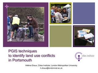
  • 1. + PGIS techniques to identify land use conflicts in Portsmouth Hélène Draux, Cities Institute, London Metropolitan University h.draux@londonmet.ac.uk
  • 2. Participatory GIS = maps to improve participation from „silent majority‟ to identify land use conflicts in Portsmouth
  • 3. + Structure  Case study: Coastal conflicts in Portsmouth  Methods used  Face-to-face survey  Summer Fair  Online survey  Recommendations
  • 4. + Case study
  • 5. + Farlington Marshes  Langstone Harbour  British, European and International designations (SSSI, SPA, SAC, a nd Ramsar)  Reclaimed three centuries ago
  • 6. + Farlington Marshes
  • 7. + Aims  Assess value of vulnerable open spaces  Assess flood knowledge  Understand perception of space regarding flood risks
  • 8. + Face-to-face methodologies
  • 9. + Face-to-face survey: Open space users and/or Farlington Marshes users, stakeholders  45 questions  15 minutes 2 types of mapping activities  162 interviews
  • 10. :(  In-depth :) qualitative  Time consuming data from each participants  Surveys only small sample, and quite  Includes “silent short survey majority”  Relies on the weather
  • 11. + Summer fair survey: Open space users and/or Farlington Marshes users, stakeholders  Organisedby Portsmouth Climate Action Network 1 sunny day  Around 60 participants for each of the 4 activities
  • 12. + :(  Can :) reach more  Needslots of people diverse population: to man the activities  Families  Relieson the fair  Young people organisers .. and  Less frequent park weather! users  ..  Limited data from each participant
  • 13. + Online survey
  • 14. + Online survey General public, open space users and/or Farlington Marshes users and stakeholders Aims to:  Attract all population in Portsmouth  Potentially get a bigger sample
  • 16. + Google Map API v3  Add markers with a click  Capture geolocalised information  Display kml layers.. Fieldwork
  • 17. + Add markers - Website Locations and flooding Marker Tutorial Instructions Postcode
  • 18. + Add markers - Coding Map: var map = new google.maps.Map(document.getElementById("map_canva s"), options); For 1 location only Add marker: google.maps.event.addListenerOnce(map, "click", function( event) var latlng = marker.getPosition(); Lat = latlng.lat() / Lon = latlng.lng()
  • 19. + Add markers - Database
  • 20. + Add markers - Database
  • 21. + Infowindow - Website
  • 22. + Infowindow - Website
  • 23. + Infowindow - Website
  • 24. + Infowindow - Coding parksLayer = new google.maps.KmlLayer(„Parks.kml',{ suppressInfoWindows: true, preserveViewport: true }); parksLayer.setMap(map); infowindow = new google.maps.InfoWindow({}); // Add a listener for the click event google.maps.event.addListener(parksLayer, 'click', showArrays); html describing the infowindow
  • 25. + Customised maps: kml and styles
  • 26. + Customised maps: kml and styles Coding Style var myStyle = featureType: "road.arterial", [ elementType: "geometry", {featureType: "road", stylers: [{ visibility: "off" }] elementType: "labels", },{ stylers: [{ visibility: "off" }] featureType: "road.local", },{ elementType: "geometry", featureType: "road.highway", stylers: [ elementType: "geometry", { visibility: "off" } stylers: [ ] { saturation: -50 }, { lightness: 20 }, { visibility: "simplified" }] },{
  • 27. + Quick analysis
  • 28. + Participation 100 100 90 80 70 60 50 40 30 20 18 10 0 Background Parks Flood Land Use Willingness to pay Farlington Marshes Participants who accessed the page and usable replies
  • 29. + Participation - map
  • 30. + Time spent 00:40 00:35 00:30 00:25 00:20 Average= 00:15 18 minutes 00:10 00:05 00:00 1 2 3 4 5 6 7 8 9 10 11 12 13 14 15
  • 31. + Flood perception
  • 32. + Preferred scenario Hold the line 88% Managed realignment, loss of 6% 80% Managed realignment, loss of 18 participants For 6% 50%
  • 33. + Issues
  • 34. + Issues specific to this method Technical Design  Extensivetime to clear  Too long survey the database Loss of interest  Notenough completed  Too many questions: surveys No clear focus  Loss of some data
  • 35. + Recommendations
  • 36. + Recommendations/suggestions  Shorter survey (5 minutes)  Focus survey on one issue  Finding gatekeepers while starting the coding  Organise hands-on sessions? (University / community centre)
  • 37. Thanks! + Hélène Draux, Cities Institute h.draux@londonmet.ac.uk http://www.openspaces-portsmouth.org.uk