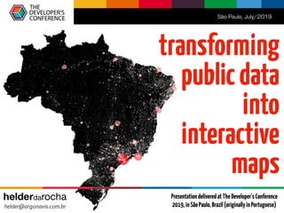
Transforming public data into thematic maps (TDC2019 presentation)
•
0 gostou•969 visualizações

A hands-on tutorial about how to use D3 (5.9) to create thematic maps for the Web based on open data obtained from public portals.

Recomendados
Mais conteúdo relacionado
Mais procurados
Semelhante a Transforming public data into thematic maps (TDC2019 presentation)
Semelhante a Transforming public data into thematic maps (TDC2019 presentation) (20)
Mais de Helder da Rocha
Mais de Helder da Rocha (20)
Último
Último (20)
Transforming public data into thematic maps (TDC2019 presentation)
- 2. Quem sou eu? Who am I? Кто я? Helder da Rocha argonavis.com.br Tech * Science * Arts HTML & Web technologies since 1995 Author of books and courses about Java, XML and Web technologies helderdarocha.art.br
- 3. This is a hands-on tutorial • You will learn how to create an interactive thematic map using: HTML, CSS, JavaScript, SVG, D3.js, CSV, GeoJSON (You should know HTML, CSS and some JavaScript) • Main steps: 1. Get shapefile from naturalearthdata.com 2. Convert to GeoJSON with mapshaper.org and run script to filter data 3. Get data from open data portals: un.data.org and geonames.org 4. Generate strings for SVG paths using D3.js 5. Apply scales, colors, projections and interactive features • Get code from: https://github.com/argonavisbr/tutorial-geojson • Playground: JSFiddle (follow links in Readme.md) • Slides only illustrate the main steps (run the examples and download the code!)
- 6. Convert to GeoJSON: mapshaper.org ne_110m_admin_0_countries.json ne_110m_admin_0_countries.zip 1 23 JSON
- 7. Alternatives: GIS ou GDALapps $ ogr2ogr -f GeoJSON resultado.geojson ne_110m_admin_0_countries.json.shp gdal.org qgis.org
- 8. GeoJSON { "type": "FeatureCollection", "features": [ { "type": "Feature", "id": "FJI", "properties": { "name": "Fiji" }, "geometry": { "type": "MultiPolygon", "coordinates": [ [[ [180,-16.067132663642447], ... [179.4135093629971,-16.379054277547404], [180,-16.067132663642447] ]], [[ ... ]], [[ ... ]] ] } },{ "type": "Feature", ... } }, ... ] } "id"property (optional) "properties"property (anycontent) "geometry"property (containsaGeoJSONtypesuchas: "Polygon","Point","MultiPolygon")
- 9. Remove unnecessary properties { "type": "Feature", "properties": { "ISO_A3":"...", "NAME":"...", "ADMIN":"...", ..., "MAPCOLOR7":"..." }, "geometry": {...} } { "type": "Feature", "id":"...", "properties": { "name":"...", }, "geometry": {...} } ForeachFeature: GitHub:tools/filter-map.js
- 11. D3.js <script src="https://d3js.org/d3.v5.min.js"></script> <script> d3.json('../geo/world.geojson') .then(function(data) { console.log(data.features); }); </script> { "type": "FeatureCollection", "features": [ ... ] }
- 12. Step 1: Load GeoJSON GitHub:tutorial/map-1.html
- 15. Step 2: List properties GitHub:tutorial/map-2.html const map = {}; d3.json('../geo/world.geojson') .then(function(data) { map.features = data.features; draw(); }); function draw() { const ol = d3.select("body").append("ol"); ol.selectAll("li") .data(map.features) .enter().append("li") .text(d => d.properties.name + " ("+ d.id + ")"); } { "type": "Feature", "id":"...", "properties": { "name":"...", }, "geometry": {...} }map.features[n]
- 16. Step 3: List object coordinates GitHub:tutorial/map-3.html const country = map.features.filter(k => k.id === "BRA")[0]; const body = d3.select("body"); body.append("h1") .text(country.properties.name); body.append("ul").selectAll("li.coord") .data(country.geometry.coordinates[0]) .enter() .append("li").attr("class", "coord") .text(d => "Lon: "+d[0]+", Lat: "+d[1]);
- 17. <html lang="en"> <head> <style> .poly { stroke: black; stroke-width: .05; fill: yellow; } </style> </head> <body> <svg height="500" width="960" viewBox="7 -13 14 28"> <path d="M-10,0 L-3,10 L10,7 L10,-7 L-3,-10 L-10,0" class="poly" /> </svg> </body> </html> Step 4: SVG <path> GitHub:tutorial/map-6a.html
- 18. Step 5: SVG <path> with D3 GitHub:tutorial/map-8.html <svg height="500" width="960"></svg> <script> const svg = d3.select("svg"); const pathData = "M-10,0 L-3,10 L10,7 L10,-7 L-3,-10 Z"; svg.append("path").attr("class", "poly") .attr("d", pathData); </script>
- 19. Step 6: Generating a <path> with D3 GitHub:tutorial/map-9.html const geoPath = d3.geoPath(); const map = {}; d3.json('../geo/world.geojson') .then(function(data) { map.features = data.features; draw(); }); function draw() { const country = map.features.filter(k => k.id === "BRA")[0]; const pathData = geoPath(country); d3.select("svg").append("path") .attr("d", pathData); }
- 20. Step 7: Binding data to SVG DOM GitHub:tutorial/map-10.html const geoPath = d3.geoPath(); svg.selectAll("path") .data(map.features) .enter().append("path") .attr("d", geoPath) Eachfeatureboundtoa <path>object
- 21. Step 8: Geographic projections GitHub:tutorial/map-12.html const geoPath = d3.geoPath(); const projection = d3.geoMercator(); //d3.geoOrthographic(), d3.geoMollweide()... geoPath.projection(projection); d3.geoMercator()
- 22. Coordinates for cities: geonames.org geonameid;asciiname;latitude;longitude;population;timezone 3040051;les Escaldes;42.50729;1.53414;15853;Europe/Andorra 3041563;Andorra la Vella;42.50779;1.52109;20430;Europe/Andorra 290594;Umm al Qaywayn;25.56473;55.55517;44411;Asia/Dubai 291074;Ras al-Khaimah;25.78953;55.9432;115949;Asia/Dubai 291696;Khawr Fakkan;25.33132;56.34199;33575;Asia/Dubai 292223;Dubai;25.0657;55.17128;1137347;Asia/Dubai 292231;Dibba Al-Fujairah;25.59246;56.26176;30000;Asia/Dubai 292239;Dibba Al-Hisn;25.61955;56.27291;26395;Asia/Dubai 292672;Sharjah;25.33737;55.41206;543733;Asia/Dubai 292688;Ar Ruways;24.11028;52.73056;16000;Asia/Dubai 292878;Al Fujayrah;25.11641;56.34141;62415;Asia/Dubai 292913;Al Ain;24.19167;55.76056;408733;Asia/Dubai GitHub:csv/cities15000.csv (23505places)
- 23. Step 9: Thematic data: cities GitHub:tutorial/map-15.html Promise.all([ d3.json('../geo/world.geojson'), d3.dsv(';', '../csv/cities15000.csv', function(row) { return { name: row.asciiname, coords: [+row.longitude, +row.latitude] } }) ]).then(function([shapes, points]) { map.features = shapes.features; map.points = points; draw(); }); svg.selectAll("circle.city") .data(map.points) .enter() .append("circle").attr("class", "city") .attr("cx", d => projection(d.coords)[0]) .attr("cy", d => projection(d.coords)[1]) .attr("r", d => 1)
- 25. Summary • D3.js is a powerful library containing a set of tools for data visualization based on openstandards • Used by large news portals (NY Times, The Guardian, etc.) in stunning visualizations and interactive maps. It's also used in higher-level datavis frameworks, tools and services. • This tutorial demonstrates how D3 can be used to create thematicmaps using opendata: an essential skill in data journalism
- 26. Slides, +source-code +demonstrations github.com/argonavisbr/tutorial-geojson www.argonavis.com.br/download/ tdc_2019_js.html (pt-BR and en-US) July/2019 helder da rocha helder@argonavis.com.br www.amazon.com/dp/B07PDBBHLLwww.amazon.com/dp/B07RFBV4PC PresentationdeliveredatTheDeveloper'sConference 2019,inSãoPaulo,Brazil(originallyinPortuguese)