
Recomendados
Recomendados
Mais conteúdo relacionado
Último
Último (20)
Destaque
Destaque (20)
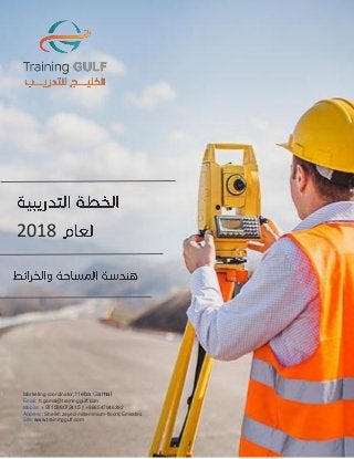
دورات هندســـة المساحـــة والخرائـــط لعام 2018 || Surveying and Mapping Engineering Training Courses for 2018
- 1. Marketing coordinator, Heba Gamal Email: h.gamal@traininggulf.com Mobile: +971588072415 || +966547946392 Address: Sheikh zayed-millemmium-floor8,Emirates Site: www.traininggulf.com 2018 Marketing coordinator, Heba Gamal Email: h.gamal@traininggulf.com Mobile: + 971588072415 || +966547946392 Address: Sheikh zayed-millemmium-floor8,Emirates Site: www.traininggulf.com
- 2. Marketing coordinator, Heba Gamal Email: h.gamal@traininggulf.com Mobile: +971588072415 || +966547946392 Address: Sheikh zayed-millemmium-floor8,Emirates Site: www.traininggulf.com دوراتهندســـةالمساحـــةوالخرائـــط-Surveying and Mapping Engineering البرنامج اسماالنعقاد تاريخالمدةاالنعقاد مكان املتقدمة الجغرافية املعلومات نظمGIS Advanced geographic informationsystem GIS 7/1/2018 5أيام 5Days دبي Dubai الدمام Dammam املناسيب وقياس الزوايا وقياساتالرصد في املساحية األجهزة استخدام Using theSurveying devices inmonitoring, measuringanglesand measuring elevations 14/1/2018 5أيام 5Days دبي Dubai جدة Jeddah للتربة والجيوفيزيائية الهندسية االختبارات Engineering andgeophysical test ofsoil 21/1/2018 5أيام 5Days االردن Jordan لاسطنبو Istanbul الجغرافية االسماء Geographic Names 21/1/2018 10أيام 10Days دبي Dubai لندن London الصناعيةاألقمار نظام بإستخدام املواقع تحديد أساسيات Basics ofhow to determine locationsusingsatellite system 28/1/2018 5أيام 5Days الشيخ شرم SharmElSheikh البحرين Bahrain بعد عناإلستشعار في مقدمة Introduction to RemoteSensing 4/2/2018 5أيام 5Days دبي Dubai لاسطنبو Istanbul ـدنــــــــــــــملا ـاحةــــــــسم City survey 11/2/2018 5أيام 5Days االردن Jordan الرياض Riyadh الزواوية القياسات ( املساحي البرنامج–)الترافرساتو التيودوليت Surveying program (measuringangles -theodolite and traverse) 11/2/2018 5أيام 5Days دبي Dubai ماليزيا Kuala Lumpur وأنواعها املساحية الخرائط Cadastral maps&their types 18/2/2018 5أيام 5Days القاهرة Cairo جدة Jeddah الجغرافية املعلومات نظم بأستخدام الطرق رصفات صيانة إدارةو انشاء PavementConstruction andMaintenance ManagementBasedon GIS 25/2/2018 10أيام 10Days دبي Dubai جينيف Geneva نظمبرنامج باستخدام الجغرافية املعلوماتArc Gis 10 Geographic InformationSystems using ArcGIS10 4/3/20118 5أيام 5Days دبي Dubai لاسطنبو Istanbul برنامج إلى مقدمةERDAS IMAGINE Introduction to ERDASIMAGINE Program 4/3/2018 5أيام 5Days دبي Dubai جدة Jeddah وأقسامها املساحة عنشاملة دورة Surveying andits classification 11/3/2018 10أيام 10Days الشيخ شرم SharmElSheikh جينيف Geneva
- 3. Marketing coordinator, Heba Gamal Email: h.gamal@traininggulf.com Mobile: +971588072415 || +966547946392 Address: Sheikh zayed-millemmium-floor8,Emirates Site: www.traininggulf.com Cadastralsurveyusing GPS&Totalstation أجهزة بإستخدام املساحى الرفعTotal Station&GPS 18/3/2018 5أيام 5Days دبي Dubai الرياض Riyadh اوتوكاد AutoCAD 25/3/2018 5أيام 5Days االردن Jordan عمان سلطنة Oman العمرانى والتخطيط باإلسكان الخاصة الجغرافية املعلومات نظم Geographic InformationSystems ofHousingand UrbanPlanning 1/4/2018 5أيام 5Days االردن Jordan الرياض Riyadh املساحة ألعمالاملوقع في الفنية الصعوبات على التغلب Overcoming thechallengesofsurveys atthesite 8/4/2018 5أيام 5Days االسكندرية Alexandria ماليزيا Kuala Lumpur والرقمي الضوئي الثيودوليت optical and digital theodolite 15/4/2018 5أيام 5Days دبي Dubai لاسطنبو Istanbul اإللكترونية لبالجداو والردم الحفر وكميات والحجوم املساحات Area, volumes&quantities ofexcavationandfilling by excel 22/4/2018 10أيام 10Days دبي Dubai برلين Berlin األعمدة وإسقاط إقامةاملساحية األرصادفي Establish anddrop columns insurveying 29/4/2018 5أيام 5Days دبي Dubai الدمام Dammam اإللكترونية باألجهزة املساحة قياس أساسيات Basicsofsurvey measureby electronic devices 6/5/2018 5أيام 5Days دبي Dubai لاسطنبو Istanbul بعدعناإلستشعار في املعلوماتمصادر Sources ofinformationin remote sensing 13/5/2018 5أيام 5Days االردن Jordan الرياض Riyadh املساحة في بالشريطالقياس أعمال Works ofmeasuring by tapeinsurvey 17/6/2018 5أيام 5Days القاهرة Cairo جدة Jeddah املعمارية املساحة في األفقية املسافة قياس أساسيات Basicsto measure thehorizontaldistance inarchitectural surveying 24/6/2018 5أيام 5Days دبي Dubai ماليزيا Kuala Lumpur مبادئتطبيقاتهو الحاسب بأستخدام الجغرافية املعلومات نظم Computer AidedGIS Principles&Applications 1/7/2018 5أيام 5Days االردن Jordan لاسطنبو Istanbul املواقع تحديد نظام1200LGO GPS SYSTEMLGO 1200 8/7/2018 5أيام 5Days دبي Dubai الرياض Riyadh املساحةواإلنشاءات والكبارى الطرق فى Surveying inroads,bridges andconstruction 15/7/2018 10أيام 10Days الشيخ شرم SharmElSheikh لندن London
- 4. Marketing coordinator, Heba Gamal Email: h.gamal@traininggulf.com Mobile: +971588072415 || +966547946392 Address: Sheikh zayed-millemmium-floor8,Emirates Site: www.traininggulf.com املساحية األرصادفي بامليزان القياس أعمال Measurementworks by totalstation insurveying 22/7/2018 5أيام 5Days دبي Dubai جدة Jeddah بعدعناإلستشعار في املعلوماتمصادر Sources ofinformationin remote sensing 29/7/2018 5أيام 5Days دبي Dubai عمان سلطنة Oman ي األراض وتسوية الحجوم مساحيةحساب أساسيات Basicsofaccountsurveying volumes&landsettlement 5/8/2018 5أيام 5Days الشيخ شرم SharmElSheikh جدة Jeddah املساحة في بالشريطالقياس أعمال Works ofmeasuring by tapeinsurvey 5/8/2018 5أيام 5Days دبي Dubai ماليزيا Kuala Lumpur املساحية األرصاد ضبط Adjust ofsurveying measurements 12/8/2018 5أيام 5Days االردن Jordan لاسطنبو Istanbul LECIAVIVA GPS SYSTEMالصناعيةاألقمار رصدأجهزة ObservationSatellite devices LEICAVIVA GPS System 26/8/2018 5أيام 5Days دبي Dubai الرياض Riyadh املعمارية املساحة في امليزانية أساسيات Basicsofbalance in architectural surveying 26/8/2018 5أيام 5Days دبي Dubai املغرب Morocco املساحية األعمال في املستخدمة والتحويالت القياس أنظمة Measurementandconversions systemsusedin thesurveyingworks 2/9/2018 5أيام 5Days االردن Jordan لاسطنبو Istanbul واملعدات املساحة فى مقدمة Introduction to surveyingand Equipments 9/9/2018 5أيام 5Days دبي Dubai الرياض Riyadh الهندسية الخرائط Engineering maps 16/9/2018 10أيام 10Days دبي Dubai املغرب Morocco وتطبيقاتها الشاملة باملحطة القياس أعمال Measurementworks by total station&its applications 23/9/2018 5أيام 5Days االسكندرية Alexandria ماليزيا Kuala Lumpur املساحية التطبيقات أساسيات Basicsofsurveying applications 30/9/2018 5أيام 5Days دبي Dubai الدمام Dammam اإلنحرافااملساحة علم في البوصلة وإستخدام ت Deviations andusecompass insurveyscience 7/10/2018 5أيام 5Days القاهرة Cairo ماليزيا Kuala Lumpur TCSET 350RX TC SET350RX 14/10/2018 5أيام 5Days االردن Jordan جدة Jeddah إلكترونيا املسافات قياس Electronic distance measurement (EDM) 21/10/2018 5أيام 5Days دبي Dubai لندن London
- 5. Marketing coordinator, Heba Gamal Email: h.gamal@traininggulf.com Mobile: +971588072415 || +966547946392 Address: Sheikh zayed-millemmium-floor8,Emirates Site: www.traininggulf.com املعمارية املساحة علم أساسيات Basicsofarchitecturalsurveyingscience 28/10/2018 5أيام 5Days دبي Dubai الدمام Dammam الزواوية القياسات ( املساحي البرنامج–التيودولي)الترافرساتو ت Surveying program (measuringangles -theodolite and traverse) 28/10/2018 5أيام 5Days دبي Dubai البحرين Bahrain املعماريةاملساحة في واإلتجاهات الزوايا قياس Measure angles andtrends inarchitecturalsurveying 4/11/2018 5أيام 5Days االسكندرية Alexandria لاسطنبو Istanbul NA3003DIGITAL LEVEL LEICA NA 3003DIGITAL LEVEL LEICA 4/11/2018 5أيام 5Days دبي Dubai ماليزيا Kuala Lumpur اإللكترونية لبالجداو والردم الحفر وكميات والحجوم املساحات Area, volumes&quantities ofexcavationandfilling by excel 11/11/2018 5أيام 5Days دبي Dubai جدة Jeddah للتربة والجيوفيزيائية الهندسية االختبارات Engineering andgeophysical test ofsoil 18/11/22018 5أيام 5Days دبي Dubai الرياض Riyadh صيانة إدارةو انشاءالجغرافية املعلومات نظم بأستخدام الطرق رصفات PavementConstruction andMaintenance ManagementBasedon GIS 25/11/2018 10أيام 10Days االردن Jordan جينيف Geneva الهندسية املساحة Engineering survey 2/12/2018 5أيام 5Days دبي Dubai البحرين Bahrain املناسيب وقياس الزوايا وقياساتالرصد في املساحية األجهزة استخدام Using theSurveying devices inmonitoring, measuringanglesand measuring elevations 9/12/2018 10أيام 10Days دبي Dubai باريس Paris ي األراضتطوير Land Development 16/9/2018 5أيام 5Days القاهرة Cairo الدمام Dammam العمرانى والتخطيط باإلسكان الخاصة الجغرافية املعلومات نظم Geographic InformationSystems ofHousingand UrbanPlanning 23/12/2018 5أيام 5Days االردن Jordan السطنبو Istanbul اإللكترونية باألجهزة املساحة قياس أساسيات Basicsofsurvey measureby electronic devices 30/12/2018 5أيام 5Days دبي Dubai الرياض Riyadh