
Recomendados
Mais conteúdo relacionado
Semelhante a The survey as basis for Documentation of cultural Heritage
Semelhante a The survey as basis for Documentation of cultural Heritage (19)
Último
Último (20)
The survey as basis for Documentation of cultural Heritage
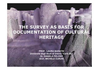
- 1. THE SURVEY AS BASIS FOR DOCUMENTATION OF CULTURAL HERITAGE PROF. LAURA BARATIN Università degli Studi di Urbino “Carlo Bo” Dr. DANIELA PELOSO Arch. MICHELE CURUNI
- 2. The survey open system of knowledge • The first level for the preservation and conservation is knowledge • Knowledge means in each case to document • The documentation is an essential support for the protection of cultural heritage
- 3. The survey open system of knowledge The survey of each body architecture must be designed so that it can be transformed into an information system Within the information system will put the various information that can be accumulated in recent times in different forms
- 4. The knowledge • The geometric model – The architectural survey • The iconic model - as analysis of the composition of space and how overview of its volume and its spaces • The distribution model - such as analysis of routes spaces of their distribution and their use • The model constructive - like technical analysis of the parties and structural building • The model of the state of conservation as analysis of changes and degradation
- 5. Palazzo Pepoli Campogrande - Bologna Survey geometrical formal 17.72 1.34 1.34 1.34 1.34 7.52 7.24 6.56 H. 5.30 H. 5.30 H. 3.70 2.72 0.23 7.95 8.16 7.97 8.05 9.59 10 11 .70 .03 3.62 0.54 3.24 H. 3.13 2.99 3.45 .76 .51 10 10 STALE DE' PEPOLI 1.68 6.79 7.06 1.25 1.24 1.38 1.36 2.61 B 1.37 0.32 0.95 7.38 2.44 2.50 1.34 2.67 2.54 H. 2.46 3.6 1.22 7 0.69 1.50 1.50 1.50 0.62 60.36 7.06 3.74 1.22 3.95 2.50 1.32 2.77 5.01 1.28 3.03 7.08 0.41 1.02 2.95 2.99 ASCENSORE 2.60 3.86 3.13 7.85 H. 4.59 6.15 BOTTE 5.25 4.38 6.3 8.0 4.37 4.09 9.3 3.76 8.6 5.8 4 1.12 1.45 7 9 H. 6.30 5 9 7.60 4.96 1.62 1.19 2.83 5.86 2.77 6.20 1.58 2.68 3.72 H. 6.30 0 6 5.9 H. 2.45 6.4 5.11 H. 6.30 0.95 7.70 1.47 1.89 10 1.71 7.37 3.94 8.32 2.10 .19 7.04 4.21 6.92 6.90 6.78 6.95 5 6.74 8 3.93 2.21 2.24 7.8 1.63 3 9.0 5.25 8.4 5.03 9.4 3.33 H. 3.70 6.66 4 H. 5.80 08 13. 1.21 5.8 3.86 6.2 3.91 1.38 2.76 3.54 3.40 H. 6.30 3.75 9.78 3.70 3.69 1 8
- 6. Palazzo Ducale di Urbania Abaco capitals
- 7. Palazzo Pepoli Campogrande - Bologna Historical Evolution
- 8. Palazzo Pepoli Campogrande – Bologna Historical Evolution
- 9. Palazzo Ducale di Urbania Iconic Model
- 10. Palazzo Ducale di Urbania Iconic Model
- 11. Palazzo Ducale di Urbania Distribution Model
- 12. Palazzo Ducale di Urbania Analysis of the deterioration of the columns
- 13. • The relief requires the integrated use of various procedures and documentation of measurement • The objective is to arrive at a correct representation as well as metrically exact object of study
- 14. Traditional survey or direct survey Traditional means Survey relief through simple tools Instrumental Survey Instrumental survey means detect architecture with complex instruments: • Topographical Survey • Photogrammetrical Survey • Survey using 3D laser scanner
- 15. Topographical Survey • The topographical survey is the preliminary phase of survey activities • The topographical survey serves to create a rigid cage around the object
- 16. Photogrammetrical Survey The photogrammetrical survey is a measurement procedure that uses photographic images of an object for the purpose of obtaining the different 2D and 3D sizes
- 26. LASER SCANNER SURVEY DATA ACQUISITION A LASER SCANNER IS CONCEPTUALLY QUITE A SIMPLE INSTRUMENT: A LASER BEAM SCANS THE REAL OBJECT, THEN CREATES A MATHEMATICAL MOCK-UP COMPOSED OF A SET OF POINTS IN THREE- DIMENSIONAL SPACE, ARRANGED ACCORDING TO A REGULAR GRID WITH A KNOWN STEP SIZE THIS GRID, KNOWN AS POINT CLOUD, IS A SET OF THREE- DIMENSIONAL COORDINATES IN A REFERENCE FRAME CONNECTED WITH THE INSTRUMENT SCANNER SYSTEMS WORK AUTOMATICALLY, CAN GATHER HUNDREDS OF POINTS EACH SECOND, AND, ACCORDING TO THE EMPLOYED SENSOR, CAN ACTUALLY CREATE VIRTUAL COPIES OF REAL OBJECTS REGARDLESS OF THEIR SIZE CLEARLY, THE SPEED OF DATA ACQUISITION AND THE BULK OF GATHERED DATA IN A SHORT TIME SPAN ARE THE MAIN FEATURES DEFINING THIS TECHNOLOGY AND SHOWING ITS GREAT POTENTIAL
- 27. Measurements 1. Distance accuracy (+/- 4mm) 2. Angular measurement (+/- 60 micro-radians) 3. Intensity (based on the object reflection factor) Saved in the Data Base
- 28. Laser property laser direction Scanning speed >1,000 pts/sec, max Space between the points up to 0.25mm origin mirror Safe for eyes “Class 2” (USA) Cyrax 2500
- 29. Spot Accuracy and Sizes < 6mm @ 50m Accuracy: 6 mm @ 50 m Precision: 2 mm @ 50 m Spot sizes: 6 mm @ 50 m
- 30. LASER SCANNER SURVEY DATA ACQUISITION THE KIND OF LASER SCANNERS THAT CAN SURVEY LARGE OBJECTS, AT A DISTANCE RANGING BETWEEN 10 AND 800 M, ARE THOSE THAT USE THE TIME-OF- FLIGHT (TOF) MEASUREMENT TECHNIQUE TOF SCANNERS CALCULATE THE THREE-DIMENSIONAL COORDINATES OF EACH POINT FROM THE MEASUREMENT OF THE EXPIRED TIME BETWEEN THE EMISSION OF THE LASER BEAM AND THE DETECTION OF THE RETURNING BEAM AFTER IT HIT THE OBJECT: THE INSTRUMENT CALCULATES THE POLAR COORDINATES TAKING THE DISTANCE BETWEEN THE CENTRE OF THE INSTRUMENT AND THE POINT, PLUS THE AZIMUTH AND ZENITH ANGLE OF THE EMITTED BEAM THE LASER BEAM IS SENT TOWARDS THE OBJECT, THANKS TO ITS OPTICAL/MECHANIC POINTING SYSTEM, WHILE THE AZIMUTH AND ZENITH ANGLES ARE DISCRETELY CHANGED
- 31. LASER SCANNER SURVEY DATA ACQUISITION THE MAIN FEATURES OF THE INSTRUMENT, THAT DEFINE ITS QUALITY AND FUNCTIONALITY IN A GIVEN ENVIRONMENT, ARE THE FOLLOWING: THE RANGE OF DISTANCES WITHIN WHICH THE SCANNER IS ABLE TO MEASURE THE OBJECT; SCAN SPEED, USUALLY MEASURED IN POINTS PER SECONDS; THE FIELD OF VIEW, I.E. THE ANGLE (IN DEGREES) THAT THE SCANNER CAN COVER WITH A SINGLE SCAN; SINGLE POINT ACCURACY, I.E. THE PRECISION OF THE MEASURED COORDINATE, AND THE SPOT SIZE, DEFINING THE NARROWNESS OF THE LASER BEAM
- 32. LASER SCANNER SURVEY DATA ACQUISITION THE INSTRUMENT IS CONNECTED TO A LAPTOP PC FROM WHICH THE SCANNING OPERATIONS CAN BE SET UP AND CHECKED. THIS SETUP HAS THE ADVANTAGE OF ALLOWING A REAL-TIME CHECK OF THE SCAN RESULTS
- 33. LASER SCANNER SURVEY DATA ACQUISITION A SCAN AND ITS DIGITAL PICTURE SHOT BY THE INTEGRATED DIGITAL CAMERA OF A LEICA HDS2500
- 34. LASER SCANNER SURVEY POST PROCESSING THE RAW CLOUD, AS FED FROM THE SCANNER INTO THE PROCESSING ENVIRONMENT, NEEDS MOST OF THE TIME TO BE “CLEANED”. LASER SCANS QUITE OFTEN INCLUDE THE SURVEY OF UNWANTED OBJECTS, SUCH AS TREES, CARS, ELEMENTS ON THE BACKGROUND; THEREFORE WE MUST LIMIT THE CLOUD TO THE SURVEYED OBJECT, FOR A BETTER DISPLAY AND IN ORDER TO AVOID THE PROCESSING OF USELESS POINTS BY THE PC. ALL THESE UNWANTED ELEMENTS, THAT WE COMMONLY DEFINE AS NOISE, MUST OF COURSE BE MANUALLY REMOVED BY THE USER.
- 35. LASER SCANNER SURVEY POST PROCESSING AFTER NOISE SUBTRACTION, THE SCANS USUALLY ARE MERGED INTO ONE 1 2 THE REGISTRATION AND MERGE OF THE NUMEROUS SCANS TAKEN AT THE GGANTIJA SITE WAS UNDOUBTEDLY ONE OF THE MOST COMPLICATED STAGES OF THE WHOLE SURVEY CAMPAIGN, BOTH SINCE THE HIGH NUMBER OF SCANS AND THE UNIQUE MORPHOLOGICAL COMPLEXITY OF THE SITE.
- 36. LASER SCANNER SURVEY POST PROCESSING PICTURE OF THE OVERALL POINT MODEL OF THE BIG TEMPLE
- 37. LASER SCANNER SURVEY POST PROCESSING THE SURVEY IS GEO-REFERENCED TO THE NATIONAL REFERENCE SYSTEM
- 38. LASER SCANNER SURVEY POST PROCESSING THE NEXT PART OF THE POST PROCESSING STAGE IS THE ONE MORE CLOSELY RELATED TO THE FINAL DESIRED OUTCOME: USUALLY, ALMOST ALL OPERATIONS GO THROUGH THE GENERATION OF A TRIANGULATED SURFACE MODEL, CALLED MESH. A MESH IS AN APPROXIMATE DESCRIPTION OF A THREE-DIMENSIONAL SURFACE WITH A GRID OF TRIANGLES