SlideShare uma empresa Scribd logo
1 de 53
Hawaii 2010 IGARSS 30 th  Anniversary July 25-30 2010 Honolulu Hawaii USA Nimbus The Evolution of the US Satellite IR Sounding Program –  From Nimbus to NPOESS  William L. Smith 1,2  and Henry E. Revercomb 1   1 University of Wisconsin-Madison 2 Hampton University NPOESS
-Part 1- Evolution of Radiance Measurements  for IR Sounding: Might detect a bit of a WI perspective,  but what do you expect?
-Part 1- Evolution of Radiance Measurements  for IR Sounding: ,[object Object]
-Part 1- Evolution of Radiance Measurements  for IR Sounding: ,[object Object],[object Object]
The 1 st  Sounders (1969)   were Spectrometers   IR Interferometer Spectrometer ( IRIS B , Rudolf Hanel) Satellite IR Spectrometer ( SIRS A , David Wark) on Nimbus 3 & 4 IRIS Spectrum  with  SIRS Channels
-Part 1- Evolution of Radiance Measurements  for IR Sounding: ,[object Object],[object Object],[object Object]
Temperature & Water Vapor IR Sounders  (Operational or Pre-op Demos) VAS   (1980-)  –1 st  Geo Sounder (Spin-Scan) GIFTS   (2015?) (30) (1200) IRT-MTG   (2017)… ITPR,VTPR   (1972)   / HIRS   (1978-) IASI / CrIS   (2006- / 2011) AIRS   (2002-) IRIS / SIRS   (1969-70)  –1 st  Sounders (1200) (2800/1200) GOES Sounder   (1994-)   – (3-Axis) (1200) (150-300) (30) (30) Spectral Resolving Power  (  /     )  Resolving Power @ 14   m Purple = Leo   Blue = Geo
Temperature & Water Vapor IR Sounder  (Operational or Pre-op Demos) VAS   (1980-)  –1 st  Geo Sounder (Spin-Scan) GIFTS   (2015?) (7-14) (<10) IRT-MTG   (2017)… ITPR,VTPR   (1972)   / HIRS   (1978-) IASI / CrIS   (2006- / 2011) AIRS   (2002-) IRIS / SIRS   (1969-70)  –1 st  Sounders (14) (12/14) GOES Sounder   (1994-)   – (3-Axis)  (4) (160-100/230)   nadir only (15/30/20-10) (8)  Spatial Footprint (km) Purple = Leo   Blue = Geo
Key Enabling Technological Advances   ,[object Object],[object Object],[object Object],[object Object],[object Object]
-Part 1- Evolution of Radiance Measurements  for IR Sounding: ,[object Object],[object Object],[object Object],[object Object]
Aircraft & Ground-based Instruments :  Development of   1.  S/C Instruments   2.  RT Model  3.  Algorithms   4.  Validation VAS   (1980-) ARM AERI   (1993-) GIFTS   (2015?) (30) (1400) (1200) IRS-MTG   (2017) ITPR/VTPR   (1972)  ,  HIRS   (1978-) IASI/CrIS   (2006- / 2011) AIRS   (2002-) HIS   (1986-1998) IRIS, SIRS   (1969-70) (1200) (2800/1200) GOES Sounder   (1994-) S-HIS/NAST-I  (1998-) (1200) (150 -300) (2000) (30) (1400/2800) (30) (  /     )  Resolving Power @ 14   m 20 yrs 20 yrs
HIS Aircraft Instrument (1983-1998)  U2 Shadowed in background, 1985 Dynamically Aligned Interferometer, Henry Buijs, Bomem
HIS (1985) ,[object Object],While traditional  phase correction or magnitude analysis  yielded large errors  Good 280.2 K result  from complex calibration (using 300K, 77K blackbodies) 16 K  Revercomb, et al., Applied Optics, 1988
UW Scanning HIS (1996-present) Ambient Blackbody Hot Blackbody Scene Mirror Motor Interferometer & Optics Electronics Data Storage Computer Longwave Midwave Shortwave CO N 2 O H 2 O N 2 O   CH 4 CO 2  O 3 CO 2
Scanning-HIS Radiometric Calibration 3-sigma Error Budget 21 November 2002 on ER2, T ABB  = 260K, T HBB  = 310K LW SW MW 0.2 K 200K  Scene T b   300K Wavenumber (cm -1 ) Tb Error, 3-sigma (K) 0 1
NIST TXR S-HIS AERI BB January 2007, testing at UW/SSEC S-HIS / TXR Side-by-side radiance intercomparison shows agreement within 60 mK (3  ) at 10µ.  Mean = -22 mK Mean = -60 mK ±90 mK TXR 10 µ Channel NIST TXR Validates S-HIS Radiances TXR is the NIST Thermal-infrared Transfer Radiometer chamber AERI blackbody TXR Ch1 TXR Ch2 Scanning-HIS spectra
AERI Cavity Blackbody (   > 0.999) (Aero-glaze Z306) Cavity Shape from UW Pioneer Venus /  Sydnor, JPL, 1970 High emissivity coupled with T accuracy & stability from ultra stable thermistors and careful calibration are key to high accuracy of AERI  Best et al., Calcon, 2003; Knuteson et al.,  J. Atm, & Oceanic Tech., 2004   [YSI 46041]
AIRS  4 May 2002 Launch AIRS 14 June 2002 Calculated NASA Aqua
[object Object],AIRS Calibration Validation with S-HIS 11/21/2002  Gulf of Mex 1 st  demo of direct airborne validation of satellite radiance Tobin et al., JGR, 2006
High Accuracy IR Radiances-CLARREO IASI on Metop   19 October 2006 launch - full cross-track scan  - 2x2 12 km pixels  sample 50x50 km
Spectral Coverage of GIFTS/IRS/HES*  Compared to  IASI ,  CrIS ,  AIRS ,  S-HIS  &  NAST-I Advanced GEO Sounders *HES option wavenumber IASI L1C Deapodized 1cm MaxOPD AIRS CrIS S-HIS NAST-I Gaussian Apodization AIRS  CrIS
Joint Airborne IASI Validation Expt (JAIVEx)  4/19/2007 SGP ARM  Tobin wavenumber Excellent agreement with Scanning HIS and NAST-I on NASA WB57 IASI,  NAST-I ,  S-HIS  Mean spectra BT (K) Diff (K) IASI minus  NAST-I , IASI minus  SHIS 0.09 K 0.16 K 0.07 K 0.12 K
Joint Airborne IASI Validation Expt (JAIVEx)  4/19/2007 SGP ARM  Tobin Excellent agreement with Scanning HIS and NAST-I on NASA WB57 wavenumber IASI,  NAST-I ,  S-HIS  Mean spectra BT (K) Diff (K) IASI minus  NAST-I , IASI minus  SHIS 0.12 K 0.20 K 0.04 K 0.03 K -0.19 K -0.08 K
IASI / AIRS Direct Comparisons May 2007-Jan 2008 Dave Tobin Excellent agreement, but issues > 0.1K remain wavenumber NORTHERN SNOs (73.8N) SOUTHERN SNOs (73.8S) Sample SNO Spectra }  0.1K }  0.1K’’
-Part 1- Evolution of Radiance Measurements  for IR Sounding: ,[object Object],[object Object],[object Object],[object Object],[object Object]
   Cross-track Infrared Sounder  (CrIS) for NPP/JPSS Mass:  < 146 kg  Power (Avg): < 110 W Data Rate:  <1.5 Mbps from Williams, Glumb and Predina, ITT, August 2005 SPIE Current Generation HIRS (20 ch) Next Generation CrIS (1307 ch)
Noise :   NEN Comparison with AIRS ( AIRS , CrIS random,  CrIS Spec )  AIRS for  250K scene, CrIS for 303 K ( SW NENs  similar for  300K scene ) CrIS NEN 4x  smaller in  15  m CO 2
CrIS  Expected On-orbit Accuracy Will be <0.2 K 3-sigma for all Scene T’s! 3-sigma Brightness Temperature Accuracy (color coded for each of 9 FOVs)
-Part 1- Evolution of Radiance Measurements  for IR Sounding: ,[object Object],[object Object],[object Object],[object Object],[object Object],[object Object]
-Part 1- Evolution of Radiance Measurements  for IR Sounding: ,[object Object],[object Object],[object Object],[object Object],[object Object],[object Object],[object Object]
Technology Developments for the CLARREO Benchmark Climate Mission High Performance FTS Spectral line shape from laser source A New Class of Advanced Accuracy Satellite Instrumentation (AASI) for the CLARREO Mission NASA IIP TEMPERATURE referenced to multiple phase change signatures Pulse-tube detector cooler OARS: Standard for On-orbit Calibration Traceability
f October 1959 - October 2009
-Part 1- Evolution of Radiance Measurements  for IR Sounding: ,[object Object],[object Object],[object Object],[object Object],[object Object],[object Object],[object Object]
Hawaii 2010 IGARSS 30 th  Anniversary July 25-30 2010 Honolulu Hawaii USA Nimbus The Evolution of the US Satellite IR Sounding Program –  Part 2 Evolution of Sounding Retrieval Capability William L. Smith 1,2  and Henry E. Revercomb 1   1 University of Wisconsin-Madison 2 Hampton University NPOESS
-Part 2- Evolution of IR Sounding Retrieval Capability:  Physical Concept IRIS Spectrum  with  SIRS Channels Nimbus
-Part 2- Evolution of IR Sounding Retrieval Capability:  Physical Concept
-Part 2- Evolution of IR Sounding Retrieval Capability:  First Satellite Sounding Wark & Fleming SIRS data started being used by the US Weather Bureau (NMC) in the final analysis used to initialize extended range Numerical Weather Forecasts on May 22,1969, less than 6 weeks after the launch of Nimbus 3.  First Satellite Sounding Kingston, Jamaica April 14, 1969 Nimbus
First Numerical Weather Prediction Validation Using Satellite Infrared Sounding Data (SIRS-A) Nimbus
Nimbus 3-day forecast errors over the western US reduced by 50% using Nimbus sounding  data over the mid-Pacific in the initial analysis Shortwave ridge predicted with the use of Nimbus soundings in the initial analysis
The problem with Nimbus -3 and Nimbus-4 Temperature Profiles was that >95 % of SIRS and IRIS Sounding Fields of View ( 150 km IFOV) contained cloud which greatly compromised the accuracy of the derived soundings -Part 2- Evolution of IR Sounding Retrieval Capability (1969-1971):  Clear Vs Cloudy
-Part 2- Evolution of IR Sounding Retrieval Capability (1972-2014):  High Horizontal Resolution TIROS-N NOAA TIROS/NOAA HIRS (TOVS) Temperature Profile Errors TOVS (HIRS/MSU) Weighting Functions and RMS Differences with Raobs (+/- 3 Hrs and 200 km) during the GWE  ITPR/HIRS HIRS The high horizontal resolution (~ 20 km) filter radiometer sounders (ITPR, VTPR, and HIRS)  provided soundings for partially clouded FOV with almost the same accuracy as obtained for  clear sky FOVs  Nimbus
-Part 2- Evolution of IR Sounding Retrieval Capability (1979 - ):  Improved Global NWP ITPR Percent Correlation of Forecast Vs Observed Year By 2001 A  SH forecast was as good as a NH forecast and a 6-day SH forecast was as good as a 3-day forecast made at the beginning of the GWE (1979) HIRS TIROS-N NOAA
-Part 2- Evolution of IR Sounding Retrieval Capability (1979-2002):  Poor Vertical Resolution ITPR The Problem With the TOVS was Lack of Vertical Resolution
-Part 2- Evolution of IR Sounding Retrieval Capability (1985 - ):  Ultra-spectral Resolution ITPR •  Broad Spectral Coverage  •  High Spectral Resolution  •  Thousands of Spectral Channels  •  High Information Content A/C HIS, NAST-I & S-HIS (1985, 1998 -, 1999-  )  IASI (2006)
-Part 2- Evolution of IR Sounding Retrieval Capability (1985 - ):  High Vertical Resolution ITPR High Vertical Resolution a result of sharper weighting functions and much higher S/N from very large number of radiance observations (1000’s Vs 10’s)
-Part 2- Evolution of IR Sounding Retrieval Capability (1985 - ):  Profile Information Content ITPR Number of Pieces of Information Radiosondes AIRS/IASI/CrIS HIRS/TOVS
-Part 2- Evolution of IR Sounding Retrieval Capability (1986 - ):  High Vertical Resolution  Soundings Demonstrated With Aircraft HIS & NAST-I  ITPR Ultra-spectral resolution sounder provides  1 K / 15% temperature and moisture accuracy for 1-2 km layers 300 Distance (75 km) Altitude (km) Radiosonde NASA ER-2 A/C Ultraspectral Sounder
-Part 2- Evolution of IR Sounding Retrieval Capability (2002 - ):  EOS Aqua AIRS Provides Large Positive Impact on Global Weather Forecasts  Impact is amazingly considering only 1% of the radiance measurements were used in the assimilation process (clear-only, spatially and spectrally thinned) (J. LeMarshall, 2004) 1-27 January, 2004 Northern Hemisphere ) Southern Hemisphere )
Joint Polar Satellite System (JPSS) N ATIONAL  P OLAR-ORBITING  O PERATIONAL  E NVIRONMENTAL  S ATELLITE  S YSTEM NPP/JPSS LTAN 1330 “ Early-Afternoon” METOP LTDN 0930 “ Mid-Morning”   Launches   Lifetime  Atmospheric  Sounders METOP  [2130]   ~2006, 2012,  2018   7 yr IASI/AMSU/MHS NPP/JPSS [1330]  ~ 2011,  2014   7 yr CrIS/ATMS
ITPR -Part 2- Evolution of IR Sounding Retrieval Capability (2006 - ):  JPSS IASI Validation (4/19/2007)
ITPR -Part 2- Evolution of IR Sounding Retrieval Capability (2012 - ):  JPSS Time Change Capability April 29 2007 IASI and AIRS data used to demonstrate  IASI/CrIS Diurnal Change Measurement Capability
[object Object],NAST-I Shows the Continuity between IASI and AIRS
-Part 2- Evolution of IR Sounding Retrieval Capability ,[object Object],[object Object],[object Object],[object Object],[object Object],[object Object]

Mais conteúdo relacionado

Mais procurados

ground penetration rader
ground  penetration raderground  penetration rader
ground penetration raderAmir Khan
 
FIRST BISTATIC SPACEBORNE SAR EXPERIMENTS WITH TANDEM-X.ppt
FIRST BISTATIC SPACEBORNE SAR EXPERIMENTS WITH TANDEM-X.pptFIRST BISTATIC SPACEBORNE SAR EXPERIMENTS WITH TANDEM-X.ppt
FIRST BISTATIC SPACEBORNE SAR EXPERIMENTS WITH TANDEM-X.pptgrssieee
 
IGARSS11_takaku_dsm_report.ppt
IGARSS11_takaku_dsm_report.pptIGARSS11_takaku_dsm_report.ppt
IGARSS11_takaku_dsm_report.pptgrssieee
 
1 IGARSS 2011 JPSS Monday Goldberg.pptx
1 IGARSS 2011 JPSS Monday Goldberg.pptx1 IGARSS 2011 JPSS Monday Goldberg.pptx
1 IGARSS 2011 JPSS Monday Goldberg.pptxgrssieee
 
Fujimura_Presen.ppt
Fujimura_Presen.pptFujimura_Presen.ppt
Fujimura_Presen.pptgrssieee
 
IGARSS2011_radarvolcanology.pptx
IGARSS2011_radarvolcanology.pptxIGARSS2011_radarvolcanology.pptx
IGARSS2011_radarvolcanology.pptxgrssieee
 
MO4.L09 - POTENTIAL AND LIMITATIONS OF FORWARD-LOOKING BISTATIC SAR
MO4.L09 - POTENTIAL AND LIMITATIONS OF FORWARD-LOOKING BISTATIC SARMO4.L09 - POTENTIAL AND LIMITATIONS OF FORWARD-LOOKING BISTATIC SAR
MO4.L09 - POTENTIAL AND LIMITATIONS OF FORWARD-LOOKING BISTATIC SARgrssieee
 
Landmines Detection
Landmines DetectionLandmines Detection
Landmines Detectionkulrao
 
ground penetrating radar
ground penetrating radarground penetrating radar
ground penetrating radarGauravate
 
20110728_IGARSS_GDPS(ryu)fin1.pptx
20110728_IGARSS_GDPS(ryu)fin1.pptx20110728_IGARSS_GDPS(ryu)fin1.pptx
20110728_IGARSS_GDPS(ryu)fin1.pptxgrssieee
 
Validation_SWOT_ground_airborne_Fjortoft.ppt
Validation_SWOT_ground_airborne_Fjortoft.pptValidation_SWOT_ground_airborne_Fjortoft.ppt
Validation_SWOT_ground_airborne_Fjortoft.pptgrssieee
 
2007 t hz astronomy with sofia
2007 t hz astronomy with sofia2007 t hz astronomy with sofia
2007 t hz astronomy with sofiaSean Casey, USRA
 
Ground Penetrating Radar
Ground Penetrating RadarGround Penetrating Radar
Ground Penetrating RadarVARUN KUMAR
 
Ground Penetrating Radar (GPR)
Ground Penetrating Radar (GPR) Ground Penetrating Radar (GPR)
Ground Penetrating Radar (GPR) Abhijit Patil
 
GROUND PENETRATING RADAR(GPR) ppt
GROUND PENETRATING RADAR(GPR) ppt GROUND PENETRATING RADAR(GPR) ppt
GROUND PENETRATING RADAR(GPR) ppt Himanshu Yadav
 
igarss_2011_cfosat.ppt
igarss_2011_cfosat.pptigarss_2011_cfosat.ppt
igarss_2011_cfosat.pptgrssieee
 
Presentation on the background theory of InSAR
Presentation on the background theory of InSARPresentation on the background theory of InSAR
Presentation on the background theory of InSARSERC at Carleton College
 
Ground Penetrating Radar : Basic and Applications for Civil Engineering
Ground Penetrating Radar : Basic and Applications for Civil EngineeringGround Penetrating Radar : Basic and Applications for Civil Engineering
Ground Penetrating Radar : Basic and Applications for Civil EngineeringKorea Expressway Corporation
 

Mais procurados (20)

ground penetration rader
ground  penetration raderground  penetration rader
ground penetration rader
 
FIRST BISTATIC SPACEBORNE SAR EXPERIMENTS WITH TANDEM-X.ppt
FIRST BISTATIC SPACEBORNE SAR EXPERIMENTS WITH TANDEM-X.pptFIRST BISTATIC SPACEBORNE SAR EXPERIMENTS WITH TANDEM-X.ppt
FIRST BISTATIC SPACEBORNE SAR EXPERIMENTS WITH TANDEM-X.ppt
 
IGARSS11_takaku_dsm_report.ppt
IGARSS11_takaku_dsm_report.pptIGARSS11_takaku_dsm_report.ppt
IGARSS11_takaku_dsm_report.ppt
 
1 IGARSS 2011 JPSS Monday Goldberg.pptx
1 IGARSS 2011 JPSS Monday Goldberg.pptx1 IGARSS 2011 JPSS Monday Goldberg.pptx
1 IGARSS 2011 JPSS Monday Goldberg.pptx
 
Fujimura_Presen.ppt
Fujimura_Presen.pptFujimura_Presen.ppt
Fujimura_Presen.ppt
 
Rocca.ppt
Rocca.pptRocca.ppt
Rocca.ppt
 
IGARSS2011_radarvolcanology.pptx
IGARSS2011_radarvolcanology.pptxIGARSS2011_radarvolcanology.pptx
IGARSS2011_radarvolcanology.pptx
 
MO4.L09 - POTENTIAL AND LIMITATIONS OF FORWARD-LOOKING BISTATIC SAR
MO4.L09 - POTENTIAL AND LIMITATIONS OF FORWARD-LOOKING BISTATIC SARMO4.L09 - POTENTIAL AND LIMITATIONS OF FORWARD-LOOKING BISTATIC SAR
MO4.L09 - POTENTIAL AND LIMITATIONS OF FORWARD-LOOKING BISTATIC SAR
 
Landmines Detection
Landmines DetectionLandmines Detection
Landmines Detection
 
ground penetrating radar
ground penetrating radarground penetrating radar
ground penetrating radar
 
20110728_IGARSS_GDPS(ryu)fin1.pptx
20110728_IGARSS_GDPS(ryu)fin1.pptx20110728_IGARSS_GDPS(ryu)fin1.pptx
20110728_IGARSS_GDPS(ryu)fin1.pptx
 
Validation_SWOT_ground_airborne_Fjortoft.ppt
Validation_SWOT_ground_airborne_Fjortoft.pptValidation_SWOT_ground_airborne_Fjortoft.ppt
Validation_SWOT_ground_airborne_Fjortoft.ppt
 
2007 t hz astronomy with sofia
2007 t hz astronomy with sofia2007 t hz astronomy with sofia
2007 t hz astronomy with sofia
 
Ground Penetrating Radar
Ground Penetrating RadarGround Penetrating Radar
Ground Penetrating Radar
 
Ground Penetrating Radar (GPR)
Ground Penetrating Radar (GPR) Ground Penetrating Radar (GPR)
Ground Penetrating Radar (GPR)
 
GROUND PENETRATING RADAR(GPR) ppt
GROUND PENETRATING RADAR(GPR) ppt GROUND PENETRATING RADAR(GPR) ppt
GROUND PENETRATING RADAR(GPR) ppt
 
igarss_2011_cfosat.ppt
igarss_2011_cfosat.pptigarss_2011_cfosat.ppt
igarss_2011_cfosat.ppt
 
Presentation on the background theory of InSAR
Presentation on the background theory of InSARPresentation on the background theory of InSAR
Presentation on the background theory of InSAR
 
Ground Penetrating Radar : Basic and Applications for Civil Engineering
Ground Penetrating Radar : Basic and Applications for Civil EngineeringGround Penetrating Radar : Basic and Applications for Civil Engineering
Ground Penetrating Radar : Basic and Applications for Civil Engineering
 
GPR for Concrete Inspection
GPR for Concrete InspectionGPR for Concrete Inspection
GPR for Concrete Inspection
 

Semelhante a WE4.L10.3: THE EVOLUTION OF THE US SATELLITE IR SOUNDING PROGRAM – FROM THE NIMBUS SIRS AND IRIS TO THE NPOESS CRIS

Platforms of Remote sensing and GIS
Platforms of Remote sensing and GISPlatforms of Remote sensing and GIS
Platforms of Remote sensing and GISMouna Guru
 
MIRAS: the instrument aboard SMOS
MIRAS: the instrument aboard SMOSMIRAS: the instrument aboard SMOS
MIRAS: the instrument aboard SMOSadrianocamps
 
SIXTEEN CHANNEL, NON-SCANNING AIRBORNE LIDAR SURFACE TOPOGRAPHY (LIST) SIMULATOR
SIXTEEN CHANNEL, NON-SCANNING AIRBORNE LIDAR SURFACE TOPOGRAPHY (LIST) SIMULATORSIXTEEN CHANNEL, NON-SCANNING AIRBORNE LIDAR SURFACE TOPOGRAPHY (LIST) SIMULATOR
SIXTEEN CHANNEL, NON-SCANNING AIRBORNE LIDAR SURFACE TOPOGRAPHY (LIST) SIMULATORgrssieee
 
The Large Interferometer For Exoplanets (LIFE) II: Key Methods and Technologies
The Large Interferometer For Exoplanets (LIFE) II: Key Methods and TechnologiesThe Large Interferometer For Exoplanets (LIFE) II: Key Methods and Technologies
The Large Interferometer For Exoplanets (LIFE) II: Key Methods and TechnologiesAdvanced-Concepts-Team
 
MIRAS: The SMOS Instrument
MIRAS: The SMOS InstrumentMIRAS: The SMOS Instrument
MIRAS: The SMOS Instrumentadrianocamps
 
TU2.L10.1 - THE THERMAL INFRARED SENSOR ON THE LANDSAT DATA CONTINUITY MISSION
TU2.L10.1	 - THE THERMAL INFRARED SENSOR ON THE LANDSAT DATA CONTINUITY MISSIONTU2.L10.1	 - THE THERMAL INFRARED SENSOR ON THE LANDSAT DATA CONTINUITY MISSION
TU2.L10.1 - THE THERMAL INFRARED SENSOR ON THE LANDSAT DATA CONTINUITY MISSIONgrssieee
 
Keeping a Sentinel Eye on the Volcanoes – from Space!
Keeping a Sentinel Eye on the Volcanoes – from Space!Keeping a Sentinel Eye on the Volcanoes – from Space!
Keeping a Sentinel Eye on the Volcanoes – from Space!Advanced-Concepts-Team
 
Remote Sensing fundamentals
Remote Sensing fundamentalsRemote Sensing fundamentals
Remote Sensing fundamentalsMohammed_82
 
Remote sensing with all fundamentals
Remote sensing with all  fundamentalsRemote sensing with all  fundamentals
Remote sensing with all fundamentalsMohammed_82
 
Design and First Results of an UAV-Borne L-Band Radiometer for Multiple Monit...
Design and First Results of an UAV-Borne L-Band Radiometer for Multiple Monit...Design and First Results of an UAV-Borne L-Band Radiometer for Multiple Monit...
Design and First Results of an UAV-Borne L-Band Radiometer for Multiple Monit...Angelo State University
 
First Observation of the Earth’s Permanent FreeOscillation s on Ocean Bottom ...
First Observation of the Earth’s Permanent FreeOscillation s on Ocean Bottom ...First Observation of the Earth’s Permanent FreeOscillation s on Ocean Bottom ...
First Observation of the Earth’s Permanent FreeOscillation s on Ocean Bottom ...Sérgio Sacani
 
20041014 AIR-257: Satellite Detection of Aerosols Satellite Types
20041014 AIR-257: Satellite Detection of Aerosols Satellite Types20041014 AIR-257: Satellite Detection of Aerosols Satellite Types
20041014 AIR-257: Satellite Detection of Aerosols Satellite TypesRudolf Husar
 
2004-10-14 AIR-257: Satellite Detection of Aerosols Satellite Types
2004-10-14 AIR-257: Satellite Detection of Aerosols Satellite Types2004-10-14 AIR-257: Satellite Detection of Aerosols Satellite Types
2004-10-14 AIR-257: Satellite Detection of Aerosols Satellite TypesRudolf Husar
 
Types of satellite metrological &amp; resource satellites
Types of satellite metrological &amp; resource satellitesTypes of satellite metrological &amp; resource satellites
Types of satellite metrological &amp; resource satellitesManish Kothe
 
3 Blackwell_IGARSS11_2860_MO3.T04.3.pptx
3 Blackwell_IGARSS11_2860_MO3.T04.3.pptx3 Blackwell_IGARSS11_2860_MO3.T04.3.pptx
3 Blackwell_IGARSS11_2860_MO3.T04.3.pptxgrssieee
 
3 Blackwell_IGARSS11_2860_MO3.T04.3.pptx
3 Blackwell_IGARSS11_2860_MO3.T04.3.pptx3 Blackwell_IGARSS11_2860_MO3.T04.3.pptx
3 Blackwell_IGARSS11_2860_MO3.T04.3.pptxgrssieee
 

Semelhante a WE4.L10.3: THE EVOLUTION OF THE US SATELLITE IR SOUNDING PROGRAM – FROM THE NIMBUS SIRS AND IRIS TO THE NPOESS CRIS (20)

Platforms of Remote sensing and GIS
Platforms of Remote sensing and GISPlatforms of Remote sensing and GIS
Platforms of Remote sensing and GIS
 
MIRAS: the instrument aboard SMOS
MIRAS: the instrument aboard SMOSMIRAS: the instrument aboard SMOS
MIRAS: the instrument aboard SMOS
 
SIXTEEN CHANNEL, NON-SCANNING AIRBORNE LIDAR SURFACE TOPOGRAPHY (LIST) SIMULATOR
SIXTEEN CHANNEL, NON-SCANNING AIRBORNE LIDAR SURFACE TOPOGRAPHY (LIST) SIMULATORSIXTEEN CHANNEL, NON-SCANNING AIRBORNE LIDAR SURFACE TOPOGRAPHY (LIST) SIMULATOR
SIXTEEN CHANNEL, NON-SCANNING AIRBORNE LIDAR SURFACE TOPOGRAPHY (LIST) SIMULATOR
 
The Large Interferometer For Exoplanets (LIFE) II: Key Methods and Technologies
The Large Interferometer For Exoplanets (LIFE) II: Key Methods and TechnologiesThe Large Interferometer For Exoplanets (LIFE) II: Key Methods and Technologies
The Large Interferometer For Exoplanets (LIFE) II: Key Methods and Technologies
 
MIRAS: The SMOS Instrument
MIRAS: The SMOS InstrumentMIRAS: The SMOS Instrument
MIRAS: The SMOS Instrument
 
TU2.L10.1 - THE THERMAL INFRARED SENSOR ON THE LANDSAT DATA CONTINUITY MISSION
TU2.L10.1	 - THE THERMAL INFRARED SENSOR ON THE LANDSAT DATA CONTINUITY MISSIONTU2.L10.1	 - THE THERMAL INFRARED SENSOR ON THE LANDSAT DATA CONTINUITY MISSION
TU2.L10.1 - THE THERMAL INFRARED SENSOR ON THE LANDSAT DATA CONTINUITY MISSION
 
Keeping a Sentinel Eye on the Volcanoes – from Space!
Keeping a Sentinel Eye on the Volcanoes – from Space!Keeping a Sentinel Eye on the Volcanoes – from Space!
Keeping a Sentinel Eye on the Volcanoes – from Space!
 
Remote Sensing fundamentals
Remote Sensing fundamentalsRemote Sensing fundamentals
Remote Sensing fundamentals
 
Rs fundamentals
Rs fundamentalsRs fundamentals
Rs fundamentals
 
Remote sensing with all fundamentals
Remote sensing with all  fundamentalsRemote sensing with all  fundamentals
Remote sensing with all fundamentals
 
Design and First Results of an UAV-Borne L-Band Radiometer for Multiple Monit...
Design and First Results of an UAV-Borne L-Band Radiometer for Multiple Monit...Design and First Results of an UAV-Borne L-Band Radiometer for Multiple Monit...
Design and First Results of an UAV-Borne L-Band Radiometer for Multiple Monit...
 
damle-lec.ppt
damle-lec.pptdamle-lec.ppt
damle-lec.ppt
 
damle-lec.ppt
damle-lec.pptdamle-lec.ppt
damle-lec.ppt
 
First Observation of the Earth’s Permanent FreeOscillation s on Ocean Bottom ...
First Observation of the Earth’s Permanent FreeOscillation s on Ocean Bottom ...First Observation of the Earth’s Permanent FreeOscillation s on Ocean Bottom ...
First Observation of the Earth’s Permanent FreeOscillation s on Ocean Bottom ...
 
Als seminar
Als seminarAls seminar
Als seminar
 
20041014 AIR-257: Satellite Detection of Aerosols Satellite Types
20041014 AIR-257: Satellite Detection of Aerosols Satellite Types20041014 AIR-257: Satellite Detection of Aerosols Satellite Types
20041014 AIR-257: Satellite Detection of Aerosols Satellite Types
 
2004-10-14 AIR-257: Satellite Detection of Aerosols Satellite Types
2004-10-14 AIR-257: Satellite Detection of Aerosols Satellite Types2004-10-14 AIR-257: Satellite Detection of Aerosols Satellite Types
2004-10-14 AIR-257: Satellite Detection of Aerosols Satellite Types
 
Types of satellite metrological &amp; resource satellites
Types of satellite metrological &amp; resource satellitesTypes of satellite metrological &amp; resource satellites
Types of satellite metrological &amp; resource satellites
 
3 Blackwell_IGARSS11_2860_MO3.T04.3.pptx
3 Blackwell_IGARSS11_2860_MO3.T04.3.pptx3 Blackwell_IGARSS11_2860_MO3.T04.3.pptx
3 Blackwell_IGARSS11_2860_MO3.T04.3.pptx
 
3 Blackwell_IGARSS11_2860_MO3.T04.3.pptx
3 Blackwell_IGARSS11_2860_MO3.T04.3.pptx3 Blackwell_IGARSS11_2860_MO3.T04.3.pptx
3 Blackwell_IGARSS11_2860_MO3.T04.3.pptx
 

Mais de grssieee

Tangent height accuracy of Superconducting Submillimeter-Wave Limb-Emission S...
Tangent height accuracy of Superconducting Submillimeter-Wave Limb-Emission S...Tangent height accuracy of Superconducting Submillimeter-Wave Limb-Emission S...
Tangent height accuracy of Superconducting Submillimeter-Wave Limb-Emission S...grssieee
 
SEGMENTATION OF POLARIMETRIC SAR DATA WITH A MULTI-TEXTURE PRODUCT MODEL
SEGMENTATION OF POLARIMETRIC SAR DATA WITH A MULTI-TEXTURE PRODUCT MODELSEGMENTATION OF POLARIMETRIC SAR DATA WITH A MULTI-TEXTURE PRODUCT MODEL
SEGMENTATION OF POLARIMETRIC SAR DATA WITH A MULTI-TEXTURE PRODUCT MODELgrssieee
 
TWO-POINT STATISTIC OF POLARIMETRIC SAR DATA TWO-POINT STATISTIC OF POLARIMET...
TWO-POINT STATISTIC OF POLARIMETRIC SAR DATA TWO-POINT STATISTIC OF POLARIMET...TWO-POINT STATISTIC OF POLARIMETRIC SAR DATA TWO-POINT STATISTIC OF POLARIMET...
TWO-POINT STATISTIC OF POLARIMETRIC SAR DATA TWO-POINT STATISTIC OF POLARIMET...grssieee
 
THE SENTINEL-1 MISSION AND ITS APPLICATION CAPABILITIES
THE SENTINEL-1 MISSION AND ITS APPLICATION CAPABILITIESTHE SENTINEL-1 MISSION AND ITS APPLICATION CAPABILITIES
THE SENTINEL-1 MISSION AND ITS APPLICATION CAPABILITIESgrssieee
 
GMES SPACE COMPONENT:PROGRAMMATIC STATUS
GMES SPACE COMPONENT:PROGRAMMATIC STATUSGMES SPACE COMPONENT:PROGRAMMATIC STATUS
GMES SPACE COMPONENT:PROGRAMMATIC STATUSgrssieee
 
PROGRESSES OF DEVELOPMENT OF CFOSAT SCATTEROMETER
PROGRESSES OF DEVELOPMENT OF CFOSAT SCATTEROMETERPROGRESSES OF DEVELOPMENT OF CFOSAT SCATTEROMETER
PROGRESSES OF DEVELOPMENT OF CFOSAT SCATTEROMETERgrssieee
 
DEVELOPMENT OF ALGORITHMS AND PRODUCTS FOR SUPPORTING THE ITALIAN HYPERSPECTR...
DEVELOPMENT OF ALGORITHMS AND PRODUCTS FOR SUPPORTING THE ITALIAN HYPERSPECTR...DEVELOPMENT OF ALGORITHMS AND PRODUCTS FOR SUPPORTING THE ITALIAN HYPERSPECTR...
DEVELOPMENT OF ALGORITHMS AND PRODUCTS FOR SUPPORTING THE ITALIAN HYPERSPECTR...grssieee
 
EO-1/HYPERION: NEARING TWELVE YEARS OF SUCCESSFUL MISSION SCIENCE OPERATION A...
EO-1/HYPERION: NEARING TWELVE YEARS OF SUCCESSFUL MISSION SCIENCE OPERATION A...EO-1/HYPERION: NEARING TWELVE YEARS OF SUCCESSFUL MISSION SCIENCE OPERATION A...
EO-1/HYPERION: NEARING TWELVE YEARS OF SUCCESSFUL MISSION SCIENCE OPERATION A...grssieee
 
test 34mb wo animations
test  34mb wo animationstest  34mb wo animations
test 34mb wo animationsgrssieee
 
2011_Fox_Tax_Worksheets.pdf
2011_Fox_Tax_Worksheets.pdf2011_Fox_Tax_Worksheets.pdf
2011_Fox_Tax_Worksheets.pdfgrssieee
 
DLR open house
DLR open houseDLR open house
DLR open housegrssieee
 
DLR open house
DLR open houseDLR open house
DLR open housegrssieee
 
DLR open house
DLR open houseDLR open house
DLR open housegrssieee
 
Tana_IGARSS2011.ppt
Tana_IGARSS2011.pptTana_IGARSS2011.ppt
Tana_IGARSS2011.pptgrssieee
 
Solaro_IGARSS_2011.ppt
Solaro_IGARSS_2011.pptSolaro_IGARSS_2011.ppt
Solaro_IGARSS_2011.pptgrssieee
 

Mais de grssieee (20)

Tangent height accuracy of Superconducting Submillimeter-Wave Limb-Emission S...
Tangent height accuracy of Superconducting Submillimeter-Wave Limb-Emission S...Tangent height accuracy of Superconducting Submillimeter-Wave Limb-Emission S...
Tangent height accuracy of Superconducting Submillimeter-Wave Limb-Emission S...
 
SEGMENTATION OF POLARIMETRIC SAR DATA WITH A MULTI-TEXTURE PRODUCT MODEL
SEGMENTATION OF POLARIMETRIC SAR DATA WITH A MULTI-TEXTURE PRODUCT MODELSEGMENTATION OF POLARIMETRIC SAR DATA WITH A MULTI-TEXTURE PRODUCT MODEL
SEGMENTATION OF POLARIMETRIC SAR DATA WITH A MULTI-TEXTURE PRODUCT MODEL
 
TWO-POINT STATISTIC OF POLARIMETRIC SAR DATA TWO-POINT STATISTIC OF POLARIMET...
TWO-POINT STATISTIC OF POLARIMETRIC SAR DATA TWO-POINT STATISTIC OF POLARIMET...TWO-POINT STATISTIC OF POLARIMETRIC SAR DATA TWO-POINT STATISTIC OF POLARIMET...
TWO-POINT STATISTIC OF POLARIMETRIC SAR DATA TWO-POINT STATISTIC OF POLARIMET...
 
THE SENTINEL-1 MISSION AND ITS APPLICATION CAPABILITIES
THE SENTINEL-1 MISSION AND ITS APPLICATION CAPABILITIESTHE SENTINEL-1 MISSION AND ITS APPLICATION CAPABILITIES
THE SENTINEL-1 MISSION AND ITS APPLICATION CAPABILITIES
 
GMES SPACE COMPONENT:PROGRAMMATIC STATUS
GMES SPACE COMPONENT:PROGRAMMATIC STATUSGMES SPACE COMPONENT:PROGRAMMATIC STATUS
GMES SPACE COMPONENT:PROGRAMMATIC STATUS
 
PROGRESSES OF DEVELOPMENT OF CFOSAT SCATTEROMETER
PROGRESSES OF DEVELOPMENT OF CFOSAT SCATTEROMETERPROGRESSES OF DEVELOPMENT OF CFOSAT SCATTEROMETER
PROGRESSES OF DEVELOPMENT OF CFOSAT SCATTEROMETER
 
DEVELOPMENT OF ALGORITHMS AND PRODUCTS FOR SUPPORTING THE ITALIAN HYPERSPECTR...
DEVELOPMENT OF ALGORITHMS AND PRODUCTS FOR SUPPORTING THE ITALIAN HYPERSPECTR...DEVELOPMENT OF ALGORITHMS AND PRODUCTS FOR SUPPORTING THE ITALIAN HYPERSPECTR...
DEVELOPMENT OF ALGORITHMS AND PRODUCTS FOR SUPPORTING THE ITALIAN HYPERSPECTR...
 
EO-1/HYPERION: NEARING TWELVE YEARS OF SUCCESSFUL MISSION SCIENCE OPERATION A...
EO-1/HYPERION: NEARING TWELVE YEARS OF SUCCESSFUL MISSION SCIENCE OPERATION A...EO-1/HYPERION: NEARING TWELVE YEARS OF SUCCESSFUL MISSION SCIENCE OPERATION A...
EO-1/HYPERION: NEARING TWELVE YEARS OF SUCCESSFUL MISSION SCIENCE OPERATION A...
 
EO-1/HYPERION: NEARING TWELVE YEARS OF SUCCESSFUL MISSION SCIENCE OPERATION A...
EO-1/HYPERION: NEARING TWELVE YEARS OF SUCCESSFUL MISSION SCIENCE OPERATION A...EO-1/HYPERION: NEARING TWELVE YEARS OF SUCCESSFUL MISSION SCIENCE OPERATION A...
EO-1/HYPERION: NEARING TWELVE YEARS OF SUCCESSFUL MISSION SCIENCE OPERATION A...
 
Test
TestTest
Test
 
test 34mb wo animations
test  34mb wo animationstest  34mb wo animations
test 34mb wo animations
 
Test 70MB
Test 70MBTest 70MB
Test 70MB
 
Test 70MB
Test 70MBTest 70MB
Test 70MB
 
2011_Fox_Tax_Worksheets.pdf
2011_Fox_Tax_Worksheets.pdf2011_Fox_Tax_Worksheets.pdf
2011_Fox_Tax_Worksheets.pdf
 
DLR open house
DLR open houseDLR open house
DLR open house
 
DLR open house
DLR open houseDLR open house
DLR open house
 
DLR open house
DLR open houseDLR open house
DLR open house
 
Tana_IGARSS2011.ppt
Tana_IGARSS2011.pptTana_IGARSS2011.ppt
Tana_IGARSS2011.ppt
 
Solaro_IGARSS_2011.ppt
Solaro_IGARSS_2011.pptSolaro_IGARSS_2011.ppt
Solaro_IGARSS_2011.ppt
 

WE4.L10.3: THE EVOLUTION OF THE US SATELLITE IR SOUNDING PROGRAM – FROM THE NIMBUS SIRS AND IRIS TO THE NPOESS CRIS

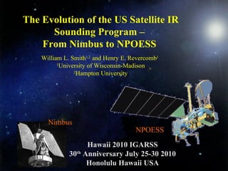
  • 1. Hawaii 2010 IGARSS 30 th Anniversary July 25-30 2010 Honolulu Hawaii USA Nimbus The Evolution of the US Satellite IR Sounding Program – From Nimbus to NPOESS William L. Smith 1,2 and Henry E. Revercomb 1 1 University of Wisconsin-Madison 2 Hampton University NPOESS
  • 2. -Part 1- Evolution of Radiance Measurements for IR Sounding: Might detect a bit of a WI perspective, but what do you expect?
  • 3.
  • 4.
  • 5. The 1 st Sounders (1969) were Spectrometers IR Interferometer Spectrometer ( IRIS B , Rudolf Hanel) Satellite IR Spectrometer ( SIRS A , David Wark) on Nimbus 3 & 4 IRIS Spectrum with SIRS Channels
  • 6.
  • 7. Temperature & Water Vapor IR Sounders (Operational or Pre-op Demos) VAS (1980-) –1 st Geo Sounder (Spin-Scan) GIFTS (2015?) (30) (1200) IRT-MTG (2017)… ITPR,VTPR (1972) / HIRS (1978-) IASI / CrIS (2006- / 2011) AIRS (2002-) IRIS / SIRS (1969-70) –1 st Sounders (1200) (2800/1200) GOES Sounder (1994-) – (3-Axis) (1200) (150-300) (30) (30) Spectral Resolving Power (  /   )  Resolving Power @ 14  m Purple = Leo Blue = Geo
  • 8. Temperature & Water Vapor IR Sounder (Operational or Pre-op Demos) VAS (1980-) –1 st Geo Sounder (Spin-Scan) GIFTS (2015?) (7-14) (<10) IRT-MTG (2017)… ITPR,VTPR (1972) / HIRS (1978-) IASI / CrIS (2006- / 2011) AIRS (2002-) IRIS / SIRS (1969-70) –1 st Sounders (14) (12/14) GOES Sounder (1994-) – (3-Axis)  (4) (160-100/230) nadir only (15/30/20-10) (8)  Spatial Footprint (km) Purple = Leo Blue = Geo
  • 9.
  • 10.
  • 11. Aircraft & Ground-based Instruments : Development of 1. S/C Instruments 2. RT Model 3. Algorithms 4. Validation VAS (1980-) ARM AERI (1993-) GIFTS (2015?) (30) (1400) (1200) IRS-MTG (2017) ITPR/VTPR (1972) , HIRS (1978-) IASI/CrIS (2006- / 2011) AIRS (2002-) HIS (1986-1998) IRIS, SIRS (1969-70) (1200) (2800/1200) GOES Sounder (1994-) S-HIS/NAST-I (1998-) (1200) (150 -300) (2000) (30) (1400/2800) (30) (  /   )  Resolving Power @ 14  m 20 yrs 20 yrs
  • 12. HIS Aircraft Instrument (1983-1998) U2 Shadowed in background, 1985 Dynamically Aligned Interferometer, Henry Buijs, Bomem
  • 13.
  • 14. UW Scanning HIS (1996-present) Ambient Blackbody Hot Blackbody Scene Mirror Motor Interferometer & Optics Electronics Data Storage Computer Longwave Midwave Shortwave CO N 2 O H 2 O N 2 O CH 4 CO 2 O 3 CO 2
  • 15. Scanning-HIS Radiometric Calibration 3-sigma Error Budget 21 November 2002 on ER2, T ABB = 260K, T HBB = 310K LW SW MW 0.2 K 200K Scene T b 300K Wavenumber (cm -1 ) Tb Error, 3-sigma (K) 0 1
  • 16. NIST TXR S-HIS AERI BB January 2007, testing at UW/SSEC S-HIS / TXR Side-by-side radiance intercomparison shows agreement within 60 mK (3  ) at 10µ. Mean = -22 mK Mean = -60 mK ±90 mK TXR 10 µ Channel NIST TXR Validates S-HIS Radiances TXR is the NIST Thermal-infrared Transfer Radiometer chamber AERI blackbody TXR Ch1 TXR Ch2 Scanning-HIS spectra
  • 17. AERI Cavity Blackbody (  > 0.999) (Aero-glaze Z306) Cavity Shape from UW Pioneer Venus / Sydnor, JPL, 1970 High emissivity coupled with T accuracy & stability from ultra stable thermistors and careful calibration are key to high accuracy of AERI Best et al., Calcon, 2003; Knuteson et al., J. Atm, & Oceanic Tech., 2004 [YSI 46041]
  • 18. AIRS 4 May 2002 Launch AIRS 14 June 2002 Calculated NASA Aqua
  • 19.
  • 20. High Accuracy IR Radiances-CLARREO IASI on Metop 19 October 2006 launch - full cross-track scan - 2x2 12 km pixels sample 50x50 km
  • 21. Spectral Coverage of GIFTS/IRS/HES* Compared to IASI , CrIS , AIRS , S-HIS & NAST-I Advanced GEO Sounders *HES option wavenumber IASI L1C Deapodized 1cm MaxOPD AIRS CrIS S-HIS NAST-I Gaussian Apodization AIRS CrIS
  • 22. Joint Airborne IASI Validation Expt (JAIVEx) 4/19/2007 SGP ARM Tobin wavenumber Excellent agreement with Scanning HIS and NAST-I on NASA WB57 IASI, NAST-I , S-HIS Mean spectra BT (K) Diff (K) IASI minus NAST-I , IASI minus SHIS 0.09 K 0.16 K 0.07 K 0.12 K
  • 23. Joint Airborne IASI Validation Expt (JAIVEx) 4/19/2007 SGP ARM Tobin Excellent agreement with Scanning HIS and NAST-I on NASA WB57 wavenumber IASI, NAST-I , S-HIS Mean spectra BT (K) Diff (K) IASI minus NAST-I , IASI minus SHIS 0.12 K 0.20 K 0.04 K 0.03 K -0.19 K -0.08 K
  • 24. IASI / AIRS Direct Comparisons May 2007-Jan 2008 Dave Tobin Excellent agreement, but issues > 0.1K remain wavenumber NORTHERN SNOs (73.8N) SOUTHERN SNOs (73.8S) Sample SNO Spectra }  0.1K }  0.1K’’
  • 25.
  • 26. Cross-track Infrared Sounder (CrIS) for NPP/JPSS Mass: < 146 kg Power (Avg): < 110 W Data Rate: <1.5 Mbps from Williams, Glumb and Predina, ITT, August 2005 SPIE Current Generation HIRS (20 ch) Next Generation CrIS (1307 ch)
  • 27. Noise : NEN Comparison with AIRS ( AIRS , CrIS random, CrIS Spec ) AIRS for 250K scene, CrIS for 303 K ( SW NENs similar for 300K scene ) CrIS NEN 4x smaller in 15  m CO 2
  • 28. CrIS Expected On-orbit Accuracy Will be <0.2 K 3-sigma for all Scene T’s! 3-sigma Brightness Temperature Accuracy (color coded for each of 9 FOVs)
  • 29.
  • 30.
  • 31. Technology Developments for the CLARREO Benchmark Climate Mission High Performance FTS Spectral line shape from laser source A New Class of Advanced Accuracy Satellite Instrumentation (AASI) for the CLARREO Mission NASA IIP TEMPERATURE referenced to multiple phase change signatures Pulse-tube detector cooler OARS: Standard for On-orbit Calibration Traceability
  • 32. f October 1959 - October 2009
  • 33.
  • 34. Hawaii 2010 IGARSS 30 th Anniversary July 25-30 2010 Honolulu Hawaii USA Nimbus The Evolution of the US Satellite IR Sounding Program – Part 2 Evolution of Sounding Retrieval Capability William L. Smith 1,2 and Henry E. Revercomb 1 1 University of Wisconsin-Madison 2 Hampton University NPOESS
  • 35. -Part 2- Evolution of IR Sounding Retrieval Capability: Physical Concept IRIS Spectrum with SIRS Channels Nimbus
  • 36. -Part 2- Evolution of IR Sounding Retrieval Capability: Physical Concept
  • 37. -Part 2- Evolution of IR Sounding Retrieval Capability: First Satellite Sounding Wark & Fleming SIRS data started being used by the US Weather Bureau (NMC) in the final analysis used to initialize extended range Numerical Weather Forecasts on May 22,1969, less than 6 weeks after the launch of Nimbus 3. First Satellite Sounding Kingston, Jamaica April 14, 1969 Nimbus
  • 38. First Numerical Weather Prediction Validation Using Satellite Infrared Sounding Data (SIRS-A) Nimbus
  • 39. Nimbus 3-day forecast errors over the western US reduced by 50% using Nimbus sounding data over the mid-Pacific in the initial analysis Shortwave ridge predicted with the use of Nimbus soundings in the initial analysis
  • 40. The problem with Nimbus -3 and Nimbus-4 Temperature Profiles was that >95 % of SIRS and IRIS Sounding Fields of View ( 150 km IFOV) contained cloud which greatly compromised the accuracy of the derived soundings -Part 2- Evolution of IR Sounding Retrieval Capability (1969-1971): Clear Vs Cloudy
  • 41. -Part 2- Evolution of IR Sounding Retrieval Capability (1972-2014): High Horizontal Resolution TIROS-N NOAA TIROS/NOAA HIRS (TOVS) Temperature Profile Errors TOVS (HIRS/MSU) Weighting Functions and RMS Differences with Raobs (+/- 3 Hrs and 200 km) during the GWE ITPR/HIRS HIRS The high horizontal resolution (~ 20 km) filter radiometer sounders (ITPR, VTPR, and HIRS) provided soundings for partially clouded FOV with almost the same accuracy as obtained for clear sky FOVs Nimbus
  • 42. -Part 2- Evolution of IR Sounding Retrieval Capability (1979 - ): Improved Global NWP ITPR Percent Correlation of Forecast Vs Observed Year By 2001 A SH forecast was as good as a NH forecast and a 6-day SH forecast was as good as a 3-day forecast made at the beginning of the GWE (1979) HIRS TIROS-N NOAA
  • 43. -Part 2- Evolution of IR Sounding Retrieval Capability (1979-2002): Poor Vertical Resolution ITPR The Problem With the TOVS was Lack of Vertical Resolution
  • 44. -Part 2- Evolution of IR Sounding Retrieval Capability (1985 - ): Ultra-spectral Resolution ITPR • Broad Spectral Coverage • High Spectral Resolution • Thousands of Spectral Channels • High Information Content A/C HIS, NAST-I & S-HIS (1985, 1998 -, 1999- ) IASI (2006)
  • 45. -Part 2- Evolution of IR Sounding Retrieval Capability (1985 - ): High Vertical Resolution ITPR High Vertical Resolution a result of sharper weighting functions and much higher S/N from very large number of radiance observations (1000’s Vs 10’s)
  • 46. -Part 2- Evolution of IR Sounding Retrieval Capability (1985 - ): Profile Information Content ITPR Number of Pieces of Information Radiosondes AIRS/IASI/CrIS HIRS/TOVS
  • 47. -Part 2- Evolution of IR Sounding Retrieval Capability (1986 - ): High Vertical Resolution Soundings Demonstrated With Aircraft HIS & NAST-I ITPR Ultra-spectral resolution sounder provides 1 K / 15% temperature and moisture accuracy for 1-2 km layers 300 Distance (75 km) Altitude (km) Radiosonde NASA ER-2 A/C Ultraspectral Sounder
  • 48. -Part 2- Evolution of IR Sounding Retrieval Capability (2002 - ): EOS Aqua AIRS Provides Large Positive Impact on Global Weather Forecasts Impact is amazingly considering only 1% of the radiance measurements were used in the assimilation process (clear-only, spatially and spectrally thinned) (J. LeMarshall, 2004) 1-27 January, 2004 Northern Hemisphere ) Southern Hemisphere )
  • 49. Joint Polar Satellite System (JPSS) N ATIONAL P OLAR-ORBITING O PERATIONAL E NVIRONMENTAL S ATELLITE S YSTEM NPP/JPSS LTAN 1330 “ Early-Afternoon” METOP LTDN 0930 “ Mid-Morning” Launches Lifetime Atmospheric Sounders METOP [2130] ~2006, 2012, 2018 7 yr IASI/AMSU/MHS NPP/JPSS [1330] ~ 2011, 2014 7 yr CrIS/ATMS
  • 50. ITPR -Part 2- Evolution of IR Sounding Retrieval Capability (2006 - ): JPSS IASI Validation (4/19/2007)
  • 51. ITPR -Part 2- Evolution of IR Sounding Retrieval Capability (2012 - ): JPSS Time Change Capability April 29 2007 IASI and AIRS data used to demonstrate IASI/CrIS Diurnal Change Measurement Capability
  • 52.
  • 53.

Notas do Editor

  1. This is just a few pictures of AIRS. The one on the top left is of AIRS just prior to integration onto the Aqua sensor suite. AIRS is a grating spectrometer. The one on the right is the Aqua sensor suite at TRW undergoing a “shake” test. The one on the bottom left is a sample simulated spectrum. X-axis is in wavenumbers. The spectral resolving power (delta v over v) is 1200.
  2. Although the agreement between AIRS and IASI observed radiances is very good on one level, the SNO comparisons reported here reveal some fundamental measurement differences which can potentially impact both weather and climate applications. Specific findings include: The comparisons show no significant long term (8 months) trends versus time. Significant differences, on the order of 500 mK, are observed between the longwave differences from the northern to southern latitude SNOs, particularly for AIRS detector array M-12 (649-681 cm -1 ). Further analyses and comparisons with L. Strow’s spectral shift analyses suggests that these differences are due primarily to orbital variations of the AIRS spectral centroids, which is not included in production of the AIRS L1B product. SNO comparisons with IASI should be performed again after production of the AIRS L1C climate products, which are expected to include knowledge of these spectral shift variations. AIRS A-B state related differences are observed within some detector arrays, most notably within array M-08 (851-903 cm -1 ) with differences of approximately 400 mK between A-side only and B-side only channels. For upper level water vapor channels, mean differences on the order of 200 mK are observed for AIRS detector arrays M-04a (1541-1623 cm -1 ) and M-04b (1460-1527 cm -1 ), while the mean differences for neighboring arrays are approximately zero, suggesting that these differences are due, at least partially, to AIRS. IASI shortwave channels are very noisy for the very cold southern latitude SNOs. Optimal random noise filtering and/or wavenumber averaging should be used to improve the comparisons for these cases.
  3. IASI and AIRS temporal variation is verified with NAST-I. Subtle field evolution characteristics (IASI-&gt;AIRS) confirmed by NAST-I.