SlideShare uma empresa Scribd logo
1 de 25
Operation IceBridge: using instrumented aircraft to bridge the observational gap between ICESat and ICESat-2
New Suborbital Mission: Operation IceBridge
[object Object],[object Object],[object Object],[object Object]
successful collaboration of  several NASA centers run out of Goddard University Partners: University of Kansas (CReSIS) Columbia University (LDEO)
  IceBridge exploits airborne platforms when making altimetry measurements to make other critical measurements to understanding change in polar ice sheets: most comprehensive  and sophisticated suite of instruments ever flown in polar regions Instrument Operator Measurement Type ATM NASA – WFF ice surface (1,500 ft AGL) laser altimeters LVIS  NASA – GSFC ice surface (35,000 ft AGL) DMS NASA – ARC digital photography MCoRDS KU CReSIS bedrock elevation radars for snow and ice thickness snow radar KU CReSIS snow thickness Ku-band radar KU CReSIS ice surface elevation accumulation radar KU CReSIS near-surface layers gravimeter SGL/ LDEO water depth, geoid onboard data NSERC aux. data: temperature, etc.
[object Object],[object Object]
 
2012 – 2015: start deploying Global Hawk over Antarctica in addition to NASA campaigns: smaller, university-led campaigns in Alaska and East Antarctica with DHC-3 and DC-3s two campaigns per year to monitor temporal and spatial changes Arctic (Mar-Apr) Antarctica (Oct-Nov) P-3B:  Greenland and  Arctic Ocean DC-8: Antarctic Peninsula and West Antarctica
Total: 143 days of deployment 69 science missions 581 flight hours 350,000 km (8.6 times around the Earth) Greenland 2010 Antarctica 2009 Greenland 2009 Greenland 2010 Antarctica 2010 Jan 2009 Jan 2011 Jan 2010 Jul 2009 Jul 2010 P-3 DC-8 P-3 DC-8 planned DC-8
Antarctica 2009 Greenland/Arctic Ocean 2010 flight lines follow ICESat tracks and provide detailed mapping of critical areas
 
 
Examples of cross calibration between IceBridge and ICESat and CryoSat-2 ,[object Object],[object Object],[object Object]
DC-8 over flight April 14, 2010  IceBridge DC-8 flying above GPS sled both measuring surface elevation Scientist measuring accumulation stacks along ICESat Track 412
Linking ICESat, CryoSat-2 and ICESat-2 with Operation IceBridge data flown at both, 35,000 ft AGL and at 1,500 ft AGL ,[object Object],[object Object],[object Object],[object Object],[object Object],[object Object],[object Object],[object Object]
IceBridge “pole hole” flight: 7 years of ICESat observations differenced with LVIS:  ~500,000 data points South Pole 86°S Credit : LVIS Team
This data calibrates ICESat data over the ice sheet, improving and extending the ICESat time series Uncertainties in ICESat determined dh/dt on the order of one-third to several times the GIS and AIS mass balance signal LVIS pole hole flight ICESat (Arctic Ocean) ICESat range bias determined from Credit: Michelle Hofton and Scott Luthcke
[object Object],[object Object],[object Object],[object Object]
ice surface velocity red = fast – blue = slow Pine Island Glacier is considered to have the greatest propensity to cause rapid sea level rise due to the massive volumes of ice that could be released rapid bottom melting near grounding line of up to 80 m/yr, potentially unstable situation sub-ice cavity geometry is needed to modeling of ice shelf decay, considered the greatest unknown in modeling of future sea level rise.
Altimeter  measurements along ICESat tracks and ATM flight lines ,[object Object],[object Object],[object Object],[object Object]
ICESat tracks ATM flight tracks 2009 ATM – 2003 ICESat 2009 ATM – 2003 ATM Ice surface velocity:  red = fast – blue = slow IceBridge ATM laser altimeter data 100 km
Right: the deep channel (blue) mapped by IceBridge is a new discovery.  The channel lies about 1 km below sea level, and provides a path for the above-freezing sea water to reach the glacier front.  Data is critical for ocean/ice sheet models to predict dynamic response of Pine Island Glacier to warming ocean waters. water depth beneath floating glacier:  blue = deep – red = shallow
Tweets: “ International collaboration lead to numerous "firsts" during the April 20 sea ice flight” “ DC-8 ... the depth sounder instrument is telling us that we're flying over 1.2 km of ice right now.” ,[object Object],[object Object],[object Object],[object Object],[object Object]
[object Object],[object Object],[object Object],[object Object],Summary
[object Object],[object Object],[object Object],[object Object],[object Object],[object Object],[object Object]

Mais conteúdo relacionado

Mais procurados

Geocap seismic oil and gas for ArcGIS- Oil and Gas seminar October 10th
Geocap seismic oil and gas for ArcGIS- Oil and Gas seminar October 10thGeocap seismic oil and gas for ArcGIS- Oil and Gas seminar October 10th
Geocap seismic oil and gas for ArcGIS- Oil and Gas seminar October 10thGeodata AS
 
Gps mobile based human position(2)
Gps mobile based human position(2)Gps mobile based human position(2)
Gps mobile based human position(2)_fahad_shaikh
 
Petroleum lunch seminar 30.10.2014
Petroleum lunch seminar 30.10.2014Petroleum lunch seminar 30.10.2014
Petroleum lunch seminar 30.10.2014Geodata AS
 
GEO Grid災害タスクフォース 〜東日本大震災における活動〜 GIS学会2011
GEO Grid災害タスクフォース 〜東日本大震災における活動〜 GIS学会2011GEO Grid災害タスクフォース 〜東日本大震災における活動〜 GIS学会2011
GEO Grid災害タスクフォース 〜東日本大震災における活動〜 GIS学会2011Naotaka YAMAMOTO CHIKASADA
 
Biancamaria_etal_IGARSS2011_22Jul2011.ppt
Biancamaria_etal_IGARSS2011_22Jul2011.pptBiancamaria_etal_IGARSS2011_22Jul2011.ppt
Biancamaria_etal_IGARSS2011_22Jul2011.pptgrssieee
 
WE2.L09 - DESDYNI LIDAR FOR SOLID EARTH APPLICATIONS
WE2.L09 - DESDYNI LIDAR FOR SOLID EARTH APPLICATIONSWE2.L09 - DESDYNI LIDAR FOR SOLID EARTH APPLICATIONS
WE2.L09 - DESDYNI LIDAR FOR SOLID EARTH APPLICATIONSgrssieee
 
Glacial Lake Mapping with Very High Resolution Space-borne SAR
Glacial Lake Mapping with Very High Resolution Space-borne SARGlacial Lake Mapping with Very High Resolution Space-borne SAR
Glacial Lake Mapping with Very High Resolution Space-borne SARGlobal Risk Forum GRFDavos
 
IUKWC Workshop Nov16: Developing Hydro-climatic Services for Water Security –...
IUKWC Workshop Nov16: Developing Hydro-climatic Services for Water Security –...IUKWC Workshop Nov16: Developing Hydro-climatic Services for Water Security –...
IUKWC Workshop Nov16: Developing Hydro-climatic Services for Water Security –...India UK Water Centre (IUKWC)
 
Scale-dependency and Sensitivity of Hydrological Estimations to Land Use and ...
Scale-dependency and Sensitivity of Hydrological Estimations to Land Use and ...Scale-dependency and Sensitivity of Hydrological Estimations to Land Use and ...
Scale-dependency and Sensitivity of Hydrological Estimations to Land Use and ...Beniamino Murgante
 
Comparison of satellite imagery based ice drift with wind model for the Caspi...
Comparison of satellite imagery based ice drift with wind model for the Caspi...Comparison of satellite imagery based ice drift with wind model for the Caspi...
Comparison of satellite imagery based ice drift with wind model for the Caspi...Sergey Vernyayev
 
Master's course defense presentation in Water Resource Management and GIS
Master's course defense presentation in Water Resource Management and GIS  Master's course defense presentation in Water Resource Management and GIS
Master's course defense presentation in Water Resource Management and GIS Tooryalay Ayoubi
 
WE2.L09 - Integrated SAR and lidar observations of the sea ice cover: Resolvi...
WE2.L09 - Integrated SAR and lidar observations of the sea ice cover: Resolvi...WE2.L09 - Integrated SAR and lidar observations of the sea ice cover: Resolvi...
WE2.L09 - Integrated SAR and lidar observations of the sea ice cover: Resolvi...grssieee
 
Drinkwater ice sheet symposium - tu delft climate inst., 17 oct 2013(1)
Drinkwater  ice sheet symposium - tu delft climate inst., 17 oct 2013(1)Drinkwater  ice sheet symposium - tu delft climate inst., 17 oct 2013(1)
Drinkwater ice sheet symposium - tu delft climate inst., 17 oct 2013(1)TU Delft Climate Institute
 
Simulated versus Satellite Retrieval Distribution Patterns of the Snow Water ...
Simulated versus Satellite Retrieval Distribution Patterns of the Snow Water ...Simulated versus Satellite Retrieval Distribution Patterns of the Snow Water ...
Simulated versus Satellite Retrieval Distribution Patterns of the Snow Water ...Agriculture Journal IJOEAR
 
Overview of Intercalibration of Satellite Instruments
Overview of Intercalibration of Satellite InstrumentsOverview of Intercalibration of Satellite Instruments
Overview of Intercalibration of Satellite InstrumentsRahul Krishnan
 

Mais procurados (20)

Geocap seismic oil and gas for ArcGIS- Oil and Gas seminar October 10th
Geocap seismic oil and gas for ArcGIS- Oil and Gas seminar October 10thGeocap seismic oil and gas for ArcGIS- Oil and Gas seminar October 10th
Geocap seismic oil and gas for ArcGIS- Oil and Gas seminar October 10th
 
Gps mobile based human position(2)
Gps mobile based human position(2)Gps mobile based human position(2)
Gps mobile based human position(2)
 
Petroleum lunch seminar 30.10.2014
Petroleum lunch seminar 30.10.2014Petroleum lunch seminar 30.10.2014
Petroleum lunch seminar 30.10.2014
 
STEM poster 2016
STEM poster  2016STEM poster  2016
STEM poster 2016
 
GEO Grid災害タスクフォース 〜東日本大震災における活動〜 GIS学会2011
GEO Grid災害タスクフォース 〜東日本大震災における活動〜 GIS学会2011GEO Grid災害タスクフォース 〜東日本大震災における活動〜 GIS学会2011
GEO Grid災害タスクフォース 〜東日本大震災における活動〜 GIS学会2011
 
Biancamaria_etal_IGARSS2011_22Jul2011.ppt
Biancamaria_etal_IGARSS2011_22Jul2011.pptBiancamaria_etal_IGARSS2011_22Jul2011.ppt
Biancamaria_etal_IGARSS2011_22Jul2011.ppt
 
WE2.L09 - DESDYNI LIDAR FOR SOLID EARTH APPLICATIONS
WE2.L09 - DESDYNI LIDAR FOR SOLID EARTH APPLICATIONSWE2.L09 - DESDYNI LIDAR FOR SOLID EARTH APPLICATIONS
WE2.L09 - DESDYNI LIDAR FOR SOLID EARTH APPLICATIONS
 
Glacial Lake Mapping with Very High Resolution Space-borne SAR
Glacial Lake Mapping with Very High Resolution Space-borne SARGlacial Lake Mapping with Very High Resolution Space-borne SAR
Glacial Lake Mapping with Very High Resolution Space-borne SAR
 
IUKWC Workshop Nov16: Developing Hydro-climatic Services for Water Security –...
IUKWC Workshop Nov16: Developing Hydro-climatic Services for Water Security –...IUKWC Workshop Nov16: Developing Hydro-climatic Services for Water Security –...
IUKWC Workshop Nov16: Developing Hydro-climatic Services for Water Security –...
 
Scale-dependency and Sensitivity of Hydrological Estimations to Land Use and ...
Scale-dependency and Sensitivity of Hydrological Estimations to Land Use and ...Scale-dependency and Sensitivity of Hydrological Estimations to Land Use and ...
Scale-dependency and Sensitivity of Hydrological Estimations to Land Use and ...
 
Comparison of satellite imagery based ice drift with wind model for the Caspi...
Comparison of satellite imagery based ice drift with wind model for the Caspi...Comparison of satellite imagery based ice drift with wind model for the Caspi...
Comparison of satellite imagery based ice drift with wind model for the Caspi...
 
CUPC2015Poster
CUPC2015PosterCUPC2015Poster
CUPC2015Poster
 
Master's course defense presentation in Water Resource Management and GIS
Master's course defense presentation in Water Resource Management and GIS  Master's course defense presentation in Water Resource Management and GIS
Master's course defense presentation in Water Resource Management and GIS
 
GPS surveying/DIGITAL SURVEYING
GPS  surveying/DIGITAL SURVEYINGGPS  surveying/DIGITAL SURVEYING
GPS surveying/DIGITAL SURVEYING
 
IVC Poster
IVC PosterIVC Poster
IVC Poster
 
WE2.L09 - Integrated SAR and lidar observations of the sea ice cover: Resolvi...
WE2.L09 - Integrated SAR and lidar observations of the sea ice cover: Resolvi...WE2.L09 - Integrated SAR and lidar observations of the sea ice cover: Resolvi...
WE2.L09 - Integrated SAR and lidar observations of the sea ice cover: Resolvi...
 
Drinkwater ice sheet symposium - tu delft climate inst., 17 oct 2013(1)
Drinkwater  ice sheet symposium - tu delft climate inst., 17 oct 2013(1)Drinkwater  ice sheet symposium - tu delft climate inst., 17 oct 2013(1)
Drinkwater ice sheet symposium - tu delft climate inst., 17 oct 2013(1)
 
Simulated versus Satellite Retrieval Distribution Patterns of the Snow Water ...
Simulated versus Satellite Retrieval Distribution Patterns of the Snow Water ...Simulated versus Satellite Retrieval Distribution Patterns of the Snow Water ...
Simulated versus Satellite Retrieval Distribution Patterns of the Snow Water ...
 
Trial and error in determining carbon budgets at policy relevant scales
Trial and error in determining carbon budgets at policy relevant scalesTrial and error in determining carbon budgets at policy relevant scales
Trial and error in determining carbon budgets at policy relevant scales
 
Overview of Intercalibration of Satellite Instruments
Overview of Intercalibration of Satellite InstrumentsOverview of Intercalibration of Satellite Instruments
Overview of Intercalibration of Satellite Instruments
 

Destaque

Radar traffic control
Radar traffic control Radar traffic control
Radar traffic control Ahmed Salah
 
Air Traffic Control Center
Air Traffic Control CenterAir Traffic Control Center
Air Traffic Control CenterEmmanuel Fuchs
 
Air traffic control & air navigation
Air traffic control & air navigationAir traffic control & air navigation
Air traffic control & air navigationKelvin Lam
 
Great Executive Summaries
Great Executive SummariesGreat Executive Summaries
Great Executive SummariesAndy Forbes
 

Destaque (8)

Radar traffic control
Radar traffic control Radar traffic control
Radar traffic control
 
Technical skills
Technical skills   Technical skills
Technical skills
 
Atm reconciliation manual
Atm reconciliation manualAtm reconciliation manual
Atm reconciliation manual
 
Air Traffic Control Center
Air Traffic Control CenterAir Traffic Control Center
Air Traffic Control Center
 
ATM monitoring
ATM monitoringATM monitoring
ATM monitoring
 
ATC
ATCATC
ATC
 
Air traffic control & air navigation
Air traffic control & air navigationAir traffic control & air navigation
Air traffic control & air navigation
 
Great Executive Summaries
Great Executive SummariesGreat Executive Summaries
Great Executive Summaries
 

Semelhante a WE2.L10.4: OPERATION ICEBRIDGE: USING INSTRUMENTED AIRCRAFT TO BRIDGE THE OBSERVATIONAL GAP BETWEEN ICESAT AND ICESAT-2

Applications of remote sensing in glaciology
Applications of remote sensing in glaciologyApplications of remote sensing in glaciology
Applications of remote sensing in glaciologyAmenu
 
Application of Satellite Geodesy in Environmental and Climate Changes
Application of Satellite Geodesy in Environmental and Climate ChangesApplication of Satellite Geodesy in Environmental and Climate Changes
Application of Satellite Geodesy in Environmental and Climate ChangesAlok Verma
 
Computer Vision in Geosciences
Computer Vision in GeosciencesComputer Vision in Geosciences
Computer Vision in GeosciencesPavel Golubev
 
igarss11swot-vadon-callahan-psc-s3.110725.pptx
igarss11swot-vadon-callahan-psc-s3.110725.pptxigarss11swot-vadon-callahan-psc-s3.110725.pptx
igarss11swot-vadon-callahan-psc-s3.110725.pptxgrssieee
 
IGARSS11_DESDynI_V2.pptx
IGARSS11_DESDynI_V2.pptxIGARSS11_DESDynI_V2.pptx
IGARSS11_DESDynI_V2.pptxgrssieee
 
Describe and explain satellite remote sensing mission for monitoring.pdf
Describe and explain satellite remote sensing mission for monitoring.pdfDescribe and explain satellite remote sensing mission for monitoring.pdf
Describe and explain satellite remote sensing mission for monitoring.pdfalshaikhkhanzariarts
 
MOSAiC – The International Arctic Drift Expedition
MOSAiC – The International  Arctic Drift ExpeditionMOSAiC – The International  Arctic Drift Expedition
MOSAiC – The International Arctic Drift ExpeditionAdvanced-Concepts-Team
 
NISAR NASA-ISRO Synthetic Aperture Radar (NISAR) Ice Sheets, Glaciers, and Oc...
NISAR NASA-ISRO Synthetic Aperture Radar (NISAR) Ice Sheets, Glaciers, and Oc...NISAR NASA-ISRO Synthetic Aperture Radar (NISAR) Ice Sheets, Glaciers, and Oc...
NISAR NASA-ISRO Synthetic Aperture Radar (NISAR) Ice Sheets, Glaciers, and Oc...Dr. Pankaj Dhussa
 
TU2.L10 - THE AQUARIUS/SAC-D MISSION OVERVIEW
TU2.L10 - THE AQUARIUS/SAC-D MISSION OVERVIEWTU2.L10 - THE AQUARIUS/SAC-D MISSION OVERVIEW
TU2.L10 - THE AQUARIUS/SAC-D MISSION OVERVIEWgrssieee
 
Understanding Artic Climate Evolution
Understanding Artic Climate Evolution Understanding Artic Climate Evolution
Understanding Artic Climate Evolution UmassGeo
 
Trends and regional variability of observed Arctic sea-ice thickness
Trends and regional variability of observed Arctic sea-ice thicknessTrends and regional variability of observed Arctic sea-ice thickness
Trends and regional variability of observed Arctic sea-ice thicknessZachary Labe
 
Saildrone Antarctica Mission
Saildrone Antarctica MissionSaildrone Antarctica Mission
Saildrone Antarctica MissionMatthieu LIENART
 
mars_ice_drilling_assessment_v6_for_public_release.pdf
mars_ice_drilling_assessment_v6_for_public_release.pdfmars_ice_drilling_assessment_v6_for_public_release.pdf
mars_ice_drilling_assessment_v6_for_public_release.pdfssuser7178bf1
 
Monitoring Changes in Antarctic Sea Ice Phenology: 1990-2015
Monitoring Changes in Antarctic Sea Ice Phenology: 1990-2015Monitoring Changes in Antarctic Sea Ice Phenology: 1990-2015
Monitoring Changes in Antarctic Sea Ice Phenology: 1990-2015priscillaahn
 
Grace satellite technology
Grace satellite technologyGrace satellite technology
Grace satellite technologydzbsjk
 

Semelhante a WE2.L10.4: OPERATION ICEBRIDGE: USING INSTRUMENTED AIRCRAFT TO BRIDGE THE OBSERVATIONAL GAP BETWEEN ICESAT AND ICESAT-2 (20)

afternoon2.pdf
afternoon2.pdfafternoon2.pdf
afternoon2.pdf
 
afternoon2.pdf
afternoon2.pdfafternoon2.pdf
afternoon2.pdf
 
Applications of remote sensing in glaciology
Applications of remote sensing in glaciologyApplications of remote sensing in glaciology
Applications of remote sensing in glaciology
 
Application of Satellite Geodesy in Environmental and Climate Changes
Application of Satellite Geodesy in Environmental and Climate ChangesApplication of Satellite Geodesy in Environmental and Climate Changes
Application of Satellite Geodesy in Environmental and Climate Changes
 
SUR-WIND Final Paper
SUR-WIND Final PaperSUR-WIND Final Paper
SUR-WIND Final Paper
 
Computer Vision in Geosciences
Computer Vision in GeosciencesComputer Vision in Geosciences
Computer Vision in Geosciences
 
igarss11swot-vadon-callahan-psc-s3.110725.pptx
igarss11swot-vadon-callahan-psc-s3.110725.pptxigarss11swot-vadon-callahan-psc-s3.110725.pptx
igarss11swot-vadon-callahan-psc-s3.110725.pptx
 
IGARSS11_DESDynI_V2.pptx
IGARSS11_DESDynI_V2.pptxIGARSS11_DESDynI_V2.pptx
IGARSS11_DESDynI_V2.pptx
 
Describe and explain satellite remote sensing mission for monitoring.pdf
Describe and explain satellite remote sensing mission for monitoring.pdfDescribe and explain satellite remote sensing mission for monitoring.pdf
Describe and explain satellite remote sensing mission for monitoring.pdf
 
MOSAiC – The International Arctic Drift Expedition
MOSAiC – The International  Arctic Drift ExpeditionMOSAiC – The International  Arctic Drift Expedition
MOSAiC – The International Arctic Drift Expedition
 
NISAR NASA-ISRO Synthetic Aperture Radar (NISAR) Ice Sheets, Glaciers, and Oc...
NISAR NASA-ISRO Synthetic Aperture Radar (NISAR) Ice Sheets, Glaciers, and Oc...NISAR NASA-ISRO Synthetic Aperture Radar (NISAR) Ice Sheets, Glaciers, and Oc...
NISAR NASA-ISRO Synthetic Aperture Radar (NISAR) Ice Sheets, Glaciers, and Oc...
 
Microwave remote sensing
Microwave remote sensingMicrowave remote sensing
Microwave remote sensing
 
TU2.L10 - THE AQUARIUS/SAC-D MISSION OVERVIEW
TU2.L10 - THE AQUARIUS/SAC-D MISSION OVERVIEWTU2.L10 - THE AQUARIUS/SAC-D MISSION OVERVIEW
TU2.L10 - THE AQUARIUS/SAC-D MISSION OVERVIEW
 
Understanding Artic Climate Evolution
Understanding Artic Climate Evolution Understanding Artic Climate Evolution
Understanding Artic Climate Evolution
 
GRACE.pptx
GRACE.pptxGRACE.pptx
GRACE.pptx
 
Trends and regional variability of observed Arctic sea-ice thickness
Trends and regional variability of observed Arctic sea-ice thicknessTrends and regional variability of observed Arctic sea-ice thickness
Trends and regional variability of observed Arctic sea-ice thickness
 
Saildrone Antarctica Mission
Saildrone Antarctica MissionSaildrone Antarctica Mission
Saildrone Antarctica Mission
 
mars_ice_drilling_assessment_v6_for_public_release.pdf
mars_ice_drilling_assessment_v6_for_public_release.pdfmars_ice_drilling_assessment_v6_for_public_release.pdf
mars_ice_drilling_assessment_v6_for_public_release.pdf
 
Monitoring Changes in Antarctic Sea Ice Phenology: 1990-2015
Monitoring Changes in Antarctic Sea Ice Phenology: 1990-2015Monitoring Changes in Antarctic Sea Ice Phenology: 1990-2015
Monitoring Changes in Antarctic Sea Ice Phenology: 1990-2015
 
Grace satellite technology
Grace satellite technologyGrace satellite technology
Grace satellite technology
 

Mais de grssieee

Tangent height accuracy of Superconducting Submillimeter-Wave Limb-Emission S...
Tangent height accuracy of Superconducting Submillimeter-Wave Limb-Emission S...Tangent height accuracy of Superconducting Submillimeter-Wave Limb-Emission S...
Tangent height accuracy of Superconducting Submillimeter-Wave Limb-Emission S...grssieee
 
SEGMENTATION OF POLARIMETRIC SAR DATA WITH A MULTI-TEXTURE PRODUCT MODEL
SEGMENTATION OF POLARIMETRIC SAR DATA WITH A MULTI-TEXTURE PRODUCT MODELSEGMENTATION OF POLARIMETRIC SAR DATA WITH A MULTI-TEXTURE PRODUCT MODEL
SEGMENTATION OF POLARIMETRIC SAR DATA WITH A MULTI-TEXTURE PRODUCT MODELgrssieee
 
TWO-POINT STATISTIC OF POLARIMETRIC SAR DATA TWO-POINT STATISTIC OF POLARIMET...
TWO-POINT STATISTIC OF POLARIMETRIC SAR DATA TWO-POINT STATISTIC OF POLARIMET...TWO-POINT STATISTIC OF POLARIMETRIC SAR DATA TWO-POINT STATISTIC OF POLARIMET...
TWO-POINT STATISTIC OF POLARIMETRIC SAR DATA TWO-POINT STATISTIC OF POLARIMET...grssieee
 
THE SENTINEL-1 MISSION AND ITS APPLICATION CAPABILITIES
THE SENTINEL-1 MISSION AND ITS APPLICATION CAPABILITIESTHE SENTINEL-1 MISSION AND ITS APPLICATION CAPABILITIES
THE SENTINEL-1 MISSION AND ITS APPLICATION CAPABILITIESgrssieee
 
GMES SPACE COMPONENT:PROGRAMMATIC STATUS
GMES SPACE COMPONENT:PROGRAMMATIC STATUSGMES SPACE COMPONENT:PROGRAMMATIC STATUS
GMES SPACE COMPONENT:PROGRAMMATIC STATUSgrssieee
 
PROGRESSES OF DEVELOPMENT OF CFOSAT SCATTEROMETER
PROGRESSES OF DEVELOPMENT OF CFOSAT SCATTEROMETERPROGRESSES OF DEVELOPMENT OF CFOSAT SCATTEROMETER
PROGRESSES OF DEVELOPMENT OF CFOSAT SCATTEROMETERgrssieee
 
DEVELOPMENT OF ALGORITHMS AND PRODUCTS FOR SUPPORTING THE ITALIAN HYPERSPECTR...
DEVELOPMENT OF ALGORITHMS AND PRODUCTS FOR SUPPORTING THE ITALIAN HYPERSPECTR...DEVELOPMENT OF ALGORITHMS AND PRODUCTS FOR SUPPORTING THE ITALIAN HYPERSPECTR...
DEVELOPMENT OF ALGORITHMS AND PRODUCTS FOR SUPPORTING THE ITALIAN HYPERSPECTR...grssieee
 
EO-1/HYPERION: NEARING TWELVE YEARS OF SUCCESSFUL MISSION SCIENCE OPERATION A...
EO-1/HYPERION: NEARING TWELVE YEARS OF SUCCESSFUL MISSION SCIENCE OPERATION A...EO-1/HYPERION: NEARING TWELVE YEARS OF SUCCESSFUL MISSION SCIENCE OPERATION A...
EO-1/HYPERION: NEARING TWELVE YEARS OF SUCCESSFUL MISSION SCIENCE OPERATION A...grssieee
 
test 34mb wo animations
test  34mb wo animationstest  34mb wo animations
test 34mb wo animationsgrssieee
 
2011_Fox_Tax_Worksheets.pdf
2011_Fox_Tax_Worksheets.pdf2011_Fox_Tax_Worksheets.pdf
2011_Fox_Tax_Worksheets.pdfgrssieee
 
DLR open house
DLR open houseDLR open house
DLR open housegrssieee
 
DLR open house
DLR open houseDLR open house
DLR open housegrssieee
 
DLR open house
DLR open houseDLR open house
DLR open housegrssieee
 
Tana_IGARSS2011.ppt
Tana_IGARSS2011.pptTana_IGARSS2011.ppt
Tana_IGARSS2011.pptgrssieee
 
Solaro_IGARSS_2011.ppt
Solaro_IGARSS_2011.pptSolaro_IGARSS_2011.ppt
Solaro_IGARSS_2011.pptgrssieee
 

Mais de grssieee (20)

Tangent height accuracy of Superconducting Submillimeter-Wave Limb-Emission S...
Tangent height accuracy of Superconducting Submillimeter-Wave Limb-Emission S...Tangent height accuracy of Superconducting Submillimeter-Wave Limb-Emission S...
Tangent height accuracy of Superconducting Submillimeter-Wave Limb-Emission S...
 
SEGMENTATION OF POLARIMETRIC SAR DATA WITH A MULTI-TEXTURE PRODUCT MODEL
SEGMENTATION OF POLARIMETRIC SAR DATA WITH A MULTI-TEXTURE PRODUCT MODELSEGMENTATION OF POLARIMETRIC SAR DATA WITH A MULTI-TEXTURE PRODUCT MODEL
SEGMENTATION OF POLARIMETRIC SAR DATA WITH A MULTI-TEXTURE PRODUCT MODEL
 
TWO-POINT STATISTIC OF POLARIMETRIC SAR DATA TWO-POINT STATISTIC OF POLARIMET...
TWO-POINT STATISTIC OF POLARIMETRIC SAR DATA TWO-POINT STATISTIC OF POLARIMET...TWO-POINT STATISTIC OF POLARIMETRIC SAR DATA TWO-POINT STATISTIC OF POLARIMET...
TWO-POINT STATISTIC OF POLARIMETRIC SAR DATA TWO-POINT STATISTIC OF POLARIMET...
 
THE SENTINEL-1 MISSION AND ITS APPLICATION CAPABILITIES
THE SENTINEL-1 MISSION AND ITS APPLICATION CAPABILITIESTHE SENTINEL-1 MISSION AND ITS APPLICATION CAPABILITIES
THE SENTINEL-1 MISSION AND ITS APPLICATION CAPABILITIES
 
GMES SPACE COMPONENT:PROGRAMMATIC STATUS
GMES SPACE COMPONENT:PROGRAMMATIC STATUSGMES SPACE COMPONENT:PROGRAMMATIC STATUS
GMES SPACE COMPONENT:PROGRAMMATIC STATUS
 
PROGRESSES OF DEVELOPMENT OF CFOSAT SCATTEROMETER
PROGRESSES OF DEVELOPMENT OF CFOSAT SCATTEROMETERPROGRESSES OF DEVELOPMENT OF CFOSAT SCATTEROMETER
PROGRESSES OF DEVELOPMENT OF CFOSAT SCATTEROMETER
 
DEVELOPMENT OF ALGORITHMS AND PRODUCTS FOR SUPPORTING THE ITALIAN HYPERSPECTR...
DEVELOPMENT OF ALGORITHMS AND PRODUCTS FOR SUPPORTING THE ITALIAN HYPERSPECTR...DEVELOPMENT OF ALGORITHMS AND PRODUCTS FOR SUPPORTING THE ITALIAN HYPERSPECTR...
DEVELOPMENT OF ALGORITHMS AND PRODUCTS FOR SUPPORTING THE ITALIAN HYPERSPECTR...
 
EO-1/HYPERION: NEARING TWELVE YEARS OF SUCCESSFUL MISSION SCIENCE OPERATION A...
EO-1/HYPERION: NEARING TWELVE YEARS OF SUCCESSFUL MISSION SCIENCE OPERATION A...EO-1/HYPERION: NEARING TWELVE YEARS OF SUCCESSFUL MISSION SCIENCE OPERATION A...
EO-1/HYPERION: NEARING TWELVE YEARS OF SUCCESSFUL MISSION SCIENCE OPERATION A...
 
EO-1/HYPERION: NEARING TWELVE YEARS OF SUCCESSFUL MISSION SCIENCE OPERATION A...
EO-1/HYPERION: NEARING TWELVE YEARS OF SUCCESSFUL MISSION SCIENCE OPERATION A...EO-1/HYPERION: NEARING TWELVE YEARS OF SUCCESSFUL MISSION SCIENCE OPERATION A...
EO-1/HYPERION: NEARING TWELVE YEARS OF SUCCESSFUL MISSION SCIENCE OPERATION A...
 
Test
TestTest
Test
 
test 34mb wo animations
test  34mb wo animationstest  34mb wo animations
test 34mb wo animations
 
Test 70MB
Test 70MBTest 70MB
Test 70MB
 
Test 70MB
Test 70MBTest 70MB
Test 70MB
 
2011_Fox_Tax_Worksheets.pdf
2011_Fox_Tax_Worksheets.pdf2011_Fox_Tax_Worksheets.pdf
2011_Fox_Tax_Worksheets.pdf
 
DLR open house
DLR open houseDLR open house
DLR open house
 
DLR open house
DLR open houseDLR open house
DLR open house
 
DLR open house
DLR open houseDLR open house
DLR open house
 
Tana_IGARSS2011.ppt
Tana_IGARSS2011.pptTana_IGARSS2011.ppt
Tana_IGARSS2011.ppt
 
Solaro_IGARSS_2011.ppt
Solaro_IGARSS_2011.pptSolaro_IGARSS_2011.ppt
Solaro_IGARSS_2011.ppt
 

WE2.L10.4: OPERATION ICEBRIDGE: USING INSTRUMENTED AIRCRAFT TO BRIDGE THE OBSERVATIONAL GAP BETWEEN ICESAT AND ICESAT-2

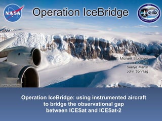
  • 1. Operation IceBridge: using instrumented aircraft to bridge the observational gap between ICESat and ICESat-2
  • 2. New Suborbital Mission: Operation IceBridge
  • 3.
  • 4. successful collaboration of several NASA centers run out of Goddard University Partners: University of Kansas (CReSIS) Columbia University (LDEO)
  • 5. IceBridge exploits airborne platforms when making altimetry measurements to make other critical measurements to understanding change in polar ice sheets: most comprehensive and sophisticated suite of instruments ever flown in polar regions Instrument Operator Measurement Type ATM NASA – WFF ice surface (1,500 ft AGL) laser altimeters LVIS NASA – GSFC ice surface (35,000 ft AGL) DMS NASA – ARC digital photography MCoRDS KU CReSIS bedrock elevation radars for snow and ice thickness snow radar KU CReSIS snow thickness Ku-band radar KU CReSIS ice surface elevation accumulation radar KU CReSIS near-surface layers gravimeter SGL/ LDEO water depth, geoid onboard data NSERC aux. data: temperature, etc.
  • 6.
  • 7.  
  • 8. 2012 – 2015: start deploying Global Hawk over Antarctica in addition to NASA campaigns: smaller, university-led campaigns in Alaska and East Antarctica with DHC-3 and DC-3s two campaigns per year to monitor temporal and spatial changes Arctic (Mar-Apr) Antarctica (Oct-Nov) P-3B: Greenland and Arctic Ocean DC-8: Antarctic Peninsula and West Antarctica
  • 9. Total: 143 days of deployment 69 science missions 581 flight hours 350,000 km (8.6 times around the Earth) Greenland 2010 Antarctica 2009 Greenland 2009 Greenland 2010 Antarctica 2010 Jan 2009 Jan 2011 Jan 2010 Jul 2009 Jul 2010 P-3 DC-8 P-3 DC-8 planned DC-8
  • 10. Antarctica 2009 Greenland/Arctic Ocean 2010 flight lines follow ICESat tracks and provide detailed mapping of critical areas
  • 11.  
  • 12.  
  • 13.
  • 14. DC-8 over flight April 14, 2010 IceBridge DC-8 flying above GPS sled both measuring surface elevation Scientist measuring accumulation stacks along ICESat Track 412
  • 15.
  • 16. IceBridge “pole hole” flight: 7 years of ICESat observations differenced with LVIS: ~500,000 data points South Pole 86°S Credit : LVIS Team
  • 17. This data calibrates ICESat data over the ice sheet, improving and extending the ICESat time series Uncertainties in ICESat determined dh/dt on the order of one-third to several times the GIS and AIS mass balance signal LVIS pole hole flight ICESat (Arctic Ocean) ICESat range bias determined from Credit: Michelle Hofton and Scott Luthcke
  • 18.
  • 19. ice surface velocity red = fast – blue = slow Pine Island Glacier is considered to have the greatest propensity to cause rapid sea level rise due to the massive volumes of ice that could be released rapid bottom melting near grounding line of up to 80 m/yr, potentially unstable situation sub-ice cavity geometry is needed to modeling of ice shelf decay, considered the greatest unknown in modeling of future sea level rise.
  • 20.
  • 21. ICESat tracks ATM flight tracks 2009 ATM – 2003 ICESat 2009 ATM – 2003 ATM Ice surface velocity: red = fast – blue = slow IceBridge ATM laser altimeter data 100 km
  • 22. Right: the deep channel (blue) mapped by IceBridge is a new discovery. The channel lies about 1 km below sea level, and provides a path for the above-freezing sea water to reach the glacier front. Data is critical for ocean/ice sheet models to predict dynamic response of Pine Island Glacier to warming ocean waters. water depth beneath floating glacier: blue = deep – red = shallow
  • 23.
  • 24.
  • 25.