
Recomendados
Mais conteúdo relacionado
Destaque
Semelhante a 7 2 Mexicali Quake April 2010
Semelhante a 7 2 Mexicali Quake April 2010 (20)
Mais de filerofish
Mais de filerofish (19)
Último
Último (20)
7 2 Mexicali Quake April 2010
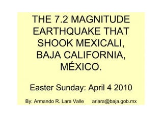
- 1. THE 7.2 MAGNITUDE EARTHQUAKE THAT SHOOK MEXICALI, BAJA CALIFORNIA, MÉXICO. Easter Sunday: April 4 2010 By: Armando R. Lara Valle arlara@baja.gob.mx
- 2. The Earthquake Stats • MAGNITUD: 7.2 Degrees on the Richter Scale. • DURATION: 89 seconds. • DATE: Sunday April 4, 2010 • TIME: 15: 40: 41 hours. • EPICENTRE: 31.128 N and 115.303 W • DEPTH: 10 Kilometers. • DISTANCE FROM THE EPICENTER TO MAIN POPULATION CENTERS: From Mexicali, 60 Km; from San Luis Río Colorado, 62 Km; from Tijuana, 167 Km. • DEATHS: 2 people. • INJURED: 254 people. • HOMES SEVERELY DAMAGED: 5,200 rural homes
- 3. The Earthquake Stats • DAMAGED ROADS: 150 Km of rural highways. The highway from “El Faro” to the “Kilómetro 57” community, was completely destroyed, with a series of fallen bridges and extensive cracks. • AFFECTED POPULATION: 35,000 affected. • DAMAGES BY FLOODING: Some 60,000 hectacres of crop land was damages due to the overflowing of the “Reforma” and “Delta” canals, which flooded 60 communities. It produced one of a kind phenomenon: the appearance of geyser which released large volumes of water with a strong smell of sulfur. • SISMIC EVENTS PRODUCED (As of Tuesday, 18:00 hours): 925 tremors. • COMPARISON: The quake was one tenth stronger than the one that demolished the capital of Haiti. • FORCE: It was felt all the way to Disneyland, 340 Kilometers away, It caused the theme park to close until damages could be assessed.
- 7. The Cucapah Sierra which ends at the “Centinela” mountain and is located between the Laguna Salada and Mexicali, seconds after the earthquake
- 8. La Sierra del Cucapah (que termina en el famoso cerro del centinela) y que se encuentra entre la Laguna Salada y Mexicali, segundos después del terremoto
- 9. Kilometer 20 on the Mexicali-Tijuana highway, near the Centinela mountain.
- 10. Kilometer 20 on the Mexicali-Tijuana highway, near the Centinela mountain.
- 11. Kilometer 20 on the Mexicali-Tijuana highway, near the Centinela mountain.
- 12. Kilometer 20 on the Mexicali-Tijuana highway, near the Centinela mountain.
- 14. Kilometer 20 on the Mexicali-Tijuana highway, near the Centinela mountain.
- 15. Kilometer 20 on the Mexicali-Tijuana highway, near the Centinela mountain.
- 16. PLAZA FIESTA, ACROSS THE STREET FROM THE CIVIC CENTER
- 17. PLAZA FIESTA, ACROSS THE STREET FROM THE CIVIC CENTER
- 18. PLAZA FIESTA, ACROSS THE STREET FROM THE CIVIC CENTER
- 19. PLAZA FIESTA, ACROSS THE STREET FROM THE CIVIC CENTER
- 20. PLAZA FIESTA, ACROSS THE STREET FROM THE CIVIC CENTER
- 21. “Vista Hermosa” Private Residence
- 22. “Vista Hermosa” Private Residence
- 23. BUSINESS AT THE INTERSECTION OF “J” STREET AND MADERO
- 27. Irrigation Canals Torn Apart By the Quake
- 28. Irrigation Canals Torn Apart By the Quake
- 29. The Colonia “La Bolsa” where two irrigation canals were destroyed. The water level reached a meter and a half high.
- 30. Flooding due to broken irrigation canals.
- 31. Flooding due to broken irrigation canals.
- 33. DOWNTOWN: Between Av. Juárez and López Mateos
- 34. CRACKS AND SINK HOLES IN MEXICALI
- 35. CRACKS AND SINK HOLES IN MEXICALI
- 36. ONE OF THE STREETS ON THE EDGE OF TOWN
- 37. CIVIC CENTRE PARKING LOT UNDER CONSTRUCTION
- 38. CIVIC CENTRE PARKING LOT UNDER CONSTRUCTION
- 39. CIVIC CENTRE PARKING LOT UNDER CONSTRUCTION
- 41. EXECUTIVE BRANCH OFFICES AT THE CIVIC CENTRE
- 42. EXECUTIVE BRANCH OFFICES AT THE CIVIC CENTRE
- 43. EXECUTIVE BRANCH OFFICES AT THE CIVIC CENTRE
- 44. BUILDING BEHIND PLAZA CALAFIA
- 45. “CALIFORNIA” RESTAURANT, IN FRONT OF COSTCO
- 46. “CALIFORNIA” RESTAURANT, IN FRONT OF COSTCO
- 47. BUSINESS AT AV. REFORMA DOWNTOWN
- 48. PRIVATE UNIVERSITY ON AV. LÁZARO CÁRDENAS AND VENUSTIANO CARRANZA
- 50. COLLAPSED ROOFS
- 51. RIO NUEVO, (Av. De los Presidentes) IN FRONT OF THE FLAG POLE AND ONE BLOCK AWAY FROM THE FACULTY OF SCIENCES’ ADMINISTRATION BUILDING OF THE BAJA CALIFORNIA UNIVERSITY
- 55. Home belonging to the Carranza Community in Mexicali Valley