Unlocking metadata through text mining
•
0 gostou•398 visualizações

Delivered by Peter Burnhill at Text Mining for Scholarly Communications and Repositories Joint Workshop, Manchester Interdisciplinary Biocentre, University of Manchester, 28-29 October 2009

Recomendados
Recomendados
Mais conteúdo relacionado
Mais procurados
Mais procurados (20)
Destaque
Destaque (20)
Semelhante a Unlocking metadata through text mining
Semelhante a Unlocking metadata through text mining (20)
Mais de EDINA, University of Edinburgh
Mais de EDINA, University of Edinburgh (20)
Último
Último (20)
Unlocking metadata through text mining
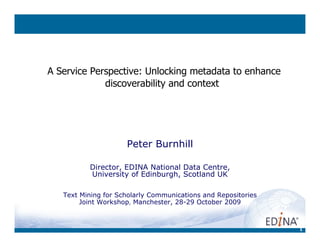
- 1. 1 A Service Perspective: Unlocking metadata to enhance discoverability and context Peter Burnhill Director, EDINA National Data Centre, University of Edinburgh, Scotland UK Text Mining for Scholarly Communications and Repositories Joint Workshop, Manchester, 28-29 October 2009
- 2. 2 A Service Perspective: Unlocking metadata to enhance discoverability and context Time & Place For Text Mining Peter Burnhill Director, EDINA National Data Centre, University of Edinburgh, Scotland UK Text Mining for Scholarly Communications and Repositories Joint Workshop, Manchester, 28-29 October 2009
- 3. 3 Time & Place For Text Mining 1. The service imperative: online services for education 2. Show time: text mining applications 3. Some concluding remark, and an unveiling!
- 4. 4 Time & Place For Text Mining 1. The service imperative: online services for education – enhancing discoverability of online information objects – providing context for the analysis of those data Transforming projects into services for research [& learning/teaching] 2. Show time: text mining applications A. Geo-enabling via geo-parsing & geo-tagging B. Geo-activating metadata; evoking the event C. Enriching audio-visual material by event-tagging 3. Some concluding remark, and an unveiling! Using text mining to Unlock space/time co-ordinates For Words, numbers, pictures, sounds!
- 5. 5 Service context: Edinburgh and beyond Edinburgh University Data Library, set up in 1983 [pre-EDINA] – 25 years as ‘an online library of research data’ Based in Centre for Application Software & Technology (PLU) • databases and graphics; access to programmers • Linking spatially-referenced datasets to geographic boundaries • interest in hypertext, ‘actionable’ metadata & SGML (TEI) Hosted at Edinburgh Regional Computing Centre • Leveraging multi-access computing & networking infrastructure Faculty & what we would now call ICT Services worked closely together • GIS; Joint project activity; movement of staff back and forth • I have history as a researcher and a senior lecturer But initial focus of Data Library was on numbers • encoded data interpretable for secondary analysis via codebook (NB codebook for datasets as structured text)
- 6. 6 Present National Service context: UK and beyond EDINA, a national academic data centre With stated mission... to enhance the productivity of research, learning and teaching in UK higher and further education • Provides networked access to a range of online resources • Focus is on service but also undertake R&D (projects services) – deliver over 20 online services – have about 10 major projects (including services in development) – deploy about 80 staff, in two locations (Edinburgh & Warrington) • These include (although not commented on here): – Technical support for UK Access Management Federation – Work to ensure continuity of access to digital content (esp. journal content)
- 7. UK funding councils JISC Sub-CommitteesJISC Collections acting as platform for network-level services & helping to build the JISC Integrated Information Environment research, learning & teaching in UK universities & colleges Research Councils UK National Data Centres
- 8. 8 Service context: UK and beyond EDINA was designated in 1995/6, co-incident with emergence of Web, with need to shift further beyond encoded numbers into indexed words New task was to host and provide user interfaces for leading Abstract and Indexing databases for scholarly literature • BIOSIS, Compendex, INSPEC, Art Abstracts, Periodical Contents, Index to The Times, CABI, etc But always an eye on developing as UK Geographic Data Unit • UKBORDERS (boundaries and geo-reference database) for ESRC • Digimap (Ordnance Survey mapping data) for JISC Switch to ‘What EDINA Does Now’ • Community Report & Website
- 10. 10 Reading & Reference Room: supporting scholarly communication the Depot international Open Access facility to support self deposit of peer-reviewed papers SUNCAT UK serials union catalogue: what’s held where No longer host specialist Abstract & Index databases …
- 11. 11 • Services: Digimap, UKBORDERS, AgCensus, Go-Geo!,GeoCrossWalk • Projects, such as – EuroGeonames (funded under EU e-Content.Plus) – SEE-GEO – A&A of geo (grid) web services – COMPASS – semantic discovery of geo-services – DIaD - Data Integration and Dissemination • History of Service Hosting • Community engagement and outreach e.g. – Chair OGC Universities WG – Sit on Scottish Government GI steering group – Acting as contact point between OGC & e-Science GRID communities – Lead on INSPIRE Directive for UK HE Map & Data Place: Geo-data Specialists
- 12. 12 User tools (clients) Common application servers Common data(base) servers Common hardware infrastructure Ordnance Survey digital map data Historic map images Geological map data Marine map data Data from another Supplier Vector map server Raster map server Database server File based data server Historic map viewer Digimap Classic end-user desktop/browser Digimap Carto Data Download Client Web Services e.g. to 3rd party Portal Digimap - One Architecture, Many Services (2004+)
- 14. 14 Resource Discovery using Go-Geo! ‘federated’ search portal using geography • User defines the area of interest as well as subject of interest • Go-Geo! does ‘federated’ search of 3rd party indexes & data services, bringing back links to geo-referenced data sources • promotes awareness of geospatial aspect of problems – facilitates understanding – provides access to geographically related resources • Part of larger strategy – to enhance geo-parsing (extract place names from documents) – geo-tagging (ensure names have geo-feet) – cross-walk across terminology (place/area/address/co-ordinates)
- 15. 15 A portal (GoGeo!) needs a resolver ( GeoCrossWalk) GeoCrossWalk Server Content Provider A Content Provider B Coordinate footprints Content Provider C Parish names Place names Portal service Post code: L34 0HS bridging the different vocabularies of geography: ‘Find resources for this postcode’ used to geo-reference survey data Knowsley 340900,392300 - 347217, 397660 BX003 <
- 16. 16 Sound & Pictures: access to new data sources • 20th Century is the first fully audio-visual century – With new forms of research material to use and to master • EDINA as platform for downloadable film, video and audio – Licensed for use in learning, teaching and research – Wide range of subject coverage, including documentary film 1. Film & Sound Online – 600 hours of film, digitised for downloading 2. NewsFilm Online – 3000 hours of material from ITN & Reuters – Over 4TBs of clips to download • Plus Education Image Gallery of still photography • Visual and Sound Materials Portal • Discovering all sorts of audio-visual material
- 17. 17 Part 2: Showcase for R&D Three examples of using text mining to Unlock space/time co-ordinates: presented here as Exhibits A, B and C A. Geo-enabling via geo-parsing & geo-tagging B. Geo-activating metadata; evoking the event C. Enriching audio-visual material by event-tagging
- 18. 18 Geo-enabling via geo-parsing & geo-tagging Part of overall strategic purpose – to enhance discoverability of online resources – to provide context for their analysis • geo-parsing (to extract place names from documents) • geo-tagging (to ensure names have geo-feet) • cross-walking across terminology Q: What’s special about the spatial? A: (Geo-)referencing! Exhibit A
- 19. 19 Back to Basics: What is geospatial data? • data with direct reference to position on surface of the earth • either latitude / longitude • or grid coordinates • or it is textual, eg placename, administrative area, address … Spatial reference Attributes
- 20. Simplest application is to parse&put place names on a map! We use Statistical Accounts of Scotland as Reference Text Test-bed
- 22. 22 Re-thinking Geo-parsing as Text-mining … From a NPL pov: automatic processing of a text to 1. identify the strings that are place names 2. check each place name against an authority file (gazetteer) 3. select among multiple entries, choose the ‘correct’ one QED: each place name in the text is linked to an entry in a gazetteer which provides information about the place including lat/long Text Analysis Strategy: • Information extraction/text mining techniques • Rule-based, not statistical • Pipeline of linguistic analysis components, starting with simple components and becoming progressively more complex • Each component adds information in the form of XML mark-up
- 23. 23 The Edinburgh Geoparser • Began as part of the GeoCrossWalk project. Link made between EDINA and Language Technology Group at UoE School of Informatics • Testing place name recognition in Scotland-centric documents (Statistical Accounts). 1. Use of GeoCrossWalk gazetteer as lexicon but no linking to gazetteer 2. Demonstrator for place name recognition and GeoCrossWalk gazetteer access but no disambiguation 3. Demonstrator for place name recognition and GeoCrossWalk and GeoNames gazetteer access plus disambiguation • GeoDigRef project refined and configured the system for JISC-funded projects of digitisation of key collections: a) Histpop: 200,000 pages of census and registration material for the British Isles. b) BOPCRIS:18th Century Official Parliamentary Publications Portal 1688 - 1834 c) British Library Sound Archive d) The Stormont Papers
- 24. .txt .html .xml Format conversion Tokenisation POS tagging Lemmatis- ation Named Entity Recognition .geotagged.xml Text Analysis Gazetteer lookup Resolution.geotagged.xml .gaz.xml Geo-referencing Edinburgh Geoparser: System Overview
- 25. 25 Output from Gazetteer Lookup • <placename> element containing a number of candidate <place> elements from the gazetteer. • These elements have as attributes: – lat (latitude) – long (longitude) – gazref (two part id (gazetteer name and id returned by gazetteer: geonames:12345) – in-cc (ISO country code, where available) – type (feature type)
- 26. 26 Resolution Stage [a longer look at Q&A] • Try to augment information about each candidate place. – by consulting lists of large places: from geonames and Wikipedia. – if place in the list with the same name and similar latitude and longitude (within one degree), assume it's the right one. • The information added is population and (containing) country • Then apply a number of heuristics: – Feature type: we prefer populated places to "facilities". – Population: we prefer bigger places (for newspaper text, we found that > 90% could be correctly identified using this alone). – Contextual information: colocations indicating containment and proximity ("London, England", "Leith near Edinburgh"). – Parameters from the user: restricting the results to a certain region, or at least strongly preferring that region. – Clustering: places in a document are often close together - try minimising the bounding box.
- 29. 29 Geo-activated metadata; evoking the event Purpose • to extract and re-present information, including geo-spatial and temporal referencing from archaeological site records – A way of linking items and collections – Beyond (but also enabling) simple mapping * Improving discoverability and providing context • This uses NLP techniques across different sources – Find and categorise entities (NER); Find and label relations (RE) – Combining in a unified format: an RDF graph – Linking entities common across sources; discovering new connections • Focus on the ‘has Event’ relation of an excavation – Many (all?) cultural collection have (hidden) space/time co-ordinates This is taken from work by Kate Byrne, also illustrated in the poster on display as: "Populating the Semantic Web with Relations from Text" Exhibit B
- 30. An archaeological site record: a technical summary
- 31. Parse to ‘mark up’ archaeological site record (metadata)
- 34. 34 Enriching audio-visual material via event-tagging Purpose: to find ways to leverage contextual metadata for audio- visual material • initial focus on (digitised) 20th Century newsfilm footage • Overcoming inherent problem of sparse metadata that inhibits discoverability – using ancillary information in the metadata – evoking ‘has Event’ relation – exploiting interoperability – finding related text for mining and so auto-creating metadata * to improve discoverability and provide/enhance context This is a set of ideas for future work between EDINA, UoE/LTG and NaCTeM Exhibit C
- 35. Sparse Metadata Very Short Clip No Soundtrack The only data we have: •1st October 1995 •Cyprus •Disturbance (street disturbance) •British soldiers •Broadcast on TV News
- 36. Related material in archives, collections and web services (open or authenticated) can be compared
- 37. The Times Archive seems to have several relevant items as part of full page images…
- 39. Two Cyprus stories in the Times Archive lead to a rich contextual artefact.
- 40. “Cyprus 1955” in Life Magazine reveals a short US perspective and a pictorial context Bringing in text and links to other resources allows a much richer view onto the original news film and allows exploration of both the topic and the wider context.
- 41. 41 Some Concluding Remarks 1) Michael Buckland spoke of two traditions in Information Science …
- 42. 42 document tradition & computation tradition “considerable simplification, … helpful to think … of two traditions, or mentalities, even cultures, co-exist in area of Information Science 1. “Approaches based on a concern with documents, with signifying records: archives, bibliography, documentation, librarianship, records management, and the like 2. “approaches based on uses for formal techniques, whether mechanical (such as punch cards and data-processing equipment) or mathematical (as in algorithmic procedures).” Michael Buckland, UC Berkeley, 1998 http://people.ischool.berkeley.edu/~buckland/asis62.html
- 43. 43 Re-learning basics of information retrieval Combine document & computation traditions to contribute to growth of digital library • Using ancillary information • to sort/filter etc in the ‘too many’ problem • as leverage in the ‘too few’ problem • exploiting the digital properties of data • to add value, impose/extract meaning, do sums and visualise • Exploiting interoperability and ‘server vs client’
- 44. 44 Some Concluding Remarks 1. Buckland spoke of two traditions 2. What meaning is there locked away in numbers, words, pictures and sounds?
- 45. 45 “Numbers, Words, Pictures & Sounds … … soon all will be digital and accessed from afar” IASSIST Conference, 1990 a) Words as text are full of meaning, including key space/time co-ordinates ripe for extracting and geo-enabling. b) The meaning in Numbers is often encoded, but datasets have codebooks and other associated documentation – these texts could provide the key to unlock some co- ordinates c) The richness of meaning in audio-visual material, sounds & pictures, is pre-theoretic, • requiring more of us, including some lateral thinking, as illustrated in Exhibit C. • But then these digital and online resources can be discovered and regarded as evidence
- 46. 46 Some Concluding Remarks 1. Buckland spoke of two traditions 2. What meaning is there locked away in numbers, words, pictures and sounds? 3. Now is the Time & Place For Text Mining
- 47. 47 Some Concluding Remarks 1. Buckland spoke of two traditions 2. What meaning is there locked away in numbers, words, pictures and sounds? 3. Now is the Time & Place For Text Mining 4. Time for an unveiling:
- 49. Unlock
- 50. Unlock
- 51. 51 Time for me to stop Hoping that I have left some space/place for questions Thank you Acknowledgements to Claire Grover & Kate Byrne (School of Informatics) to Jo Walsh (EDINA) • And to all their colleagues who did the work • And, of course, to JISC for funding, and to you as taxpayers …