SlideShare uma empresa Scribd logo
1 de 19
Spatial Analysis of East AnglianAnglo Saxon Archaeology Edward Kemp MSc Applied Geographical Information Systems  Wednesday 7th September 2011
Presentation Structure Provide a background to the project. Explain the projects aims and objectives. Introduce the study area and data. Briefly explain the methods used. Share some results and conclusions. Did we achieve our objectives? I mages from:  Culture 24 www.culture24.org.uk
Background Dissertation topic inspired by a project from 2006 by John Naylor at Ashmolean Museum in Oxford Uses of an online database of archaeological finds found using metal detectors by members of the public Started in 1997 now has over 450,000 unique objects on the searchable database Run by the Portable Antiquities Scheme (PAS) in conjunction with the British Museum
Aims and Objectives Explore archaeological data using spatial analysis techniques Explore distributions and patterns in the data  with the aim of better understanding the development of Anglo Saxon East Anglia Assess the ‘productivity’ (level/type of activity) at previously identified archaeological sites using spatial analysis techniques and the PAS database Combine the results highlighting areas that could be investigated further through fieldwork or additional spatial analysis
Study Area
Preparing PAS Data Remove inconstancies in data Remove any unclassified or incomplete items Object types assigned object groups Finds assigned a period in Anglo Saxon history Plotted using easting and northing grid references
Assigning Categories Object groups and time periods were assigned to each item One of six object groups were assigned to each item: Clothing	 		(buckle, hooked tag, sleeve clasp) Coins			(single coins, ingots) Horse Items	 		(stirrup, strap ends, bridle bit, harness mount) Commercial and Household:	(spoon, bowl, tweezers, hinge, gaming piece) Jewellery			(brooch, ring, bracelet, bead, armlet) Pins			(hair pin, linked pin) One of three time periods were also assigned to each item: Early:			400 – 600AD Middle:			601 – 800AD Late:			801 – 1066AD Each object group was broken down further by time period
Spatial Analysis Techniques Average Nearest Neighbour: Compare the distance between feature locations Global Morans I: Compares the distance between feature values Are similar or dissimilar values clustering Getis – Ord G* Hotspot Analysis: Identifies whether features with high values or features with low values tend to cluster together in a study area(forming ‘hot’ or ‘cold’ spots) All results were accompanied by a level of significance  Either 99%, 95% or 90% Use to accept or reject the null hypothesis Points/ values were located as a result of a random process
Average Nearest Neighbour Findings Results gave an insight into the distribution of some object groups Overall finds showed less tendency to cluster over time  Jewellery items showed the highest tendency to cluster Commercial and household items the least Both at a 99% confidence level
Global Morans I Findings Provided slightly different picture Finds again showed less tendency to cluster of time  Clothing items showed the highest tendency to cluster at a 99% confidence level Commercial and household the least but with no confidence level attached
Getis –Ord G* Hotspot Analysis Findings No statistically significant cold spots were found Significant hotspots move around the study area over time The central area around the town of Hoxne seems to be important in the early – middle period The shift is then to the north and west of Norfolk Patterns in two of the maps indicate possible trade or communication routes – aid of underlying OS map One running from the VASLE site at Freckenham NE to Great Yarmouth and the other running SE to Felixstowe
All  Coin Finds
Commercial  and Household Late Period Finds
Possible trade routes
VASLE Productive Site (VPS) Analysis Aim to assess the productivity of the 22 VPS using buffering and intersection functions No specific definition of what a productive site is so buffer size and criteria were based on the 2006 project: 2.5 mile buffer chosen because of: Dispersed settlement pattern Increased distribution through trade as time goes on Take into account disposal and accidental loss Productivity would  be assessed by counting the number of object groups and time periods returning above average numbers of finds from the PAS dataset More than 4 out 6 object groups AND 2 out of 3 time periods and the VPS would be deemed productive throughout the Anglo Saxon period
22 VPS + 2.5 mile buffers
VASLE Productive Site (VPS) Buffer Analysis Results 7 out of 22 sites were deemed to be productive as a result of the spatial analysis process Gave an indication as to when some sites developed  Gave an indication of each sites primary function  Pin manufacture, tax and trade. Timings for the possible trade routes could be given, northern route earlier, southern route later
Conclusions – Did we achieve out objectives? Spatial analysis techniques can be successfully used in conjunction with complex archaeological data  Patterns are revealed that can tell a story about a town or area These would not be apparent using purely visual inspection Each technique complimented each other The project has set the scene for future possible GIS projects
THANK YOU  FOR LISTENING ANY QUESTIONS?

Mais conteúdo relacionado

Semelhante a Masters Dissertation - Presentation

SKA Regional Sciences Centres - A Platform for Global Astronomy
SKA Regional Sciences Centres - A Platform for Global AstronomySKA Regional Sciences Centres - A Platform for Global Astronomy
SKA Regional Sciences Centres - A Platform for Global AstronomyEUDAT
 
Unlocking the geospatial potential of survey data
Unlocking the geospatial potential of survey dataUnlocking the geospatial potential of survey data
Unlocking the geospatial potential of survey datatomensom
 
Clustering over the cultural heritage linked open dataset xlendi shipwreck
Clustering over the cultural heritage linked open dataset xlendi shipwreckClustering over the cultural heritage linked open dataset xlendi shipwreck
Clustering over the cultural heritage linked open dataset xlendi shipwreckMohamed BEN ELLEFI
 
Digitised collections: Toward a digital strategy for for the NHM, London
Digitised collections: Toward a digital strategy for for the NHM, LondonDigitised collections: Toward a digital strategy for for the NHM, London
Digitised collections: Toward a digital strategy for for the NHM, LondonVince Smith
 
Towards a Spatial Data Infrastructure for Archaeology: Peter McKeague
Towards a Spatial Data Infrastructure for Archaeology: Peter McKeagueTowards a Spatial Data Infrastructure for Archaeology: Peter McKeague
Towards a Spatial Data Infrastructure for Archaeology: Peter McKeagueSHED Strategy
 
Feature Geo Analytics and Big Data Processing: Hybrid Approaches for Earth Sc...
Feature Geo Analytics and Big Data Processing: Hybrid Approaches for Earth Sc...Feature Geo Analytics and Big Data Processing: Hybrid Approaches for Earth Sc...
Feature Geo Analytics and Big Data Processing: Hybrid Approaches for Earth Sc...Dawn Wright
 
C7.01: Current activities of the International Ocean Colour Coordinating Grou...
C7.01: Current activities of the International Ocean Colour Coordinating Grou...C7.01: Current activities of the International Ocean Colour Coordinating Grou...
C7.01: Current activities of the International Ocean Colour Coordinating Grou...Blue Planet Symposium
 
Aspects of Reproducibility in Earth Science
Aspects of Reproducibility in Earth ScienceAspects of Reproducibility in Earth Science
Aspects of Reproducibility in Earth ScienceRaul Palma
 
Barriers and Opportunities for Linked Open Data Use in Archaeology and Cultur...
Barriers and Opportunities for Linked Open Data Use in Archaeology and Cultur...Barriers and Opportunities for Linked Open Data Use in Archaeology and Cultur...
Barriers and Opportunities for Linked Open Data Use in Archaeology and Cultur...ariadnenetwork
 
How to do Research Project
How to do Research ProjectHow to do Research Project
How to do Research ProjectManuscriptpedia
 
Open Access Barometer to Open Access Indicator: lessons learned from the jour...
Open Access Barometer to Open Access Indicator: lessons learned from the jour...Open Access Barometer to Open Access Indicator: lessons learned from the jour...
Open Access Barometer to Open Access Indicator: lessons learned from the jour...Mikael Elbæk
 
Preparing for the UK Research Data Registry and Discovery Service
Preparing for the UK Research Data Registry and Discovery ServicePreparing for the UK Research Data Registry and Discovery Service
Preparing for the UK Research Data Registry and Discovery ServiceRepository Fringe
 
Item 5: Introduction to the Global Spectral Calibration Library
Item 5: Introduction to the Global Spectral Calibration LibraryItem 5: Introduction to the Global Spectral Calibration Library
Item 5: Introduction to the Global Spectral Calibration LibrarySoils FAO-GSP
 
Warehouse Activity Profiling
Warehouse Activity Profiling Warehouse Activity Profiling
Warehouse Activity Profiling Mohammad Hye
 
Virtual Marine Geophysical Data Center July 2010 Original
Virtual Marine Geophysical Data Center July 2010 OriginalVirtual Marine Geophysical Data Center July 2010 Original
Virtual Marine Geophysical Data Center July 2010 OriginalBrad Ilg
 
Drones in the Earth Sciences - Opportunities and issues
Drones in the Earth Sciences - Opportunities and issuesDrones in the Earth Sciences - Opportunities and issues
Drones in the Earth Sciences - Opportunities and issuesARDC
 
Easter JISC metadata May25 DT
Easter JISC metadata May25 DTEaster JISC metadata May25 DT
Easter JISC metadata May25 DTdstudhope
 
ODIP: integrating regional marine data infrastructures for global ocean science
ODIP: integrating regional marine data infrastructures for global ocean science ODIP: integrating regional marine data infrastructures for global ocean science
ODIP: integrating regional marine data infrastructures for global ocean science Helen Glaves
 

Semelhante a Masters Dissertation - Presentation (20)

SKA Regional Sciences Centres - A Platform for Global Astronomy
SKA Regional Sciences Centres - A Platform for Global AstronomySKA Regional Sciences Centres - A Platform for Global Astronomy
SKA Regional Sciences Centres - A Platform for Global Astronomy
 
Unlocking the geospatial potential of survey data
Unlocking the geospatial potential of survey dataUnlocking the geospatial potential of survey data
Unlocking the geospatial potential of survey data
 
Clustering over the cultural heritage linked open dataset xlendi shipwreck
Clustering over the cultural heritage linked open dataset xlendi shipwreckClustering over the cultural heritage linked open dataset xlendi shipwreck
Clustering over the cultural heritage linked open dataset xlendi shipwreck
 
Digitised collections: Toward a digital strategy for for the NHM, London
Digitised collections: Toward a digital strategy for for the NHM, LondonDigitised collections: Toward a digital strategy for for the NHM, London
Digitised collections: Toward a digital strategy for for the NHM, London
 
Fieldwork Cranedale
Fieldwork Cranedale Fieldwork Cranedale
Fieldwork Cranedale
 
Towards a Spatial Data Infrastructure for Archaeology: Peter McKeague
Towards a Spatial Data Infrastructure for Archaeology: Peter McKeagueTowards a Spatial Data Infrastructure for Archaeology: Peter McKeague
Towards a Spatial Data Infrastructure for Archaeology: Peter McKeague
 
Feature Geo Analytics and Big Data Processing: Hybrid Approaches for Earth Sc...
Feature Geo Analytics and Big Data Processing: Hybrid Approaches for Earth Sc...Feature Geo Analytics and Big Data Processing: Hybrid Approaches for Earth Sc...
Feature Geo Analytics and Big Data Processing: Hybrid Approaches for Earth Sc...
 
C7.01: Current activities of the International Ocean Colour Coordinating Grou...
C7.01: Current activities of the International Ocean Colour Coordinating Grou...C7.01: Current activities of the International Ocean Colour Coordinating Grou...
C7.01: Current activities of the International Ocean Colour Coordinating Grou...
 
Aspects of Reproducibility in Earth Science
Aspects of Reproducibility in Earth ScienceAspects of Reproducibility in Earth Science
Aspects of Reproducibility in Earth Science
 
Barriers and Opportunities for Linked Open Data Use in Archaeology and Cultur...
Barriers and Opportunities for Linked Open Data Use in Archaeology and Cultur...Barriers and Opportunities for Linked Open Data Use in Archaeology and Cultur...
Barriers and Opportunities for Linked Open Data Use in Archaeology and Cultur...
 
How to do Research Project
How to do Research ProjectHow to do Research Project
How to do Research Project
 
Open Access Barometer to Open Access Indicator: lessons learned from the jour...
Open Access Barometer to Open Access Indicator: lessons learned from the jour...Open Access Barometer to Open Access Indicator: lessons learned from the jour...
Open Access Barometer to Open Access Indicator: lessons learned from the jour...
 
Preparing for the UK Research Data Registry and Discovery Service
Preparing for the UK Research Data Registry and Discovery ServicePreparing for the UK Research Data Registry and Discovery Service
Preparing for the UK Research Data Registry and Discovery Service
 
Item 5: Introduction to the Global Spectral Calibration Library
Item 5: Introduction to the Global Spectral Calibration LibraryItem 5: Introduction to the Global Spectral Calibration Library
Item 5: Introduction to the Global Spectral Calibration Library
 
Warehouse Activity Profiling
Warehouse Activity Profiling Warehouse Activity Profiling
Warehouse Activity Profiling
 
Location theories
Location theoriesLocation theories
Location theories
 
Virtual Marine Geophysical Data Center July 2010 Original
Virtual Marine Geophysical Data Center July 2010 OriginalVirtual Marine Geophysical Data Center July 2010 Original
Virtual Marine Geophysical Data Center July 2010 Original
 
Drones in the Earth Sciences - Opportunities and issues
Drones in the Earth Sciences - Opportunities and issuesDrones in the Earth Sciences - Opportunities and issues
Drones in the Earth Sciences - Opportunities and issues
 
Easter JISC metadata May25 DT
Easter JISC metadata May25 DTEaster JISC metadata May25 DT
Easter JISC metadata May25 DT
 
ODIP: integrating regional marine data infrastructures for global ocean science
ODIP: integrating regional marine data infrastructures for global ocean science ODIP: integrating regional marine data infrastructures for global ocean science
ODIP: integrating regional marine data infrastructures for global ocean science
 

Último

Nutritional Needs Presentation - HLTH 104
Nutritional Needs Presentation - HLTH 104Nutritional Needs Presentation - HLTH 104
Nutritional Needs Presentation - HLTH 104misteraugie
 
Z Score,T Score, Percential Rank and Box Plot Graph
Z Score,T Score, Percential Rank and Box Plot GraphZ Score,T Score, Percential Rank and Box Plot Graph
Z Score,T Score, Percential Rank and Box Plot GraphThiyagu K
 
Ecological Succession. ( ECOSYSTEM, B. Pharmacy, 1st Year, Sem-II, Environmen...
Ecological Succession. ( ECOSYSTEM, B. Pharmacy, 1st Year, Sem-II, Environmen...Ecological Succession. ( ECOSYSTEM, B. Pharmacy, 1st Year, Sem-II, Environmen...
Ecological Succession. ( ECOSYSTEM, B. Pharmacy, 1st Year, Sem-II, Environmen...Shubhangi Sonawane
 
Micro-Scholarship, What it is, How can it help me.pdf
Micro-Scholarship, What it is, How can it help me.pdfMicro-Scholarship, What it is, How can it help me.pdf
Micro-Scholarship, What it is, How can it help me.pdfPoh-Sun Goh
 
Unit-IV- Pharma. Marketing Channels.pptx
Unit-IV- Pharma. Marketing Channels.pptxUnit-IV- Pharma. Marketing Channels.pptx
Unit-IV- Pharma. Marketing Channels.pptxVishalSingh1417
 
Food Chain and Food Web (Ecosystem) EVS, B. Pharmacy 1st Year, Sem-II
Food Chain and Food Web (Ecosystem) EVS, B. Pharmacy 1st Year, Sem-IIFood Chain and Food Web (Ecosystem) EVS, B. Pharmacy 1st Year, Sem-II
Food Chain and Food Web (Ecosystem) EVS, B. Pharmacy 1st Year, Sem-IIShubhangi Sonawane
 
Making and Justifying Mathematical Decisions.pdf
Making and Justifying Mathematical Decisions.pdfMaking and Justifying Mathematical Decisions.pdf
Making and Justifying Mathematical Decisions.pdfChris Hunter
 
Measures of Dispersion and Variability: Range, QD, AD and SD
Measures of Dispersion and Variability: Range, QD, AD and SDMeasures of Dispersion and Variability: Range, QD, AD and SD
Measures of Dispersion and Variability: Range, QD, AD and SDThiyagu K
 
Beyond the EU: DORA and NIS 2 Directive's Global Impact
Beyond the EU: DORA and NIS 2 Directive's Global ImpactBeyond the EU: DORA and NIS 2 Directive's Global Impact
Beyond the EU: DORA and NIS 2 Directive's Global ImpactPECB
 
Basic Civil Engineering first year Notes- Chapter 4 Building.pptx
Basic Civil Engineering first year Notes- Chapter 4 Building.pptxBasic Civil Engineering first year Notes- Chapter 4 Building.pptx
Basic Civil Engineering first year Notes- Chapter 4 Building.pptxDenish Jangid
 
This PowerPoint helps students to consider the concept of infinity.
This PowerPoint helps students to consider the concept of infinity.This PowerPoint helps students to consider the concept of infinity.
This PowerPoint helps students to consider the concept of infinity.christianmathematics
 
Role Of Transgenic Animal In Target Validation-1.pptx
Role Of Transgenic Animal In Target Validation-1.pptxRole Of Transgenic Animal In Target Validation-1.pptx
Role Of Transgenic Animal In Target Validation-1.pptxNikitaBankoti2
 
Class 11th Physics NEET formula sheet pdf
Class 11th Physics NEET formula sheet pdfClass 11th Physics NEET formula sheet pdf
Class 11th Physics NEET formula sheet pdfAyushMahapatra5
 
ComPTIA Overview | Comptia Security+ Book SY0-701
ComPTIA Overview | Comptia Security+ Book SY0-701ComPTIA Overview | Comptia Security+ Book SY0-701
ComPTIA Overview | Comptia Security+ Book SY0-701bronxfugly43
 
Key note speaker Neum_Admir Softic_ENG.pdf
Key note speaker Neum_Admir Softic_ENG.pdfKey note speaker Neum_Admir Softic_ENG.pdf
Key note speaker Neum_Admir Softic_ENG.pdfAdmir Softic
 
Python Notes for mca i year students osmania university.docx
Python Notes for mca i year students osmania university.docxPython Notes for mca i year students osmania university.docx
Python Notes for mca i year students osmania university.docxRamakrishna Reddy Bijjam
 
ICT Role in 21st Century Education & its Challenges.pptx
ICT Role in 21st Century Education & its Challenges.pptxICT Role in 21st Century Education & its Challenges.pptx
ICT Role in 21st Century Education & its Challenges.pptxAreebaZafar22
 
Activity 01 - Artificial Culture (1).pdf
Activity 01 - Artificial Culture (1).pdfActivity 01 - Artificial Culture (1).pdf
Activity 01 - Artificial Culture (1).pdfciinovamais
 
Unit-IV; Professional Sales Representative (PSR).pptx
Unit-IV; Professional Sales Representative (PSR).pptxUnit-IV; Professional Sales Representative (PSR).pptx
Unit-IV; Professional Sales Representative (PSR).pptxVishalSingh1417
 

Último (20)

Nutritional Needs Presentation - HLTH 104
Nutritional Needs Presentation - HLTH 104Nutritional Needs Presentation - HLTH 104
Nutritional Needs Presentation - HLTH 104
 
Z Score,T Score, Percential Rank and Box Plot Graph
Z Score,T Score, Percential Rank and Box Plot GraphZ Score,T Score, Percential Rank and Box Plot Graph
Z Score,T Score, Percential Rank and Box Plot Graph
 
Asian American Pacific Islander Month DDSD 2024.pptx
Asian American Pacific Islander Month DDSD 2024.pptxAsian American Pacific Islander Month DDSD 2024.pptx
Asian American Pacific Islander Month DDSD 2024.pptx
 
Ecological Succession. ( ECOSYSTEM, B. Pharmacy, 1st Year, Sem-II, Environmen...
Ecological Succession. ( ECOSYSTEM, B. Pharmacy, 1st Year, Sem-II, Environmen...Ecological Succession. ( ECOSYSTEM, B. Pharmacy, 1st Year, Sem-II, Environmen...
Ecological Succession. ( ECOSYSTEM, B. Pharmacy, 1st Year, Sem-II, Environmen...
 
Micro-Scholarship, What it is, How can it help me.pdf
Micro-Scholarship, What it is, How can it help me.pdfMicro-Scholarship, What it is, How can it help me.pdf
Micro-Scholarship, What it is, How can it help me.pdf
 
Unit-IV- Pharma. Marketing Channels.pptx
Unit-IV- Pharma. Marketing Channels.pptxUnit-IV- Pharma. Marketing Channels.pptx
Unit-IV- Pharma. Marketing Channels.pptx
 
Food Chain and Food Web (Ecosystem) EVS, B. Pharmacy 1st Year, Sem-II
Food Chain and Food Web (Ecosystem) EVS, B. Pharmacy 1st Year, Sem-IIFood Chain and Food Web (Ecosystem) EVS, B. Pharmacy 1st Year, Sem-II
Food Chain and Food Web (Ecosystem) EVS, B. Pharmacy 1st Year, Sem-II
 
Making and Justifying Mathematical Decisions.pdf
Making and Justifying Mathematical Decisions.pdfMaking and Justifying Mathematical Decisions.pdf
Making and Justifying Mathematical Decisions.pdf
 
Measures of Dispersion and Variability: Range, QD, AD and SD
Measures of Dispersion and Variability: Range, QD, AD and SDMeasures of Dispersion and Variability: Range, QD, AD and SD
Measures of Dispersion and Variability: Range, QD, AD and SD
 
Beyond the EU: DORA and NIS 2 Directive's Global Impact
Beyond the EU: DORA and NIS 2 Directive's Global ImpactBeyond the EU: DORA and NIS 2 Directive's Global Impact
Beyond the EU: DORA and NIS 2 Directive's Global Impact
 
Basic Civil Engineering first year Notes- Chapter 4 Building.pptx
Basic Civil Engineering first year Notes- Chapter 4 Building.pptxBasic Civil Engineering first year Notes- Chapter 4 Building.pptx
Basic Civil Engineering first year Notes- Chapter 4 Building.pptx
 
This PowerPoint helps students to consider the concept of infinity.
This PowerPoint helps students to consider the concept of infinity.This PowerPoint helps students to consider the concept of infinity.
This PowerPoint helps students to consider the concept of infinity.
 
Role Of Transgenic Animal In Target Validation-1.pptx
Role Of Transgenic Animal In Target Validation-1.pptxRole Of Transgenic Animal In Target Validation-1.pptx
Role Of Transgenic Animal In Target Validation-1.pptx
 
Class 11th Physics NEET formula sheet pdf
Class 11th Physics NEET formula sheet pdfClass 11th Physics NEET formula sheet pdf
Class 11th Physics NEET formula sheet pdf
 
ComPTIA Overview | Comptia Security+ Book SY0-701
ComPTIA Overview | Comptia Security+ Book SY0-701ComPTIA Overview | Comptia Security+ Book SY0-701
ComPTIA Overview | Comptia Security+ Book SY0-701
 
Key note speaker Neum_Admir Softic_ENG.pdf
Key note speaker Neum_Admir Softic_ENG.pdfKey note speaker Neum_Admir Softic_ENG.pdf
Key note speaker Neum_Admir Softic_ENG.pdf
 
Python Notes for mca i year students osmania university.docx
Python Notes for mca i year students osmania university.docxPython Notes for mca i year students osmania university.docx
Python Notes for mca i year students osmania university.docx
 
ICT Role in 21st Century Education & its Challenges.pptx
ICT Role in 21st Century Education & its Challenges.pptxICT Role in 21st Century Education & its Challenges.pptx
ICT Role in 21st Century Education & its Challenges.pptx
 
Activity 01 - Artificial Culture (1).pdf
Activity 01 - Artificial Culture (1).pdfActivity 01 - Artificial Culture (1).pdf
Activity 01 - Artificial Culture (1).pdf
 
Unit-IV; Professional Sales Representative (PSR).pptx
Unit-IV; Professional Sales Representative (PSR).pptxUnit-IV; Professional Sales Representative (PSR).pptx
Unit-IV; Professional Sales Representative (PSR).pptx
 

Masters Dissertation - Presentation

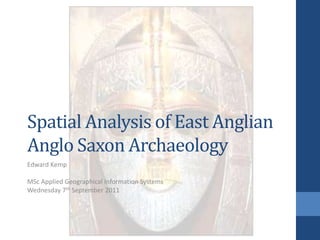
  • 1. Spatial Analysis of East AnglianAnglo Saxon Archaeology Edward Kemp MSc Applied Geographical Information Systems Wednesday 7th September 2011
  • 2. Presentation Structure Provide a background to the project. Explain the projects aims and objectives. Introduce the study area and data. Briefly explain the methods used. Share some results and conclusions. Did we achieve our objectives? I mages from: Culture 24 www.culture24.org.uk
  • 3. Background Dissertation topic inspired by a project from 2006 by John Naylor at Ashmolean Museum in Oxford Uses of an online database of archaeological finds found using metal detectors by members of the public Started in 1997 now has over 450,000 unique objects on the searchable database Run by the Portable Antiquities Scheme (PAS) in conjunction with the British Museum
  • 4. Aims and Objectives Explore archaeological data using spatial analysis techniques Explore distributions and patterns in the data with the aim of better understanding the development of Anglo Saxon East Anglia Assess the ‘productivity’ (level/type of activity) at previously identified archaeological sites using spatial analysis techniques and the PAS database Combine the results highlighting areas that could be investigated further through fieldwork or additional spatial analysis
  • 6. Preparing PAS Data Remove inconstancies in data Remove any unclassified or incomplete items Object types assigned object groups Finds assigned a period in Anglo Saxon history Plotted using easting and northing grid references
  • 7. Assigning Categories Object groups and time periods were assigned to each item One of six object groups were assigned to each item: Clothing (buckle, hooked tag, sleeve clasp) Coins (single coins, ingots) Horse Items (stirrup, strap ends, bridle bit, harness mount) Commercial and Household: (spoon, bowl, tweezers, hinge, gaming piece) Jewellery (brooch, ring, bracelet, bead, armlet) Pins (hair pin, linked pin) One of three time periods were also assigned to each item: Early: 400 – 600AD Middle: 601 – 800AD Late: 801 – 1066AD Each object group was broken down further by time period
  • 8. Spatial Analysis Techniques Average Nearest Neighbour: Compare the distance between feature locations Global Morans I: Compares the distance between feature values Are similar or dissimilar values clustering Getis – Ord G* Hotspot Analysis: Identifies whether features with high values or features with low values tend to cluster together in a study area(forming ‘hot’ or ‘cold’ spots) All results were accompanied by a level of significance Either 99%, 95% or 90% Use to accept or reject the null hypothesis Points/ values were located as a result of a random process
  • 9. Average Nearest Neighbour Findings Results gave an insight into the distribution of some object groups Overall finds showed less tendency to cluster over time Jewellery items showed the highest tendency to cluster Commercial and household items the least Both at a 99% confidence level
  • 10. Global Morans I Findings Provided slightly different picture Finds again showed less tendency to cluster of time Clothing items showed the highest tendency to cluster at a 99% confidence level Commercial and household the least but with no confidence level attached
  • 11. Getis –Ord G* Hotspot Analysis Findings No statistically significant cold spots were found Significant hotspots move around the study area over time The central area around the town of Hoxne seems to be important in the early – middle period The shift is then to the north and west of Norfolk Patterns in two of the maps indicate possible trade or communication routes – aid of underlying OS map One running from the VASLE site at Freckenham NE to Great Yarmouth and the other running SE to Felixstowe
  • 12. All Coin Finds
  • 13. Commercial and Household Late Period Finds
  • 15. VASLE Productive Site (VPS) Analysis Aim to assess the productivity of the 22 VPS using buffering and intersection functions No specific definition of what a productive site is so buffer size and criteria were based on the 2006 project: 2.5 mile buffer chosen because of: Dispersed settlement pattern Increased distribution through trade as time goes on Take into account disposal and accidental loss Productivity would be assessed by counting the number of object groups and time periods returning above average numbers of finds from the PAS dataset More than 4 out 6 object groups AND 2 out of 3 time periods and the VPS would be deemed productive throughout the Anglo Saxon period
  • 16. 22 VPS + 2.5 mile buffers
  • 17. VASLE Productive Site (VPS) Buffer Analysis Results 7 out of 22 sites were deemed to be productive as a result of the spatial analysis process Gave an indication as to when some sites developed Gave an indication of each sites primary function Pin manufacture, tax and trade. Timings for the possible trade routes could be given, northern route earlier, southern route later
  • 18. Conclusions – Did we achieve out objectives? Spatial analysis techniques can be successfully used in conjunction with complex archaeological data Patterns are revealed that can tell a story about a town or area These would not be apparent using purely visual inspection Each technique complimented each other The project has set the scene for future possible GIS projects
  • 19. THANK YOU FOR LISTENING ANY QUESTIONS?

Notas do Editor

  1. WelcomeWelcome to my dissertation presentation which will apply GIS techniques to the world of archaeology!Recreation of the Sutton Hoo helmet found in 1939
  2. Structure of PresentationBit of background, aims and objectives, methodology used, results, conclusions, finally asking whether I achieved my objectives.
  3. BackgroundInspiration came from a project undertaken in 2006 by a guy called John Naylor.Make use of the finds made by metal detector usersThe online database designed to hold the information on their finds now has over 450,000 objects on it. Run by the Portable Antiquities Scheme in conjunction with the British Museum.
  4. Aims and ObjectivesInvestigate a complex set of archaeological data using spatial analysis techniques . Reveal patterns in the data that otherwise would be unseenAssess the levels of activity at 22 previously identified sites using spatial analysisMay even be able to pinpoint where the next coin hoard worth £1,000’s may be!
  5. Map of Study AreaMap of study area which encompassed the counties of Norfolk and Suffolk in the east of England3500 sq miles rich in Anglo Saxon finds
  6. Preparing DataTook ages! Initial searches revealed over 3000 finds for the study areaWhen dealing with data supplied by the general public inconstancies everywhere.I broke down the mass of data into logical object groups Dated everything to an AS period because every item only had a possible date range. Plotted using e + n in the database.
  7. Assigning CategoriesEach of the 2617 items were assigned an object group and time periodHere are the 6 categories and 3 time periods and an example of some of the finds placed in each of the object categories.
  8. Spatial Analysis Techniques3 different clustering techniques used in the projectAverage Nearest Neighbour – Compare distance between feature locationsGlobal Morans I - Compare the distance between feature valuesGetis Ord G* Hotspot Analysis – shows whether features with high values or features with low values tend to cluster together. Thus forming hot or cold spotsZ Score significance 99% -90%Used to approve or disprove the null hypothesis that all the points were distributed as the result of a random process
  9. Average Nearest Neighbour FindingsClustering tended to be less over timepossible reason:Anglo Saxon lifestyles became more rural over time Jewellery was found to cluster the most.Tend to be located togetherSafe storage Commercial and household least clustered.Less care taken over storage and disposal of these items
  10. Global Morans I FindingsSlightly different picture, some object groups showed different degrees of clusteringClothing showed the greatest tendency to cluster this timeAgain storage a probable causeClothes and related items tend to be kept in closets or chests Commercial again the least clustered but no confidence level attached this time
  11. Hotspot Analysis FindingsNo coldspots were foundAreas of high value clusters moved over time from central – north west of study areaSome object groups clustered in certain areas: Example:Coins in and around the town of Freckenham which was one of the sites identified in 2006Corridors of higher value clusters shown in the coins and commercial object groups can be seen stretching away NE and SE from FreckenhamThis could indicate possible trade or communication routesRoman roads underneathCouple of maps to illustrate this
  12. Hotspot Map of all Coin findsMap showing the possible trade route to the NE towards the coast at Great Yarmouth
  13. Hotspot Map of late period commercial and household findsMap showing the possible trade route to the SE towards the port at Felixstowe
  14. Map showing possible trade routesLines show possible routes of trade or communication
  15. VASLE Site AnalysisFinal piece of analysis aimed to evaluate the productivity of 22 sites identified by the 2006 projectUse buffering and intersect techniques to see how many finds fell within a 2.5 mile radius of each siteAs there is no definition of what a productive site is criteria based on the 2006 project were used. Buffer size criteria were unique to this projectProductivity would be based on whether there was an above or below average number of finds falling within an object group or time period.The numbers of object groups and time periods showing above average would indicate whether the site was productive or not
  16. Map showing VPS sites and buffersLocations of 22 sites 17 in Norfolk 5 in Suffolk
  17. VASLE Site Analysis Results7 out of the 22 sites were deemed to be productive as a result of the buffering processFurther analysis of the finds within each buffer gave an indication of when and how each of the sites developedMost developed as time went on others started strong and weakened over timeHigh quantities of some object groups indicated possible functions of some of the sitesCoins indicated trade or tax collection functions such as in the town of FreckenhamIt also helped assign timings to the possible trade routes
  18. Did we achieve our objectives?The project has proved that you can successfully use spatial analysis techniques on complex archaeological datasetsIt’s shown that you can reveal which areas were important and when as well as which towns played a key role The spatial analysis techniques complimented each other helping build a bigger picture for the projectSet the scene for further analysis either through fieldwork or other GIS analysis
  19. Thanks for listening any questions?