Redistricting: When Participative Geography meets Politics
•Transferir como PPT, PDF•
3 gostaram•1,215 visualizações

This document discusses how technology is changing redistricting and participatory mapping. It presents DistrictBuilder and PublicMapping as examples of technology applications that allow the public to participate in redistricting. The document also discusses how inferences can be drawn from redistricting maps using the BARD software. It notes that while technology increases participation, redistricting remains a difficult problem with no consensus on criteria or solutions.

Recomendados
Mais conteúdo relacionado
Semelhante a Redistricting: When Participative Geography meets Politics
Semelhante a Redistricting: When Participative Geography meets Politics (20)
Mais de Micah Altman
Mais de Micah Altman (20)
Último
Último (20)
Redistricting: When Participative Geography meets Politics
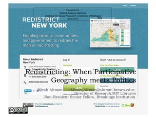
- 1. Prepared for Spatial Analysis Seminar Institute for Social Research, University of Michigan June 2012 Redistricting: When Participative Geography meets Politics Micah Altman <Micah_Altman@alumni.brown.edu> Director of Research,MIT Libraries Non-Resident Senior Fellow, Brookings Institution
- 2. This Talk Why is redistricting a difficult problem? How is technology changing redistricting? Application: DistrictBuilder & PublicMapping What kind of inferences can we draw from maps? Application: BARD Redistricting: When Participative Geography meets Politics
- 3. Collaborators* Michael P. McDonald Associate Professor Department of Public and International Affairs George Mason University Web: http://elections.gmu.edu [ A Principle Investigator on the Public Mapping project, regular co- author since 1999] Karin Mac Donald Director Statewide Database U.C. Berkeley [ Co-author on studies of computer use in redistricting1980-2000 ] Research Support Thanks to the Sloan Foundation, the Joyce Foundation, Amazon, Inc. * And co-conspirators Redistricting: When Participative Geography meets Politics
- 4. Warning: this presentation is for educational purposes only and may contain oversimplifications, errors, and/or preliminary conclusions. Caveat Lector. Related Work For citation and reference please use the related published work below. Reprints available from: micahaltman.com Micah Altman, 1997. "Is Automation the Answer? The Computational Complexity of Automated Redistricting", Rutgers Computer and Technology Law Journal 23 (1), 81-142 Altman, M. (1998b). Districting principles and democratic representation. California Institute of Technology. Ph.D. Thesis., Altman, Micah (1999). "Modeling the Effect of Mandatory District Compactness on Partisan Gerrymanders", Political Geography 17 (8): 989-1012. Altman , Micah . 1998. "Traditional districting principles - Judicial myths vs. reality Social Science History22 (2): 159-200 Altman, Micah 1998. "Modeling the Effect of Mandatory District Compactness on Partisan Gerrymanders", Political Geography 17 (8): 989-1012. Altman, Micah, 2002. "A Bayesian Approach to Detecting Electoral Manipulation" Political Geography 22(1):39-48 Micah Altman, Karin Mac Donald, and Michael P. McDonald, 2005. "From Crayons to Computers: The Evolution of Computer Use in Redistricting" Social Science Computer Review 23(3). Micah Altman, Karin Mac Donald, and Michael P. McDonald, 2005. "Pushbutton Gerrymanders", in Party Lines: Competition, Partisanship, and Congressional Redistricting Thomas E. Mann and Bruce E. Cain (eds), Brookings Press. McDonald, M.P. (2007) “Regulating Redistricting”, PS: Political Science & Politics, 40 : pp 675-679 Levitt, J. & M.P. McDonald (2007), ‘Taking the “Re” out of Redistricting’, Georgetown Law Journal 95(4) 1247-1285. Altman, M. and M.P. McDonald. (2010) “The Promises and Perils of Computer Use in Redistricting”, Duke Constitutional Law and Policy Journal. Altman, M. and M.P. McDonald. (2011). "BARD: Better Automated Redistricting." Journal of Statistical Software.. Altman, M., & McDonald, M. P. (2012). Technology for Public Participation in Redistricting. In G. Moncrief (Ed.), Redistricting and Reapportionment in the West . Lexington Books Altman, M., and M.P. McDonald (Forthcoming), Redistricting Principles for the 21rst Century, Case-Western Law Review. Redistricting: When Participative Geography meets Politics
- 5. Why is redistricting a difficult problem? Redistricting: When Participative Geography meets Politics
- 6. Definitions? Redistricting. The aim of redistricting is to assign voters to equipopulous geographical districts from which they will elect representatives, in order to reflect communities of interest and to improve representation. Gerrymandering. Gerrymandering is a form of political boundary delimitation, or redistricting, in which the boundaries are selected to produce an outcome that is improperly favorable to some group. The name “gerrymander” was first used by the Boston Gazette in 1812 to describe the shape of Massachusetts Governor Elbridge Ger- ry’s redistricting plan, in which one district was said to have resembled a salamander. Redistricting: When Participative Geography meets Politics
- 7. Redistricting Often Fails to Capture the Public Imagination Redistricting: When Participative Geography meets Politics
- 8. S i m p le s o lu ti o n – Ve rs i o n 1 “F i rs t p ri n c i p le s ” Choose the redistricting plan that provides the “best” representation for the state. Choose district plan X > plan Y, iff. Representativeness(X)> Representativeness(Y) Redistricting: When Participative Geography meets Politics
- 9. Problem with Version 1… There is a story about a very senior political scientist and a world- renowned scholar in the field of representation who traveled to Russia shortly after the fall of communism to lecture to the newly formed Duma. After speaking, a newly-minted member of the Duma approached him and asked him a question with great earnestness. “I have been elected as a representative,” the Duma member asked, “so when I vote, should I vote the way I think the electors want me to, or should I vote the way I think is right?” “That’s a good question… Scholars have been studying this for two thousand years. And, let me just say, there are many opinions.” Participative Geography Redistricting: When meets Politics
- 10. Simple solution – Version 2 “Let’s Randomize” Pure random redistricting equivalent to at- large elections [Grofman 1982] Compact districts on randomly clustered population disadvantage parties with geographically clustered support [Altman 1999, Jerit and Barabas 2004; Rodden and Chen 2010] In Vieth vs. Jubelirer 2004 , Justice Kennedy Agreed: Second, even those criteria that might seem promising at the outset (e.g., contiguity and compactness) are not altogether sound as independent judicial standards for measuring a burden on representational rights. They cannot promise political neutrality when used as the basis for relief. Instead, it seems, a decision under these standards would unavoidably have significant political effect, whether intended or not. For example, if we were to demand that congressional districts take a particular shape, we could not assure the parties that this criterion, neutral enough on its face, would not in fact benefit one political party over another. Redistricting: When Participative Geography meets Politics
- 11. Simple Solution Version 3 “Neutral Criteria” Eliminating judgment leads to calcification: Electoral District-based systems are unique in incorporating expert judgment into this process converting voter preferences to candidate selection Weak empirical links between process and outcomes Little empirical support for restrictions other than population Population restriction, etc. has not prevented gerrymanders Unintended consequences Baker & Karcher lead to widescale abandonment of other traditional principles (Altman 1998a) Intended (second order) consequences Choice of combination of neutral rules to disadvantage minorities (Parker 1990 Compactness rules have partisan consequences (Altman 1999; Barabas 2005; Rodden & Chen 2010) (Parker 1990) Redistricting: When Participative Geography meets Politics
- 12. Solution Version 4 “Consensus Criteria” U.S. State Criteria Scholarly criteria Neutrality’ (unbiasedness) [Niemi & Coincidence with “major roads, streams, or Deegan 1978] other natural boundaries”. symmetry of seats-votes curve Coincidence with census tract boundaries. ‘Range of responsiveness’ [Niemi & Being “square, rectangular or hexagonal in Deegan 1978] range of vote shares across which shape to the extent permitted by natural or electoral results change political boundaries.” Constant Swing [Niemi & Deegan 1978] Being “easily identifiable and understandable by increase of seat share is constant in voters”. increase in seat share ‘Competitiveness’ [Niemi & Deegan 1978] Facilitating “communication between a maximize number of districts with representative and his constituents”. competitive margins Preserving “media markets”. Compactness – perception of district appearance [see Altman 1998b] Enhancing “opportunity for voters to know Minimize voting for a loser their representative and the other voters he (anticompetitiveness) [Brunell 2008] represents.” ‘Cognizability’ [Grofman 1985] Aligning with “prior legislative boundaries”. ‘Communities of Interest’ [See Forrest 2004] Consistency with “political subdivisions”. Clustering [Fryer & Holden 2007] Utilizing “vernacularly insular regions so as to Conformance with natural/administrative allow for the representation of common boundaries interest”. Media market preservation Moderate majoritarianism Continuity of representative relationship (incumbency protection) [ see Persily 2003] Graphical symmetry around expected partisan vote share [Kousser 1996] Redistricting: When Participative Geography meets Politics
- 13. Problems with Version 4 - Satisfiability Logically exclusive: Competitiveness and anticompetitiveness Mathematically bounded: Can’t maximize competitiveness & guarantee constant swing [Niemi & Deegan 1978] Can’t maximize competitiveness & symmetry [Niemi & Deegan 1978] Empirically bounded: Compactness, communities of interest, competitiveness, symmetry, etc. Redistricting: When Participative Geography meets Politics
- 14. Solution Version 5 “Let a Computer Do it” First suggested: 1961. [Vickrey] Regularly proposed Advantages: Could increase transparency Could reveal range of alternatives not otherwise generated by political process Results from “redistricter” software. [Olson 2008] Redistricting: When Participative Geography meets Politics
- 15. Problems with Solution 5 Too many solutions to enumerate: 1 r r! S ( n,r) = ∑ ( −1) ( r − i) r n = r! i= 0 ( r − i) !i! Even redistricting using common criteria is NP-complete [Altman 1997] Optimal partisan gerrymander and optimal unbiased districts also NP-complete [Puppe & Tasnadi 2008,2009] Not mathematically possible to find optimal solutions to general redistricting criteria! Redistricting: When Participative Geography meets Politics
- 16. Are Redistricting Criteria more Transparent than Plans? Compactness 30+ different base measures to choose from, e.g. Then variations … Map orientation can change results for Length-Width/Bounding box measures Map measurement scale can matter for perimeter based measures Map projection can matter for any measure Treatment of water? Ignore it Assign to closest land area C = .1 5 8 C= .1 9 4 Include it Transform it away Treatment of bounding region? Ideal area – all area in bounding region Practical area – all area available for redistricting Treatment of population Ignore it Drop zero population blocks A Square is more A: B: Rotating a district makes it Weight it compact than a circle? less compact? Type of population: any, voting age, citizen, eligible voter Transform map Even ‘contiguity’ involves many operational decisions: theoretical contiguity vs. census block contiguity vs. transportation feasibility single point vs. multi-point vs. line segment crossover permissibility nesting permissibility Redistricting: When Participative Geography meets Politics
- 17. No unbiased algorithm Dozens of ad-hoc heuristics for particular criteria Lots of general heuristics applied: tabu-search, hill-climbing, evolutionary optimization, GRASP, TSP , recursive partitioning, k-means [See Altman 1997, de Cortona et al 1999, Duque 2007] No heuristic does best on all problems – “no free lunch” [Wolpert & Macready 1997] General heuristics still require adaptation/tuning to particular problem in practice Thus potential for interaction between geography, criteria and algorithms (“third order” bias) Not possible to completely disconnect algorithm, criteria, and political geography Redistricting: When Participative Geography meets Politics
- 18. Solution Version 5 “Institutional Design” Redistricting/boundary “commissions” appear to be reasonably well-insulated from partisan politics in most other developed democracies using geographical districts: United Kingdom, Canada, Australia, New Zealand [See Altman-McDonald 2012 for a summary] Redistricting commissions in many states Redistricting: When Participative Geography meets Politics
- 19. The Problem with Institutions – Participation Theater? Many U.S. independent non-partisan redistricting commissions aren’t Ex-ante bi-partisanship incumbent gerrymanders Ex-ante power to veto/modify by legislature Ex-post partisan litigation against commission? Many public hearings on redistricting are theater Do not change the plans actually adopted Do not produce evidence that can be used by the courts later Much public information isn’t Much electoral data is not shared Proposed plans not available for analysis Closed meetings and back-room deals are common Redistricting: When Participative Geography meets Politics
- 20. How is technology changing redistricting? Redistricting: When Participative Geography meets Politics
- 21. Media Coverage is Oversimplified “In “Until is advances inkeepingisdistricts equalthesimple andduringcomputer allcan play summary, this Article reapportionment — feed into the would to redraw recently only political parties had “The rapid only while computer… “There manpower and the tools eliminationto describe in education politically feasible of gerrymandering the last two “The purpose of way to do technology and population. Now anybody boundaries one a seemfactorsprogrampoliticalcan reapportion a little asdistrictsautomatic the to require as a registration.” as legislaturean other body this make at least the establishment of or the geographic decadesgame,it relatively simple to draw contiguous $3,500 of equal of computer except which kibitzer. For population ReaganCaliper Corp. will letdistricts. …The software and census data you - Ronald [and] at the same time to further have the secondary goals the State people who represent 1973] analysis firm [Goff geo- graphical you whatever redistricting program andneedcomputer donovel geometries onvalue judgmentsHarvardaresearcher Micah has.”impersonal procedure for PC screen. of those responsible “Let a to is designed to implement the a carrying out proposed try out it” redistricting.in Karcher v. Daggett (1983)not at all difficult to districts. for reapportionment”– [Nagel 1965] be Altman and It appears to - -Justice Brennan,others have put together a program that draws compact Washington Post, 2003 ( And software is free. His many, many blogs) devise rules for doing this which will produce results notDemocratic redistricting could work like which would becommission in markedly inferior to those this. After a census, a each state entertains proposals from the political parties and any do-gooder arrived at individual willing to compete. The commission picks the most-- group or by a genuinely disinterested commission.” [Vickrey 1961] according to some simple criterion. (Say, add up the miles compact solution, of boundary lines, giving any segments that track municipal borders a 50% discount, and go for the shortest total.) The mathematical challenge might inspire some gifted amateurs to weigh in.” – William Baldwin, Forbes 2008
- 22. How can computers improve redistricting?
- 23. When computers became ubiquitous Computing systems used in only a handful NO Voting Registration Block of states in the SOFTWARE Data Data Data 1980’s 1992 Congressional 5.3% (2) 71.4 (30) 64.3% (27) 66.7% (23) In 1990 redistrictings Legislative .9.3% (4) 64.6% (31) 58.3% (28) 46.2% (24) 2002 Congressional 0% 72.7% 75% 71 % computer use was Legislative (0) 0% (32) 66% (33) 68% (27) 53.9% nearly universal (0) (33) (34) (28) In 2000, computer use was universal, data use had increased Redistricting: When Participative Geography meets Politics
- 24. What could redistricting system do in the last round? All systems used 2000 Congressional redistricting could perform: Thematic mapping Software % of Thematic Numeric Automated Most could perform: Package States Mapping Tabulation Redistricting & Tabulations Geographic demographic/voting variables Reporting Autobound 45% Yes. Yes Yes. Geographic reports (Digital . Engineering (compactness, holes, plan comparisons, Corp.) contiguity) Maptitude 14% Yes. No. No. (Caliper Corp.) Only one could perform practical automated Maptitude for 12% Yes. Yes No. redistricting. Redistricting (Caliper Corp.) Plan 2000 5% Yes. Yes No. (Public Systems With this exception, the available software tools Associates) were qualitatively the same, although much Custom 14% Yes. Yes. No. cheaper and faster, as in the previous 1990’s systems (Except round of redistricting Texas) Redistricting: When Participative Geography meets Politics
- 25. GIS – Ubiquitous Goal: Aid in the efficient creation of maps associated with data. First invented: 1962. [Tomlinson] Maturity: The 2000 round of redistricting. [Altman, Mac Donald, McDonald 2005] Redistricting: When Participative Geography meets Politics
- 26. Computer use and compactness, compared Measured Plan Compactness Voting Data Automated Redistricting ‘Reock’ and Perimeter-Area 0.11 0.1 0.11 0.1 Compactness scores 0.09 0.08 0.09 0.08 congressional districting plans (>3 0.07 0.07 PA PA 0.06 0.06 districts) 0.05 0.04 0.05 0.04 0.03 0.03 No significant difference by 0.02 0 1 0.02 0 1 software capability or voting data Block Data 0.11 USE_VOTING_DATA Tabulations and Geographical Reports 0.11 soft_automated_redis use 0.1 0.09 0.1 0.09 0.08 0.08 Districts using block data are 0.07 0.07 PA PA 0.06 0.06 slightly more compact 0.05 0.04 0.05 0.04 0.03 0.03 0.02 0.02 0 1 0 1 USE_BLOCK_DATA soft_tabulation Redistricting: When Participative Geography meets Politics
- 27. Expert Support Systems Unjustly Feared Fears Mappers were able to specify a desired outcome or outcomes — the number of people in a district, say, or the percentage of Democrats in it — and have the program design a potential new district instantly. These systems allow redistricters to create hundreds of rough drafts easily and quickly, and to choose from among them maps that are both politically and aesthetically appealing. [Peck and Caitlin, 2003] Evidence Widespread adoption of computers in the 1990’s post-dates precipitous changes in district shape and composition Redistricting software prices dropped in 2000, but features remained essentially the same. Competitiveness declined in 2000, after computers and election data already ubiquitous. No statistical correlation between computer use/data and bad outcomes Redistricting: When Participative Geography meets Politics
- 28. Optimal Automated Redistricting – State of the Art Enumeration Explicit enumeration intractable even for small #’s of units Early work with implicit enumeration (branch and cut) yielded solutions for 30-50 units [E.g. Mehohtra, et. al 1998] Practice: Integer Programming Similar, but not equivalent, school districting problem solved for < 500 units. [Caro et. al 2004] Related multi-site land-use allocation problem solved for 900 units [Aerts, et al 2003] Integer programming applied to < 400 units, but used early termination, rendering solution non-exact. [Shirabe 2009] Redistricting: When Participative Geography meets Politics
- 29. Heuristic Automated Redistricting General Limitations Limited to population, compactness, contiguity Ad-hoc definition of compactness Often implicitly include a specific geographic model for districts Recent Work “Redistricter” [Olson 2008] Not peer reviewed, but open source uses kmeans with ad-hoc refinements (including annealing) to solve Using 500000 census blocks can find solutions within 1% of population Weighted Voronoi Diagrams [Ricca, et. al 2008] Applied to up to <1300 population units Yielded large population variances Q State Pott’s Model [Chou and Li 2007] Applied to <450 population units Shortest Split-line [Kai et al 2007] Population variance of 5% Appears to require continuous data, results of discretizing solution not clear Ad Hoc Greedy Heuristics [Sakguchi and Wado 2008] <1000 units Yielded large population variance Redistricting: When Participative Geography meets Politics
- 30. Metaheuristics Approaches Genetic Algorithms [Xiao 2003] <500 Units (?) Population variance< 1% Genetic Algorithm w/TSP Encoding [Forman and Yu 2003] <400 Units Some post-processing Population variance< 1% Annealing [Andrade & Garcia 2009] <400 Units Tabu Seach [Bozkaya et. al 2003] <850 units Population variance <25% General Metaheuristics [Altman & McDonald 2010] Framework for multiple metaheuristics & criteria Preliminary results on <1000 units Redistricting: When Participative Geography meets Politics
- 31. State of the Practice Redistricting: When Participative Geography meets Politics
- 32. No unbiased algorithm Dozens of ad-hoc heuristics for particular criteria Lots of general heuristics applied: tabu-search, hill-climbing, evolutionary optimization, GRASP, TSP , recursive partitioning, k-means [See Altman 1997, de Cortona et al 1999, Duque 2007] No heuristic does best on all problems – “no free lunch” [Wolpert & Macready 1997] General heuristics still require adaptation/tuning to particular problem in practice Thus potential for interaction between geography, criteria and algorithms (“third order” bias) Not possible to completely disconnect algorithm, criteria, and political geography Redistricting: When Participative Geography meets Politics
- 33. Application: DistrictBuilder & PublicMapping Redistricting: When Participative Geography meets Politics
- 34. The Next Wave – Open Access Redistricting In last round of redistricting much more data was available publicly, but public participation lagged. Generally, only well-organized political interests – political parties, incumbents, and minority voting rights groups – have had the capacity to draw redistricting plans. This can change… “We have the technology.”
- 35. Ohio 2009 Competition Demonstration project by Ohio Secretary of State Based on 2000 round data Complex user interface. Spearheaded by Mark Salling, for state 100+ participants, 11 final plans
- 36. Major Components Identify barriers and principles Software Data Education Dissemination
- 37. Challenges to Transparency Participation matters Systems that help people identify their neighborhoods Systems that can create plans meeting all measurable legal criteria Systems that people can use Code matters Open Source for verification, replication, and correction Documented algorithms for measuring and adjusting plans Data matters Open data Complete information Accessible formats Known provenance Online systems do not guarantee transparency Are algorithms, code and data used open and transparent? Is sponsorship of the system transparent? Can data and plans be transferred in and out of the system freely
- 38. Principles for Transparency All redistricting plans should include sufficient information such that the public can verify, reproduce, and evaluate a plan Proposed redistricting plans should be publicly available in non-proprietary formats. Public redistricting services should provide the public with the ability to make available all published redistricting plans and community boundaries in non-proprietary formats. Public redistricting services must provide documentation of any organizations providing significant contributions to their operation. All demographic, electoral and geographic data necessary to create legal redistricting plans and define community boundaries should be publicly available, under a license allowing reuse of these data for non-commercial purposes. The criteria used to evaluate plans and districts should be documented. Software used to automatically create or improve redistricting plans should be either open-source or provide documentation sufficient for the public to replicate the results using independent software. Software used to generate reports that analyze redistricting plans should be accompanied by documentation of data, methods, and procedures sufficient for the reports to be verified by the public. Software necessary to replicate the creation or analysis of redistricting plans and community boundaries produced by the service must be publicly available.
- 39. Bi-Partisan Endorsements for Principles Endorsements for Principles of Transparency • Americans for Redistricting Reform • Brennan Center for Justice • Campaign Legal Center • Center for Governmental Studies • Center for Voting and Democracy • Common Cause • Demos • League of Women Voters of the United States. Project Advisory Board - Nancy Bekavac, Director, Scientists and Engineers for America - Derek Cressman, Western Regional Director of State Operations, Common Cause - Anthony Fairfax, President, Census Channel - Representative Mike Fortner (R), Illinois General Assembly - Karin Mac Donald, Director, Statewide Database, U. C. Berkeley - Thomas E. Mann*, Brookings Institution - Norman J. Ornstein*, American Enterprise Institute. - Leah Rush, Executive Director, Midwest Democracy Network - Mary Wilson, President, League of Women Voters * Co-Principle Investigators and Editors
- 40. Public Mapping Software – Features Powered by Open Source Create Create districts and plans Identify communities* Evaluate Visualize Summarize Population balance Geographic compactness Completeness and contiguity Report in depth Share Import & export plans Publish a plan Run a contest Redistricting: When Participative Geography * Coming soon meets Politics
- 41. The Public Mapping Project Supported by The Sloan Foundation Joyce Foundation Amazon Corporation Judy Ford Wason Center at Christopher Newport Univ. Michael McDonald Micah Altman George Mason University Harvard University Brookings Institution Brookings Institution Robert Cheetham Azavea The DistrictBuilder software was developed by the Public Mapping Project with software engineering and implementation services provided by Azavea Redistricting: When Participative Geography meets Politics
- 42. Advisory Board Mike Fortner Illinois state Representative, 95th District Carling Dinkler John Tanner's office, Tennessee 8th Congressional District Mary Wilson Past President, League of Women Voters Derek Cressman Western Regional Director of State Operations, Common Cause Anthony Fairfax President, Census Channel Kimball Brace President, Election Data Services Gerry Hebert Executive Director, Campaign Legal Center and Americans for Redistricting Reform Leah Rush Executive Director, Midwest Democracy Network Nancy Bekavac Director, Scientists and Engineers for America Karin Mac Donald Director, Statewide Database, Institute for Government Studies, UC Berkeley Thomas E. Mann Senior Fellow, The Brookings Institution Norman J. Ornstein Senior Fellow, The American Enterprise Institute Redistricting: When Participative Geography meets Politics
- 43. Map a State -- Change the Nation Identify communities Explore the alternatives Understand political consequences Establish transparency Catalyze participation Create alternatives to politics-as-usual Redistricting: When Participative Geography meets Politics
- 44. Launch Your Own Competition www.districtbuilder.org
- 46. Redistricting: When Participative Geography meets Politics
- 47. Now…Public Access Redistricting Open Data Open Access Open Source Redistricting: When Participative Geography meets Politics
- 48. Choose Your Legislature Redistricting: When Participative Geography meets Politics
- 49. Look Around – Get the Picture Redistricting: When Participative Geography meets Politics
- 50. Drill Down – Get The Facts Redistricting: When Participative Geography meets Politics
- 51. Make A Plan Redistricting: When Participative Geography meets Politics
- 52. Get the Details Redistricting: When Participative Geography meets Politics
- 53. Run The Numbers Redistricting: When Participative Geography meets Politics
- 54. Is it legal? How Well Are You Doing? Redistricting: When Participative Geography meets Politics
- 55. Spread the Word Shareyour plans with others Have a contest Mash up and plug in Redistricting: When Participative Geography meets Politics
- 56. Early Results More plans produced in the Virginia Competition than in any previous public effort Suggests that public plans can be truly different Illuminates tradeoffs among redistricting goals Redistricting: When Participative Geography meets Politics
- 57. Completed Redistricting Competitions Eight competitions in different states Hundreds of legal plans Thousands of active participants Millions of viewers Redistricting: When Participative Geography meets Politics
- 58. External Impact? Politico “best policy innovation” of 2011 APSA ITP Award Dozens of local and national media articles Redistricting: When Participative Geography meets Politics
- 59. What didn’t we do? Surveys Randomized interventions – group level Pre-post evaluation Randomized intervention – individual level Deploy community mapping effectively Redistricting: When Participative Geography meets Politics
- 60. Redistricting: When Participative Geography meets Politics
- 61. Increasing Public Participation Draw the Lines Evaluate maps Get the data Watch the News "Forthe first time in U.S. history, a court has allowed the public to submit their own redistricting maps for consideration." Redistricting: When Participative Geography meets Politics
- 62. Where Do We Go From Here? Redistricting: When Participative Geography meets Politics
- 63. What kind of inferences can we draw from maps? Redistricting: When Participative Geography meets Politics
- 64. Redistricting as Graph Partitioning Redistricting: When Participative Geography meets Politics
- 65. Forecasting Forecasting, Inference & Optimization in redistricting Forecasting election results does not require combinatoric optimization, may be convincing Observational/correlational evidence may be compelling when analyzing change of institutions Revealed preference sometimes revealing Statistical causal inference (e.g. that district plan intended as a gerrymander) often rests on hidden & unreliable computational assumptions Redistricting: When Participative Geography meets Politics
- 66. Using WARP in Redistricting 1. Divide the relevant characteristics of a plan into three categories. Criteria that describe the feasible set of districts, K, such as the maximum population deviation between districts, contiguity, etc. A characteristic, I, that best proxies the intent you wish to test. Characteristics, R, representing any other politically relevant criteria. 2. Enter the current plan, and any alternative plan that is part of the public record, into a GIS system, along with the data necessary to evaluate K, I, and R. 3. Use these plans as starting points for metaheuristic optimization (simulated annealing, genetic algorithms, or GRASP) 4. Use the optimization algorithm to search for a plan p* that such that: If a feasible p* exists, then the motive proxied by I can not have been overriding (lexically preferred). 5. To further explore the trade-off among criteria. Use the optimization algorithm to search for a plan p** that such that: And then maximize I, subject to holding all but one (j) of the other relevant criteria constant Use optimization algorithms to find alternatives to given plan Attempt to find alternatives that differ in one dimension Probe the trade-offs among maj-minority seats, partisan seats, etc. Redistricting: When Participative Geography meets Politics
- 67. Sampling Problem - General Redistricting: When Participative Geography meets Politics
- 68. Sampling Bias in “Random Districting” Analytic Approach 3 1 2 4 2 6 5* 5* 1 3 2 2 4 6 1 2 3 1 2 3 1 2 3 5 5 4 5 6 4 5 6 4 5 6 3 4 Event-trees showing the 1 generation of the district plans in 5* 2-District Plans using 6 counties 2 six block case. Each sub-tree is equally likely (P=1/6), and the 1 3 probability of following any branch 5* at each node is equal to 1/ (number of branchs). Starred 6 nodes indicate illegal plans, which 5* cause the algorithm to restart with subtree selection Redistricting: When Participative Geography meets Politics
- 69. Legal Standards for Proving Discriminatory Intent “Ely”: no other rational basis can explain state action “Arlington Heights”: action would not have occurred but for illicit motives “Feeney”: action was caused, in part, because of illicit motives “Miller”: race is the predominant motive of legislature Redistricting: When Participative Geography meets Politics
- 70. Intent: Definitional Problems Collective Intent Predominant Intent Collective Intent. Hypotheticals Hypotheticals collective choice fundamentally differs 1. Four legislators split on 1. Legislature wants to from individual intent plan for non-racial reasons. Fifth legislator has only racial create maj-min. districts, but would trade two maj-min. (Arrow) motivations votes for legislation solely on racial seats in to gain an additional democratic seat overall. Scalia:with respect to 99.99 grounds. 2. Like 1 above. But 5th 2. Control of legislature is percent of the issues of legislator has lexicographic threshold criteria (lexically construction reaching the preferences, race is 10th in preferred). Once this the list of her preferences, threshold is reached, courts, there is no legislative but plans are identical on first legislature prefers to create intent, so that any clues 9 criteria. majority minority seats. 3. Only one legislator in a 3. As above, but legislature provided by the legislative (non-minimal) majority has will only values creating a history are bound to be any racial motive. That maximum of K maj-min false.” – Antonin Scalia legislator’s sole motive is seats. racial. Predominant Intent 4. Legislature assigns simple linear weights of {3,3,4} to Must be defined precisely protecting (non-racial) before a mechanical test can be communities of interests, applied protecting incumbents, and creating majority-minority seats Redistricting: When Participative Geography meets Politics
- 71. Intent: Statistical plan p* from the set of all possible plans The planner chooses some Problems conditioned on their intent y. The scholar must supply plausible hypotheses about the value that y could take on. E.g.: (0) intent only to create legal districts (1) mixed -- intent to maximize probability of controlling the legislature, protect incumbents, protect communities, and create k maj-min seats (2) predominant intent to create a racial gerrymander. We observe characteristics of the plan C, and of elections EV(E) When is it likely that the observed characteristics indicate a gerrymander? Using Bayes’ rule, this occurs iff. (Altman 2002): ( {~ prob y ∈ {1 ∪ 0} | C, EV (E) = }) ~ ({ } ) prob C, EV (E) | y ∈ {1 ∪ 0} prob( y ∈ {1 ∪ 0}) << 1 ( { ~ prob y = 2 | C, EV (E) }) ({ ~ } ) prob C, EV (E) | y = 2 prob( y = 2) * If you prove the existenceRedistricting: When Participative Geography of a deity… meets Politics
- 72. Current Statistical Methods for Assessing Intent Ignore Counterfactuals* CDR Methodology: if “random” plans differ from actual plan racial motivation predominates Typical Use of Bias/Responsiveness: if bias is high assume partisan motivation Flaws: At most, we can reject ‘null’ hypothesis that ( ~ prob y = 0 | C, EV (E) { }) No basis for evaluating likelihood of competing hypotheses regarding intent * Will the real null hypothesis please stand up… Redistricting: When Participative Geography meets Politics
- 73. Application: Better Automated ReDistricting (BARD) Redistricting: When Participative Geography meets Politics
- 74. BARD – Open Source for Experts Create plans Fix/Refine plans automatically Generate reports Compare plans Analyze … Released in 2006
- 75. BARD What is BARD A tool for modifying and analyzing redistricting plans An open model for implementation of redistricting criteria A framework for experimentation with redistricting An R module What BARD is not A GIS system “the redistricting game” A comprehensive battery of tests A pushbutton gerrymander A solution to optimal redistricting Redistricting: When Participative Geography meets Politics
- 76. What can you do with BARD? Analyze district plan characteristics Create districting plans Explore trade-offs among different redistricting goals Redistricting: When Participative Geography meets Politics
- 77. Modular, Object-Oriented Configuration Data Goals Plan generation Randomly generate Use existing plan Create plan interactively Refinement Refine starting plan to fit goals Create sequence of plan with reweighted pairs of goals Analysis Analyze single plan Compare pairs of plans “Comparative statics” for pair of goals Redistricting: When Participative Geography meets Politics
- 78. Plan Input and Manipulation Load a plan from a GIS shape file Generate plans kmeans greedy random assignment Create or edit a plan interactively Redistricting: When Participative Geography meets Politics
- 79. Generating Plans Redistricting: When Participative Geography meets Politics
- 80. Plan Comparison Generate reports contiguity holes compactness population equality competitiveness partisanship communities of interest completely extensible Redistricting: When Participative Geography meets Politics
- 81. Plan Comparison (Visual) Redistricting: When Participative Geography meets Politics
- 82. Metaheuristic Refinement Greedy Local Search: Metaheuristics combine some form of greedy local search with a mechanism for making non-improving selections – needed to escape local optima a mechanism for increasing search effort in a selected solution space, based on history of plans evaluated As much “art” as science Examples: Simulated annealing Tabu Search Genetic optimization GRASP Redistricting: When Participative Geography meets Politics
- 83. Arbitrary Plan Sampling Redistricting: When Participative Geography meets Politics
- 84. Some Informal Observations Field experiments are hard … Kranzberg’s law – technology is neither good, nor bad – neither is it neutral Technology matters in politics Transparency, data and information technology are interconnected Data transparency can enable participation Transparency & Data Involves IP law Electronic Access / formats Timeliness Completeness Redistricting: When Participative Geography meets Politics
- 85. Additional References J. Aerts, C.J.H,. Erwin Eisinger,Gerard B.M. Heuvelink and Theodor J. Stewart, 2003. “Using Linear Integer Programming for Multi-Site Land-Use Allocation”, Geographical Analysis 35(2) 148-69. M. Andrade and E. Garcia 2009, “Redistricting by Square Cells”, A. Hernández Aguirre et al. (Eds.): MICAI 2009, LNAI 5845, pp. 669–679, 2009. J. Barabas & J. Jerit, 2004. "Redistricting Principles and Racial Representation," State and Politics Quarterly¸4 (4): 415-435. B. Bozkaya, E. Erkut and G. Laporte 2003, A Tabu Search Heuristic and Adaptive Memory Procedure for Political Districting. European Journal of Operational Re- search 144(1) 12-26. F. Caro et al . , School redistricting: embedding GIS tools with integer programming Journal of the Operational Research Society (2004) 55, 836–849 PG di Cortona, Manzi C, Pennisi A, Ricca F, Simeone B (1999). Evaluation and Optimization of Electoral Systems. SIAM Pres, Philadelphia. J.C. Duque, 2007. "Supervised Regionalization Methods: A Survey" International Regional Science Review, Vol. 30, No. 3, 195-220 S Forman & Y. Yue 2003, Congressional Districting Using a TSP-Based Genetic Algorithm P. Kai, Tan Yue, Jiang Sheng, 2007, “The study of a new gerrymandering methodology”, Manuscript. http://arxiv.org/abs/0708.2266 J. Kalcsics, S. Nickel, M. Schroeder, 2009. A Geometric Approach to Territory Design and Districting, Fraunhofer Insititut techno und Wirtshaftsmethematik. Dissertation. A. Mehrotra, E.L. Johnson, G.L. Nemhauser (1998), An optimization based heuristic for political districting, Management Science 44, 1100-1114. Grofman, B. 1982, "For single Member Districts Random is Not Equal", In Representation and Redistricting Issues, ed. B. Grofman, A. Lijphart, R. McKay, H. Scarrow. Lexington, MA: Lexington Books. B. Olson, 2008 Redistricter. Software Package. URL: http://code.google.com/p/redistricter/ C. Puppe,, Attlia Tasnadi, 2009. "Optimal redistricting under geographical constraints: Why “pack and crack” does not work", Economics Letter 105:93-96 C. Puppe,, Attlia Tasnadi, 2008. "A computational approach to unbiased districting", Mathematical and Computer Modeling 48(9-10), November 2008, Pages 1455-1460 F. Ricca, A. Scozzari and B. Simeone, Weighted Voronoi Region Algorithms for Political Districting. Mathematical Computer Modelling forthcoming (2008). F. Ricci, C, Bruno Simeone, 2008, "Local search algorithms for political districting", European Journal of Operational Research189, Issue 3, 16 September 2008, Pages 1409-1426 T. Shirabe, 2009. District modeling with exact contiguity constraints, Environment and Planning B (35) 1-14 S. ,Toshihiro and Junichiro Wado. 2008, "Automating the Districting Process: An Experiment Using a Japanese Case Study" in Lisa Handley and Bernard Grofman (ed.) Redistricting in Comparative Perspective, Oxford University Press D.H. Wolpert, Macready, W.G. (1997), "No Free Lunch Theorems for Optimization," IEEE Transactions on Evolutionary Computation 1, 67 N. Xiao, 2003. Geographical Optimization using Evolutionay Alogroithms, University of Iowa. Dissertation Redistricting: When Participative Geography meets Politics
- 86. Questions & Contact micahaltman.com Redistricting: When Participative Geography meets Politics
Notas do Editor
- This work, by Micah Altman (http://redistricting.info) is licensed under the Creative Commons Attribution-Share Alike 3.0 United States License. To view a copy of this license, visit http://creativecommons.org/licenses/by-sa/3.0/us/ or send a letter to Creative Commons, 171 Second Street, Suite 300, San Francisco, California, 94105, USA.
- This work. “The Public Mapping Project”, by Micah Altman (http://redistricting.info) is licensed under the Creative Commons Attribution-Share Alike 3.0 United States License. To view a copy of this license, visit http://creativecommons.org/licenses/by-sa/3.0/us/ or send a letter to Creative Commons, 171 Second Street, Suite 300, San Francisco, California, 94105, USA.
- This work. “The Public Mapping Project”, by Micah Altman (http://redistricting.info) is licensed under the Creative Commons Attribution-Share Alike 3.0 United States License. To view a copy of this license, visit http://creativecommons.org/licenses/by-sa/3.0/us/ or send a letter to Creative Commons, 171 Second Street, Suite 300, San Francisco, California, 94105, USA.