Interferometria
•Transferir como PPT, PDF•
1 gostou•361 visualizações

Codevintec Days 2018 - Trieste Relazione di Luana Testa - Metasensing

Recomendados
Recomendados
Mais conteúdo relacionado
Mais procurados
Mais procurados (18)
Semelhante a Interferometria
Semelhante a Interferometria (20)
Mais de Codevintec Italiana srl
Mais de Codevintec Italiana srl (20)
Último
Último (20)
Interferometria
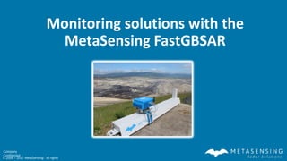
- 1. Al l r i ght s r eser ved t o © 2008 – 2017 MetaSensing - all rights Company Confidential Monitoring solutions with the MetaSensing FastGBSAR
- 2. Al l r i ght s r eser ved t o © 2008 – 2017 MetaSensing - all rights Company Confidential 2 * Global Network of distributors: Australia, Brazil, Chile, China, South-Africa, India, Indonesia, Iran, Italy, Malaysia, Pakistan, South Korea, South America, Taiwan, Turkey, USA MetaSensing Group
- 3. Al l r i ght s r eser ved t o © 2008 – 2017 MetaSensing - all rights Company Confidential 3 Develops and manufactures: -affordable -advanced -innovative -COTS & Custom-made Client Government Academia R&D Industry Design (User/Application) Requirements definition Manufacturing Assembly Integration Testing Installation Operation Data Processing & Visualization MetaSensing Radar SystemsRadar Systems
- 4. Al l r i ght s r eser ved t o © 2008 – 2017 MetaSensing - all rights Company Confidential 4 Clients/Partners
- 5. Al l r i ght s r eser ved t o © 2008 – 2017 MetaSensing - all rights Company Confidential 5 Distributors SOUTH AMERICA: InDelta Spa IRAN: Larzeh Sakht Savalan Consulting Engineers Co. AUSTRALIA: Geosystems – ESS Earth Sciences CHINA Five Star Electronic Technology Co. Ltd PAKISTAN: FEB Pakistan ITALY: Codevintec Italiana Srl INDIA: AIMIL Ltd
- 6. Al l r i ght s r eser ved t o © 2008 – 2017 MetaSensing - all rights Company Confidential 6 MetaSensing Portfolio Frequency Resolution Main Application [GHz] [m] P - 0.400 0.75 x 0.25 Vegetation penetration, DEM, concealed target detection, sea ice, sand penetration L - 1.3 0.75 x 0.20 Vegetation mapping, agriculture, soil moisture, DEM, land cover classification, glaciers, InSAR C - 5.3 0.75 x 0.20 Sea Ice, mapping, snow and ice properties, forest, transponder, DInSAR X - 9.6 0.25 x 0.20 Weather Radar, sea wave radar, Imaging, MTI, mapping, DSM, surveillance, reconnaissance, weather, coherent change detection Ku - 13.5 & 17.2 0.5 x 0.20 Mapping, imaging, snow and ice properties, deformation monitoring, DSM Ka - 34.5 & 35.75 0.30 x 0.10 Altimeter, mapping, imaging, cryosphere, water height • Airborne and ground-based radar • FMCW & Pulse technology • Low transmit power (< 10 Watts) • Compact and light-weight • Easy deployable • Control & Processing software • End-to-End system (HW & SW) • At least 2 transmitters and 2 receivers • Multiple frequencies in one system
- 7. Al l r i ght s r eser ved t o © 2008 – 2017 MetaSensing - all rights Company Confidential 7 Systems vs Platforms FastGBSAR Weather Radar QX-60 SeaWave radar Avalanche radar Car-borne Surveillance Radar Coastal Surveillance Radar Network MiniSAR MetaSAR (P, L, C, S, X, Ku, Ka) QX-AVIO Ka-Altimeter
- 8. Al l r i ght s r eser ved t o © 2008 – 2017 MetaSensing - all rights Company Confidential 8 R&D towards UAV-SAR Mid size UAV with instrument payload > 20 kg VLOS and BVLOS Prolonged endurance Stable flight pattern Autopilot Compact SAR systems for any application Short-Medium-Long range Light-weight InSAR system High-frequency SAR for mm accuracy deformation
- 9. Al l r i ght s r eser ved t o © 2008 – 2017 MetaSensing - all rights Company Confidential 9 MetaSensing with NASA How much water is stored in Earth’s terrestrial snow-covered regions? Unique combination of sensors: •LiDAR •Radar •passive microwave •imaging spectrometer •infrared sensors •Ground-based instruments, snow field measurements and modeling http://neptune.gsfc.nasa.gov/hsb/index.php? section=327 MetaSensing is participating with its SnowSAR sensor since February 2017
- 10. Al l r i ght s r eser ved t o © 2008 – 2017 MetaSensing - all rights Company Confidential 10 MetaSensing with NASA
- 11. Al l r i ght s r eser ved t o © 2008 – 2017 MetaSensing - all rights Company Confidential The FastGBSAR 11
- 12. Al l r i ght s r eser ved t o © 2008 – 2017 MetaSensing - all rights Company Confidential 12 FastGBSAR overview The FastGBSAR is an interferometric radar system operating in the Ku-band. When it is mounted on a linear rail the radar operates in Synthetic Aperture Radar (SAR) mode and it delivers two dimensional displacement maps of the monitored surface. Description Symbol Value Central frequency fc 17.2 GHz (Ku-band) Wavelength λc 17.43 mm Maximum bandwidth Bmax 300 MHz* Maximum range Rmax 4000 m Maximum rail velocity vmax 0.5 m/s Resolution in range (1) δr 0.5 m Resolution in azimuth (2) δa 4.8 mrad Rail effective length(3) L 1.8 m (1) Range resolution depends on the frequency bandwidth allowed by local authorities, which is generally limited to 200 MHz, leading to a range resolution of 0.75 m. (2) In SAR Mode, azimuth resolution depends on rail effective length. (3) Rail effective length is the length over which the sensor moves with constant velocity. Effective length is slightly dependent on sensor velocity. Listed value corresponds to maximum velocity of 0.5 m/s. Effective rail length at minimum velocity of 0.1 m/s is 1900 mm.
- 13. Al l r i ght s r eser ved t o © 2008 – 2017 MetaSensing - all rights Company Confidential 13 FastGBSAR overview Operational frequency band: • Standard • Polarimetric • Synthetic Aperture Radar (SAR) mode: radar unit on rail • Real Aperture Radar (RAR) mode: radar unit on tripod Operational modes: • Ku-band • Center frequency 17.2 GHz • Wavelength 17.43 mm Hardware versions:
- 14. Al l r i ght s r eser ved t o © 2008 – 2017 MetaSensing - all rights Company Confidential 14 Applications: SAR mode • Deformation monitoring • Risk assessment and early warning • Projection on Digital Elevation Model Infrastructures Land slopes Open pi t mi nesOpen pi t mi nes
- 15. Al l r i ght s r eser ved t o © 2008 – 2017 MetaSensing - all rights Company Confidential 15 Applications: RAR mode • Vibration monitoring • Estimation of modal parameters • Static load tests Tower sTower s Br i dgesBr i dges
- 16. Al l r i ght s r eser ved t o © 2008 – 2017 MetaSensing - all rights Company Confidential 16 FastGBSAR RAR operational mode RAR x y Range resolution RAR Resolution - range: - azimuth: 0.5 m - Measurement frequency/interval: 4000 Hz Maximum range: 4 km Accuracy: 0.01 mm
- 17. Al l r i ght s r eser ved t o © 2008 – 2017 MetaSensing - all rights Company Confidential 17 tower RAR measurement principle • The FastGBSAR in RAR mode measures range profiles of the backscattered power. RARHighly reflecting points which show a low variation in the reflection are selected for the analysis RANGE PROFILE • The software evaluates the phase difference at different times for the range profiles so it detects variations in the target distance
- 18. Al l r i ght s r eser ved t o © 2008 – 2017 MetaSensing - all rights Company Confidential 18 ViMon Software for RAR mode • MetaSensing’s ViMon is the current software for processing RAR data. It allows for: vibration analysis in the time domain and in the frequency domain, modal analysis
- 19. Al l r i ght s r eser ved t o © 2008 – 2017 MetaSensing - all rights Company Confidential 19 FastGBSAR SAR operational mode SAR x yAzimuth resolution Range resolution RAR SAR Resolution - range: - azimuth: 0.5 m - 0.5 m 4.8 mrad Measurement frequency/interval : 4000 Hz 10 sec Maximum range: 4 km 4 km Accuracy: 0.01 mm 0.1 mm
- 20. Al l r i ght s r eser ved t o © 2008 – 2017 MetaSensing - all rights Company Confidential 20 The SAR technique θ LS FastGBSAR moving on the rail • While the FastGBSAR moves on the linear rail it continuously transmits and receives signals and it acquires the raw data • The time during which it acquires the raw data is called the coherency time. The SAR technique coherently combines the collected data during the coherency time. The result is a 2 dimensional image (the focused image), whose resolution is half the one which would be achieved by a radar whose antennas are as wide as the rail.
- 21. Al l r i ght s r eser ved t o © 2008 – 2017 MetaSensing - all rights Company Confidential 21 Coherency time A SAR-based system assumes the scenario and the atmospheric conditions do not change during the coherency time. FastGBSAR’s coherency time is only 4 seconds The assumption is much easily verified with respect to systems with longer acquisition times 10 seconds measurement repeat time: 4 seconds: acquiring data 6 seconds: going back to the original position
- 22. Al l r i ght s r eser ved t o © 2008 – 2017 MetaSensing - all rights Company Confidential 22 Data transfer and processing
- 23. Al l r i ght s r eser ved t o © 2008 – 2017 MetaSensing - all rights Company Confidential 23 The FastGBSAR Ranger software • The FastGBSAR Ranger software is the new software for processing and visualization of the SAR mode FastGBSAR data for critical structure monitoring. • Straightforward processing of the FastGBSAR radar data • Processing results available in a few seconds • Data download and storage handling • Simultaneous visualization of displacement maps, quality parameters and time series • Real time processing and back analysis • Time of failure estimation • Planar and 3D view • Alert system for situational awareness
- 24. Al l r i ght s r eser ved t o © 2008 – 2017 MetaSensing - all rights Company Confidential 24 Quality parameters: 3D coher ence St abi l i t y I ndex Mean Ampl i t ude
- 25. Al l r i ght s r eser ved t o © 2008 – 2017 MetaSensing - all rights Company Confidential 25 Alarms Active areas are blinking areas in different colors Color and priority can be set • The user can select alarm raising rules on different areas and can associate different colours and priorities to each rule. • Active pixels are displayed in the alarm and 3D tabs. Active areas are displayed in the analysis tab too.
- 26. Al l r i ght s r eser ved t o © 2008 – 2017 MetaSensing - all rights Company Confidential Case studies: SAR mode
- 27. Al l r i ght s r eser ved t o © 2008 – 2017 MetaSensing - all rights Company Confidential 27 Monitoring of a landslide Santa Sofia (FC), Italy Rocks fall event detections FastGBSAR Displacement map Amplitude dispersionMean amplitude Amplitude dispersion
- 28. Al l r i ght s r eser ved t o © 2008 – 2017 MetaSensing - all rights Company Confidential 28 Monitoring of a landslide Rock fall 16:37 UTC
- 29. Al l r i ght s r eser ved t o © 2008 – 2017 MetaSensing - all rights Company Confidential 29 Monitoring of a landslide Coherence map Before rock fall Projection on the DTM After rock fall
- 30. Al l r i ght s r eser ved t o © 2008 – 2017 MetaSensing - all rights Company Confidential 30 Monitoring of a glacier Features: Basin, stepped and serac Sector: Graian Alps (Mont Blanc) Maximum altitude: 3690 m Minimum altitude: 2500 m Exposure: S Maximum length: 2200 m Maximum width: 870 m Maximum extension: 1087 Km2 Maximum deep: 40/50 m N
- 31. Al l r i ght s r eser ved t o © 2008 – 2017 MetaSensing - all rights Company Confidential 31 Monitoring of a glacier y (m) Mean Amplitude
- 32. Al l r i ght s r eser ved t o © 2008 – 2017 MetaSensing - all rights Company Confidential 32 Monitoring of a dam in China Three Gorges test dam, Hubai province, China: a smaller scale replica of the homonym dam, the biggest in the world. Monitoring of the dam during a water discharge test performed in four different stages with an increasing quantity of discharged water open cl os ed
- 33. Al l r i ght s r eser ved t o © 2008 – 2017 MetaSensing - all rights Company Confidential 33 Monitoring of a dam in China 3 1 2 54 Opening stage 1 - 06:06:53Opening stage 1 - 06:06:53 Opening stage 2 - 06:11:23Opening stage 2 - 06:11:23 Opening stage 3 - 06:16:13Opening stage 3 - 06:16:13 Opening stage 4 - 06:21:03Opening stage 4 - 06:21:03 Closing stage 5 - 06:26:23Closing stage 5 - 06:26:23
- 34. Al l r i ght s r eser ved t o © 2008 – 2017 MetaSensing - all rights Company Confidential 34 Monitoring an open pit mine, 2015 • Bilina coal open pit mine, Czech republic • 2 weeks measurement campaign in May 2015
- 35. Al l r i ght s r eser ved t o © 2008 – 2017 MetaSensing - all rights Company Confidential 35 Monitoring an open pit mine, 2015 FastGBSAR Excavation area A Excavation area B Maximum distance: 1500 m Range resolution: 0.5 m Azimuth resolution: 5.4 mrad Repeat interval: 10 - 40 sec Excavation area A Excavation area B
- 36. Al l r i ght s r eser ved t o © 2008 – 2017 MetaSensing - all rights Company Confidential 36 Monitoring an open pit mine, 2015 Displacement projected on 3D DEM Time span 3 days
- 37. Al l r i ght s r eser ved t o © 2008 – 2017 MetaSensing - all rights Company Confidential 37 Monitoring an open pit mine, 2015 Excavation area A
- 38. Al l r i ght s r eser ved t o © 2008 – 2017 MetaSensing - all rights Company Confidential 38 Chile, Sierra Gorda mine, January 2017 The radar has been installed on the portable InDelta trailer together with the hybrid and portable InDelta power supply equipped with solar panels, wind turbine and diesel generator
- 39. Al l r i ght s r eser ved t o © 2008 – 2017 MetaSensing - all rights Company Confidential 39 Chile, Sierra Gorda mine, January 2017 Real time monitoring with the FastGBSAR is currently active at Sierra Gorda mine, El Teniente mine and Los Bronces mine
- 40. Al l r i ght s r eser ved t o © 2008 – 2017 MetaSensing - all rights Company Confidential 40 Sierra Gorda mine, Blast monitoring blast, h 18:10 Loss of coherency due to the blast
- 41. Al l r i ght s r eser ved t o © 2008 – 2017 MetaSensing - all rights Company Confidential Case studies: RAR mode
- 42. Al l r i ght s r eser ved t o © 2008 – 2017 MetaSensing - all rights Company Confidential 42 Monitoring of a highway bridge Structural health monitoring highway railway highway railway Backscattered power intensity Loads (vehicles) Vertical displacement time series measured while vehicles were passing
- 43. Al l r i ght s r eser ved t o © 2008 – 2017 MetaSensing - all rights Company Confidential 43 Monitoring of a highway bridge 2.7 Hz 2.9 Hz 11.4 Hz 18.6 Hz 19.9 Hz table from Miao et al. 2015
- 44. Al l r i ght s r eser ved t o © 2008 – 2017 MetaSensing - all rights Company Confidential 44 Monitoring of a railway bridge Vertical displacement time series measured while a train was passing: The time series shows the deflection due to the load of the coaches. The first coach is heavier as it carries the motor, indeed it gives a higher displacement with respect to the other coaches which carry the passenger Load of the coaches Load of the train head
- 45. Al l r i ght s r eser ved t o © 2008 – 2017 MetaSensing - all rights Company Confidential 45 Monitoring of a long cable stayed bridge 400 m 60 m Analysis of the modal shapes
- 46. Al l r i ght s r eser ved t o © 2008 – 2017 MetaSensing - all rights Company Confidential 46 Monitoring of a long cable stayed bridge 0.026 Hz 0.26 Hz 0.31 Hz 0.026 Hz 0.31 Hz 0.45 Hz 0.45 Hz 0.64 Hz 0.26 Hz 0.64 Hz Modal shapes
- 47. Al l r i ght s r eser ved t o © 2008 – 2017 MetaSensing - all rights Company Confidential 47 Load tests on a railway bridge
- 48. Al l r i ght s r eser ved t o © 2008 – 2017 MetaSensing - all rights Company Confidential 48 Load tests Vertical displacement time series measured while different vehicles were passing: Loads Martinus bridge, (NL)
- 49. Al l r i ght s r eser ved t o © 2008 – 2017 MetaSensing - all rights Company Confidential 49 Polarimetric FastGBSAR Features • Four antennas (2 x vertical polarization, 2 x horizontal polarization) • Pulse to pulse switching in transmission and simultaneous reception • Four measurements: • VV = Vertical transmitted / Vertical received • HV = Horizontal transmitted / Vertical received • VH = Vertical transmitted / Horizontal received • HH = Horizontal transmitted / Horizontal received Potentials: • Distinguish different scattering mechanisms (e.g. single bounce / double bounce / volume scattering) • Distinguish different behaviours of scatterers in the same resolution cell • Less disturbance by other objects due to more redundancy Rx H Rx V Tx H Tx V
- 50. Al l r i ght s r eser ved t o © 2008 – 2017 MetaSensing - all rights Company Confidential 50 Monitoring a Telecom tower with the polarimetric FastGBSAR Objectives • Determine modal parameters • Investigate microwave scattering mechanisms by means of the four polarimetric channels of the FastGBSAR
- 51. Al l r i ght s r eser ved t o © 2008 – 2017 MetaSensing - all rights Company Confidential 51 Monitoring a Telecom tower with the polarimetric FastGBSAR VV HH HV / VH Power range profile and selected points • The first output of the processing software for data analysis is the plot of the reflected power along the tower height for the four channels. • The black crosses mark the points that have been chosen by the user for the vibration analysis. • Each point is identified by its position on the tower (height). • For each point it is possible to perform the analysis of the vibration in the frequency and time domains.
- 52. Al l r i ght s r eser ved t o © 2008 – 2017 MetaSensing - all rights Company Confidential 52 Vibration analysis, single points Horizontal displacement of the point at height= 31.2m as a function of time for the four polarimetric channels Horizontal displacement of the point at height= 31.2 m as a function of frequency for the four polarimetric channels.
- 53. Al l r i ght s r eser ved t o © 2008 – 2017 MetaSensing - all rights Company Confidential 53 Vibration analysis, single points unfiltered data – object passing through the same resolution cell: disturbance only in VV data Height 34.6 m Sometimes the use of polarimetric channels can help in reducing disturbs in the measurements, such as passing objects. In this plot a moving object has interfered with the measurement but only in the VV cannel, the HH cannel was not affected.
- 54. Al l r i ght s r eser ved t o © 2008 – 2017 MetaSensing - all rights Company Confidential 54 Modal shape analysis VV HV VH HH 0.96 Hz 3.1 Hz 3.8 Hz For each frequency the modal shape can be displayed, that is the amplitude of the displacement along the height of the tower
- 55. Al l r i ght s r eser ved t o © 2008 – 2017 MetaSensing - all rights Company Confidential MetaSensing BV The Netherlands MetaSensing Asia Pacific Pte Ltd Singapore WWW.METASENSING.COM MetaSensing Italia S.r.l.